
Deni J. Seymour
Fierce and Indomitable
The Protohistoric Non-Pueblo World in the American Southwest
1. “Fierce, Barbarous, and Untamed”
Dispensing with the Notion of a Hiatus
Reorienting the Protohistoric Problem
From Late Prehistory to Late History
Impact on Prehistoric Populations
Evidence of Mobile Groups: Material Culture
2. Terminal Puebloan Occupation
3. Bison, Trade, and Warfare in Late Prehistoric Southeastern New Mexico
4. Conceptualizing Mobility in the Eastern Frontier Pueblo Area
Conceptualizing Mobility in the Pueblo Area
Distinguishing Puebloan and Mobile Structures
Artifacts in the Pueblo Sphere
Additional Features around Pueblos
Puebloan Shrines around Pueblos
Shepherding Features around Pueblos
5. Eastern Extension of Lehmer’s Jornada Mogollon Ancestors to the Jumano/Suma
Jornada Mogollon—Eastern Extension: Are They Really Jumano?
6. Embracing a Mobile Heritage
Paradigm of Government-to-Government Relationships
Criteria and Standards as Interpretation of History
The Model Tribe versus Mobile Societies
What Constitutes Tribe and Community in Mobile Societies
Tribes Defined by Outsiders and an Outsider’s View of Tribe
Decentralized Leadership versus Contradictory Histories
Mobile People, Changing Profile
“Tribe” versus Flexible Social Organization
Distinct Communities: Enclaves and Reservations
Previous Research of Protohistoric Groups Nearby
Emerging Clusters of Thermal Features
8. From Economic Necessity to Cultural Tradition
Stone Tools and Economic Realities
Comparing Spanish Chipped-Stone Assemblages
9. Protohistoric Arrowhead Variability in the Greater Southwest
The Bow-and-Arrow Weapon System
Approaches to the Study of Arrowhead Variability
A Neutral Approach to the Metrics of Size and Shape
Relating Protohistoric Point Types to Their Shape Measurements
10. Akimel O’odham and Apache Projectile Point Design
Flaked-Stone Projectile Point Design
Akimel O’odham Projectile Points
Projectile Point Design Physical Constraints
Projectile Point Design Summary
Akimel O’odham Historic Period Settlement Patterns
Middle Gila Flaked-Stone Arrow Point Size
Ceramics in Sedentary and Mobile Societies
Archaeological Examples of Ceramic Assemblages of Sedentary and Mobile Peoples
12. Architectural Visibility and Population Dynamics in Late Hohokam Prehistory
Coalescent Communities Database
Two Case Studies: The Rillito Fan and Cactus Forest Sites
The SSNP Narrative on Depopulation
The San Pedro as an Opportunity for Refinement
A More Complete Network Analysis for the San Pedro
15. The Colorado Wickiup Project
Chronometric Analysis of Ephemeral Wooden Feature Sites
Pisgah Wickiup Village (5EA2740)
A Reappraisal of the Final Years of Sovereign Ute Occupancy in Colorado
16. A Numic and Ancestral Pueblo Ceramic Assemblage at 42UN5406 in the Uintah Basin
Description of the 42UN5406 Artifact Assemblage
Awatovi Black-on-Yellow (Hopi)
Discussion of the Ceramic Assemblage
Description of the Three Sisters Site
18. A Protohistoric to Historic Yavapai Persistent Place on the Landscape of Central Arizona
Cultural Landscape and Persistent Place Approach
Yavapai Research in Western and Central Arizona
Reclamation’s Role at Lake Pleasant
Rockshelter Excavations and Results
Yavapai Material Culture and Subsistence over Time
Lithic Artifacts and Protein Residue Analysis Results
Analysis of Protein Residue on Selected Artifacts
Envisioning a Long-Term Yavapai Persistent Place
19. Now You See ’Em, Now You Don’t
Summary of Yavapai Archaeological Work
Agave Knives (“Tabular Tools”)
AR-03-04-06-745—State Route 89A
Rock-Cleared Areas: Yavapai U-was or Natural Features?
Caveats on “Diagnostic” Yavapai Characteristics
Southern Nevada’s Environment and Chronological Framework
The Archaeological Data (ad 1300–1776)
Settlement Patterns and Systems
Cultural Boundaries and Ethnographic Groups
A Push-Pull Model for Southern Nevada
21. Tweaking the Conventional Wisdom in Southwestern Archaeology
Situating Protohistoric Archaeology
Contextualizing the Protohistoric
Simultaneously Addressing Continuity and Change
Archaeologies of Unexpected Times and Unexpected Places
Refining Protohistoric Chronologies
“Protohistoric” Interactions on the Northern Periphery
Fresh Approaches to Radiocarbon Dating
Stochastic Calibration Distortions
Defining Relevant Signatures of Mobility, Sedentism, and Ethnicity
Feature and Artifact Correlates
Defining Signatures of Ethnic Identity
An Impatience with the Conventional Wisdom
[Front Mater]
[Title Page]
Fierce
and
Indomitable
THE PROTOHISTORIC NON-PUEBLO WORLD
IN THE AMERICAN SOUTHWEST
EDITED BY DENI J. SEYMOUR
The University of Utah Press
Salt Lake City
[Copyright]
Copyright © 2017 by The University of Utah Press. All rights reserved.
The Defiance House Man colophon is a registered trademark of the University of Utah Press. It is based on a four-foot-tall Ancient Puebloan pictograph (late PIII) near Glen Canyon, Utah.
21 20 19 18 17 12345
Library of Congress Cataloging-in-Publication Data
Names: Seymour, Deni J., editor.
Title: Fierce and indomitable : the protohistoric non-Pueblo world in the American Southwest / edited by Deni J. Seymour.
Description: Salt Lake City : The University of Utah Press, [2016] | Includes bibliographical references and index.
Identifiers: lccn 2016025835 | isbn 9781607815211 (cloth : alk. paper) | ISBN 9781607815228 (ebook)
Subjects: lcsh: Indians of North America-Southwest, New—Migrations. | Indians of North America—Ethnozoology—Southwest, New. | Indians of North America-Southwest, New—Antiquities. | Indians of North America-Southwest, New-Social life and customs.
Classification: lcc E78.S7 F545 2016 | ddc 979.004/97—dc23
lc record available at https://lccn.loc.gov/2016025835
Printed and bound by Edwards Brothers Malloy, Inc., Ann Arbor, Michigan.
[Dedication]
This book is dedicated to
the late David Brugge and Jane Kelley.
Both were generous, dedicated, and thoughtful scholars
whose work has been an inspiration to many.
Contents
List of Figures ix List of Tables xii Acknowledgments xiii
1. “Fierce, Barbarous, and Untamed”: Ending Archaeological Silence on Southwestern Mobile Peoples 1
Deni J. Seymour
2. Terminal Puebloan Occupation: An Example from South-Central New Mexico 16
Meade F. Kemrer
3. Bison, Trade, and Warfare in Late Prehistoric Southeastern New Mexico: The Perspective from Roswell 28
John D. Speth
4. Conceptualizing Mobility in the Eastern Frontier Pueblo Area: Evidence in Images 39
Deni J. Seymour
5. Eastern Extension of Lehmer’s Jornada Mogollon Ancestors to the Jumano/Suma 64
Patrick H. Beckett
6. Embracing a Mobile Heritage: Federal Recognition and Lipan Apache Enclavement 77
Oscar Rodriguez and Deni J. Seymour
7. Excavations in the Carrizalillo Hills of Southwestern New Mexico Reveal Protohistoric Mobile Group Camps 89
Alexander Kurota
8. From Economic Necessity to Cultural Tradition: Spanish Chipped-Stone Technology in New Mexico 106
James L. Moore
9. Protohistoric Arrowhead Variability in the Greater Southwest 115
Mark E. Harlan
10. Akimel Oodham and Apache Projectile Point Design 138
Chris Loendorf
11. Theoretical and Methodological Approaches to the Study of the Ceramics of Protohistoric Hunter-Gatherers 154
David V. Hill
12. Architectural Visibility and Population Dynamics in Late Hohokam Prehistory 161
Douglas B. Craig
13. Sobaipuri Oodham and Mobile Group Relevance to Late Prehistoric Social Networks in the San Pedro Valley 170
Mark E. Harlan and Deni J. Seymour
14. Needzu: Dine Game Traps on the Colorado Plateau 188
James M. Copeland
15. The Colorado Wickiup Project: Investigations into the Early Historic Ute Occupation of Western Colorado 198
Curtis Martin
16. A Numic and Ancestral Pueblo Ceramic Assemblage at 42UN5406 in the Uintah Basin 212
James A. Truesdale, David V. Hill, and Christopher James (CJ) Truesdale
17. Three Sisters Site: An Ancestral Chokonen Apache Encampment in the Dragoon Mountains 222
Deni J. Seymour
18. A Protohistoric to Historic Yavapai Persistent Place on the Landscape of Central Arizona: An Example from the Lake Pleasant Rockshelter Site 240
Robert J. Stokes and Joanne C. Tactikos
19. Now You See ’Em, Now You Don’t: In Search of Yavapai Structures in the Verde Valley 256
Peter J. Pilles Jr.
20. It’s Complicated: Discerning the Post-Puebloan Period in Southern Nevada’s Archaeological Record 281
Heidi Roberts
21. Tweaking the Conventional Wisdom in Southwestern Archaeology 301
David Hurst Thomas
References 315
Contributors 365
Index 367
Figures
1.1. Fray Alonso de Benavides’s 1634 text describing the indios bárbaros 2
1.2. General distribution of ethnic groups throughout the Southwest 3
2.1. Location of the south-central New Mexico study area 17
2.2. Major villages in the southern San Andres Mountains area 18
2.3. Fleck Ranch village plan map 18
2.4. Cimiento upright stone foundation at Fleck Ranch village 19
2.5. Fleck Draw village 20
2.6. Indian Tank village 21
2.7. Cottonwood Area A village 22
2.8. The Cottonwood group 22
2.9. Late Pueblo period sites 24
3.1. Location of the Henderson site and Bloom Mound 29
3.2. Map of the Henderson site 30
3.3. Aerial photo of Bloom Mound, 1950s 32
3.4. Map of Bloom Mound 34
4.1. Eastern Frontier Pueblos 40
4.2. Prehistoric Puebloan rock alignment and rubble alignment 45
4.3. Prehistoric Puebloan field house and room block 46
4.4. Mobile group structure at LA 152447 47
4.5. Boulder-rimmed circles 48
4.6. Upright slabs at LA 152447 49
4.7. Rock ring structural features 50
4.8. Mobile group clearing 51
4.9. Structural features against rock face 52
4.10. Structural clearings on rocky slopes 53
4.11. Variable rock sizes forming structure outlines 54
4.12. Tipi rings 55
4.13. Modern modifications to mobile group sites 56
4.14. Agricultural terraces 57
4.15. Puebloan shrines on raised topographic features 60
4.16. Puebloan shrines near Abó 62
5.1. Culture areas in the Jornada Mogollon area 65
5.2. Distribution of culture groups around 1650 66
5.3. Chupadero Black-on-white production and distribution from Gran Quivira, ad 1150–1200 71
5.4. Chupadero Black-on-white production and distribution from Sierra Blanca, AD 1200–1400 72
5.5. Continued (unchanged) Chupadero Black-on-white production and distribution from Gran Quivira,AD 1200–1550 73
5.6. Possible Chupadero Black-on-white production from Jumano/Suma, AD 1400–1700 74
6.1. Key locations in Lipan Apache territory 78
6.2. Plan of Lipan Apache El Peyote Land Grant 87
7.1. Southwestern New Mexico Protohistoric period sites 90
7.2. Map of LA 125753 at Nineteen Canyon 92
7.3. Features excavated at Nineteen Canyon 93
7.4. Overview of large ring midden 94
7.5. Projectile points recovered at LA 125753 95
7.6. Scraping tools and choppers recovered at LA 125753 96
7.7. Bifacial tools and tabular knives
recovered at LA 125753 97
7.8. Metates recovered at LA 125753 98
7.9. Manos recovered at LA 125753 99
7.10. Mortar, pestles, and quartz crystals
recovered at LA 125753 100
7.11. Small-rock pit thermal features at Three Sites 101
7.12. Projectile points and scrapers recovered at Three Sites 102
7.13. Histogram showing flake sizes 103
7.14. Clusters of thermal features identified at Three Sites 104
8.1. Edge wear on strike-a-light flints 110
8.2. Various types of gunflints 112
8.3. Spanish-made projectile points from northern New Mexico 113
9.1. Reducing arrowhead shapes to metric form 119
9.2. Principal Components Analysis of arrowhead metric data 120
9.3. Metric bands used as inputs for the K-Means cluster analysis 130
9.4. Relationships among the typological categories 131
9.5. Measurements for the arrowhead categories that are not members of a cluster 132
9.6. Measurements for the arrowhead categories that are members of a cluster 133
9.7. Measurements for the arrowhead categories that are weakly independent in the Discriminant Analysis 134
9.8. Measurements for the arrowhead categories that are paired in the Discriminant Analysis 135
10.1. P-MIP survey coverage within the GRIC 139
10.2. Histograms for projectile point weights, middle Gila River 146
10.3. Historic point weights, Gila River 146
10.4. Projectile points collected from the Sacate site 148
10.5. Feature locations, cemeteries, and site segments at Sacate 150
10.6. Point weight by site area at the Sacate site 151
10.7. Point weight for finished and complete projectile points 152
11.1. Sites discussed in the text 156
12.1. Locations of key Late Classic period sites in southern Arizona 162
12.2. CCD population trends by region 163
12.3. CCD sites in the Hohokam region 164
12.4. Rillito Fan and Cactus Forest sites 165
12.5. CCD site abandonment data for the Hohokam region 167
12.6. CCD room abandonment data for the Hohokam region 168
12.7. Suggested modifications to CCD room count data 169
13.1. Location of the middle and lower San Pedro River 172
13.2. Locations of sites on the middle and lower San Pedro River 178
13.3. Network connections among sites in the SWSN database, ad 1250 179
13.4. Network connections among sites in the SWSN database, ad 1300 180
13.5. Network connections among sites in the SWSN database, ad 1350 181
13.6. Network connections among sites in the SWSN database, ad 1400 182
14.1. Antelope trap petroglyph 190
14.2. Navajo deity Monster Slayer with antelope trap 191
14.3. NLC trap site S-MLC-LP-A in Arizona 192
14.4. Distribution of Navajo game traps on the Colorado Plateau 193
14.5. Game traps from the San Juan Basin 195
15.1. Map of known wickiup sites in Colorado 199
15.2. Plan map of the Ute Hunters’ Camp 204
15.3. Artist’s interpretation of the Ute Hunter’s Camp 205
15.4. Plan map of the Pisgah Wickiup Village 206
15.5. Metal artifacts from the Pisgah Wickiup Village: projectile points 207
15.6. Metal artifacts from the Pisgah Wickiup Village: tinklers 208
15.7. Plan map of Feature 12 at the Pisgah Wickiup Village 208
15.8. Feature 12 at the Pisgah Wickiup Village 209
16.1. Location of 42UN5406 213
16.2. Overview of 42UN5406 214
16.3. Map of 42UN5406 214
16.4. Desert Side-notched projectile point from 42UN5406 215
16.5. Scraper from 42UN5406 215
16.6. Rim sherds from corrugated vessels from 42UN5406 216
16.7. Sherds of Awatovi Black-on-yellow from 42UN5406 218
16.8. Uncompahgre Brownware ceramics from 42UN5406 219
17.1. Area map showing Dragoon Mountains in southern Arizona 223
17.2. Locus A, Three Sisters site 224
17.3. Boulder-ring structure, Feature 4 225
17.4. Lean-to, Feature 1 226
17.5. Fire area in lean-to 227
17.6. Roasting pit, Feature 2 227
17.7. Cache in corner of lean-to 228
17.8. Cache in boulder outcrop and manos inside 229
17.9. Grinding slick 230
17.10. Possible gaming feature 231
17.11. Idealized drawing of game board 231
17.12. San Carlos Apaches playing stick dice game 232
17.13. Defensive wall at AR 03-0501-600 236
17.14. Cairn at lookout station 238
17.15. Knife from near lookout station 239
18.1. Location of Lake Pleasant in central Arizona 241
18.2. General view of the Lake Pleasant Rockshelter 246
18.3. Landscape view from the rockshelter 246
18.4. Plan map of the Lake Pleasant Rockshelter interior 248
18.5. Yavapai pottery recovered from the Lake Pleasant Rockshelter 251
18.6. Hohokam and Pai/Yavapai projectile points recovered from the Lake Pleasant Rockshelter 252
18.7. Lithic tools that registered positive protein reactions 253
19.1. Ancestral Yavapai territory 257
19.2. Yavapai pottery jars 258
19.3. Yavapai projectile points 259
19.4. Yavapai groundstone tools 260
19.5. Agave knives 262
19.6. Agave roasting pit mounds 263
19.7. Wipukpaya Yavapai pictographs 264
19.8. Yavapai habitation structures 266
19.9. Small u-wa 267
19.10. U-was in Prescott, ca. 1900 268
19.11. Orme School site structures 269
19.12. Structures at AR-03-04-06-745 270
19.13. Map of AR-03-04-06-745 272
19.14. Possible u-was at AR-03-0406-745 273
19.15. Test units at AR-03-04-06-745 274
19.16. Compacted floor surfaces at AR-03-04-06-745 276
19.17. Pictographs attributed to the Dilzhee 278
19.18. “Verde Incised” petroglyphs 279
20.1. Geographic regions and radiocarbon- dated Post-Puebloan sites 282
20.2. Southern Nevada Post-Puebloan radiocarbon dates 285
20.3. Fragile-pattern site 286
20.4. Incised stones from the Coyote Springs Rockshelter 298
21.1. Curve of calibration for the postcal ad 1200 interval 307
Tables
2.1. Defensive characteristics among the major villages 24
8.1. Spanish Colonial sites with chipped- stone assemblages 108
9.1. Length/width ratios by K-Means cluster 121
9.2. Correspondence of K-Means cluster pairs to typological categories 122
9.3. Length/width ratios for the typological categories 123
9.4. Discriminant Analysis classification matrix (size-dependent data) 124
9.5. Discriminant Analysis classification matrix (differences between data sets) 125
9.6. Discriminant Analysis classification matrix using reclassified groups 126
13.1. Recent thirteenth-fifteenth-century chronometric dates in the southern Southwest 176
14.1. Game trap dendrochronological dates on the Colorado Plateau 194
15.1. Dendrochronological dating results from the Colorado Wickiup Project 202
15.2. The Baker Model of Ute culture history 210
16.1. Color and diameter of ceramic vessels at 42UN5406 216
17.1. Chronometric dates from the Three Sisters site 233
18.1. Analytic artifact assessment by level at AZ T:4:15o(ASM) 250
20.1. Thermoluminescence dates on pottery from Post-Puebloan components 290
Acknowledgments
This volume has been a long time in coming. Some chapters were solicited specifically for this book to round out its content, but most result from conferences. One chapter dates back to the 1998 Protohistoric conference titled Transition from Prehistory to History, which Pat Beckett and I organized in Albuquerque; the chapter remains pertinent. Others are from a 2006 Mo- gollon Conference session called Transition from Prehistory in the Mogollon Area: An Emphasis on Mobile Groups, while most are from the 2010 New Mexico Archaeological Council Proto-historic conference: Indigenous Mobile Groups of the Protohistoric and Historic Periods. I thank all the participants whose contributions made this book possible and whose patience is commendable. I also thank Dave Snow and John Carpenter for their reviews and appreciate comments from Scott Kwiatkowski with the Yavapai- Prescott Indian Tribe. As always, I am in debt to Reba Rauch, University of Utah Press acquisitions editor, for her open-mindedness regarding this work and her ability to see beyond politics and evaluate the content on its own merit.
1. “Fierce, Barbarous, and Untamed”
Ending Archaeological Silence on Southwestern Mobile Peoples
Deni J. Seymour
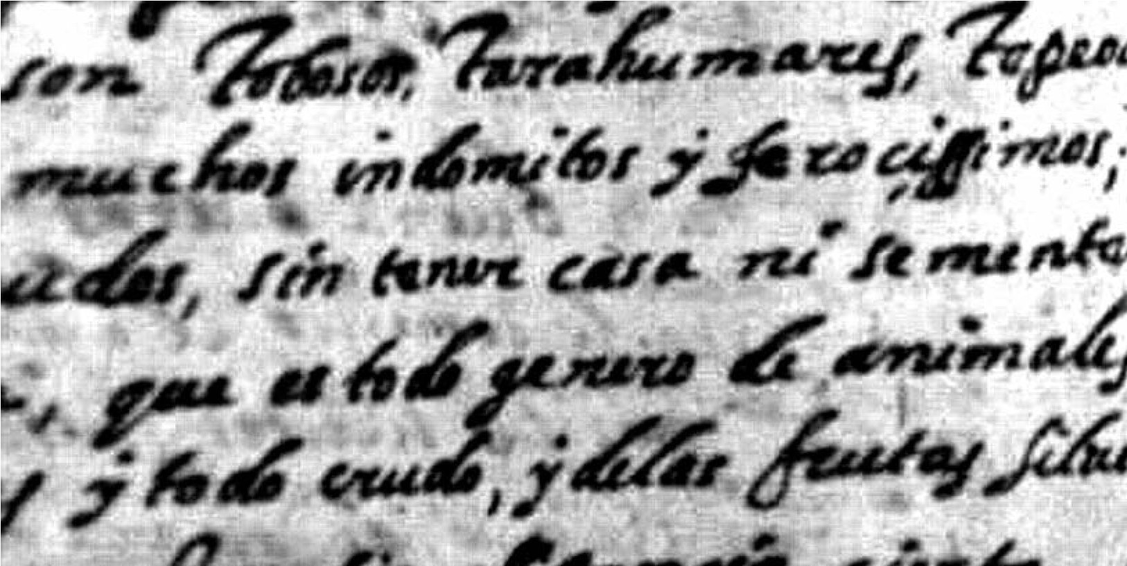
When Fray Alonso de Benavides described the indios bárbaros of the 1620s along the road to New Mexico, he referred to them as “people very fierce, barbarous, and untamed” (gente muy feroz, bárbara, y indómita; Ayer 1965:8789; Benavides 1630; Figure 1.1). He also provided his reasoning for this pejorative reference, commenting that they were so barbarous “that they will not even let themselves be talked with,” much less converted or pacified (Ayer 1965:8789; Benavides 1630). Of course, the peoples who embraced the mobile lifeway were not interested in the haughty talk of foreigners. These mobile naciones expressed fierce behavior toward the newcomers to ensure their freedom, for they did not wish to be “tamed.” As part of their conquest rites and initiation of lawful political domination, the Spanish asserted their sovereignty over all Indians and required their peaceful submission to the king. Dire consequences followed if submission was not made or if there was malicious delay (Flint and Flint 2005:616). In the 1512–1573 era Spanish conquistadors read aloud the Requirement (Requerimiento), which was an ultimatum for indigenous peoples they encountered to acknowledge the superiority of Christianity or be warred upon (Seed 1995:70). The Spanish would implore residents they encountered to acknowledge the church, the pope, and the king as superior, and as lord and king, stating that if they didn’t:
I will enter forcefully against you, and I will make war everywhere and however I can, and I will subject you to the yoke and obedience of the Church and His Majesty, and I will take your wives and children, and I will make them slaves... and I will take your goods, and I will do to you all the evil and damages that a lord may do to vassals who do not obey or receive him... the deaths and damages received from such will be your fault and not that of His Majesty, nor mine, or the gentlemen who came with me. (Seed 1995:69)
In this context it is possible to see that being fierce, barbarous, and untamed meant that these mobile peoples remained unconverted and did not settle down to farm (they are without house, nor any sowing; sin tener casa, ni sementera alguna); they remained, therefore, untamed and untamable. They were indomitable, and part of what made them unconquerable was their lifeway, which led them from hill to hill (mudándose para esto de unos cerros a otros). Because of this way of life, they could not be easily subjugated. These peoples did not wish to be subjects, as testimony in the investigation of the Coronado expedition conveyed: “They were not familiar with his majesty nor did they wish to be his subjects” (Flint 2002:353).[1] They fiercely defended their way of life and their families, and when arrogant Spaniards read the Requerimiento, stating that native women and children would be enslaved if they did not submit to the king’s authority, the fierce defenders may not have understood the words but as time went on they began to comprehend the intent. These fierce, barbarous, and untamed ones are any of a number of peoples who did not submit, nor did they recognize the legitimacy of this asserted domination. When they knelt on bended knees, begging for missionaries and baptism, it was often a ruse to get the Spanish to accompany them through enemy territory, for they knew how easily the Spanish could be fooled (Hodge i9iob:26i; Kelley 1955:984). These are the people who moved around the landscape not only to pursue game (they live off what they catch; viven de lo que cachan) but to evade the “yoke and obedience of the Church and His Majesty” avoiding the deaths and injuries that, although inflicted by the Spanish, would be their fault, according to the Requerimiento. While the Spanish did “all the evil and damages that a lord may do” these mobile peoples melted into the landscape, living as they chose.
It was not always this way. Many of the same groups that Benavides and others described as fierce were initially friendly and welcoming. Members of these small mobile groups hid from the first explorers, as noted by Hernán Gallegos of the Chamuscado-Rodríguez expedition: “On entering the mountainous territory, we saw an Indian brave and two inhabited huts. Taking our horses and arms we went in that direction and discovered many people, who fled toward the mountains when they saw us approaching” (Hammond and Rey 1966:80–81). Others welcomed the Spaniards and helped them along the way. The Tanpachoas, thought to be the people later referenced as the Mansos, provided the 1582–1583 Espejo expedition with “a large quantity of mesquite, maize, and fish” during their seven-day visit (Hammond and Rey 1929:69). As the Yavapai point out today, their ancestors were noted by the same expedition as being initially friendly to the Europeans: “In this locality we found many peaceful, rustic people who received us well” (Hammond and Rey 1929:107). Regional hospitality dictated that locals share their food with visitors and shelter them from harm. Others were looking for new allies in the already war-torn region. But as Europeans imposed their will on the locals, the locals changed their approaches to these newcomers. Their responses were in many instances dictated by how accessible they were to the Spaniards and how easily they could move to more remote locations.
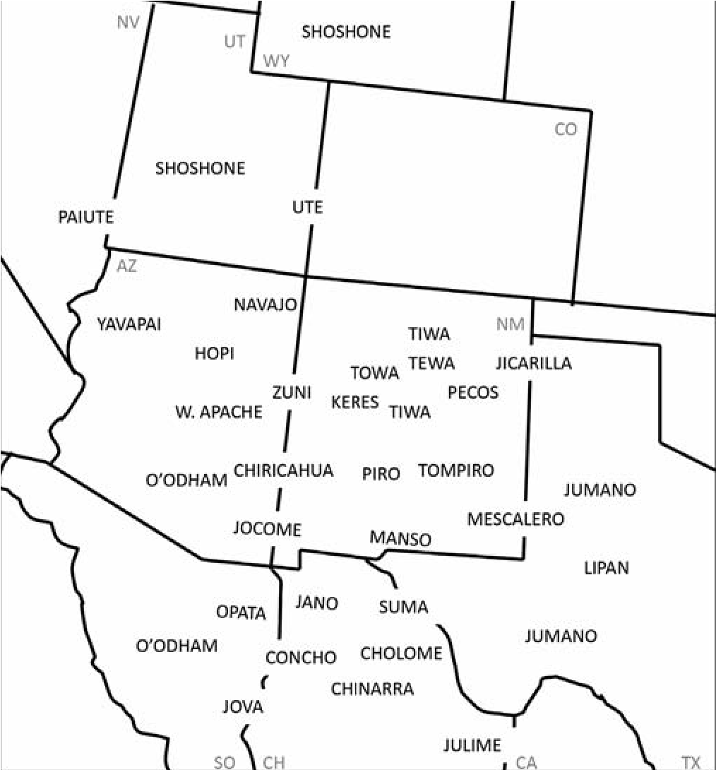
But the chapters in this book are not about the Spaniards, or even about native people’s interactions with the Spaniards. This book is about The People themselves, in their own right, and the archaeology of these mobile people of the Terminal Prehistoric and Native American Historic periods, collectively referred to as the Protohistoric (Figure 1.2).[2]
The People, on the Periphery
Most indigenous groups refer to themselves as The People, the implication being that all those surrounding, even close neighbors, are “others,” less than people.[3] The use of these titles that self-reference as The People (those of relevance) remains true for the vast majority of groups that refer to themselves in traditional ways. The historic and sometimes the current name used to identify a tribe is often not the traditional name it uses for itself. This holds true for the historic Pima and Papago, now known as the Oodham; the Ute, who call themselves Nuutsiu or Nuchu (or a variation on this term, depending on the band); and the Yavapai, who call themselves Pai. The Chiricahua Apache refer to themselves as Ndeh, the Mescalero say Nde, and other Apaches and Athabascan-speaking groups call themselves Dine, Tinde, or Inde, all dialectical variations meaning The People. Each saw themselves as central in their world, their self-reference as The People conveying their sense of belonging in a land fashioned specifically for them by the Creator. Each of these groups is discussed in this book not as isolated entities, as the only real people, but as a mosaic of peoples peripheral in many ways to the better-known Puebloan groups and other settled peoples of the Historic and Late Prehistoric periods.
The peoples discussed in this book are mostly those that have remained at the periphery of Southwestern archaeological investigation. Until recently, little was known about the archaeological signatures of these groups and so they were not available for study, other than through history, oral history, and ethnography. Mystery surrounded the presence of these mobile groups, owing to an insular focus on farming communities. Such limited focus was justified by the absence of evidence and by the much richer material records of many of the farmers, whose decorated vessels and sizable communities with thick midden deposits have attracted archaeological researchers since the beginning of a formally organized discipline (Chapter 13). Early researchers engaged discussion of some of these peripheral peoples by suggesting they attacked the settled farmers and were therefore responsible for key organizational changes late in prehistory (Kidder 1932; Rouse 1958). Chapters 2 and 3 in this book discuss violence, but initially these groups remained on the outside of scholarly inquiry, rarely the focus of study themselves. Even visiting mobile peoples who encamped at the periphery of the pueblos have remained invisible until recently (Chapter 4; Seymour 2015a).
Many of these groups are also at the geographic periphery of the Southwest, such as the Numic-speaking Ute and Paiute, and the Pa- tayan, all of whom were at the northern edge, and the Jumano, who occupied the far eastern edge. Many Apachean groups were in the center but occupied niches that were used by their settled neighbors only tangentially or in narrowly prescribed ways. Other Apachean groups moved throughout a vast territory, usually circumventing settled populations but preying on them when needed. Some of these peripheral groups, such as the Sobaipuri Oodham and other Akimel Oodham, used the same landscapes as their predecessors and practiced a farming way of life, but their material signature is so light that study of their past is challenging and thus they have been marginal to mainstream study (Chapter 13). These are the lesser-known Protohistoric groups of the North American Southwest, who were also many of the peoples encountered by the first Europeans.
Defining a Period of Study
Protohistoric is typically used to denote a vague, poorly defined period in the American Southwest. More often than not it is defined with reference to preceding and succeeding periods.[4] Mostly, it carries with it the assumption that we do not know when or how the grand adaptations of a ceramic-titivated prehistory ended and new or derivative ones formed. It is a period of many transformations, and this problem of how the primary prehistoric manifestations became those of the Historic period remains a key question. In this sense Protohistoric defines a negative, a void, and an absence of knowledge and evidence. For this reason and to set the stage, the book includes two chapters on the Late Prehistoric Jornada Mogollon (Chapter 2) and Hohokam (Chapter 12), along with one that discusses the interaction of existing peoples and newcomers (Chapter 13). These provide a sense of what was occurring locally before and during key turns of events that sent them headlong into the Protohistoric.
Most people think of the Protohistoric as a transitional period between the Prehistoric and Historic periods. Customarily in the southern Southwest this period lies between ad 1450 and 1700, although the temporal boundaries are imprecise. Yet even in this region the dates used to denote the Protohistoric period vary widely (Di Peso 1953; Gilpin and Phillips 1998; Ravesloot and Whittlesey 1987; Riley 1987; Seymour 2011a; Wilcox and Masse 1981). One reason is that history begins at different times in different regions. In northern New Mexico, Francisco Vázquez de Coronado’s quest for Cibola in the mid-sixteenth century is relevant, while directly to the south the 1581 Rio Grande crossing by Fray Agustín Rodríguez and military escort and expedition leader Captain Francisco Sánchez Chamuscado is seen as the pertinent event. In Utah, Fathers Francisco Atanasio Domínguez and Silvestre Vélez de Escalante established historic contact in 1776, and in 1706 Juan de Ulibarri claimed the territory of Colorado.
Moreover, the actual act of history that spurs the initiation of the Historic period varies among researchers as they choose which contact event to emphasize. Most treatments are imprecise as to when the Historic period begins and whether or not this apparent watershed event depicts the time of continuous occupation or the first recorded contact with Europeans. Initial (documented) contact tends to occur much earlier than sustained contact, but many, for example in Arizona, do not consider history beginning until there is a sustained presence. Before this, numerous undocumented Spaniards and Indians from the south traveled north to obtain slaves and other items worthy of illegal import from the Pueblos and nomadic tribes that occupied this land uncharted by Europeans. Depending on perspective, history may begin in southern Arizona in 1539 with the arrival of Marcos de Niza or, conversely, in 1691 with Father Eusebio Francisco Kino in the southern portion of the state and in 1629 at the ancestral Hopi village of Awatovi on Antelope Mesa in northern Arizona. One implication of this is that the conditions and nature of contact vary widely.
Differences in contact events between drainages and in geographic zones may be pronounced as well. Groups living along major travel corridors, such as rivers and key trails through the mountains, would have encountered many more varied people and much earlier than those who lived in the hinterlands. All of these issues are relevant, yet one important aspect of the Protohistoric concept is that the initial encounter with Europeans was an event of a very different nature and magnitude for local indigenous populations than the encounter with other natives. I am confident that it is time to reevaluate this assumption.
Additionally, our view of when history is initiated varies among groups. For example, the Oodham are generally viewed as being encountered by Niza in 1539, but we think of the Apache as not being contacted until the late 1500s. This apparent absence of direct encounter has led many to continue to argue that Athabascan- speakers, the Dene, were not in the region until long after Spanish presence, despite strong evidence to the contrary (Seymour 2012a, 2012b, 2013a; Chapter 17). Yet even though the ancestral Apache may not have been encountered by the Spanish until much later, it is legitimate to question if and how they might have been affected by European presence much earlier. Disease is one vector by which they might have been impacted, but their interactions with other groups were likely affected as well. Their ability to trade was influenced by the new goods that became available to the Oodham and Pueblo groups. Evaluation of the costs and benefits for raiding would have been altered. New alliances likely created imbalances. Contact with one group could no doubt have profound ripple effects throughout a wider region, affecting groups that did not experience direct encounter for many decades.
People in different geographic areas and cultures experienced this period in unique ways. Because of this geographic component, archaeologists have tended to conflate ethnicity with chronology (Seymour 201^:230–231; Ravesloot and Whittlesey 1987:83). Although such equations originate with archaeologists who study sedentary farmers perceived as residing within distinct territories, the problems with this imprecision become visible among groups with overlapping territories and intertwined histories. In this conception, one geographic area does not equal just one culture group. Conversely, even the larger tribal entities of today are composed of many that were previously distinct groups. The Oodham along the Gila and Salt rivers experienced this period very differently than the Sobaipuri Oodham of the Santa Cruz and San Pedro rivers, just as the more mobile Soba and Tohono Oodham did. Consequently it is expected that there were substantial differences in local or regional processes, specific events of contact, and types and amounts of evidence available. This means that our studies will be most effective when focused on a specific group within a specific geographic area. At the same time, however, we should not ignore adjacent areas because the period cannot be understood without a much broader geographic focus. The historic groupings so important in ethnographic accounts were not necessarily groupings visible archaeologically many centuries earlier.
As data accumulate, our understanding increases, yet Protohistoric temporal boundaries have been based on guesses and lack of data. These vague and varying notions of the Protohistoric period result largely from a lack of archaeological sites and other forms of evidence on which to base assessments, including past uncertainty in chronometric placement of sites. The lack of dates has left a significant period of time unaccounted for between the end of the prehistoric era and the Spanish entrada.
The lack of a coherent and organized body of archaeological evidence has been largely responsible for the widespread use of the term Protohistoric. This catchall period defines a nebulous time when the classificatory rules of the prehistoric periods do not apply, when boundaries change, and when new groups form and migrate in. It is during this time—as much as if not more than others—that assumptions must be examined, theory devised, and methodologies adjusted.
One important part of the problem is that prehistoric periods are based on changes we can see in the archaeological record, while the initiation of the Historic period is marked by a pen stroke, generally with no commensurate alterations visible in the regional or local archaeological record. Even when historical figures proclaimed a fundamental alteration in local practices, in reality it is often many decades before transformations appear in the archaeological record, suggesting that actual practice did not conform to these politically motivated claims (Seymour 20iia:288–289). In other instances, critically important happenings with long-term effects were either not mentioned or purposefully denied (Seymour 2009a, 20iia:23i).
These labels (prehistoric Classic period vs. Protohistoric) are not comparable or compatible classificatory criteria. Although “Protohistoric” can be a helpful term to denote a period of study, it is generally more problematic than useful owing to its imprecision. Conceptually, the term “Protohistoric” makes sense when nothing is known for a block of time and is equivalent to Haury’s (1975:18–21) term “dark age” to reference unknown cultural patterns. Yet as we learn more about this wedge of time, more precise labels seem appropriate because of the diversity of processes occurring and the nature of transformations taking place, which can be seen as a consequence of their impacts on the material and spatial record. Throughout much of this region the Terminal Prehistoric gives way to the Expedition period, and then period and phase labels proliferate to reflect local developments visible in the archaeological record and in historic documents (see Seymour 201^:230–232). “Protohistoric” is still most useful to denote the vague, general, and unknown. As I have noted, the term “should signal to the reader ambiguity in understanding, doubt in accuracy, or imprecision in content.” Nonetheless, it can be helpful as a shorthand reference that acknowledges the substantial changes under way in cultural systems, while allowing temporal considerations and details to be set aside while other issues are addressed (Seymour 201^:230).
Earlier Than Expected
Assumptions of a shallow time depth for many of the groups that define the Native American Historic period has influenced the search for and detection of relevant evidence. The postulated late arrival of many groups has prohibited recognition of earlier-than-expected evidence, which in turn prohibits investigation of the processes surrounding the initiation of the sometimes profound differences manifest clearly a century or two later. Hardened conceptual schemes allow researchers to distrust and dismiss carefully collected chronometric dates that fall before the arbitrary 1450 date (Chapters 7, 13, 16, 17, 19, and 20). This temporal margin is perceived as real and even meaningful, and so it is customary to argue away dates relating to late components that occur on sites thought to be older, because, after all, these dates are presented as probabilities, always with some degree of uncertainty. Similarly, it is common practice to assume that dates in the ad 1200s and 1300s are reflective of the underlying cultural manifestations rather than evidence of new groups. Chapters in this book suggest it is time to reconsider the relevance of late dates on aceramic and multicomponent sites and to remain open to the possibility of nonstandard assumptions about episodes of site use.
A significant number of chronometric dates have been obtained relatively recently from numerous intensively studied archaeological sites. In many instances, these sites were used by the historically referenced groups encountered by the first Europeans even though they date to long before European presence. Earlier-than-expected dates associated with distinctive material culture indicate that fundamental changes in the social landscape and in predominant lifeways occurred over a vast geographic area. Chronometric dates indicate that the Oodham were present perhaps as early as the ad 1200s and their mobile neighbors the Jano, Jocome, Manso, and Suma at least as early as the 1400s (see Chapters 7, 13, 17), and probably even as early as the ad 1200s or 1300s (Seymour 2016). Yavapai and Ute sites are also presenting early dates (ad 1300s), as are Great Basin sites (Chapters 16, 19, and 20).
A growing body of evidence regarding early ancestral Apache presence in the southern Southwest provides chronometric dates in direct association with Apachean material culture in the ad 1300s (Seymour 2008a, 2013a). One of the first ancestral Apache sites found that dated to this early period (discovered in 1994) was the small encampment referred to as Three Sisters; although not published until now owing to its controversial nature (Chapter 17), this site has been foundational for our thinking about an early ancestral Apache presence in Arizona. Its character is consistent with later ethnographic data, indicating stability and temporal depth in some aspects of Apachean lifeways.
Moreover, this site and a Yavapai one discussed by Stokes and Tactikos (Chapter 18) demonstrate that mobile groups may stay only a short time but tend to return repeatedly to favored locations, creating persistent places, places of intervallic use (Seymour 2009b). This understanding of encampment reuse allows for effective chronometric sampling of features (Chapter 17). Other aspects of mobile group behavior seemingly account for the frequency of late dates obtained by Roberts in the Pai area (Chapter 20). Incredibly, 35 percent of the accumulated dates in southern Nevada fall into the target period, which is partially related to the greater number of sites that mobile groups produce as a result of moving around. Also, however, sites with ceramics and other artifacts considered diagnostic do not require the added expense of chronometric sampling, which also likely contributes to the skewed numbers.
The problem of lack of data and dates for this period has been exacerbated by the fluctuations in carbon 14 and cyclic oscillations that result in multiple intercepts and excessively long age estimates. Yet use of a combination of luminescence and Accelerator Mass Spectrometry (AMS) radiocarbon dating has exponentially increased the number of chronometric dates available for the post-1600 period. These results indicate that “Protohistoric” adaptations, which begin in the AD 1200s and 1300s, or even before, overlap with prehistoric cultures in the Terminal Prehistoric period. This inability to temporally partition these data sets explains in part why these Protohistoric groups have been so difficult to define (Seymour 2008a, 2008b, 2010a, 2011a, 2011b, 2013a). Recognition that these groups were present much earlier means that we cannot use ad 1450 as a point of departure for investigation. There is no great divide at ad 1450 that separates distinctive adaptations but rather there is an overlap between extant prehistoric cultural entities and those present in the Historic period, even when new groups entered the region (Chapter 13). As shown in Chapter 20, use of the “Post-Puebloan” label, like the term “Protohistoric,” often keeps us from seeing or accepting this overlapping presence and examining the processes when they actually begin.
The Terminal Prehistoric is when new groups and new organizational systems first appear and when changes in existing ones are most visible. Previous focus on the transition to history has masked the timing and impetus behind these transformations. Consequently the explanations for change adopted derive inappropriately from processes that were not relevant until many decades or even centuries later. Much happened in the 100-300-year period that lies between the end of prehistory and the beginning of history, and when the Historic period arrived, these altered lifeways were already well entrenched. Many of these historical groups changed substantially through time as well, which means we must track their archaeological signatures temporally and spatially while recognizing the basis for changes in landscape use, feature characteristics, and artifact types (Seymour 2012a). In many cases these long-established practices provide a basis for the later actions of indigenous peoples when confronted with European practices and conventions.
Dispensing with the Notion of a Hiatus
Recognizing depth of occupation has not been an issue for Puebloan groups, for which continuity is assumed owing to the distinctiveness and high visibility of their material culture. But for non-Puebloan groups the assumption of a late arrival has contributed to the postulation of a temporal hiatus and a substantial break in material culture between prehistory and history. This notion of an occupational hiatus after about ad 1450 remains a dominant theme in the Southwest and accounts for the bracketing of the Protohistoric period between ad 1450 and 1700 in the southern Southwest. It was thought that when the prehistoric cultures in the southern Southwest “ended,” there was an occupational hiatus before the historic groups, such as Apache, Oodham, Jano, Suma, and their neighbors, moved in. This notion originates in a long intellectual tradition, most notably advanced by Haury (1975, 1985), who proposed a hiatus in the Forestdale Valley and also in the Papagueria (now the Tohono Oodham reservation).
This occupational model has lent credence to the idea of the dispersal of the Hohokam and the emptying of the central basins of Arizona. The term “Hohokam,” referring to prehistoric irrigation farmers, originates from the Oodham word Huhugam, meaning “something that is all used up” or finished, from huhug, “to perish, disappear” (Bahr 2009:1). The archaeological distinction between the Late Prehistoric and Historic Native American cultures reinforced this idea, especially in the absence of evidence for the intervening period. Models of a massive die-out or out-migration have remained viable because of lack of knowledge, which has been equated to lack of presence. Unfortunately, positing a hiatus has allowed archaeologists to abrogate the responsibility of explaining this substantial change (Chapters 12 and 13). Migration into an empty niche is a much easier scenario than entry into a contested terrain where complex social processes, such as conflict, must be addressed. Assumptions regarding the occurrence of a hiatus dispense with the need to engage in multifaceted arguments about how the end occurred and new beginnings came about. With the addition of new data, however, simple unicausal environmental or migration-related explanations are no longer warranted.
Some have recognized the unlikely nature of the empty niche scenario and have proposed a reorganization of existing systems rather than a disappearance. Southeastern New Mexico models have accommodated this notion, suggesting that groups went back and forth from stationary village farming to a more mobile hunting adaptation (Hodge 1910^257–258; Jelinek 1967; Speth and Staro 2012, 2013; Sebastian and Larralde 1989; Speth, Chapter 3 this volume; Beckett, Chapter 5 this volume). In southern Arizona similar models are lacking, and some continue to argue for the filling of an empty niche. In this scenario there is no conflict, no resistance, no accommodation, and so only a single process requires consideration: the recognition and timing of migrated groups. There is no perceived need to consider processes for the Terminal Prehistoric that approximate those of contact with Europeans in the Historic period. We have yet to consider the material and spatial consequences when organizations disintegrate and form smaller, independent, self-interested groups. It is reasonable to infer that as the Jornada Mogollon faced stress, their way of life transformed into that characterized by the Ju- mano and others, as Beckett suggests (Chapter 5; Jelinek 1967; Sebastian and Larralde 1989). It is equally important to ask whether there was always a mobile element that has remained archaeologically “invisible” If so, how were these people impacted when newcomers arrived?
When the Pueblo world is viewed as the center of the social universe, it may be difficult to see that, in the Terminal Prehistoric period at least, Pueblos were small nodes of concentrated populations in a sea of mobile people rather than exclusive occupiers within a vast and uncontested Pueblo domain (Seymour 2015a; Chapters 4 and 13). Our ability to see these mobile peoples provides a glimpse into their widespread presence, hinting at the need to consider this element when we discuss social processes. At the same time, in Chapter 3 Speth discusses Plains margin hunters who occupied pueblos, a difference that highlights the conceptual contrast between highly mobile groups and seasonally mobile stationary groups.
The processes under way at this time were complex, involving political and economic reorganization and migration of new peoples. Each area likely experienced this transition differently, and so archaeological evidence is not expected to be consistent on a more widespread basis (Seymour 2011a). Thus while there may have been a hiatus in the Forestdale Valley (still to be demonstrated), people were, in fact, present in nearby areas (Seymour 2012b). As Wilson (1984:44) remarked regarding the Apaches: “The realization that an Indian group could enjoy almost unlimited use of a territory for roughly 300 years and yet leave few traces upon the landscape should sober archaeologists as to the imprecision of their customary tools for interpretation.” Clearly our tools of interpretation require improvement, but the techniques of recognition are also in need of refinement. Now we have evidence to suggest that the Apache had “free reign” for roughly 600 years. New data presented in this book and elsewhere demonstrate that there was no occupational hiatus, nor were the Apache alone.
Reorienting the Protohistoric Problem
One important and misleading aspect of the Protohistoric conceptualization is that initial encounter with Europeans was the seminal event for indigenous groups. Just as indigenous people have seen themselves as The People, historians have viewed that which was written and those initiating the record of encounter as the legitimate focus of study (Rubertone 2000:428). Along with this it has been presumed that our first window into the Terra Incognita was eventful for all, and that this encounter was an event of a very different magnitude than encounter with contemporary natives. New data suggest that it is time to reevaluate this assumption, in part because indigenous people had their own histories with equally varied agendas that played a role in steering the course of events. They were not passive, helpless, and ignorant recipients of outside offerings and threats. No doubt many were superstitious, but so were the Europeans of the time. The first encounters were often violent and intrusive, and indigenous groups were impacted when, for example, Esteban and nearly 200 So- baipuri were killed at Cibola for trespassing (e.g., Flint and Flint 2005:73–75). Yet there had been many such intrusions already, and there would be others. Past conflict was part of the reason Esteban was not welcomed at Cibola, for when the Cibolans saw what were probably Tarascan bells on Esteban’s gourd, they recognized these as being the type made by their enemies. Still, and importantly, it was not until much later that Europeans became relevant to indigenous peoples—when disease, new technologies, crops, and livestock were introduced, when the slave traders arrived, when new alliances formed, when tribute was demanded, and when there was a sustained European presence.
Too heavy a reliance on historic documentary sources has skewed history toward one focused on Europeans (Rubertone 2000:428; Seymour 2011a). Yet the observed people did not immediately change; rather, our ability to access knowledge of them has in the recent past hinged on the presence of a historic record. Thus, with the commitment of ink to paper, Cabeza de Vaca and Marcos de Niza established the conceptual framework used to study indigenous peoples. The view has been from the outside in. In contrast to prehistoric periods, the Protohistoric period is defined by external events and processes that have nothing to do with local and regional developments and everything to do with the arrival of Europeans. It is this conceptual framework that is in need of reconsideration. The data provided in the documentary record are to be welcomed, but our understandings of who these indigenous people were, where they came from, and what events and processes affected them most must be rooted in archaeological data, for it is one of the best sources for examining the long term. Critically assessed oral history can also be of help in this way, especially when the information is passed directly on. Importantly, however, circumstances do not change for the reticent native positioned at the edge of the explorer’s camp when mention of him is committed to parchment. Awareness of smoke in the distance did not alter fundamental lifeways for people who had long resided along ancient travel routes.
The indigenous inhabitants have been viewed through the lens of Europeans whether contact was relevant or not. Once the Historic period begins, scholars tend to focus on Europeans and consider indigenous occupants only in relation to Europeans. This is why I have intentionally excluded contributions that involve using European artifacts as indices of this period. Although as Thomas (Chapter 21) notes, it is important to use the full suite of tools available to investigate sites of this period, Protohistoric Native American historic research has taken a turn where we no longer must rely on European artifacts to identify indigenous components. Significant advances have been made that allow us to identify these components and sites solely on the basis of the indigenous material culture. Previously, native modifications to European artifacts or trade goods were required to identify Protohistoric sites. When we can identify mobile group evidence without metal detecting or European artifacts, we are better able to understand origins, timing, and a host of other processes (Seymour 2010b, 2010c).
Because of the bias toward Europeans and in an attempt to counter it, some scholars extend the Protohistoric period well into the Historic period, terminating it at perhaps the mid-i700s or at 1800, so as to remain focused on natives. Because records of initial contact are usually sketchy and it is difficult to evaluate impacts of European presence, the Protohistoric period tends to include the beginning of the Historic period, a shadowy time when records are sparse and Europeans came and went but did not stay. The Native American Historic period tends to be subsumed into and considered a subset of European colonial history, with European-relevant phases and research themes focused on topics pertinent to Europeans. In mainstream historical archaeology, indigenous happenings are evaluated and valued only with respect to their impact on and as a consequence of European history. Indigenous occupants are not in themselves considered historic peoples! As such, they have generally been outside the course of study for historical archaeologists, relegated to prehistory, protohistory, or Native American studies (Seymour 2013b). It has been agreed for some time that although “the proper concept of American history would not exclude the aborigine,” the field would focus on “the history of white men in North America” (Harrington 1978:3). Native American sites become relevant to historical archaeology “only when their basic cultural and ecological patterns have been altered by contact and when this is displayed in the archaeological data” (Schuyler 1970:85).
Fortunately, most Southwestern scholars consider Native American history part of the Historic period. The chapters herein are concerned with indigenous developments and focus on local sequences and processes. While many rely on historical documents and ethnographic data to frame questions or provide interpretive guidance, they are concerned with understanding the Protohistoric period from an archaeological perspective that focuses on indigenous populations. In doing so, they hope to capture relevant aspects of local and regional sequences and to develop new understandings on which to base more meaningful chronologies and narratives.
From Late Prehistory to Late History
The chapters in this book cover many of the non-Puebloan groups present throughout the American Southwest during the Terminal Prehistoric and Historic periods. The authors are attempting to define these groups, sometimes for the first time (culture history), at the same time placing them in more generalized contexts and attempting to understand a range of larger implications. We can only benefit from thinking more broadly, envisioning a much more encompassing area, and considering cross-regional processes. Because scholars tend to work within modern geopolitical boundaries, there is less consideration of similarities across state and international lines or between regions than would be beneficial. Space and time are used to separate the major prehistoric culture groups, but most of the peoples discussed in this book were mobile, so they moved throughout much larger areas. Consequently our conceptions and understandings of this time period will only be improved by thinking much larger, by comparing regions, and by examining behavioral similarities between distinct groups. Moreover, archaeologists could learn from the methodological developments in adjacent areas that are suitable to these groups, whereas now-current boundaries provide an excuse not to cite relevant literature and to be distrustful of results.
During the Protohistoric period vast expanses of the Southwest were occupied by small groups that moved over hundreds of miles and whose territories overlapped; consequently more than one contemporaneous group was present in each area. Together their territories encompass vast tracts that include Arizona, Utah, Colorado, and New Mexico, not to mention Nevada, Texas, Chihuahua, Sonora, and Coahuila. In addition to moving throughout broader expanses than their farming neighbors, they traded, raided, scavenged, and intermarried with and kidnapped people from neighboring groups. If we know the patterns representative of groups in surrounding areas, we can isolate those within specific geographic areas. We are also learning that one group, such as the Apache, may be very different when bordered on the west by the Yavapai than when bordered on the east by the Jumano.
One of the most important messages of this book is that the types of sites left by mobile peoples can be identified and studied (Chapters 4, 7, 14, 15, 16, 17, and 19). Many researchers have stated that these types of sites are not discoverable, as their occupations were too short or the impact too light. For example, Spielmann (1982:301–302) comments with respect to mobile group evidence around the Salinas Pueblos: “A combination of highly impermanent structures and probable short-term occupations makes it highly unlikely that much will be recoverable archaeologically.” Discussing the depopulation model following the Jornada Mogollon El Paso phase in southern New Mexico, Lockhart (1997: 115) suggests: “From the ‘abandonment’ to the arrival of the Spaniards in the Southwest, such [mobile group] camps would be archaeologically ‘invisible.’” These are just two of many similar statements that judge the evidence far too ephemeral and unobtrusive to identify. Nevertheless, the chapters of this book present tangible evidence of these peoples across the North American Southwest. There is much to be learned from these sites, including new avenues of research and rethinking of existing research themes. The information contained in these sites is relevant to prehistory and to history, as well as to modern descendant tribes that directly trace their lineage to them.
Recognition of these sites is enhanced when examples are recent enough for perishable elements of features to be preserved. Usually archaeological evidence for hunting is provided only by projectile points and faunal material. It is rare indeed to find evidence of hunting structures used in traditional forms of communal hunting. Copeland’s (Chapter 14) archaeological examples of perishable game traps are an important landscape element regarding cultural subsistence practices. As Copeland notes, when these features deteriorate, there will be little or no physical evidence of their existence.
Work on Late Historic Ute sites provides an unprecedented look at material culture, house construction techniques, and the use of space. Martin’s (Chapter 15) study of still-standing wickiups provides rich insights into aspects of the Ute not preserved in earlier contexts, including site structure, the use of space, wickiup construction, and the range of artifacts used.
Such is the case with Promontory Cave, Utah, which represents an exceptional sample with intriguing new analyses, as mentioned by Thomas (Chapter 21). Yet most Protohistoric mobile group sites are in the open, and there is little preserved with relatively few artifacts. We must nonetheless figure out how to make these sites useful, including where little or no datable material is present. Less prolific sites have value, and we must continually work on ways to extract what data they do possess by studying them on their own terms rather than seeking only rarely occurring, exceptionally strong sites as our only focus (Seymour 2010a, 2013a, 2017).
Turbulence usually accompanies the presentation of new findings, a fact to which many authors in this book can attest. This is no less true of the strong new evidence that is mounting regarding the early presence of Numic-speaking peoples in the northern Southwest. Ancestral Ute people were likely in the northern Southwest by the late 1200s and certainly by the 1300s, an inference supported by recent evidence from a fourteenth-century site in northeastern Utah (Chapter 16) and Brunswig’s (2005:227–228, 2013:24, 27) early Ute sites.
Like Ute and Apache archaeology, Yavapai archaeology has long been recognized but is acknowledged with a degree of hesitancy because of its unobtrusive character. Pilles’s contribution (Chapter 19) speaks to the core of the issue of using appropriate conceptual models. The chapter struggles with the question of how to connect what has been found archaeologically to ethnographic and historic entities, how to effectively distinguish the record, and how to make what sometimes seems a monumental step from description to interpretation, from archaeological manifestation to ethnic or cultural entity. Efforts to make sense of the faint footprint have been frustrated by conceptual models brought to bear that are more appropriate for more stationary groups—models that dominate thinking in our region. When we accept the nature of the data as they exist, we can devise more appropriate methodologies and establish effective conceptual frameworks and middle-range theory (Seymour 2010a). With appropriate bridging arguments, speculation can be differentiated from inference building.
Impact on Prehistoric Populations
Defining these groups archaeologically and ascertaining the timing of their arrival or movements and transitions remain key questions for this time period throughout the Southwest. One important implication is the effect of the entrance of mobile groups on local sedentary farming populations and their role in the reorganization of other Southwestern cultures. Kemrer’s and Craig’s chapters (2 and 12) set the stage for the Late Prehistoric period and explore interrelations between established sedentary groups, while others show that the manifestations of later times have their origins in this Late Prehistoric period (Chapters 16 and 17). While the chapters by Kemrer and Craig are not about mobile groups, they are included to show what went before and to demonstrate what the regional landscape looked like from the perspective of the existing peoples. Craig’s contribution (Chapter 12) examines the issue of the Late Prehistoric period in the Hohokam area of southern and central Arizona. The Hohokam did not disappear but rather utilized different environmental settings, and their adobe features are difficult to recognize from surface evidence. This issue is also discussed by Harlan and Seymour (Chapter 13), who reevaluate social network analyses for the San Pedro Valley in southeastern Arizona, supplementing existing databases with information on Sobaipuri Oodham and mobile group sites. The shift to the Oodham pattern occurs at the same time as ancestral Pueblo groups retract to the north.
Because the chapters proceed geographically from east to west and south to north, Kemrer’s contribution begins the book. He discusses a Terminal Prehistoric context and a response to violence that began in southern New Mexico at about ad 1150. Speth (Chapter 3) introduces evidence of both amiable and violent interaction between existing Late Prehistoric semisedentary populations and mobile groups in the first decade or two of the ad 1300s. Seymour’s (Chapter 4) work at the Eastern Frontier Pueblos has produced evidence of mobile group encampments near pueblos, including evidence for short-term visitation and large groups wintering over as early as the ad 1200s. In Chapter 5 Beckett argues that the Jumano and Suma encountered by the Spanish are the descendants of the prehistoric Eastern Extension of the Jornada Mogollon.
Indigenous Perspectives
Indigenous and alternative perspectives of what archaeologists study provide insights into community organization, persistence of cultural entities, identity, meaning, and perceptions of landscape. In Chapter 6 Rodriguez and Seymour discuss how the process of federal recognition does not take into account the unique organizational aspects of mobile peoples. Like other Apaches and mobile groups, Rodriguez’s Lipan ancestors did not organize themselves in tribes as they are presently perceived, but rather resided and operated in small local groups and recognized band associations, only occasionally gathering in larger multiband associations that might be considered a tribe. This traditional practice has considerable implications for seeking official recognition when demonstration of tribal unit persistence is one of the main criteria used in decision making.
Stokes and Tactikos (Chapter 18) show that small places on the landscape may retain significant cultural meaning to indigenous populations, even if they no longer actively visit, use, or occupy these places. Many modern treatments suggest that such places are part of a landscape imbued with multiple layers of meaning and purpose because indigenous people maintain different concepts of linear time, reuse, abandonment, and ownership than others. Seymour (2009b, 20iod, 2011c, 2012c), however, attributes at least part of this to key differences between highly mobile peoples and those that are more settled. Consequently, rather than seeing this as an indigenous versus modern (or Indian versus Western) conception, we may find it useful to examine different types of attachment to the landscape relative to degrees and types of mobility. It is also useful to critically assess whether such concepts are retained in tradition or whether they represent an important aspect of the revitalization of traditional values and connections. Many Apache and Oodham have forgotten their connection to important places, a consequence of the danger awaiting them beyond reservation boundaries, government removal and reeducation efforts, changes in lifeways, and extreme poverty. Nonetheless, they may still be awed and often feel a connection when visiting ancestral sites, as do non-indigenous visitors. People worldwide repurpose, revive, reinvigorate, reinterpret, and maintain interest in historical and ancestral places (Seymour 2011cm. 61, 2012d).
Chapter 19 demonstrates a Yavapai presence after 1870 in an area said to have been abandoned, demonstrating how political and economic factors influence historic accounts of indigenous distributions. A similar narrative exists around the Oodham’s departure from the eastern portion of their traditional homeland along the San Pedro River in southern Arizona. They were said to have abandoned the San Pedro in 1762, but there is clear evidence that many of them stayed (Seymour 2011c). Moreover, archaeological evidence suggests that when land grants were issued in the 1830s along the San Pedro, Oodham residents were still there (Seymour 2011a, 2011c). Likewise, Martin’s (Chapter 15) Ute sites demonstrate a continued presence in areas thought to have been devoid of indigenous occupation, contradicting understandings regarding historic Ute distributions that rely on existing documentary and historical evidence. These sites represent Utes who did not participate in the mandatory 1881–1882 relocation to reservations. Each of these examples highlights the important role archaeology plays in setting the record straight and in contributing to a more prominent voice for the indigenous elements of history.
Evidence of Mobile Groups: Material Culture
Kurota (Chapter 7) isolated Protohistoric manifestations when all other indications, ceramics and lithic artifacts, at the sites pointed to a prehistoric presence yet every excavated feature dated to the Protohistoric/Early Historic era. As is typical, many of the features were nondescript and vague, and crews were hesitant to record them as cultural, even scoffing at Kurota—reactions that are all too common—only to change their minds when confronted with dating results.
Interpretations rely on basic assumptions, so it is important for these to be sound. Moore’s (Chapter 8) contribution on stone tool use among Spanish New Mexicans provides a basis for questioning the meme that stone tool use is an indication of an indigenous component. With imports such as metal so costly and rare, local residents resort to more economical alternatives, such as stone, reworked glass, and repurposed metal, to carry out daily tasks. I have argued that such use reflects the practices of people living outside mainstream economic systems, showing that human behavior in broadly different contexts often converges when people are faced with similar life circumstances. These commonalities are worthy of study and should not be confounded with inferences about ethnicity.
Many of the archaeological correlates established to define the ancestral Apache—such as structural rings—actually apply to mobile groups in general because these correlates are adaptation-based. They are found crossculturally among mobile peoples, based on degree of mobility, expectation for duration of stay, and a variety of other factors (Seymour 2008b, 2009c, 2009d, 20iod, 2013c, Chapter 4). Consequently, other criteria of affiliation must be considered, given that a number of different mobile groups were present. It is understood that pottery and points are the most commonly used material culture classes to distinguish between groups, but in the Protohistoric period these are frequently absent from sites, including those used for habitation. One reason for this is that sites were used for such a short period that materials did not have a chance to accumulate. Moreover, many groups did not use pottery on a routine basis, and for the Apache there remain questions as to whether pottery was part of their household assemblage when they first arrived in the American Southwest.
When pottery and points are present, they are not always sufficiently distinct to allow us to discern ethnicity. Moreover, artifacts from other groups are often present because of raiding, trading, and scavenging (see Seymour 2014a; Chapter 17), yet all too often their presence leads to misconceptions about cultural affiliation because mobile group assemblages tend to be limited (Seymour 2010a, 2014a, 2017; Chapter 4). For all these reasons, points and pottery are most useful for discerning the correct time period, but additional interpretations must consider the processes responsible for their presence. Equally important, when pottery and points are not present, just as when glass and metal are absent, we must still be able to identify a Protohistoric presence on the basis of other tool forms and styles, technological characteristics, hut construction attributes, site layout, and landscape use. Points and pottery, though, remain the diagnostics of choice, used for discerning temporal and cultural affiliation, and the chapters by Harlan (9), Loendorf (10), and Hill (11) focus on what some of this variation means.
When effective, the material culture studies directed toward mobile groups underscore the unique arrays and forms of data as well as fresh perspectives that engage models specifically adapted to mobile groups. This is nowhere more apparent than with respect to ceramic production. Cross-cultural ceramic studies have shown that clays are obtained within a 5-km radius of settlements, yet mobility brings people in contact with clay and lithic sources many hundreds of miles apart and so the compositions of their tools and pots may be highly variable (Seymour 2008c). Moreover, the use of numerous encampments means that each may be near sources with different clay and inclusion compositions. These are some of the factors that explain the especially high variability in Protohistoric plainwares and the compositional diversity that characterize mobility. Hill (Chapter 11) describes the ceramic assemblages of mobile peoples as smaller than those of stationary groups, with limited vessel forms and with more compositional variability as a result of trading and raiding for vessels.
Concluding Statement
One reason the archaeology of this period has remained undefined is that it differs and is often less obtrusive than that of earlier and later periods. Lack of attention to these archaeological cultures has persisted for decades despite the fact that historical records document their presence and in many cases tell us where to look and what will be found. Although the documentary and archaeological records have different spatial and temporal scales, the processes we infer may be effective in establishing isomorphism between documentary content and archaeological observations, with theory as the connective element. With rigorous evaluation of the correspondences between sources, both implied and direct, it is possible to distinguish groups archaeologically and assess their relationship to historical documents. Documentary content is not the same as systemic context, and the Spanish emic perspective should not be confused with that of the indigenous residents.
Many scholars have assumed that the Protohistoric period is characterized by relatively little variability, whereas in fact the chapters in this book demonstrate that the lifeways and their resulting material record were highly variable. Even nations thought of as single political entities, such as the Oodham, Apache, and Jumano, were actually composed of many different groups that practiced different ways of life in their respective geographic areas.
Other scholars assume that this period was not complex but rather is a temporal backwater to the two more important periods that bracket it, or that the mobile people were of secondary importance to the settled farming groups. In fact, this period may be much more complex than earlier or later periods and is certainly more challenging than Puebloan archaeology. While the often meager material culture is frequently equated with simplistic, this period is far from simplistic, and the peoples represented are highly varied in their representations.
Clearly, it is time to dispense with existing notions that Protohistoric mobile groups are unknowable and that their archaeology is too ephemeral and unobtrusive to find, understand, or be of use. It is time to rescue the archaeology of these transient groups from neglect and integrate them into the mainstream of archaeological inquiry. This requires new conceptualizations of method and theory. While only in the last decade have some of these groups been defined archaeologically, their importance is already being recognized. And while there are sometimes stormy reactions to new findings, a robust body of evidence is amassing that should no longer be ignored. The general reluctance to incorporate new data and to reconceptualize this period is giving way to excitement at the new challenges that these data and formulations pose.
2. Terminal Puebloan Occupation
An Example from South-Central New Mexico
Meade F. Kemrer
This chapter describes the formation, composition, and related organizational characteristics of a Terminal Puebloan occupation in the Jornada Mogollon area in south-central New Mexico (Figure 2.1). Viewed as the outcome of regional integration, this settlement represents a transitional form, a precursor to the fully integrated pueblos dating to the Protohistoric and Historic periods. The sites discussed here represent two architectural forms: those often found in the Sierra Blanca area, consistent with the “Lincoln expression” villages described by Marshall (1973), and local pueblo construction types found farther to the south. Consequently, Whalen’s (1980) generalized ad 1300–1400 Late Pueblo period is a more appropriate cultural/ temporal category for these southern San Andres sites than the “Lincoln phase” or “El Paso phase” terminology. Ceramic assemblages date the Late Pueblo to ad 1275–1400 in the study area.
Background
As information accumulated over the years, it became increasingly clear that a large Late Pueblo (ad 1275–1400) population occupied a relatively discrete area on the western flank of the southern San Andres Mountains in southcentral New Mexico (Browning 1991; Carmichael 1990; Chapman 1926; Duran 1982; Kemrer 2003a, 2004; Lehmer 1948; Lekson and Rorex 1987, 1994; Miller 2004, 2005; Sale and Laum- bach 1989; Whalen 1982; Yeo 1931). The setting is east of the Rio Grande from Hatch, New Mexico, and entirely within the White Sands Missile Range (WSMR) military reservation. Two key resources correspond to this high occupational concentration: reliable water sources and abundant arable soil. The study area receives proportionately higher precipitation via the orographic process. Major fault blocks segment the range, manifested as a series of canyons and fractured zones in the sedimentary bedrock. The fault zones serve as precipitation reservoirs that feed springs and some perennial stream flows emanating from the canyons.
Soils are suitable for maize agriculture. A sand sheet, from the base of the mountains to the Rio Grande, covers the montane alluvial deposits. The bajada’s uppermost slopes exhibit a perched water table formed by the interface between the sand-alluvium layers, ideal for dry farming. Eolian sand deposits have accumulated since the end of the Pleistocene, producing a series of varied substrata containing sandy and silty soils, good for water retention essential for crop maturation (Blair et al. 1990; Dominguez and Kolm 2005; Gile et al. 1981).
The study area attracted ad 900–1140 agriculturalists who occupied four major villages and numerous smaller seasonal sites (Kemrer 2009). However, sites dating to the ad 1150–1275 interval are relatively rare, consistent with survey data from the Rincon Valley (O’Laughlin 1985), situated along the Rio Grande directly west of the San Andres study area. The ad 1125–1140 drought undoubtedly forced out-migration.
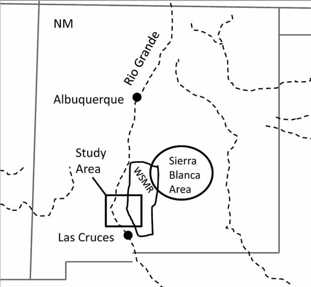
The persistence of multiple drought years in the ad 1146–1151, 1166–1169, and 1186–1190 intervals could have depressed settlement in the area (Grissino-Mayer et al. 1997). Climatic conditions are relatively normal during most of the ad 1200s, but larger Puebloan groups did not inhabit the study area until the end of the thirteenth century. Warfare apparently depressed occupation, for all sites found in the study area dating to ad 1150–1275 were burned, an extremely rare occurrence in the area before ad 1150. After ad 1275 a large Late Pueblo population moved into the study area and occupied it through the fourteenth century, the topic of this chapter.
The Major Villages
All of the six major villages that date to the Late Pueblo period are located in the WSMR portion of the study area (Figures 2.1 and 2.2). Three of these are spatially associated with the mountains. Three remaining villages rest on the alluvial slope, immediately west of the mountains. Village architectural characteristics vary by location. The three mountain-associated villages, Fleck Ranch, Fleck Draw, and Cottonwood-A, exhibit cimiento foundation construction, upright stone alignments outlining the adobe room walls. The three alluvial slope adobe villages, Indian Tank and Cottonwood-D and — E, lack cimiento alignments. The major villages also form two groups, with the northern group containing Fleck Ranch, Fleck Draw, and Indian Tank villages and the southern group made up of the Cottonwood complex, villages Cotton — wood-A, -D, and -E. Permanent domestic water availability segregates the two groups. Village descriptions follow group membership, beginning with the northern group.
Fleck Ranch Village
The earliest large cimiento-constructed pueblo was Fleck Ranch village, LA 142783 (Kemrer 2003a). It is located in a canyon (see Figure 2.2), where runoff and springs created a perennial stream. The pueblo contains a cluster of room blocks that occur on both sides of the canyon (Figure 2.3).
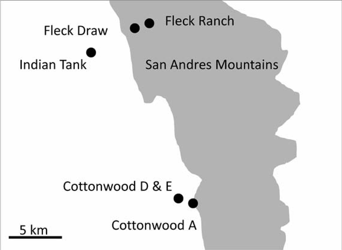
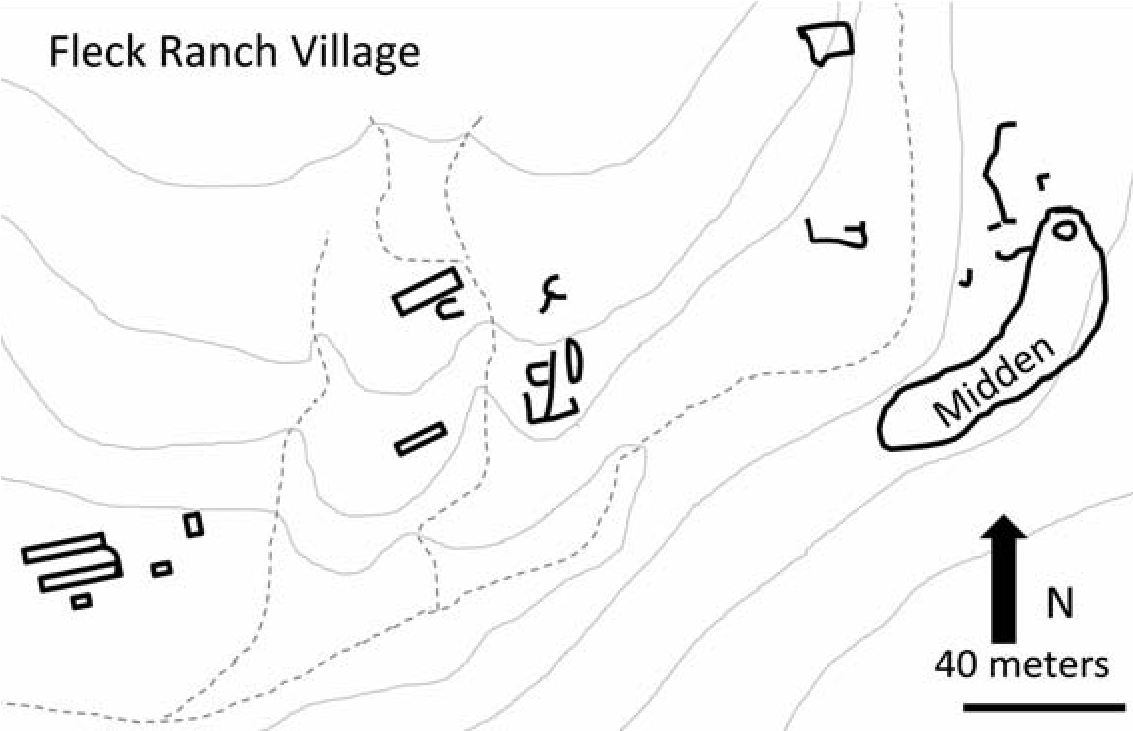
Fleck Ranch village room-block layouts exhibit a wide range of architectural styles. Ceramic types include St. Johns Polychrome, Three Rivers Red-on-terracotta, Playas Red Incised, Lincoln Black-on-red, Gila Polychrome, Ramos Polychrome, Chupadero Black-on-white, El Paso Polychrome, and Seco Corrugated. Figure 2.4 illustrates an example of upright stone cimiento adobe foundation in Fleck Ranch. Tests indicate that the foundation supported 40-50-cm-thick walls.
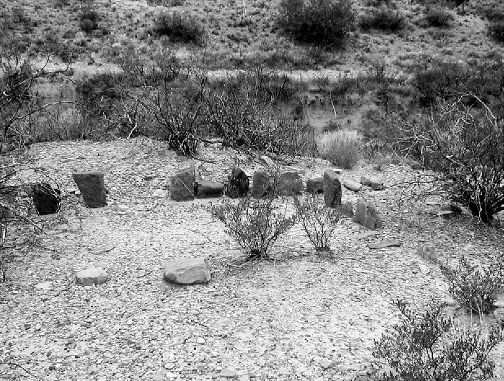
Late Pueblo villages that comprise a cluster of room blocks and adobe cimiento foundations are unknown in this area but relatively common in the Sierra Blanca region in western and northeastern Lincoln County (Kelley 1984), some 80100 miles (129–161 km) northeast of Fleck Ranch village (see Figure 2.1). Sierra Blanca systematics indicate that Fleck Ranch would represent a late Corona phase or an early Lincoln phase site (Kelley 1984). One example, LA 1231, is located adjacent to the perennial Three Rivers drainage (Wimberly and Rogers 1977:255–267). Site setting, architectural layout variability, cimiento construction, and the pottery types present are virtually identical to those of Fleck Ranch.
It is likely that the Fleck Ranch village cluster formed by accretion as small groups from the Sierra Blanca area migrated to the San Andres Mountains. Low occupational debris density within the site indicates a short life span of probably no more than two generations. The site usage chronology estimate is ad 1275–1300+, based on the presence of pre-1300 St. Johns Polychrome (Kintigh et al. 2004) and the later types Gila Polychrome (Crown 1994) and Seco Corrugated (Toni Laumbach, personal communication 2004).
Conditions in the Sierra Blanca area likely stimulated migration to Fleck Ranch. The infamous ad 1276–1299 drought that affected Puebloan populations throughout the Southwest (Adler 1996) and regional warfare (Wiseman 1997) represent two important factors.
Fleck Draw Village
Fleck Draw village (LA 72851) architecture, ceramics, and chronological characteristics correspond to those that define the Lincoln phase in the Sierra Blanca area (Kelley 1984). The site is a large aggregated pueblo (Sale and Laumbach 1989). Consistent with sites immediately within and adjacent to the San Andres Mountains, it exhibits cimiento construction and a location next to the Fleck Draw perennial stream (Figure 2.5).
Fleck Draw village appears to have been occupied later than Fleck Ranch village. Ceramics from this site lack St. Johns Polychrome, a type that disappears immediately before or after ad 1300 (Kintigh et al. 2004:437). Three Rivers Red-on-terracotta and Playas Red types are rare, but Lincoln Black-on-red, including the later glaze variety, occurs throughout the village. Other fourteenth-century pottery types include Gila Polychrome, Ramos Polychrome, Chupadero Black-on-white, El Paso Polychrome, Agua Fria Glaze-on-red, Seco Corrugated, and Tonto Polychrome, a type that dates after ad 1325–1350 (Crown 1994).
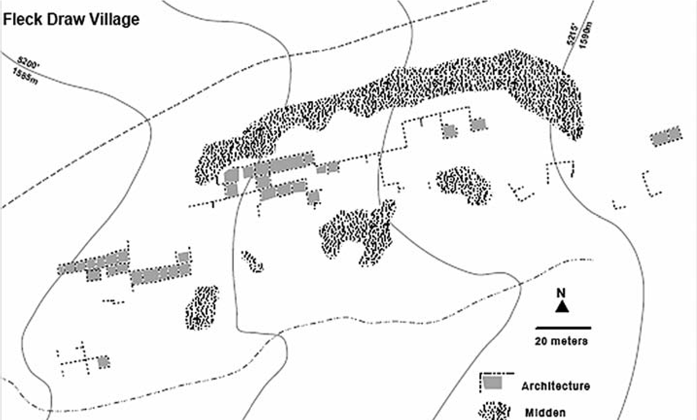
The occupants of Fleck Ranch likely moved and occupied Fleck Draw village. Based on the ceramics, the initial occupation of Fleck Draw coincides with the abandonment of Fleck Ranch. The two villages are close to each other and share the same water source (see Figure 2.2). It is likely that the narrow, steep canyon setting of Fleck Ranch did not provide room for additional growth and thus village relocation was inevitable.
The chronological relationship between these two villages also specifies the outcome of an important settlement and social process. The postulated migration from the east occurred at the end of the thirteenth century, and later the village moved to the Fleck Draw pueblo, forming aggregated room blocks in the beginning of the fourteenth century. These events coincide with the migration-aggregation process undergone by Puebloan populations throughout the Southwest (Adler 1996).
Indian Tank Village
Indian Tank rests on the alluvial slope, 3.3 km (2.1 mi) west of the San Andres foothills (see Figure 2.2). The architecture of Indian Tank (LA 59560) differs from that of the cimiento villages. It is a square-shaped adobe pueblo with a central plaza (Figure 2.6). Lekson and Rorex (1987, 1994) recorded this important Late Pueblo site. Our remapping data indicate, based on mound height and looter information, that Indian Tank was at least a two-story pueblo (Mark Sale, personal communication 2006). It is a fully enclosed plaza pueblo type (Marshall 1973:95–98), similar to those found approximately 115 km (72 mi) directly to the east (Lehmer 1948:57–58, 80). Adobe pueblos with plazas occur in both the southern Jornada Mogollon area (Thomas O’Laughlin, personal communication 2006) and farther north of the project area in south-central New Mexico (Lekson 1985, 1989).
Magnetometer surveys in Indian Tank revealed wall construction details (Kemrer 2003b). Massive, wide, continuous walls parallel to each other and to the four sides supported the upper story or stories. Thin walls perpendicular to thick wall pairs created the room spaces, an example of “ladder” construction (Roney 1996:164). Our remapping of Indian Tank found that the pueblo contains approximately 160 ground floor rooms and at least one additional story, sufficient space to house 400 people.
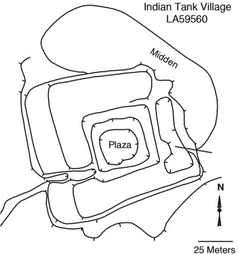
The pueblo rests on top of a small buried drainage. Subsurface groundwater from the drainage likely supplied water via a dug well in the plaza, similar to a well dug in the plaza by a rancher between 1920 and 1940. Seasonal surface runoff from the piedmont slope that diverted to at least one adjacent reservoir also augmented water supplies (Kennedy and Kemrer 2006).
Prehistoric reservoirs found south of Indian Tank in the Hueco Bolson also trap seasonal runoff with earthen dams located on drainage channels (Bentley 1993; Leach et al. 1993; Scarborough 1988). They are also associated with a large village dating to the ad 1250–1400 interval, consistent with the age of Indian Tank.
The age of Indian Tank likely spanned the ad 1275–1400 interval, based on the ceramic assemblage described by Lekson and Rorex (1987: 26, 1994:25) combined with our samples. Pottery types include Lincoln Black-on-white, Gila Polychrome, Ramos Polychrome, Chupadero Black-on-white, El Paso Polychrome, Agua Fria Glaze-on-red, and Seco Corrugated.
Cottonwood-A Village
The southern village group contains the Cottonwood Spring site (LA 175) areas A, D, and E. Cottonwood Area A is the largest Lincoln phase room-contiguous cimiento-built pueblo in the southern San Andres Mountains (Figure 2.7). Two additional villages cluster adjacent to the fully aggregated Area A pueblo. As with all of the major cimiento villages, it shares a setting adjacent to the mountains in the mouth of a canyon. The occupants also enjoyed reliable water from at least one spring. The Lekson and Rorex (1987, 1994) reconnaissance recorded the entire Cottonwood complex, although Chapman (1926) and Yeo (1931) previously described portions of the site. Subsequently, we remapped the entire complex in detail.
Cottonwood-A village was built and occupied during the fourteenth century. Ceramic assemblage descriptions by Lekson and Rorex (1987, 1994) and our independent samples contain Tonto Polychrome dates after ad 1325 (Crown 1994), and St. Johns Polychrome is absent. Other types present include Lincoln Black- on-white, Three Rivers Red-on-terracotta, Gila Polychrome, Ramos Polychrome, Chupadero Black-on-white, El Paso Polychrome, Agua Fria Glaze-on-red, and Seco Corrugated. The site was constructed as a cimiento adobe pueblo with contiguous rooms, an architectural type that occurs more frequently in the Sierra Blanca area (Kelley 1984; Lehmer 1948).
Cottonwood-D and -E
The Cottonwood group (LA 175) includes two smaller villages, designated Areas D and E (Lekson and Rorex 1987:17–21, 1994:16). They are both west of Area A and situated on the montane alluvial slope (Figure 2.8).
Our mapping at village Cottonwood-D identified a cluster of small adobe houses and one large, elongated room block. Yeo recorded and alidade-mapped the large room block (Lekson and Rorex 1987, 1994). It measured 107 m (350 ft) by 6.7 m (22 ft) and oriented approximately east- northeast. Construction, shape, and easterly orientation are consistent with the configuration for El Paso phase room blocks found in the southern Tularosa and Hueco Basins (Marshall 1973: 94–95). The largest linear-style El Paso room block known, it contains 80 rooms, based on both our and Lekson and Rorex’s (1987:20) estimate. Our ceramic sample from Area D indicates occupation in the 1300s. All of our samples from Cottonwood-A, -D, and -E include Lincoln Black-on-white, Gila Polychrome, Three Rivers Red-on-terracotta, Ramos Polychrome, Chupadero Black-on-white, El Paso Polychrome, Agua Fria Glaze-on-red, and Seco Corrugated.
[[d-j-deni-j-seymour-fierce-and-indomitable-11.png][Figure 2.7. Cottonwood Area A village. Figure prepared by Meade Kemrer after Lekson and Rorex 1987.
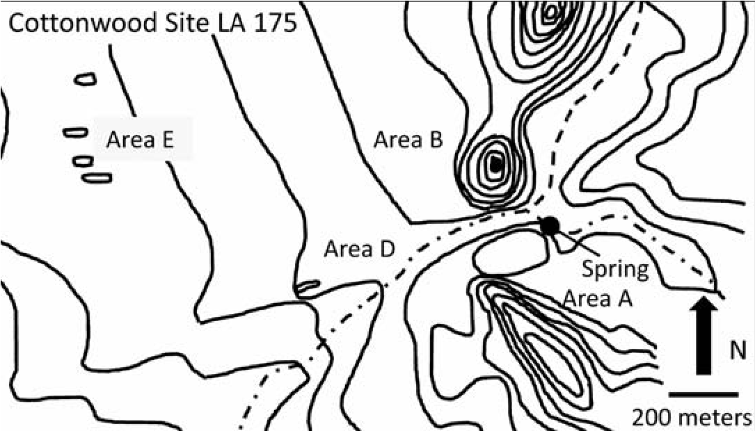
Drone photography (Kemrer 2013) and our on-ground map indicate that Cottonwood-E village contains a cluster of linear adobe room blocks (see Figure 2.8). Yeo instrument- mapped three of these room blocks (Lekson and Rorex 1987:13, 1994:14). Cottonwood-E is a classic example of an El Paso phase “linear- multiplelinear” pueblo (Marshall 1973:94–95) that occurs south of the Sierra Blanca region. Ceramic types identified in Cottonwood-E date to the fourteenth century.
The size of the individual Cottonwood-D and — E linear room blocks differ from their southern counterparts. There is some evidence for population aggregation within the individual room blocks. The Cottonwood room counts range from 25 to 80 rooms per room block, but the southern El Paso linear room blocks rarely contain more than 12 rooms (for example, Leh — mer 1948; O’Laughlin 2001; Scarborough 1985).
Architecture and ceramics indicate that the Cottonwood community contains three contemporaneous villages occupied in the early into the middle portions of the fourteenth century. They exhibit a cultural mixture of Lincoln phase (Area A) and El Paso phase (Areas D and E) settlement.
Supportive Settlement
Smaller settlements temporally and architecturally associated with the large villages played supportive roles. Previously, Browning (1991) noted that smaller sites exhibiting cimiento construction located in the mountain-foothill zone and spatially associated with the large cimiento-built Fleck Draw village formed a single settlement system. The smaller sites were likely seasonal agricultural production loci. This study included Late Pueblo small sites previously reported (Duran 1982; Human Systems Research 1989; Kemrer 2004; Laumbach et al 2003; Sale and Laumbach 1989; Seaman and Doleman 1988) and new sites identified by our reconnaissance. Based on architectural complexity and size, there are four types of sites: the previously discussed large villages, and the small villages, hamlets, and field houses (Figure 2.9). Kemrer (2006) details smaller site criteria for identification and content that extends beyond the scope of this chapter.
Community Structure
The southern San Andres Mountains Late Pueblo sites, large and small, form a single coherent settlement structure. The major villages have different histories, layouts, and architecture. Nonetheless, they share other qualities important for understanding relationships among them. These qualities fall into two related categories: defense and alliance. The San Andres community was undergoing the initial process of regional integration, important for understanding Terminal Late Pueblo organization for this population and its projected trajectory into the subsequent periods.
Defense
The primary villages exhibit defensive characteristics. Based on the previous portions of this chapter, construction of the San Andres community began at or about ad 1275, when Fleck Ranch, Indian Tank, and possibly Cottonwood-A were established. Shortly thereafter, at or about ad 1300, occupation began at the remaining villages of Fleck Draw, Cottonwood-D, and -E; Fleck Ranch was abandoned when the occupants apparently moved, establishing Fleck Draw.
Regional warfare and the need for protection undoubtedly produced rapid population buildup within this relatively small area. The postulated migrants from the Sierra Blanca area who likely populated Fleck Ranch, Fleck Draw, and Cottonwood-A villages came from an area where ongoing warfare took place in the Late Pueblo period (Wiseman 1997). The presence of burned architecture in the southern San Andres Mountain study area dating to the late twelfth and thirteenth centuries suggests a similar situation (Kemrer 2004; Sale and Laumbach 1989). Prehistoric Southwestern warfare studies (LeBlanc 1999; Rice and LeBlanc 2001) produced a list of settlement traits related to defense. Many of these characteristics apply to the southern San Andres Mountains community (Table 2.1).
We found that fortified architecture occurs among all of the pueblos. Indian Tank, with its two-storied, four-sided architecture, embodies a classic fort shape. The top-of-hill Cottonwood-B, immediately adjacent to village Cottonwood-A (see Figure 2.8), contains a residential adobe room block and a large masonry room (a blockhouse in fort parlance). The most vulnerable slope contains a low wall (a rampart) near the hilltop. A pile of masonry on top-of- hill Cottonwood-C indicates that the occupants of Cottonwood-A planned to fortify this hill. Another residence-blockhouse structure (a redoubt) overlooking the village and the canyon also occurs in the Fleck Ranch village. All of the main village adobe pueblo residential architecture has fortified characteristics. Resident defenders could use their roofs for repelling attacks, as described in the early Spanish documents (Flint and Flint 2005). The occupants of villages Cottonwood-D and -E fortified their linear room blocks by making them longer and wider. These were the latest construction activities, before -D and -E abandonment.
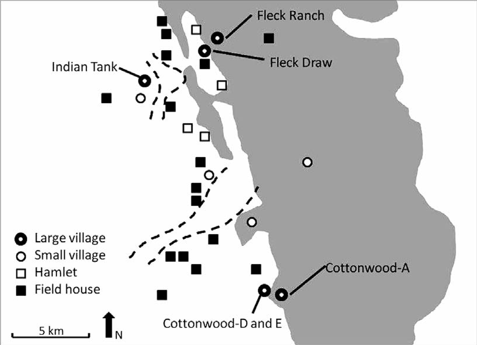
Table 2.1. Defensive Characteristics among the Major Villages.
| Defensive Attributes | Fleck Ranch | Fleck Draw | Indian Tank | Cottonwood A | Cottonwood D | Cottonwood E |
| Fortification | Yes | ? | Yes | Yes | ? | ? |
| Large population | Yes | Yes | Yes | Yes | Yes | Yes |
| Defensive landform | Yes | Yes | No | Yes | Yes | Yes |
| Rapid construction | No | Yes | Yes | Yes | Yes | Yes |
| Secure water supply | Yes | Yes | Yes | Yes | ? | ? |
| Line-of-sight | No | Yes | Yes | Yes | Yes | Yes |
| Unoccupied areas | Yes | Yes | Yes | Yes | Yes | Yes |
One outcome of aggregating into larger villages is the protection offers by a large population. This is a particularly effective defense from small raider groups. All of the major villages represent large aggregated populations.
Three of the six villages are situated within and at the mouth of canyons, representing defensive settings. An intruder detection system using sentries and the smaller settlements in the surrounding alluvial plain, foothills, and mountains protected these villages. Occupational data indicate that landform sentry posts protected a number of villages. The two hills, Cottonwood-B and -C, undoubtedly served as sentry posts with wide view-spreads that extend for many kilometers. A low hill immediately southeast of Cottonwood-E was another detection station with long-distance views along the piedmont slope. Much of the slope is visible for scanning from Fleck Draw village. The Fleck Ranch redoubt overlooks the canyon surrounding the village. Atop the two-story Indian Tank roof, much of the montane slope could be scanned for potential attacks.
The villages were rapidly constructed, a probable defensive trait (LeBlanc 2001). Magnetometer data (Kemrer 2003b) demonstrated that Indian Tank manifests “ladder” construction (Roney 1996) with massive long parallel walls and thinner cross-walls added later. Cotton- wood-D and -E, with their elongated room blocks, were likely built quickly using the ladder method, judging by our wall probes. The three cimiento-constructed villages located in defensive landforms, Fleck Ranch, Fleck Draw, and Cottonwood-A, may not have been built as efficiently and quickly as the other three villages. Fleck Ranch, a cluster of room blocks, each block constructed by its individual resident group, likely lacked the cooperative labor of the entire village. The aggregated cimiento pueblos, Fleck Draw and Cottonwood-A, were probably built somewhat more efficiently with a larger corporate work force.
Perennial water flow or spring resources occur immediately adjacent to Fleck Ranch, Fleck Draw, and Cottonwood-A, a characteristic of defensive settlement. The fort, Indian Tank, contains a dug or walk-in well in the plaza, and at least one reservoir abutted to the pueblo (Kennedy and Kemrer 2006). Cottonwood-D is situated 150 m from a drainage (Lekson and Rorex 1987), but Cottonwood-E is 800 m from current reliable water supplies. Given our findings at the other villages, nearby reliable spring or reservoir water sources likely supplied the occupants of D and E pueblos.
Line-of-sight signaling via smoke or fire as a defensive alarm system could have occurred among some the major villages, as postulated elsewhere in the Southwest (LeBlanc 2001: 48; LeBlanc and Rice 2001:15). The hills at Cottonwood-B,-C and -E undoubtedly facilitated communication with villages Cottonwood-A, -D and -E. Fleck Ranch village, situated in a canyon, had no line-of-sight communication with any of the other villages. However, the occupants of Fleck Ranch moved to Fleck Draw village, which could signal to and from Indian Tank but could not communicate directly with the southern villages. Despite these obstacles, a relay signal system along the mountains and foothills could connect all of the major villages to each other.
Unoccupied “no-man’s” zones that separate warring communities can also reduce conflict between friendly groups. This role applies to the two vacant, unoccupied zones in the study area (see Figure 2.9). The northern, smaller vacant area clearly separates Fleck Ranch and Fleck Draw from Indian Tank. This zone remained unoccupied during the ad 1275–1400 Late Pueblo period despite the fact that this was one of the most intensively utilized and productive agricultural lands in the study area in the ad 1000–1150 Early Pueblo period. A similar situation occurs in the Cottonwood area, where a 200-m-wide area is devoid of Late Pueblo occupation between Cottonwood-D and -E, a zone heavily utilized during the Early Pueblo period. Unused land between communities prevented intervillage land tenure disputes, as demonstrated in the Mimbres area (Stokes 2005), and likely occurred throughout the Puebloan Southwest. The southern unoccupied zone between two major drainages partitioned the Cottonwood village group from the Fleck-Indian Tank group. In this case, vacant land circumvented conflict at a larger scale. This zone also represents a traditional boundary established at or about ad 900, based on ceramic data.
Less common defensive characteristics apply to Late Pueblo occupations in the southern San Andres Mountains study area. Survey found evidence of intensive agricultural activities in a 500-m-wide zone from the Indian Tank fortress. Few field houses occur in this zone, indicating village-based farming, a defensive tactic found in Southwestern communities (Rice and LeBlanc 2001). Small villages could have been refuges used by the farmers populating the surrounding field houses, similar to findings in central and east-central Arizona (Tuggle and Reid 2001; Wilcox et al. 2001).
Late Pueblo settlement patterning in the study area does not correspond to full-scale continuous warfare with a neighboring community. Such settlements (1) contain fortress and refuge architecture where the population can concentrate adjacent to these structures, (2) occupy highly defensive locations, and (3) exhibit excellent communication among the occupational components (see, for example, Wilcox et al. 2001). The smaller San Andres sites do not cluster tightly around the major villages, but they exhibit the examples of defensive landform selection and likely had an intervillage communication system.
Analysis of the San Andres defense system indicates that it was optimized for protecting against raiders that attacked individual villages. It was primarily designed to guard each village and secondarily the community. Given the lack of evidence of intercommunity warfare, the villagers’ foes were not members of the community but likely mobile groups that periodically attacked individual villages.
Alliance
The southern San Andres Mountains Late Pueblo major villages were apparently allied at two levels. The major villages form two geographic groups: the three Fleck-Indian Tank villages and the three Cottonwood villages, which represent the lower level of intervillage alliance (see Figure 2.9). Each group contains a mixture of architectural traditions consistent with interethnic alliance. These architectural differences may represent separate ethnic groups or populations within a single linguistic group, as Beckett argues in this volume.
The Fleck-Indian Tank group contains two distinctive types of cimiento and adobe plaza architecture. The previous discussion of regional architectural variation suggests that two separate populations with different architectural traditions built these stylistically different pueblos. Similarly, the fully contiguous room construction at Cottonwood-A differs from the linear room blocks at Cottonwood-D and -E, and the two types were likely built by two different populations.
The two village groups exhibit relationships consistent with alliance. The villages are spatially close to each other, avoid intervillage land use conflicts, have line-of-sight communication with each other, and lack evidence of intervillage tension, given the dispersed nature of the supportive small villages, hamlets, and field houses.
Evidence of intergroup connectivity represents the higher level of alliance. The extensive vacant land separating the two village groups (see Figure 2.9) eliminates land tenure conflicts at the intergroup level and fosters a cooperative relationship between the two groups. Both groups contain major cimiento-constructed villages and share a traditional stylistic relationship. The cimiento villages, Fleck Ranch, Fleck Draw, and Cottonwood-A, also share identical montane settings, consistent with shared behavior.
Ceramic assemblages are virtually identical among all of the villages, which share at least the same pottery type preferences if not the same sources. The most important pottery types, ranked from high to low relative incidence shared by all of the villages, are El Paso Polychrome, Seco Corrugated, Lincoln Black- on-red, Chupadero Black-on-white, and Gila Polychrome.
Shared ideology undoubtedly fostered and maintained the alliance between the village populations. Crown (1994) convincingly argues that a cult arose and spread throughout the southern Southwest in the Late Pueblo period. The iconography of Gila Polychrome, a pottery type that occurs in the southern San Andres community and was sampled by Crown in her study (Crown 1994:27–28), constitutes evidence for cult membership. Dual warfare-hunting beliefs symbolized by the roadrunner track and cat paw glyphs found in artifact and rock art from San Andres sites (Kemrer and Berrier 2013) represent an iconic ideology and organization shared with Late Prehistoric communities found throughout the region, including historic and contemporaneous pueblo groups.
Regional Integration
The formation of a single community with the three Late Pueblo architectural traditions known in this Jornada Mogollon area represents the initial process of regional integration. Most Puebloan populations throughout the Southwest underwent aggregation, often including migration, and formed large communities during the mid-thirteenth and early fourteenth centuries (Adler 1996). Aggregation often involved the formation of integrated multiethnic communities, well documented in the northern Rio Grande pueblos (Habicht-Mauche 1993) and the western Mogollon in eastern Arizona and western New Mexico (Zedeno and Triadan 2000). Warfare and defense can be attributed to Puebloan demographic reorganization (Rice and LeBlanc 2001), which undoubtedly played a role in San Andres community formation.
Integration Consequences
Southwestern Puebloan aggregated populations composed of multiethnic integrated villages usually represent those that survived into the Historic period. The San Andres community was
Note
My research at the Jornada Experimental Range (JER) was supplemented by the work of volunteers at the WS-ES Environmental Stewardship Division, White Sands Missile Range, New Mexico. My thanks extend to WS-ES archaeologists Michael Mallouf and Jim Bowman for their support; to Kris Havstad, JER, who facilitated our endeavor; and to JER soil scientists Curtis Monger and Arlene Tugel. Crew members include Marylin Harkey, Warren Harkey, Brian undergoing the initial “tribalization” process whereby various ethnic populations coalesce into a single community and sets of these communities form “tribes” (Habicht-Mauche 1993). Stable village and intervillage interethnic relations produced by shared behaviors, beliefs, and symbols maintained by cooperation and communication allowed for the persistence of the Puebloan tradition. The San Andres community occupation terminated at or about ad 1400. Puebloan dislocation occurred in the Jornada Mogollon area, which became virtually devoid of Puebloan occupation by ad 1450. If the San Andres community members or portions thereof continued as Puebloans, they would have maintained their shared Sierra Blanca traditions by migrating 140 km immediately north and northeast of the White Missile Range (see Figure 2.1). At that location integrated displaced Jornada Mogollon populations formed substantially larger pueblos in the southern Salinas province, especially in the Chupadera Mesa and drainage (Montgomery and Bowman 1989), eventually becoming the Protohistoric and Historic central Salinas Jumano tribal pueblos, as postulated by Mera (1940a, 1940b) and Beckett (Chapter 5 this volume). The Puebloan residential form and organization apparently disintegrated for some groups south, southeast, and southwest of the San Andres area after ad 1400. These peoples became ancestors to, for example, Beckett’s Early Historic Mansos.
Halstead, Patricia Holguin, Lonnie Ludeman, Janet and Jack Mathews, Frank Parrish, Frank Sherman, and Lee Webb. John Kennedy performed geohydrological studies. The ceramic identification by Toni Laumbach and discussions with Patrick Beckett, Patricia Gilman, David Kirkpatrick, Karl Laumbach, Paul Minnis, Thomas O’Laughlin, Deni Seymour, and Regge Wiseman are much appreciated.
3. Bison, Trade, and Warfare in Late Prehistoric Southeastern New Mexico
The Perspective from Roswell
John D. Speth
In 1977 I began excavating a mid-fifteenth- century bison kill—the Garnsey site (LA 18399)— located in a small, seasonal drainage cutting its way through the bluffs bordering the eastern margin of the Pecos Valley near Roswell, New Mexico (Speth 1983). The site consisted of numerous small, spring-of-the-year kill events, probably foot surrounds or ambushes, conducted by small bands of cooperating hunters. At the beginning of the project I simply assumed that the kills were the product of nomadic hunters and gatherers whose livelihood was intimately tied to the year-round pursuit of bison. However, as the work progressed, I began to suspect that I was actually dealing with kills made by peoples who not only lived fairly close by but may not have been mobile hunters throughout the year. I even began to entertain the possibility that the Garn- sey hunters were farmers who engaged seasonally in bison hunting, both to supplement their agricultural resources and perhaps to use as a commodity in exchange with other communities in the region. Though this was more a hunch than a reasoned deduction, one piece of evidence in particular seemed to point in that direction. There was remarkably little evidence at Garnsey of the systematic processing and culling of low- utility body parts that one might expect had the hunters been fully nomadic (e.g., Todd 1987). Instead, the hunters appear to have transported entire limbs away from the site, not bothering to discard the more marginal parts of the feet and lower limbs. So if “home” was actually somewhere close at hand, the million-dollar question was to figure out what such a settlement would look like and where it might be located.
Thus in 1978 I began searching for a base camp or village that might have been the jumping-off point for the Garnsey bison hunters (in reality, I assumed Garnsey was but one of a whole series of similar kills that were produced by hunters from several, perhaps many, settlements in the Roswell area). To my chagrin, I quickly found out that not many major settlements of roughly the same age as Garnsey were known around Roswell, and of the few that had once existed (see Wolfe 1931), most had been obliterated years ago by vandalism, water-control projects, overgrazing and deflation, and urban expansion. According to local lore, the only major Late Prehistoric site in the area that had once been worth digging was Bloom Mound, but everyone assured me there was nothing left. The amateurs also knew of another site on a ridge near Bloom, but that one—known today as the Henderson site (Speth 2004)—had the reputation of not being worth digging. In fact, this site had been reported by R. A. Prentice to the Museum of New Mexico in 1934 as nothing more than “a serpentine pile of small rocks about 50’ long and varying in width from 2’ to 3’” (information provided by Cordelia Thomas Snow, Archaeological Records Management Section, Historic Preservation Division and Museum of New Mexico, Santa Fe). Nevertheless, in 1980, though having very little confidence that the “serpentine pile of rocks” was worth bothering with, I began working at Henderson.
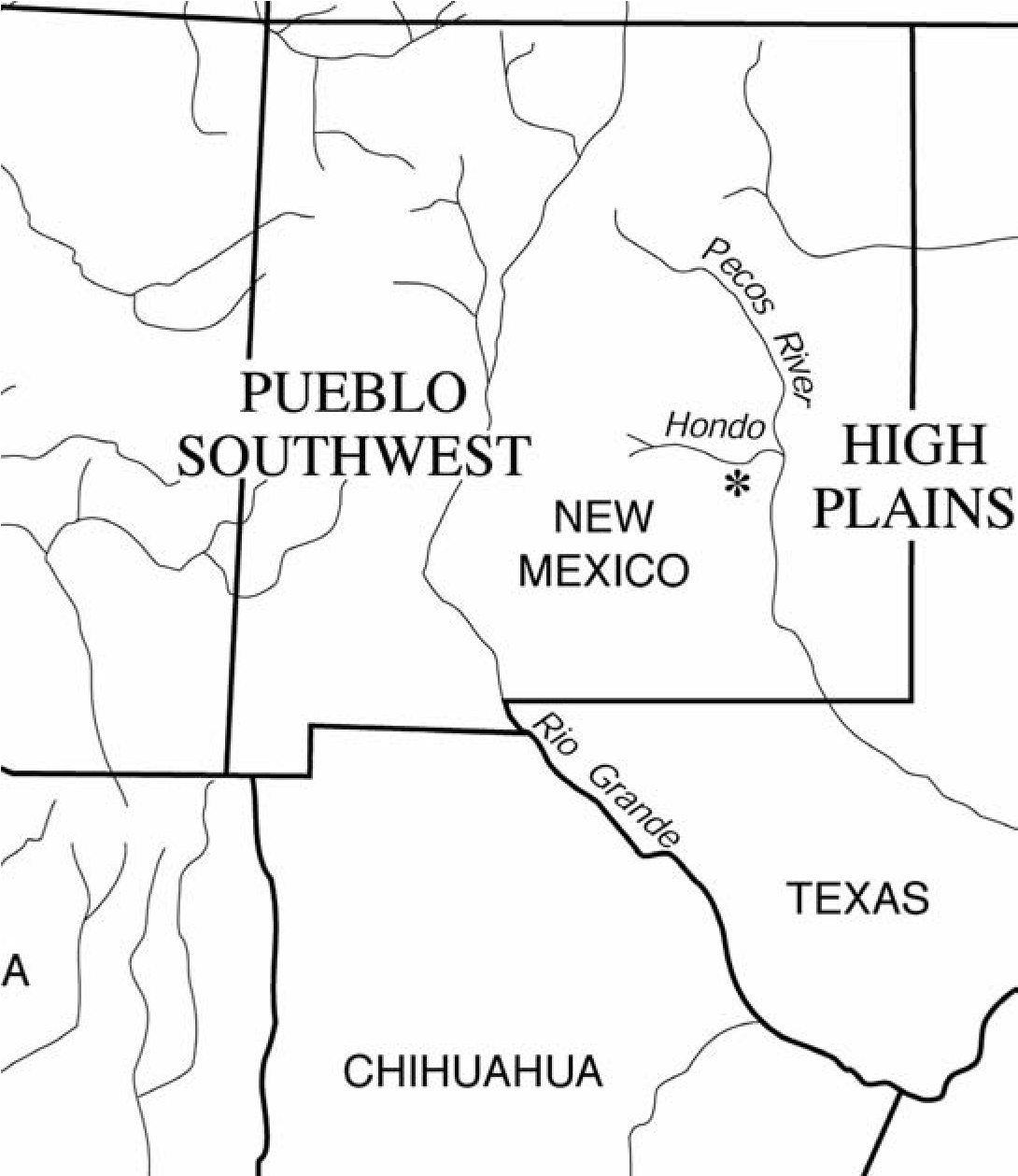
Henderson Site (LA 1549)
The Henderson site turned out to be a modestsized “pueblo” sitting atop a limestone ridge overlooking the right bank of the Hondo River, about 10.5 miles (17 km) southwest of downtown Roswell (Figure 3.1). The site, like the few others that are known in the area, had suffered from extensive pothunting. Large, shallow depressions and low mounds of grassed-over backdirt were visible everywhere. And there was a gaping and very fresh pothunter’s pit near the center of the site that had clearly destroyed an important part of the settlement. Despite the obvious vandalism, however, work at Henderson quickly revealed that a surprising amount of the site still remained reasonably intact. This good fortune is due in large part to the peculiar architecture of the village. Many of the room floors were sunk well below the original ground surface, and the walls were constructed by setting a series of upright limestone slabs at ground level and then raising the adobe (occasionally jacal) walls above these. Pothunters excavated down until they reached the base of the uprights and then quit, assuming apparently that they had reached or passed floor level. We encountered the real floors anywhere from 35 cm to nearly a meter below the bases of the uprights, and most of these floors, aside from extensive rodent burrowing, were largely intact.
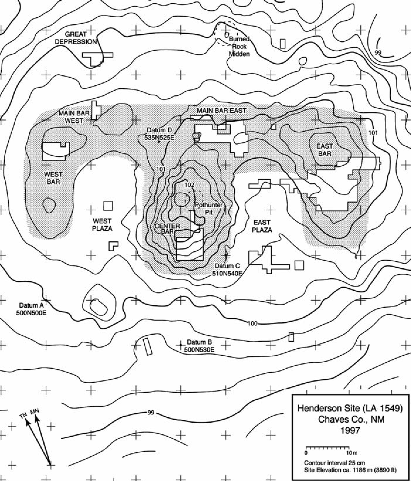
Five seasons of excavation, which sampled barely 20 percent of the site, revealed it to be an adobe “pueblo” with more than 70 contiguous, single-story, square to rectangular rooms. Ceramics, projectile points, and a suite of conventional and AMS radiocarbon dates all converge to show that Henderson was occupied during the last quarter of the 1200s and first quarter to half of the 1300s. The room blocks are laid out like a capital E, open to the south, with small plazas between the arms of the E (Figure 3.2). Entry into the rooms was by ladder through a hatch in the roof. The rooms are arranged in tiers, with at least five parallel tiers comprising the Main Bar of the E and at least four tiers making up the Center and East Bars. The West Bar, which is shorter than the others and much less well preserved, may have had only two or three tiers.
Unfortunately, most of the deposits at Henderson were shallow, not surprising given its exposed location on the crest of a limestone ridge. The lack of stratified fill was frustrating, however, because I was particularly interested in economic change over the life of the community. Even more frustrating was the apparent scarcity of bones, most especially bison bones, in room fill, because it was bison that had motivated me to look at the site in the first place.
Fortunately, things began to change in 1981. Following the advice of the late Robert H. (Bus) Leslie, a knowledgeable and dedicated amateur archaeologist from Hobbs, New Mexico, I shifted my focus from rooms to plazas. We soon encountered a huge roasting feature in a natural karstic depression in the limestone bedrock of the East Plaza. This depression was filled with tons of fire-cracked rock and literally thousands of bones of bison, antelope, mule deer, cottontails and jackrabbits, prairie dogs, butchered domestic dogs, birds, mollusks, and fish (including at least four different species of catfish). We found other sizable roasting features as well, one affectionately dubbed “The Great Depression” because of its depth and because of the record high temperatures the crew had to endure during the 1994 summer field season when we excavated it. Thanks to the many roasting complexes, I soon had more economic data than I ever dreamed possible (Speth 2004), but still no real stratigraphy. The big roasting features had all been emptied out when they were no longer needed, a closure offering—typically a bird of some sort—put at the bottom of the pit, and then backfilled. In other words, what little stratigraphy there was in these deep deposits meant next to nothing chronologically.
Then we had another stroke of luck. Despite the relatively brief occupation span of the community (almost certainly less than a century, and perhaps less than 50 years), the rim profiles of one of the site’s principal ceramic types—El Paso Polychrome jars—seriated, allowing us to recognize two arbitrarily delineated occupation phases: Early phase and Late phase. I now was able to look at economic change, albeit spatially rather than stratigraphically, and the patterning that emerged was quite striking (Speth 2004). In the Early phase, which I “guesstimate” to date between about ad 1275 and 1300 or slightly later, the villagers made their living by a mix of farming, wild plant gathering, hunting, and fishing. Bison were important, but only moderately so. Despite the permanent architecture, the village was probably semi-sedentary; many, perhaps most, of the able-bodied inhabitants left after the harvest was in, presumably to hunt bison. I suspect the village was never totally abandoned during these seasonal hunting events, and that at least some of the residents stayed behind, because we never found any evidence of clandestine storage—storage in below-ground bellshaped pits that were well away from rooms and would have concealed the contents from unwanted visitors to the vacant community (DeBoer 1988). The village was also quite insular in the Early phase, as we found very little ceramic or other evidence of long-distance exchange (Speth 2004).
Then, in the Late phase, probably beginning in the first decade or two of the ad 1300s, this all changed rather abruptly. The quantity of bison brought to Henderson increased dramatically (both in absolute numbers and in density of bones per cubic meter of excavated deposit). And the bones that were brought back were distinctly biased in favor of high-utility parts, especially upper limbs, implying either greater average transport distance between kills and village, or larger numbers of animals taken per kill event, or some combination of the two (Speth 2004). The communal importance of bison also increased. Whereas in the Early phase we found roughly half of the bison bones in domestic contexts (i.e., room trash), in the Late phase over 80 percent occurred in and around public roasting features in the plazas.
In addition, trade involving dried meat appears to have risen sharply in the Late phase, as evidenced by a significant drop in the quantities of bison ribs, the most easily dried portion of the animal. That this decline is not a taphonomic artifact of the bone-crunching proclivities of hungry village dogs is indicated by the fact that the abundance of much more delicate antelope and deer ribs, which should have been the first to be destroyed by village scavengers, remained more or less unchanged.
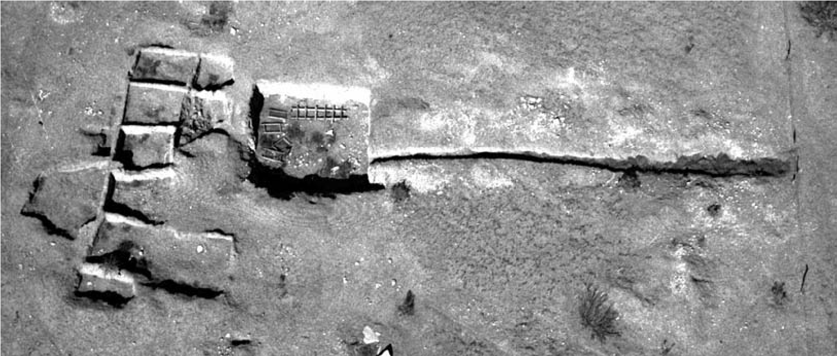
Hand in hand with the increasing importance of bison in long-distance exchange, Henderson suddenly became inundated with exotic ceramics from distant parts of the Southwest. The most common of these was Gila Polychrome, but others were also well represented, including Heshotauthla Polychrome, Rio Grande glazes, Chihuahuan wares, and others. Turquoise, marine shells (especially Olivella but also some Glycymeris from the Gulf of California), and obsidian, though never abundant at Henderson, also became more common. In essence, what we were seeing in Henderson’s Late phase was the beginnings of the classic pattern of Plains-Pueblo interaction so vividly described by the Spanish a few centuries later (Speth 2004; Spielmann ed. 1991).
Bloom Mound (LA 2528)
The small site of Bloom Mound is less than a mile (1.6 km) downstream from Henderson (i.e., toward Roswell) on the opposite side of the Hondo (see Figure 3.1). The site is easily visible from Henderson, and Kelley’s (1984) inventory of the ceramics that the amateurs had pulled out of the site in the 1930s and 1940s suggested that its assemblage was very similar to Henderson’s. Intriguingly, however, a small sample of El Paso Polychrome jar rims that we were able to glean from the surface of the site suggested that Bloom’s occupation might actually extend somewhat later than Henderson’s. Bloom might therefore hold the key to what happened to the economy of communities in the Roswell area during the last century or so before the Spanish entrada.
Unfortunately, there seemed to be nothing left of Bloom. What the amateurs had found, vaguely recorded in an on-again-off-again dig diary kept by members of the Roswell Archaeological Society, was a small village of only 10 rooms—nine contiguous, single-story, adobe surface structures and an adjacent semisubterranean square pitroom or ceremonial chamber (Figure 3.3). The amateurs emptied all but one of these rooms and crisscrossed the site with additional exploratory holes and trenches. They even stripped off part of the “mound” using a blade pulled by a pickup truck. Yet, despite the site’s small size, the amateurs unearthed a remarkable wealth of exotic ceramics, obsidian, turquoise, marine shell ornaments, and perhaps as many as seven copper bells (see Vargas 1995), leading Kelley (1984:455) to characterize Bloom as a “trading center of unusual affluence.” From what the amateurs reported in their diary, it seemed as if the entire village had been torched, perhaps violently destroyed in a single disastrous raid, to judge by the many burned victims they found scattered helter-skelter in room fill and sprawled on house floors (see Kelley 1984; Wiseman 1997). The extraordinary wealth of nonlocal items, much more than we had found at Henderson, as well as the evidence for intense conflict, suggested that Bloom might allow us to track the development of Plains-Pueblo interaction during the critical decades following Henderson’s abandonment.
Everyone, myself included, was convinced that there was nothing left of Bloom. Many of the artifacts recovered by the amateurs had disappeared into private collections. Others had been stored, uncatalogued, in the basement of the Roswell Museum and Art Center (RMAC). Unfortunately, the vast majority of these were either lost in a disastrous flood that swept through the museum in the 1950s or subsequently discarded because their provenience was no longer known (the copper bells survived and are still curated by the RMAC). Miraculously, however, as part of her dissertation research, Kelley (1966, 1984) interviewed some of the most active amateurs about their finds and inventoried the collections stashed in the museum basement shortly before their unfortunate demise. Also, at the invitation of the Roswell Archaeological Society, she excavated one of the original 10 rooms (Room G near the north end of the room block) and finished clearing the floor of the subterranean ceremonial chamber (D/F). These materials, both artifacts and fauna, are now safely curated at Texas Tech University in Lubbock. Kelley also mapped the site, something the amateurs had never done even though they had gone through the motions of setting up an elaborate 10-foot-by-10-foot grid system demarcated by large, numbered nails (Figure 3.4; the room block excavated by the amateurs is in the lower center of the figure). That seemed to be it. Bloom was gone and would remain an enigma forever.
Though my better judgment told me there was nothing left, in 2000, with a permit from the Archaeological Conservancy (which now owns and protects both Henderson and Bloom), I nonetheless began excavating at Bloom with the vague hope of at least being able to salvage some economic data from the pothunters’ back- dirt. I also hoped to get a large enough sample of El Paso Polychrome jar rims to be able to date Bloom’s occupation relative to the two occupation phases at Henderson. To my amazement and delight, auguring and limited testing in 2000, and larger-scale excavations in 2003, showed that parts of Bloom, particularly at the north end of the “mound,” actually remained reasonably intact, inadvertently buried beneath the mountains of backdirt the amateurs had stripped from other parts of the site. Our excavations also showed that the community was bigger than we had thought, and that it had quite a different layout as well. Instead of being a single north-south linear room block with just nine surface rooms and an adjacent pit structure to the east, it was a partially, perhaps completely, enclosed rectangular structure surrounding the deep chamber, with at least 20 to 25 rooms, and probably more.
We also relocated the original corners of the large subterranean structure, allowing us to connect Kelley’s 1950s map of Bloom to our own (see Figure 3.4). As anticipated, seriation of the El Paso Polychrome jar rims we recovered during the excavations placed Bloom after Henderson, though perhaps by only a generation or so, indicating that Bloom’s heavy involvement in long-distance exchange with the Puebloan world continued and greatly amplified the process that had begun at Henderson.
Like the amateurs, we found a number (n = 7) of human skeletons whose remains give silent testimony to the violence that befell this small New Mexico community sometime during the mid to late fourteenth or early fifteenth century. But what we found differed from the burned and clearly unburied skeletons encountered by the amateurs. Our human remains were all bona fide burials, interred according to what seems to have been the standard pattern for the area-bodies tightly flexed, probably wrapped in some sort of shroud, and placed beneath house floors, close to, and parallel to, the walls of the structures, heads oriented toward the cardinal directions (for burial locations, see Figure 3.4: F4, F6, F8, F9, F10, F19, F20; see Rocek and Speth 1986 for details on the Henderson burials). None were burned. None of the rooms we opened were burned either. To our utter surprise, however, several, perhaps all, of these individuals had nonetheless met a violent end. Substantial portions of the faces of the adults were missing, and the skulls of adults, and even of infants less than a year old, showed debilitating or lethal impacts and punctures from clubs, arrows, or spears. Two burials—one adult, one infant—also had points in or near their abdomens, suggesting they had been shot.
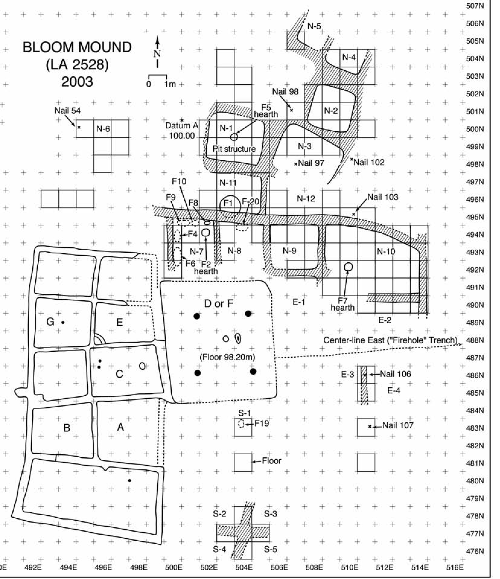
Although our sample is small, the ages of the individuals are also revealing. They include infants, young adult women, and elderly males (i.e., more than about 30 to 35 years old); none would have been prime-adult warriors. In addition, a few of the bones appear to have been gnawed by dogs or coyotes. The damage is minor, not enough to destroy entire bones or even disarticulate the affected skeletal elements, but it is unmistakable nonetheless. At least some of the bodies may have been left exposed and unprotected, albeit briefly, before they were taken into the rooms and buried.
The picture that is beginning to take shape at Bloom dovetails quite well with our reconstructions at Henderson (Speth 2004; Speth and Newlander 2012), though with some interesting surprises as well. Thus, like Henderson, Bloom was probably a semi-sedentary community, with many of the able-bodied adults away from the village each year in the autumn after the harvest was in, probably hunting bison, trading with the Pueblos, and perhaps raiding other communities. As at Henderson, the absence of clandestine, below-ground storage pits positioned well away from the rooms argues against Bloom having been totally vacated for part of each year.
As expected, evidence of long-distance exchange with the Pueblo world was even greater at Bloom than at Henderson, pointing toward increasing involvement in Plains-Pueblo interaction. The most common of these trade items were ceramics, again especially Gila Polychrome, but also Rio Grande glazes, various Chihuahuan wares, and others. Using just the rims of jars and bowls as a proxy for the entire ceramic assemblage (body sherds from the two sites, numbering well in excess of 100,000 pieces, have not been fully tabulated as yet), we found that the proportion of nonlocal ceramics increases from a mere 1.5 percent of all rims in Henderson’s Early phase to just over 6.0 percent in Henderson’s Late phase to 12.5 percent at Bloom (Speth and Newlander 2012). Percentages of marine shell, turquoise, and obsidian follow a similar trend, and the source of these exotic items seems to have remained the same.
However, contrary to what we had expected, the quantity of bison coming into Bloom seems to have declined sharply (Speth and Newlander 2012). This could be an artifact of sampling. At Henderson, bison bones were not very common in the rooms, particularly during the Late phase, and became evident in quantity only when we sampled nonroom contexts. It was in the plazas that we encountered the big roasting features. We assumed that a similar spatial pattern might hold at Bloom as well. However, every time we sampled what we thought would be a plaza area, we encountered remnants of floors and walls. This led to our realization that the Bloom community was bigger than the amateurs had suspected, an important finding in its own right, but it meant that our faunal sample still came mostly from room contexts. Only further testing at greater distances away from the heart of the village will determine with certainty whether the scarcity of bison bone at Bloom is real or an effect of sampling. Despite the potential of bias in our faunal assemblage, I continue to suspect that bison was in fact much less prominent in Bloom Mound’s economy than in Henderson’s. The evidence, aside from the bones themselves, that most strongly points to this conclusion is the number of arrowheads. At Henderson we recovered a staggering 831 points and point fragments in five seasons of excavation, for an average of 166 points per season. In contrast, at Bloom we found 130 points in two seasons, for an average of only 65 per season, a recovery rate two and a half times smaller than at Henderson. To the extent that points provide an independent proxy, admittedly a crude one, for the intensity of big-game hunting, Henderson’s hunters were clearly far more heavily engaged in the activity than were Bloom’s.
Thus, we have a troublesome conundrum at Bloom. Trade was clearly up—substantially so, judging by the quantities of exotic ceramics and other items—yet the major commodities that the Roswell communities had been contributing to the exchange, products of the bison hunt, were down. Also, unlike Henderson, where we found no evidence of foul play, Bloom was attacked, probably more than once, and probably precisely at those times of year when many of the able-bodied men and women were away, either hunting or trading, and the community was undermanned.
The two arrow points found among the bones of Bloom victims (F19 and F20) are particularly interesting in this regard. Both appear to be made on Edwards Plateau chert, and one of them is a Perdiz or Perdiz-like point, a distinctive and well-known type whose homeland lies hundreds of kilometers to the southeast on the Edwards Plateau of central Texas (e.g., Black 1989; Hester 1995; Johnson 1994; Ricklis 1992; Suhm and Jelks 1962). While Perdiz points are not abundant at Bloom (only six so far have been found out of a total of 130 identifiable specimens, or 4.6 percent), at Henderson this unmistakable form is absent altogether, even though we recovered more than 570 points complete enough to classify to type.
The Perdiz point is generally thought to appear by about ad 1300 and persist until ad 1600 or 1650. It is one of the hallmarks of the Toyah phase, an archaeologically defined cultural entity found throughout central Texas (Black 1989; Hester 1995; Johnson 1994; Kelley 1986; Kenmotsu and Boyd 2012; Prewitt 1981, 1985). Perdiz points, however, are not restricted to the Toyah phase or to central Texas; they are also found in other, more or less contemporary Late Prehistoric cultural entities, their distribution extending nearly across the width and breadth of Texas and into northern Mexico. They are rare in New Mexico, however, even in the southeastern part of the state (see Leslie 1978).
A number of authors have attempted to link the classic Toyah phase with the historically documented Jumanos (see Hickerson 1994; Johnson 1994; Kelley 1986; Wade 2003). While this attribution may be correct, or at least partly so, it seems very likely that many other ethnic groups in Texas and northern Mexico made use of similar points (Wade 2003). For example, Wade (2003:222) and Kenmotsu (2007; Kenmotsu and Wade 2002) show that more than 20 named bands occupied the Edwards Plateau in the early 1600s, and Seymour (2002) shows the same diversity of groups for the southern Southwest. Thus, we may never know which specific group or groups were fighting with the residents of Bloom. What we can say on the basis of the emerging evidence, however, is that this small community, and perhaps others like it in the Roswell area and elsewhere along the margins of the Southern Plains, by the mid- to late fourteenth century had become embroiled in violent, often lethal, conflict with groups coming into southeastern New Mexico from the southeast, probably from the Edwards Plateau region of central Texas (Speth and Newlander 2012).
A similar pattern may be in evidence at the Salt Cedar site, a small Ochoa phase (ca. ad 1300–1500) hamlet or ranchería located in Andrews County, Texas, close to the southeastern corner of New Mexico (Collins 1968). The Ochoa phase, defined primarily on the basis of a distinctive brownware pottery type known as Ochoa Indented, is a poorly documented cultural entity that is found in extreme southeastern New Mexico, east of the Pecos River, and adjacent parts of Texas, extending eastward to about Midland (Corley 1965; Leslie 1970, 1979). The site had three or four square to rectangular jacal structures and a dense trash midden, as well as numerous extramural hearths, roasting features, and artifact caches. Animal bones were abundant in the midden, especially bison, as well as smaller numbers of antelope, deer, jack- rabbits, and a variety of smaller mammals. Collins (1968) excavated four burials at the site. Two of the individuals, both relatively old adult males (>35 years old), had died violently, as evidenced by arrowheads found in various parts of the body cavity that were clearly not there as offerings. In addition, one of the adults had a puncture wound on the right parietal and cut marks on the frontal that could be the result of scalping. The other two burials, an elderly male and an infant, showed no obvious evidence of violent death. Interestingly, though Perdiz and Perdiz-like points were not common at Salt Cedar (23 out of 437 points, or 5.3 percent, a value very similar to the 4.6 percent figure we observed at Bloom), four of these points were found in the body of one of the individuals who had met a violent death.
At Bloom and at Salt Cedar we of course are seeing only one end of the violence; the folks from Bloom, and perhaps from Ochoa sites as well, may have been making their own forays into central Texas and elsewhere, wreaking similar havoc on other communities. The milliondollar question, of course, is why? Why would raiding parties travel long distances on foot, perhaps hundreds of kilometers, to beat up on insignificant little mud-walled hamlets like Bloom and Salt Cedar?
The evidence from Bloom provides clues to the nature of the violence and, in the process, what might have been motivating it. In a crosscultural study of warfare in middle-range societies, Julie Solometo (2004) found that deliberate killing of noncombatants (children, women, and elderly men) occurred primarily among enemies that were socially distant, and often geographically distant as well. Similarly, deliberate disfigurement and mutilation of victims, particularly when directed at infants, children, and women, was a way to dehumanize the victims, to set them apart as “other,” thereby making their extermination more easily justifiable. Wholesale destruction of structures was also more typical of warfare among socially distant enemies, particularly in contexts where there was little or no prospect of mutual benefit or cooperation in the future. The victims at Bloom-young women in their prime, infants, and older men-as well as the extensive burning of both victims and buildings documented by the amateurs, clearly point in this direction. These were not merely punitive, wife-stealing, or trophy-seeking raids at Bloom; whoever the enemy was, they were making a serious effort to extirpate the community and its inhabitants.
The deadly seriousness of the conflict is also suggested by the nearly or completely enclosed layout of the community. Again in cross-cultural studies, Solometo (2004) found that communities seldom fortify themselves unless actual conflict, not just the threat of conflict, occurs more or less on an annual basis. If she is right, Bloom must have been locked in a protracted and deadly struggle with other peoples on the margins of the Southwest.
Though the nature of the conflict seems reasonably clear, its cause is less so. The answer, however, may be staring us in the face. Henderson’s economy underwent a dramatic transformation in the late thirteenth and early fourteenth centuries. Bison hunting, much of it taking place far from the village, increasingly took center stage in Henderson’s rapidly evolving economy, and trade with the other Pueblos increased markedly at the same time. Westward-focused trade continued to increase a generation or so later at Bloom. Particularly striking about the trade items coming into both villages-at least those items that have been preserved-is that almost all come from the Puebloan world to the west (i.e., ceramics, turquoise, marine shell, obsidian, copper bells, and a macaw found in the backdirt of another pothunted local village known as Rocky Arroyo; see Emslie et al. 1992). We found very little, aside from bison, that we can confidently say came from the Plains. What we seem to be witnessing at Henderson and Bloom is the beginnings of intense trade with the other Pueblos, and procurement of bison clearly figured prominently in these relationships (Speth 1991, 2004). Dried meat, as a source of protein, may of course have become increasingly important to the eastern Pueblos as they aggregated into large, sometimes huge, communities heavily dependent on farming (Speth and Scott 1989). Hides may have become even more important than meat in the trade, in part for robes but also as raw material for shields, a need triggered by the destabilizing introduction of a new and far more lethal shock weapon, the backed or recurve “Turkish” bow, which rendered traditional Pueblo cane armor obsolete (LeBlanc 1997, 1999). But if the interaction witnessed at Henderson continued and intensified at Bloom, why did bison hunting suddenly decline and socially distant warfare simultaneously explode into prominence?
The archaeology of the Toyah phase in central Texas may hold the answer. One of the most striking features of the Toyah phase is that many of these peoples also began to exploit Southern Plains bison intensively, apparently traveling considerable distances to get to the herds (e.g., Johnson 1994; Ricklis 1992; Thompson et al. 2007). And judging by the early Spanish chronicles that relate to central and south Texas, fights between groups over access to the herds may have been commonplace (e.g., Wade 2003: 21–22). Toyah folks may also have come into conflict with Roswell and Ochoa peoples over access to trading partners among the eastern Pueblos. This seems less likely, however, because trade goods emanating from the Pueblos do not appear to be all that common in the Toyah heartland (Johnson 1994). Conflict over trading partners, and its flip side, mutualism, may have been more common and pervasive to the north in the Texas and Oklahoma panhandles, where Puebloan trade goods are many orders of magnitude more common than on the Edwards Plateau (Brosowske 2005; Eiselt 2006; Spielmann 1983, ed. 1991). Whatever the cause-access to herds or trading partners, or some more complex combination of factors-Roswell hunters may have become increasingly embroiled in these conflicts, ultimately forcing them to curtail their
Note
I thank Jane Kelley (who, sadly, passed away as this volume was going to press) and Regge Wiseman for their friendship, help, and inspiration over the years. Without their pioneering work in Roswell, none of this would have happened. I also acknowledge the help of the many others who have participated over the years in the excavation and analysis of Garn- sey, Rocky Arroyo, Henderson, and Bloom. Among these, I owe an especially large debt of gratitude to Dave Snow and Cordelia (Dedie) Thomas Snow, the bison hunting activities on the Southern Plains and instead take on the role of “middlemen” in the burgeoning Plains-Pueblo trade. Ultimately, however, lethal conflict may have reduced the small population at Bloom to the point where the survivors were either absorbed by other groups or driven off the Southern Plains.
The Roswell sites (four major ones are known: Henderson, Bloom Mound, Rocky Arroyo, and Fox Place) clearly hold great potential for understanding the culture history of the Roswell area (Emslie et al. 1992; Speth 2004; Wiseman 2002). But their value extends far beyond that. Through these sites we are getting a glimpse of the social and political upheavals that engulfed the Southern Plains during the tumultuous years preceding European contact. If we are right in our reading of the evidence from Bloom, as well as from sites like Salt Cedar, various Antelope Creek sites in the Texas and Oklahoma panhandles, and many other Late Prehistoric and Protohistoric sites in and adjacent to the Southern Plains (Bovee and Owsley 1994; Brooks 1994, 2004:342–343), Plains-Pueblo interaction was not just a benevolent bond of economic cooperation and interdependence that sprang up to the mutual benefit of those who participated (see discussion in Vehik 2002; see also Spielmann 1991). Instead, it may at times have been a costly and blood-stained relationship that arose out of the wreckage of more than a century of conflict between scores of competing entities, only a few of which survived to witness the Spanish entrada.
late Robert H. (Bus) Leslie, and Richard Ford. I also offer my warmest thanks to the ranchers-Skip and Jane Garnsey, Matt and Karen Henderson, Calder and Candy Ezzell, and Jay and Carrie Hollifield-for their kindness and hospitality and for their invaluable efforts in protecting Roswell’s archaeological treasures. Finally, my thanks go to the Archaeological Conservancy, owner of Henderson and Bloom Mound, for its role in safeguarding southeastern New Mexico’s rapidly vanishing archaeological heritage.
4. Conceptualizing Mobility in the Eastern Frontier Pueblo Area
Evidence in Images
Deni J. Seymour
Documentary sources from the Spanish Colonial period in New Mexico mention mobile visitors to the Eastern Frontier Pueblos (Figure 4.1). Mobile groups off the plains and from the mountains visited the Salinas pueblos, the Galisteo Basin pueblos, Pecos Pueblo, and, on the north, Taos and Picuris. They came in the Late Prehistoric and Historic periods (ad 1300s through 1700s), sometimes staying for the winter (Baugh 1984, 1991; Kenner 1969; Seymour 2015a; Spielmann 1982; Vehik 2002; Wilcox 1984). Until recently, little has been known about these mobile visitors except what can be gleaned from documentary sources. Limited excavations within the pueblos themselves have revealed Plains-originated tools (beveled bifacial knives, unifacially retouched Plains-style scrapers, nonlocal raw stone materials such as Alibates, burinated flake perforators, non-Puebloan projectile points, blade flakes, bison bone fleshers, and Plains species shell ornaments) and bison ribs thought to have been obtained through Plains-Pueblo trade (Graves 2012; Kidder 1932; Speth 2005; Speth and Staro 2012, 2013). Some of these mobile visitors stayed within the pueblo walls, but others, the early documents tell us, resided outside the pueblo, at a safe distance of hundreds of meters. These latter visitors were less familiar with the pueblo inhabitants and in many cases were enemies. Documents suggest that these visits were a regular occurrence by groups of different sizes throughout a 300- to 500-year period.
Given the many documentary references and the amount of work conducted at these pueblos, evidence of mobile group encampments should have long since been identified. Instead, such evidence has been found only at San Cristobal and Tenabo, where stone tipi rings have been recorded (Hayes 1981; Lang 1977), and perhaps in excavations at Pecos, where Apachean pottery was identified (Gunnerson 1969, 1970; Gunner- son and Gunnerson 1970). Those approaching this issue from a Puebloan perspective have tended to believe that such evidence is not observable. For example, Spielmann (1982:301–302) states that “a combination of highly impermanent structures and probable short-term occupations makes it highly unlikely that much will be recoverable archaeologically.” Yet work throughout the Southwest demonstrates that mobile group encampments with structures from this period can be identified (Seymour 2002, 2004a, 2008a, 2009a, 2009b, 2010a, 2010b, 2013c, 2015a). Moreover, the documentary evidence is so strong from the Eastern Frontier Pueblos that the question is raised as to why mobile group structures have not been previously identified around any of the pueblos, a question I address here (also see Seymour 2013c, 2015a).
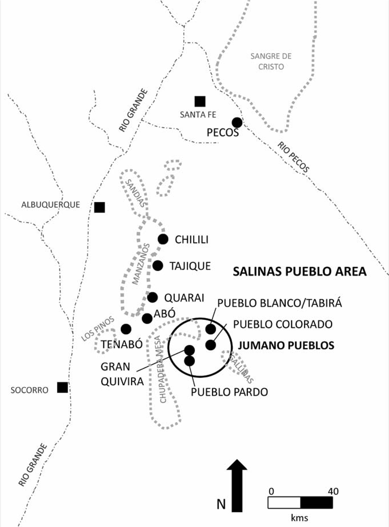
A portion of my research over the past decade has focused on the peripheries of many of the Eastern Frontier Pueblos in an effort to identify some of these mobile group encampments. Archaeological evidence that is inferred to pertain to these mobile groups has been found at many of the pueblos. This evidence includes structural features and artifacts in residential locales that are consistent with expectations provided in documentary sources that place some of these mobile group encampments outside the pueblos (see Seymour 2014b, 2015a). These occurrences are also consistent with cross-cultural studies showing that people always build shelters when staying overnight, unless they bring shelters with them (e.g., tents) or used naturally occurring shelters (such as rockshelters; Binford 1990:121122; Seymour 2009^256). Consequently it is reasonable to infer that structural remains will be the most consistently occurring and some of the most diagnostic and durable evidence of these groups outside the pueblos. The archaeological evidence found is also consistent with mobile group habitation sites throughout the rest of the North American Southwest. This chapter provides pictorial, descriptive, and interpretive evidence of how to distinguish between sites related to highly and persistently mobile people and those related to Puebloan ones.
Conceptualizing Mobility in the Pueblo Area
It is common for new evidence to be met with skepticism, and so it has been with the recent discovery of the mobile group residential sites across the American Southwest. In particular, there has been considerable resistance to accepting encampment remains found adjacent to the Eastern Frontier Pueblos as evidence of the mobile visitors mentioned in Spanish documentary sources. Those researchers most resistant to this new evidence question how I can tell the difference between sites and structures of mobile hunter-gatherers and mobile Puebloans. A corollary of this question is why mobile group structures have not been previously identified around most of the pueblos. The answer first and foremost is conceptual. Puebloans practiced different scales and types of movement than truly mobile peoples, and these behavioral differences are reflected in certain key aspects of the archaeological record.
A critical conceptual roadblock is that Pueb- loans are now conceived by many scholars as being mobile because they seasonally lived in field houses and also because every few decades they shifted between pueblos. This has led to the inaccurate impression that a subset of Puebloan housing reflects a mobile lifestyle that is presumed to be similar to that of hunter-gatherers. This view gains credence from the mistaken notion that there is no discernible difference between settled and mobile lifeways (Barnard and Wendrich 2008:2). This impression is to some degree founded in the concept that people are highly adaptable and consequently move back and forth between sedentism and mobility, as was practiced by a subset of ethnographic and archaeological societies. In fact, this has been posited at the end of the El Paso phase in the southern Southwest (see Lockhart 1997 for a discussion, as well as Hodge 1910^257–258; Jelinek 1967; Speth and Staro 2012, 2013; Sebastian and Larralde 1989). This shift may occur as part of a coordinated program or perhaps in response to changing circumstances (Barnard and Wendrich 2008:11; Barth 1998; Bernbeck 2008:45).
In the American Southwest, as throughout the world, there are substantial differences between highly mobile people and farmers who were tethered to pueblos and fields. Many existing conceptualizations and some of the most current mobility theory obscure the difference between highly mobile people (high-frequency mobility) and variable forms of low-frequency and punctuated or partial movement (relocation and migration). This creates unnecessary and distractive ambiguity regarding the characteristic material and spatial correlates of truly mobile people.
These theoretical and practical differences tend to be minimized in an effort to emphasize that the major pueblos were not characterized by centuries of uninterrupted occupation. Since this notion has been hard won, the emphasis on Puebloan mobility has been overstated. There is a reluctance to diminish the notion of Puebloan mobility by discussing its limits. As Nelson and Anyon (1996:275–276) note, there was an initial unwillingness to accept that many Puebloan sites were temporary “because it shook long- held assumptions concerning the associations of ‘permanent’ architecture with agriculture and sedentism.” But efforts to elucidate a more flexible and fluid Pueblo use of the landscape has obscured significant differences between stationary farmers and highly mobile peoples. No doubt, in the Pueblo Southwest farmers used both field houses and more permanent habitations in sizable communities, and there is also evidence for populations moving to a new pueblo after remaining stationary for years or shifting between valleys and back. For these reasons, arguments have been advanced that farming Pueblo peoples have an extensive history of local and regional residential mobility (Powell 1983; Ramenofsky et al. 2009; Varien 1999). This pattern of movement is consistent with other Southwestern farming groups, such as the Sobaipuri Oodham (Seymour 1989, 2003a, 2011a). I have been arguing for decadal movement for the Sobaipuri Oodham for some time, but, conversely, my objective has been to reconcile their relatively light and distinctive footprint with their irrigation farming lifestyle. The Sobaipuri Oodham may have shifted at more frequent intervals and their sites exhibit a lighter archaeological imprint than Puebloan ones, but even the Sobaipuri Oodham were not mobile and their sites exhibit distinctive differences from those of truly mobile peoples.
Residential mobility can be conceived at different scales, but these residential moves by Puebloan groups were relatively low frequency, perhaps on the order of every two decades or even after a century. Consequently, residents invested in architecture and fields, refuse accumulated and was deposited in designated areas, and the pueblo environment was planned and built to conform to preconceived conceptions of spatial organization and permanency in the Pueblo world. Not surprisingly, the consequences of this way of life are manifest archaeologically in ways that differ from the housing and site characteristics of peoples who move more often as part of an annual round. Puebloans just shifted residences more often than previously thought, but this way of life and its material consequences is very different from being mobile, even on the more temporary sites.
Regrettably, in an otherwise constructive effort to distinguish centuries-long from less persistent forms of decades-l ong residence, scholars have obscured an important referential and behavioral chasm. There has been a denial of a “threshold” (e.g., Varien 1999) that marks the difference between highly mobile strategies, on the one hand, and occasional movers (or people who stay in one place for years and then move or relocate), on the other. Repudiation of this threshold accounts for why many researchers have difficulty conceptualizing the fundamentally distinctive material culture and landscape use differences between them. It is no wonder, then, that when signatures similar to those of Puebloan groups are expected, the sites of the highly mobile have remained unrecognized.
Substantial evidence supports the notion that high-frequency residential mobility (that involves several moves within a single year) differs significantly from low-frequency movement, demographic fluctuations, or reoccupation that occurs every 16 to 26 years at persistent places (e.g., Ramenofsky et al. 2009; Varien 1999:3, 195) or even every three to four years (e.g., Bernbeck 2008:47). These forms of leaving behind and reoccupation are different in fundamental ways from high-frequency residential mobility and might best be considered something other than mobility or movement (e.g., relocation, reoccupation, even migration). Discussions of “small habitations, dispersed settlements, and short duration of occupation” and “the relatively small investment in the habitation sites,” or the “significantly shorter” occupations and a “low level of investment in facilities” (e.g., Matson et al. 1988:254, 259), are an order of magnitude different from the ephemeral residential sites of highly mobile people. We are not describing and interpreting the same phenomena.
The seasonal and decadal shifts of agriculturalists vary substantially from high inter- vallic forms of residential mobility practiced by nonagriculturalists in the region. The pace of movement has discernible spatial and material consequences. As Nelson and Anyon (1996:276) note and as is widely known, agriculture entails much greater labor investment than hunting and gathering. Similarly, Puebloan housing requires planning, investment, and modification as well as an entirely different conception of space, landscape, and materials use than among highly mobile peoples (Seymour 2009b, 2010b). The underlying differences result in readily discernible distinctions between the Puebloan archaeological signature, even on special- or limited-use sites, and that of mobile groups.
It is warranted to explore various forms of residential movement, but it is also essential not to confound high-frequency movement with intermediate forms of staying in which people really do exhibit an attachment to place and invest in its improvement and maintenance. The distinctive signatures revealed in the archaeological record—which are consistent with cross-cultural comparative ethnographic and archaeological data—indicate that these intermediate-frequency strategies differ between mobile and stationary groups. Historically, people who are mobile but stay a bit longer do not look the same materially and spatially (e.g., archaeologically) as people who tend to stay but move a bit more frequently. The basis for these differences may be inferred from the material and spatial signatures found in the archaeological record.
People who are basically stationary farmers do sometimes and at intervals move around or relocate into fresh new cultural landscapes (or reoccupy persistent places), but the terrain sectors selected, the nature of their habitation units, and the way they dispose of their refuse betray their affiliation as sedentary folk (or low-frequency movers), at least in the American Southwest, and elsewhere as well. The attributes of isolated Puebloan structures (field houses) and mobile group structures found in some of the same zones surrounding the main Eastern Frontier Pueblos exhibit clear and distinctive signatures (as they do throughout other portions of the American Southwest; see below). General cross-cultural theory supports these observations (see Seymour 2009a), as do historical photographically documented and archaeologically analyzed Apache sites. These photograph-to-field comparisons show what types of structures, terrain attributes, and landscape sectors were used by high-frequency residentially mobile groups (e.g., Seymour 2009a, 2009b; Seymour and Robertson 2008). Such comparisons have allowed investigation of the ways in which these archaeological signatures differ from those of people who are more stationary. With the aid of ethnographically and historically documented sources we can begin to understand how specific aspects of their lifeways contribute to material and spatial differences. These sources also provide data on the differences that are difficult for skeptics to ignore.
There are fundamental differences in approaches to living and ways of operating within their natural and social landscapes for Pueb- loan versus mobile groups. Recent efforts to archaeologically define the material and spatial attributes of various residentially mobile strategies, as seen on the ground, have helped isolate substantive descriptive and theoretically relevant qualities, which are, seemingly, thresholds of difference between these ways of life. This establishes an empirical basis—which derives from the archaeological record itself—for us to surmount vacant definitional restrictions of the mobile-to-sedentary typology. Yet until now this classificatory ambiguity has been expanded in ways that do not acknowledge fundamental differences between mobility and movement. Productive future study will emphasize the difference between low-interval movement (forms of staying) in mobile strategies and the highinterval end (forms of occasionally moving) of stationary existence.
Some of the basic differences between highly mobile and essentially settled people in the material and spatial residues left at sites include the way space was used, what portions of the landscape and terrain were selected, amount of investment in shelters and material goods, the way household space was organized and trash was discarded, and flexibility in the use of intrasite space to manage social circumstances (Cribb 2008; Eder 1984:850; Kelly et al. 2005, 2006; O’Connell 1979; Reher 1983; Savishinsky 1974; Seymour 2009b, 2009c, 2010a, 2010b, 2015a; Woodburn 1972; Yellen 1977). The intrinsic flexibility provided by persistent mobility, as well as by the factors that motivate movement, result in different social and behavioral practices than those characteristic of the occasional movement of Puebloans. The material and spatial consequences of these practices are observable in the archaeological record, and when they recur across a wide set of social contexts, they provide evidence of more broadly applicable behavior that is not culturally or historically bound.
Distinguishing Puebloan and Mobile Structures
What are some of the material and spatial differences between highly mobile and essentially settled people? This issue is best addressed with multiple lines of evidence because the data are less robust as compared with Puebloan evidence (e.g., evidence is sparse, difficult to sort, and relatively nondescript). In this regard, structures are often the most visible diagnostic available for locating and identifying mobile group residential sites. Thus, it is helpful to discuss why I am inferring that these are mobile group structures—or, for that matter, why I consider them structures at all.
Mobile group visiting encampments look different than Pueblo ones because the residential features are constructed differently. Fundamental differences between mobile group and Puebloan structures include the primary criterion that most Puebloan structural residential features are rectilinear whereas those made by mobile groups tend to be curvilinear. Puebloan wall stubs and foundations form ±90-degree angles (Figures 4.2, 4.3a). This distinction in housing practices between mobile and sedentary people has been well documented on a worldwide basis (Binford 1990:123; Diehl 1992; McGuire and Schiffer 1983:284; Robbins 1966; Seymour 2009b, 2010b, 2013c, 2015a; Whiting and Ayers 1968) and so is attributable to more generalizable behavioral differences between highly mobile peoples and those who are more stationary. This is a practical matter and has implications for the ways that mobile and stationary groups conceptualize space (Seymour 2009d).
It is inferred that these encampments are mobile group structures because they are consistent with mobile group structures throughout the world, in the American West, and on other mobile group sites in the Southwest (Seymour 2008a). Throughout the world, mobile groups practicing similar lifeways and facing similar limiting factors tend to build structures in similar ways, regardless of ethnicity (Seymour 2009c, 2013c). Cross-cultural studies demonstrate commonalities, including that they tend to be circular, small, built on the surface, and use materials at hand.
Hut ring footprints are often small (1.251.50 m in diameter) but highly variable (generally ranging from 1.25 to 4 m in diameter). At the low end they are much smaller than expected, which is one reason those unfamiliar with mobile group behavior have difficulty believing they are cultural, and even more trouble believing they are structural. Yet ethnographic data indicate that mobile groups use their structures differently than more settled peoples and so space requirements differ (Seymour 2009a, 2013c). Archaeological evidence also supports these inferences. Structural remains found around the Eastern Frontier Pueblos are remarkably similar to those structures seen on hundreds of ancestral Chiricahua and Mescalero sites. They are also similar to mobile group structures throughout the West (Seymour 2008a), and they conform to hut footprints found on historical sites where photos were taken during or shortly after the Apache presence in the late 1800s (Seymour 2009b; Seymour and Robertson 2008). Similar types of evidence have been used to understand tipi sites (Banks and Snortland 1995).
Puebloan structure walls are more substantial and more purposefully built than those of mobile groups. Pueblo walls tend to be made of coursed stone layers or upright slabs that are embedded in the ground. Sometimes the constituent stones are shaped. When walls collapse, they form rubble mounds or piles, depending on the height and width of the walls. The room itself often fills with rubble, forming a low rubble pile or field (Figure 4.3b). The result is that even small field houses of the same size as some mobile group structures look distinct.
Mobile groups simply stacked or pushed rocks together (Figure 4.4), sometimes even placing just a couple of stones between naturally occurring outcrops to improve an already suitable space (Figure 4.5). Stones were rarely coursed and not shaped, unless they were scavenged from a Puebloan feature. If elongated rocks or slabs are positioned upright, they tend to be on the surface (Figure 4.6). On a rocky surface an area will often be cleared (Figures 4.7 and 4.8).
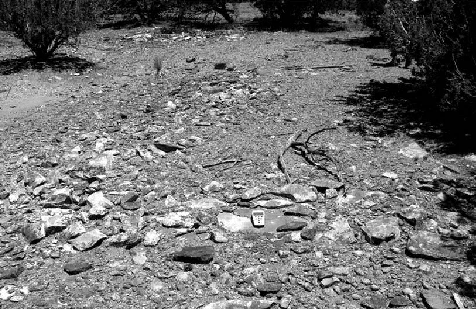
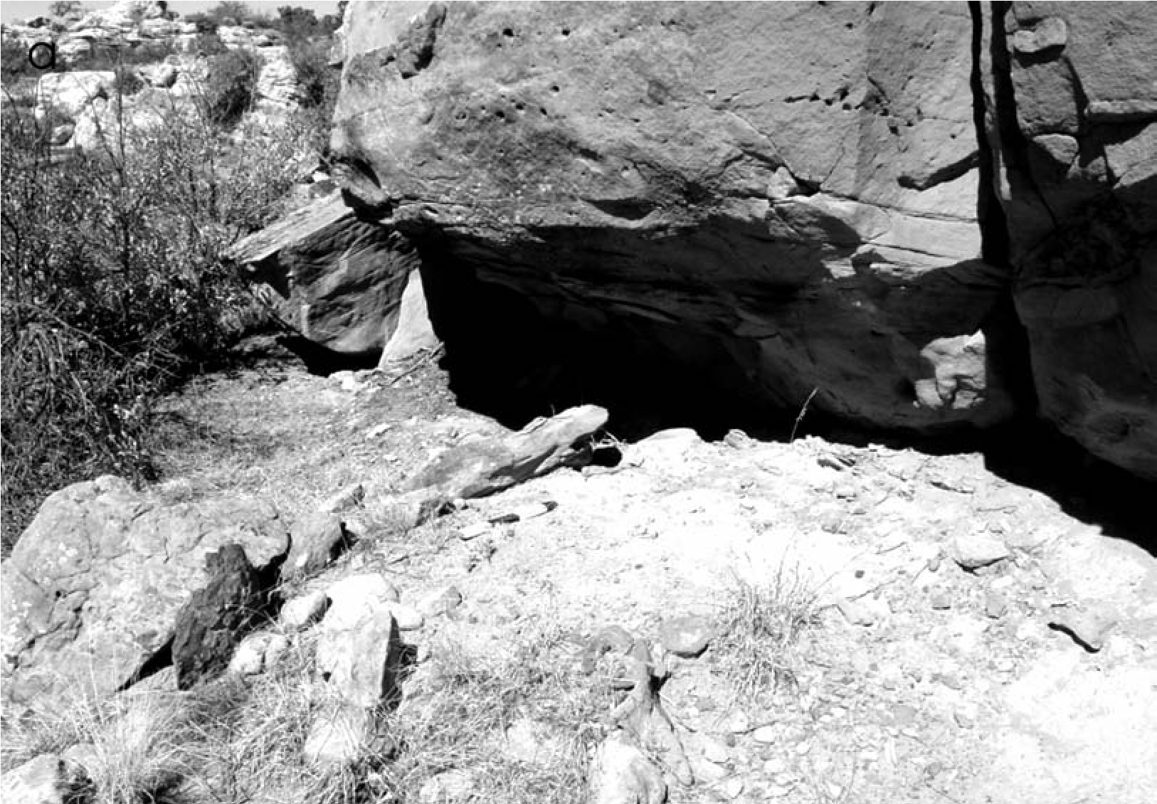
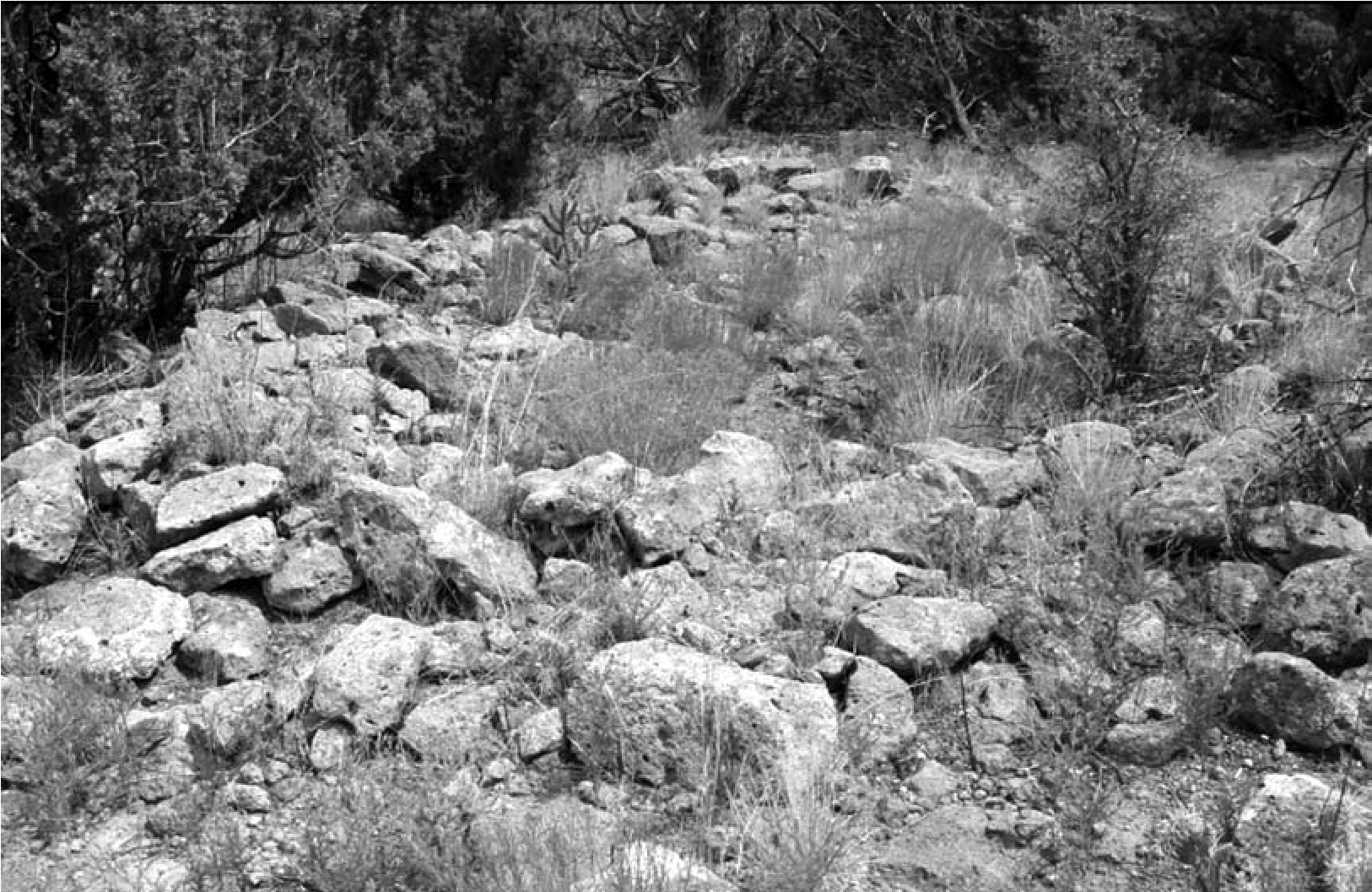
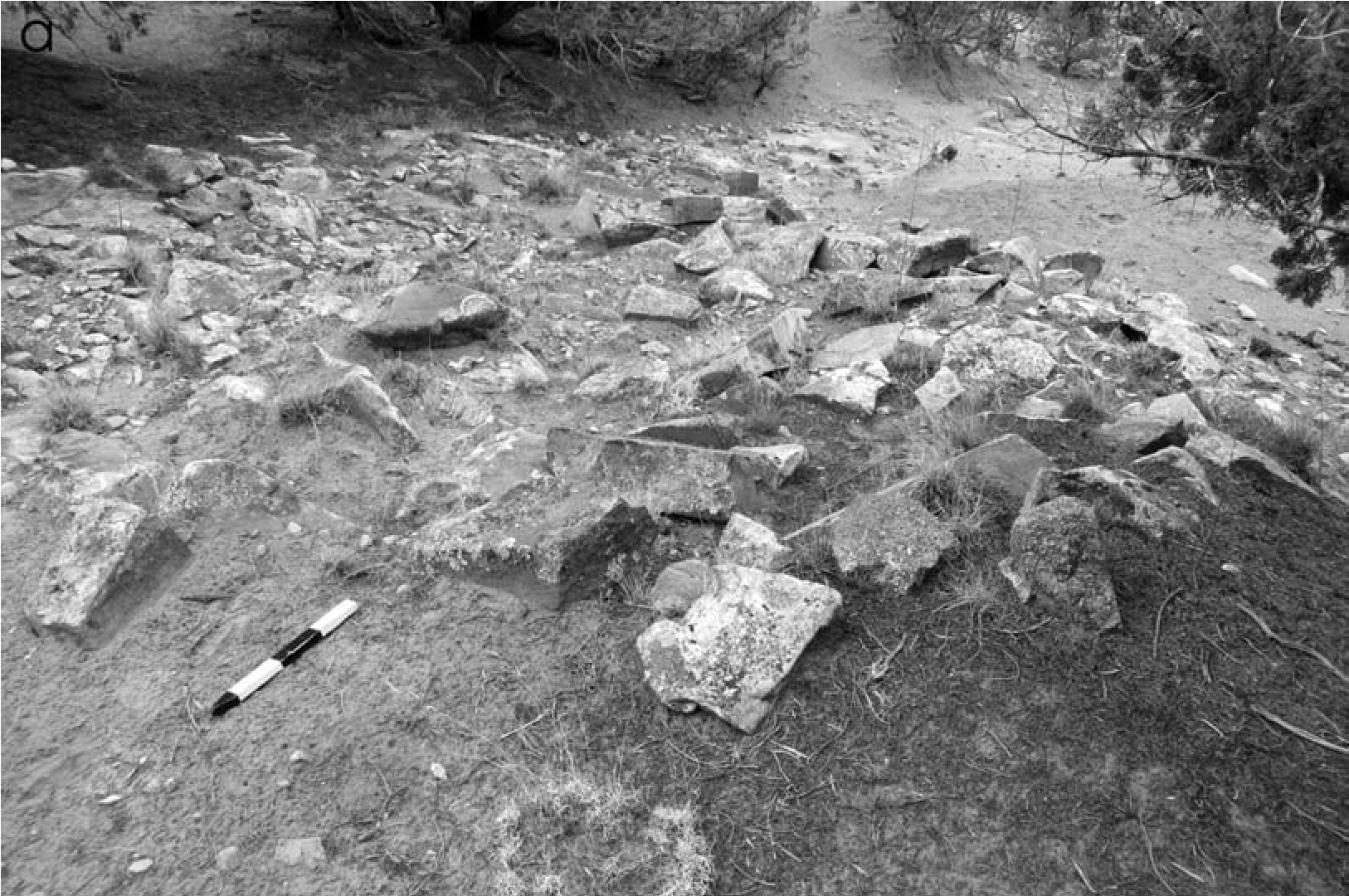
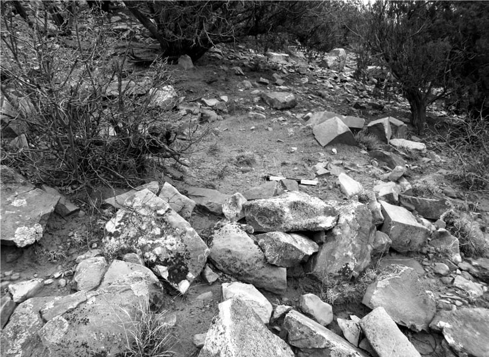
Almost all Eastern Frontier Pueblos examined have evidence of a mobile presence. The notable exceptions are Burnt Corn and Koyoti, which probably relate to the short period of use and the time during which they were occupied.
One reason these mobile group sites have only recently been identified is that researchers have approached discovery of these encampments using inappropriate expectations. In many cases they are expecting conical tipi rings, as are common on the Plains. In this region, mobile group structures were generally of two types: tipi rings and wickiup rings. Some tipi rings are known from eastern New Mexico, but where there are mountains and ridges many more structural features are represented as the bases of wickiups, or smaller, dome-shaped, hide- covered or “straw huts” (Seymour 2002, 2009a, 2009b, 2010a). Unlike tipi rings, which are made with cobbles or boulders that are clearly out of place, wickiup rings take any of a number of forms. One reason for this is that the structural features are often set up in between boulders, against rock faces (Figure 4.9), and in rocky areas on slopes (Figure 4.10) to take advantage of the terrain. Thus, a clearing, a level area on a slope, or a few stacked rocks are more likely than an alignment, although alignments are known (Figure 4.11a). Variably sized rocks were used, including boulders, and ring size varies widely (Figure 4.11b). These structures have no consistency in form or size because they are improvised in relation to available materials, climatic conditions, and terrain features (Seymour 2009a, 2009d, 2015a).
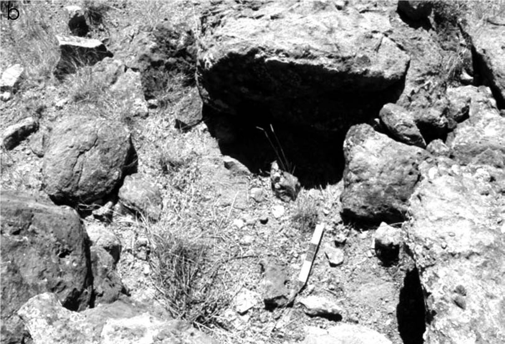
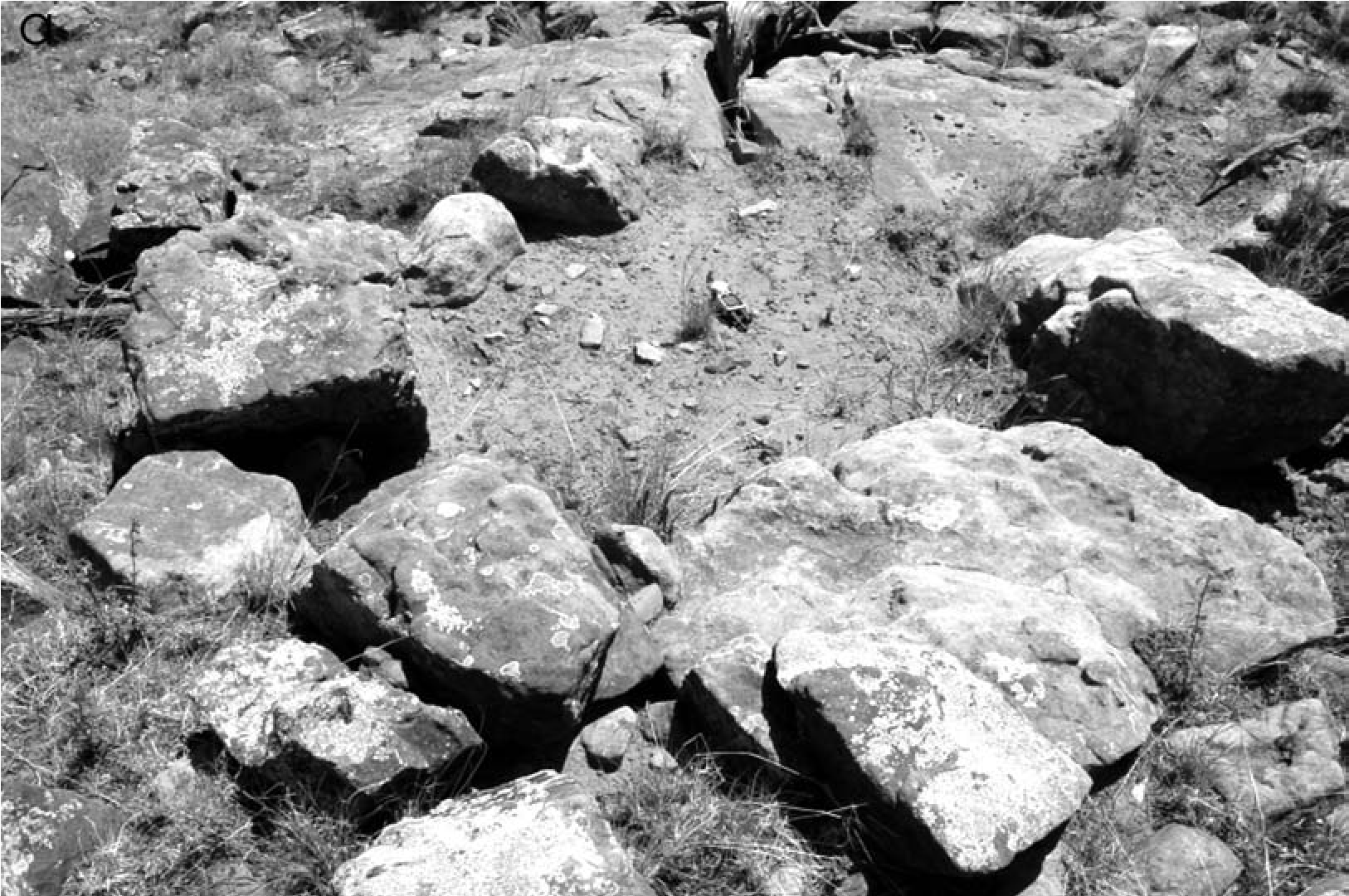
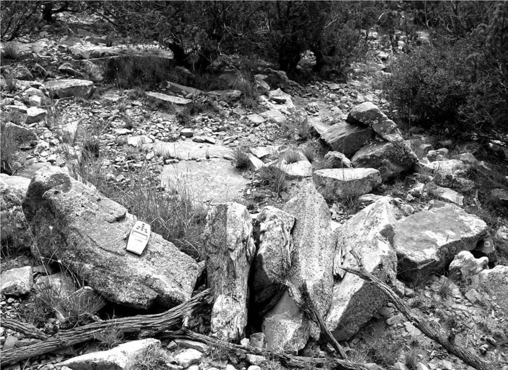
Tipi rings tend to be on flat or gently sloped terrain, including on the tops and bases of ridges, owing to design restrictions that limit their placement (Figure 4.12). But most mobile group features found in the Eastern Frontier Pueblos are the bases of wickiups or perhaps in some instances small tipis. It is assumed that the larger tipi encampments were on flat terrain. Many locations that may have had tipi rings have been disturbed, and so most evidence of these features has been erased. Many of these locations have since been modified by ranchers, logging, and National Park Service and archaeological activities. This is true at Pecos Pueblo, where a flat area suitable for a large tipi encampment was bulldozed as part of former ranching activity and then chained as part of Park Service site development and maintenance. Owing to artifact distributions on the slopes beyond the disturbance, this location is inferred to have been the one described in the documentary record as the Vaquero locus, situated “300 to 400 paces” from the pueblo (Hammond and Rey 1953:660–661). Elsewhere, such as at Gran Quivira, where there has been substantial modern and historic activity, presumed mobile group loci are also lacking. At Tenabo, Hayes (1981:10) reported a tipi ring locus situated a half mile from the main pueblo. Today this locus remains but has been substantially modified by modern visitors (Figure 4.13). Comparison of the original photograph of this tipi ring shows it much less perfect, and where there were once seven stone circles now there is only one, along with animal-like geoglyphs.
The Visiting Landscape
Mobile group visiting encampments not only look different than Pueblo ones but are positioned differently on the terrain. Puebloans used the landscape surrounding the pueblo differently than mobile groups did. Puebloan field houses are situated at the base of slopes and on level terrain. Some are associated with roasting pits. Others are associated with agricultural terraces found on nearby slopes, which are linear rock alignments oriented perpendicular to the gradient and designed to capture runoff (Figure 4.14). These associated field houses are indicated by rubble, with corners at discernible angles and often with Puebloan sherds densely clustered in and around the feature.
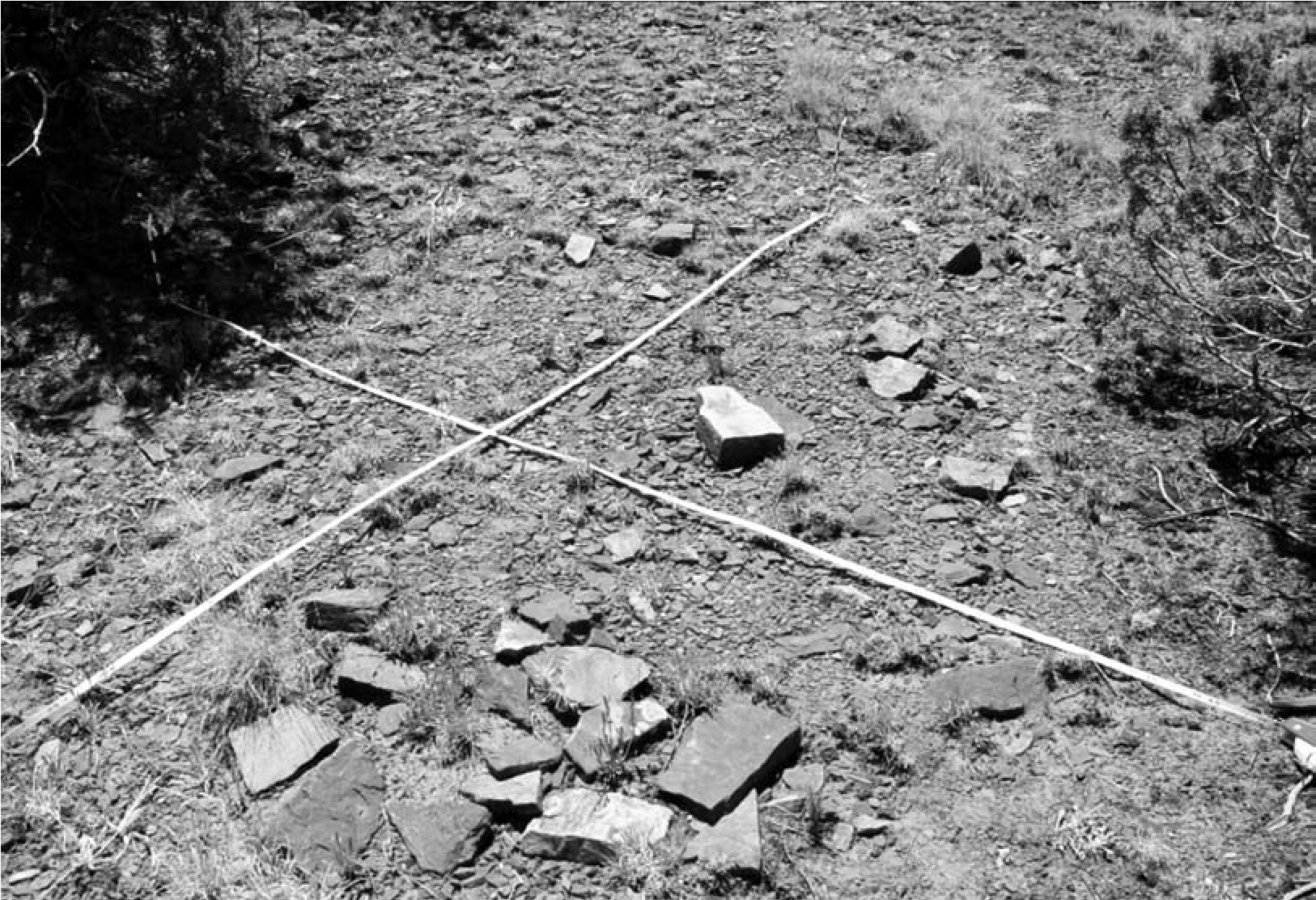
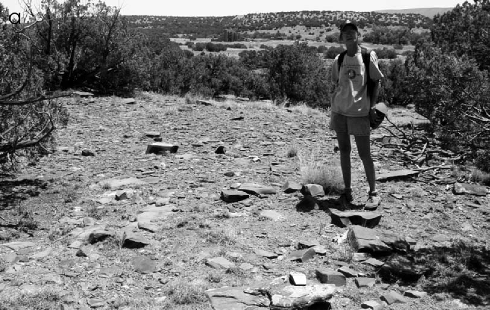
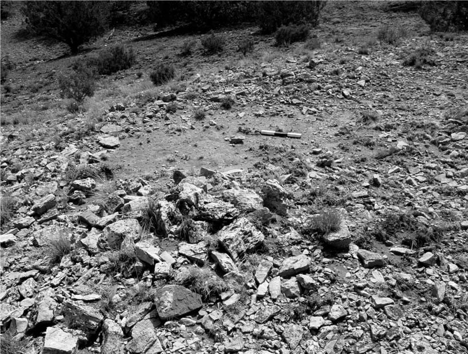
At many of the Eastern Frontier Pueblos, mobile group structures are positioned on the slopes themselves where rocky areas were specifically selected. From these locations they would have had a view of the pueblo and the surrounding terrain, and building materials would have been readily at hand. The relatively small size of visiting groups placed them at a disadvantage if relations turned for the worse. Situated on elevated slopes, they would have had sufficient warning if attacked, and they could have dispersed and escaped across the ridge or landform behind them. Moreover, with little effort the extant rocks could have been rearranged, providing the foundation stones to hold poles and hides in place for structures. Placement of encampments was often designed to take advantage of the winter sun and to protect against chilly winter winds off the plains.
Placement on the landscape provides clues as to these structures’ contemporaneity with the pueblo. Pueblos tended to be built in locations that were attractive for settlement, and therefore both earlier and later sites are expected. The abandoned pueblo itself tended to draw later visitors who scavenged from the remains, stayed within the walls, or incorporated it within their ritual rounds or sacred landscape. But when structures and structure clusters are positioned in the vicinity of the pueblos, it is reasonable to question whether some might represent contemporary encampments of visitors to the pueblos, as mentioned in documentary sources. This inference is strengthened when the structures produce chronometric and ceramic evidence that they are contemporaneous with the pueblo.
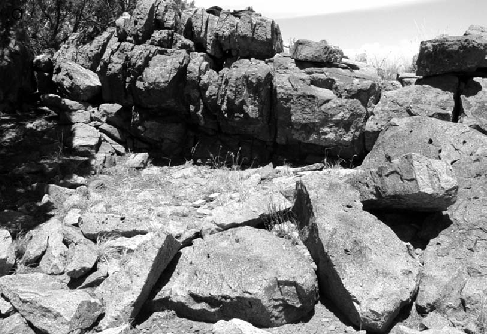
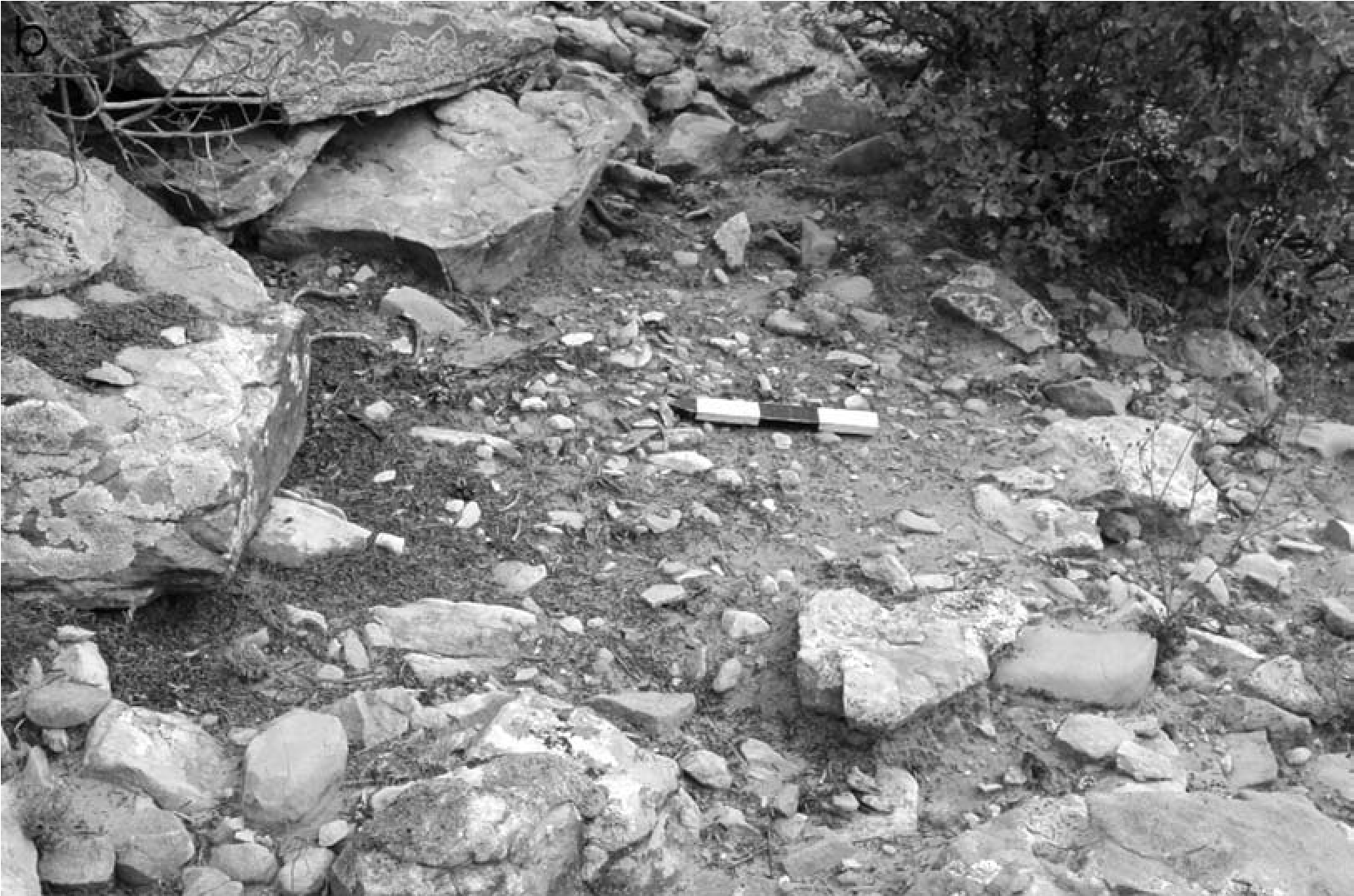
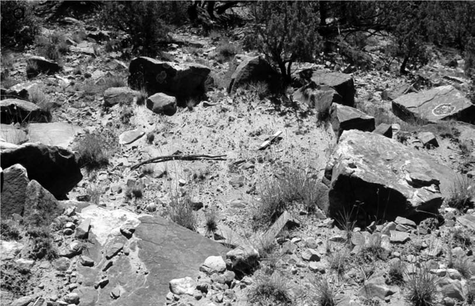
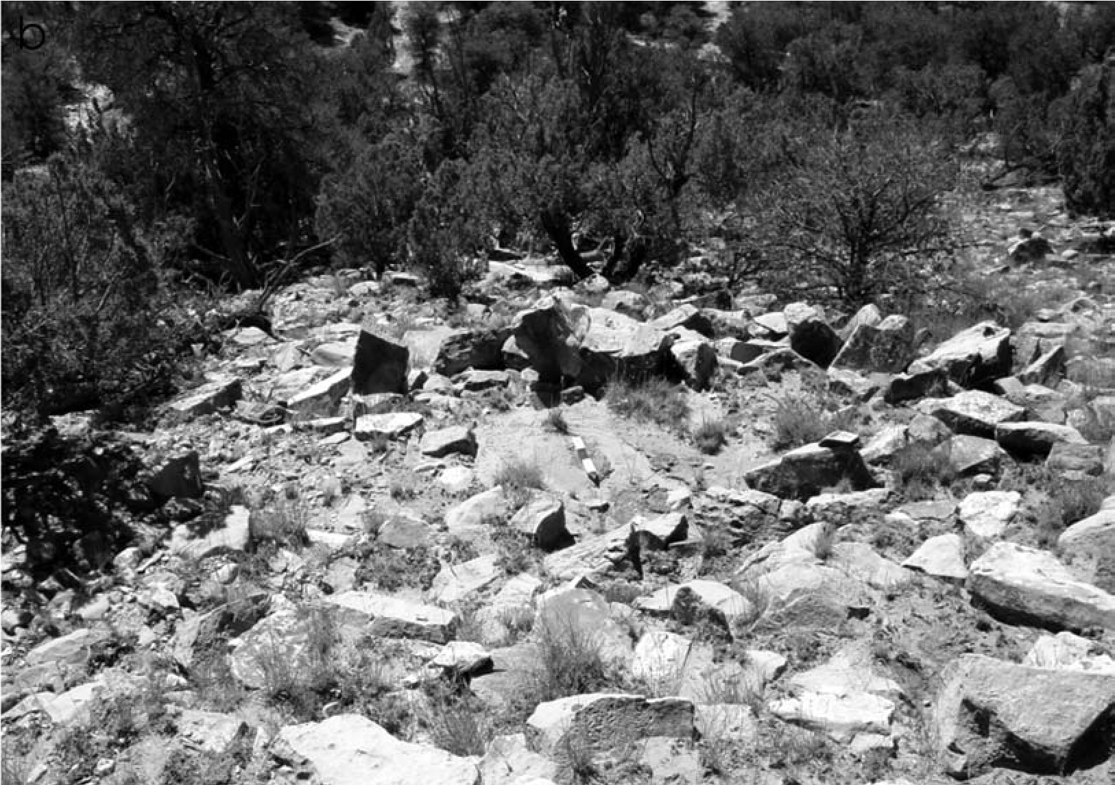
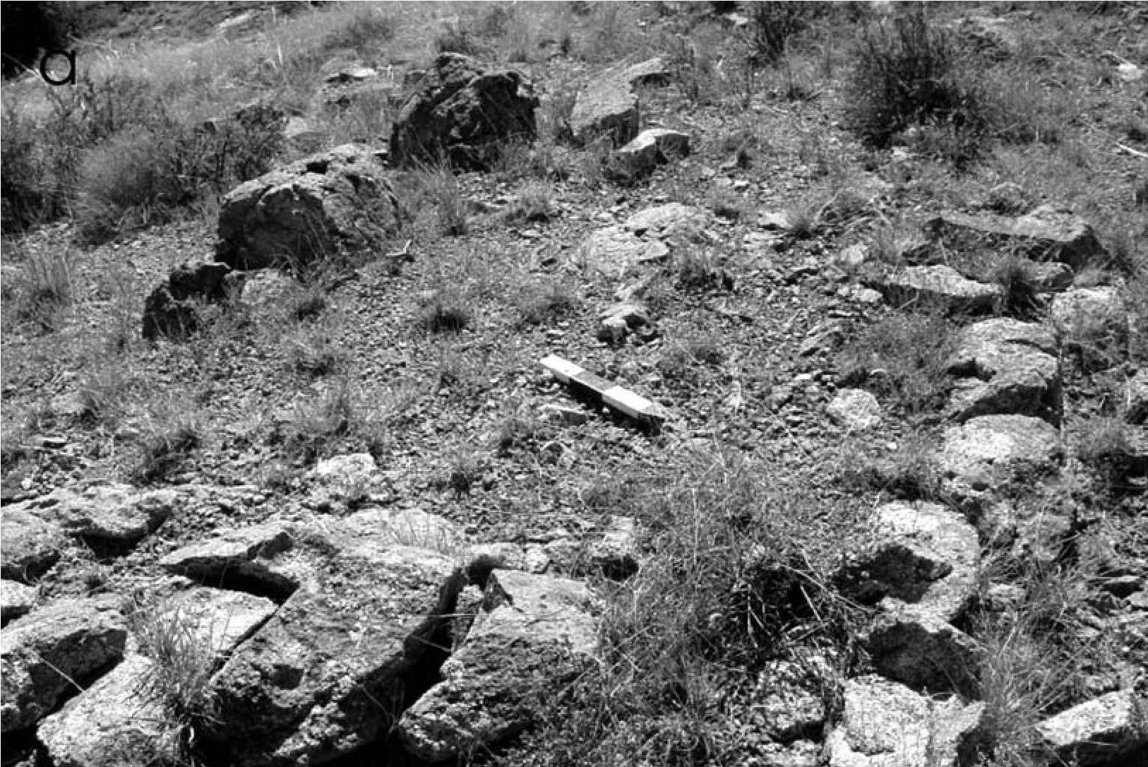
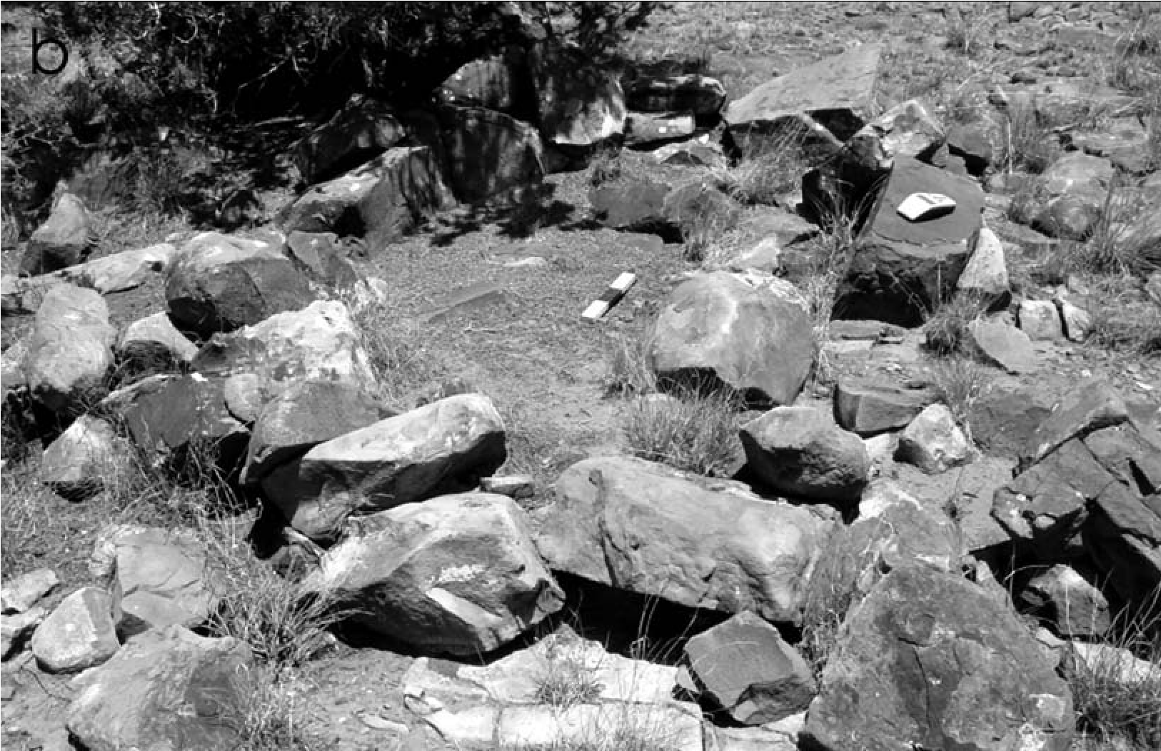
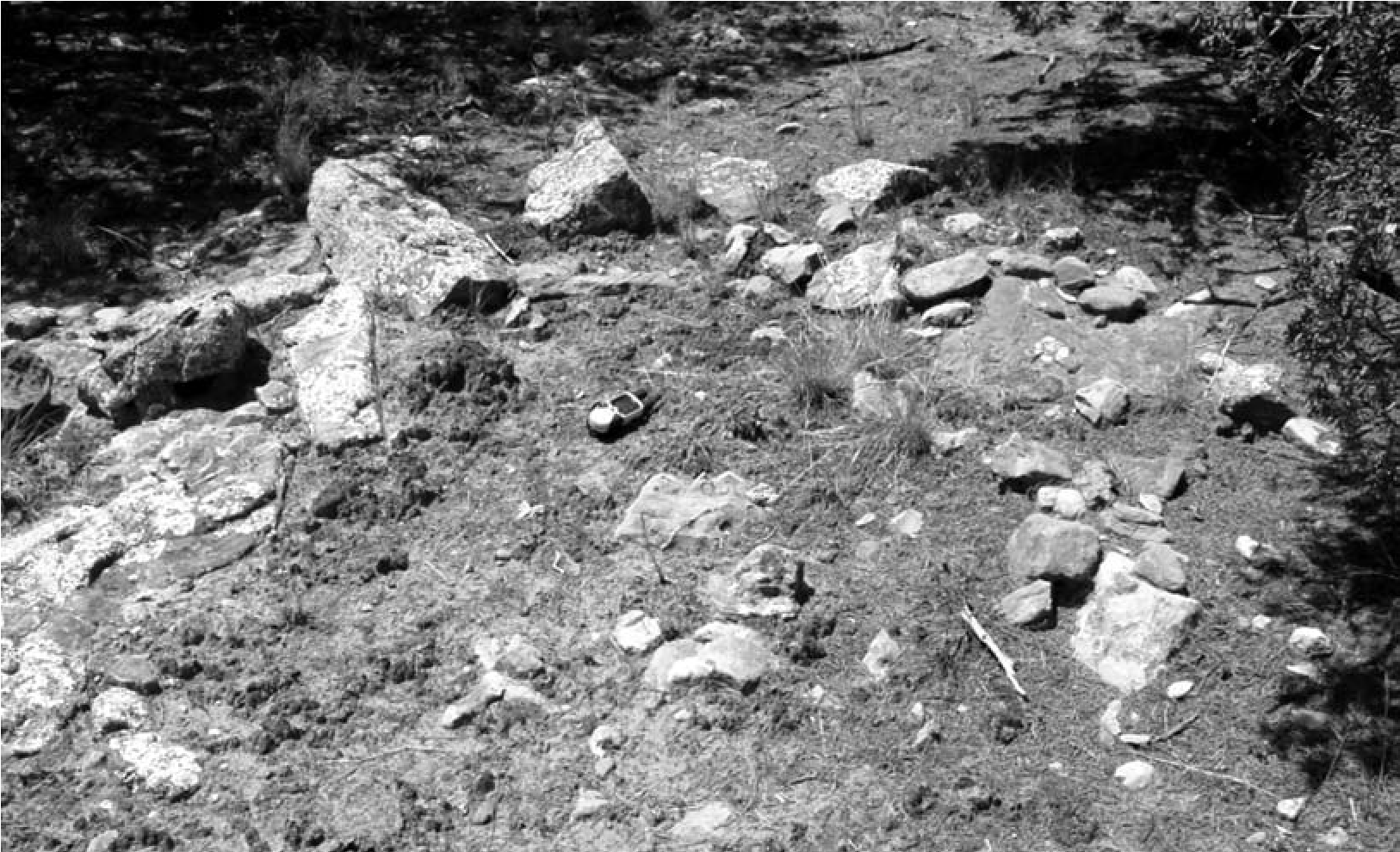
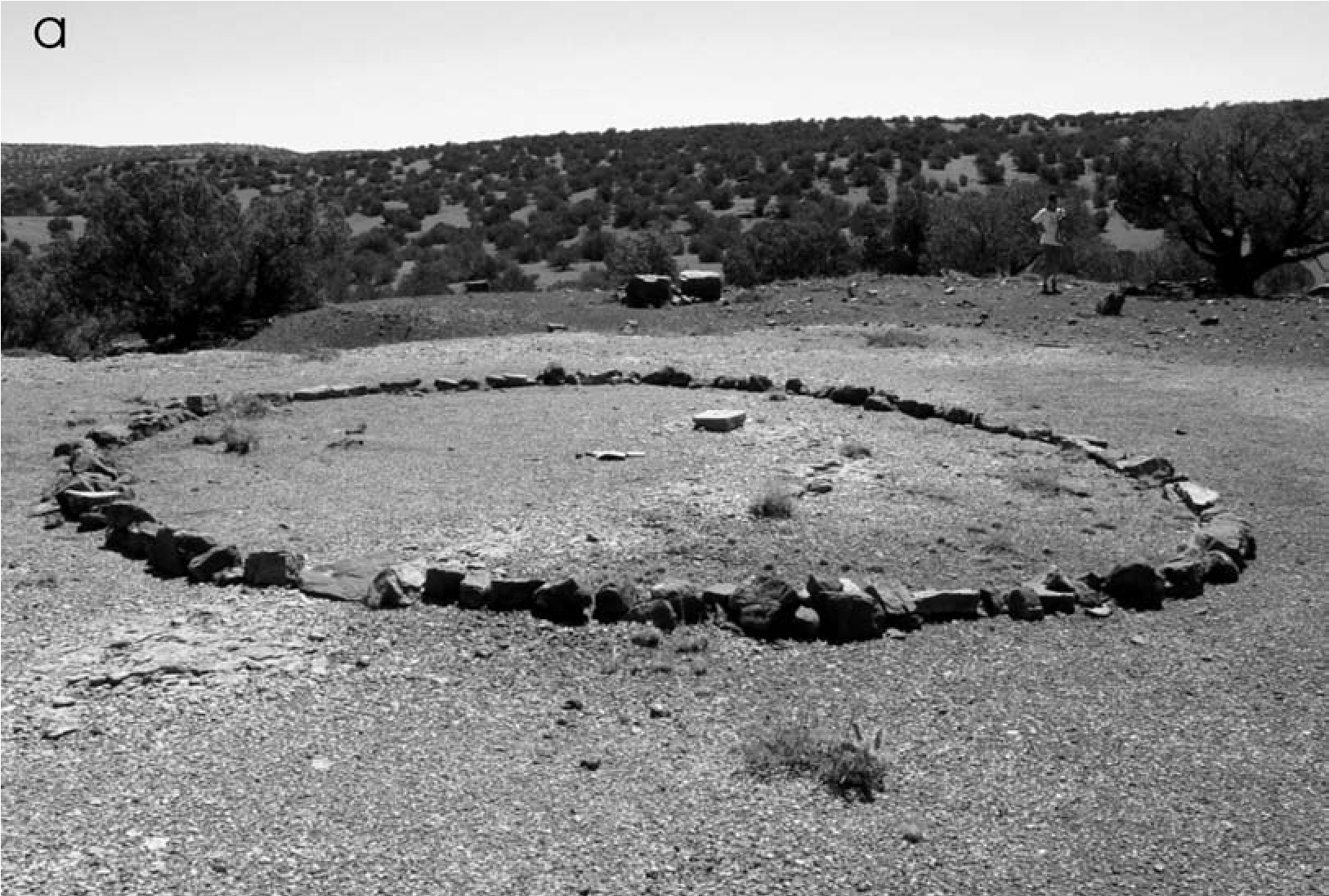
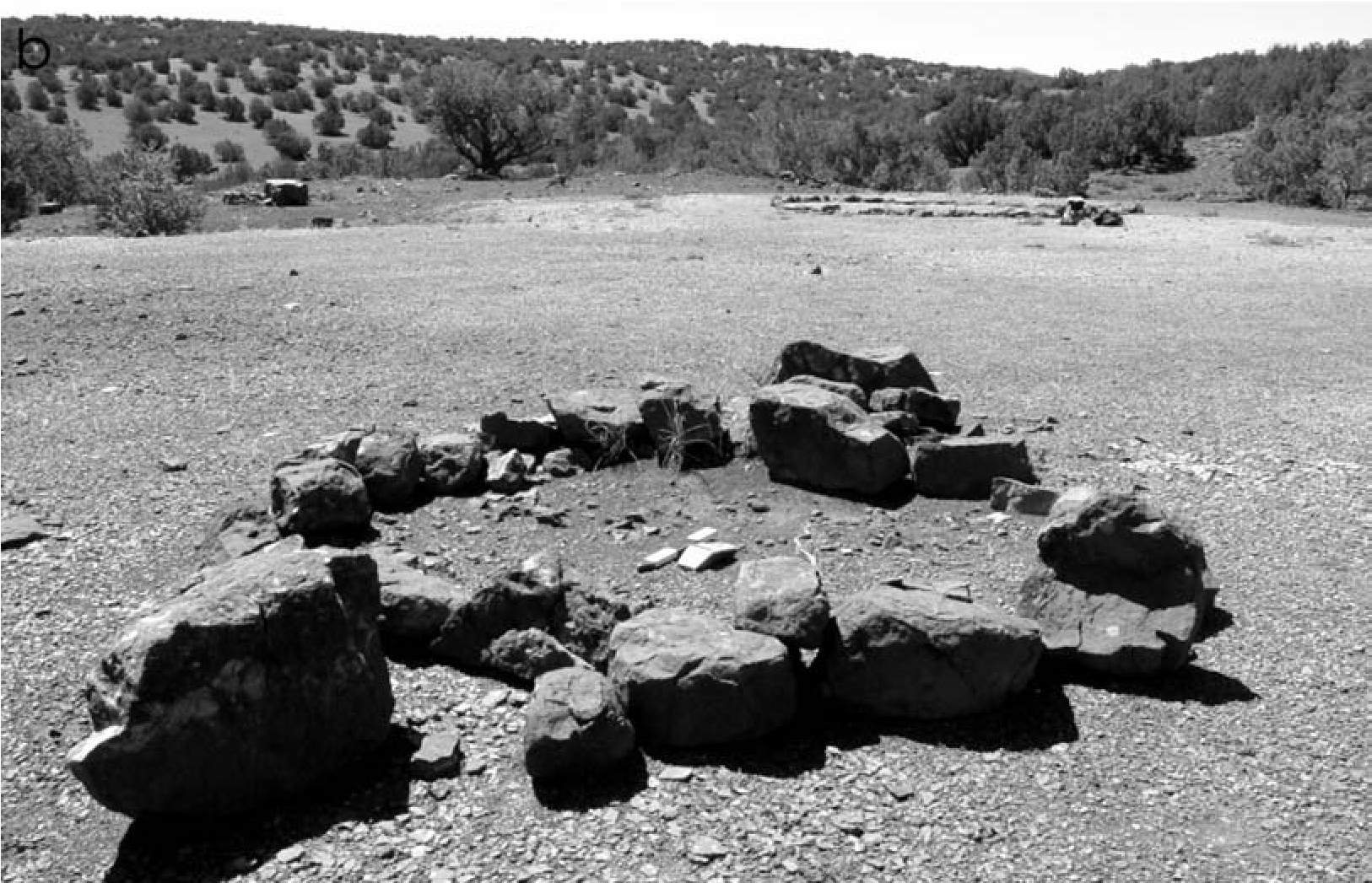
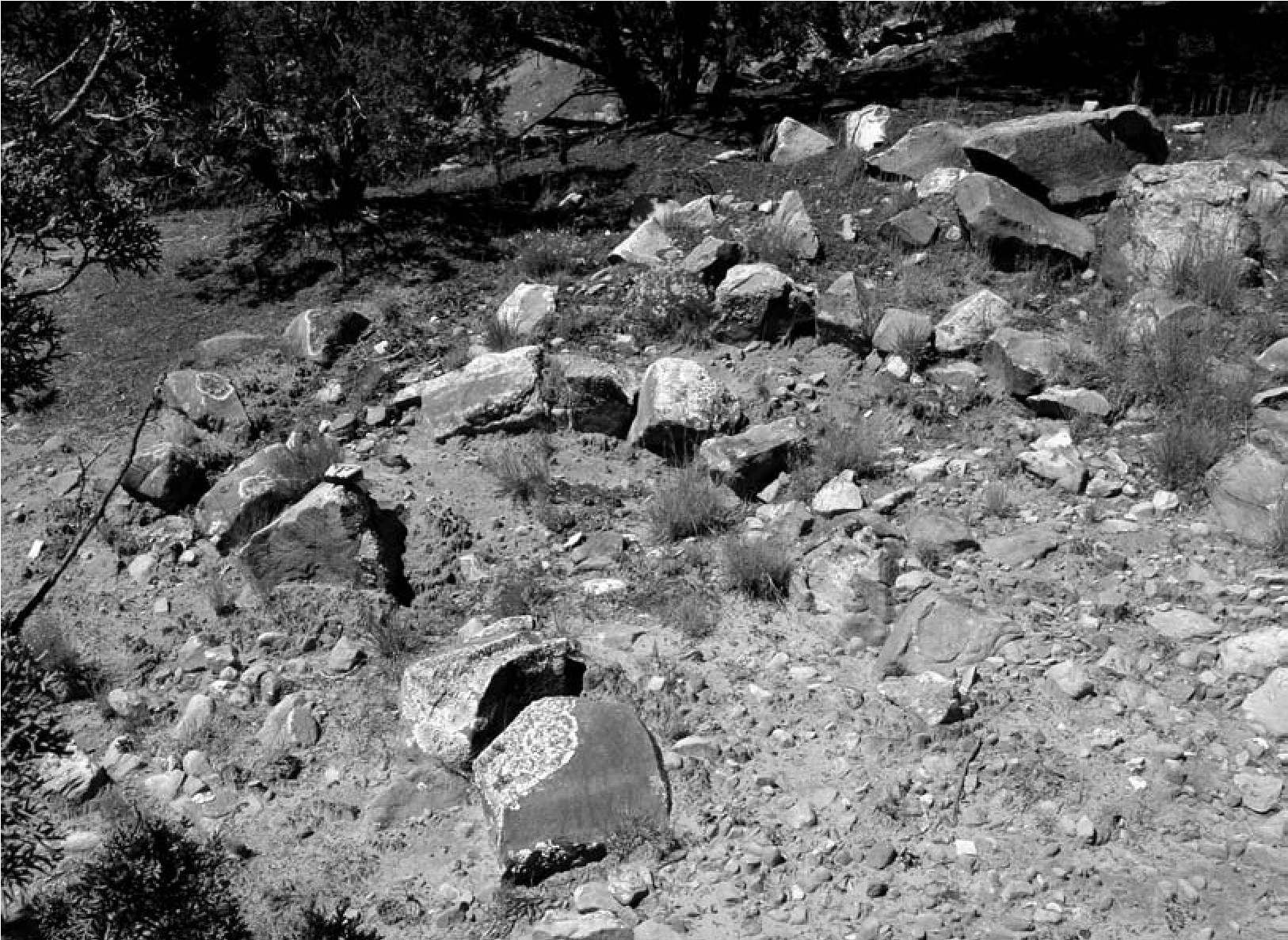
Artifacts in the Pueblo Sphere
High artifact densities characterize pueblo spaces, even at Puebloan field houses. In comparison, mobile groups usually leave very few artifacts. Typically, an area of high density of Puebloan architecture, other features, and artifacts is surrounded by a background scatter of Puebloan artifacts for a distance around each pueblo. This light background scatter that extends out from the pueblo consists of a diffusion of pottery and other items. Both density and diversity are low, and typically if features are encountered they tend to be isolated and of limited morphology. This background artifact distribution eventually falls off, marking the outer edge of the pueblo use and erosion zone. Nonsite surveys have shown this type of distribution most clearly, quantifying observations detectable in the field. Space relatively devoid of artifacts and features separates pueblos from one another and distinguishes pueblos from field houses and other limited-activity or short-term special-use locales. Within this zone around the pueblo, archaeological work and ethnographic data indicate that there may be contemporaneous shrines, seclusion areas, defensive lookouts, procurement locales, and so on. These special-use locales are visible as isolated features, a feature with a limited array of artifacts, or a discernible increase in density and diversity of artifacts.
Both later and earlier use of the vicinity may also contribute to an uptick in artifact density and diversity and in features in this low-density zone peripheral to the main pueblo. These are sites in their own right. In many instances artifacts and/or feature morphology provide clues as to the lack of contemporaneity with the pueblo. These interpretations of lack of contemporaneity rely on the fundamentals of archaeological field identification, and so these manifestations can easily be removed from consideration when we assess pueblo-wide activity areas and interactions.
Visitor encampments conform to this pattern as well, often occurring within the low-density zone around the pueblo, sometimes occurring beyond this zone. These mobile group loci differ from other contemporaneous locales within and beyond this zone in any of a number of ways. Structure morphology is distinctive from Pueb- loan forms and representative of mobile group housing throughout the region, as just discussed. Moreover, a redundancy is apparent in the function of features found here and in the pueblo (e.g., both have habitation structures), coupled with their distinctive morphological character and landscape placement.
Artifact density and diversity may increase significantly in these mobile group encampment areas. These locations often have unusually and noticeably high artifact densities as compared to surrounding areas. With regard to this latter point, however, there are several additional considerations. Foremost among them is that mobile group artifact density is generally low overall and the assemblages are often mixed in with those of the host pueblo. This means that any Puebloan artifacts present will dominate the assemblage, both because many are decorated (and thus visible and easily recognized and identifiable) and because they tend to occur in greater frequencies than mobile group artifacts. The sparseness of the mobile group assemblage results from many factors, including the overall tendency for mobile people to have fewer items than sedentary people. Also, the perishable nature of many of the constituents of mobile group assemblages makes items easily transportable, light, and easily replaced so extra baggage is not carried around; at the same time, this means these perishable items will not generally be preserved and therefore represented in site assemblages.
But why are there Puebloan artifacts present in these mobile group loci? One reason is that the presence of earlier occupations, such as field houses or special-use areas, may predate the use of the area as a mobile group encampment. Multicomponentcy is common and presents one of the most difficult challenges with regard to recognition and visibility of mobile group loci and components. But contemporaneous Puebloan and mobile group assemblages are often intermixed in these locations as well, and the Puebloan artifacts are often dominant. One reason for this is that the character of these mobile group loci is influenced by problems of transference. Documentary sources are clear that mobile groups came for two key reasons: to trade and to find shelter from the severe winter weather on the plains. These are not mutually exclusive reasons, but the former probably allowed the latter to occur. Similarly, winter was a time when plains resources would have been in short supply and bison were more difficult to hunt, so trading provided much-needed food supplies at a critical point for plains hunters. Thus, once mobile groups arrived, they would have unloaded the many bison products (bison meat, fat, hides) and raw materials and tools they carried with them and had plenty of, in exchange for manufactured items (cotton blankets and pottery, if for nothing other than storage containers for items being traded), corn, and so on, items they desired and in some cases craved. Sedentary Puebloans stored, transported, and ate out of ceramic vessels, and so when they provided goods to the mobile visitors in trade events or during other functions, these goods would likely have been transferred in vessels, some of which would have broken during use in the mobile encampment or in transport to those locations. Importantly, mobile groups would not have brought their own pots with them because better ones were available at the pueblo; there is no reason to bring “coals to Newcastle” (Seymour 2010a). Moreover, mobile groups would not have transported their own clay vessels because they would have been heavy, clumsy, breakable, and not particularly suitable for transporting the types of items traded. As noted, baskets, hide containers and wrappings, and other light, flexible, and perishable materials would have been used by mobile groups to transport trade items to the pueblos.
Ceramics are not found on most mobile group sites, but when they are present they are usually on longer-term residential sites. In such instances they are characterized by a mixture of those made by the mobile residents and those that have been obtained through raiding, trading, or scavenging (see, for example, the Cerro Rojo site; Seymour 2002, 2004a, 2008b). One applicable ethnographic example is from a Tonto Apache woman who noted with regard to a series of pots situated around her house, “These [pots] are not ours,” and then she went on to describe from which neighboring groups she had obtained the vessels (Goodwin 1929–1939). Opler (1941:398) notes another: “The women who didn’t make their own pots got them in trade from the Pueblos and from the Navaho too” Consequently, vessels found on sites are often representative of neighbors and enemies, a process I have described elsewhere as the Interaction Index (Seymour 20^:195). In many instances those ceramics representing other groups dominate the assemblage, both in terms of visibility and with regard to sherd frequencies. Mobile group sites at the Eastern Frontier Pueblos are no exception, and when ceramics are present they tend to be Puebloan in origin.
Most archaeologists are trained to view pottery (especially decorated or slipped) and projectile points as diagnostic and assign age and cultural affiliation based on these alone. Puebloan ceramics are often present on mobile group sites (also see Hayes 1981:10), and because they are recognized as culturally diagnostic, sites are assigned a Puebloan affiliation. In contrast, mobile group ceramics are usually plainwares, which are difficult to see against the same- colored ground surface and amid plainwares of other origins. Moreover, plainwares are not usually the focus of analysis and are generally not considered for assessing age when decorated wares are present, which eliminates one avenue for identifying mobile peoples who lack decorated pottery (Seymour 2010a). The problem is that focus on the clear and long-accepted diagnostics routinely masks other components, including those of mobile groups. An example is the Cerro Rojo site, where attention to the few Jornada Mogollon artifacts (and misidentifica- tion of ancestral Apache pottery as prehistoric) contributed to the large mobile group component being missed despite the presence of hundreds of structures and artifacts (Seymour 2002, 2004a, 2008a). Mobile group ceramics are difficult to distinguish from those of other groups and are often misidentified (see Seymour 2009b). An Eastern Frontier mobile group site I identified (LA 152447) near Tabira was subsequently recorded by the Forest Service as prehistoric because of the dominance of Puebloan ceramics (Seymour 2015a).
The focus on pottery and projectile points is a far too narrow perspective because many other aspects of the mobile group assemblages are temporally and culturally diagnostic. Plain- ware ceramics can certainly be diagnostic, as can beautifully crafted stone tools, such as bifaces, owing to distinctive manufacturing trajectories and unique flaking attributes (Seymour 2009c, 2014a). The presence of certain unique lithic materials themselves (obsidian or Alibates dolomite) can signal shifts in raw material sources and new exchange relations, which in turn may provide an indication of the presence of or interactions with mobile groups.
Low overall artifact frequencies in mobile group visiting locations can be expected for a number of reasons, including that the visitors would have brought completed tools with them for use over the long stay, eliminating a lot of the debitage. These tools were of types that were intended to be durable for repeated use over long periods. Such items and raw materials would have been desirable for Puebloans as well and were likely traded or gifted to them. Undoubtedly Puebloans, if only children, sorted through the remains of these mobile encampments after the visitors left. In particular, Puebloans likely scavenged lithic debris and broken tools discarded by mobile groups, materials that were still usable by Puebloans who did not have direct access to these sources. By the end of the visiting season, Puebloan items would have ended up in the mobile group locus and mobile group items would have been transferred to the pueblo.
All of these factors contribute to the character of these mobile group visiting encampments, making them difficult but not impossible to identify. Despite these complicating factors, a number of mobile group loci exhibit low densities of artifacts indicative of these mobile groups, from both the plains and the mountains. These artifacts include bifacial knives, unifacially retouched tools, plains-style scrapers, nonlocal raw stone materials such as Alibates and obsidian, blade flakes, burinated flake perforators, non-Puebloan projectile points, and occasionally bison bones.
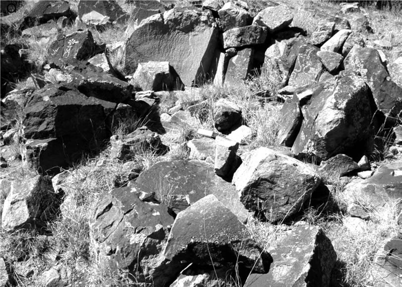
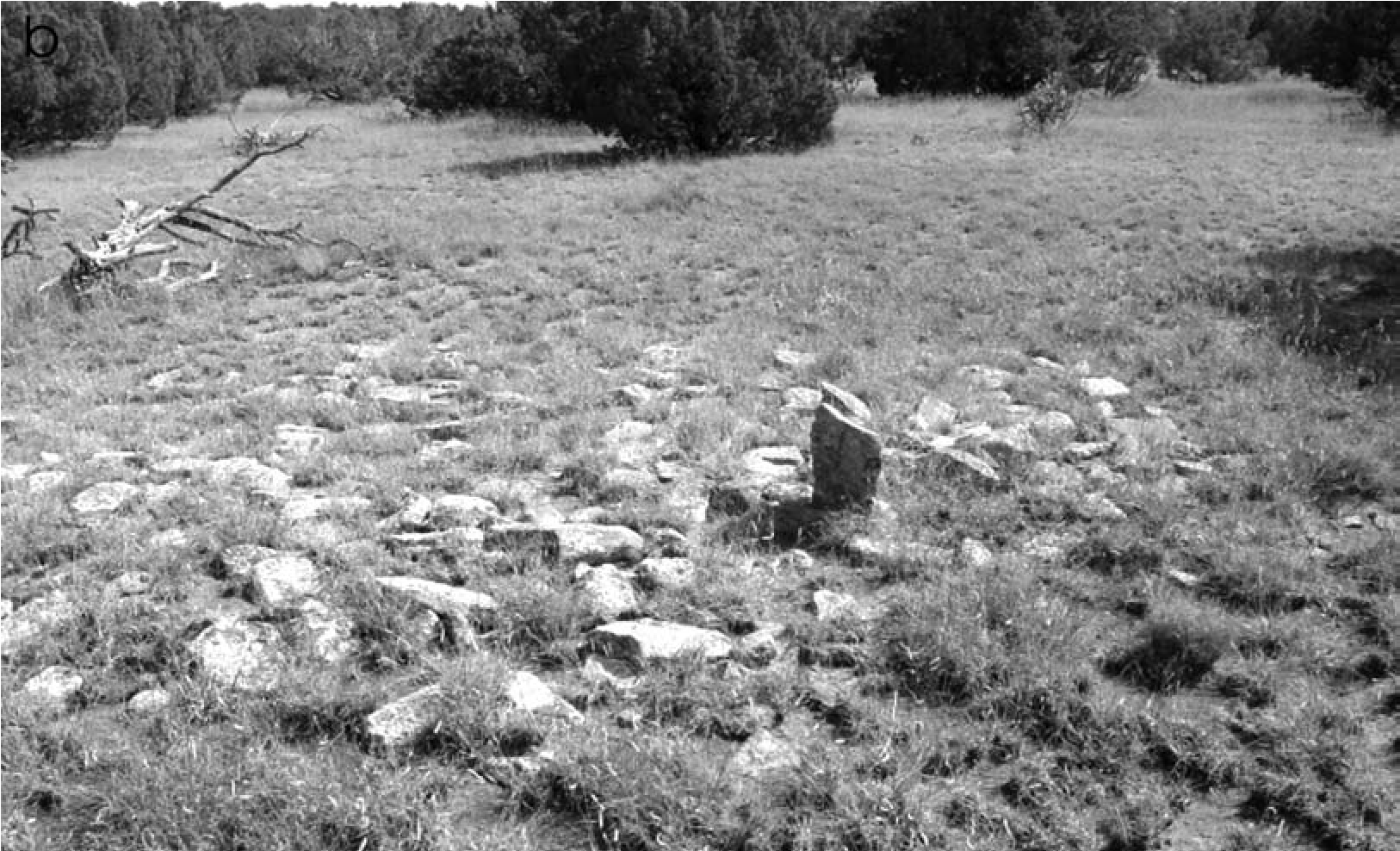
Additional Features around Pueblos
Puebloan features and evidence of later and earlier use are expected around the pueblos. Therefore a legitimate question is why I am inferring that the identified mobile group structures are actually mobile group structures rather than Puebloan visitors’ structures, shrines, sheep- herder’s structures, and so on. This section addresses these questions, including assessing similarities in morphology.
Puebloan Shrines around Pueblos
As discussed earlier, the setting of the feature is crucial for identification, with respect to both function and cultural affiliation. Interpretation is complicated, however, by the fact that most mobile group structures, such as wickiups, are on elevated terrain, as are Puebloan shrines. Yet features thought to be Puebloan (and Hispanic) shrines exhibit distinct morphology and are often situated on high points on the landscape (also see Fowles 2009; Gunnerson 1970; Legare 2011; Ortiz 1969). Many shrines, and ritual features of other types, look similar to mobile group structures because they consist of curvilinear arrangements of stones. Those with associated petroglyphs can be effectively differentiated. Some shrines are constructed as circular features, but unlike the case with structures, their centers have not been cleared of rocks. Many such features on Petroglyph Hill in the Galisteo Basin are characterized as curvilinear rock outlines that look much like structures, but their centers are rocky and petroglyphs are present on stones around the circumference (Figure 4.15a). Mobile group structures may have utilitarian artifacts present, such as flaked-stone debris. In contrast, when artifacts are associated with shrines, they tend to be of specific types (such as offerings of decorated pottery or turquoise), and artifacts usually have lower densities and diversities than may occur in or associated with residential features. Comparison to modern (still in use) shrines indicates that some shrines appear as rubble piles but with an upright stone (Figure 4.15b). Many more found surrounding the Eastern Frontier Pueblos are consistent with known shrine forms (Figures 4.16), and some have been reconstructed, as at San Lázaro.
Shepherding Features around Pueblos
Shepherding camps around pueblos often contain structures with low walls made of dry-laid rock. Typically these masonry walls are constructed by horizontally layering slabs or tabular stones (e.g., Cattle et al. 1981). This layering or horizontal stacked effect distinguishes these shepherding walls from those constructed by indigenous mobile groups. Their rectilinear outline and corners are at or near right angles. Walls are coursed, rubble mounded, and lambing pens and corrals are distinctive in form and in their attachment to larger corrals, often with metal ax-cut limbs in evidence.
Mobile group structural rock rings are constructed of dry-laid stacked rock, but rocks and slabs are arranged in a way that they interlock with one another in a jumble; they slope against one another but tend not to be laid neatly and horizontally to form an upright wall. The resulting wall is low, often several rocks thick. Sometimes these are made with vertically placed slabs laid off kilter, leaning against the other rocks, which are inferred to hold hides in place. Instead of gaining in height, these walls are wider, designed to hold poles or branches in place that form the superstructure.
Natural Features
Natural outcrops surrounding flat open spaces or unmodified natural alignments are routinely found around the villages. Mobile groups often used these locations, which were almost perfect, thereby reducing the amount of effort needed to make a shelter. In fact, they sought such locations, among the boulders, in cobble-rich areas, precisely because building material was readily at hand. Yet not all of these “structure blanks” were used for cultural purposes or were culturally modified. Not all suitable locations were selected for use.
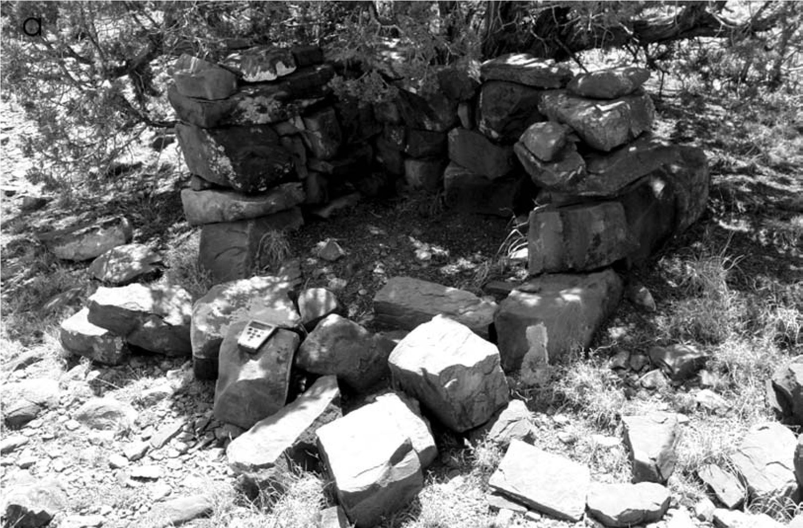
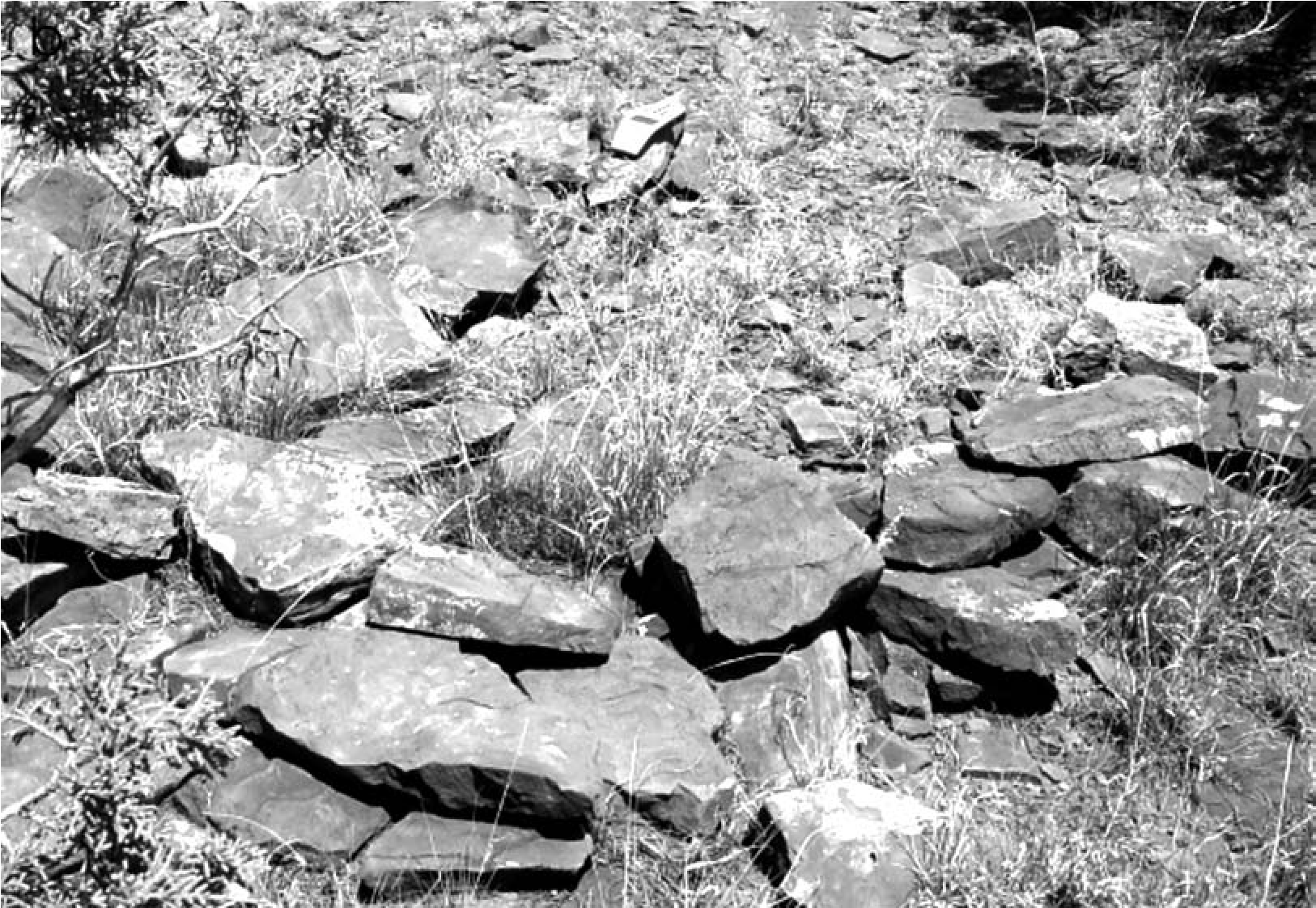
There are several ways these natural occurrences can be distinguished from culturally prepared features. For one, the locations must show actual and definitive evidence of cultural modification. This may appear as the addition of stone to a space between extant boulders. Rocks may be stacked, piled, or pushed together, or they may be aligned. Sometimes the rock surfaces show differences in weathering after being turned up on end or moved. Sometimes these features have artifacts associated, which makes their identification more definite. Oftentimes, however, these structural features have no artifacts directly associated because activity areas of different types may have been situated in different portions of the site.
Even in cultural features the sediment that may have once filled and leveled the interior sometimes washes away. Structures are often on slopes, so erosional processes can be severe. At LA 152447 near Tabira/Pueblo Blanco/LA 51 the insides of clearly cultural structures are often devoid of sediment. At other sites the original structure was built on bedrock and so there was no sediment to begin with. In other cases, the interior of the structure is inferred to have had sediment (because other structural features around it have sediment on their interiors) but this has washed away. Sometimes, such as at the Cerro Rojo site (FB 9609) and also at the Sharples site (AZ DD:8:44, ASM), naturally occurring boulders or cobbles situated in the center of the feature were incorporated into the structure, perhaps as improvised furniture.
Conclusion
This chapter has presented pictorial and descriptive evidence to address the recurring question of how mobile group structures can be distinguished from Puebloan ones in the field. Additionally, I have addressed how we know these are structures and have referred to other publications where these issues are discussed more fully. This chapter has focused on evidence from the Eastern Frontier Pueblos, where documentary sources state clearly that mobile group encampments should be found around the perimeter of the pueblos. Some of these sources even state how far they should be from the pueblo itself. Until this current effort, mobile group encampments had been found only at San Cristobal and Tenabo, where tipi rings were recorded (Hayes 1981; Lang 1977). Evidence at other pueblos had defied identification because many previous researchers were looking for the wrong types of evidence and in the wrong places. Now that mobile group evidence has been identified at most of the Eastern Frontier Pueblos, these signatures can be used to define additional encampments at these same pueblos and elsewhere.
5. Eastern Extension of Lehmer’s Jornada Mogollon Ancestors to the Jumano/Suma
Patrick H. Beckett
The Jumano and Suma encountered by the Spanish in southeastern New Mexico, West Texas, and northern Chihuahua are the descendants of the people classified in the archaeological sequence as the Eastern Extension of the Jornada Mogollon (Figures 5.1 and 5.2). The Jumano and Suma are one and the same. By the use of distinctions between cultural groups in the Jornada Mogol- lon region, combined with archaeological data, historical records, and linguistics, I demonstrate how I arrived at these conclusions.
Jornada Mogollon—Eastern Extension: Are They Really Jumano?
The Formative archaeological record in southeastern New Mexico and West Texas has been pondered for more than 75 years. Mera’s 1938 publication on southeastern New Mexico was one of the first systematic reports on the area. Hodge (1910b), Bolton (1911), Sauer (1934), and Scholes and Mera (1940) also addressed the “Jumano problem” In addition, the Jumano were dealt with by Kelley in his 1947 dissertation, published in 1986, and by Hickerson (1994, 2003).
Corley (1965) linked the region to the prehistoric Jornada Mogollon when he proposed an eastern extension to Lehmer’s (1948) earlier Jornada Mogollon area (see Figure 5.1). Corley’s conclusions resulted from finding ceramics and some pueblo housing features similar to those of the Jornada Mogollon east of Lehmer’s (1948) area. This archaeological evidence moved the eastern border of the prehistoric Jornada Mogollon into southeastern New Mexico and West Texas, which was the domain of the Jumano as well as other groups. While Corley (1965) was correct in noticing similar archaeological traits, Lehmer and Corley differed in their timing of the initiation of this prehistoric culture group. They placed early brownware ceramics at around ad 900 and ad 950, respectively. Corley adopted Lehmer’s original chronological framework for the Jornada Mogollon for his expanded region. He also added 50 years for the development of ceramics in his extension area because he figured the region was a backwater and it would take about that long for ceramics and other cultural artifacts to reach the area. We now know that both he and Lehmer (1948) were wrong in their date assignments, judging from more recent chronometric data (Whalen 1977, 1978; Oakes 1998).
Lehmer (1948) saw a different artifact assemblage between the northern and southern Jornada Mogollon areas, and in this he was correct. These differences justified what he referred to as the northern and southern branches of the Jornada Mogollon (see Figure 5.1). Yet it is now generally accepted that the early dates for Jornada Mogollon brownware ceramics extend back to ad 200 (Miller and Kenmotsu 2004:237).
Beckett and Corbett (1992) have assigned the historic Manso to a small portion of the western edge of Lehmer’s original Jornada Mogollon region and have suggested that they are directly descendant from the Jornada Mogollon. This suggestion questions the purported hiatus at the end of the El Paso phase of the Jornada Mogollon. Chronometric dates on late mobile group sites from this area and throughout the region indicate that there is no hiatus (Seymour 2002, 2009f, 2009g, 2009h, 2010a, 2012a, 2013a, 2016; see also Chapter 1 this volume). I suggest that there was a late entry of the Jumano/Suma into this southern portion of the Jornada Mo- gollon area, as they were pushed south from the northern Jornada Mogollon area by the Apache, probably in the ad 1300s or 1400s. The Manso, Jano, and Jocome were in the area of Lehmer’s original branch of the (southern) Jornada Mogollon. These Jumano/Suma pushed the southernmost Jornada Mogollon in northern Mexico aside, thereafter occupying a narrow corridor that ran east-west, overlapping with the El Paso area. I suggest that this explains the presence of late-occurring Chupadero Black- on-white in this southernmost area (into the ad 1500s), because the Jumano/Suma brought this ceramic tradition with them as they moved west into northern Mexico and east to central Texas. In contrast, early Chupadero Black-on-white ceramics before ad 1400 in the Casas Grandes area were traded into that area and do not represent a Jumano/Suma occupation there at that time.
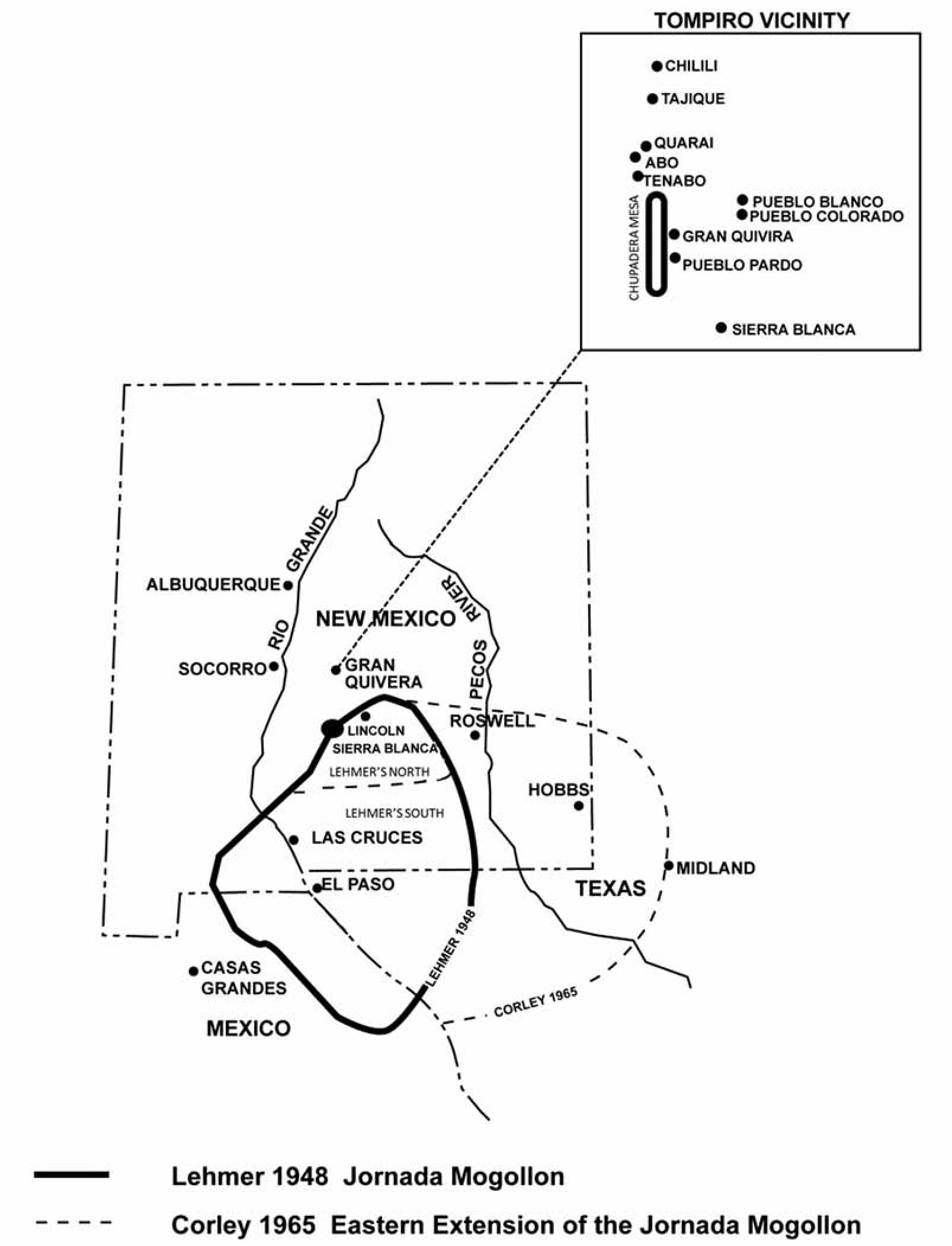
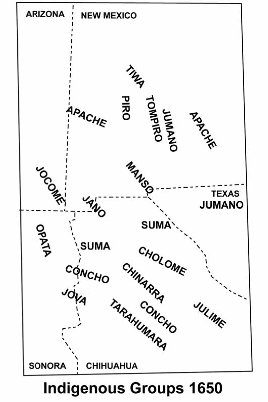
Origin of Jumano and Suma
For the Historic period, a primary question in this region is who the Jumano groups were that inhabited southeastern New Mexico and West Texas when the Spanish arrived. A related question addresses the origin of the Suma found in West Texas and northern Chihuahua. I argue that both the Suma and Jumano were late representations of Corley’s 1965 proposed Eastern Extension of the Jornada Mogollon archaeological culture group and are a single ethnic entity that generally occupied the area east of the Tularosa Basin over into West Texas (including the Gran Quivira/Chupadera Mesa area). This is where the sites with brownwares and Chupadero Black- on-white are most heavily concentrated. I suggest that these are the archaeological markers of the Jumano and Suma as well as their prehistoric counterpart, the Eastern Extension of the Jornada Mogollon. Hickerson states: “The Jumano culture developed in situ, out of the heritage of the Jornada Mogollon, and was indigenous to the South Plains” (Hickerson 2003:195).
It should be stated that while brownwares and Chupadero Black-on-white co-occur, Chupadero Black-on white is found with a wide variety of local brownwares that are not discussed here; local temper and clays vary too substantially to treat in this chapter. It is acknowledged that brownwares are found not only throughout the Jornada Mogollon area and its eastern extension but throughout a large portion of the Southwest and elsewhere. “Chupadero Black-on-white reaches farthest from its places of origin (Jumano pueblos and the Sierra Blanca region) and toward the east, onto the plains and across them. In the Pecos [River] Valley, it appears in the company of El Paso Brown and the various southern red types” (Hayes et al. 1981:68). Furthermore, Hayes and others (1981:68) state that Stallings (1932) “was of the opinion that the quantities [of Chupadero] found at sites in the vicinity of El Paso indicated that it was manufactured in that locality. Brand (1935) found Chupadero on sites as far south in Chihuahua as the Rio Carmon south of Villa Ahumada, and described it as being the dominant type on some sites on the lower Rio Casas Grandes in the northwest corner of the state.”
Clark (2006), in a study using Instrumental Neutron Activation Analysis (INAA), demonstrated that there are at least two production areas for Chupadero Black-on-white. One was in the Gran Quivira/Chupadera Mesa area, which has always been considered the Chupadero production center homeland until abandonment in 1672. The second, which is closer to the El Paso area, is the upper Rio Bonito and the Sierra Blanca region. Both of these are in the northern branch of the Jornada Mogollon area. All of Clark’s samples from across southern New Mexico were linked to the Sierra Blanca source, not to Gran Quivira. Sierra Blanca production of Chupadero Black-on-white ends ca. ad 1400 with the abandonment of that area (Kelley 1984: 156), which left the pueblos in the Gran Quivira area as the sole Chupadero Black-on-white production area to the north. The abandonment dates of the Sierra Blanca region and Chupadera Mesa are closely related to the movements of the Jumano/Suma out of the northern branch of the Jornada Mogollon area into West Texas and northern Chihuahua, where they were encountered by the Spanish in the 1500s.
The Sierra Blanca region (in the north) was abandoned by ad 1400, but I contend that, for the most part, the southern half of the Jornada Mogollon region was not abandoned by this time (ad 1400–1450), although the eastern extension was also abandoned by ad 1400. “These southeastern groups left their homeland at some point in the 1300s” (Chamberlin et al. 2011:6). Rather, environmental and cultural factors came into play about that time, changing the adaptation of the Jornada Mogollon to that associated with the Manso, Jano, and Jocome, all historical subsets of Lehmer‘s original Jornada Mogollon. Chupadero Black-on-white may have been imported to this southern area later than this time as a trade ware from new production centers, but information is still lacking. I infer that at this time the intrusive Jumano/Suma groups were still using Chupadero Black-on-white, which was now being made in new production centers. Although these production centers have not been identified, Chupadero shows up on late sites for some time after the abandonment of Casas Grandes and the closing of Sierra Blanca production centers. Hickerson (i994:xxiv) infers that the people in southeastern New Mexico and on the Llano Estacado in West Texas were Jumanos who traded all over eastern New Mexico and West Texas before the advent of the Apache, although we now know that the ancestral Apache were present at the time this adap- tational transition took place.
In support of this idea of a transformation of the Jornada Mogollon into Jumano and Suma, Speth points out that cultures change from one form of adaptation to another depending on environment and resources: “Where anthropologists once viewed hunter-gatherers and farmers as discrete, separate, and virtually immutable ethnic, sociopolitical, and economic entities, we now see emerging a dramatically different view in which these seemingly disparate systems interact on a regular basis, and frequently transform themselves from one into the other and back again” (Speth i986:xiv).
The historic Jumano found in southeastern New Mexico at the time of Spanish contact were the remnants of the aboriginal population that occupied the region earlier (Scholes and Mera 1940:284). These earlier populations that we see archaeologically were the Eastern Extension of the Jornada Mogollon. Before the Spanish arrived, Apache pressure on the Jumano from the north concentrated some of the Jumano at Gran Quivira, Pueblo Pardo, Pueblo Colorado, and Pueblo Blanco. Others moved south and then to the east and west of the Guadalupe Mountains. It is these people who are almost always seen and referred to in the Spanish chronicles of the region. This eastward and southward migration is also illustrated by Hickerson (i994:xxiv). This scenario also matches the distribution of Chupadero Black-on-white and the local brownware distributions (although there are conflicting sequences and names, this refers to a number of types: El Paso Brown, Jornada Brown, Ochoa Brown, etc.).
With regard to defining the archaeological signature of the Jornada Mogollon, Mera wrote:
As a beginning, an effort was made to find some cultural factor which would be common to the entire area.... Although village types alone were found to be insufficient for the purpose, a more encouraging situation was encountered when we turned to pottery. After a study of sherd material from all parts of the district, it was found that a brownware in some form or other occupied a prominent position in the collections from all sites. This led to the conclusion that there had been an original basic undecorated brown-ware pottery type, variations of which appear to have survived through all succeeding developmental horizons until perhaps about the beginning of the sixteenth century. After this time, more specialized forms of this ware extended even into the closing years of the eighteenth century. (in Scholes and Mera 1940:292)
Brownwares are found throughout the entire known Jumano geographical area and beyond, including in the Jornada Mogollon area. Despite this, Lehmer was not interested in expanding his Jornada Mogollon culture farther east to include Corley’s later 1965 Eastern Extension of the Jornada Mogollon (Donald Lehmer, personal communication 1968). Lehmer ignored Mera’s 1938 data on southeastern New Mexico, which indicated that brownwares and Chupadero Black- on-white were present in that region. When in 1965 Corley introduced the “proposed Eastern Extension of the Jornada Branch of the Mogollon,” this expanded the Jornada Mogollon area to reflect the approximate limits of major distributions of Chupadero Black-on-white except in cases in which isolated trade wares were found in more distant areas. Since then, virtually every excavation or major survey in southeastern New Mexico, West Texas, and northern Chihuahua has included Chupadero Black-on-white in its material culture inventory (Beckett 1985:27).
With respect to the origin of Chupadero Black-on-white and its relation to the Jornada Mogollon, Mera further states: “Toward its end, Socorro Black-on-white became much coarsened and finally evolved into a distinctly new type, Chupadero Black-on-white. It was in this guise that Pueblo pottery was taken over and adapted, spreading to the east and south until the type ultimately became a component of a ceramic complex normal to practically the whole brown-ware region” (in Scholes and Mera 1940: 293). Wiseman (1996:100), referring to his excavations along the upper Rio Hondo, states, “For the most part, the sherds of Chupadero Black- on-white appear to be local to the Sierra Blanca country,” and it shows up as the dominant decorated ware in these excavations.
Discussing the temporal distribution of Chupadero Black-on-white, Mera continues: “The first epoch may be said to have extended from about the ninth to the latter part of the twelfth century. On the evidence procured, it has been possible more or less to picture for that period the existence of an agricultural people who made generalized brown pottery and lived in small rancheria-like settlements” (in Scholes and Mera 1940:295). Thus, both Mera and I (Beckett 1985) have argued that Chupadero Black-on-white and a prescribed set of brown- wares are consistently found in the geographical region that the historic Jumano occupied in southeast New Mexico and West Texas.
Gerald gives a geographical description of the Suma/Jumano: “The group known as Suma, in northern Chihuahua, northeastern Sonora, and along the Rio Grande from Paso del Norte (the El Paso-Ciudad Juarez area today) downriver for about 130 miles to El Cajon, were linguistically and culturally similar to a group known as Jumanos who occupied the region between the La Junta area of the Rio Grande (Ojinaga, Chihuahua, today) and the upper Nueces River” (Gerald 1974:69). David Hill reports that Chupadero Black-on-white has been previously identified in the La Junta area along with El Paso brownwares (Hill 2012a:41). This is not surprising since the Jumanos traded with the people from the La Junta area and were refugees from the main Chupadero-producing areas. The Jumano refugees who ended up on the Pecos and Colorado Rivers and at La Junta in Texas were the Jumanos driven south out of their (Gran Quivira and Chupadera Mesa) homeland by Apache pressure by the fourteenth century. La Junta is the approximate southern edge of the Jumano refugees.
These Jumano refugees joined their longtime trading partners, the Patarabueyes, along the Rio Grande from El Paso south to La Junta. Some settled as sedentary farmers at La Junta while others fled westward, hunting buffalo in the basin-and-range country of northern Chihuahua, thus splitting the Jornada Mogollon language group (e.g., the Manso, Jano, and Jocome of the Historic period). The Jumano/ Suma maintained a basic hunting-and-gathering economy until the Spanish built a mission for the Mansos and Sumas in Paso del Norte (present- day Juárez) and near Casas Grandes, Chihuahua, for the Sumas.
Tompiro Pueblos
As noted above, Apache pressure was responsible for concentrating Jumano populations in some of the Eastern Frontier Pueblos, referred to as the Jumano pueblos. Many of the plaza pueblos on Chupadera Mesa show signs of warfare, burning, and abandonment, starting in the ad 1300s. Chamberlin and others point out: “The extent of burning suggests an act of violence perpetrated by people who were socially distant from the affected villagers. After the attacks, some of the pueblos’ inhabitants remained for a time; by the fifteenth century, the residents of Chupadera Mesa had moved off the mesa, probably to Gran Quivira” (Chamberlin et al. 2011:6).
Historically these Humano (Jumano) or Tompiro pueblos were those population centers positioned east and southeast of the Manzano Mountains. Only those Tompiro pueblos around Gran Quivira that have been referred to as the Jumano pueblos are dealt with here. These include Gran Quivira (called Las Humanas by the Spaniards and identified as the same pueblo by Kubler 1939, Scholes and Mera 1940, and Vivian 1964), Pueblo Pardo, Pueblo Blanco, and Pueblo Colorado. Not only are these four pueblos Ju- mano, but I believe that those pueblos found in the Sierra Blanca region are as well (those producing Chupadero Black-on-white; see Kelley 1984). The predominant early ceramics at Gran Quivira, Pueblo Pardo, Pueblo Blanco, Pueblo Colorado, and earlier pueblos on Jumano Mesa are brownwares and Chupadero Black-on-white, hence my suggestion that they are Jumano.
The pueblos on Chupadera Mesa are closely related archaeologically to the Tompiro pueblos of Gran Quivira, Pardo, Colorado, and Blanco. Pueblos in both areas exhibit a basic brownware tradition, and the primary decorated grayware at these sites was Chupadero Black-on-white. As noted, Chupadero Black-on-white was an extremely long-lasting and widely distributed ceramic type found throughout the area that was occupied by the Jumano and Suma at the time of Spanish contact: “The Jumanos cluster is fairly homogeneous in terms of architecture and material culture. Remarkably, these communities continued to make and use black-on-white pottery after much of the Pueblo world had adopted red-and-yellow-slipped pottery in the 1200s and 1300s” (Spielmann 2011:1).
I believe that those people who were prehistorically in the northern portion (Lehmer’s north) of the Jornada Mogollon region were the forerunners of the peoples who historically inhabited the Sierra Blanca region, Chupadera Mesa, and the region around Gran Quivira. It is possible that the population at Gran Quivira was a mixed population of eastern Tompiro and Jumano. The historic populations at Gran Quivira have been referred to as Tompiros by historians and archaeologists for most of the twentieth century (e.g., Baldwin 1988:iii; Hammond and Rey 1966:22; Hayes et al. 1981:1). Yet I suggest that these Jumano people are somewhat different from the other pueblos in the Tompiro region because the ceramics are different and because painted or striped body adornment noted at Gran Quivira was apparently absent in the rest of the Tompiro area (e.g., Tenabó, Abó, Quarai). The Chupadero Black-on-white ceramics that are so predominant at Gran Qui- vira and in the major pueblos on Chupadera Mesa are not found in as great a quantity in Abó, Tenabó, or Quarai or in the rest of the historic Piro pueblos. This again supports the purported difference in groups occupying these different pueblos. The predominant pottery at Gran Quivira is Chupadero Black-on-white (Figure 5.3), which locally changes into Tabira Black-on-white when ceramics were made for the Spanish before abandonment ca. the 1670s (Hayes et al. 1981:12). Chupadero Black-on- white extends in high frequencies throughout a broad geographic area to the east and south, but not in any substantial frequencies to the north and west. This distribution suggests that the people using Chupadero Black-on-white and brownwares were geographically in the regions occupied by the Jumano/Suma. Chupadero Black-on-white is also widely distributed as a trade ware throughout the Southwest from its inception on, but not as the dominant ware to the north and west.
Toulouse and Stephenson (1960:40) argue that Chupadero Black-on-white and Jornada Brown continued in use throughout the temporal periods of Pueblo Pardo. This suggests that there is a long continuum of these two ceramic traditions at Pueblo Pardo and that they continued to be used in the area that was described as being occupied by the Jumano. Archaeologists still characterize the Tompiro by the presence of Chupadero Black-on-white (Tainter and Levine 1987:70), which occurs at Abó and Tenabó but not in great quantities.
The distribution of and in some cases the lack of brown utility wares are also somewhat unique in the western region of the Tompiro area and distinguish the Jumano pueblos from others. The non-Jumano pueblos of Abó and Tenabó have an earlier horizon of Salinas Redware, whereas the Jumano pueblos of Gran Quivira, Pueblo Pardo, Pueblo Blanco, and Pueblo Colorado are characterized by a brownware horizon. The brownware distribution closely follows the geographical distribution of Chupadero Black- on-white to the east and southeast into West Texas and to some extent into central Texas. This suggests that these distributions are consistent with the historic distribution of Jumano.
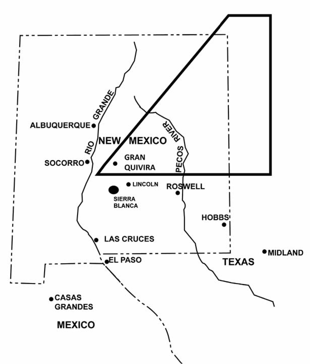
Sierra Blanca: Capitan Region
The ceramic assemblages found in the Sierra Blanca-Capitan region are predominantly brownwares and Chupadero Black-on-white (e.g., Kelley 1984). The early Chupadero Black- on-white before approximately ad 1400 found in the Jornada Mogollon area of southern New Mexico, West Texas, and northern Chihuahua was being traded in from the Sierra Blanca- Capitan region of central New Mexico (Figure 5.4). After the abandonment of this area, post ad 1400, Chupadero Black-on-white continued to be used in the Jumano/Suma area (Figure 5.5). The early Chupadero Black-on-white ceramics found in northern Chihuahua, including in the Casas Grandes area, were trade wares before ad 1400. After the Suma arrived in the south, post ad 1400, they continued to produce Chupadero Black-on-white, which explains its late existence in the area. Historically there was an active Suma village next to the Spanish mission San Antonio de Padua de Casas Grandes, a few miles north of Casas Grandes. The village and the mission were burned during the 1684 Indian uprising in northern Chihuahua.
Garrett (1991:193) shows that Chupadero Black-on-white was produced locally in the Capitan North project area. These ceramics and other archaeological assemblages closely resemble those found in the Chupadera Mesa area. These distributions suggest that the Capitan and Sierra Blanca region were part of the early Jumano sphere, before the regional abandonment to West Texas and northern Mexico. This inference is supported by Stuart and Gauthier’s (1981:277) statement distinguishing this area from surrounding ones: “Our strong suspicion is that at times the majority of population involved in Chupadera Mesa-Sierra Blanca developments were neither Anasazi nor Mogollon physical types.”
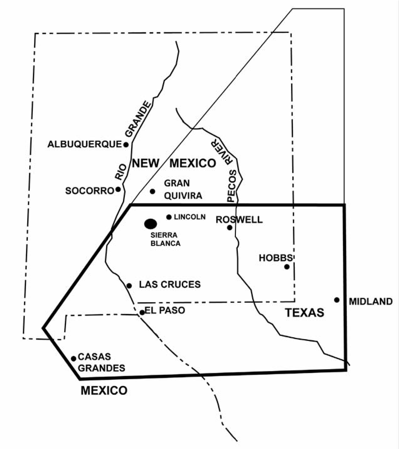
Jumano/Suma
When the Spanish first entered the archaeological homelands of the Jornada Mogollon and the Casas Grandes area in northern Chihuahua, they found numerous groups of local inhabitants. Among the groups were the Concho, Chinarra, Jano, Jocome, Jumano, Manso, and Suma. These various people have long perplexed historians and archaeologists as to their origins and their ethnic affiliations with each other (for further discussions on their affiliations, see Forbes 1959; Kelley 1986; Naylor 1969; Newcomb 1961:225228; Schroeder 1969).
The earliest known mention of the term “Suma” is in the Benavides Memorial of 1630 (Ayer 1965:12), which describes the Suma living in the same area as was noted earlier for the Jumano, that is, south and east of El Paso along the Rio Grande. This coincidence suggests that these are different names for the same people. Western Sumas were first mentioned in 1645 as being on the warpath around Teuricachi in northeastern Sonora, where they endangered the lives of pioneering Franciscan missionaries (Bannon 1955:87).
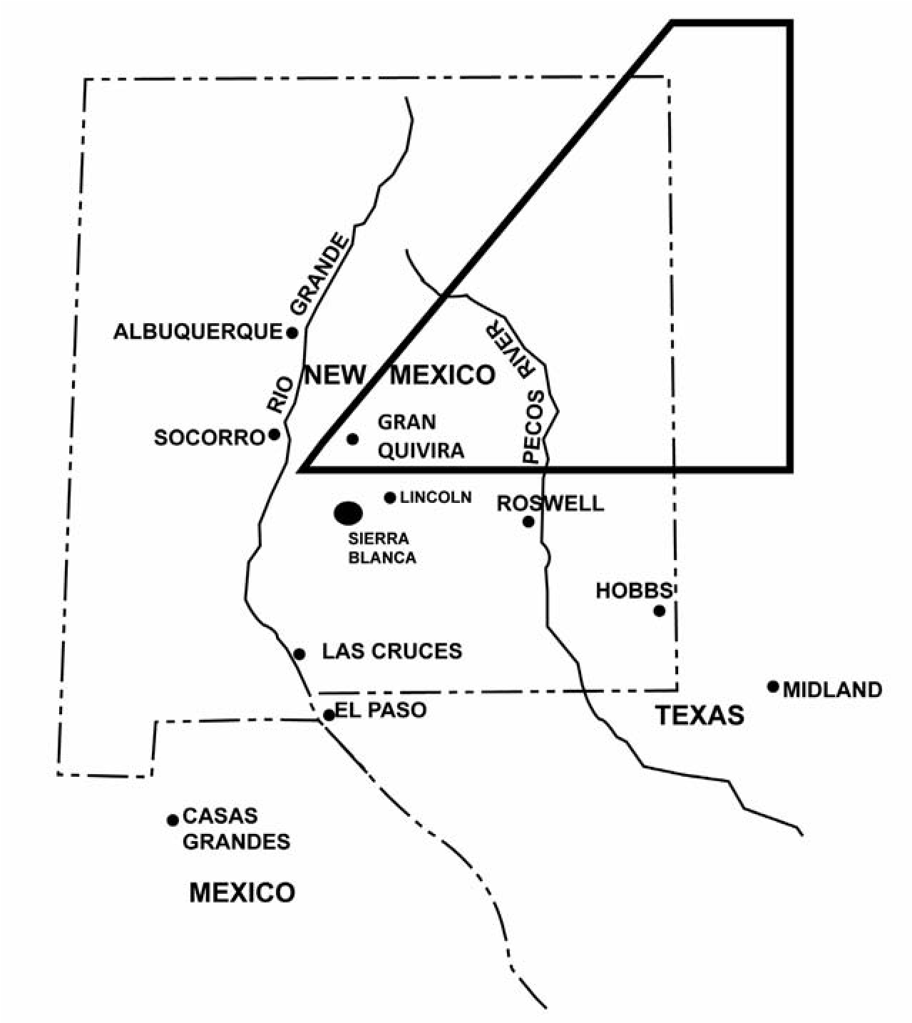
The Suma at the time of Spanish contact were found in an east-west belt running from West Texas into and throughout northern Chihuahua (Figure 5.6). The farthest west mention of this group at this time was in the vicinity of Casas Grandes and southeastern Arizona. The Suma were bordered on the north by the Manso and Jano, on the south by the Concho, on the west by the Ópata and Jocome, and on the east by the Jumano (which, as we have seen, was another Spanish name for the Suma).
Obregón (Di Peso 1974:758; Hammond and Rey 1928:207–8) wrote in the 1560s that the “beautiful valley” (Casas Grandes) was occupied by a rustic people who were not given to farming and who claimed that the children of the original builders of the “great houses” had moved to the mountains, where they still lived: “At Casas Grandes itself,...on the Diablo Phase fill of one of the rooms, remains of a fire were found which were dated ad 1480. This suggested that somebody had stopped for a time at the abandoned city, perhaps one of the ‘rude’ Suma who had drifted in from the east to fill the demographic vacuum caused by the exodus” (Di Peso 1974:758).
From 1971 to 1982, when I used to see Di Peso at the Amerind Foundation about once or twice a month, a continuing conversation was why some Chupadero Black-on-white ceramics were found late on top of some later sites in northern Chihuahua. The earlier Chupadero Black-on-white was where it should have been as a trade ware at the earlier Casas Grandes sites. The Chupadero Black-on-white found stratigraphically on top, overlying earlier components on sites, probably represents later use by the Suma. I assume that Chupadero Black-on-white was produced in the Casas Grandes area, or at least in northern Chihuahua, because the Suma had been there for around 150 to 200 years before the abandonment of the Gran Quivira area. This explains why the production of Chupadero Black-on-white ceases at about ad 1400 in the Capitan, Sierra Blanca, and Chupadera Mesa and in 1672 in the Salinas Pueblo area but not in the Casas Grandes area until later.
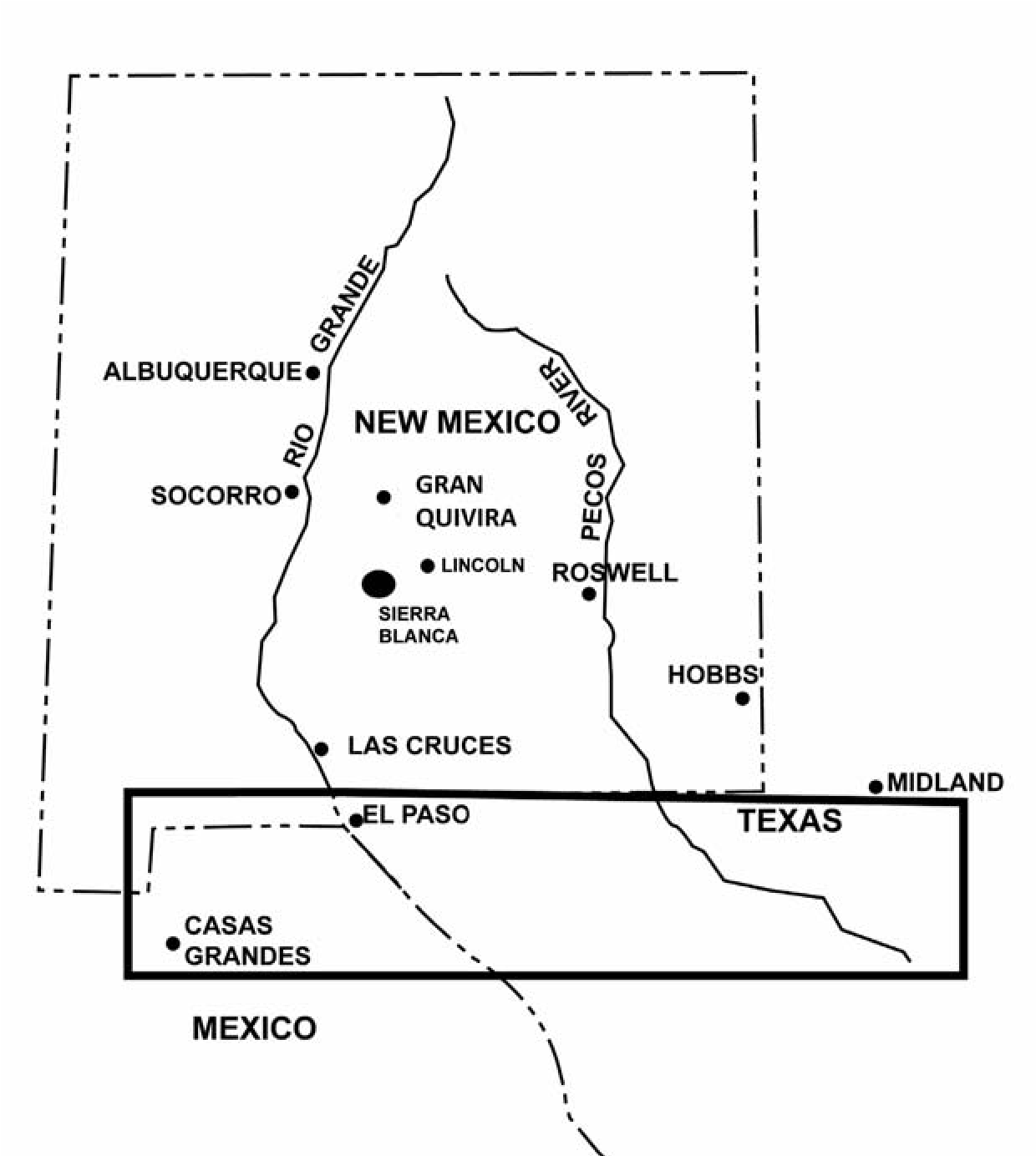
Long conversations with Tom Naylor at the University of Arizona and Rex Gerald at the University of Texas at El Paso demonstrated agreement that the Suma and Jumano were one and the same and that they probably produced Chupadero Black-on-white locally in West Texas and northern Chihuahua for a short time after other production centers ceased to produce this type in the Gran Quivira area. Di Peso apparently agreed as well: “All of these data point to an unbroken historical continuum for the Suma- Jumano through this segment of the area’s history which began for this group after the fall of Casas Grandes with the Chichimecan Revolt of ad 1340 and they were still active seven generations later at the time of Ibarra’s visit in the 1560s” (Di Peso 1974:759).
Jumano-Suma Relationship
Both the Suma and Jumano are mentioned often in the historical records of the mid-seventeenth century (see Figure 5.2). This raises questions about where each of these groups came from, whether they are related, and whether they originated in the prehistoric population. In an earlier publication on the Manso it was argued that the Concho, Chinarra, Jano, Jocome, and Manso spoke Uto-Aztecan languages of the Sonoran group (Beckett and Corbett 1992:36–37). It was also argued that the Suma spoke a different non- Uto-Aztecan language, which can be referred to as the Shuman language, as discussed below. And it was proposed that the Suma home territory at the time of Spanish contact was in an east-west zone or belt in the northern Chihuahua Desert (Beckett and Corbett 1992:36–37). This territorial zone of the Suma (and presumably the Shuman language) completely separated members of the Uto-Aztecan language group from one another north and south of this belt.
Numerous other authors have established the link between the Suma and Jumano. For example, Di Peso noted: “Their progeny, when encountered in the Casas Grandes Valley and along the Rio Grande during the course of the first Spanish entrada into New Mexico, were called Suma, yet there seems to be no clear-cut cultural differentiation between the Jumano Plains folk and this group” (Di Peso 1974:840). Sauer was of a similar opinion: “I do not think that there was any clear difference between the Jumano and the Suma. The latter name was generally applied to the west, the former to the east. The Jumano included sedentary colonies and nomad bands; the Suma were primarily wanderers. The name ranges through the following forms: Humano, Jumano, Jumana, Xumana, Chouman (Fr.), Zumana, Zuma, Suma, Yuma” (Sauer 1934:68). Scholes agreed with Sauer’s Suma/Jumano connection, stating: “I have recently noted an incidental statement in a document of 1682 which confirms Sauer’s thesis of a Jumano-Suma affiliation” (Scholes and Mera 1940:287).
Swanton (1952:325) coined the term “Shuman” to cover all of the groups known under the terms Suma, Jumano, and so on. There is good evidence to support the conclusion that the Suma and Jumano were linguistically and culturally allied, as previously noted. Both spoke a mutually intelligible and distinct language (Shuman) that was not intelligible to their Uto- Aztecan-speaking neighbors, the Manso, Jano, and Jocome (Beckett and Corbett 1992:35–36).
Our first good description of the Shuman people comes from Diego Luxan, the chronicler of the Espejo expedition. He called the people of the area north of La Junta, which is the area later referenced as Jumano territory, the Oto- moacos. Luxan also noted that the Otomoacos spoke almost the same language as their northern neighbors the Caguates but that their language was different from that of the Conchos. He was able to speak to both the Otomoacos and Caguates through his Otomoaco servant Pedro (Hammond and Rey 1966:169).
Forbes (1959:108) identifies the Otomoaco with the Caguate, and the Cholome with the Suma. Ruben Zelis, captain of the presidio of Paso del Norte, noted in his reconnaissance of the Coyame area in northeastern Chihuahua that the Cholome of that area spoke the same language as the Suma (Forbes 1959:113). On reaching Manso country, the Espejo expedition could no longer communicate with the natives through the interpreter Pedro (Hammond and Rey 1966:218). That the Manso and Suma spoke languages that were not mutually intelligible is also supported by additional historical evidence presented in Beckett and Corbett (1992:36). Moreover, when Espejo’s party reached the Piro pueblos farther north along the Rio Grande, they were still unable to communicate with the natives through their interpreter. On reaching the Jumanos on their return trip down the Pecos River, Luxan’s servant Pedro was again able to translate for the Spanish explorers (Hammond and Rey 1966:229). Further evidence that the Suma and Jumano spoke closely related languages comes from a 1682 letter of Governor Otermm in which he describes an encounter in the area of Casas Grandes between Sumas and Apaches. The Apaches had a Jumano captive with them who, on hearing the Suma visitors talk, fled to the Sumas since they spoke a language very similar to his own (Forbes 1959:139).
Only a very few words from the Shuman languages have been preserved. Most of these are from the Otomoaco. Unfortunately these terms were apparently miscopied at some point, and we have several different versions for them: abad (water); teoy/tooy (maize); aguacate (beans); and parba/porba/payla (copper) (Sauer 1934:65). Troike (1988:235) lists what he believes to be the correct version of the words in his note on the Amotomonco language and discusses the possibility that the terms for maize and beans may have been borrowed from a Nahuatl dialect. Other words preserved from the Shuman language include the word apalito, which is the Otomoaco designation of the sky or sky god. Sauer also records the term nayessa as the Suma word for friend (Sauer 1934:74).
Conclusion
The most probable origin for these late intruders (Jumano/Suma) into the state of Chihuahua toward Casas Grandes is westward from southeastern New Mexico. Naylor (1969) states: “The writer favors the model that the Sumas were originally Jumanos who moved westward after the abandonment of Casas Grandes.” This would have taken place after Casas Grandes was no longer a power center. It is my contention that these people have been referred to archaeologically during the prehistoric period as the Eastern Extension of the Jornada Mogollon. Historically they were called Jumano in southeastern New Mexico and West Texas and Suma in West Texas and northern Chihuahua. I argue that these are all one and the same people. In the fourteenth and early fifteenth centuries these Jumano-Suma felt pressure from the Apache. In response, these semi-sedentary farmers, hunter-gatherers, and buffalo hunters simply moved south from the Gran Quivira and Chupadera Mesa area to the southern end of the Guadalupe Mountains and from there went both east and west. They stayed in bison country as far west as Casas Grandes and as far east as central Texas, where they had long-term friendly relationships. The Jumano who occupied the Gran Quivira area just before abandonment of the region and before the 1680 Pueblo Revolt scattered to other nearby pueblos, and some show up in Paso del Norte (Juárez) at the church of Nuestra Señora de Guadalupe, built for the Manso and Suma.
6. Embracing a Mobile Heritage
Federal Recognition and Lipan Apache Enclavement
Oscar Rodriguez and Deni J. Seymour
The U.S. government’s process for recognizing American Indian tribes represents a rare space in the social sciences where a government decree is more normative than the scientific and historical methods. It is an asymmetric relationship vis-à-vis a common subject matter. Peer-scrutinized research and prevailing understandings in the scholarly literature may view a certain historic-social group as a tribe, but only an official acknowledgment by the Bureau of Indian Affairs (BIA) establishes the fact. The two forums pursue different objectives in different universes such that they do not necessarily contradict one another, but the facts sometimes lead to different interpretations, suggesting that the two processes would benefit from greater crossfertilization. One area where this would be advantageous is the use of specialists to pronounce on the legitimacy of tribal claims.
For some American Indian tribes that have not yet gone through the BIAs process, such as the Lipan Apache Tribe of Texas, federal acknowledgment represents an urgent yet almost impossible objective. The Lipan Apache Tribe is a legitimate indigenous entity with verifiable traditional practices and a deep and continuing heritage that effectively constitutes a “tribe” by established scholarly standards today, although it does not currently nor has it ever been characterized by the pattern that informed much of the legal acknowledgment model. Research and progress in the social sciences, particularly in the area of group identity, ethnic enclaves, and the character of residential mobility, offer hope that newly formulated and credible knowledge may provide pathways for this tribe to join the other U.S.-recognized tribes and, with that, preserve an important and hard-fought legacy.
Historical Background
The Lipan Apache Tribe of Texas is a major North American tribe that is recognized by the State of Texas House and Senate but has yet to go through the BIA acknowledgment process. With a base of more than 5,000 eligible members, including a roll of almost 300 verified direct descendants of members of historic Lipan bands, it is one of the largest Apache tribes and is larger than many U.S.-government-acknowledged tribes. The tribe is headquartered in McAllen, Texas, and the traditional communities that comprise it today are found in Texas and the neighboring Mexican states of Coahuila and Chihuahua, although historically the Lipan also lived in the Southern Great Plains, including eastern and southern New Mexico (Lucius Peso in Henderson 1957:263, 266, 267, 269; Governor Fernando de la Concha in Simmons 1970:38) (Figure 6.1).
Tribal Composition
The tribe that came to be known as Lipan is an amalgamation of different Eastern Apache bands that used to be part of a vast confederacy linking cultural kinsmen from the Great Plains in the United States to the Bolsón de Mapimí in north- central Mexico. This confederacy included, among others, the Culcahende (Tall Grass People), who ranged from southwestern Kansas to northeastern Durango, and the Tchesha- hende (Sun Otter People), who inhabited a region extending from central Texas to northern Tamaulipas. Apart from sharing a cultural and historic bond, the confederated bands united for mutual aid and defense against the Spanish and Comanches and their allies. Each band provided for the confederacy in its own way according to tradition, need, and ability.
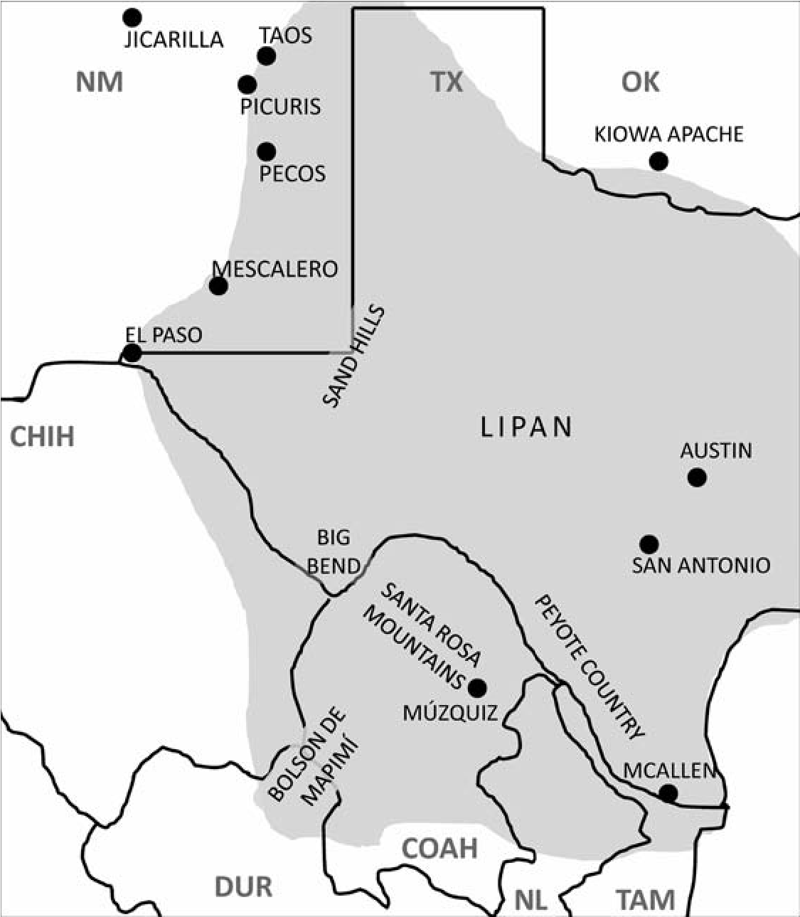
Through the late 1700s the confederacy was led by a respected leader, Picax-ande, from a base in the sand hills region of southeastern New Mexico and West Texas (Ugalde 1787). The confederacy remained together until Picax-ande was killed in battle at the turn of the century. Among those who separated completely were the Northern Llanero. This band joined the Saitinde Apache near Taos Pueblo to form what later became known as the Jicarilla Apache Tribe (Eiselt 2012; Gunnerson 1974). Many of the other bands stayed together, however, and at first they functioned as a close alliance under different leaders during the Spanish, Mexican, and Texan periods. This alliance entered into treaties with the Republic of Texas, State of Texas, and the United States. Starting in the 1840s, military aggression by the Republic of Texas and disease decimated the bands’ populations, forcing some of their members to seek refuge with the Sun Otter People, whose leader at the time, Cuelgas de Castro, had won favorable treatment from the Texians. From that point forward the alliance again functioned more as a single entity under the traditional leadership of the Sun Otter People.
Intense and relentless military pressure by Europeans and the Comanche and their allies gave individual band members in the old alliance few options to survive: (1) join another Lipan band, (2) join other Apache or allied tribes, or (3) mix in with the local populations as enclaved Indian neighbors. The Lipan who joined the Sun Otter People either moved into the Sun Otter People’s settlements in the Nueces, Frio, and lower Rio Grande valleys or maintained an association with them from their traditional communities in South and West Texas and Mexico. The Lipan who joined traditional allies or other Apache tribes, such as the Tonkawa or Mes- calero, left Texas for reservations in Oklahoma, New Mexico, and Arizona. Some even went to live in Oklahoma with their erstwhile rivals, the Comanche.
Modern Lipan Tribal Structure
The Lipan Apache Tribe of Texas descends directly from the tribe of Sun Otter People and other Lipan bands it embraced, in keeping with the Lipan tradition of mutual aid and commonwealth. The Sun Otter Lipans political and familial structure and, most importantly, its homeland orientation was and remains closely tied to part of their traditional role as peyote proselytizers (Berlandier 1969; Minor 2009a; Morgan and Stewart 1984; Stewart 1987; Ugalde 1788). A key characteristic of the traditional governance structure of the Sun Otter Tribe is, as in many of the other bands in the old confederacy, hereditary succession of political power. The leader of the Sun Otter Lipan at the time the plains confederacy broke up was Joseph Castro. Political power was passed from him to his son Cuelgas, and the line of succession continued until it passed to the tribe’s leader today.
The Sun Otter Lipan Tribe (what anthropologists would reference as a band) kept a low profile as a socially and politically integrated but physically dispersed social and cultural group generally led by a single leader. The leader was aided by a body of counselors appointed either by him or by group consensus, depending on the circumstances. In 1999, when the Sun Otter Tribe began to pursue federal acknowledgment, its first step was to establish a precedent of legal identity as a nonprofit group under U.S. tax law. In April 1999 the Lipan Apache Band of Texas was officially formed, and it aligned its traditional functions with the requirements of this section of U.S. law. Consistent with a modern corporation, it established by-laws, internal control and reporting procedures, new ways of conducting business and engaging with leadership, and processes for naming the tribe’s executive and legislative branches and for sharing decision making.
After a dispute erupted among the tribe’s governing board, the organization splintered. Most board and tribal members stayed with the traditional group, chartered a new nonprofit organization in 2007, and adopted a new name that reflected that its members descended from more than one band. In March 2009 the Lipan Apache Tribe of Texas was officially recognized by the Senate and House of the Texas Legislature as the historical Lipan tribe of Texas. The tribe saw this as the first step to regaining its place among the other Apache and federally acknowledged tribes as a sovereign and historic people.
Paradigm of Government-to-Government Relationships
The standing paradigm of official recognition is that the United States enters into a government- to-government relationship with a given American Indian tribe when it comes to believe it is dealing with one. With the exception of a few notable new elements that arose as the United States’ power relationship with the tribes evolved, the paradigm continues essentially unchanged from the 1600s, when the first northern European colonists arrived and, on encountering natives in an unfamiliar land, sought to establish a relationship with the prevailing local political leadership. Yet from the start, impressions and conceptions of who were considered legitimate representatives, who and what they represented, and what constituted a tribe was a construct of colonialism, a military strategy, and a notion the indigenous people themselves did not come to fully appreciate until much later in their history with the colonists.
Today the decision to enter into a formal relationship is, while mutual, not symmetrical. The United States represents an undeniable fact to every American Indian tribe whether or not it has a government-to-government relationship. This is not the case the other way around. Although it has recognized 566 tribes as of January 2014 (United States Government 2014), the United States does not accept a nonrecognized tribe’s assertion unless and until the tribe submits to a long and costly formal review process to establish the legal fact of tribal status. This policy is perhaps also a holdover from times when it was vital to know if the natives in question constituted enough of a nation that it was worth entering into a treaty with them for, say, trade or peace.
The Code of Federal Regulations (CFR) Title 25 Part 83, Procedures for Federal Acknowledgment of Indian Tribes (United States Government 2015a), sets out the basis and process for U.S. government acknowledgment of American Indian tribes. Until 1978, when this section was enacted, the United States recognized tribes through an Act of Congress in the same general fashion it entered into a treaty with foreign powers. CFR 25 Part 83 made official recognition of American Indian tribes an administrative function assigned to the Bureau of Indian Affairs (BIA). It also conformed with the modern view that, although sovereign in some respects, tribes were no longer foreign powers. By the late 1970s the basis for a government-to-government relationship was a legally protected status, with services from the BIA in exchange for submission. Old considerations of trade and peace are no longer relevant.
CFR 25 Part 83 also introduced canon law into what had until then been primarily a security and political calculation. It established that official recognition of a tribe is delimited by relevant decisions made by the United States in the past, ensuring that legal precedents set along the way are not contradicted. For example, tribes the United States declared officially extinguished by merger, violence, or other means could not stand for BIA acknowledgment. Moreover, a non-acknowledgment decision, which is a declaration of nontribal status, permanently excludes a petitioner from petitioning again in the future.
Criteria and Standards as Interpretation of History
CFR 25 Part 83 establishes a uniform set of criteria and standards for nonrecognized tribes to prove they are tribes with a continuous autonomous existence since before 1900. The petitioner bears the entire burden of proof. The BIA, through the Office of Federal Acknowledgment (OFA), reviews the petitioner’s submission and, if it so finds, acknowledges that the tribe is and has always been functioning as a tribe. From that point forward, the tribe and its members are offered BIA services and enjoy protected status.
Seven mandatory criteria, each with specific standards (below), relate specifically to issues discussed herein. The review process affords petitioners some latitude in how they prove they meet the standard for each criterion, but it requires that all of the criteria be met. Most of these criteria (Criteria D, E, F, and G) are ministerial in nature and can be positively satisfied with actual documentation. For example, the petitioner can produce pertinent documentation and the genealogy of its members, tying them back to known members of the historic tribe from which the group descends (Criterion E). Proof for each criterion is a matter of producing the necessary artifacts, leaving very little room for interpretation. The Lipan have gathered documentation for more than 200 members who descend from known members of the Sun Otter and Poca Ropa bands and have roots in the Lipan’s traditional settlements in peyote country in South Texas (Lipan Apache Tribe of Texas 2015a; see Figure 6.1).
Mandated Criteria for Acknowledgment of Tribal Status
(a) The petitioner has been identified as an American Indian entity on a substantially continuous basis since 1900.
(b) A predominant portion of the petitioning group comprises a distinct community and has existed as a community from historical times until the present.
(c) The petitioner has maintained political influence or authority over its members as an autonomous entity from historical times until the present.
(d) The petitioner has a functioning present governing document including membership criteria.
(e) The petitioner’s membership consists of individuals who descend from a historical Indian tribe or from historical Indian tribes that combined and functioned as a single autonomous political entity.
(f) The membership of the petitioning group is composed principally of persons who are not members of any acknowledged North American Indian tribe.
(g) Neither the petitioner nor its members are the subject of congressional legislation that has expressly terminated or forbidden the Federal relationship.
Unlike the last four, the first three criteria turn on the interpretation of history and an understanding of social processes that are best viewed and evaluated within the realm of anthropology and history. Yet they are also inextricably bound up with the broader society’s current norms and legal canons. These criteria are identification by the broader society as an Indian tribe since 1900 (Criterion A), proof of existing as a distinct community since historic times (Criterion B), and maintenance of political control since historic times (Criteria B and C). These criteria are embedded in the political and economic fabric of society and ensconced in ideas about race and identity, many of which are rapidly changing as society reevaluates the narrow and outdated framework underlying these notions. The remaining discussion focuses on these three criteria because they represent CFR 25 Part 83’s most salient legalistic abridgments of a subject that is otherwise the province of the scientific and historical disciplines. CRF 25 Part 83 was recently revised after an extended public input process. For Criterion A, which was among those that saw the most change, the BIA added another way to legitimately establish existence as an Indian entity on a substantially continuous basis: by means of how the petitioner has seen itself (United States Government 2015b). Because the concept of tribe remains unchanged, this does not necessarily improve the chances for mobile peoples to prove their tribal existence in a way that conforms to the prescribed model, yet it raises the possibility that other forms of social and political cohesion will be recognized.
The Model Tribe versus Mobile Societies
The outcome of this process rests on interpretation of the proffered artifacts and historical record and, in some cases, prior government decisions. Fundamental to interpretation is the question of what constitutes a tribe and a community, and how the issue of continuity of political exercise within these institutions is addressed specifically for historically mobile peoples. This is particularly relevant when larger social aggregates (tribal equivalents) periodically dissolve and reform as part of a long and verifiable history (and prehistory), following a pattern that is characteristic of mobile peoples the world over.
What Constitutes Tribe and Community in Mobile Societies
The first three federal criteria are value-laden and when presented to the public and legal establishment hinge on predetermined conclusions as to what constitutes a tribe. Tribe is conservatively viewed as a singular and consistent entity. Yet when examined in the context of cross-cultural comparison, culture change, and ethnicity, the issue can be empirically addressed within a historically defensible framework, taking into account a more comprehensive array of social and political forms. Among the questions that arise are the following: Is a band a tribe when it is part of group of autonomous bands bound together for mutual aid? If a band collaborates as part of a commonwealth with other bands, is it still a distinct community or does that designation pass on to the whole? Is the act of different bands coming together temporarily, only to return in the same year or a decade or two later to their autonomous existence after the reason or charismatic leader that brought them together dissipates, an act of governance? How does intermarriage between groups (something documented since prehistoric times for most peoples) affect group composition and views of distinct identity? These are vital questions for the Lipan Apache Tribe of Texas because its culture and history are characterized by band identity and occasional cooperation with other Lipan bands and other Apache and non-Apache Southwestern tribes.
A constructive discussion about what constitutes a tribe or a legitimate historical indigenous political form requires a shift away from the static, unsophisticated, and legalistic paradigm currently embedded in the tribal recognition process. The definition is not as objective as the BIA assumes because the reality of a tribe or collective social-political grouping is not singular or universal. Anthropological notions of the nature and implications of the tribe have improved through the decades, beginning with understandings of the tribe as a stage on an evolutionary progression, wherein Western society situated itself at the pinnacle of advancement. Colonialist characterizations are only now giving way to a less chauvinistic view of non-Western forms of political organization, one that is more dynamic and dialectical. Tradition is now also understood as continually evolving, adjusting to ever-present realities rather than remaining in a primeval status. Social and political entities, including tribes, evolve with, react to, and are influenced by the broader society, as through the millennia they have always influenced and been influenced by neighbors and political relations. Over time, those who interact politically and economically evolve to accept new paradigms of one another.
Tribes Defined by Outsiders and an Outsider’s View of Tribe
Arguments turn tautological and circular in the absence of an informed paradigm of the many veritable manifestations of tribal identity. A legitimate and important critique of Criterion A is that tribes are not necessarily only those native groups that some outside person or entity in history saw as a tribe. Not every instance of tribe should be considered a legitimate recognition of tribal status, for there have been uninformed observers of societies throughout history. European military leaders and colonists often thought they were dealing with an Indian nation that spoke for a given region or a larger group of people only to be proven wrong later (Minor 2009a). This was the foundation of many misunderstandings between Apachean peoples and Europeans beginning in the Early Historic period when agreements were made with one group that were meant to apply to the imagined tribe as a whole, only to be broken by another group not in communication or agreement with the first. The need to facilitate colonization and the control of new lands, not necessarily the definition of a tribe, drove the paradigm of which relationships were worthy of government-to- government agreements. Various subsets of the Lipan entered into treaties with Spain, Mexico, the Republic of Texas, and the United States at different points in history because they were a major force to be reckoned with in the Southwest and on the Southern Great Plains, yet they did not own or till the land nor did they maintain a standing political body situated within hallowed halls.
The Lipan have long been known as a quintessential Southwestern and Plains “tribe,” recognized by historians, archaeologists, ethnographers, and other scholars since the formation of these disciplines (Berlandier 1969; Gatschet 1884; Hoijer 1975; Minor 2009a; Opler 2001; Robinson 2013). Moreover, the Lipan have always considered themselves a distinct and autochthonous people, just as other Apachean groups and other Indians have recognized their distinction. The Lipan have been referenced in newspapers and books for a considerable period of time as a distinct series or sequence of people, in many instances initially known by other names (Cre- mony 1868; John and Wheat 1991:148; O’Conor 1777). Even the courts formally found the Lipan to be a distinct group (Indian Claims Commission 1975), and both the Republic and State of Texas have done so as well in recognizing them as a tribe in 1838 (Republic of Texas 1838) and again in 2009 (State of Texas 2009).
Nonetheless, recorded history presents a story that can often be seen to contradict itself, for example, when observers referenced the Lipan as part of the Apache Nation (John and Wheat 1991) or as a single group (Neighbors 1846). Consequently, one must ask if these contradictory histories are inappropriate characterizations. Observers were not trained ethnographers and characterized the Lipan using preconceived and racially charged notions. Moreover, chroniclers were rarely privy to the internal workings of enemy peoples and therefore filled in the narrative in ways that were consistent with their own conceptions. Enemies with unfamiliar practices are generally assigned derogatory and subhuman behavior, if for no other reason than to justify actions taken. Additionally, the historic record documents the Lipan as a people who were known by many names. These seemingly distinct peoples were recorded as (a) living in disparate places like Kansas and Durango, (b) consolidated with different groups as well as with other Lipan bands, (c) living in traditional communities on both sides of the U.S.-Mexico border, and (d) infiltrating new places and leaving regions where they used to proliferate. While these varied reports present difficulties for conceptualizing a cohesive “tribe” from a legal and layman’s standpoint, the reality is that the Lipan existed historically in ways that fall outside the mold for tribal status embedded in CFR 25 Part 83, but this does not make them any less a tribe or community, or any less traditional.
The Lipan alternatively existed as part of the Apache race (John and Wheat 1991; O’Conor 1777); operated as a vast confederacy led by Picax-ande (Ugalde 1787); were effectively brought into reservations by the mid- 1800s (Neighbors 1846), consolidated with other tribes—Apaches and otherwise—on their own volition (Ball 1988:267–271; Chebahtah 2007); were forced into the Mescalero, Tonkawa, Jica- rilla, Comanche, and Kiowa Apache reservations (Minor 2009a); or remained in their traditional haunts on both sides of the Rio Grande Valley from El Paso-Juárez to Brownsville-Matamoros (Lipan Apache Tribe of Texas 2015b). Emphasis on one or more of these historical realities changes over time and depends on the particular circumstance and on how one formulates and addresses each issue. One may even believe the Lipan Tribe to be effectively extinct if one considers only that a specific manifestation of it at a particular point in time in a particular geographic location no longer exists. For example, the Lipans exit from the Great Plains in the 1700s or the incorporation of some Lipan into the Mes- calero Apache Tribe in 1936 could serve as the basis for such an argument.
Yet anthropologists understand that societies change and that as part of this change traditions are altered and adjusted to address new circumstances. Historians have documented examples over the millennia where people shift to new homelands as necessity arises. Ethnographers recognize that social mechanisms are embedded within socially relevant contexts and respond to the surrounding state of affairs, transforming traditions, recasting customs, and reformulating social relations. This flexibility is what makes societies distinct and allows humans to adjust to a changing world. Even federally recognized tribes are substantially different culturally than they were 100 or even 50 years ago, and their traditions have changed through time. Alterations in many aspects of life are expected. The way ethno- historians and archaeologists solve this problem when attempting to access and understand past traditions is to (a) seriate the data rather than assume long-term continuity, (b) subject their sources, including elder knowledge and eyewitness accounts, to standard forms of criticism, and (c) be aware of and analyze differences between consultant factions, group interests, and political agenda (Seymour 2012d).
Decentralized Leadership versus Contradictory Histories
The fact that each historical Lipan subgroup did not experience the past in the same way can result in different and seemingly contradictory histories. Small dispersed groups encountered different hardships, interacted with neighbors in different ways, and survived by different means. In contrast to the consistent tribal accounts that encompass large cohesive political entities, the most authentic histories and stories of small family-based societies are more fractured, individualized, and divergent (Seymour 2011a, 20i2d). This means also that different and uncoordinated perceptions of the proper course of action under similar influences prevailed. For example, many contemporaneous Lipan leaders marked different legacies over the course of recorded history. Some leaders appear on record as representatives of a people who have come a long way toward assimilating into the predominant society (Schilz 2015), while others cast a profile of the quintessential rebel fighting an impossible battle for a disappearing way of life (Robinson 2013). In the face of persistent external pressure, this diversified presentation of themselves to the broader society and their shift between centralized and decentralized leadership structure helped the Lipan survive.
Mobile People, Changing Profile
The Lipan’s band identity and mobile legacy place them at the low end of the spectrum of plausibility regarding standards of proof for Criteria A through C when based on the modes of thinking reflected in CFR 25 Part 83 because of the dependency on perceptions of tribal association. The historic record offers considerable evidence of the Lipan being identified as a tribe by broader society, but it also situates the mobile Lipan in so many geographic places that it can be difficult to narrate a discrete, stable, and cogent profile from historic times to the present. Places and people are so interconnected in modern perceptions that, without a consistent and bounded territory, issues of identity and persistence naturally come into question. As expected for a mobile people, the historic record finds the Lipan alternatively and concurrently throughout the Southern Great Plains, southwestern United States, and northeastern Mexico. As is consistent with the flexibility in social organization among mobile peoples, the Lipan at any given point existed as an established autonomous band, an amalgamation of more than one band following several leaders, or a confederation of many self-determined bands under a single leader. Broader society may have seen them as a robust entity at one time and place, especially when in conflict with them, and then as a vanquished or extinguished people at another time and place when power relations changed or when land acquisition issues were in play. The historic record documents both official pronouncements of the Lipan’s demise (Neighbors 1846; Indian Claims Commission 1975; Simmons 2014) and accounts of continuing conflict and trade with them after they were supposedly either wiped out or removed to a reservation (Ball 1988; Flores 1892).
An often repeated story of the Lipan Tribe’s end involves 37 Lipan originally from Zaragoza, Coahuila, who were moved to the Mescalero Reservation in 1903. The story was told to Ball (1988:271–272) by one of the Lipan who was part of the group that was moved from a Chihuahuan corral to the Mescalero Reservation. Because of his isolation, this informant surmised that his would be one of the last generations of Lipan. The same year as this momentous final removal of the free Lipan Tribe to a reservation, however, the New York Times published a story about another community of Lipan living in another part of Coahuila (New York Times Special Correspondent 1903), apparently quite settled into a lifestyle of trading furs along the Rio Grande. Despite evidence like this of other Lipan communities outside reservations, several decades later the Indian Claims Commission found the Lipan at the Mescalero Reservation to be the last version of the independent tribe of Lipan. The Lipan who were moved into Oklahoma with the Tonkawa in the 1850s attempted to assert their presence and join the Mescalero Lipan’s land claim, but the commission denied them standing (Indian Claims Commission 1975). The $5 million payment to the Lipan at Mescalero who settled the case anchored the United States to this official view of Lipan history and status. It did not see that it was dealing with only a small part of the old but still-functioning Lipan commonwealth. Of course, the group now named the Lipan Apache Tribe of Texas clearly contradicts this finding, clarifying that many Lipan originally residing in Texas and northern Mexico represented then and continue to represent a much larger segment of the Lipan Apache whose members are dispersed in the traditional pattern. These more numerous nonreservation Lipan who successfully survived chose a different path, that of the enclaved community, from those who ended up at the Mescalero Reservation.
Because of an inaccurately portrayed historical context, the broader society is confronted with a contradictory narrative. Historical interpretation has been influenced and confounded by factionalism and power plays among groups that in the past would have simply split off from one another and maintained their way of life until some future alliance need arose, at which time they might have regrouped, consistent with mobile group conflict resolution patterns (Cribb 2008). The effect of living as bands was that the whole carried on even if one of the bands in the commonwealth departed momentarily or ceased to exist. There was also more advantage to allowing a band to separate than trying to keep it in the circle. Such associations of bands expanded the network and range of options available to the remaining bands and at the same time allowed plausible deniability to the other bands for any missteps any of them might take.
“Tribe” versus Flexible Social Organization
Recognition set out by CFR 25 Part 83 imposes a paradigm of a generally unified and persistently cogent tribal group that makes an already complicated path all the more complex for once- mobile peoples like the Lipan who did not historically conform to this standardized notion of tribalism. The Lipan are a traditional entity with deep historical roots, but they, like other Apa- chean peoples, did not constitute a tribe in this fashion. The history and current reality of the people who eventually came to be known as the Lipan differs substantially from the basic model supporting the BIA’s recognition process. Lipan history was characterized by a small mobile band structure bound together by tradition, kinship, and common interest with members spread over a vast region. This is in contrast with a legalistic structure of recognition that requires tribes to be territorially circumscribed, consistently constituted, and formally organized to maintain order and internal consistency in the process.
Petitioners have to prove not only that they descend from a “tribe” that the United States encountered in historic times, but also that they are the continuation of that tribe in terms of documentation that the broader society would have generated over the course of history (Criteria A and B). But while the Lipan were a recognized historical people and were considered distinct, by themselves and by other Apache and non-Apache peoples, their political and social organization never conformed to these notions. The lack of continuous visible tribal cohesion is sometimes and inappropriately seen as disintegration of tradition and loss of identity, whereas, in fact, the Apache as a whole were never characterized by a tribal type of formal and institutionalized organization, despite common reference to the Apache in general as a tribe. This concept of a tribe was imposed from the outside by colonial governmental entities as well as by military, missionary, and explorer chroniclers, and despite its inappropriateness, it continues to dominate the legal paradigm and popular conceptual framework.
Instead, the ethnographic, ethnohistoric, and archaeological records make clear that most Apache groups, including the Lipan, operated in families, local groups, and bands. These smaller groupings came together for larger gatherings and coalitions for war, raids, and ceremonies but then dispersed into their customary smaller social groups (Cortés y de Olarte 1989; Minor 2009a; Opler 2001; Seymour 2004a, 2008b). There was no overarching or institutionalized authority, and authority is maintained on a temporary basis and by consensus when situation- specific leaders were chosen. Thus it is possible to see that the persistence of a physically bound tribe with consistent membership was not characteristic; rather, community and tribal level organizations were flexible and situational, but nonetheless real, practical, and traditional. Hereditary leaders were consistently chosen because of favorable family traits and lifelong training that made them valued leaders; these positions were not guaranteed, however, but were won through demonstrated behavior and decided by consensus.
Understanding and acknowledging that many once-mobile peoples never existed as “tribes” per se with a persistent overarching and institutionalized leadership means that current federal models that adhere to this notion deny from the start peoples like the Lipan their legitimate and continuing legacy. On the other hand, the Lipan did form confederations, as documented in the Historic period, and while these usually dissolved once the purpose was fulfilled, the late-i700s confederacy surrounding Picax-ande is a notable exception that transcended a specific event. Since 1873, when President Grant ordered the establishment of the Mescalero Reservation, the Mescalero Apache now enjoy BIA recognition as a tribe formed by an amalgamation of Mescalero, Chiricahua, and Lipan bands that were forced into the reservation (Mescalero Apache Tribe 2015). The subgroups now residing at Mescalero occupy a territory much reduced from their collective historical distributions. While it might be considered a historical accident that some Apache bands were recognized while others were not, we suggest that it is the process of systematic extermination, the social effects of racism, the legal aspects of land transfer, and the insidious processes of assimilation that have delayed Lipan recognition. Moreover, it is this inappropriate concept of tribe—the notion that there was some larger and generalized pan-Apache tribe—that makes it difficult for distinct Apachean peoples like the Lipan to rightfully attain federal recognition. Instead, those who evaluate legitimacy, both the public and in the government, tend to group all of the southernmost Apache together in their perceptions and on one reservation, despite some very different traditional practices, histories, and historical territories.
Distinct Communities: Enclaves and Reservations
At the core of this issue is that modern-day Lipan communities exist both as enclavements and on reservations, past choices having been made along family and band lines. Recognition of the social processes involved in each of these two distinct historical trajectories is important from both a scholarly and legal standpoint because somehow preservation of tradition is equated with reservation life. Enclaves recognize the nested nature of human communities, manifest as ethnically distinct neighborhoods in larger towns, and provide the necessary linkage between past and present forms of Lipan community. This understanding that an ethnic community may exist and thrive within a larger town or city explains how the current Lipan community evolved from the historical Lipan Apache and how it carried on as a community in Texas and Mexico. The Lipan are not the only tribe to have survived this way. Their close kin, the Jicarilla Apache, did essentially the same in rural northern New Mexico (Eiselt 2012), leveraging their historically close relationship with Hispanic and Pueblo Indian communities to eventually overcome internment in the Mescalero Reservation in the 1870s. This experience advocates for community, tradition, and tribal identity to be seen as a dialectical and dynamic process, not just as a static or end state. It also allows for a more complete understanding of the history and current presentation of nonrecognized mobile tribes.
Today Lipan membership continues to be tied to a subset of key geographic locations, including South Texas, San Antonio, Nueces River Valley, Rio Grande Valley, and the Santa Rosa Mountains in Coahuila (see Figure 6.1). These relatively constricted locations provided refuge for many Lipan starting in the late 1800s when military pressure was strongest and when the geographic territory they ranged in shrank. In this region the Poca Ropa Band of South Texas maintained a cogent and robust community, at first purposefully out of view and at the margins of the broader society; then, starting in the 1960s, it began asserting itself more prominently. In the early 1900s the representatives of this community participated in the peyote trade in South Texas. There are members of the tribe today, including tribal council members, who still live in peyote country, which in 1799 and 1835 was designated a reserve for the Lipan by the Spanish and Mexican militaries (Wood 1998; Sierra Gorda Peace Treaty 1799) (Figure 6.2). Other bands, for example the Tall Grass Band of the Big Bend region, first appeared in the historic record in 1747 (Ydoiaga 1747 in Madrid 1992). This community formed an irrigation authority in Chihuahua in the early 1880s. It recently won historic landmark designation of a cemetery located in a settlement on the U.S. side of the border known locally as the Barrio de los Lipanes, which was enumerated as such by the 1880 U.S. Census (Wright 2000).
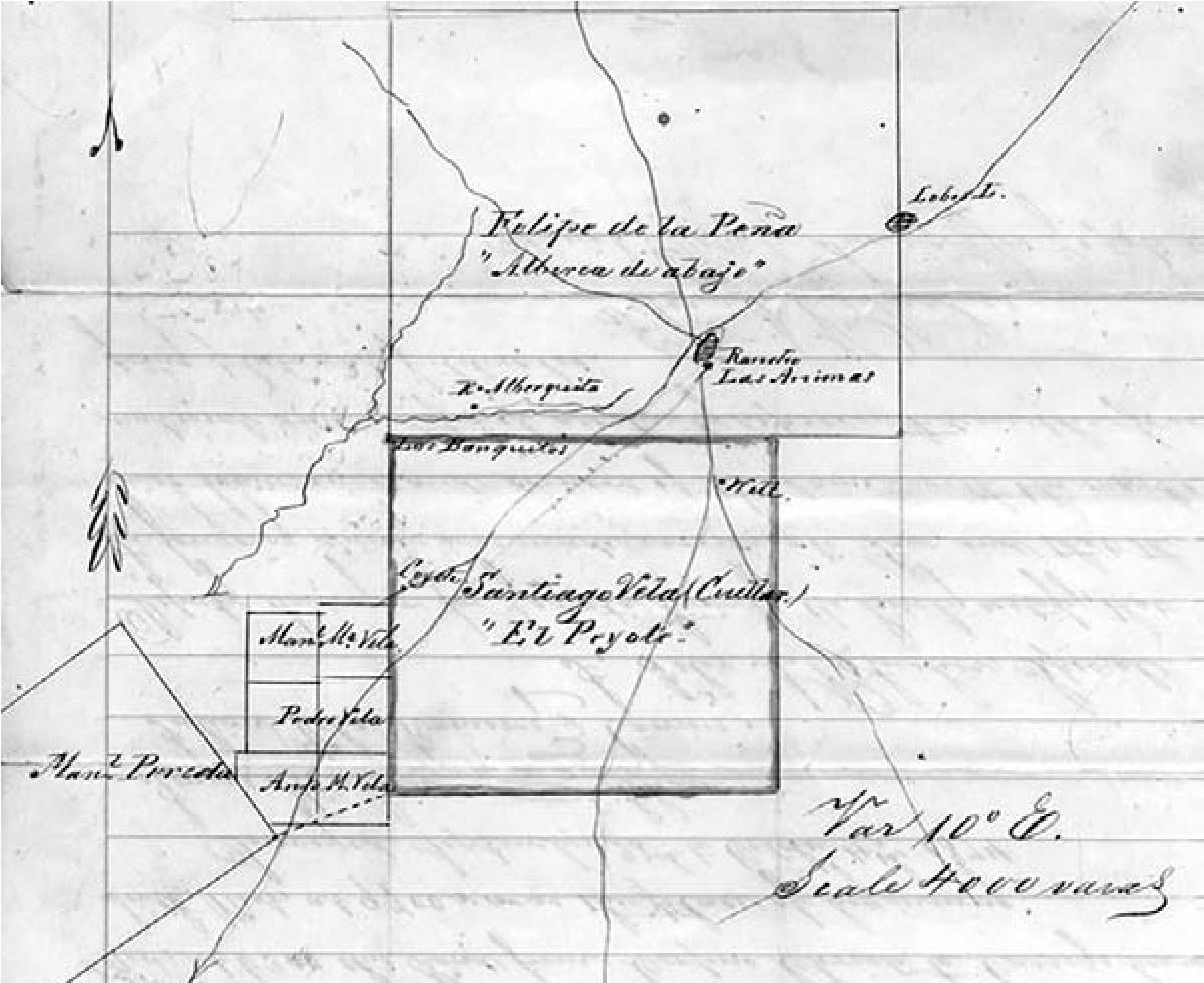
There are other still-intact communities of Lipan in Mexico. In 2009 the municipality of Müzquiz, Coahuila, invited the leaders of the Lipan Apache Tribe of Texas to celebrate the Lipan’s long history with the community and meet with representatives of the Lipan community ensconced in the region. All of these serve as proof of community and political control in pockets where it has been acceptable and safe to express indigenousness.
Conclusion
The challenge for the Lipan Apache Tribe of Texas is that because of tribal history juxtaposed against federal requirements, the bands have only recently come together consistently to act again as a single tribe in the fashion dictated by the BIAs paradigm, as a persistent and formal institutional entity. This continues a well-marked history of the bands dispersing and coming together only for certain types of events, such as coordination for war, raids, or ceremonies, or for longer periods under certain important leaders, such as Picax-ande. As Criteria B and C are currently written and understood, however, this collective institution is what must be documented as having a continuous existence since historic times despite the fact that this continued existence would not be traditional for the Lipan as a whole, nor characteristic of this type of leadership. Not unlike the other instances in Lipan history when the bands were called together for an extraordinary meeting to confront the latest big challenge to their existence or under the great leader Picax-ande, the bands came together in the late twentieth century to seek official recognition as the ancient commonwealth of Lipan bands.
7. Excavations in the Carrizalillo Hills of Southwestern New Mexico Reveal Protohistoric Mobile Group Camps
Alexander Kurota
Archeological data recovery at four sites located in the Carrizalillo Hills of southwestern New Mexico produced evidence of Protohistoric mobile group occupation (Figure 7.1). In addition to providing new knowledge of Protohistoric subsistence, this chapter advances a model of Protohistoric landscape use, presents four types of thermal features, and discusses lithic tool manufacturing and core reduction strategies. Importantly, survey observations indicated that only one of the four excavated sites (LA 85777) had a possible Protohistoric component, based on two projectile points (Sechrist 1994). All four sites had earlier diagnostic artifacts (such as Middle and Late Archaic projectile points or Playas Red and El Paso brownware ceramics). However, radiocarbon assays obtained from the four excavated sites all produced Protohistoric dates (see Kurota 2009a, 2010). In all, 14 Protohistoric and three late Formative dates were obtained from the excavated features. These two projects revealed valuable new information on the mobile Protohistoric cultures of southwestern New Mexico.
Previous Research of Protohistoric Groups Nearby
Protohistoric period research has been sparse in the region surrounding the project area, although some progress has been made in the past 15 years. Worth mentioning is archaeological testing in the Doyle Peak area in the northeast corner of the Boot Heel, where two samples from two thermal features yielded 1-sigma calibrated date ranges of ad 1670–1870 and ad 1420–1460 (Kirkpatrick et al. 1994:195).
More recently, Kemrer (2002) conducted an archaeological survey and test excavations in the Cedar Mountains a few miles northeast of Doyle Peak. Numerous thermal features were documented, and some also yielded Protohistoric dates. Additionally, Kemrer suggested that some of the documented rock-ring features may have functioned as Apache wickiups.
Research by Seymour (2009O has added a new dimension to our knowledge of Native cultures during this poorly understood cultural adaptation in the southern Southwest. Seymour carried out surveys on Fort Bliss that documented an extensive number of sites with suspected or confirmed Protohistoric occupation (Seymour 2002, 2003b; Seymour and Church 2007). One of these is the Cerro Rojo site, which yielded a large number of thermal features and rock rings inferred to represent Protohistoric Apache temporary structures (Seymour 2004a, 2008b, 2009f).
Possible Protohistoric loci are present around the northeastern part of the Boot Heel (Kurota and Cohen 2010a). Two (LA 162020 and LA 162021) are lithic and ceramic scatters with plain brownwares that have a broad date range, and are located on a tall ridge north of the Big Hatchet Mountains. A third site (LA 162015), in the Playas Valley ca. 1.6 km west of U-Bar Ridge, is noteworthy because of the number of thermal features, three white chert indeterminate projectile points, and the absence of ceramics. As many as 40 probable roasting pits are present, some with charcoal, providing the potential to date the occupations through radiocarbon.
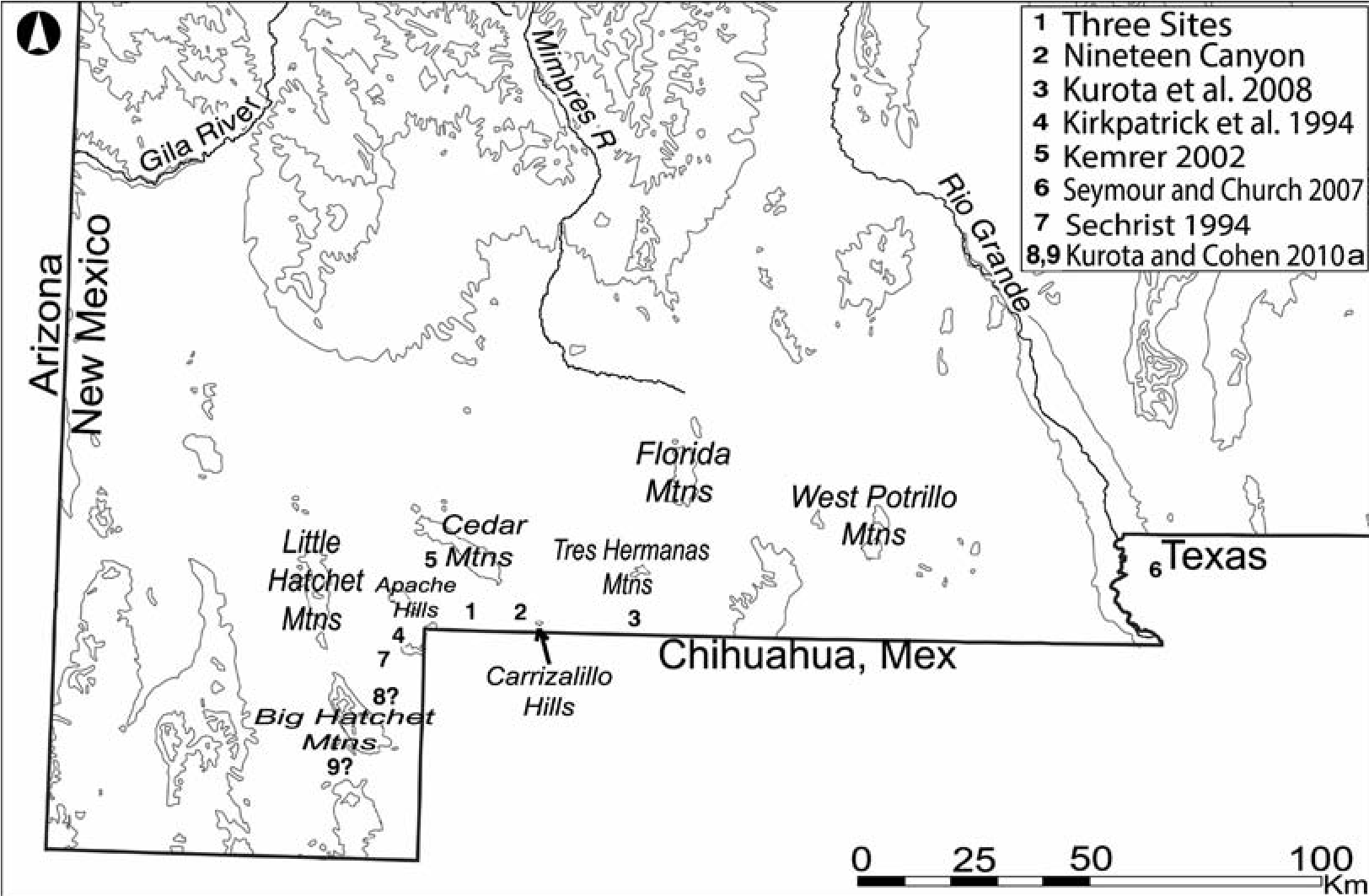
This previous research has revealed traces of Protohistoric period human occupation between the eastern New Mexico Boot Heel and El Paso, Texas (see Figure 7.1). While archaeological evidence remains inconclusive regarding the four sites’ cultural affiliation, Sumas, Mansos, Janos, Jocomes, and Apaches were known to have roamed this territory.
Fieldwork
The project consisted of a survey and subsequent excavations and construction monitoring. For Nineteen Canyon and Three Sites, 12 thermal features were excavated, usually in 5-x-5-m units, and all surface artifacts were collected within the area of potential effect (APE).
Nineteen Canyon
LA 125753, which is about 1 km long east-west and at least 150 m wide north-south, is in Nineteen Canyon within the Carrizalillo Hills (Figure 7.2). A pronounced unnamed hill extends high above the southwest end of the site. LA 125753 was initially documented in 1998 (Rieder 1999: 75) and was resurveyed in 2006 (Gibbs et al. 2006:47–50); subsequently, archaeological excavations were undertaken (Kurota 2010). Vegetation consists largely of mesquite, tarbush, Spanish bayonet, sotol, soaptree yucca, and agave. The cactus family is represented by barrel cactus, ocotillo, hedgehog cactus, prickly pear, and cholla. Isolated junipers are scattered along the hillslopes and inside the Nineteen Canyon arroyo, where rainwater gets trapped during the monsoon season.
In all, 26 features were documented during data recovery and subsequent construction monitoring (Kurota 2012), including both Native American (18) and historic mining features (9). Twelve of the former were thermal features, of which seven were inside the APE and were fully excavated. Six were moderately large fire-cracked- rock-filled roasting pits. The seventh was a small rock-ring hearth (Feature 26) less than 2 m from one of the roasting pits. A large ring midden located outside the APE was not excavated.
Roasting pits (aka large-rock pits; Gilby 2010) were on average 2 m in diameter and about 25 cm deep (Figure 7.3a, b) with from 600 to more than 3,000 fire-cracked rocks each. Individual rocks ranged from 5 to 25 cm in maximum length with average rock length about 8 cm. Charred macrobotanical remains included caudex and agave stalk as well as exudate (sap), also thought to be agave. Faunal analysis revealed jackrabbit, cottontail, and a small indeterminate mammal. Since agave roasting takes several days, the faunal remains may reflect meals consumed while agave was being processed and cooked.
The interior feature fill revealed single stratigraphic units consisting of an ashy matrix mixed with large amounts of charcoal and fire-cracked rock. This suggested that the individual features may have been used only once, although a large volume of fire-cracked rock was found around the 3-m perimeter of all features and likely represents rake-out, removed to access the cooked agave hearts. While the lack of any natural sediment accumulation inside the features indicates they were not reused during subsequent seasons, the features may have been used for multiple cooking events during a single camp episode.
The single rock-ring pit was discovered during the removal of fill and the rake-out material surrounding one of the roasting pits. Feature 26, located less than 2 m away from Feature 2, was an earthen pit with a rock ring around its perimeter and had a 50-cm interior diameter (Figure 7.3c). This general-purpose hearth may have been used in conjunction with the roasting pit next to it. The encircling rocks suggest the feature was utilized for fire restriction/heat retention or as a support for other cooking apparatus such as a spit. Macrobotanical remains recovered during flotation consist primarily of charred Apodanthera undulate (melon loco) seed coats and one cactus areole, indicating its probable use for processing vegetal resources, although some possible agave sap was also recovered.
Similarities in morphology between the unexcavated thermal features within and beyond the APE and the five excavated roasting pits suggest similar functions in the Protohistoric period. A large ring midden, Feature 7, outside the APE, was originally thought to be a historic dugout, appearing as a C- shaped rock berm with an interior depression where rocks from inside the feature had been removed after the cooking process and piled up around the perimeter. Evidence for repeated use of the ring midden was indicated by the presence of a fire- cracked rock concentration (4 m east-west by 3 m north-south) about 5 m south of the feature. These rocks probably represent one of the rake- outs before a new fire was started. At the top of the berm the feature is about 6 m long east-west and 4.5 m wide north-south, with about 1,000 variably sized rocks (3–45 cm, 22 cm average) forming the berm with natural eolian sediment mixed in between the rocks. About 30 percent of the rocks showed clear signs of fire-cracking or burning, while on others soot and smoke staining may have eroded away.
Three almost complete inverted and partially buried unshaped metates were found along the western and southern perimeter of the ring midden, 10 m away. They were conveniently spaced about 5 to 7 m apart, suggesting that the three work stations were used simultaneously (Figure 7.4). This is consistent with Apache practice during Late Historic times, when women worked independently with mescal in separate places so there would be no mixing (Ferg 2003a:22).
Chronometric evidence gathered from eight thermal features indicates that Nineteen Canyon was occupied during multiple visits in the Protohistoric period. Effort was made to avoid the “old wood” problem by using annuals (such as Flourensia, Berberis, monocots, and dicots) for radiocarbon dating. When such charcoal material was not available, the outer rings of Juniperus charcoal were used for dating. This is the case for the ring midden, where a rodent burrow brought juniper charcoal to the surface of the berm; the charcoal produced a 2-sigma calibrated radiocarbon age of cal ad 1460–1650 (cal bp 490–300). This date corresponds well with the radiocarbon assays obtained from all other features at Nineteen Canyon.
[[d-j-deni-j-seymour-fierce-and-indomitable-54.jpg][Figure 7.2. Map of LA 125753 at Nineteen Canyon. Note the concentration of thermal features in the southwestern portion of the site. Image prepared by New Mexico, Office of Contract Archeology.
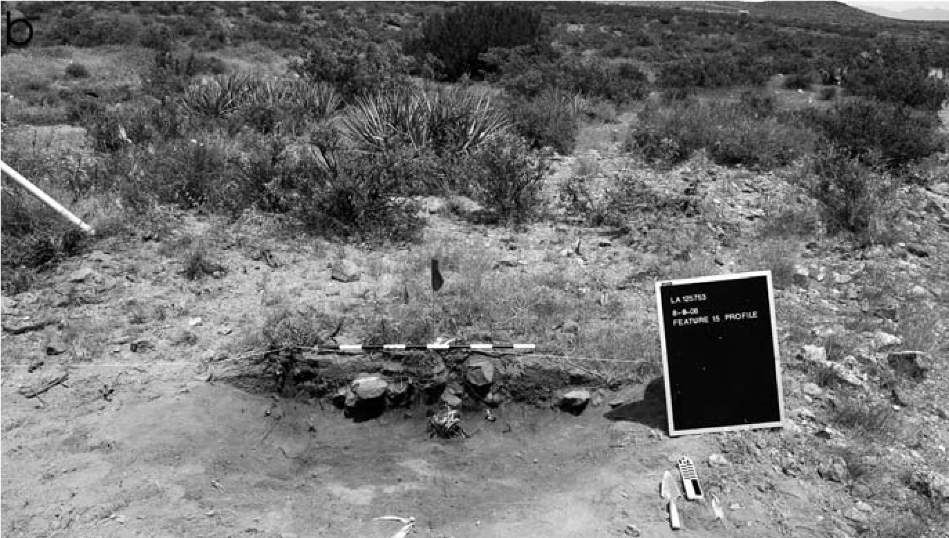
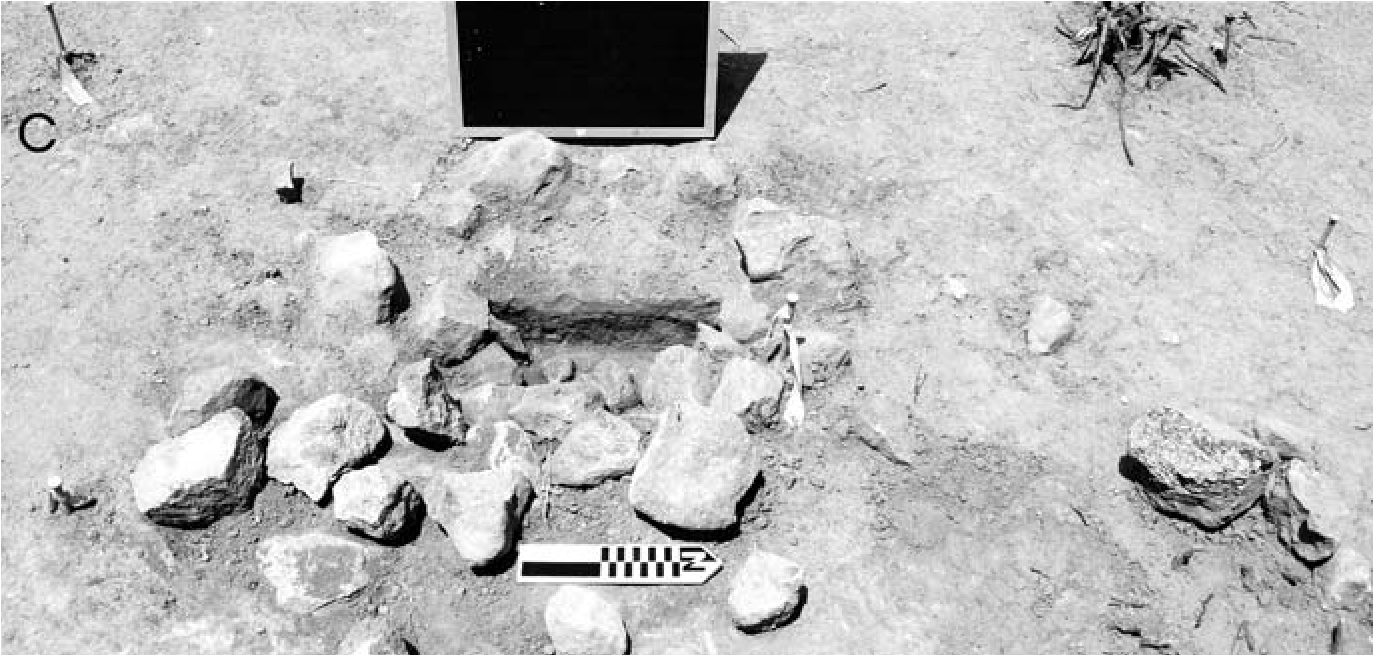
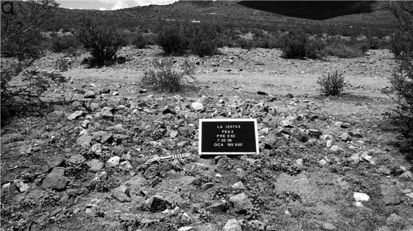
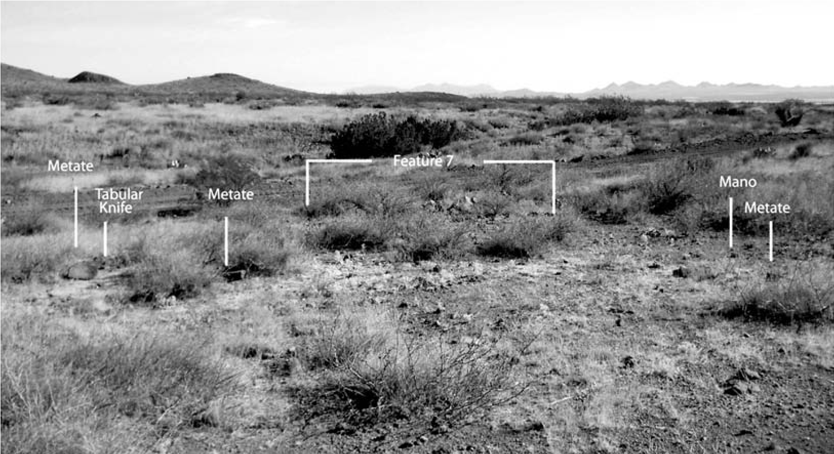
Although the 2-sigma 95 percent probability dates offer a broad range of occupation, with the earliest at the end of the twelfth century and the last ending in the mid-twentieth century, several dates overlap during a narrower time period. Originally we offered a tighter occupational range of ad 1420–1540 for the overlapping 14C dates. After the project was completed, we obtained two thermoluminescence dates from fire- cracked rock in two thermal features (Features 4 and 9). One of them (Feature 9) fell within the proposed range at ad 1497 ± 33 while the other (Feature 4) fell outside the range at ad 1599 ± 34. For this reason, the site’s proposed range of sequential occupations was expanded to ad 1420–1660.
In all, 1,016 flaked-stone and groundstone artifacts were documented during the excavations at Nineteen Canyon. The assemblage is dominated by debitage, consisting primarily of flakes, angular debris, cores, and tested cobbles. Tools include projectile points, bifaces, scrapers, choppers, retouched flakes, retouched pieces of angular debris, and tabular knives, as well as several metates and a one-hand mano. This variability in tools is characteristic of residential sites rather than highly specialized logistical camps.
Projectile points indicate both Archaic and possible Protohistoric origin. One is a Gypsum/ Augustin point (Figure 7.5a), another is a San Pedro-like point fragment (Figure 7.5b), and another is basally notched fragment of probable Protohistoric origin (Figure 7.5d). One indeterminate point may have functioned as a knife (Figure 7.5e). Although some points are Archaic, the flaked lithic assemblage is more like those found at other Protohistoric campsites in southwestern New Mexico.
Scrapers included both small and larger plane scrapers (Figure 7.6a-f). Use-wear analysis revealed that some were used to work soft materials, such as hides, while at least one stationary scraper was used for woodworking. Choppers were also used on both soft and hard materials; those used to work hard materials were much smaller than those used for cutting and tearing soft materials (Figure 7.6g-k).
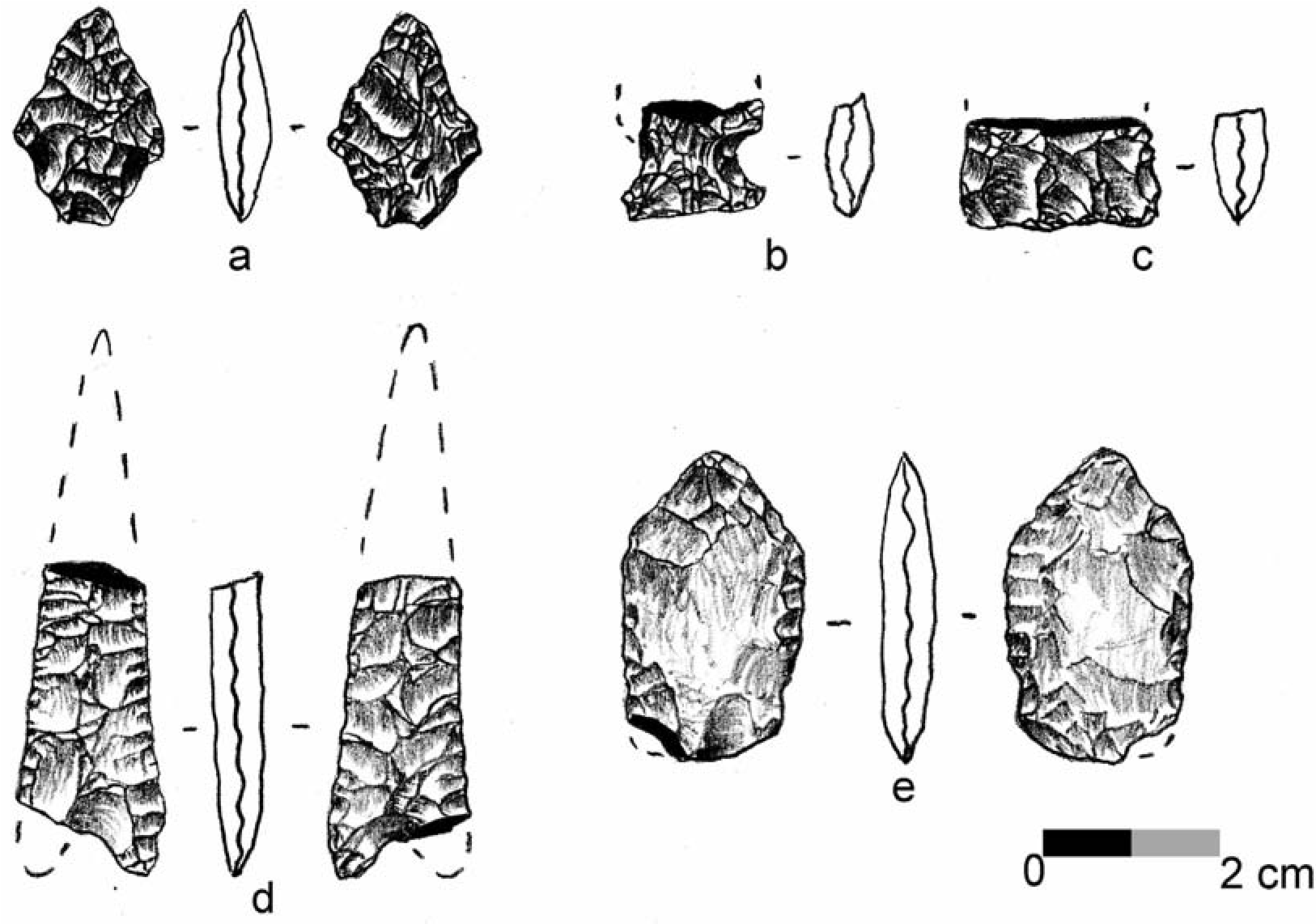
The largest biface was 8 cm long (Figure 7.7a), while the remaining complete specimens ranged from 4 to 5 cm long. Two of the complete bifaces had a moon-like or crescentic shape (Figure 7.7d, f). One of the bifaces had a bent protrusion at its tip that was likely a graver (Figure 7.7e). Two tabular knives were likely used for separating agave hearts (Figure 7.7 h, i).
The 81 tools recovered constitute 8 percent of the total flaked lithic assemblage. This is a fairly high proportion for a campsite but is similar to the proportion of tools on another recently completed data recovery project about 6.5 km to the west (Kurota 2009a). Archaic sites have much smaller proportions of flaked-stone tools in their assemblages than Protohistoric sites (Hughes et al. 2009:106).
The groundstone assemblage consisted of 33 specimens: 18 metates, 7 manos, 5 hammerstones, 2 pestles, and 1 mortar. Of the 18 metates, 12 were of the flat/concave type, 5 were of the basin type, and 1 was unspecified (Holtkamp 2012). Metates (Figure 7.8) show signs of light use wear, which is typical for this period (Seymour 2002, 2011a). One metate was also pecked, probably to refurbish the grinding surface. All manos were one-hand manos, 6 of the flat-convex type and 1 of the basin type (Figure 7.9). A single mortar and two fragmentary pestles were also documented (Figure 7.10).
Lithic Reduction Strategies
Most of the lithic assemblage was made from locally available materials, including quartzite and rhyolite. An andesite bifacial chopper found on the surface was surrounded by 20 conjoinable primary and secondary flakes, removed in an alternating bifacial direction, indicating local manufacture. Flakes ranged from 46 to 76 mm in length, and one terminated in a step fracture, indicating the use of a hard hammer (Hughes 2010:125,134–135).
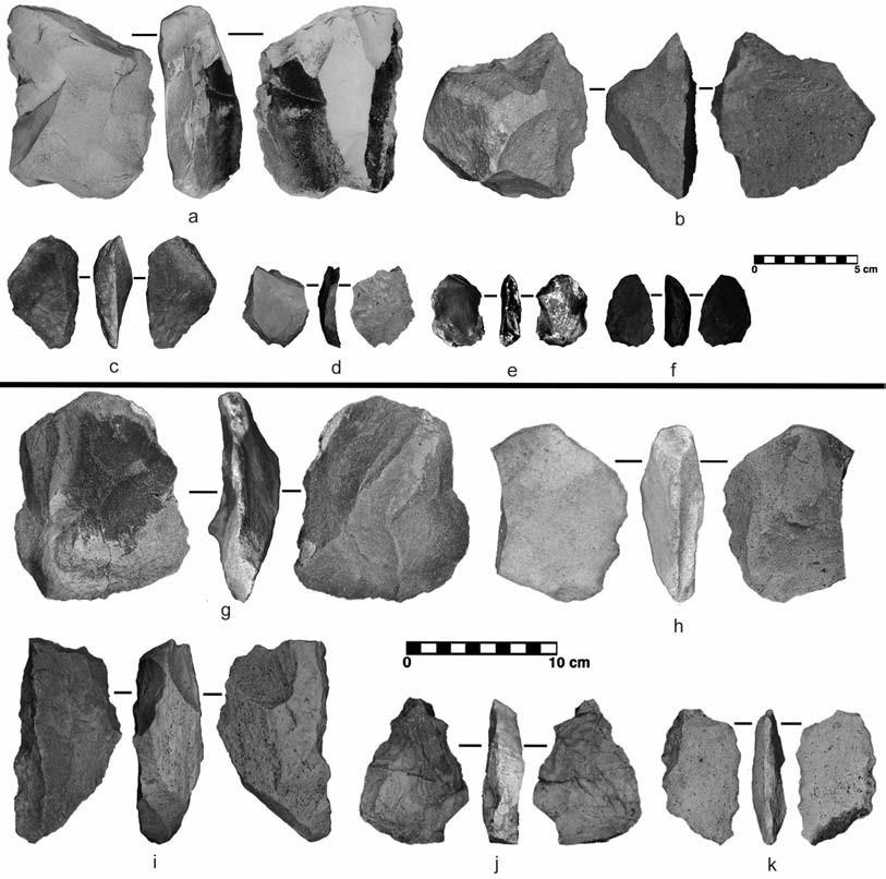
Intrasite Spatial Patterning
Nine of the 10 thermal features clustered in the southwestern half of the site in a relatively flat area south of the incised arroyo. The exception was north of the arroyo. The majority of the metates were in the cluster, surrounded by the roasting pits, suggesting their direct behavioral association. The southwestern locus was likely preferred because it was equidistant between agave growing on the nearby mountain slopes and water available during spring/summer rains.
Three Sites
The Three Sites project area is located on a broad alluvial fan emanating from Las Sierras de los Moscos to the south. The project was named for the excavations at three sites—LA 85776, LA 85777, and LA 85779—all located in close proximity. The Cedar Mountains are located to the north, and to the south are the Sierra Altas and Las Sierras de los Moscos in Chihuahua, Mexico. Intermittent streams and drainages flow out of the Cedar Mountains and the Carrizalillo Hills to Laguna de los Moscos to the south. The drainage, located approximately 2 km northeast of LA 85779, had running water when the fieldwork was conducted during the summer monsoon season of 2008. Plants include grama grasses, creosote bush, tarbush, various species of yucca, broom snakeweed, and prickly pear cactus.
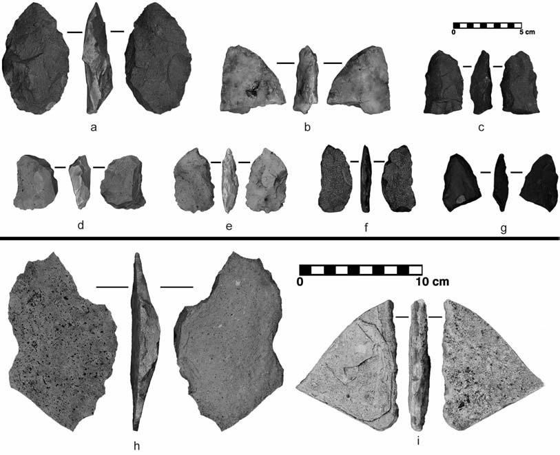
The three investigated sites were initially documented during a 1991 survey (Sechrist 1994:108–109) and then were redocumented in 2006 (Gibbs et al. 2006:40–47). These surveys documented burned rock features and artifacts indicative of the Late Archaic, Late Pueblo, and Protohistoric periods. One projectile point previously collected from LA 85776 shows morphological features consistent with Clovis, suggesting the possibility of an even earlier, Paleoindian, component. Yet five excavated features that yielded datable charcoal all produced radiocarbon dates pointing to occupation during the Protohistoric/Early Historic periods. Analysis of the lithic technology also suggested a dominant Protohistoric occupation. The earlier prehistoric artifacts were probably scavenged from other locations.
In all, 18 thermal features were documented during data recovery, and 11 inside the APE were fully excavated. Features appeared on the surface as small, moderate to dense concentrations of burned rocks. Some were concealed by creosote bushes and others were completely covered or disturbed by creosote roots. The disturbed nature of these features may account for the fact that they were missed on previous surveys. Indeed, some of our field crews were hesitant to accept them as cultural features before they were excavated.
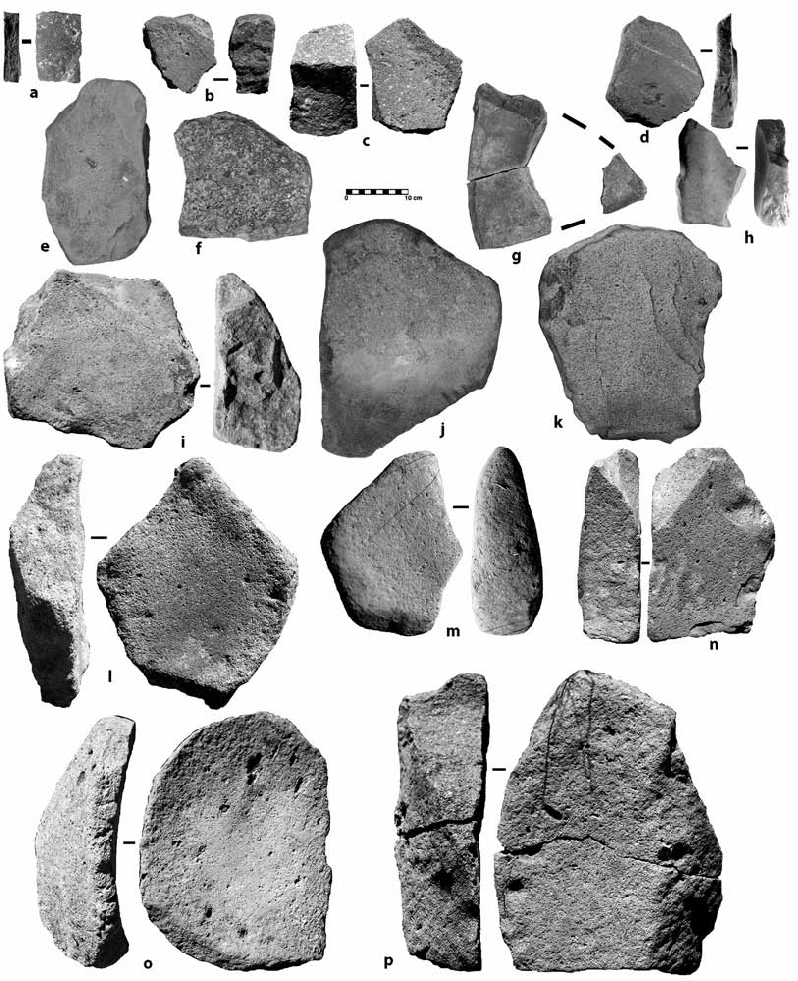
The excavated thermal features at Three Sites have a different appearance than the Nineteen Canyon’s large-rock pits. They are composed of much smaller rocks, averaging only 4 cm in maximum diameter, and all occurred in shallow basins about 18 cm deep and 135 cm in diameter (Figure 7.11). There were 400 to 1,900 feature rocks, and most were fire-affected but not cracked. These characteristics suggest that these predominantly limestone rocks were subject to lower fire temperature, which would more likely be achieved in an open fire. Macrobotanical remains recovered from these features included various parts of yucca, prickly pear, and Cheno- podium. Five excavated features yielded charcoal suitable for dating, and all were Protohistoric. Reviewing the overlaps of 14C dates, I proposed a range of sequential visits for the Three Sites to be between cal ad 1620 and 1800, a range that largely postdates that of Nineteen Canyon (cal ad 1420–1660).
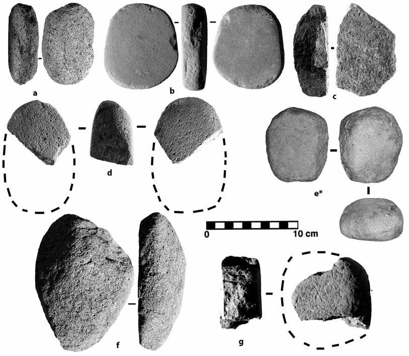
The artifact assemblage is typified by moderate to large quantities of stone artifacts. Only one site, LA 85779, contained groundstone, which consisted of a basin and a slab metate. In general, the assemblages tend to be similar to that of Nineteen Canyon, consisting of projectile points, bifaces, scrapers, choppers, retouched flakes, and debitage resulting from core reduction and biface manufacture. Some points are Protohistoric, others are Late Archaic, and, as noted, one is Clovis (Figure 7.12).
One of the two metates found was an almost complete, unifacial, basin-shaped metate made of coarse-grain rhyolite. The metate was surrounded by a concentration of large flakes that had been removed from this grinding tool. The metate was inverted, suggesting that the occupants purposefully tried to conceal it for use on a return visit.
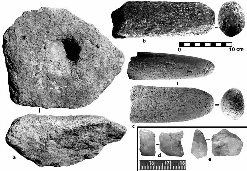
Lithic Procurement
The Three Sites lithic assemblages consist of locally available materials that are often of low- quality rhyolite, welded tuff, and quartzite. Rhyolite, basalt, and andesite come from the volcanic rocks in the Apache Hills and Cedar Mountains, while the source of quartzite and siltstone is most likely the Apache Hills. Chalcedony is common in the area.
Occasional nonlocal chert and some obsidian are also present. Chert source areas include the Little Hatchet Mountains to the west and the Klondike Hills (Zeigler 2009:119). Trace amounts of nonlocal Beartooth quartzite and Eagle Mountain chert were also recovered. The closest documented source for Beartooth quartzite is the Burro Mountains, 95 km north of the Nineteen Canyon area (Zeigler et al. 2011:90). The chert, resembling material found about 1.6 km southeast of Eagle Mountain, has been documented throughout the eastern and western part of the Boot Heel (Kurota and Cohen 2010a; Zeigler et al. 2011). The Eagle Mountain chert source is about 20 km from these sites. X-ray fluorescence analysis of the single obsidian artifact (a fragmentary projectile point) reveals that it came from the Antelope Wells source in the southern Boot Heel, which is 45 km (28 mi) from the Nineteen Canyon site.
The assemblages are dominated by debitage (±73 percent). Several small concentrations of debitage made from medium- to coarse-grain rhyolite documented on the surface of the sites represent individual lithic reduction episodes, as indicated by conjoinable flakes, angular debris, and cores.
These sites were remarkably similar in overall layout, types of features present, and period of occupation, suggesting that similar cultural groups produced them. Their lithic assemblages were therefore grouped into a single analytical unit. Comparisons were made between the Three Sites and Nineteen Canyon lithics on the one hand and nearby Archaic sites on the other (Kurota 2009b). Analysis revealed that the Archaic flakes tend to be smaller and thinner than the Protohistoric flakes from the Three Sites and Nineteen Canyon (Figure 7.13). Otherwise the lithic assemblages appear strikingly similar with respect to platform types and amounts of cortex. These similarities between the Archaic and Protohistoric sites likely result from one or several factors, including (1) mixing of components (Kurota and Cohen 2010a) and (2) scavenging of artifacts from earlier occupation sites (Seymour 2002:83; Sullivan et al. 2001); another possibility is that the overall mobility strategies of both Archaic and Protohistoric occupations resulted in similar technology of acquisition and manufacture (Richard Chapman, personal communication 2012; Seymour 2009k 2014a).
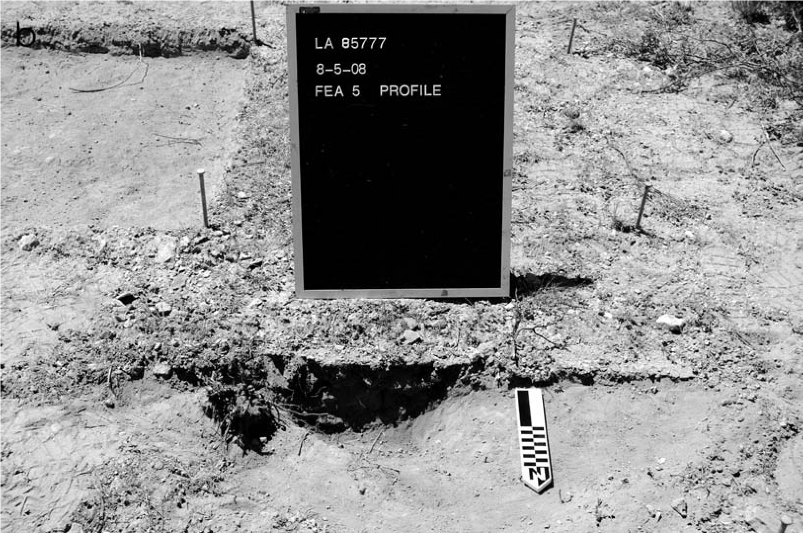
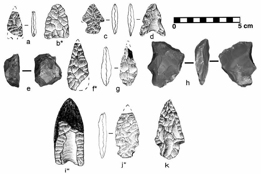
Emerging Clusters of Thermal Features
Spatial analysis of thermal features documented in the Three Sites area revealed feature clusters, each having between two and nine thermal features. The pattern was accentuated when features from another nearby site, LA 85778 (not included for data recovery), were added to the map. The 20 thermal features together form five thermal feature clusters; thermal features in each cluster are spaced between 10 and 90 m apart, and individual feature clusters are separated by 300 to 400 m. The individual feature clusters likely represent distinct campsites, each hearth reflecting a family unit or family subunit.
If multiple thermal features occurred in a single camping episode, they might reflect multiple gathering units (perhaps related to each other through intermarriage). Feature clusters seem purposely separated given that all five are similarly spaced from one another (300–400 m apart) (Figure 7.14a). This may suggest several revisits by distinct social groups, so that three or more groups visited concurrently and then came back. Macrobotanical material from Three Sites revealed fragments of yucca leaves and prickly pear spines, suggesting that the thermal feature clusters reflect gathering/foraging camps where these plants and perhaps other succulents were collected from about 150 to 200 m around the camp. Once all the edible plants from the perimeter were exhausted, the site was probably abandoned and the next camp (perhaps established the following season) was placed 300 to 400 m from the previous one, allowing the exploitation of unharvested plants in the vicinity of each new camp. Because four camps have been identified within such a small area and the area has been arbitrarily defined, more can be expected nearby in unsurveyed areas, assuming similar resources prevail. If the occupants of the individual gathering camps indeed purposefully spaced the seasonal camps from each other so as to have access to unharvested succulents, then more such camps should be found to the north and south. I propose a model of evenly distributed Protohistoric gathering camps throughout the landscape, which would have been occupied seasonally until the edible resources were fully exhausted, at which point the camps would have been moved to a different area. This pattern would mimic the relatively even distribution of resources, including plants, rocks, and water.
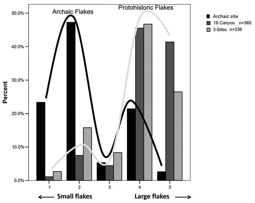
Summary
Recent excavations in the Carrizalillo Hills revealed new information on Protohistoric subsistence practices. Sites at Nineteen Canyon and the Three Sites are typified by small concentrations of thermal features and moderate to high densities of artifacts, including flaked stone, groundstone, and some prehistoric ceramics. At Nineteen Canyon the six excavated roasting pits revealed dark red to black fragments of hard matter with bubbly surfaces resembling clinker. These were identified as organic matter hardened in the fire, probably originating from agave, sotol, or another plant of the yucca family. Fragments of caudex and leaves of agave were also recovered. Lithic analysis revealed numerous tools made for specialized activities, such as working soft materials, including succulents, an inference that is reinforced by use wear. Others showed signs of chopping on a hard matrix, such as wood for use as fuel. The single ring midden at Nineteen Canyon indicates repeated use of the area by larger groups, as evidenced by three metates encircling the feature.
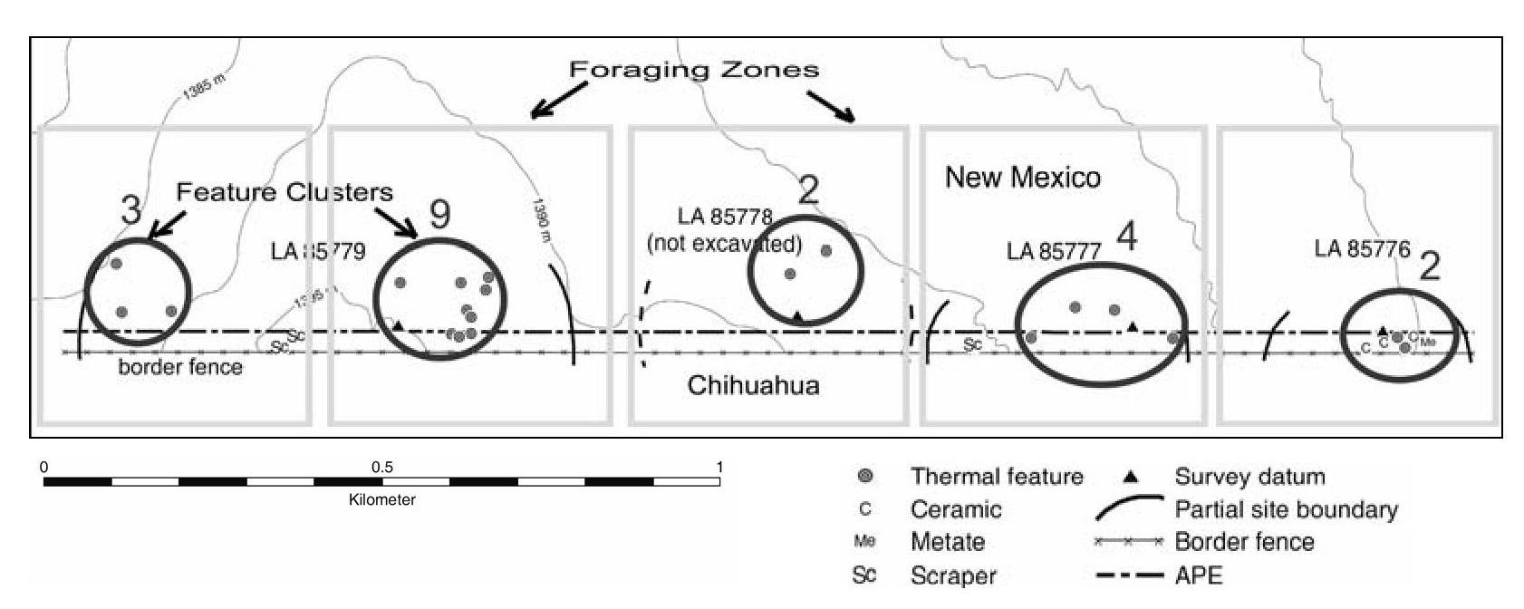
The rock-ring hearth (Feature 26) provided information on what the occupants may have done while the agave hearts were being roasted. Large quantities of outer shells from melón loco seeds indicate that the seeds may have been roasted and consumed during this waiting period. Melón loco may also have been used as a hallucinogenic agent. The proposed range of cal ad 1420–1660 indicates that Nineteen Canyon was occupied repeatedly during the early part of the Protohistoric period.
At Three Sites, charred yucca leaves and seeds of prickly pear cactus, goosefoot, and plants from the monocot family were recovered from thermal features, indicating that these plant foods may have been cooked in them. Five feature clusters may represent separate temporally segregated Protohistoric occupations. Flotation analyses revealed that prickly pear tunas and yucca stems were harvested, roasted, and consumed at the sites. Yucca stems from features also imply occupation in the spring, when flower stalks are young and could have been gathered for roasting. The date range of cal ad 1620–1800 indicates that Three Sites was occupied for shortterm repeated episodes during the Late Protohistoric and Early Historic periods.
The lithic assemblage was generated by procurement and reduction of a large volume of local poor-quality materials, primarily rhyolite, andesite, and quartzite. The low ratio of tools and the character of the debitage indicate an expedient technology associated with food processing and preparation. This contrasts with the high percentage of tools associated with thermal features at Nineteen Canyon, which was occupied during repeated visits.
Protohistoric groundstone typically consists of very shallow basins or flat/concave metates and one-hand cobble manos. The unshaped metates usually show little unifacial grinding wear. The manos are small one-hand natural cobbles with little or no evidence of edgeshaping and exhibit light to moderate unifacial or bifacial wear.
Although Protohistoric mobile groups are typically viewed as occupying only mountain slopes and other high elevations, current research suggests that flatter portions of the landscape were used on a seasonal basis (Seymour 2002, 2011a). The Three Sites area probably saw only sporadic human activity, likely limited to short, task-specific episodes timed with seasonal precipitation. Future research should focus on evaluating the proposed model of the distribution of feature clusters across the landscape and further refining the diagnostic attributes of Protohistoric thermal features and artifact assemblages.
8. From Economic Necessity to Cultural Tradition
Spanish Chipped-Stone Technology in New Mexico
James L. Moore
Chipped-stone tools are ubiquitous at Spanish sites occupied between the early seventeenth and early twentieth centuries in New Mexico. At one time, archaeologists discounted the association of chipped-stone artifacts with the more obvious historic materials recovered from these sites, suggesting that they represented an earlier occupation of the area or were washed in from elsewhere. However, the presence of chipped-stone tools in stratified and unmixed deposits at just about every Spanish site excavated in New Mexico argues for their historic association and use by the Spanish population. While fire-making activities were the most common tasks in which the Spanish used chipped-stone tools, analyses have shown that stone tools were also used in a variety of other tasks, including hunting/warfare, hide working, and the manufacture and maintenance of tools made from perishable materials.
The use of chipped-stone components in fire-making kits and in the ignition systems of firearms is not surprising, because these functions were common worldwide before the development and widespread adoption of the match and the percussion cap. Gunflints were integral components of firearms between at least the early seventeenth and mid-nineteenth centuries. Flints and steels were commonly used to ignite fires from Roman times into the early nineteenth century and even later. However, finding stone tools used in other tasks at Spanish sites was initially surprising, and was closely linked to economic conditions in a remote province at the edge of the Spanish Colonial world.
While most information concerning the Spanish use of chipped-stone tools is derived from archaeological analyses, some documentary sources also mention this practice. Information gathered at Placitas, New Mexico, by WPA writers in the 1930s documents the extensive use of stone tools by nineteenth-century Spanish residents of that area (Rebolledo and Márquez 2000). Mention is made of “obsidian arrows,” presumably meaning obsidian-tipped, and sharp stones that were used to cut and scrape hides, in carpentry, and in leather rope-making (Rebolledo and Márquez 2000:268, 329, 353, 385, 434). Economic hardship is often cited in these stories as the reason for using stone tools rather than more efficient metal tools. Members of the Penitente Brotherhood have a long history of using stone or glass flakes as cutting tools in ceremonies, continuing to the present day (Chávez 1954; Gregg 1844; Weigle 1971). Archaeological studies have documented the continued use of certain chipped-stone tools into the early twentieth century in urban settings where manufactured goods were easily and more affordably available. What began as economic necessity appears to have morphed into a traditional practice that still occurs among some segments of the Spanish population.
Stone Tools and Economic Realities
Despite the passing of the “Stone Age” in Europe, the use of chipped-stone tools persisted long after Europeans were thought to have made the switch to metal tools. This was partly because stone tools remained integral components in certain tasks, for which no viable replacements were available until the twentieth century. Economy can also be factored in since metal tools were not always affordable for everyone. Stone “flints” (also called tinderflints and strike-a-light flints) remained integral parts of fire-making kits into the twentieth century because using flint and steel for this purpose continued to be efficient and economical. Several authors present evidence for the continuation of this practice. Stevens (1935) photographed an Estonian using flint and steel to light his pipe in 1925, and noted that English flints were exported to Spain, South America, and Borneo for use in fire-making kits as late as 1924. Evans (1887) recorded the manufacture of chipped-stone gunflints and strike- a-light flints in Albania in the late nineteenth century, and Woodward (1960) observed that flint and steel was still used to make fires in poorer sections of Mexico in 1951.
Chipped-stone tools were commonly used by Spaniards in New Mexico because supplying metal tools to this distant province was difficult and expensive before the opening of the Santa Fe Trail in 1821. Even after that event, stone tools continued to be used by segments of Spanish society because they could not afford the metal tools that had become more widely available. While the initial substitution of stone for metal tools might be partly attributable to influence from the Pueblo and Athabascan neighbors of the Spanish in New Mexico, one must remember that stone tools continued to be used for a variety of tasks in Europe during much of the Spanish Colonial period. Thus, Spanish use of chipped- stone tools in New Mexico was an expansion of an existing and widespread cultural tradition rather than the assimilation of a “new” technology from others.
Besides the continuing use of strike-a-light flints, Europeans began manufacturing gunflints by the early 1600s, and by the mid-166os a Stone Age technique for striking blades from specially prepared cores was rediscovered in France (Blanchette 1975; Hamilton 1980). Bifacial gunflints were manufactured in Spain, Portugal, and other Mediterranean countries (Evans 1887; Lavin 1965; Moore 2004; Runnels 1982; White 1975; Witthoft 1966). Runnels (1982:371) has documented the use of chipped-stone technology in Greece during the Iron Age, the Classical period, and contemporary times. Chipped-stone tools are sometimes discovered in Medieval British sites, where they are usually considered intrusive prehistoric artifacts, even in the absence of evidence for contamination and other prehistoric materials (Runnels 1982:369). Klingelhofer (1987) found chipped glass and stone tools in nineteenth-century slave quarters in Maryland, and discusses similar artifacts found at other historic sites in that area. Thus, the use of chipped- stone tools of various types was probably common among certain segments of European and American populations before and during the Spanish Colonial period in the Southwest, and knowledge of the techniques used to produce usable stone tools was undoubtedly widespread. For the most part, the continued use of stone tools in Europe long after the development of metallurgy was probably economic in nature. Stone tools were cheap and easy to acquire, and when one could not afford new metal tools, one had to make do with what was available.
Use of chipped-stone tools in fire-making kits and in the ignition systems of firearms was a given in Spanish Colonial New Mexico, considering the ubiquitous nature of these usages in Europe. Substitution of stone tools for metal implements became a necessity owing to the nature of the Colonial supply system and the cost of manufactured goods when they finally reached the northern terminus of the Camino Real. Metal tended to be in short supply in New Mexico, and nearly all the iron used in New Spain was imported from Spain (Simmons and Turley 1980). Indeed, a 1639 letter from the Santa Fe cabildo to the viceroy of New Spain lamented a lack of iron in the province, where the last shipment had been received in 1628 (Bandelier and Bandelier 1937:73). By the time imported iron reached New Mexico, it was quite expensive; a lack of metal tools forced people to get along with little furniture, and farm tools were often made entirely of wood (Gregg 1844; Jones 1932). As late as 1827, Severino Martínez, a resident of Taos, bequeathed one or more pounds of iron to certain relatives, showing the continuing value and scarcity of this commodity (Minge 1963). As was made clear by the WPA stories collected from Placitas (Rebolledo and Márquez 2000), poor people often employed chipped-stone tools for tasks in which metal tools would normally have been used because the stone tools were cheaper and more accessible. The use of chipped- stone tools is archaeologically visible from early in the Spanish occupation and persisted until at least the early twentieth century, when some types of stone tools continued to occur because they had become part of the traditional cultural baggage rather than an economic necessity.
Table 8.1. Spanish Colonial Sites with Chipped-Stone Assemblages.
| Site Number | Site Name | Date | Reference |
| LA 160 | Espinosa-Sena site | Santa Fe Trail period | Moore 2016 |
| LA 953 | Valencia Pueblo | Spanish Colonial period | Vierra 1997 |
| LA 4968 | Vicente Valdez site | Santa Fe Trail period | Moore 2016 |
| LA 6579 | Romero site | Late Spanish Colonial period | Moore 2016 |
| LA 16768 | Late Spanish Colonial period | unpublished | |
| LA 25674 | Las Huertas Late | Spanish Colonial period | Moore 2005 |
| LA 54000 | La Fonda Parking Lot site | Early Spanish Colonial period | Moore 2004 |
| LA 54313 | La Puente | Santa Fe Trail period | Moore 2004 |
| LA 59658 | Trujillo House | Railroad period | Moore 2004 |
| LA 65005 | Pedro Sánchez site | Late Spanish Colonial period | Moore 2001b |
| LA 67321 (OCA) | Valencia | Late Spanish Colonial period | Brown and Vierra 1997 |
| LA 67321 (OAS) | Valencia | Late Spanish Colonial period | Moore 2001b |
| LA 77861 | Vigil Torres site | Railroad period | unpublished |
| LA 83110 | Late Spanish Colonial period | unpublished | |
| LA 99029 | Martinez site | (LA 99029) Santa Fe Trail period | Moore 2003 |
Comparing Spanish Chipped-Stone Assemblages
Comparative data were available from 15 Spanish sites that contained chipped-stone assemblages, 13 of which I examined using comparable analytic frameworks (Table 8.1). These sites represent individual residences and communities dating from the Early Spanish Colonial period through the Railroad period, or the early 1600s through the late 1800s. Three assemblages contained many fewer than 100 artifacts (LA 16768, LA 77861, and LA 83110) and were dropped from some comparisons because of potential sample error. Currently, the best and most abundant data are available for the Late Spanish Colonial period (ad 1700–1821) and the Santa Fe Trail period (ad 1821–1880), with only a few sites representing the Early Spanish Colonial (ad 1600–1680) and Railroad (ad 1880-present) periods. A few chipped-stone artifacts have been recovered from early-twentieth-century house sites in Albuquerque and Santa Fe, but these assemblages are too small for inclusion in our database and are used only anecdotally.
Some economic data are visible in this array of assemblages, mostly related to improvements in transportation systems that resulted in the increased availability of manufactured consumer goods. As noted earlier, metal was expensive and sometimes hard to acquire in Spanish Colonial New Mexico (Simmons and Turley 1980), and chipped stone was sometimes used as a substitute for metal tools. This shortage was at least partly alleviated by the opening of the Santa Fe Trail, which introduced cheaper and more abundant consumer goods from the United States to New Mexico. Further changes occurred when the railroad reached New Mexico in 1880, vastly increasing the supply of consumer goods. While the arrival of the railroad did not immediately end the use of chipped-stone tools in New Mexico, it certainly hastened that end by increasing the supply of affordable manufactured goods, and in general improving the economic climate in New Mexico.
Since fire making was one of the main tasks in which chipped-stone tools were used, this focus is reflected in the types of rocks that were mainly used for chipped-stone reduction. Cherts are best suited for use as strike-a-light flints because chert flakes possess very sharp edges and are hard enough to withstand an impact with metal. When struck with a chispa, or strike-alight, a sharp chert edge shears off a minute sliver of steel, which is ignited by the kinetic energy produced by the strike (Ripplinger 1984). The flaming slivers of steel fall on tinder and are used to ignite a fire. Strike-a-light use produces diagnostic wear patterns on flints that are usually distinguishable from other types of use, and they often exhibit use on multiple edges, showing that these tools were likely retained until they were no longer functional. Using data derived from a study of 936 strike-a-light flints, we identified an average of 2.04 utilized edges per tool, with between one and six utilized edges occurring on individual tools. Nearly half the assemblage (45.19 percent) had one utilized edge, 23.18 percent had two, 17.52 percent had three, 10.68 percent had four, 2.67 percent had five, and only 0.75 percent had six utilized edges. Thus, up to three utilized edges per tool is fairly common, but more edges than that is comparatively rare.
Continued use of a strike-a-light flint causes edge attrition as blows from the chispa remove small flakes, reshaping edges until they reach a point of stability at 61 to 72 degrees. This often produces one or more concavities along an edge, resembling those created by spokeshave use but displaying an entirely different wear pattern. Edges with shallow angles were continually resharpened by the inadvertent removal of small flakes until they reached angles of stability, at which time further rejuvenation flakes became difficult to remove. After stable edge angles were reached, further use tended to dull these tools, and they were eventually discarded in favor of fresh edges or flakes. The small microflakes removed by this process are sometimes recoverable, and they show considerable damage related to use at the juncture of their dorsal surface and platform.
Edges with steeper angles approaching or at the point of stability tended to undergo little reshaping during use. While use might result in the removal of a few flakes from these stronger edges, they tended to stabilize more quickly and hence dulled faster. Steeper edges often resemble scraper edges in shape and, superficially, in the type of wear exhibited. However, rather than the rounding and polishing that often occurs on scrapers, strike-a-light flint use results in a more battered appearance. After an edge stabilizes and few or no subsequent rejuvenation flakes are struck, continued use can remove microflakes with mostly stepped and sometimes feathered terminations. The edge itself is abraded (but not rounded or polished) by the glancing blow struck by the chispa (Figure 8.1).
One of the most diagnostic characteristics of strike-a-light flint use is the occurrence of metal adhesions on and adjacent to utilized edges. Metal adhesions form when slivers of steel are sliced from the chispa and adhere to flint edges rather than falling into tinder. These adhesions appear as brown lumps or streaks on and adjacent to working edges, and remain in place even after washing. While there are other ways in which metal can adhere to the surface of a chipped-stone artifact in a historic assemblage, the presence of metal adhesions along edges combined with the wear patterns discussed above is good evidence for this type of use.
Not surprisingly, cherts were the dominant materials found in every component in our sample, comprising at least 70 percent of all but two of the assemblages that contain 99 or more artifacts. Since there was a definite underlying prehistoric component at one of these two sites (LA 953) and a possible prehistoric component at the other (LA 25674), chert percentages may have been diluted in those assemblages by mixing. Thus, dominance of chert is a common characteristic of Spanish sites, with nearly three- quarters of assemblages commonly being made up of this material. However, if fire making was the only task in which stone tools were used, we would expect to only find cherts in Spanish assemblages. Since this is not the case, the array of other materials found at these sites is indicative of their use in a variety of tasks requiring different stone qualities and textures.
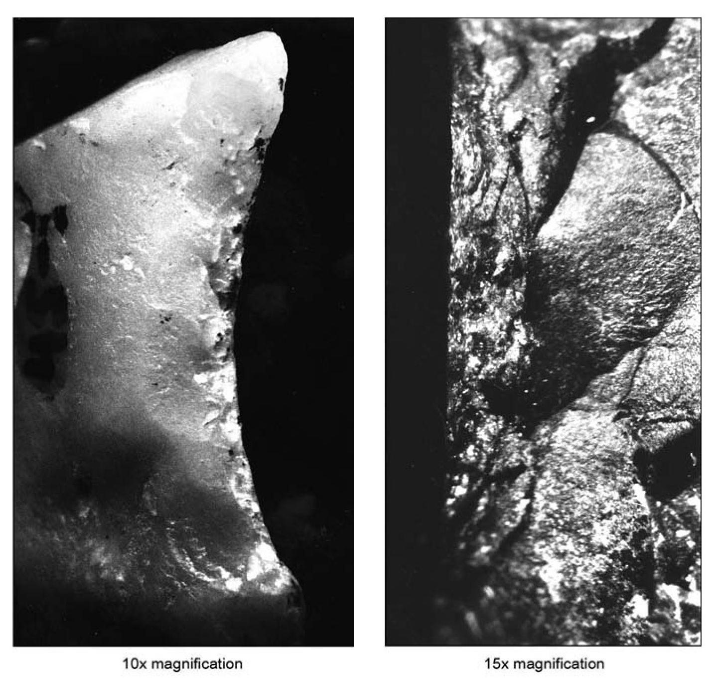
Economic changes induced by improvements in transportation and the availability of manufactured goods are reflected in the amount of cherts found in Spanish assemblages, increasing from a mean of 75.62 percent in Late Spanish Colonial period assemblages to 83.53 percent in Santa Fe Trail and 92.08 percent in Railroad period assemblages. This suggests a greater focus on fire-making tasks for chipped-stone tools in later sites, which in turn implies that metal tools were replacing many of the chipped-stone tools that were formerly used. This idea is partly confirmed by an increase in the mean percentage of identifiable strike-a-light flints in assemblages: Spanish Colonial components contain 25.84 percent strike-a-light flints, Santa Fe Trail components contain 21.04 percent, and Railroad period assemblages contain 35.64 percent. Clearly, while fire making was always the main task in which chipped-stone tools were used by the Spanish, that task may have assumed somewhat greater importance after the supply and transportation system was improved by the opening of the Santa Fe Trail, as shown by the increased proportion of chert for that period, and most certainly assumed greater importance after the arrival of the railroad, as demonstrated by increases in proportions of both cherts and strike-a-light flints.
The variety of tool types found at Spanish sites and the common occurrence of materials other than cherts in associated assemblages indicate that stone tools also functioned in other capacities, just as the historic examples cited earlier suggested. In the sample of thirteen Spanish assemblages in our database, the array of formal and informal tools includes projectile points (and preforms) for defense and hunting from seven sites, gunflints from six sites, spoke- shaves and denticulates for woodworking from two sites, and scrapers for leather working from four sites. More general-purpose tools used in a variety of manufacturing and maintenance tasks included utilized debitage from twelve sites, choppers from three, and unidentified bifaces from six. The presence of a single chipped-stone drill in one assemblage probably represents a tool that was made prehistorically and collected by Spaniards. Whether the drill represented a keepsake or was reused by the Spanish is uncertain, but even if we discount this category, there remains a wide array of chipped-stone tools used in several noninclusive tasks.
Though the sample of sites for which we have comprehensive data is small, a few broad temporal trends can be discerned in overall stone tool use. Excluding the two assemblages that contained fewer than 20 artifacts, the largest percentage of formal tools, at 6.06 percent, was found in the single Early Spanish Colonial period assemblage in our sample. The Late Spanish Colonial period assemblages yielded only 1.33 percent formal tools, Santa Fe Trail period components contained 2.31 percent, and the smallest proportion of formal tools was 1.06 percent in the single Railroad period assemblage. Percentages of informal tools other than strike-a-light flints were even more erratic and show a steady decline from the Early Spanish Colonial period through the Santa Fe Trail period, then a steep increase in the Railroad period that is difficult to account for. The strongest trend is in percentages of strike-a-light flints in assemblages, from 14.39 percent in the Early Spanish Colonial period, increasing to 27.29 percent in the Late Spanish Colonial period, declining slightly to 21.37 percent in the Santa Fe Trail period, and increasing sharply to 36.70 percent in the Railroad period.
These data suggest that while trade over the Santa Fe Trail improved the availability of manufactured commodities in New Mexico, it did not sufficiently increase the supply of metal tools to Spanish households to significantly affect the use of chipped-stone tools. The presence of gunflints and projectile points on Santa Fe Trail period sites indicates that traditional weapons continued to be used by many Spaniards, despite the availability of more modern firearms. Similarly, the presence of an array of chipped- stone tools used for working wood and leather in Santa Fe Trail period components indicates that these tasks also continued to be performed using stone tools. Since the ethnohistorical examples of stone tool use cited for Placitas mainly occurred during the Santa Fe Trail period, this is not surprising. The dominant changes in chipped- stone tool use appear to have occurred after the railroad arrived, as formal chipped-stone tool use declined considerably and the focus on firemaking tasks increased significantly.
While certain chipped-stone tool types may be temporally sensitive, this is not really true for the types of formal tools in these assemblages. Gunflints can be used as relative temporal indicators in the eastern United States but are usually not suitable for this purpose in the Spanish Southwest. France and England were the primary producers of gunflints in northern Europe, exporting large numbers of mass-produced flints. Traditionally, the earliest gunflints in Europe were bifacial, a requirement of the steep angle at which the flint struck the frizzen in early gun- locks (Cadiou and Richard 1977; Peterson 1956; Witthoft 1966). By 1700, in northern Europe, bifacial gunflints were mostly replaced by gunspalls (Hamilton 1980), wedge-shaped flakes that were produced and trimmed by hammer blows. This replacement was made possible by the development of new types of gunlocks in which the flint grazed the frizzen rather than striking it directly, as was the case for earlier styles of gunlocks, allowing the use of flints with more fragile edges. Gunflints manufactured from snapped prismatic blades were made in France by at least 1663 (Blanchette 1975; Hamilton 1980), were a common article of commerce by 1740, and had completely replaced gunspalls by 1775 (Witthoft 1966). French prismatic gunflints tend to be honey-colored, with back edges trimmed and rounded by flaking, while English prismatic gunflints are dark gray to black and do not have rounded back edges (Figure 8.2). The English appropriated the snapped blade technique from France, where it was a state secret, probably learning the technique from gunflint makers captured during the American Revolution. By the early 1800s, Great Britain dominated gunflint manufacture and sales.
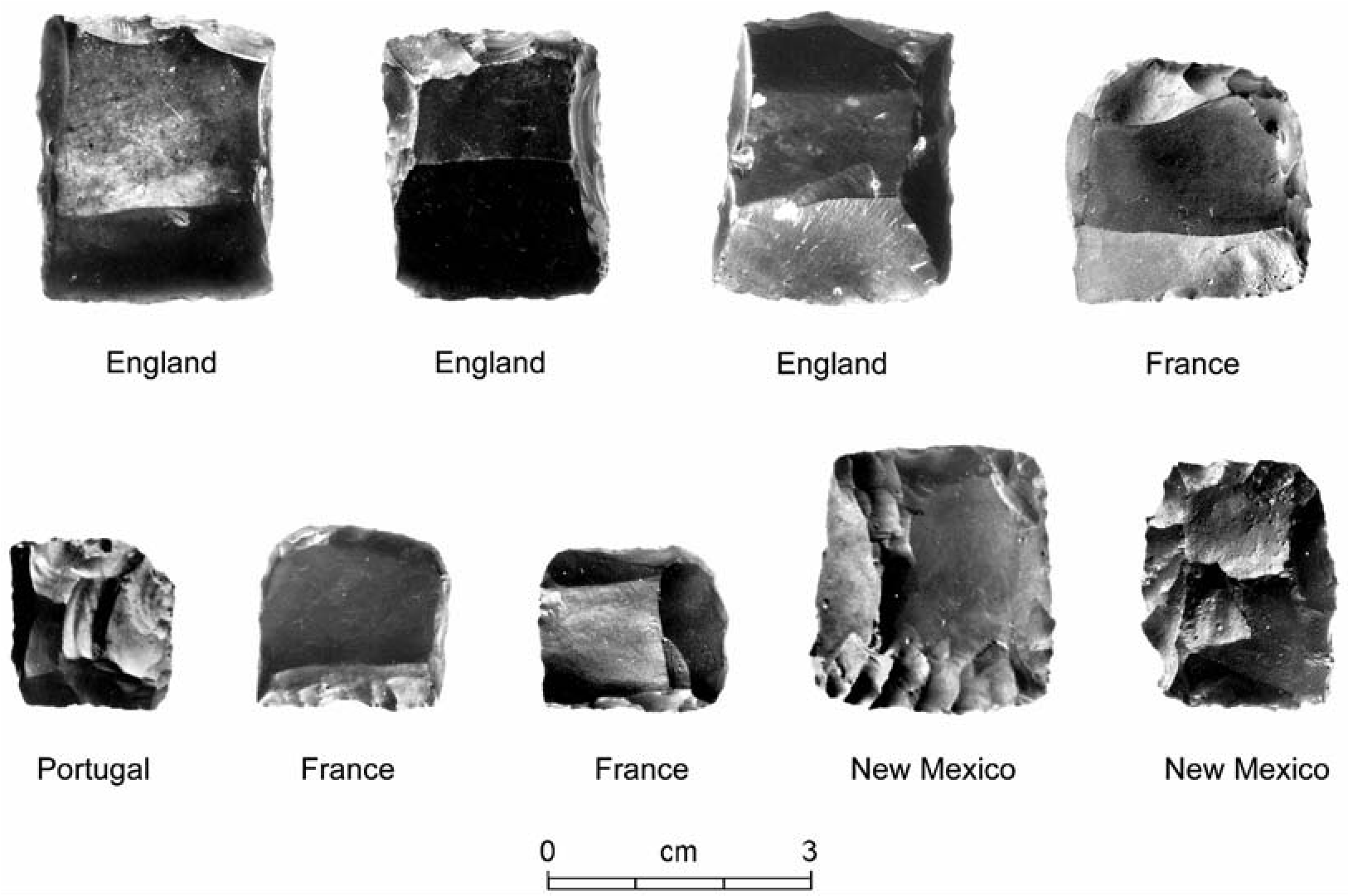
Thus, in the eastern United States there is a gunflint manufacturing sequence that begins with bifacial flints, moves through gunspalls, and ends with prismatic gunflints, and the sequence has somewhat different dates for French versus English manufactured specimens. This contrasts with parts of southern Europe, including Spain and Portugal, where an early style of gunlock employing bifacial gunflints remained in use until at least the mid-nineteenth century, when the traditional gunlock was finally replaced by French-style gunlocks (Brinkerhoff and Chamberlain 1972). However, the same regulations that changed the style of gunlocks used by the Spanish military in the mid-eighteenth century provided for the continued use of the old-style gunlocks in New Mexico (Brinkerhoff and Chamberlain 1972:18). Thus, New Mexico continued using essentially obsolete Spanish flintlock weapons that employed bifacial gunflints in their ignition systems until and after the American conquest in 1846. This means that the same style of gunflint was in use from ca. 1600 to 1846+ in New Mexico, severely limiting this tool type as a temporal indicator. However, there are occasional exceptions to this general statement. For example, an English gunflint made from a prismatic blade was recovered from LA 16769 near Santa Fe; it had been reworked into a bifacial form for use in a traditional Spanish flintlock. This artifact thus dates after 1775 and probably after 1800, and represents an import that was modified for use in a local weapon.
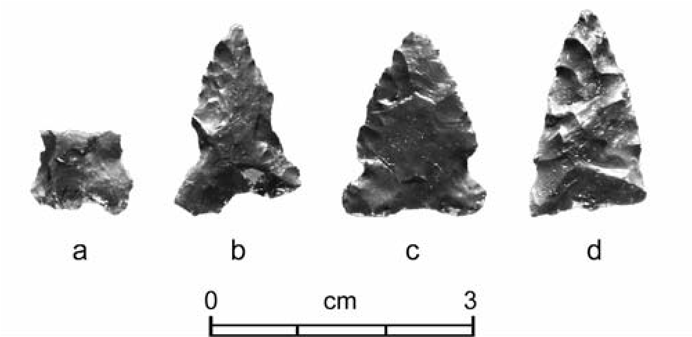
In addition to acquiring projectile points from earlier sites and probably their contemporary Native American neighbors, Spaniards made their own projectile points. Unfortunately, there has been little research into this aspect of Spanish chipped-stone technology, and it is uncertain whether this class of tool can be used to date sites. There is no evidence that the Spanish assigned symbolic values to chipped- stone tools—these tools had only a functional value to the Spanish, so outward appearance did not particularly matter as long as they were usable. Spanish-made projectile points tended to be rather crude in appearance, with marginal flaking and shallow side-notches (Figure 8.3). Lacking the symbolic values with which Native Americans typically imbued their projectile points, Spanish projectile points probably cannot be seriated into temporally sensitive stylistic groups and are therefore no more temporally sensitive than gunflints.
The large assemblage of strike-a-light flints available for analysis provided some important information on this class of tool. Though cherts were the best material for strike-a-light use, quartz and quartzite were also occasionally used to strike sparks. However, these coarser- grained materials did not demonstrate the same tendency toward resharpening by this type of use that chert did, and consequently they dulled more quickly. Thus, the use of coarse-grained materials with durable edges for fire making seems to have been very limited. The presence of strike-a-light flints in an assemblage is indicative of a historic occupation, since the high-grade steel needed for this task did not exist before the Spanish settlement of New Mexico. However, our examination of these tools showed that there were no important temporal trends in wear or use patterns that could be used to assign dates to sites based solely on characteristics of the strike- a-light flints in their assemblages.
As shown by the presence of several strike- a-light flints in the assemblage of LA 76138, a seventeenth-century farmstead occupied by residents of Pecos Pueblo (Moore 2003), the occurrence of these tools at a site is not necessarily indicative of a Spanish occupation. The use of flint and steel for fire making was easier than traditional Pueblo methods and probably replaced prehistoric techniques as soon as chispas became widely available. Since our sample of native strike-a-light flints is currently limited to specimens from LA 76138, it was not possible to determine whether differences in use patterns exist between Spanish and Pueblo assemblages.
Conclusion
Though the study of Spanish chipped-stone technology is still in its infancy, several patterns are beginning to emerge. A simple core flake reduction trajectory was used at Spanish sites. This is suggested by low flake-to-angular-debris ratios, very small percentages of modified flake platforms, and very small percentages of biface flakes. Most chipped-stone reduction seems to have been freehand, though limited evidence for bipolar reduction has also been found. Materials were sometimes scavenged from nearby prehistoric sites, as shown by the occurrence of occasional prehistoric projectile points in Spanish assemblages and at least one probable Archaic biface fragment that was reused as a strike-alight flint (Moore 2004). Evidence for salvaging, which was specifically monitored for during the analysis of materials from LA 25674, demonstrated that at least 3.5 percent of the artifacts in that assemblage were collected from earlier sites (Moore 2005). Salvaged materials included both formal tools and debitage, and most of these artifacts were probably gathered for use rather than as curios. Because fire making was the main activity in which chipped-stone tools were used, Spanish assemblages tend to be dominated by cherts. However, chipped-stone tools were also used for hunting/warfare, woodworking, leather working, and many as yet undefined tasks in which other material types were also suitable for use. Spanish-made bifaces tend to be small and rather crude in appearance and were marginally flaked, indicating an emphasis on functionality rather than aesthetics and symbolic meaning.
As noted earlier, some variation in assemblage characteristics can be linked to economic trends. When manufactured goods became more abundant and cheaper in the Railroad period, the use of chipped-stone substitutes for metal tools declined. As this occurred, flint knapping become more focused on fire-making tasks. Thus, between the Santa Fe Trail and Railroad periods there were significant increases in percentages artifacts in early twentieth-century assemblages from Spanish residences in Albuquerque and Santa Fe may represent the existence of a cultural tradition rather than an economic necessity. Indeed, continued ritual use of chipped-stone or glass implements by the Penitentes (Weigle 1971) is evidence of a cultural rather than economic function.
Thus, chipped-stone tools remained an important part of the Spanish economy until the fairly recent past. Debitage was used informally as tools into at least the late 1800s, even after the arrival of the railroad. Strike-a-light flints have been found in early-twentieth-century Spanish assemblages, indicating that fire making using flint and steel remained part of Spanish life until fairly recently. Rather than a necessity, the use of flint and steel to make fire probably became a traditional skill until it was finally superseded by more modern techniques. Matches and lighters were invented and became common and easily obtained, and flintlock weapons were replaced by firearms using percussion caps or cartridges, yet the use of chipped-stone tools for fire making persisted in some Spanish households long after other segments of society had abandoned those methods.
Department, and I would like to express my appreciation to the NMDOT for its continued support of New Mexico archaeology. Photographs were taken by Nancy Hunter Warren, and figures were composed by Rob Turner; figures are used courtesy of the Office of Archaeological Studies, Museum of New Mexico.
Note
I’m appreciative to Matthew Barbour and Steven Post for organizing the symposium in which the original version of this chapter was presented. Thanks also to Deni Seymour for collecting the chapters in this volume for publication. Most of the data drawn on in this discussion were generated by projects funded by the New Mexico State Highway and Transportation of cherts and strike-a-light flints in Spanish assemblages and a decline in the proportion of formal tools in assemblages. These changes suggest that chipped-stone tools had finally become less economically necessary in many tasks. The continued occurrence of occasional chipped-stone
9. Protohistoric Arrowhead Variability in the Greater Southwest
Mark E. Harlan
Southwestern archaeologists and ethnohistori- ans have tended to view the period between the terminus of the “great cultures” (Anasazi/Ances- tral Pueblo, Mogollon, and Hohokam) and the arrival of the Spanish expeditions in the region as a kind of Dark Age. They take at face value the early explorers’ description of a despoblado, with a narrow band of settlements along the Rio Grande, the islands of Hopi and Zuni, and the Oodham groups in Arizona standing in stark contrast to an empty wasteland.
Regional archaeology has appeared to confirm the Spaniards’ observations. For three generations of scholarship, archaeologists have focused on major ruins and developed a view of the Southwest based on their rise and fall. While they have recognized lesser manifestations, especially the many limited artifact scatters that often lack diagnostics, they have generally assumed these sites to be Archaic on the basis of one or two diagnostic points or relegated them to an amorphous “unknown lithic scatter” category if no diagnostics are found. The dominant view has been that most or all such locations represent a hunting-and-gathering lifeway that was superseded by the food-producing pueblo- and mound-building societies that rose to replace them. To the extent that these artifact scatters clearly appear to postdate the Archaic, they are seen as limited-use sites left by logistical expeditions coming out of the agricultural settlements they surrounded. These manifestations are usually ignored by those not interested in the Archaic.
A recent change of views (Harlan and Seymour, this volume; Seymour 2002, 2004a, 2007a, 2008a, 2009a, 2009f, 2009g, 2010a, 2012a, 2013a) clearly demonstrates that the despoblado is a misconception, resulting from the failure of both the Spanish explorers and most archaeologists to perceive the mobile peoples that filled areas empty of settlements. This chapter is not the place to address critical questions concerning the ethnic identity of these mobile peoples or the temporal depth of their presence. The purpose here is, rather, to examine the range of variability of one of their key artifact types: arrowheads. Protohistoric arrowheads constitute a distinctive artifact category, one of only a few lithic items providing evidence for a mobile group presence on sites that might otherwise be attributed to Archaic peoples or to hunting parties from prehistoric farming settlements.
Despite controversy over whether smaller points are invariably associated with use of the bow and arrow while larger points indicate use of the atlatl and dart (Ahler 1971:107; Butler 1975; Flenniken and Wilkie 1989; Mallouf 1987:57), the general association of points weighing less than 3.5 g with arrows, and larger points with darts, is abundantly clear (Justice 2002a:15–16), assertions to the contrary (Browne 1938:359; Evans 1957:83) notwithstanding. It is also well demonstrated that arrows began to supplant darts or javelins in North America, including the Southwest, by about ad 500 but that the proliferation of arrowheads in both numbers and variety postdates ad 1300 (Bamford 1986:42–44; Justice 2002a:44–45). This later period, which may mark the beginnings of the changes associated with the Terminal Prehistoric or Protohistoric, also saw development of distinct regional and subregional variability in arrowhead forms. This chapter seeks to better understand that variability and suggest approaches to exploiting its distribution. The focus here is on methodology and on a characterization of the variability, but the ultimate goal is to achieve an improved picture of the Protohistoric groups that occupied the southern Southwest and produced the points.
The Bow-and-Arrow Weapon System
Before concentrating on the formal variability of a collection of arrowheads from the southern Southwest, we may find it useful to remind ourselves that arrowheads were actually a relatively minor part of a complex weapons system and that inferences based on their form are rather like reconstructions of extinct shark species from their teeth alone, without the relative certainty provided by genetic descent in the case of biological species. In both cases, the vagaries of preservation force us to deal with what time has left for us, not with the far more important parts of a complex system that has vanished.
Viewed over the long term, the changeover from atlatl and dart to bow and arrow is not just a stylistic shift providing useful temporal information. It marks a set of fundamental improvements in weapons system efficiency (using this term in the sense of Bleed 1986:739–740 but recognizing that the bow-and-arrow system is both maintainable and reliable). The progression has continued, first with the development of the crossbow and then with improvements in the firearms that have gradually replaced all other projectile weapons in both hunting and warfare. At each step the systems are characterized by smaller projectiles that travel at higher velocities and allow those adept in their use to consistently hit and damage targets at greater distances (Bergman and Newcomer 1983:239; Higgins 1978:100). Whether employed in hunting or in warfare, this capability has obvious advantages.
A further advantage of this trend in projectile technology may be less readily apparent. At each stage the learning curve for employment of the technologies has been reduced. We have little historical or ethnographic information on the relative skill sets required for atlatl and dart versus bow and arrow, but anecdotal evidence seems to indicate that the learning curve for the bow is less steep, with a better chance for more people to achieve proficiency. Still, Medieval armies that depended on massed archers had behind them systems of learning that favored lifelong devotion to archery practice, a critical element in their success (Browne 1940:212; Pope 1918:103, 122–125).
The trend toward a reduced learning curve has extended beyond the use of spears and bows and arrows and into modern times. In contrast to yeomen who spent their lives in archery practice, the musketeers who served in later armies could be recruited and trained on a more or less ad hoc basis (Hackett 1983:25–33; Pope 1918:103). This is not just a function of the inherent inaccuracy of their weapons and the employment of mass formations to compensate for it. The riflemen who replaced musketeers in the nineteenth century got more training in drill formations than in actual use of their weapons, and even modern conscript armies have generally found that a couple of weeks spent on the firing range is sufficient for training most recruits, followed up with a day or two of refresher each year. Since the basic requirement for all of these weapons systems is to accurately place a projectile on target at considerable distance, the information from warfare probably extends to hunting, with the caveat that the skill needed to find and stalk the game far exceeds the skill needed to hit it.
The replacement of personal skill by technological advancement might be referred to as the “kung fu effect” Training a human being to fight effectively empty-handed or without projectile weapons takes a lifetime of training, with daily attention to the art. Achieving efficiency with a spear, even with the atlatl to assist, also appears to be extremely difficult, on the basis of the one experiment I have found referenced in the literature (Browne 1940:212). However, groups in the Southwest seem to have seen no need for the shorter learning curve and increased range of the bow and arrow until late in the prehistoric sequence. Since the mechanical function of the bow-and-arrow system seems quite obvious and its use was clearly known by no later than ad 500 (Justice 2002a:44), we may infer that the increased importance of the bow-and- arrow technology in the Protohistoric period responded to an emerging need. Unfortunately, actually elucidating this point would call for a massive distributional study that is beyond the scope of this discussion, perhaps even exceeding the capacity of available data sets.
Given the likely importance of the bow-and- arrow weapons system for mobile groups in the Protohistoric period, it is unfortunate that, in practice, we actually examine its least important component. In order of importance, the system consists of the bow (itself a compound tool consisting of stave and string), the arrow shaft (another compound tool consisting of required main shaft, optional foreshaft, and optional fletching), and finally a sharp tip, which precontact Native Americans could make from stone but also from bone or wood. The tip may also be provided merely by sharpening the foreshaft. It should also be clear from the brief discussion of the kung fu effect that the archer is actually the most critical component of the system and the archer’s skill can largely compensate for shortcomings in the other system components, making the specific form of any one arrowhead even less critical to system performance.
The sharp arrowhead has two basic functions: to assist the projectile in penetrating the target and to cut a large wound that will cause hemorrhage (Browne 1940:209; Cheshier and Kelley 2006:353; Flenniken and Wilkie 1989:152). If the arrow is intended to deliver a dose of poison, penetration alone is sufficient since poison is most often applied to the foreshaft, but for most uses, the design of the arrowhead is a compromise between the depth and the size of the wound it causes, a fundamental distinction that Medieval archers recognized in designating their points as either broadheads or bodkins.
Broadheads and bodkins share design parameters at the front end, and both types of arrowheads start with a sharp point. From there back, design optimization can result in compromises. Penetration is maximized by keeping the surface that the point presents to the target at or near the diameter of the arrow shaft or foreshaft, hence the relatively common practice of simply sharpening the foreshaft, an approach that works well for small game.[5] However, for larger game and human beings, the small wounds caused by this type of arrow are not immediately debilitating, although infection may cause death in the long run and a perfectly placed bodkin, like the one said to have felled King Harold at the Battle of Hastings, is something to be feared, even by animals with thick hides and people wearing armor.
Broadheads are more effective when penetration is not the sole concern because they are, in essence, knife blades delivered at the end of a wooden shaft and so will cause extensive bleeding. Further sacrificing penetrating power, barbing of the arrowhead will tend to keep it in the wound so that the mechanical effect of a moving arrow shaft can exacerbate the hemorrhage, unless the target becomes immediately still (Browne 1940). A simple triangular point provides some barbing, but such points can be difficult to attach firmly to the shaft. Various types of projections created by side-notching or other shaping provide good anchor points for tying the point to the shaft while simultaneously barbing the point. For hunting, a good attachment of the point to the shaft (or at least the foreshaft) is an advantage because movement as the prey runs will enhance hemorrhaging (Flenniken and Wilkie 1989:151). For warfare, it may actually be more advantageous if the point detaches in the wound, leading to a debilitating infection or death.
As with many mechanical devices, arrowheads can fulfill their physical function while assuming a range of actual shapes. The basic requirements for penetrating a target or causing a large wound may tightly constrain the front end of the point’s shape, but shaping the haft end is less constrained by physical requirements and more open to personal preference or learning traditions. The analysis discussed here has been designed to consider both physical design constraints and personal or cultural preferences as sources of variability. A brief survey of the literature on projectile point variability indicates that this will constitute something of a departure from past practice.
Approaches to the Study of Arrowhead Variability
A survey of the literature has found that the majority of studies addressing projectile point variability are confined to dart points (Ahler 1971; Bamford 1986; Benfer 1970; Benfer and Benfer 1981; Bettinger et al. 1996; Butler 1975; Curran 1993; Eerkens and Bettinger 2001; Fenenga and Wheat 1940; Gunn and Pruitt 1975; Thomas 1981; Towner and Warburton 1990) or confound dart points and arrowheads (Benfer and Benfer 1981; Bleed 1986, 1991; Cheshier and Kelley 2006; Hester 1986; Keeley 1982). Fewer studies are exclusively concerned with arrowheads (Barton and Bergman 1982; Bergman and McEwen 1997; Bergman and Newcomer 1983; Browne 1938; Higgins 1978; Mallouf 1987; Odell and Cowan 1986; Pope 1918, 1923). This is problematic in that the design constraints on dart points and arrowheads differ considerably. At the most fundamental level, dart points appear to function as a generalized element of a multipurpose tool. Use-wear studies indicate that the dart and its point were used for butchering game as well as taking it down, combining the design constraints of projectiles and knives (Ahler 1971). Arrowheads are more specialized. Their small size makes them less useful for butchering, and the aerodynamic requirements of arrow flight constrain the practical range of shapes and sizes (Higgins 1978). Interestingly, tools designed to function as single-purpose knives are relatively rare in Archaic assemblages and more common on Protohistoric sites (Seymour 2002).
The profession’s focus on dart points is readily evident in the production of projectile point typologies. Work in the Great Basin has resulted in elaborate typologies for dart points (Bettinger and Eerkens 1997; Thomas 1981) but only a general recognition that arrowheads from that region seem to form a single unified category (Thomas 1981). Elaborate point typologies have been developed for Texas (Justice 2002a), but mainly by amateurs anxious to name their finds and distinguish themselves among their fellow collectors (see, for example, Phelps 1987). The general lack of attention to arrowheads as a separate class is especially evident in the many metrically based studies that have been conducted.
A number of researchers have explored the feasibility of using measurements, sometimes combined with attribute observations, as the basis for categorizing projectile points, but nearly all of these studies have addressed dart points, not arrowheads (Ahler 1971; Benfer and Benfer 1981; Cheshier and Kelley 2006; Eerkens and Bettinger 2001; Gunn and Pruitt 1975; Thomas 1981). The metrics themselves are generally linear measures (less commonly angles) tied to the perceived key landmarks on the points. In almost all cases, those key landmarks are on the hafting end of the point and are designed to result in categories that strongly reflect variations in how the points were attached. This approach is arguably appropriate in the study of dart points, which tend to be heavily reworked before discard, so that a typology of bases is more useful than one that would require whole points. Further, it seems likely that, as a low-velocity weapon, the dart depends mainly on weight for penetration, and the impression from examining numerous illustrations is that the distinction between broadheads and bodkins may not apply to darts.
An earlier metric study of Protohistoric arrowheads I conducted took off directly from the metric approaches developed for studying Great Basin dart points, with mixed results (Harlan 2002). An early indicator of potential difficulties arose when it became apparent that only a subset of the arrowheads in the study population have any of the landmarks that assist measurement of dart points. These problems carried through the multivariate analysis of the metric data, and despite a range of techniques being applied, the metrics neither sorted the data into meaningful units nor corresponded to units imposed by assigning the points to traditional types. The present study, another metric analysis using a subset of the same artifacts measured previously, takes a different approach to quantification.
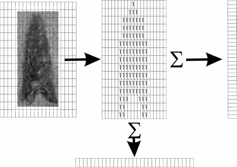
A Neutral Approach to the Metrics of Size and Shape
The underlying theme of the measurement approach used for this study has been to maintain neutrality, not assuming that any single part of an arrowhead is more important than any other in the search for meaningful categories. This rules out the use of landmarks and makes application of linear measures and angles difficult. The solution chosen here has been to divide each point into a series of horizontal and vertical bands, measure the area of the bands, and compare the points on the basis of differences in all of the bands. The specific steps, as summarized in Figure 9.1, are simple: (1) convert a digital image of each point to a matrix of zeros and ones, with the ones corresponding to each pixel of the image occupied by the point, and (2) sum up the values across the rows and down the columns of the matrix to provide the individual areas of a set of horizontal and vertical bands. The measures were then normalized to 40 horizontal and 25 vertical units so that points of varying sizes could occupy the same multivariate space.[6]
Two of the many ways to examine the metrics provided by this technique are size-neutral and size-dependent treatments. The data as extracted are size dependent, since the horizontal and vertical pixel counts correspond to areas on the points.[7] A size-neutral representation can be achieved by converting each measurement band to its corresponding percentage of the total area of the point. The size-dependent view is most likely to highlight variation related to the intended physical function of the points, since it captures both the distribution of area over the length of the point and the absolute relationship between the dimensions of the point and the arrow to which it was once attached. The size-independent view is primarily sensitive to shape, closely relating two points with the same outline even though they differ substantially in size.
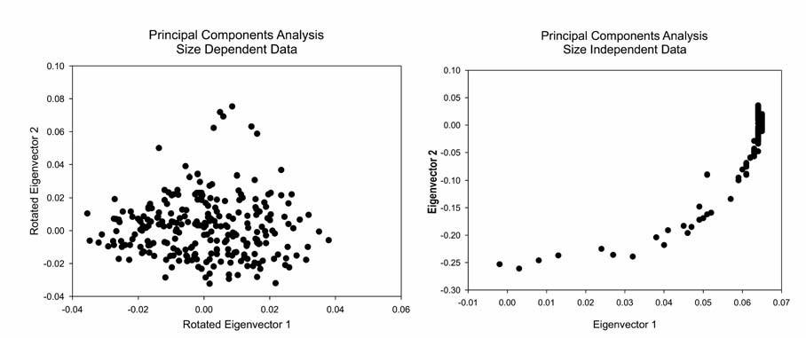
Both examinations of the data are designed to address the same basic questions: (1) Can any basic categories be extracted from the underlying variability? (2) Is there correspondence between the variability as measured by this approach and the categories of traditional arrowhead typologies? As discussed below, the size-dependent and size-independent views produce different results for underlying categories in the measures themselves but similar views with respect to the correspondence between the categories from traditional typology and the measurement data.
Results
Selection from the larger data set of 1,140 arrowheads used in the earlier study cited above, combined with winnowing out problem images, resulted in a data set of 254 points for use in the present study. As discussed in more detail in the earlier report, the points are from private collections made on both sides of the international border in the general vicinity of El Paso, Texas, by members of the El Paso Archaeological Society. While it would have been preferable to include all of the points from the earlier study, developing and applying a new measurement technique proved time-consuming and a smaller subset was selected. However, blocks of the full data set were taken in without further selection, and it is likely that the sample chosen is reasonably representative of the entire group of collections.
Even this smaller set of points is too large to approach by inspection, especially given the large number of observations (40 horizontal bands and 25 vertical bands per point), so the analysis is based primarily on multivariate statistical manipulations, with other techniques applied as appropriate. The search for underlying groups in the data relies on Principal Components Analysis,[8] followed up by K-Means cluster analysis, and the investigation of relationships between the metric data and traditional typology uses Discriminant Analysis. These are all standard multivariate tools familiar to many archaeologists and described in standard texts (such as Cooley and Lohnes 1971 and Harmon 1967).
Figure 9.2 presents the results of Principal Components Analysis with a plot of the first two eigenvectors from the size-dependent data on the left and size-independent data on the right. A complete lack of pattern is readily apparent in the plot based on the size-dependent data. The plot for the size-independent data has a peculiar form because the correlation matrix derived from the size-independent data is somewhat ill- conditioned, with the first eigenvector accounting for 93.7 percent of the total variance. Plots of the second and third and third and fourth eigenvectors were examined and showed no improvement in form. This is a problem often encountered with data converted to percentages.
The lack of clustering in the Principal Components Analysis indicates that underlying variation in the data set as a whole is continuous. It does not, however, indicate that partitions do not exist in the data set, just that other methods may be needed to search for them. In line with the discussion of factors influencing variability in the shape and size of arrowheads, two sources seem most appropriate for further discussion here: the possibility (1) that meaningful partitions may relate to the distinction between broadheads and bodkins and (2) that coherent groups may be revealed by imposing the classification of traditional typology onto the data. These alternatives are not mutually exclusive, and potential interactions are addressed.
As noted above, broadheads should generally be short and wide while bodkins should be longer and narrower to achieve greater penetration, so a K-Means cluster analysis was performed using only the maximum horizontal and vertical bands from each point rather than the full set of band measurements that was input to the Principal Components Analysis. Since K- Means clustering starts with a specification of the number of groups to be formed, three separate analyses were run calling for two, four, and eight groups, avoiding a preconception that only two groups exist corresponding to the categories of broadhead and bodkin. Table 9.1 summarizes the results of these analyses, comparing average length-to-width ratios and total size for the grouping derived from each run.[9] The groups from each run have been sorted on length/width ratio in descending order.
Because each of the cluster analyses is just a different view of the same underlying data, they reveal how the shape of the points reflects the functional categories of broadhead and bodkin. The two groups called for in the first analysis are not really strongly differentiated by either size or length/width ratio, recalling the thorough mixing seen in the Principal Components Analysis. The four-group analysis begins to reveal something of the underlying structure of the data. Viewing the four groups as two pairs shows a marked difference in length/width ratio, coupled with an interior division of each pair into larger and smaller points, showing that within the broadhead and bodkin categories points can be either larger or smaller. This pattern carries through to the eight-group solution, except for the last pair (combining groups 2 and 6). In this case, the pair consists of large points that are shorter and broader than the rest of the sample.
Table 9.1. Length/Width Ratios by K-Means Cluster.
| Run | Group No. | W/L | Size |
| 2 Groups | 2 | 1.87 | 45.65 |
| 1 | 1.73 | 43.50 | |
| 4 Groups | 3 | 1.93 | 41.89 |
| 4 | 1.92 | 50.69 | |
| 1 | 1.73 | 37.56 | |
| 2 | 1.72 | 41.89 | |
| 8 Groups | 7 | 2.10 | 42.95 |
| 5 | 2.07 | 56.90 | |
| 4 | 1.91 | 48.20 | |
| 3 | 1.90 | 41.69 | |
| 8 | 1.75 | 23.53 | |
| 1 | 1.73 | 39.67 | |
| 2 | 1.73 | 52.57 | |
| 6 | 1.66 | 50.21 |
A reasonable interpretation of the results of cluster analysis is that, for Protohistoric arrowheads from the southern Southwest, broadhead and bodkin do not form a dichotomy but rather describe a tendency across a range of possible shapes created as design trade-offs between the need to penetrate the target or create a large wound. We might think of the arrows in these archers’ quivers as analogous to the clubs in a golf bag. As a dichotomy, golf clubs are designed to impart a parabolic trajectory for short shots or a flattened trajectory for long shots (discounting the function of the putter). The well- equipped golfer does not, however, carry two clubs but rather fourteen to sixteen, allowing for fine adjustments to the wide range of situations the game presents. Protohistoric archers may have equipped themselves in a similar fashion, allowing themselves to choose just the right combination of arrowhead and shaft to give them a maximum probability of success in an even more complex set of potential situations. This leaves open the question of whether or not groups created by the traditional typologies of arrowheads will also partition the metric data set and how these categories might or might not correspond to the functional distinction of broadhead versus bodkin.
Table 9.2. Correspondence of K-Means Cluster Pairs to Typological Categories.
| Category/Pair | One | Two | Three | Four | Total |
| Animas | 1 | 2 | 3 | ||
| Basal-notched | 1 | 5 | 3 | 9 | |
| Bliss | 1 | 1 | 2 | ||
| Cameron | 1 | 10 | 4 | 15 | |
| Fresno | 1 | 2 | 3 | ||
| Garza | 1 | 2 | 3 | 4 | 10 |
| Harrell | 6 | 8 | 7 | 12 | 33 |
| Huachuca | 1 | 1 | 2 | ||
| Lott | 1 | 6 | 3 | 10 | |
| Mesilla | 3 | 1 | 4 | ||
| Side-notched | 4 | 5 | 12 | 21 | |
| Soto | 3 | 6 | 24 | 16 | 49 |
| Stemmed | 3 | 3 | 5 | 11 | |
| Toyah | 1 | 12 | 25 | 23 | 61 |
| Triangle | 1 | 5 | 2 | 8 | |
| Un-notched | 1 | 1 | 1 | 3 | |
| Washita | 4 | 6 | 10 | ||
| Total | 12 | 47 | 99 | 96 | 254 |
Note: Chi-square = 0.435633 for 48 degrees of freedom; probability = 1.0.
Before any correspondence between the clusters derived from K-Means cluster analysis and the groups created by traditional typological approaches is discussed, it is necessary to indicate how the typological groups were derived. As a first step in the process, Seymour assigned 202 of the 254 points to Protohistoric types as described in sources for the archaeology of the southern Southwest (Seymour 2002:266–273).[10] This procedure left 52 points not assigned to types, and these were classed into generalized shape categories (Stemmed, Basal-notched, Side-notched, Un-notched, and Triangular). Table 9.2 shows the distribution of typological categories over the four pairs of clusters from K-Means cluster analysis calling for eight groups. As clearly shown, there is no association.
Table 9.3. presents the minimum, maximum, and average length/width ratios for each of the typological categories. Looked at in terms of the average ratio, the categories are arranged from the one showing the most bodkin-like tendencies (Huachuca) to the category that would appear to be dominated by broadheads (the Unnotched points). However, a closer look indicates the need for caution. First, the two categories at the top of the table and the two at the bottom contain few specimens and may reflect nothing more than the effects of small numbers. The range of ratios for most of the other categories overlaps the average minimum and maximum ratios. Looked at this way, Toyah points, for example, tend to be broadheads but the type extends over a range that clearly includes bodkins. In another example, the average length/width ratio for Harrell points would make them appear to fall in the middle of the spectrum, whereas consideration of their range shows that the type runs the full gamut from broadhead to bodkin. Thus, while tendencies are apparent, it would seem that any of the typological categories may contain either of the functional categories.
Table 9.3. Length/Width Ratios for the Typological Categories.
| Name | Min Ratio | Max Ratio | Avg Ratio | Count |
| Huachuca | 1.77 | 3.45 | 2.61 | 2 |
| Fresno | 2.29 | 3.03 | 2.60 | 3 |
| Garza | 1.44 | 2.94 | 2.06 | 10 |
| Side-notched | 1.34 | 3.30 | 2.03 | 21 |
| Lott | 1.52 | 3.04 | 2.02 | 10 |
| Basal-notched | 1.36 | 3.24 | 1.95 | 9 |
| Washita | 1.24 | 2.66 | 1.93 | 10 |
| Triangle | 1.56 | 2.76 | 1.91 | 8 |
| Stemmed | 1.50 | 2.40 | 1.90 | 11 |
| Mesilla | 1.74 | 1.96 | 1.81 | 4 |
| Harrell | 1.25 | 2.45 | 1.78 | 33 |
| Animas | 1.65 | 1.90 | 1.74 | 3 |
| Soto | 1.07 | 2.58 | 1.73 | 49 |
| Cameron | 1.09 | 2.29 | 1.70 | 15 |
| Toyah | 1.07 | 2.73 | 1.63 | 61 |
| Bliss | 1.53 | 1.58 | 1.56 | 2 |
| Un-notched | 1.21 | 1.61 | 1.40 | 3 |
| Averages | 1.45 | 2.58 | 1.90 |
Thus it seems that function may explain some small part of the differing shapes seen in the typological categories but that much variation remains unaccounted for. For further consideration of variation within the typological categories as it relates to the metric data, Discriminant Function Analysis is an appropriate tool since it takes predefined groups as a starting point. Table 9.4 presents the classification from a Discriminant Analysis of all of the points. The input data are size-dependent.
The rows of the table correspond to the assignments made by Seymour and to the residual categories for specimens she did not type. The columns of the table are the classifications made by the analysis. It is important to note that these groupings begin with an assumption that the ty- pologist has made correct category assignments. The types and residual categories identify the central points (centroids—basically group grand means for all variables) in the multivariate space the metrics define. Reassignments occur for any specimens that lie closer to a different group centroid than to their “own” group. As seen in Table 9.3, the correspondences between the typologist’s assignments and the locations in multivariate space are fairly close, varying from perfect to no worse than 60 percent, with an overall success rate of 73 percent. The metrics are measuring at least some of the same vectors of variability that the typologist has employed to classify the points.
Discriminant Analysis of the size- independent data results in a classification matrix that is similar to the size-dependent matrix, with a total correct classification of 76 percent but some differences in the individual categories, with improved classification for seven categories and poorer classification of three, and with the balance remaining at the same percentage. Viewed in terms of individual specimens, the only outstanding difference is in the Soto points: slightly fewer of them remain in their typologically assigned categories, and there is a larger drop in the number of points from other typological categories assigned to Soto (Table 9.5). This result is not surprising, given the distinctive shape of Soto points.
Table 9.4. Discriminant Analysis Classification Matrix (Size-Dependent Data).
| Category | Animas | Basal-notched | Bliss | Cameron | Fresno | Garza | Harrell | Huachuca | Lott |
| Animas | 3 | 0 | 0 | 0 | 0 | 0 | 0 | 0 | 0 |
| Basal-notched | 0 | 6 | 0 | 0 | 0 | 0 | 0 | 0 | 0 |
| Bliss | 0 | 0 | 2 | 0 | 0 | 0 | 0 | 0 | 0 |
| Cameron | 0 | 0 | 0 | 13 | 0 | 0 | 0 | 0 | 0 |
| Fresno | 0 | 0 | 0 | 0 | 3 | 0 | 0 | 0 | 0 |
| Garza | 0 | 0 | 0 | 0 | 0 | 9 | 0 | 0 | 0 |
| Harrell | 0 | 1 | 0 | 3 | 0 | 0 | 22 | 0 | 0 |
| Huachuca | 0 | 0 | 0 | 0 | 0 | 0 | 0 | 2 | 0 |
| Lott | 0 | 0 | 0 | 0 | 0 | 0 | 0 | 0 | 7 |
| Mesilla | 0 | 0 | 0 | 0 | 0 | 0 | 0 | 0 | 0 |
| Side-notched | 0 | 0 | 0 | 1 | 0 | 0 | 0 | 0 | 1 |
| Soto | 1 | 1 | 0 | 5 | 0 | 0 | 1 | 0 | 2 |
| Stemmed | 0 | 0 | 0 | 2 | 0 | 0 | 0 | 0 | 1 |
| Toyah | 0 | 1 | 0 | 3 | 2 | 0 | 1 | 0 | 2 |
| Triangle | 0 | 0 | 0 | 1 | 0 | 0 | 0 | 0 | 0 |
| Un-notched | 0 | 0 | 0 | 0 | 0 | 0 | 0 | 0 | 0 |
| Washita | 0 | 0 | 0 | 1 | 0 | 0 | 0 | 0 | 0 |
| Total | 4 | 9 | 2 | 29 | 5 | 9 | 24 | 2 | 13 |
| Mesilla | Side-notched | Soto | Stemmed | Toyah | Triangle | Un-notched | Washita | % correct | |
| Animas | 0 | 0 | 0 | 0 | 0 | 0 | 0 | 0 | 100 |
| Basal-notched | 0 | 0 | 2 | 0 | 0 | 1 | 0 | 0 | 67 |
| Bliss | 0 | 0 | 0 | 0 | 1 | 0 | 0 | 0 | 50 |
| Cameron | 0 | 0 | 2 | 0 | 0 | 0 | 0 | 0 | 87 |
| Fresno | 0 | 0 | 0 | 0 | 0 | 0 | 0 | 0 | 100 |
| Garza | 0 | 0 | 0 | 0 | 1 | 0 | 0 | 0 | 90 |
| Harrell | 1 | 1 | 3 | 1 | 1 | 0 | 0 | 0 | 67 |
| Huachuca | 0 | 0 | 0 | 0 | 0 | 0 | 0 | 0 | 100 |
| Lott | 0 | 0 | 2 | 0 | 1 | 0 | 0 | 0 | 70 |
| Mesilla | 3 | 0 | 0 | 0 | 0 | 1 | 0 | 0 | 75 |
| Side-notched | 0 | 18 | 0 | 0 | 0 | 1 | 0 | 0 | 86 |
| Soto | 0 | 0 | 37 | 1 | 1 | 0 | 0 | 0 | 76 |
| Stemmed | 0 | 0 | 0 | 8 | 0 | 0 | 0 | 0 | 73 |
| Toyah | 1 | 1 | 5 | 1 | 42 | 2 | 0 | 0 | 69 |
| Triangle | 0 | 0 | 0 | 0 | 0 | 7 | 0 | 0 | 88 |
| Un-notched | 0 | 0 | 1 | 0 | 1 | 0 | 1 | 0 | 33 |
| Washita | 0 | 1 | 0 | 0 | 1 | 0 | 0 | 7 | 70 |
| Total | 5 | 21 | 52 | 11 | 49 | 12 | 1 | 7 | 74 |
| Category | Animas | Basal-notched | Bliss | Cameron | Fresno | Garza | Harrell | Huachuca | Lott |
| Animas | -1 | 0 | 0 | 0 | 0 | 0 | 0 | 0 | |
| Basal-notched | 0 | 3 | 0 | 0 | 0 | 0 | 0 | 0 | 0 |
| Bliss | 0 | 0 | 0 | 0 | 0 | 0 | 0 | 0 | 0 |
| Cameron | 1 | 0 | 0 | -2 | 0 | 0 | 1 | 0 | 0 |
| Fresno | 0 | 0 | 0 | 0 | 0 | 0 | 0 | 0 | 0 |
| Garza | 1 | 0 | 0 | 0 | 0 | -2 | 0 | 0 | 1 |
| Harrell | 0 | 0 | 0 | -3 | 0 | 0 | 3 | 0 | 1 |
| Huachuca | 0 | 0 | 0 | 0 | 0 | 0 | 0 | 0 | 0 |
| Lott | 0 | 1 | 0 | 0 | 0 | 0 | 0 | 0 | 0 |
| Mesilla | 0 | 0 | 0 | 0 | 0 | 0 | 0 | 0 | 0 |
| Side-notched | 1 | 1 | 0 | 0 | 0 | 0 | 0 | 0 | 0 |
| Soto | -1 | -1 | 1 | -3 | 0 | 4 | 0 | 0 | 1 |
| Stemmed | 0 | 0 | 0 | -2 | 0 | 0 | 0 | 0 | 0 |
| Toyah | 1 | 0 | 1 | -1 | 0 | 0 | 2 | 0 | -1 |
| Triangle | 0 | 0 | 0 | -1 | 0 | 0 | 0 | 0 | 0 |
| Un-notched | 0 | 0 | 0 | 0 | 0 | 0 | 0 | 0 | 0 |
| Washita | 0 | 0 | 0 | -1 | 0 | 0 | 1 | 0 | 0 |
| Total | 2 | 4 | 2 | -13 | 0 | 2 | 7 | 0 | 2 |
| Category | Mesilla | Side-notched | Soto | Stemmed | Toyah | Triangle | Un-notched | Washita | % correct |
| Animas | 0 | 0 | 0 | 0 | 0 | 0 | 0 | 1 | -33 |
| Basal-notched | 0 | 0 | -2 | 0 | 0 | -1 | 0 | 0 | 33 |
| Bliss | 0 | 0 | 0 | 0 | -1 | 0 | 0 | 0 | 50 |
| Cameron | 0 | 1 | -1 | 0 | 0 | 0 | 0 | 0 | -14 |
| Fresno | 0 | 0 | 0 | 0 | 0 | 0 | 0 | 0 | 0 |
| Garza | 0 | 0 | 1 | 0 | -1 | 0 | 0 | 0 | -20 |
| Harrell | -1 | 0 | -2 | 0 | 1 | 0 | 0 | 0 | 9 |
| Huachuca | 0 | 0 | 0 | 0 | 0 | 0 | 0 | 0 | 0 |
| Lott | 0 | 0 | -2 | 1 | 0 | 0 | 0 | 0 | 0 |
| Mesilla | 1 | 0 | 0 | 0 | -1 | 0 | 0 | 25 | |
| Side-notched | 0 | -1 | 0 | 1 | 0 | -1 | 0 | 0 | -9 |
| Soto | 1 | 0 | -2 | -1 | 0 | 1 | 0 | 0 | -5 |
| Stemmed | 0 | 0 | 0 | 1 | 1 | 0 | 0 | 0 | 9 |
| Toyah | 0 | 1 | -3 | -1 | -1 | 0 | 1 | 1 | -2 |
| Triangle | 0 | 0 | 0 | 0 | 1 | 0 | 0 | 12 | |
| Un-notched | 0 | 0 | -1 | 0 | -1 | 0 | 2 | 0 | 67 |
| Washita | 0 | -1 | 0 | 0 | 0 | 0 | 0 | 1 | 10 |
| Total | 1 | 0 | -12 | 1 | -2 | -1 | 3 | 3 | 2 |
| Group | Animas | Basal-notched | Bliss | Cameron | Fresno | Garza | Harrell | Huachuca | Lott |
| Animas | 3 | 0 | 0 | 1 | 0 | 0 | 0 | 0 | 0 |
| Basal-notched | 0 | 8 | 0 | 0 | 0 | 0 | 0 | 0 | 0 |
| Bliss | 0 | 0 | 1 | 0 | 0 | 0 | 0 | 0 | 0 |
| Cameron | 0 | 0 | 0 | 28 | 0 | 0 | 0 | 0 | 0 |
| Fresno | 0 | 0 | 0 | 0 | 5 | 0 | 0 | 0 | 0 |
| Garza | 0 | 0 | 0 | 1 | 0 | 8 | 0 | 0 | 0 |
| Harrell | 0 | 0 | 0 | 2 | 0 | 1 | 21 | 0 | 0 |
| Huachuca | 0 | 0 | 0 | 0 | 0 | 0 | 0 | 2 | 0 |
| Lott | 0 | 0 | 0 | 0 | 0 | 0 | 0 | 0 | 13 |
| Mesilla | 0 | 0 | 0 | 0 | 0 | 0 | 0 | 0 | 0 |
| Side-notched | 0 | 0 | 0 | 0 | 0 | 0 | 0 | 0 | 0 |
| Soto | 0 | 0 | 0 | 2 | 0 | 0 | 0 | 0 | 0 |
| Stemmed | 0 | 0 | 0 | 1 | 0 | 0 | 0 | 0 | 0 |
| Toyah | 0 | 0 | 0 | 3 | 0 | 0 | 0 | 0 | 0 |
| Triangle | 0 | 0 | 0 | 2 | 0 | 0 | 0 | 0 | 0 |
| Un-notched | 0 | 0 | 0 | 0 | 0 | 0 | 0 | 0 | 0 |
| Washita | 0 | 0 | 0 | 0 | 0 | 0 | 1 | 0 | 0 |
| Total | 3 | 8 | 1 | 40 | 5 | 9 | 22 | 2 | 13 |
| Group | Mesilla | Side-notched | Soto | Stemmed | Toyah | Triangle | Un-notched | Washita | % Correct |
| Animas | 0 | 0 | 0 | 0 | 0 | 0 | 0 | 0 | 75 |
| Basal-notched | 0 | 0 | 1 | 0 | 0 | 0 | 0 | 0 | 89 |
| Bliss | 0 | 0 | 0 | 0 | 0 | 0 | 0 | 0 | 100 |
| Cameron | 0 | 1 | 0 | 0 | 0 | 0 | 0 | 0 | 97 |
| Fresno | 0 | 0 | 0 | 0 | 0 | 0 | 0 | 0 | 100 |
| Garza | 0 | 0 | 0 | 0 | 0 | 0 | 0 | 0 | 89 |
| Harrell | 0 | 0 | 0 | 0 | 0 | 0 | 0 | 0 | 88 |
| Huachuca | 0 | 0 | 0 | 0 | 0 | 0 | 0 | 0 | 100 |
| Lott | 0 | 0 | 0 | 0 | 0 | 0 | 0 | 0 | 100 |
| Mesilla | 5 | 0 | 0 | 0 | 0 | 0 | 0 | 0 | 100 |
| Side-notched | 0 | 20 | 1 | 0 | 0 | 0 | 0 | 0 | 95 |
| Soto | 0 | 0 | 9 | 0 | 0 | 1 | 0 | 0 | 94 |
| Stemmed | 0 | 0 | 0 | 8 | 2 | 0 | 0 | 0 | 73 |
| Toyah | 0 | 0 | 2 | 0 | 43 | 1 | 0 | 0 | 88 |
| Triangle | 0 | 0 | 0 | 0 | 0 | 10 | 0 | 0 | 83 |
| Un-notched | 0 | 0 | 0 | 0 | 0 | 0 | 1 | 0 | 100 |
| Washita | 0 | 0 | 0 | 0 | 0 | 0 | 0 | 6 | 86 |
| Total | 5 | 21 | 53 | 8 | 45 | 12 | 1 | 6 | 91 |
A final pass through Discriminant Analysis has been used to ask whether or not the groups as reclassified might create a multivariate space where the units are more separate from one another and more cohesive within themselves. Table 9.6, the classification matrix from that analysis, clearly shows that the percentage of “correct” classification is greater and the groups have become essentially discrete.
Coupling the results of Discriminant Analysis based on typological categories with the earlier discussion of functional categories appears to yield a bottom line that the types of the traditional typology are alternative methods of achieving the basic function of the arrowheads. Those familiar with how these types are constructed will recognize that the alternatives relate mainly to how the points were hafted and, to a lesser extent, how they were barbed. With the exception of the stemmed forms, the points that were not assigned to a defined type may either represent less skilled attempts to produce a point of one of the types or more expedient forms. Clearly, then, the typological categories relate to the poorly defined realm of “style,” and further discussion should focus there.
Protohistoric Arrowhead Style
This chapter is not the place to enter into the debate over what “style” is, its relationship to typology, or how artifacts should be classified, a discussion with considerable breadth of coverage, time depth, and staying power (Abbott et al. 1996; Beck 1998; Berlin et al. 1968; Bet- tinger et al. 1996; Binford 1962, 1963, 1989; Braun 1995; Carr and Neitzel 1995; Dunnell 1986; Ford 1954a, 1954b; Ford and Griffin 1937; Gifford 1960; Krieger 1944; Read 1989; Sabloff and Smith 1969; Spaulding 1953a, 1953b, 1954, 1960, 1973, 1977; Wissler 1916).. However, it is necessary to place the discussion of Protohistoric arrowhead style within the debate and to indicate where the view taken here falls with respect to the many theoretical and methodological alternatives that have been proposed.
In general, the thrust of the present discussion falls close to the concepts formulated by Wobst (1977) and Wiesner (1982, 1983, 1985) and rejects the approaches of Sackett (1977, 1985), especially as they guide Jelinek (1976). The discussion here does not adopt Dunnell’s (1978, 1986) formulations or those who follow him in employing a selectionist theory of cultural variation. The aspect of Sackett’s concept of style most firmly rejected is his assertion that “emblematic” style, the use of artifacts as a ready means of group identification, is rare and unimportant. His alternative, a concept he labeled “isochrestic” style, recognizes that craftsmen take varying approaches to the same physical function, but his bottom-line explanation is, essentially, that they just tend to do so, in the same way that they have different gestures, eating habits, or attitudes toward cross-cousins; and that they do not employ these differences to signal group membership or identity within the group (Sackett 1985:158). Sackett provides no empirical support for his assertions, relying instead on rejections of Wiesner’s findings that are logically inconsistent within themselves or misapplications of the data in her studies.
Jelinek (1976:19) accepts Sackett’s concept that function relates to task performance whereas style represents choices among the functional equivalents. Like Sackett, he believes that a given attribute may be either functional or stylistic, depending on the situation in which the analysis is conducted (Jelinek 1976:20). Based on this starting point, his expectation is that functional attributes will exhibit less variability than stylistic attributes. In the case of Protohistoric arrowheads, the data presented above show that the biggest metric variation separates broad- heads from bodkins while the variation that appears to be stylistic is more subtle. It would then seem necessary to diverge from Sackett’s formulation and its implications for stone tools as seen by Jelinek to achieve a better understanding of arrowheads. There is simply too much patterning in Protohistoric arrowhead variability beyond that needed for physical function to see it as a residual category devoid of meaning.
There are similar problems with Dunnell’s (1978) formulation, whether as he has expressed it or as it has been explored by others (Graves and Cachola-Abad 1996; Graves and Ladefoged 1995; Nieman 1990, 1995; O’Brien and Holland 1990). Dunnell too has relegated style to a residual category, defining it as the aspect of artifact variability that is not subject to selective pressure. However, it seems clear that he is really focusing on those aspects of artifact variability in which alternatives in form serve the same function, and he does not recognize the adaptive significance of the alternatives themselves. Nieman has followed up with a more formal analysis but falls into the same trap, since he attributes stylistic variability to drift (Nieman 1995:8), confounding the diachronic causes of stylistic variation with their potential synchronic significance.
In contrast to both Sackett and the selectionists, Wiesner and Wobst provide a workable framework for examining the aspects of arrowheads’ variability that are not related to their function as broadheads or bodkins. Following their lead, we may look for the aspects of variability that were imparted because these craftsmen thought they made the arrowheads “look and feel” the way they should, beyond functional design constraints. Wobst has advanced a set of concepts around the central theme that stylistic variability in artifacts comprises those aspects of variation containing information the makers wished to communicate to themselves and those around them. Wiesner has given us a detailed example of how these concepts map onto variability in San arrowheads, bringing us to the realm of the present study. I explore the work of both authors further, rejecting the objections Sackett raised to Wiesner’s work and ignoring the fact that Wobst’s formulation is incompatible with Dunnell’s concept of style and with the way that Jelinek has applied Sackett’s definitions to stone tools. Most fundamentally, the discussion here pays no credence to the time-honored assertion that all equations of projectile points with group membership are fundamentally flawed at their base and cannot proceed, recognizing that this view has been widely held and continues as gospel in some archaeological circles.
As indicated at the outset, the population of projectile points that provide the data for this study are from amateur collections, and their proveniences, although available to some extent, are not considered here. It is clear that these points were made by a range of communities and were likely produced at varying times throughout the Protohistoric period (and perhaps earlier or later). Before the stylistic aspects of the data set are examined, a brief consideration of another amateur collection may provide a useful starting point, since this one is tightly provenienced and attributable to a single event.
Mallouf (1987) has studied a large collection of points from a cache found by amateurs in a cairn in northern Mexico. The cairn contained the burial of an adolescent and possibly an adult, but Mallouf, who visited the site, was unable to determine exactly what was associated with the points because the amateurs had totally looted the cairn. The points comprise 180 of Perdiz style (there are no Perdiz points in this study because they do not occur in the El Paso area) and a few Toyah, Fresno, Basal-notched, and Side-notched types (the last two used as formal categories in Mallouf’s study, not as residual categories). Like the Perdiz points, the other types are mainly made on local jasper. Perdiz points appear around ad 1350 and were in use up into historic times, with a hiatus around ad 1500 (Mallouf 1987:62–63).
Mallouf does not believe that the variability seen in the points from the cairn is associated with band or tribal differences (Mallouf 1987:61), but he recognizes that Perdiz points are often attributed to the Jumano (Mallouf 1987:64). He believes that this point style was designed to work with cane foreshafts whereas the other types in the cache would work best with hardwood foreshafts, some of which were recovered from the cairn (Mallouf 1987:61). He links the people who built the cairn to his Cielo complex (Mallouf 1987:64–65). The Cielo complex is also characterized by a range of distinctive tool types that are essentially the same as those that Seymour has associated with the Canutillo complex (Mallouf 1987:65–66; Seymour 2002, 2004a, 2009f). Mallouf links the Cielo complex to bison hunting but not to any one ethnic group.
If these points had been found in a quiver hanging from the back of a !Kung San hunter, their variability would make perfect sense. Mallouf has an impression that, as a group, they are exceptionally well made. Thus the person who owned them (perhaps the adult in the cairn) may have been an outstanding flint knapper, just as some of the San are exceptionally skilled at coldhammering arrowheads (Wiesner 1983:261). In a San quiver the distinctive point types would represent items traded from partners in other hunting communities (Wiesner 1983:261).
Extending the conformity between Wiesner’s results and the points from Mallouf’s cairn, we may consider the possibility that the points in the present study were made by flint-knapping arrow makers from a range of communities across the southern Southwest. Each artisan would have possessed a distinctive tradition for giving arrows a sharp tip designed for some degree of trade-off between deeply penetrating the target and causing extensive hemorrhage. This view of how and why the points addressed in this study were made guides the analysis and discussion of relationships between point types.
Relating Protohistoric Point Types to Their Shape Measurements
The discussion of the metric shape of the projectile point categories takes the multivariate analysis already discussed as its starting point but returns to simpler statistical representations. Figure 9.3 is offered as a starting point for the discussion. The two histograms in that figure show the average value for each of the horizontal bands (shown in a bar chart) and vertical bands (shown in a columnar histogram) that were input to all of the size-independent analyses. The long narrow shape of the bodkins (pairs 1 and 2) is readily apparent in the columnar histogram of the vertical band areas, contrasting with the short squat broadheads (pairs 3 and 4). The bar charts of horizontal band areas also generally reflect the two shapes but are complicated by more subtle differences in outline. Pairs 2 and 3 contain points that have more regular outlines whereas pairs 1 and 4 contain points with more complex notching. In the examination of these and the other histograms discussed below, it is important to remember that each plot represents average values for the horizontal and vertical bands, which are themselves areas, not linear measurements. Further, the averages have been taken over a varying number of points as assigned to each group. Overall, the horizontal band charts best track the treatment of hafting elements and other notching whereas the histograms of vertical bands are better indicators of overall shape.
Returning to the typological groups, Figure 9.4 shows potential relationships among the types and residual categories used in the analysis. The plot uses the first two canonical scores for the reclassified groups from the Discriminant Analysis, eliminating the two Bliss points to decompress the range for the other categories. Clockwise around the plot, Fresno, Side-notched, Harrell, and Washita appear to be isolated from each other and from the other types. Focusing on the center bottom of the plot shows that Mesilla, Triangle, Soto, Cameron, and Lott appear to form a group while Garza, Animas, Huachuca, and Stemmed may be part of the same cluster but are not as closely associated. The Basal-notched and Toyah points seem to be associated as a pair apart from the cluster of categories.
Figures 9.5 through 9.8 present paired sets of bar charts (horizontal bands) and columnar histograms (vertical bands) for each of the categories created by Discriminant Analysis reclassification. An interesting element visible in most of the vertical band histograms is the lack of symmetry: the columns rise more sharply on the left side of the plot and trail off more gradually to the right. This reflects an underlying lack of symmetry in the points, which Mallouf (1987:50–51) also noted for the Perdiz points from his cache. It is possible that this pattern results from majority right-handed point makers, but that is a matter for future investigation.
Summary metric data for the typological categories not grouped in the plot of canonical scores are presented in Figure 9.4. It is worth noting that two of the four ungrouped typological categories (Fresno and Washita) represent fewer than seven points each while the other two (Harrell and Side-notched) have just over 20, about half the size of the larger categories. All of the groups appear distinctive from one another and from the categories that seem related to one another, especially when the bar charts of horizontal bands are compared.
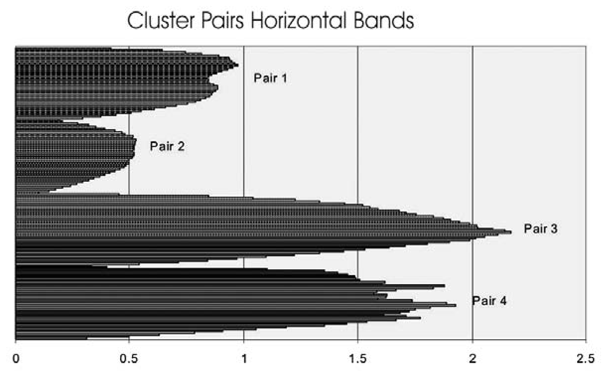
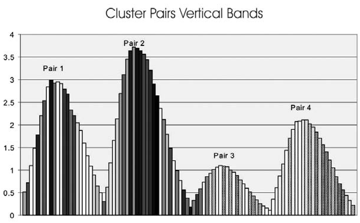
Figure 9.6 presents summary metric data for the cluster of typological categories seen to the right of center in the plot of canonical scores (see Figure 9.4). If the Triangle residual category were removed from this group, the similarities in overall outline shown in the columnar histograms of average vertical band areas would be striking. What all of these categories share is a basically triangular outline with no side- notching. The bar charts of horizontal band areas show more variation, indicating why the groups remain distinct in the Discriminant Analysis. The differences are in the treatment of the point bases, with weak or absent basal notching on the Mesilla and Cameron points and strong basal notching on Soto and Lott, giving these points their characteristic “Eiffel Tower” shape. Lott points tend to be strongly serrated and Soto points do not, pulling these types apart.
Figure 9.7 presents summary metric data for the points that are not as distinct as those in Figure 9.5 but still do not appear to be part of any cluster. Clearly the stemmed points form the most distinct group shown here. Stemmed points are a fundamentally different approach to hafting that Mallouf (1987:61) has suggested may result from use with a cane foreshaft, while the other hafting methods in the study sample are more appropriate for hardwood foreshafts. The three types are all small categories, and small numbers may account for much of their apparent distinctiveness. That noted, and in a focus on the bar charts of average horizontal band area, the remaining categories look generally similar, indicating a common approach to hafting. Each of the categories consists of points that are moderately to strongly basally notched, without side- notching. The final figure (Figure 9.8) shows the pairing of Basal-notched and Toyah points. The strong similarity in the bar charts reflects the fact that Toyah is a basally notched type but with strong side-notching. The irregularities in the histogram for the Basal-notched category reflect the fact that this group is a true residual in comparison to the other points with basal notches.
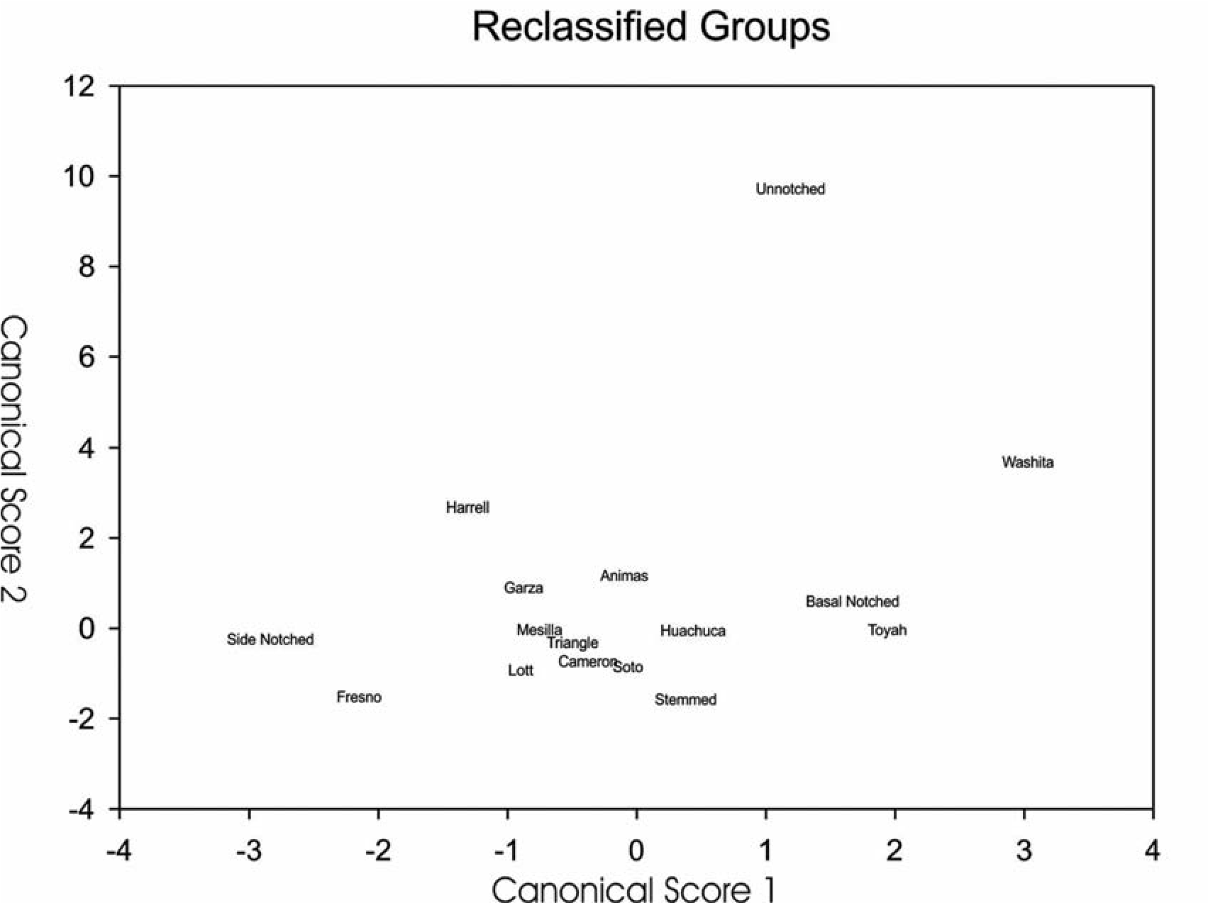
After the metric data have been sliced, diced, examined, and regrouped in light of traditional typological categories, clearly the categories track metrically defined shapes but do so imperfectly. It also seems that some of the groups are more closely related than others, perhaps indicating learning traditions that interacted without complete sharing. It would seem that shared learning relates mainly to alternative hafting methods since the typological categories do not correspond closely to differences in the fundamental function of arrowheads as broadheads or bodkins.
In light of the discussion of “style” presented above, especially Wiesner’s study of arrowhead production among the San, it seems reasonable to assert that the typological categories into which Seymour sorted the points correspond to differing ways of solving the basic problems of providing arrows with a sharp point and attaching that point to the arrow shaft. Of course, as every typologist knows, the categories are reasonably clear at the center but fuzzy at the edges, whether the boundaries are defined by an expert applying type descriptions or a computer program seeking communalities. Nevertheless, the logical extension of the results is a set of working hypotheses that the point types correspond to discrete interacting communities of people who lived just before and after Spaniards intruded on their world.
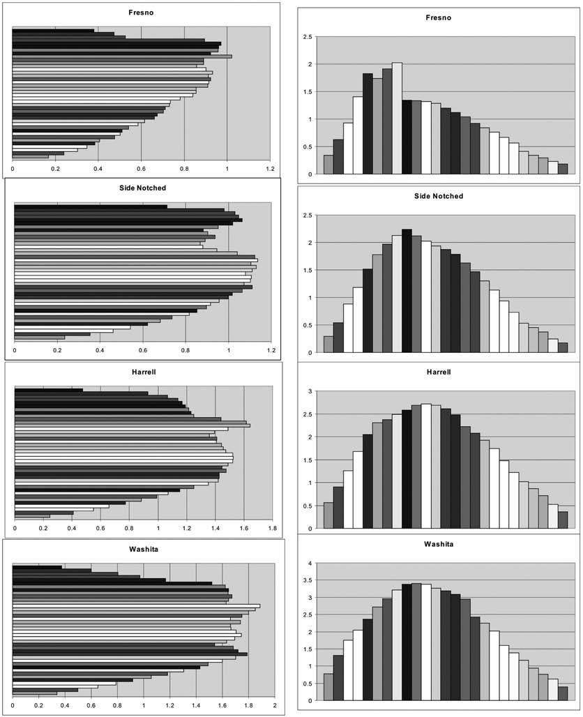
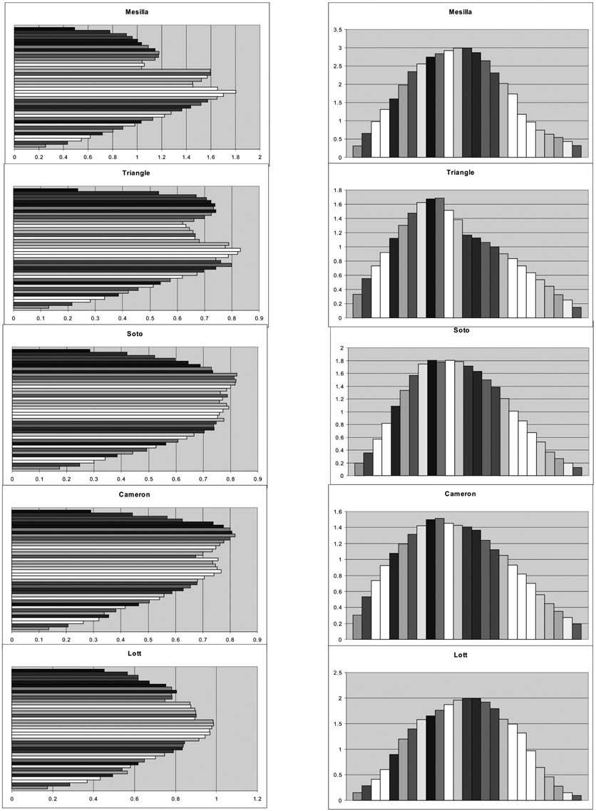
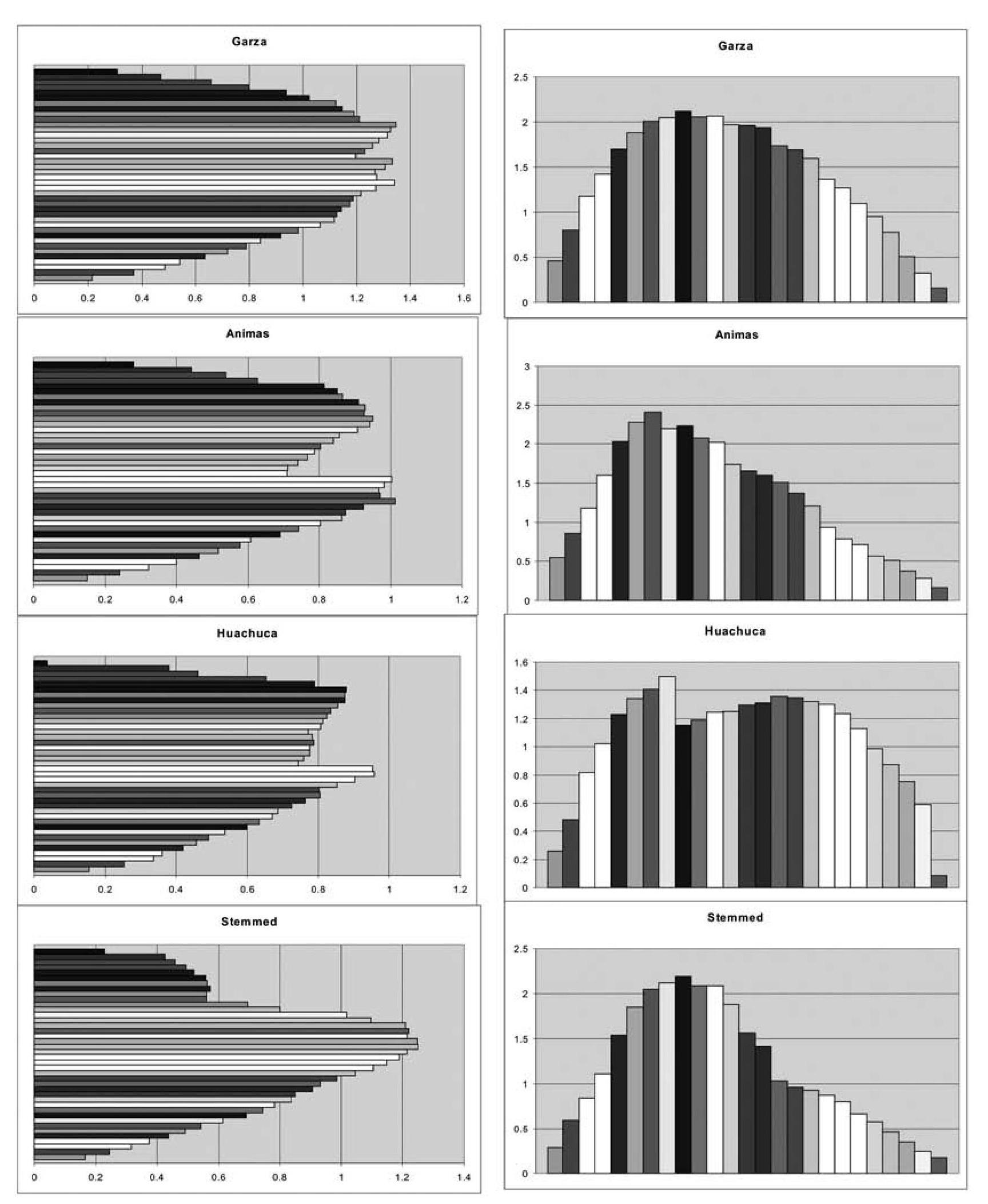
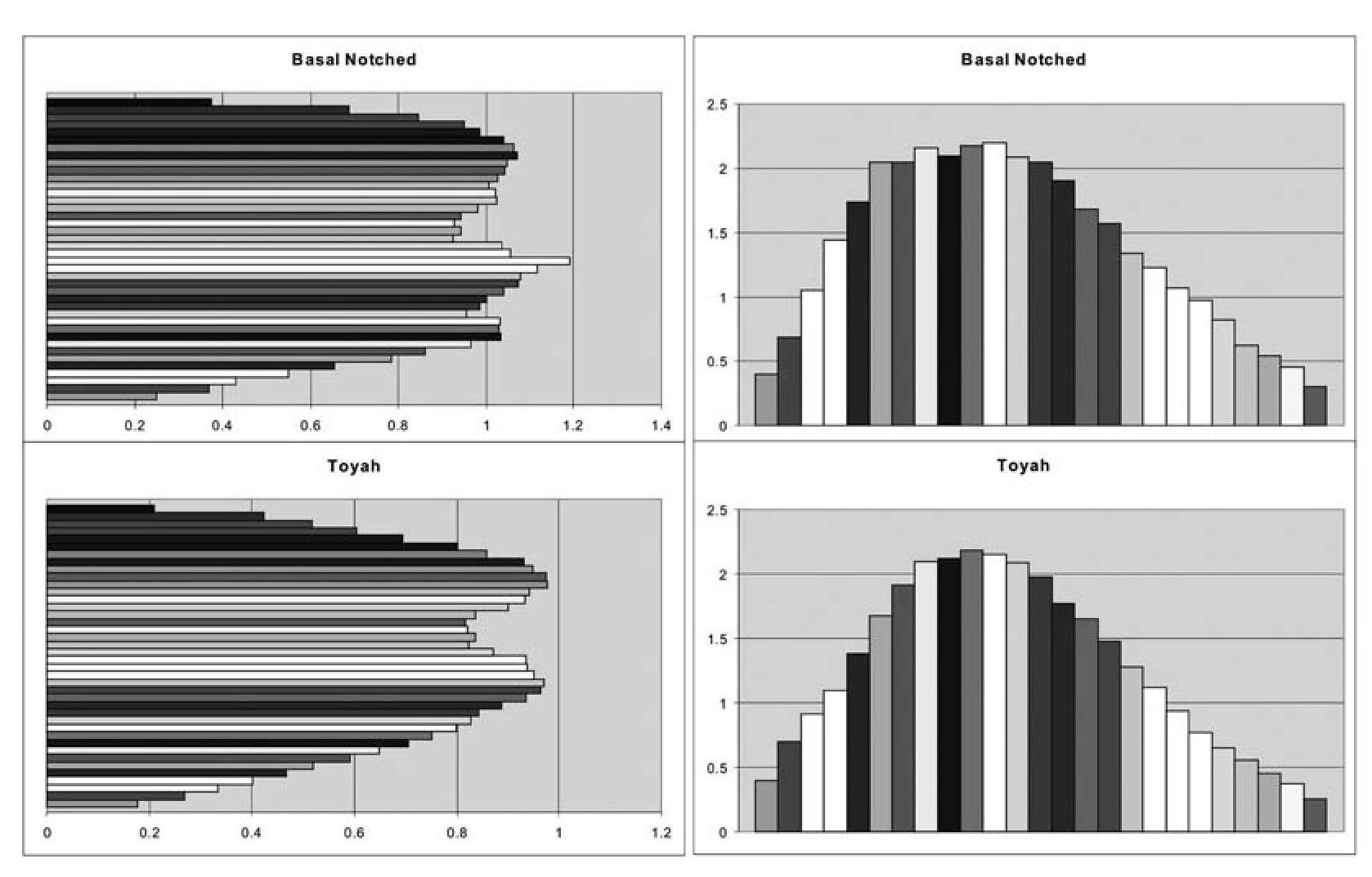
This assertion would, of course, create a correspondence between point types and people, a form that many archaeologists have been trained to reject out of hand as mere speculation. There are two reasons for rejecting that rejection. The first is logical. Readers still following the exegesis at this point likely have some basic grounding in statistical analysis and so are trained to avoid Type I error, accepting an untrue hypothesis on the basis of associations that are not sufficiently significant. Abhorrence of Type I error is not confined to the world of statistical analysis. Archaeologists are taught never to accept an apparent association, like that between projectile point types and the people who produced them, unless given an iron-clad argument based on irrefutable for the arrowhead categories that are paired in the evidence that those particular people really did make those specific points, and they are willing to accept a single point found out place as all the proof needed to reject an association based on otherwise compelling evidence.
This approach creates its own set of problems. Avoiding Type I error can doom us to continually committing Type II error, rejecting potentially useful hypotheses on the basis of limited incongruities or unclear patterning, then moving off to other investigations that provide greater certainty but often yield trivial results. The present extended discussion of arrowhead variability examined through neutral approaches to shape and without assumptions about which variability should receive a priori privilege is sufficient basis to proceed to the next step in the analysis. This step is to consider the possibility that the arrowhead types defined for the Protohistoric, with suitable refinements, may provide information on the emergence, distribution, and interaction of the human communities whose lives constitute the history of the period. The potential rewards are considerable, since we might then be able to trace the movements of peoples during the critical time period leading up to European contact. Such studies could also help to unravel the identities of some of the “historic” peoples mentioned in the sources but not really documented by them. With this background, the discussion passes over to actual speculation to suggest some areas for additional research.
Where Next?
Having just asserted a basis for using point types as possible indicators of membership in ethnic groups and other communities that shared common traditions, I leave investigation of the details to future studies and other investigators, preferring to spend my speculative dime considering the design function of the bow-and- arrow weapons system and the implications of its heightened importance in the Protohistoric. Starting where little controversy should exist, it is almost certain the system was adopted for its advantages in two key activities, hunting and warfare. Given that earlier prehistoric peoples also hunted and probably were not fundamentally less prone to armed conflict than people in the Protohistoric, we may wonder why the bow- and-arrow system assumed greater importance at that time.
In the area of hunting, the potentially increased importance of bison has not gone unnoticed by other investigators and seems a reasonable basis for greater use of the bow and arrow. Small game in the size range of squirrels and especially rabbits can be easily taken with snares and throwing sticks. Faunal remains from the Archaic forward attest to the success of rabbit hunting without use of the bow and arrow. Deer would be better candidates for bow hunting, but as all deer hunters know, the best bet is a good blind near a watering point or on the edge of meadow with good browse. It is not unreasonable to believe that hunters employing the dart and atlatl successfully hunted deer and other medium-sized, relatively thin-skinned game, again as well attested by faunal remains in the archaeological record.
Bison are another matter entirely. First, because they are thick-skinned, a spear, even assisted by an atlatl, would be less effective in taking them down, unless employed at close range (Butler 1975:109). More importantly, they are dangerous, and engagement from a distance is a desirable alternative. The bow-and-arrow weapons system solves both problems. It offers both higher velocity and greater range, providing the opportunity to inflict a potentially fatal wound on these large animals at distances that do not endanger the hunter.
Armed conflict is an even clearer venue for the advantages of the bow-and-arrow system. As historically documented to heart-wrenching effect, the availability of projectile-launching systems that send out their lethal messengers at higher velocities, to greater ranges, and at higher rates of delivery makes it exponentially easier to defend fixed positions—say, for example, one’s adobe-walled habitation. On the other side of a violent equation, suppressive fire against those fixed positions calls for attackers with equally effective projectile weapons. When the object of violence was theft rather than conquest, the bow and arrow would have been an effective deterrent. The wickedly serrated points that appear during the Protohistoric, especially those that narrow at the haft, would have been capable of causing discomfort, debilitation, and possibly death weeks after the wound was inflicted. This potential may have made communities with a reputation for effective archery less desirable targets.
Like the investigation of associations between projectile point types and the groups that produced the points, consideration of the changing exigencies that led to greater use of the bow-and-arrow weapons system has the potential to help us understand the key set of changed conditions that followed the fall of the Southwestern great cultures and preceded the arrival of European invaders. Clearly, profound changes occurred. The possibility that the sedentary folks who have always been our focus were not at the center of a changing world is worth looking into. I, for one, would really like to know who made these arrowheads and why they felt the need for a more effective weapons system.
[[Notes]]
This chapter was presented at the 2006 Mogollon Conference and has been online in the interim.
10. Akimel O’odham and Apache Projectile Point Design
Chris Loendorf
In contrast to the prehistoric periods and phases, the Protohistoric period is defined on the basis of external events rather than changes observed in the material culture of southern Arizona, and there is little reason to expect that variation in indigenous artifacts should closely coincide with either the beginning or the end of this period. As a result, the Protohistoric period remains poorly defined in the Akimel Oodham core area within the Phoenix Basin of southern Arizona, and this chapter explores a different methodological approach for identifying temporal variation in indigenous assemblages. Specifically, this discussion considers the hypothesis that flaked- stone arrow points generally decreased in size over time, and as a consequence, variation in point weight can be employed to estimate relative age (cf. Shott 1996). Archaeologists have long recognized that spear and atlatl points are generally larger than arrow points, and size has been widely employed to separate these types (Erlandson et al. 2014; Hildebrandt and King 2012; Thomas 1978; Shott 1993, 1996, 1997; Walde 2014). However, previous investigators have largely not considered the weight of these artifacts, and the focus of this research has been on technological rather than temporal variation. Archaeologists have also devoted less attention to continuous variation within technological types, such as the bow and arrow, and the temporal implications of this patterning (though see Shott 1996).
Vectored change in flaked-stone point weight is argued here to be related to changes in launching mechanism design that increased the maximum attainable projectile velocity. I maintain that projectile mass was minimized in order to maximize velocity, and because of improvements in delivery systems, flaked-stone projectile points generally became lighter through time (Loendorf 2012). A case study is presented that tests this hypothesis using Classic and Historic period arrow points from the Gila River Indian Community (GRIC), which is home to the Akimel Oodham (i.e., Pima). These analyses suggest it is possible to identify temporal variation in artifact assemblages using arrow point weight as a discriminating variable.
Setting and Data Set
The GRIC borders Phoenix, which is now one of largest cities in the United States (Figure 10.1). In contrast to most other Native Americans who lived close to major centers of Euroamerican settlement, the Akimel Oodham managed to retain a comparatively large fragment of their Historic territory, which consequently encompasses a wealth of the archaeological data that are their heritage. Compared with the surrounding urban sprawl, economic underdevelopment of the community has left its archaeological remains relatively untouched. The following analyses employ Pima-Maricopa Irrigation Project (P-MIP) flaked-stone point data, which were collected from the middle Gila portion of the Hohokam core area in the Phoenix Basin (Loendorf and Rice 2004). As part of long-awaited economic redevelopment, the P-MIP, funded by the Bureau of Reclamation, is designed to bring water to the many long-dormant agricultural fields in the community. In advance of construction, the GRIC-Cultural Resource Management Program (GRIC-CRMP) conducted full-coverage survey of over 525 km2 of the community, where archaeological remains were identified in a range of geophysical settings from the uplands to the lower river terraces (Loendorf 2012; Ravesloot and Waters 2004; Waters and Ravesloot 2000; Ravesloot 2007; Wells 2006; Woodson 2010). Projectile point data employed in this research, including images of all points in the P-MIP survey collection, can be found in Loendorf and Rice (2004).
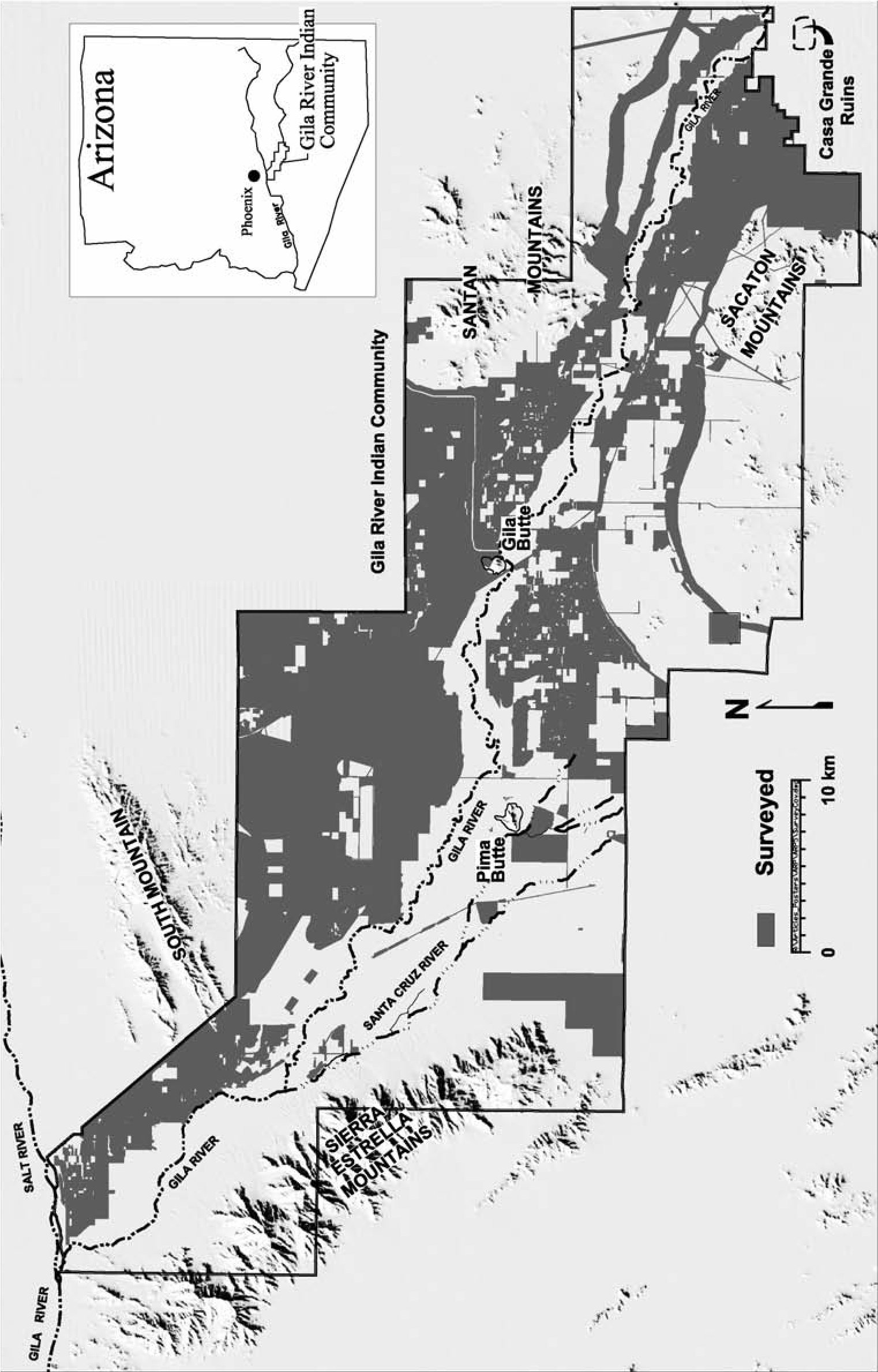
Flaked-Stone Projectile Point Design
Contrary to a common assumption, a stone projectile tip is not necessary to “balance” the shaft. As is considered in greater detail below, the inertia of a dense point actually destabilizes an elongated projectile during rapid acceleration from the opposite end, as occurs during the launching of an atlatl dart or an arrow from a bow. Ethnographic observations, including those of Akimel Oodham practices, indicate that projectiles frequently lacked stone points, and instead, organic tips such as bone, antler, or wood were commonly employed (Mason 1894). In a cross-cultural review of over 100 societies, Ellis (1997) found that different types of projectile tips were used for separate purposes. Stone projectile points were nearly invariably associated with hunting large game animals (>40 kg) and/or warfare, while organic points were generally employed to hunt small game (<40 kg).
These data indicate that stone projectile points were used for a small subset of all projectiles tasks (i.e., large game hunting or warfare), and the following discussion focuses on performance limits that are common to both practices. Certain design constraints for these two activities, however, are expected to differ in ways that may affect point design (Ahler 1992:46–47; Harlan 2006, Chapter 9 this volume; Loendorf 2012; Loendorf et al. 2015). Before discussing physical constraints on point design, I present additional details regarding Akimel Oodham projectile technology.
Akimel O’odham Projectile Points
The Akimel Oodham living along the middle Gila River possessed few firearms until near the end of the nineteenth century (Ezell 1994:346), and stone points continued to be used until the late 1800s (Russell 1908:111). They only rarely hunted large game (Ezell 1961; Russell 1908:9596; Rea 2007:72; Whittemore 1898). Instead, they primarily hunted locally available small game, and the arrows they used for this purpose lacked stone tips. However, flaked-stone stone tips were attached to arrows intended for use in warfare (Bancroft 1886; Ezell 1961:65; Grossman 1873; Hodge 1910a; Mason 1894; Rea 2007:81). For example, in 1873 Grossman stated:
The only weapons used by the Pimas before the introduction of fire-arms were the bow and arrow and war-club. For defensive purposes they carried a round shield, about two feet in diameter, made of rawhide, which, when thoroughly dry, becomes so hard that an arrow, even if sent by a powerful enemy at a short distance, cannot penetrate it. These weapons are still used by them to a great extent, and, like all Indians, they are good marksmen with the bow, shooting birds on the wing and fishes while swimming in the shallow waters of the Gila River. For hunting fishes and small game they use arrows without hard points, but the arrows used in battle have sharp, two-edged points made of flint, glass, or iron. (Grossman 1873:416)
In addition to differences in the arrow points, the Akimel Oodham used separate bow designs for small game hunting and warfare. Self-bows were used with arrows that lacked stone points for small game hunting, while recurve bows that are capable of higher arrow velocities were employed for warfare. Akimel Oodham arrows generally had solid shafts made from arrow- weed, whereas the Apache usually employed cane shafts (Bourke 1890; Coues 1866:351; Mason 1894:668–669; Russell 1908:96; Spier 1933). Bourke (1890:58) suggested the Apache design was superior:
“The Apaches have a myth which states that they overcame all of the tribes in their path because the god, To-va-dis-chinni (‘The Mist Rising from the Water’), placed them in a reed swamp and gave them pieces of obsidian as tips for their arrows. When read between the lines this myth relates an important truth: The Apaches did subdue or drive the other tribes before them on account of having better arrows”
Projectile Point Design Physical Constraints
The following discussion considers point variation from an etic design perspective, which posits that highly shaped artifacts, such as projectile points, were intentionally produced for the purpose of performing one or more specific tasks. The design process is limited by available materials and known manufacturing techniques, while the performance of projectiles is constrained by the laws of physics. The latter are employed in the subsequent discussion to suggest cross-cultural regularities of the point design process. Although the designers of these weapons may have had a different understanding of the physics principles underlying this discussion, they were fully capable of evaluating what performed better even if they explained why this was the case differently. This difference is irrelevant, however, as the goal of this section is only to provide a modern scientific perspective on constraining factors for projectile point design.
Christenson (1997) argued that penetration (i.e., depth) and wound size (i.e., diameter) are the two most critical aspects of stone projectile point performance (see also Vanpool 2003:123). He maintained that wound size is principally related to point width. Penetration, however, is more important than width because the victim of a large but shallow wound is more likely to survive than one that receives even small wounds to critical internal organs, especially the heart and lungs (Bill 1862:385; Milner 2005). The most efficient and rapid way to kill any large animal with a projectile is to completely penetrate both lungs and the heart. Even a puncture to a single lung is likely to cause death through suffocation; this area is a larger target than the head or neck and is encased by less bone. This vital area, however, is still protected by the rib cage, a potentially effective barrier, and the shot requires passing through or between the ribs (Stevens 1870:564). Flaked points must necessarily be made from brittle stone that readily fractures on impact (this is how points are manufactured), and wider points are more likely to hit the ribs and shatter, resulting in a wide but shallow and non-life-threatening wound on the exterior of the rib cage (Bill 1882:104).
These two performance characteristics (wound width and penetration depth) are also inversely related such that all else being equal, projectiles with larger cutting diameters will not penetrate as deeply (Nelson 1997:377; Pope 2000: 43). Because of the greater importance of penetration, it is likely that the cutting diameter was compromised in favor of penetration for stone projectile tips. The precise nature of this relationship, however, differs for projectile points made from metal, which has different performance characteristics than stone.
Penetration is the product of kinetic energy (i.e., impact force), sectional density (i.e., point cross section), and projectile geometry, including edge sharpness (cf. Christenson 1997:137; Kooi 1983:24; Loendorf 2012; Vanpool 2003). Kinetic energy is a fundamental factor because without sufficient force a projectile will not penetrate regardless of how sharp it is or the nature of the cross section. The kinetic energy of a projectile is a function of its mass and velocity. When used with a bow of a fixed propulsive force, heavier arrows have greater energy because, as Newton’s laws of motion inform us, for every action there is an equal and opposite reaction—consequently more energy is transferred to heavier projectiles during launch (Baker 2001:107; Cotterell and Kamminga 1992:33–35; Klopsteg 1993; Kooi 1983: 28; Vanpool 2003:162). Not only does a heavier arrow have more kinetic energy when launched, it also decelerates at a slower rate (Kooi 1983:69; Vanpool 2003:122). Therefore, a heavier arrow begins with more kinetic energy and retains a higher percentage of its impact force downrange. On the other hand, because they have lower inertia, lighter projectiles will leave the launching mechanism at higher velocities than heavier projectiles (Baker 2001:107; Cotterell and Kam- minga 1992; Kooi 1983:28; Vanpool 2003:122).
Increasing the velocity of projectiles has important performance advantages. First, higher velocities allow greater range (Klopsteg 1993; Vanpool 2003:119; Ratzat 1999). Excluding friction, this is because projectiles begin to fall, accelerated by gravity at the same rate, as soon as they leave the launching mechanism, regardless of their speed. Consequently, the greater the velocity the longer the forward distance a projectile will travel before hitting the ground. Second, higher velocities allow increased accuracy because it is possible to aim more directly at targets, which is colloquially referred to as “flatshooting” (Cotterell and Kamminga 1992; Klop- steg 1993:14; Kooi 1983:24). The lower the velocity the greater the necessity to aim above a target at a given range (the maximum distance occurs at approximately a 45-degree angle above the target; Cotterell and Kamminga 1992:162–163). For the same reason, low-velocity projectiles also require greater accuracy in target distance estimation and control over projectile speed in order to determine precisely how far above the target to aim (Klopsteg 1993:24). Third, the higher the velocity the less time will elapse between launching the projectile and its impact with the target. This makes hitting moving targets easier and allows less time for an intended target to avoid the projectile. The fundamental advantages of higher projectile speed, particularly for warfare, placed a premium on the design and/or adoption of higher-velocity delivery mechanisms through time.
The mass of stone tips attached to elongated projectiles is also constrained by the acceleration method employed to launch the missile. Hand- thrown spears are held closer to the center of mass (i.e., balance point) during launch, while both atlatl darts and arrows are launched by accelerating the distal end, which creates different constraints on the distribution of mass for these projectiles. For example, when an arrow is launched from a bow, the nock (i.e., notch for the bowstring) is accelerated before the tip. The greater velocity of the nock, when combined with the inertia of a tip of higher density than the shaft and on its opposite end, tends to spin the distal portion of the projectile forward (Ratzat 1999:201). A heavy point also increases stresses that occur in the shaft when rapidly accelerated from the opposite end, which can result in “fishtailing” of the projectile or even shatter the shaft if severe (Klopsteg 1993:22; Ratzat 1999:200). Fletching (e.g., feathers) near the nock slows this end of the shaft and helps counteract these forces (Ratzat 1999:201). Fletching, however, is the primary source of drag that slows the projectile after launch, which would result in unacceptable performance even if large fletching and a massive shaft were used in an attempt to compensate for a heavy arrow or atlatl tip (Klopsteg 1993:22–23; Ratzat 1999).
Diachronic changes in launching technology also suggest that the range of acceptable variation among projectile tips became increasingly constrained through time. The thrower receives feedback during launching both spears and atlatl darts that within certain limits allows compensation for differences in the mass of individual projectiles. In contrast, once an arrow is released, it is not possible to alter the rate of acceleration, and projectiles of varying mass will have different points of impact (Klopsteg 1993:11–22; Mason 1894:660). Consequently, reworking broken points is less likely to have occurred for arrow tips but may more commonly have happened with atlatl dart and especially spear points (Flenniken and Raymond 1986; Hoffman 1985). In addition, the comparatively small size of the arrow points considered here limits the extent to which fragmented portions could be maintained or reused for other tasks.
Projectile Point Design Summary
Flaked-stone projectile points were designed exclusively for large game hunting or warfare. The most important performance characteristic for projectiles is the kinetic energy of the weapon. Effective projectile design is consequently a trade-off between mass and velocity. Because potential velocity is constrained by the launching mechanism technology (e.g., arm, atlatl, bow, or firearm), prehistoric projectiles were designed to have only sufficient mass for the level of kinetic energy necessary to effectively penetrate the large game or human targets for which they were intended. Because projectile mass was minimized in order to maximize velocity, and as a consequence of improvements in delivery systems, flaked-stone projectile points generally became smaller through time.
Both refinements within existing technologies (e.g., atlatl length, flexibility, and weight placement) and more dramatic alterations to design such as the introduction of the bow and arrow can increase the maximum attainable projectile velocity, which theoretically should be associated with concurrent decreases in stone projectile point size. Developments of the former type should result in incremental modifications to point design while changes of the latter variety must be associated with substantial alterations. Hypothetically, these changes are expected to produce a kind of “punctuated equilibrium” in point design, in which long periods of gradual decrease are interspersed by comparatively short periods of more dramatic change to design. Diachronic changes in launching technology also suggest that the parameters for acceptable projectile tip mass variation became increasingly constrained through time.
Many aspects of bow design can be altered to incrementally or more substantially increase potential arrow velocities (Cotterell and Kam- minga 1992:180–186; Baker 2001; Hamm 1991; Heath 2001; Laubin and Laubin 1980; LeBlanc 1999; Klopsteg 1993; Kooi 1983; Vanpool 2003: 151–162). The more rapidly a bow springs back to shape when the string is released, the faster the arrow will be propelled (Baker 2001; Klopsteg 1993). The speed that the bow snaps back is related to draw weight (i.e., how much energy is required to deform the bow from its resting state), characteristics of the bow limbs, the nature of the string, and other factors (Heath 2001; Klopsteg 1993). Bow design changes that will increase recovery speed can occur within types, as well as between designs (e.g., self-bow, recurve bow, composite bow). For example, the limbs of self-bows can be tapered to decrease the mass at the tips and thereby reduce their inertia and increase bow performance (Baker 2001:109). The species of wood and/or other materials the bow is made from (e.g., bone, horn, sinew), bow length, portion of tree used (e.g., heartwood and/or sapwood), the diameter of the tree the bow is cut from, length-to-width ratio of the bow, cross-section shape of the bow stave, string material (e.g., plant fiber or sinew), and additional factors can all be modified to increase recovery speeds (Baker 2001; Cotterell and Kam- minga 1992:185–187; Heath 2001; Klopsteg 1993). Such incremental changes are expected to be associated with gradual decreases in flaked-stone projectile point weight (Vanpool 2003:162–163). The next section summarizes one of the more dramatic changes to propulsive designs in the Southwest, a change that increased the velocity at which arrows could be launched.
Recurve Bow Technology
The possibility that Protohistoric and Historic period points are generally smaller than Classic period artifacts is consistent with evidence that recurve bow designs, which increased potential arrow velocities, were introduced during the Classic period. LeBlanc (1999:99–100) argued that arrows fired from recurve bows are 25 to 50 percent faster than arrows shot from self-bows. Empirical data provided by Baker (2001:108) shows a nearly 20 percent increase in arrow velocity for a recurve bow design, and Cotterell and Kamminga (1992:185) suggested these bows can “store 50% more energy than a simple longbow [i.e., self-bow] of the same weight.”
LeBlanc (1999) reviewed bows recovered from dry caves and depictions on pottery, as well as kiva mural images, and he concluded that the recurve bow was introduced to the Southwest somewhere between ad 1200 and 1450. However, according to Schaafsma (2000:48), “the recurve bow, which may have been sinew backed, does not appear in the art before the fourteenth century.” Although LeBlanc suggested that sinew-backing and recurving almost always co-occur in the Southwest, Schaafsma (2000:48) maintained that Puebloan recurve bows are not sinew backed, nor are those made by the Akimel Oodham (Russell 1908:95; Rea 1998:74–76).
Baldwin (1997:4), who considered bows recovered from dry caves, pottery depictions, kiva murals, and petroglyphs, concluded, “Archaeological evidence documents the presence of only the self-bow in the Southwest before a.d. 1300.” Counter to Schaafsma (2000:48), Baldwin (1997:3) suggested that “ethnographic data show the sinew-backed bow to be limited in production and use to the Pueblo Indians, the Navaho, and the various Apache groups... and lacking among the Yuman-speakers and the Pimas and other Uto-Aztecan-speakers of Southern Arizona and northern Mexico.” Based on his analysis of the data, Baldwin (1997:7) suggested “that the appearance of ‘double-curved’ [i.e., recurve] bow forms in the depictions dating after a.d. 1300 is a symptom of the arrival of the sinew-backed bow technology.” Baldwin associated the introduction of this technology with the arrival of the Apache, which he places at around ad 1400 in the Pueblo area. LeBlanc (1999:102) argued that “the arrival of the Athapaskans appears to have been too late for them to have been vectors” for the introduction of the technology. However, LeBlanc did not cite any evidence regarding when Athapaskans first appeared in the region, and the date range he suggested for the introduction of recurve bow technology overlaps Baldwin’s interpretation of the data. While previous researchers have generally argued that the Apache did not enter southern Arizona until after the end of the Classic period around roughly ad 1450 (e.g., Doyel 1978; Hodge 1895; Pinter and Stokes 2009; Whittlesey et al. 1997), Seymour (2008a, 2011a:74, 2013a; Chapter 17, this volume) concludes, based on her own research and a comprehensive review of archaeological, ethnographic, and ethnohistoric information, that “proto-Apache” were present in southern Arizona as early as the ad 1300s. For example, Apache oral traditions describe their arrival before the abandonment of the Classic period sites in the Tonto Basin and elsewhere (Goodwin 1942). One story refers to a time when adobe dwellings in the Tonto Basin were still inhabited by a people the Apache referred to as the Saikine (Sand House People). Initially some Apache peacefully settled in the area and lived nearby, but conflict soon arose. As a result of the fighting, the Saikine were forced to abandon the area and move to the Phoenix Basin (Goodwin 1942:64). Akimel Oodham oral traditions also indicate they interacted with the Apache during the Classic period. Their creation story says that Elder Brother created the Apache at the same time he re-created people after a catastrophic flood and before the conquest of the Classic platform mound sites (Bahr et al. 1994; Russell 1908: 206–230). One version says that conflict between the Apache and Akimel Oodham was instigated by Earth Doctor, Elder Brother, and Coyote because people were multiplying too rapidly; in order to control the population growth, they “caused a quarrel between an Apache child and a Pima child, and the Apache child cried and came to its mother. She was angry and whipped the Pima child. Then the Pima mother fought the Apache mother, and the Pima father came to help her, and the Apache father came and fought also. So there was a fight between the Apaches and the Pimas, and Earth Doctor taught the Apaches to live on the north side of the Gila Valley” (Bahr 2001:20–24).
Earth Doctor gave the Apache and Akimel Oodham weapons to fight with, but he saw that the Apache arrows were too powerful, so he weakened them such that they were equal to the Akimel O’odham arrows (Bahr 2001:22). Further ethnographic evidence that the Apache introduced recurve bows was provided by one of Goodwin’s Apache informants, who said, “The double arc bow [i.e., recurve] we had before the single arc bow [i.e., self-bow]” (Basso and Goodwin 2004:224).
The ad 1400 date suggested by Baldwin (1997) corresponds with Schaafsma’s (2000:48) argument for the introduction of recurve bows but postdates Seymour’s (2008a, 2011a; Chapters 1 and 17, this volume) data regarding the arrival of the Apache in southeastern Arizona and New Mexico. All three estimates place the introduction of this technology during the Classic period Hohokam sequence, between roughly ad 1300 to 1450. However, recurve bows did not fully replace self-bows, and both types continued to be employed by the Akimel Oodham in the late nineteenth century (Russell 1908). If recurve bows were indeed introduced by the Apache sometime during the Classic period, this suggests that a subsequent gradual decline in arrow point weights should have occurred. Because the design did not immediately replace earlier technologies, a long period of transition is expected when larger points designed for self-bows were replaced by smaller points intended for recurve bows. Therefore, transitional assemblages with a mixture of sizes are expected, and as recurve designs became more common because of their superior performance, the average weights for point assemblages are expected to have gradually declined over time.
Support for the possibility that the Akimel Oodham were emulating introduced designs is provided by differences in construction techniques among recurve bows in the Southwest, including the lack of sinew backing on the Akimel Oodham bows. If the Akimel Oodham copied the Apache design, then they would have gone through a period of experimentation during which they improved the performance of their own design. The effects of the lack of sinew backing on recurve bow performance are unclear. Spier (1933:132) suggested that the Piipaash (i.e., Maricopa) used both sinew-backed and self-bows in the nineteenth century, and his informants said that sinew-backed bows did not draw harder or give more penetration than bows that lacked sinew. Similarly, experiments done by Pope (2000:68–69) suggested that sinew backing had little effect on arrow cast and instead primarily prevented the bow from breaking (see also Baugh 2001:117; Heath 2001:106; Laubin and Laubin 1980:53–72). Hamm (1991:49–51), however, argued that sinew backing makes the bow faster and the high tensile strength of the material prevents breakage of recurve bows resulting from the increased stress caused by curving the tips (see also Bergman and McEwen 1997). Without the sinew backing, it would have been necessary for the Akimel Oodham to carefully shape and cut bows such that the grain structure of the wood provided greater strength (Baugh 2001:117; Burch 2004:89–122; Eagle 1988; Hamm 1991:22–49; Heath 2001; Pope 2000:55–80), and this also may have slowed adoption of the technology.
The suggestion that recurve bows were introduced is also supported by a Tohono Oodham story recorded by Densmore (1929:59) regarding construction techniques for recurve bows. The story describes an interesting juxtaposition of roles:
[Coyote] went east, cut two [mulberry] saplings for the children and one for himself and brought them home. He threw down the two for the children and their mother pulled off the bark, curved them by the heat of the fire, and put strings on them, doing this at once. Coyote cleaned the wood of his tree nicely and bent his bow by leaning the tree against another tree so that when dry it would be in the proper form. The mother had used the whole tree except the rough outer bark but Coyote scraped off part of the wood on each side of his bow. He told the woman she was doing something that no one ever did and that his way was right.
Rea (1998:76) observed, “While Coyote is usually the paradigm of the bungler, in this case he is making the bow correctly, in contrast to the mother”
The next section presents historical descriptions of Akimel Oodham settlement locations that are employed to generate expectations for the distribution of Protohistoric and Historic period flaked-stone projectile points. These expectations are tested in the following analyses.
Akimel O’odham Historic Period Settlement Patterns
The Akimel Oodham did not experience intensive Colonial contact for most of the Historic period (Ezell 1994:319; Eiselt 2002:10). Initial historical documentation of the middle Gila River was not until ad 1694, and subsequent written records were sporadic and limited in scope until the arrival of Americans in the 1800s. Sufficient references exist, however, for us to make numerous inferences regarding Akimel Oodham settlement patterns and population movements between roughly ad 1700 and the time stone point manufacture ceased, sometime in the late nineteenth century (cf. Russell 1908:111).
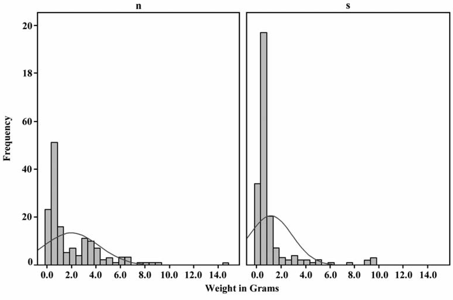
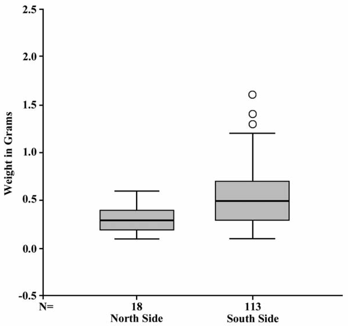
When missionaries first visited the Phoenix Basin in ad 1694, Akimel Oodham settlements were already largely located on the south side of the Gila River, and this continued until at least 1850 (Bolton 1948; Ezell 1983:151; Hackenberg 1974:236; Loendorf 2012; Russell 1908; Wells 2006:22–25; Wilson 2014). During the 1700s the occupied area along the middle Gila River contracted by at least half, and the Akimel Oodham concentrated their settlements in the Casa Blanca area on the south side of the Gila River. Akimel Oodham settlements had become the target of more frequent raiding by the Apache during this time (Ezell 1983; Ferguson and Colwell-Chanthaphonh 2006; Russell 1908; Wilson 2014). To defend against these constant threats, the Akimel Oodham adopted this denser settlement pattern, introduced mandatory military service for all males, and conducted punitive campaigns (Wilson 2014). By the mid-1800s, however, the Apache raiding began to abate and the Akimel Oodham returned to a more dispersed settlement pattern, and some communities moved to locations farther upstream to the east along the middle Gila or to the north along the Salt River (Ezell 1961; DeJong 2009; Loendorf 2012:57–60; Russell 1908:29–30; Shaw 1994: 58–65; Upham 1983:56–57; Wilson 2014; Wells 2006; Webb 1959:38).
Middle Gila Flaked-Stone Arrow Point Size
This section tests the hypothesis that arrow points generally became smaller through time through analyses of flaked-stone data from the middle Gila River (Loendorf and Rice 2004; Loendorf 2012). Because Historic period settlement was largely restricted to the south side of the middle Gila, it is expected that points from this time should be concentrated on that side of the river. Figure 10.2 compares weight by side of the Gila River for all 311 finished and unbroken projectile points in the GRIC collection, regardless of morphology. Projectile points from the south side are significantly lighter on average than projectile points from the north side (T-test p < 0.001, equal variances not assumed). This analysis involves the fewest assumptions and includes all points from throughout the archaeological sequence: spear, atlatl, and arrow points. Different patterning, however, is apparent if only points that were assigned Historic period types are considered, and all of the following analyses exclude large spear or atlatl tips (Loendorf and Rice 2004). The Akimel Oodham returned to a more dispersed settlement pattern after the arrival of Euroamericans in the mid-1800s, suggesting that Historic points found on the north side of the river should generally be most recent and therefore lighter than points from the south side. Within the artifacts classified as Historic points (Loendorf 2014), the data are consistent with the expectation that Historic points from the north side should generally be smaller because they are more recent than those from the south side (Figure 10.3; T-test p < 0.001, equal variances not assumed).
Another way to examine variability in Historic period projectile points is to examine patterning in surface collection data from a single site. The Sacate site (GR-909) is a Historic period Akimel Oodham village roughly 3 km long and 0.8 km wide that is located near the center of the modern GRIC, on the south side of the Gila River in the Casa Blanca area (Loendorf et al. 2013). Diagnostic artifacts from the site are almost exclusively from the Protohistoric or Historic periods, and the site was visited by the first Euroamericans who traveled to the Phoenix Basin (Loendorf et al. 2013). Sacate therefore provides an opportunity for us to consider diachronic variation in artifact collections that postdate the Classic period, when the recurve bow appears to have initially been introduced, in a context where earlier remains are largely not intermixed. Almost 100 arrow points were recovered from GR-909. These artifacts are almost exclusively small triangular forms that lack notching or serration (Figure 10.4).
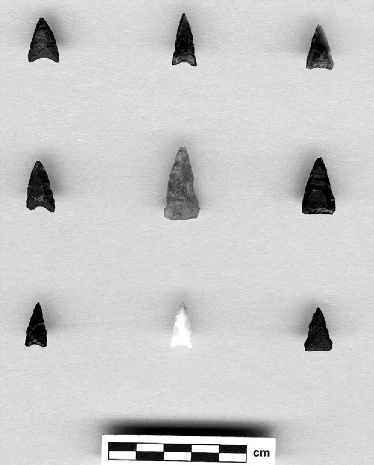
Darling (2011; see also Spier 1933; Seymour 1989, 2003a, 2011a) described a process whereby village locations drift over time, resulting in horizontal stratigraphy, and analyses of nonindigenous artifacts from Sacate support this model (Randolph et al. 2002:13). Non-indigenous artifact data suggest that the initial area of habitation at Sacate occurred in the central section of the site, and this portion of the site was occupied for the longest period of time (Figure 10.5). The area of occupation then extended to the east and west, in the locations designated the expansion segment on Figure 10.5. The most recent habitation occurred in the western portion of the site. Because Euroamerican goods were rare in the area until the mid-1800s, it is difficult to establish when the site was first occupied based on this evidence alone. The oldest non-indigenous artifacts were recovered from the central area and consist of one-piece metal buttons that were manufactured between ad 1750 and 1812. Other non-indigenous artifacts suggest the area was occupied through at least the late 1800s. In contrast to the central area, ki-kuh (traditional Akimel Oodham round houses) depressions are less common in the expansion area. A shift in structure types occurred in the late 1800s, but there is evidence that ki-kuh were used until at least the 1930s (Sayles 1938).
The low incidence of ki-kuh in the expansion area suggests it was first inhabited more recently than the central portion of the site. Non-indigenous artifacts from the expansion area include military buttons and black glass, one example of which has an “improved” pon- til scar, suggesting the area was used before the 1880s. The non-indigenous assemblage from the western area differs substantially from the assemblages collected from the rest of the site, and the percentage of glass and ceramics, as well as metal items, is higher, suggesting this area has the most recent occupation (Randolph et al. 2002). Shifts in the occupied area at the site appear to have resulted from historical and environmental events, including Apache raiding, movement of the Gila River channel, flooding episodes, and Euroamerican interactions (Randolph et al. 2002).
Figure 10.6 shows boxplots of weights for complete small projectile points by area of the site. The smallest points on average are from the western portion of the site, where the most recent occupation appears to have occurred, based on the non-indigenous artifact assemblage. Statistically significant differences exist between the western and central areas (T-test p = 0.002, equal variances not assumed), and the western and expansion portions (T-test p = 0.003, equal variances not assumed), but greater similarity exists between the central and expansion area point weights. These data suggest that a gradual decrease in the size of arrow points occurred over time during the Historic period, which is consistent with the development of improved bow designs.
Independent Age Estimates
The most rigorous way to test the arrow point size hypothesis is to compare projectile points from controlled contexts with independent age estimates. If the hypothesis that point size may decrease as a result of improvements in the performance of projectile delivery systems is correct, then this pattern should be widespread and also occur in other culture areas. Although he does not appear to have considered weight, Shott (1996) compared radiocarbon age estimates for occupational levels at seven Woodland and later sites in the American Bottom. These components ranged in age from 1620 bp to 883 bp. When ordered by site, the correlations between metric attributes and age ranged between 0.50 and 0.97. Based on his analysis of the data, Shott (1996:294–297) found that probable arrow tips decreased in size over time. Furthermore, he observed that “time-dependent trends in the size of probable arrows are found in other areas” For example, correlations between age estimate midpoints and metric attributes ranged between 0.36 and 0.72 for a collection of 126 points from southeastern Colorado (Owens et al. 2000:275281). Shott (1996) used optimal foraging theory to explain continuous variation in point size. He suggested, “If projectile length and shaft diameter must decline to achieve improvements in accuracy and range, then projectile point width, especially neck and base width, also should decline” (Shott 1996:301). The investigation described in this chapter suggests that weight is the best single metric measurement of the relationship between age and size. This discussion has also further explored the association between point size and performance.
Historic period Akimel Oodham habitation within the Phoenix Basin was largely restricted to the location of the modern GRIC, and until recently little research had been done in the area (Wells 2006; Loendorf et al. 2013). As a result, only one Historic period projectile point has been recovered from a controlled excavation context associated with an absolute age estimate (Woodson 2002). This projectile point was found in a nonthermal pit (Feature 58) at the Sweetwater site, and a thermoluminescence (TL) age estimate of 1808 ± 21 was obtained for a sherd in a deeper portion of the feature. One of the two coins found at the site was minted between 1832 and 1838 and was recovered from another pit (Feature 51) located 8 m south of Feature 58. A TL estimate of 1836 ± 49 was obtained for this feature, which falls within the range of manufacture for the coin. The weight of the point is .4 g, which is less than the average size for Classic period points from the GRIC (Loendorf 2012:92).
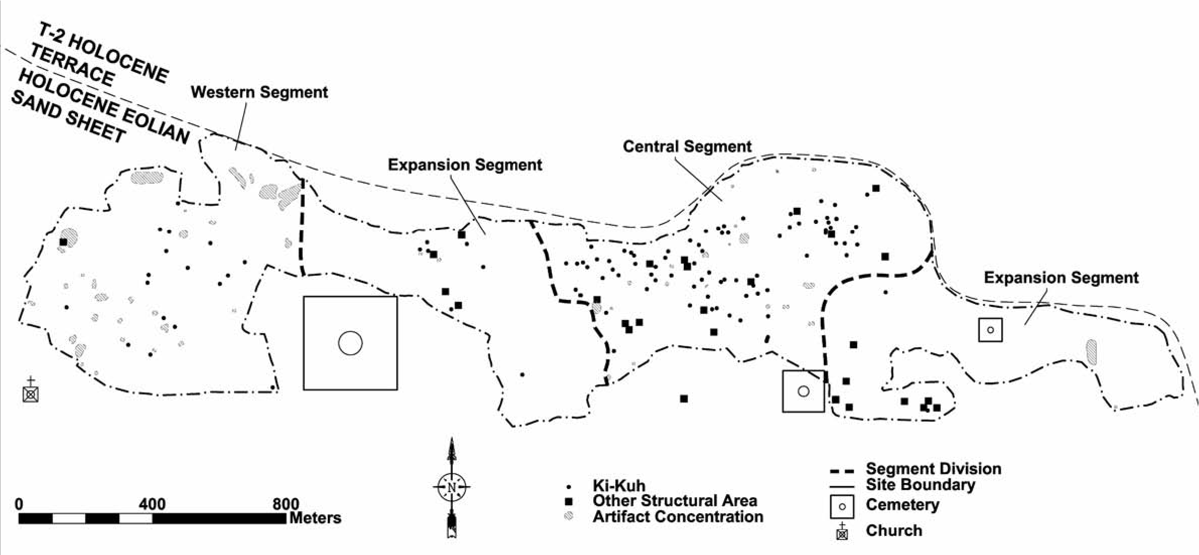
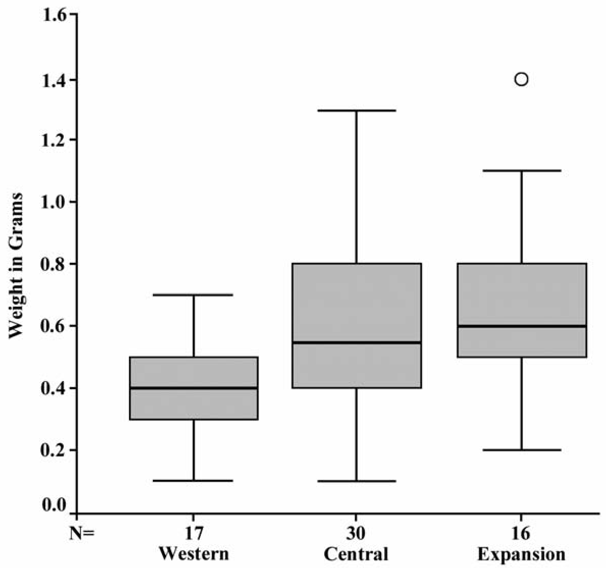
In order to increase the sample size, Figure 10.7 presents boxplots of weight for all complete points in the P-MIP surface collection that were assigned to Classic or Historic categories in the typology (see Loendorf and Rice 2004 for descriptions of the types). Although substantial overlap occurs, the Historic period artifacts are significantly lighter than Classic period point types (T-test p = 0.02, equal variances not assumed), which supports the suggestion that there was a tendency for arrow points to gradually decrease in size over time.
Previous researchers have also identified a tendency for arrow points from the Sonoran Desert to decline in weight over time (Bustoz et al. 2009; Craig 1992; Marshall 2001). For example, Craig (1992:231) found that the Classic period projectile points were lighter than earlier types, and they also generally have a lower size index (length x width/thickness), which he suggested was the result of “increased standardization or specialization during that time period” This chapter has presented the possibility that this general decrease in weight is the result of diachronic technological changes.
Point Weight Data Discussion
Analyses presented here support the suggestion that arrow points generally decreased in size over time as a result of improvements in bow design. At the same time, considerable overlap occurs among different contexts, and the weights for individual artifacts cannot be used alone to suggest temporal estimates. Furthermore, because culturally contingent technological factors caused the change in size over time, points are not expected to have decreased uniformly among different cultural areas, and any comparisons across technological traditions are expected to produce spurious results. For example, if the Apache did indeed introduce recurve bow technology, then it would be expected that they made smaller points earlier in time than existing Southwestern populations. As a result, smaller points should occur earlier within the areas they occupied.
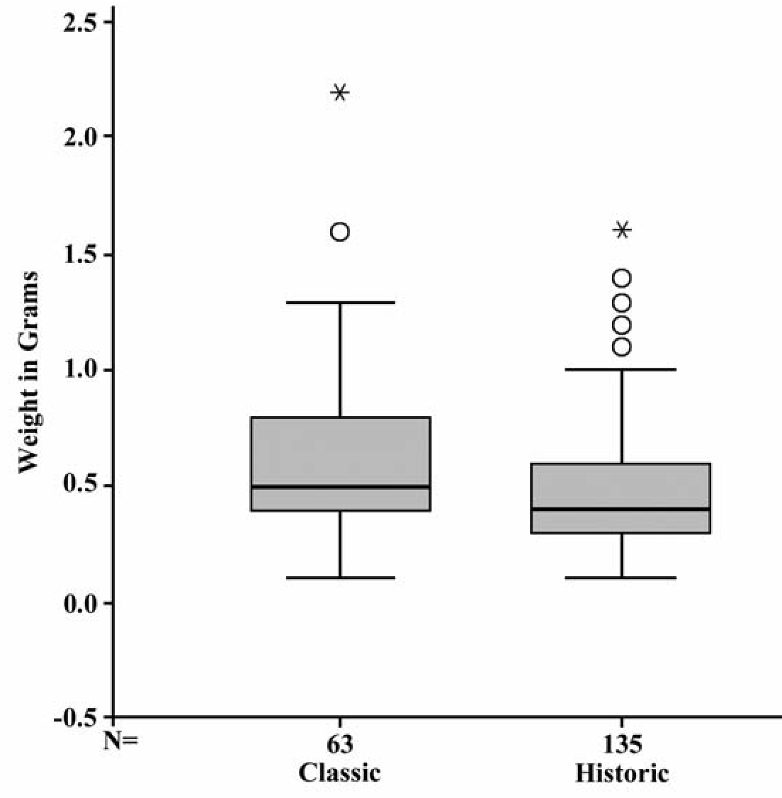
Conclusion
The successful design of flaked-stone projectile points has important consequences. Large game hunting requires considerable energy investment but offers substantial rewards. Successful performance is of an even greater concern in human conflict, where point designs are in direct competition with one another in a life- or-death struggle. These benefits from successful design, and more importantly the negative consequences for ineffectual design, combine to produce comparatively strict limits on variation. Research presented here suggests that weight can be employed to indicate the relative ages of Akimel Oodham arrow points, and the designers of these weapons appear to have exercised relatively precise control over this variable. One of the advantages of using point weight to suggest diachronic patterning is that this association can readily be tested using archaeological data. The use of weight data to estimate age is not a replacement for traditional typological analyses that are based on the morphology of points; instead, this approach complements these data. Archaeologists have developed middle-range theory linking point shape with cultural practices, and using size to suggest age simply offers a way to establish temporal control, which is especially important for regions where some simple shapes (e.g., isosceles triangular) were produced for thousands of years.
Several lines of evidence presented here suggest that the Apache introduced recurve bows into the southern Arizona and that the Oodham copied these designs. Both Akimel Oodham and Apache oral traditions say that the Apache moved into southern Arizona during the Classic period before ad 1450, and recent research suggests their arrival was closer to ad 1300 (Seymour 2008a, 2011a, 2011b, 2013a; Loendorf 2012). This possibility is also supported by obsidian source acquisition data that suggest access to northern and eastern obsidians was restricted by intervening Apache populations during the Classic period (Loendorf et al. 2013). Data presented here support the suggestion that the Apache
Note
This research is part of the Pima-Maricopa Irrigation Project, which is partially funded by the Department of the Interior, U.S. Bureau of Reclamation, under the Tribal Self-Governance Act of 1994 (P.L. 103–413). Comments provided by Keith Kintigh, Barbara Stark, J. Andrew Darling, David Jacobs, Larry Loendorf, introduced the recurve bow into the southern Arizona at this time. The increased arrow velocities that are possible with recurve bows appear to have resulted in a concurrent decrease in the mass of the stone projectile points that were employed on arrows. Even though the morphology of points remained similar over time (Loendorf 2012, 2014), this change in design allows assemblages of recent points to be recognized based on their small size.
Lorrie Lincoln-Babb, Ted Oliver, John Ravesloot, Glen Rice, Arleyn Simon, E. Christian Wells, M. Kyle Woodson, and Deni Seymour were essential for improving and clarifying this chapter. I thank Lynn Simon for drafting the figures.
11. Theoretical and Methodological Approaches to the Study of the Ceramics of Protohistoric Hunter-Gatherers
David V. Hill
Many of the Protohistoric and Historic native peoples in the southwestern United States and northern Mexico pursued nonsedentary or seasonally sedentary lifestyles. The production of ceramics and ceramic toolkits by mobile peoples differs from the production of ceramics by sedentary populations. While this statement may seem obvious, the typological approaches developed for use in dating and interpreting the lifestyles of sedentary populations in the American Southwest and elsewhere may not be applicable to understanding the production and use of pottery by mobile hunter-gatherers. The following presentation explores the differences in ceramics produced by sedentary and mobile peoples.
Ceramics in Sedentary and Mobile Societies
Sedentism plays a significant role in ceramic technology. The physical characteristics and availability of raw material, functional considerations, and labor investment affect the appearance and diversity of ceramic vessels. Among sedentary groups, different vessel forms were produced to suit various specialized functions. Besides cooking, in sedentary societies ceramic vessels could be used for storage, service, or other functions such as in ritual. In conjunction with the development of different functional classes of vessels, different sizes or types of aplastic materials were often added to ceramic clays to enhance various mechanical properties of those vessels, such as increased resistance to thermal shock or durability for frequently handled vessels and transport (Hill 1994; Mills 1984).
Sanitation and the accumulation of refuse present both a convenience and a health issue for sedentary peoples. Although sherds could be recycled into tools or ceramic temper, most broken pottery would have been cleaned up and deposited away from trafficked areas or formal trash disposal areas.
Among sedentary groups the surfaces of vessels would frequently be decorated. Decorative techniques often required the acquisition and preparation of exotic materials such as slip- clay and pigment. In the Mogollon area, interior smudging, a technique that served both utilitarian and decorative functions, required considerable skill on the part of the potter to control the firing environment and subsequent smudging process (Rogers 1980). To produce the smudged interior of Mogollon brownwares requires inverting a vessel while still hot from the fire or covering a pottery firing with a flammable material that will bond with the heated vessels. Maria Martinez and other Tewa potters used animal dung to create the proper firing environment to create their distinctive black pottery. Either of these processes could decrease the temperature of the hot vessel so quickly that the vessels could shatter from thermal shock.
Ceramics and ceramic assemblages produced by semi-sedentary peoples are quite different from those of mobile hunter-gatherers in terms of production, function, and discard. Hunter-gatherers who reside in environments with rich natural or cultural resources tend to be relatively more sedentary and produce a wider range of vessel forms than hunter-gatherers who are more mobile (Binford 1980; Kent 1992). For example, Seri potters produced both large vessels and small so-called eggshell jars that have been recovered from the extensive shell mounds of coastal Sonora (Bowen and Moser 1968). Some California pottery-making groups that reside in resource-rich areas produce ceramic vessels in multiple sizes and shapes in direct imitation of basket forms (Gayton 1929; Johnson 1990; Mack 1990). Yuman potters residing in relative permanence near the Spanish presidios in southern California and fed in part by the missions produced a wide range of vessel shapes, including vessel forms based on Spanish models (Rogers 1936).
Sites occupied during the mobile phase of semi-sedentary people would likely have a diversity of vessel forms and represent the remains of several vessels, reflecting the patterns of ceramic production and trade practiced during the groups’ more sedentary seasonal periods. Transport of ceramic vessels produced elsewhere and recovered from nonresidential sites may have paste compositions that do not reflect the local geological environment. These same assemblages may also contain ceramics that were produced elsewhere and acquired through trade or as gifts.
Ethnographic and archaeological studies indicate that ceramics used by mobile hunter- gatherers were produced primarily to simmer or boil food products to rehydrate and/or soften meat or seeds (Dean and Heath 1990; Linton 1944; Reid 1989). Boiling also releases nutrients in the foodstuffs (Dean and Heath 1990; Reid 1989, 1990). The results of these meals would have been shared by groups rather than individuals. Thus, the types of cuisine made available through boiling could have been shared by families or contributed to communal feasting (Hayden 1995; Jordan and Zvelebil 2009).
Ceramics produced by highly mobile hunter- gatherers are less well finished and likely to represent only a single formal class of vessel (Bright and Ugan 1999; Hoopes and Barnett 1995; Simms et al. 1997). However, the appearance of the ceramic vessels produced by mobile peoples is as much controlled by the properties of the materials that were used to form the vessels as by the efforts of the potter (Hill 2012b; Simms et al. 1997). As a consequence of mobility, and during the Historic period, ceramic clays or completed vessels recovered from hunter-gatherer sites could have been derived from distant sources by horse transport (Dean 1992; Eiselt 2004).
The number of ceramic vessels present at a mobile hunter-gatherer camp would most likely be small, possibly only one. Breakage and subsequent discard would result in only a few sherds being recovered from single-component occupations. Given the potential use for large sherds as tools, such as scoops for digging, containers for parching seeds, or clean surfaces, sites occupied by pottery-producing mobile hunter-gatherers could become at least partially depleted of ceramics.
Archaeological Examples of Ceramic Assemblages of Sedentary and Mobile Peoples
This section provides a series of archaeological examples comparing the production, use, and discard of ceramics by sedentary, semisedentary, and mobile peoples and illustrates that relative degrees of mobility even among hunter- gatherers is a significant contributor to ceramic variation. Western Mogollon residential sites dating between the first and fourth centuries ad and assumed to be more mobile than later ones are characterized by greater diversity and include plain brown and red-slipped ceramics (Berman 1978; Haury and Sayles 1947; LeBlanc 1982; Light- foot 1984; Wilson 1999). The plain brown and red-slipped vessels come in various sizes of jars, some of which resemble gourd shapes, seed jars (tecomates), and bowls that vary in size in early Mogollon ceramic assemblages (LeBlanc 1982:39). The diverse ceramic toolkit indicates not only a wide range of activities that include the use of ceramics but also a level of sedentism required by the storage of many different types of vessels. More vessels and a longer period of occupation result in a larger accumulation of trash (Kent 1992). Petrographic analysis of early brownware and redware ceramics from the Luna Project conducted in conjunction with resource surveys of local clay sources indicates that these ceramics were produced with locally available self-tempered clays (Hill 1999). The local acquisition of these clays is consistent with what Arnold has argued for more sedentary peoples across the world (Arnold 1985:49).
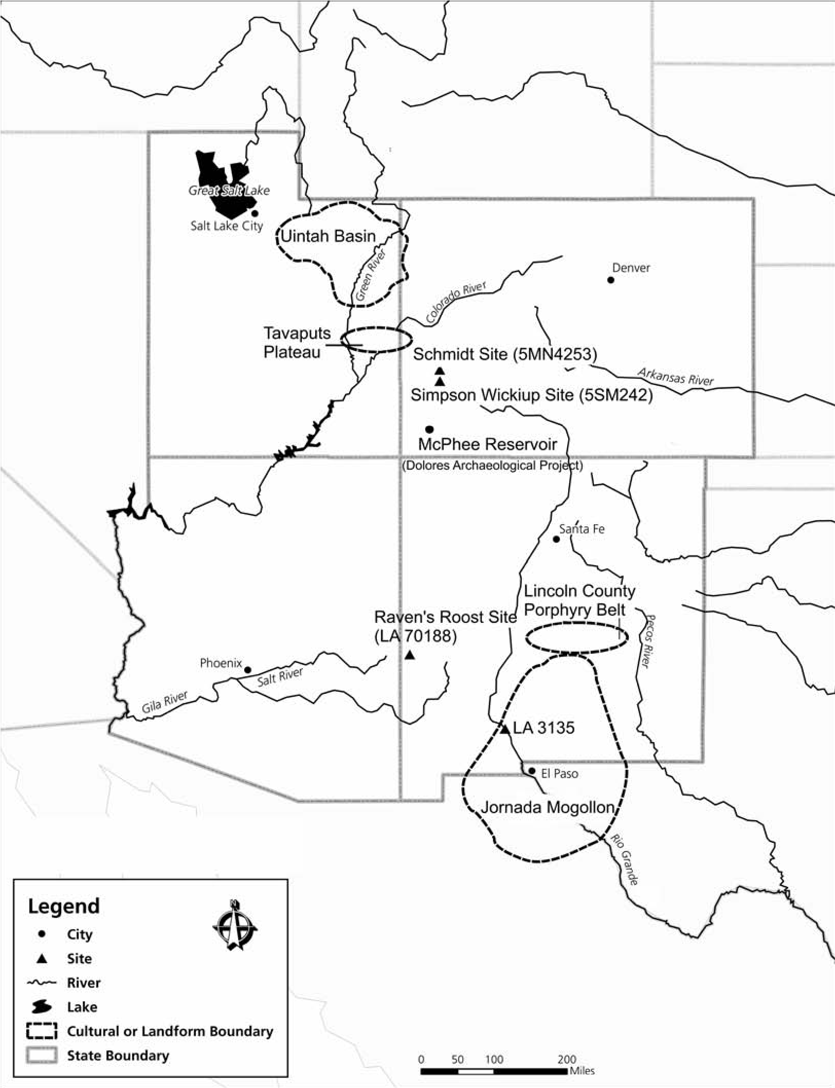
Ceramic assemblages in early Mogollon sites tend to be small. For example, only 59 sherds were recovered from LA 701188 (Raven’s Roost), a single-component residential site dated by radiocarbon to between 70 bc and ad 330 (Wilson 1999:90) (Figure 11.1). Although the ceramic assemblage is small, it displays both functional and decorative diversity, producing plain and red-slipped ceramics representing bowl and jar forms. The low number of ceramics recovered from Raven’s Roost was attributed to the mobile adaptation of the site’s residents (Wilson 1999). The limited excavations that have been undertaken at early sites (ca. ad 100–400) in the Jornada Mogollon area near Hatch, New Mexico, repeat the pattern of the presence of bowls and jars, some of which are coated with a red slip (Morenon and Hayes 1984). The diversity in forms is attributed to the residential nature of this site whereas the low frequency of sherds overall relative to assemblages from more sedentary occupations is attributed to these people’s semi-sedentary lifestyle, based on hunting, collecting wild plants, and limited horticulture.
Ceramic assemblages from nonresidential sites occupied by semi-sedentary peoples in the Eastern Jornada Mogollon area of southeastern New Mexico include bowls and jar forms. While the potential for reuse of the same site through time is likely an issue for sites used by seasonally sedentary hunter-gatherers, sherds are much more numerous, often in the low hundreds, than in ceramic assemblages recovered from more mobile hunter-gatherer sites (Hill 2000, 2006).
Ceramics recovered from sites occupied by seasonal resource-tethered hunter-gatherers are frequently characterized by paste compositions that do not reflect local geological resources (Wiseman 2002). The composition of these ceramics likely reflects curation and transport from the location where the vessels were made. Brownware ceramics recovered from archaeological sites located in the open plains of southeastern New Mexico were produced using materials from the Lincoln County Porphyry Belt, located in the mountains to the west and north (Hill and Staley 1999). Other types of ceramics recovered in southeastern New Mexico originate from more distant places, including the Tularosa Basin, the Mimbres area of southwestern New Mexico, and Casas Grandes, Chihuahua (Hill 2000, 2006). Whether the brownware ceramics recovered in southeastern New Mexico and West Texas were brought there by residents of the adjacent regions or were traded to more mobile peoples who lived in these areas is unknown (Hill 2009, 2014).
Another example of ceramic production and use by semi-sedentary peoples comes from northeastern Utah. Archaeological survey and excavation in the area occupied by the prehistoric Uintah Basin Fremont of the Tavaputs Plateau found that there was considerable variability in architecture, including pit structures, small dry-laid masonry pueblos, and formal storage features. Evidence of corn horticulture in the form of cobs and complete ears was recovered from the excavated contexts (Spangler 2000). However, ceramics are uncommon to nonexistent on both surveyed and excavated sites. When ceramics are recovered in the Uintah Basin, they contain nonlocal limestone (Truesdale and Hill 1999).
Ceramic vessels appear between 13,000 and 20,000 years ago or earlier among mobile hunter-gatherers across China, eastern Siberia, and Japan (Hill 1995a; Kajiwara 1995; Kajiwara and Kononenko 1999; Wang 1995; Wu et al. 2012; Zhushchikhovskaya 2005). Limited publication of excavation data hampers detailed comparison of these pottery assemblages with assemblages from other hunter-gatherer populations elsewhere. Where illustrations of continuous vessel profiles are available, vessels from these early pottery-producing sites appear conical or conical with flat bases. Decorative treatment is limited to a few incised lines or punctuations near the vessel’s rim. Only a limited number of vessel forms, predominantly jar forms, are represented in the ceramic assemblages from these early pottery- producing sites in East Asia and Japan. The limited variety in the shapes of vessels in East Asia is consistent with highly mobile groups elsewhere in the world, including the American Southwest and Great Basin. When compositional studies are conducted of the ceramic pastes, the vessels are found to be self-tempered (Garko- vik and Zhushchikhovskaya 1995). This is also a common characteristic of the composition of plainware produced by mobile hunter-gatherers in the Southwest and Great Basin.
The Protohistoric in the Great Basin provides another set of examples of ceramic production and use by full-time hunter-gatherers. Jar forms are the dominant vessel shape recovered from western Utah and eastern Nevada. Other vessel shapes are virtually unknown. In the northern portion of the Great Basin, Protohistoric ceramic vessels are made in the shape of truncated cones and have flat bases. In the southern part of the Great Basin, vessels are more conical in shape with pointed bases (Janetski 1990; Lockett and Pippin 1990). The differences in vessel forms roughly correspond to the present-day Shoshoni-Southern Paiute linguistic boundary (Janetski 1990).
Limited attempts have been undertaken in the Great Basin to identify the use of ceramic vessels. Analysis of botanical material adhering to the interior surfaces of 13 sherds recovered from cave sites located around the Great Salt Lake indicates that the vessels had most recently been used to boil Chenopodium seeds or other unidentified plant remains (Dean and Heath 1990). Similar botanical analysis of coatings adhering to the interiors of a complete Shoshoni vessel from Mineral County, Nevada, and a Shoshoni sherd from the Snake River in Idaho also reported the presence of grass pollen and phytoliths (Tuohy 1990:94).
The limited petrographic studies that have been conducted of Protohistoric pottery-pre- dominantly of materials from contexts located around the Great Salt Lake-indicate the use of self-tempered clay to form the vessels. This observation was based on the continuous size distribution of rock and mineral grain inclusions present in the ceramic paste observed in a sample of petrographic thin sections (Dean 1992). Five major paste compositions were recognized during this study, indicating multiple sources of ceramic clay. The variation in the types of mineral inclusions observed indicates an equally wide range of mobility practiced during the Protohistoric period in northwestern Utah.
In addition to the extensive record of prehistoric occupation reported during the Dolores Archaeological Program between 1978 and 1983, a limited amount of cultural material could be attributed to occupation of the area by the historic Ute, who are known to be a highly mobile group. Only 67 self-tempered micaceous sherds of Ute manufacture were recovered from nine survey sites located within the McPhee Reservoir Maximum Pool survey area (Hill and Kane 1988). Although the assemblage was highly fragmented, only open jar forms were observed (Errickson and Wilson 1988). The single Ute wickiup site excavated by the Dolores Archaeological Program produced no associated ceramics. Only two chipped-stone flakes were associated with this structure (Kleidon 1984).
Characterization of a sample of Ute pottery from western Colorado by Instrumental Neutron Activation Analysis (INAA) reported that at least some of the micaceous Ute ceramics were produced using clays that originated in north- central New Mexico (Eiselt 2004). Other micaceous Ute pottery analyzed during this study indicates the use of other clay resources. This study provides an example of the considerable distance that raw materials for ceramics production or finished vessels could be transported, especially in this case, in which horses were likely involved as part of the mobility strategy (Eiselt 2004).
Other Ute sites in western Colorado also produced small ceramic assemblages. The Schmidt site, 5MN4253, a Ute site excavated as part of the Trans-Colorado Natural Gas Pipeline project, consisted of a single standing wickiup and associated artifact scatter (Greubel and Cater 2001). Only 18 sherds, possibly representing a single vessel, are attributable to the Ute ceramic tradition were recovered from this site. The Simpson Wickiup site was also excavated during this project (Greubel and Cater 2001). This site, which consisted of three structures and an extensive scatter of artifacts, produced 174 sherds. All of the sherds were attributed to the Early Historic Navajo type Dinetah Gray. The Dinetah Gray sherds were most likely derived from the same vessel because most of them were found near the door of one of the structures. The limited number of sherds recovered from these two sites provides an example of the narrow use of ceramics by the highly mobile Ute of western Colorado. Although limited, data from the Ute occupation in western Colorado conform to the small ceramic assemblages, the exclusive use of jars, and the presence of ceramics with exotic paste compositions that characterize the ceramic assemblages of hunter-gatherers.
In addition to the Ute material, 174 Hopi sherds were recovered during the Dolores Archaeological Program. When identifiable, most of the Hopi sherds were found to be derived from both bowls and jars. Four sites, all ancestral Pueblo architectural sites, produced both Hopi and Ute pottery from the surface. The other Hopi sherds were recovered from 10 sites; four sherds were associated with earlier ancestral Pueblo architectural sites and two with artifact scatters (Errickson and Wilson 1988).
It is probable that at least some of the Hopi material represents visits to the area for hunting or ritual by the Hopi, while other parts of it represent trade by the Ute with the Hopi. Regardless of the reasons for the appearance of Hopi ceramics in the Dolores Archaeological Program area, the greater number of Hopi sherds and the variation in the forms of vessels further illustrate the differences in the types of ceramic assemblages derived from mobile hunter-gatherers and those of more sedentary peoples.
Discussion
Previously collected archaeological data can be used to suggest approaches to the analysis of ceramic artifacts made by mobile Protohistoric hunter-gatherers. First of all, are the ceramics Protohistoric in age? Optically stimulated luminescence dating avoids the problems with multiple intercepts that are present in the radiocarbon curve during the fifteenth and sixteenth centuries and is a widely accepted chronometric technique throughout the world (Seymour 2003b). Direct dating by optically stimulated luminescence of Apache and historic Pueblo pottery from Fort Bliss and from southern Arizona by Deni Seymour and myself has presented dates between the fourteenth and sixteenth centuries that are consistent with the historic record and the period of the occupation of historic Pueblos of the El Paso area (Seymour 2002, 2003b, 2003c, 2004a, 2010a). Optical stimulated luminescence dating of Uncompahgre Brownware from the Uintah Basin demonstrated that the dated sherd was contemporary with the fourteenth-century Hopi pottery also recovered from the site (see Chapter 16, this volume).
The number of ceramic samples from a single site occupied by Protohistoric hunter-gatherers may be limited, leaving only a very small sample of sherds to examine. The multicomponent nature of some sites may also be missed because of the similarity in the appearance and composition of prehistoric and Protohistoric or Historic native plainware ceramics. If the same clay sources, manufacturing techniques, and firing conditions were used by both prehistoric and Protohistoric peoples, in the absence of distinctive formal characteristics or without direct dating of the sherds it may be difficult to distinguish the ceramics from different time periods from one another. This has been pointed out by Seymour for areas of the southern Southwest such as Fort Bliss (Seymour 2002). The use of locally available untempered clay by Late Prehistoric mobile, semi-sedentary, and Protohistoric mobile group potters in southeastern Arizona has resulted in some typological confusion (Masse 1981:38). Continuity in the use of specific ceramic clay sources may be the reason for the similarities reported in some Tizon brownwares, Cerbat Brown, and Yavapai pottery (Pilles 1981:169). The use of geologically related clay resources by Basketmaker III and Pueblo I and Navajo potters in the upper San Juan drainage makes distinguishing the plainware products of these two ceramic traditions difficult (Hill 1995b; Kemrer 1995).
The source of aplastic inclusions within a ceramic body should be treated as a research question (Shepard 1964). Mobile hunter-gatherers tend to use natural clays lacking an added tempering agent to construct their vessels—probably because this is the expedient way to make pots and because they have access to a relatively broad number of clay sources. However, potters from semi-sedentary and sedentary Southwestern Pueblo groups are also known to have used untempered clay to produce ceramic vessels, sharing a practice with semi-sedentary horti- culturalists and mobile hunter-gatherers (Fowles et al. 2007; Hill 1999, 2003). Given the potential for variation in individual clay deposits and in the ceramics, very detailed descriptions of ceramic thin sections are required for characterization of ceramic pastes and inclusions (Mason 1995). Whenever possible, samples of local clays should be collected and analyzed as part of the ceramic petrographic study. However, variability in the types and sizes of inclusions within an alluvial or primary clay deposit may preclude the assignment of a particular sherd to a specific clay deposit (Allen 1965; Delvigne 1998). Tempering agents derived from outcrop sources, collected as sediments, or naturally present in alluvial clays are also subject to the compositional and textural variability within the sources of the sediments or rock outcrops. Similarities in the types of mineral inclusions observed across broad regions, as is the case in southeastern New Mexico, also preclude assigning a particular type of ceramic to a specific geological source without the use of such techniques as INAA.
It is inaccurate to assume that the inclusions observed in a ceramic paste represent added materials. Pottery produced by Yuman groups located on the lower Colorado River is not tempered in the traditional sense of adding a nonplastic material such as sand or crushed pottery sherds but rather is a reductive process that removes the larger fragments of granite that are naturally present in the source clay (Rogers 1936: 6–7). The Yuman potters’ process of removing the coarser mineral grains and rock fragments results in a considerable amount of skewing of the ratios of the constituents (Rogers 1936). The use of self-tempered clays seems to be a widespread characteristic of mobile-group pottery.
It is important to note that petrographic thin sections may not necessarily represent the compositional variation within a single vessel. Limited point-counting experiments using multiple sections indicate that even added tempering agents may not be evenly distributed within the same vessel (Smith and Hill 1994). While extensive point counting may provide a “feel-good” approach by providing a suite of numbers that can be manipulated statistically, given the potential variation in inclusions in both clay sources the time would be spent more productively examining a greater sample of sherds and clay sources and preparing detailed descriptions that focus on the variability within a larger sample of ceramics (Mason 1995). When feasible, petrographic analysis of sherds and clays should be conducted in conjunction with additional analytical techniques such as INAA.
In addition to dating and compositional techniques such as thin-section petrography and INAA, detailed descriptions of ceramics, even if their numbers are few, should be made and published. If preservation conditions warrant, analysis of potential organic residues that may be present in the sherd should be conducted (Eerkens 2007).
Most of the Protohistoric and Historic peoples of the southern U.S. Southwest, such as the Apache, Ute, and Pai, followed a mobile hunting and gathering or semi-sedentary horticultural lifestyle. As such, they produced and used ceramics in ways that are different from those of more settled peoples. Using these suggestions for research should add to our understanding of the place of ceramics in the lives of these peoples.
12. Architectural Visibility and Population Dynamics in Late Hohokam Prehistory
Douglas B. Craig
The abandonment of large villages across the Hohokam region of southern Arizona after ad 1400 is usually viewed as evidence of widespread systemic failure and demographic collapse. Among the common explanations for why the region was abandoned are resource depletion, crop failure, overpopulation, nutritional stress, disease, social and political conflict, or some combination thereof. In addition, environmental hardships, particularly episodes of flooding and river channel widening, are often cited as contributing factors, but mainly in the sense of pushing a society already on the verge of collapse over the edge (Abbott 2003; Gregory 1991; Hill et al. 2004; Masse 1991; Wilcox et al. 2001).
Not everyone agrees with this interpretation, however. Some researchers argue that the case for regional abandonment and demographic collapse has been overstated. They point to the presence of Late Prehistoric settlements in upland areas away from major drainages as evidence for cultural continuity and reorganization (Fish et al. 1994; Henderson and Hackbarth 2000; Marmaduke and Henderson 1995). They also note that historically documented Oodham and Piipaash villages along the middle Gila River, some with hundreds of residents, have been difficult to identify archaeologically, a consequence of their floodplain setting and a land use strategy known as “village drift,” in which settlements shift their locations slightly over time in response to a combination of social and environmental factors (Ezell 1961:110–111; Darling et al. 2004).
In this chapter I evaluate these competing hypotheses, drawing on lessons learned from recent excavations at two Late Classic period Hohokam sites, one (Rillito Fan) located in a floodplain setting along the Santa Cruz River in Tucson, the other (Cactus Forest) located in an upland setting near Florence (Figure 12.1). Special attention is paid to the low-visibility nature of architectural features at the sites and the implications for understanding regional population dynamics, particularly for the period postdating ad 1375. Both sites are large pithouse settlements with occupations extending into the mid-fifteenth century, and probably later. One of them (Rillito Fan) may even have still been occupied when Father Kino and Captain Manje passed through the region in the 1690s, based on artifacts identified in another portion of the site and documentary evidence indicating the presence of a large Oodham village (San Agustín de Ouiar) with hundreds of residents in the same general location (Doelle 1984). Unfortunately, modern farming has disturbed the site’s surface and upper fill deposits, and it is not currently possible to link the prehistoric and historic components.
The results of my study lend support to the belief that Hohokam populations did not disappear from the region following the abandonment of large aggregated villages in the late fourteenth century. Instead, it is my contention that much of the population adopted a more dispersed and flexible land use strategy, similar to patterns reported following the abandonment of village centers in other parts of the prehistoric Southwest in earlier times (e.g., Chaco, Mimbres). It is further suggested that current interpretive models, which generally equate abandonment with failure and collapse, may be overlooking an effective strategy of shifting land use that served to sustain regional occupational continuity (for a similar point, see Marmaduke and Henderson 1995; Nelson 1999; Tainter and Plog 1994).
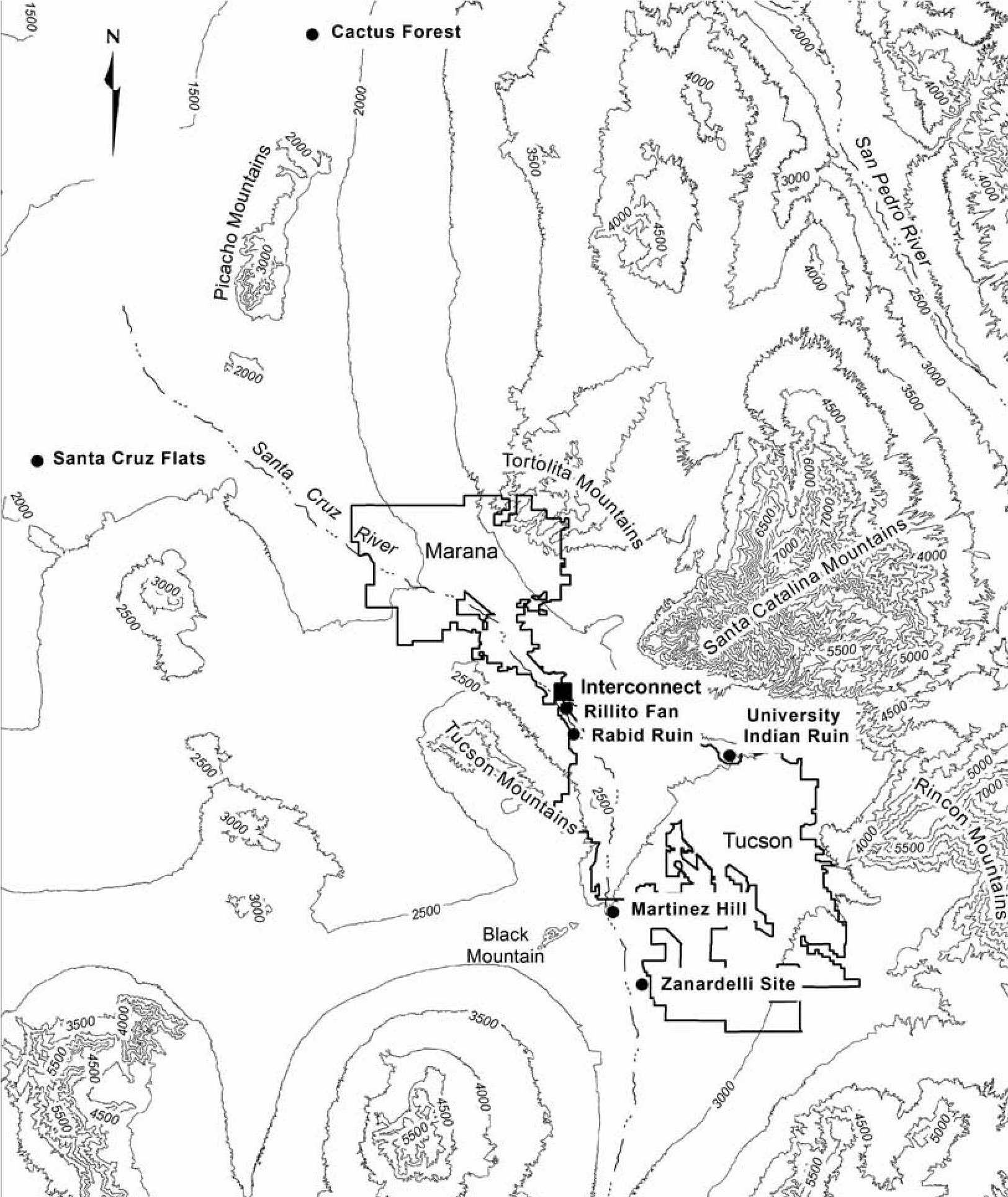
Coalescent Communities Database
In order to establish a broader context for the case studies presented here, I begin by considering the Coalescent Communities Database (Wilcox et al. 2003). Commonly known as the CCD, the database represents an impressive compilation of information on the size, age, and location of every known settlement in the Southwest with more than 12 surface rooms dating to between 1200 and 1700. At last report, the database contains information on more than 3,000 sites with nearly 6,000 temporal components (Hill et al. 2004:690). The results of a time-series analysis of macroregional population trends based on the CCD room count data are shown graphically in Figure 12.2 (after Hill et al. 2004:Figure 4). The CCD data indicate that the northern Southwest remained relatively stable until at least the midfifteenth century, but the southern Southwest appears to have reached a peak population in the early fourteenth century, followed by a gradual decline in the late fourteenth century, a much sharper decline in the early fifteenth century, and the virtual depopulation of the region by the middle of the fifteenth century. In contrast, the northern Southwest, like many parts of the New World, did not experience a sharp decline in population until after European contact in the fifteenth century (Hill et al. 2004:696).
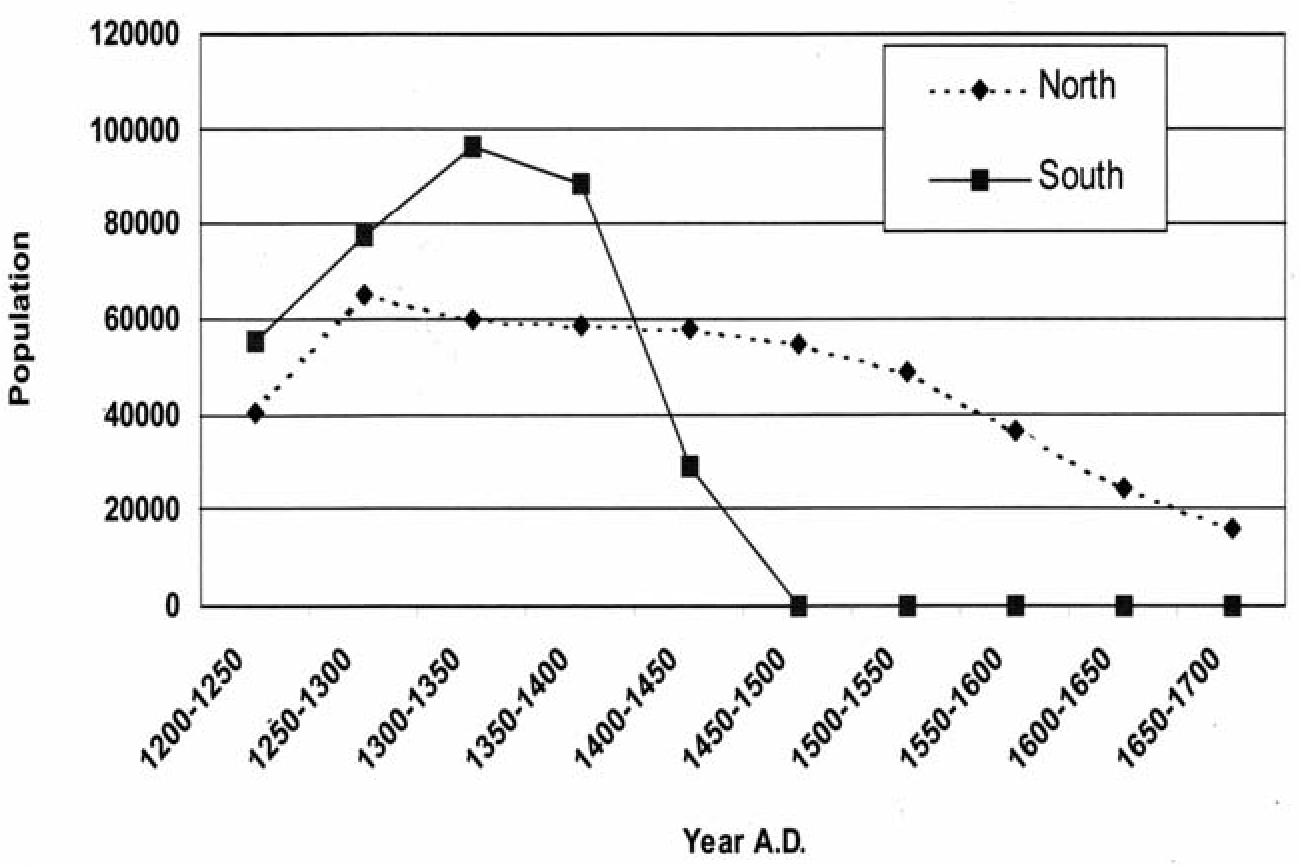
Although one can quibble with some of the methods underlying the CCD population estimates, for the most part they seem reasonable and follow fairly standard procedures for converting room count data to population data (e.g., Doelle 1995; Kintigh 1985). Room counts for the overwhelming majority of sites in the database seem reasonable as well, though spatial coverage appears uneven, particularly for areas south of the Phoenix Basin and west of the San Pedro River Valley (Figure 12.3). A bigger problem is that the CCD data are biased toward sites with surface architecture. The problem is especially apparent for the post-1375 period, when pithouses replace surface architecture in many areas (e.g., Abbott 2003; Sires 1987). Consequently, room counts are difficult to derive without extensive excavations.
Further complicating matters, the number of chronometric samples from Late Classic sites is just now becoming adequate to sort out real temporal patterns from anomalies (Henderson and Hackbarth 2000). Advances in ceramic dating have also recently been made (e.g., Lyons 2004) that are only just beginning to be applied to actual data sets. Previously unknown sites are still being discovered as well, many of them large pithouse settlements like the two discussed here. The bottom line is that many Late Classic period sites now appear to have been occupied well into the fifteenth century, suggesting that the CCD room count estimates for the post-1375 period are too low, perhaps by as much as 30–50 percent. If so, the sharp decline in population indicated by the CCD room count data for the southern Southwest in the fifteenth century may be more apparent than real.
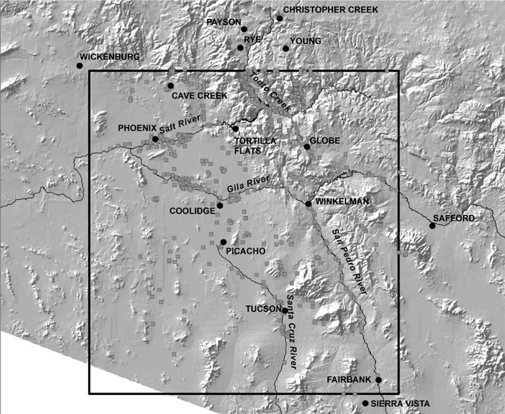
Two Case Studies: The Rillito Fan and Cactus Forest Sites
In support of this argument, I turn now to a consideration of two Classic period sites excavated by Northland Research, Inc. (Northland), over the past decade. The Rillito Fan site is located on the floodplain of the Santa Cruz River, near the confluence of the Santa Cruz and Rillito Creek. Cactus Forest is located in the uplands of the middle Gila River Valley, about six miles south of Florence and seven miles south of the Gila River. Both sites are large pithouse settlements that undoubtedly contain scores of houses, yet neither is currently included in the CCD Hohokam data set—again, not because of oversight or sloppy scholarship, but because little was known about the sites until recently.
Rillito Fan
Archaeological investigations were conducted at Rillito Fan in 2008 and 2009 as part of a Pima County sewer line installation project. Northland’s data recovery efforts focused on a roughly 80-foot-wide corridor that crossed near the eastern boundary of the site (Craig 2011). Of note, the area investigated was directly adjacent to a portion of the site excavated by Desert Archaeology, Inc., as part of earlier Interstate-10 Frontage Road work (Wocherl 2007). The Northland excavations resulted in the discovery of 8 houses and 10 burials, as well as a dozen or so extramural pits, while the Desert Archaeology excavations found a similar number of houses and extramural pits but no burials (Figure 12.4). Importantly, only about 1 percent of the total site area was investigated by the two projects, suggesting there are many more houses still to be found.
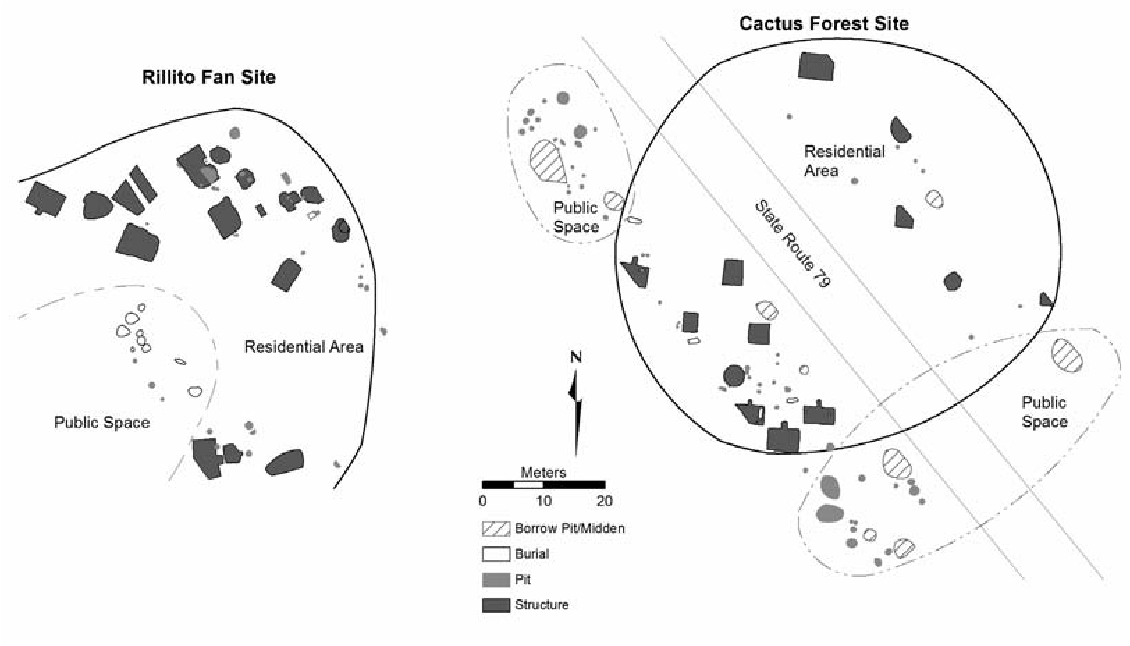
The portion of the site investigated by Northland was dated to the late fourteenth and early fifteenth centuries, based on diagnostic ceramics (Cliff Polychrome) and chronometric dates (Craig 2011:334). A radiocarbon sample from a possible roof support post in one of the houses (Feature 10) produced a calibrated (2-sigma) date with two options: ad 1320–1350 and ad 13901440. A radiocarbon sample from a piece of mesquite recovered from the fill sediments just above the floor also produced a calibrated (2-sigma) date with the same two options. An archaeomag- netic sample from one of the hearths provided a sample with five dating options: ad 585–690, ad 910–1015, ad 1410–1500, ad 1475–1625, and ad 1600–1865. Based on this evidence, combined with the ceramic evidence, a post-1390 date for the feature is likely, with the period of overlap for the three chronometric samples extending from ad 1410 to 1440.
The houses and other domestic features investigated by Northland at Rillito Fan were part of two separate groups of houses (see Figure 12.4). The only extramural feature found in association with the one of the house groups was an adobe mixing pit, perhaps indicating that most food storage and preparation occurred indoors. In contrast, several nonthermal pits were found near structures in the other house group.
Skeletal remains identified by the Northland investigations were associated with a small cemetery area located between the two house groups. In total, the remains of nine adults and one subadult (4–6 years old) were found, an age distribution that is unlikely to reflect the true demographic profile of the site’s occupants. Regardless, analysis of the skeletal remains did not find evidence for infectious disease or nutritional deficiencies, suggesting adequate adult health; however, the number of young adults (under 30 years) outnumbered older adults (over 30 years) by a ratio of 3:1, suggesting possible demographic stress on a segment of the population of childbearing age.
Roughly 6,000 sherds were recovered from Northland’s investigations, with plainware accounting for more than 90 percent of the assemblage; however, decorated wares were also common, particularly Salado polychromes. The presence of Gila Polychrome, Cliff Polychrome, and perforated plates provides strong evidence for a late-fourteenth-century site occupation. Ceramics recovered from the nine inhumations reveal similar patterns to those from houses, indicating their likely temporal association. Petrographic analysis of the temper from a sample of nonburial plainware and decorated sherds indicates multiple production sources from both within and outside the Tucson Basin. The temper analysis also indicates that most of the pottery recovered was probably not produced at the site. This suggests that the residents of the site were part of a larger network of exchange relationships.
Further evidence that the residents of Ril- lito Fan participated in regional exchange networks is provided by the lithic materials recovered. Although most of the flaked stone and groundstone materials were probably obtained from local sources, 45 pieces of obsidian from nonlocal sources were also recovered. Most of these obsidian artifacts (n = 38) were chemically sourced using XRF methods, indicating they were obtained from six sources, ranging from northern Arizona to northwestern Mexico and from western Arizona to southwestern New Mexico. Marine shell from the Gulf of California was also recovered from both burial and domestic contexts. These patterns reinforce the impression that Late Classic period exchange networks throughout the region were far flung (Loendorf 2010).
Maize was common in both flotation and pollen samples. Cotton was also recovered from both flotation and pollen samples, and common bean was recovered from one of the flotation samples. The presence of cholla and cattail pollen in house hearths suggests their probable use as food (cholla buds) or in food preparation (cattail), as well as a probable occupation of the site in early spring. The presence of cattail may also suggest the presence of standing water or marshy conditions nearby. Lagomorphs dominated the faunal assemblage, though artiodac- tyls and large mammal remains were present in low frequencies. All body parts of artiodactyls were recovered, including both low- and high- yielding meat elements, suggesting procurement may have occurred close to the site.
Cactus Forest Site
Excavations were conducted by Northland at the Cactus Forest site in 2004 as part of an Arizona Department of Transportation (ADOT) road-widening project (Marshall 2009). Nearly 100 cultural features were found in the ADOT right-of-way, which covered a total area of less than one acre. Among the features found were 13 pithouses or pitrooms, 8 burials, and dozens of thermal and nonthermal pits (see Figure 12.4). Of note, unlike the Rillito Fan site, where houses appear to have been arranged around courtyards and there was a formal cemetery area, all of the houses uncovered at Cactus Forest were oriented in the same direction and the burials were associated with individual houses, not cemeteries. Based on surface artifact distributions, the Cactus Forest site is estimated to cover about 13 acres, suggesting that our sample of features represents less than 10 percent of the site total.
Nearly 20 percent of the more than 12,000 sherds recovered at the Cactus Forest site were Salado polychromes—mainly Gila Polychrome, but also Tonto Polychrome and Cliff Polychrome, as well as apparently one piece of Pinto Polychrome. Obsidian artifacts were common as well, making up more than 15 percent of the lithic assemblage. Sourcing studies (XRF) of a sample of about 80 pieces obsidian were performed. These studies indicate that the assemblage was dominated by materials from the Sauceda source in western Arizona, though Government Mountain in northern Arizona, Los Vidrios in northern Mexico, Black Tank in western Arizona, and Mule Creek in western New Mexico were also represented.
Three archaeomagnetic samples from hearths produced calibrated dates that overlapped between ad 1375 and 1470. Multiple lines of evidence indicate that the site was occupied year-round, but probably on a short-term, repeated basis over a number of years. The burial data suggest that the population was relatively healthy, though the sample is admittedly small (n = 8). Maize was a staple of the diet, but it was supplemented by a variety of native plants, including agave and cholla. Lagomorphs dominated the faunal assemblage, with jackrabbit remains outnumbering cottontails by a ratio of more than 12:1. The shell artifact assemblage was small but diverse, and included Glycymeris bracelet, ring, and pendant fragments; Conus tinklers; an Olivella bead; and unmodified fragments of Dosinia and Laevicardium (Marshall 2009). All this leads us to conclude that the residents of the site were active participants in regional exchange networks. Given the amount of polychrome pottery at the site, they may have even served as middlemen for the distribution of pottery. There are no indications at the present time that pottery was produced at the site.
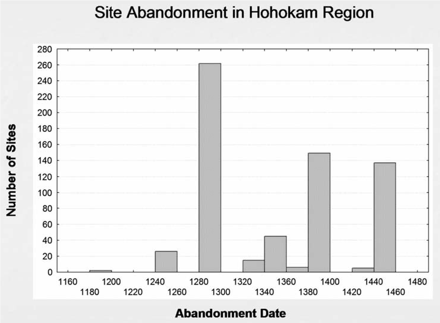
Discussion
When we look at the combined weight of the evidence, neither Rillito Fan nor Cactus Forest gives the impression of a population undergoing severe stress or on the verge of collapse. Rather, the residents of both sites appear to have been relatively successful, resilient farmers who cultivated a range of crops and who also exploited a variety of locally available wild resources, including large game in the case of Rillito Fan. There is no evidence for resource depletion in the vicinity of either site, even along the floodplain of the Santa Cruz River, which had been intensively farmed for thousands of years before the Classic period occupation of Rillito Fan.
At an even larger analytical scale, the Rillito Fan and Cactus Forest results call into question regional population estimates for the postad 1375 period, which are based on the assumption that most of the population continued to live in high-visibility, above-ground compounds (Hill et al. 2004; Wilcox et al. 2003). Therefore, in an attempt to get a better handle on how much of the late population may have lived in low- visibility settings, the CCD data were examined in an effort to sort out possible temporal patterning in the room count data, which are the basis for the CCD population estimates. Selecting only Hohokam sites with more than 10 rooms, which still amounted to 700 or so sites, I first looked at when each site was abandoned (Figure 12.5). Then I weighted the site variable by the maximum number of rooms to get a better sense of when most of the rooms were occupied and abandoned (Figure 12.6). Again, the data used to generate these histograms come directly from the CCD and were not modified in any way.
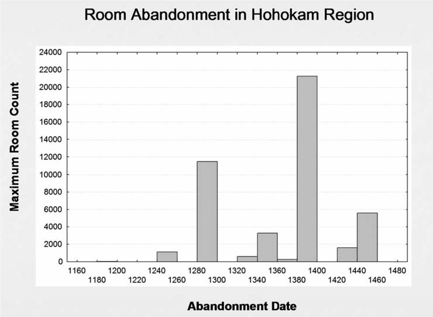
The histograms illustrate several key points. First, they graphically show the transformation in Hohokam society that took place at about ad 1300, plus or minus a decade or so. Not only were many sites abandoned, including some that had been occupied for several centuries, but there was also a shift to a more aggregated settlement pattern in which far fewer sites contained many more rooms. Aggregation, then, seems to have characterized settlement in the region for much of the fourteenth century, as in many other parts of the Southwest. In order to convert these data into population estimates, Hill and others (2004:692–693) made a number of assumptions about room size and occupancy rates, which are fairly well accepted at this point.
More problematic from my perspective are the abandonment dates assigned to many of the sites, which seem somewhat arbitrary. For example, some sites with good chronometric evidence for fifteenth-century occupations, such as Escalante Ruin, Brady Wash, and Los Rec- tangulos, and the Gecko site in the Santa Cruz Flats, are recorded as having been abandoned by ad 1400 (see Marmaduke and Henderson 1995), as are other sites that were likely occupied into the fifteenth century, such as Adamsville, Florence Ruin, Casa Blanca, Sweetwater, and the Waste Dump site, to name a few. Some of these late sites may have also had many more rooms than recognized by the CCD. For example, the 10 rooms identified at Los Rectangulos from work done by Northland in the 1980s came from less than 1 percent of the site, yet only 50 rooms in total are recognized by the CCD. A similar situation holds at the Gecko site, where 12 rooms were recorded in about 1.5 percent of the site area (Marmaduke and Henderson 1995), suggesting there may have been hundreds of rooms at the site, not the 50 listed in the CCD, and there are other unexcavated sites (e.g., the Waste Dump site) where the same situation likely holds.
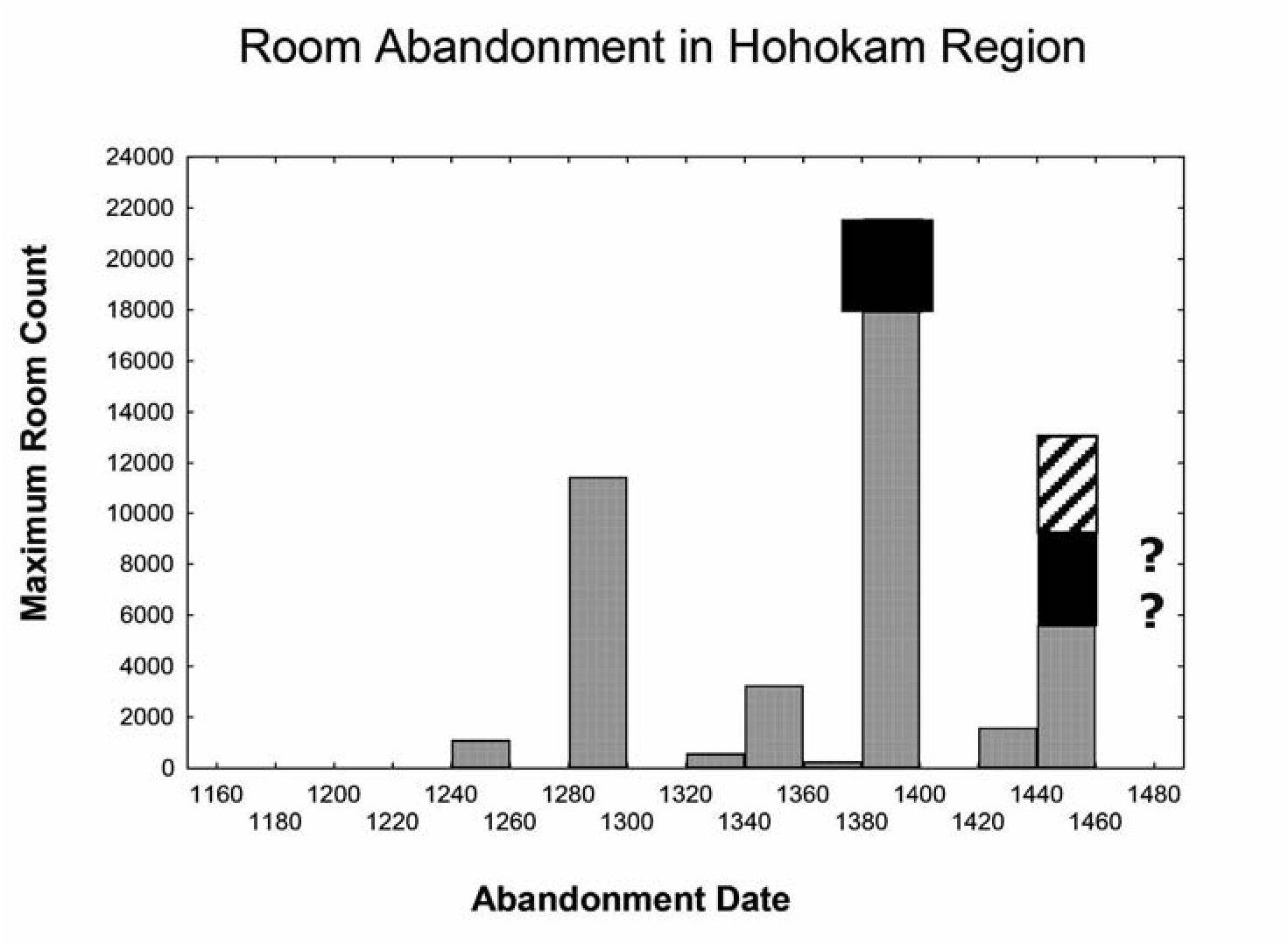
Conclusion
What are the implications of my study? How can low-visibility sites like Rillito Fan and Cactus Forest be accounted for in the CCD population estimates? Although final answers to these questions must await further research, some preliminary answers are possible based on lessons learned from this study. First, working off the room count abandonment histogram (see Figure 12.6), I suggest moving some of the rooms to an ad 1450 abandonment date rather than an ad 1400 date, maybe for even as much as 20 percent of the sample. Then I propose adding higher room count totals to some of the late sites and including in that total the sites in low-visibility settings, such as Rillito Fan and Cactus Forest, as well as late sites in the CCD with room counts that are too low. While exact numbers still need to be worked out, the net effect of these adjustments, as can be seen in Figure 12.7, is to greatly increase fifteenth-century population figures, which of course also has the effect of making the population decline curve for the early fifteenth century not nearly as steep. As to what the curve might look like for the late fifteenth century, without more data it is difficult to say. Room counts and population estimates aside, the CCD, as its name implies, is strongest for those periods when most of the population lived in large aggregated villages and weakest when the population lived in more dispersed settlements or a combination of aggregated and dispersed settlements, which is what appears to have been the case in many parts of southern Arizona after ad 1375. Currently we lack a full understanding of the relationship between aggregation and dispersion, particularly the shift from aggregation to dispersion. Given these data gaps, we need to be careful and not assume that the absence of evidence is evidence of absence. Village abandonment is clearly part of the story, but it is doubtful that it is the final chapter.
13. Sobaipuri O’odham and Mobile Group Relevance to Late Prehistoric Social Networks in the San Pedro Valley
Mark E. Harlan and Deni J. Seymour
Since the earliest research into the prehistory of the American Southwest, the disjuncture between historically observed populations and the distribution of impressive archaeological sites has fascinated and frustrated researchers and lay persons alike (Bandelier 1890:182–183; Kidder in Rouse 1962:337; Rouse 1962:41–44). The problem has generally been parsed in terms of “abandonment” or its corollary, migration. The questions have centered on why, after flourishing in areas like the Four Corners, the San Francisco Peaks, and the Mogollon Rim, populations left, only to be found by the first European explorers in a few remaining concentrations in the Rio Grande Valley of New Mexico; along the Gila, Salt, San Pedro, and Santa Cruz rivers in Arizona; and in additional isolates like the Hopi Mesas and Zuni. Closely related questions center on how and when those enclaves came to be surrounded by a sea of mobile hunter-gatherer-raiders who were hardly noticed when Marcos de Niza and Francisco Vasquez de Coronado made the initial European forays into the region.
As dendrochronology began to provide both chronological control and an understanding of past climatic events, explanations centered on two main schemes: (1) climatic change as evidenced by the Great Drought that occurred between ad 1276 and 1299, rendering favorable areas essentially uninhabitable, and (2) the arrival of Athabascan-speaking mobile people (ancestral Apaches and Navajos) in the Southwest, which was thought to have occurred at about the same time as the drought. The concurrence of events tipped the balance into one permanently unfavorable to peoples like those who had occupied Mesa Verde, Aztec Ruin, and other communities that flourished in the earlier part of the thirteenth century. The second explanation, however, was quickly dismissed, largely because no one was able to identify archaeological sites the mobile groups might have occupied, and it came to be accepted doctrine that the earliest evidence of Athabascan speakers or Dene presence was limited to early communities dating to the sixteenth century or later, located in the Dinetah.
In some sectors this view is still maintained despite fresh and abundant evidence of the widespread occurrence of mobile peoples and new and competing groups of sedentary farmers in the Late Prehistoric period. As evidence for the presence of competing groups has accumulated, some researchers still do not concede the presence of these groups because it implies intercultural conflict in pre-European times and so clashes with conventional wisdom and accepted narratives. Researchers also sometimes find it difficult to integrate these data into large-scale data sets owing to their low visibility and the challenge of assessment based largely on survey data. Consequently climate change remains an important explanatory mechanism and is still viewed favorably by many Southwestern- ists today.
Against this backdrop, a team of researchers residing mainly at Archaeology Southwest and the School of Anthropology at the University of Arizona have employed newly available research tools to modify and refine this long-standing narrative, rejecting abandonment as an event and seeking to understand processes of change that took place over the century and a half between ad 1300 and 1450. The new tools consist of extensive databases and the analytical methods applied to them. The foundation for this research is encapsulated in the Coalescent Communities Database, or CCD (see Hill et al. 2010 and citations therein), consisting of information on 3,000 sites occupied between ad 1200 and 1700 that have 12 or more rooms visible on the surface (Hill et al. 2004; Hill et al. 2010). Work on the database continued under the Southwest Social Networks Project (SSNP), an effort massively funded by the National Science Foundation (NSF) (Clark et al. 2004; Mills et al. 2013). The result is the Southwest Social Networks Database (SWSN). Published research using both databases took place while they were works in progress, so the cutoff for room counts, exact number of sites, and scope of available information varies over time. The version that supports the analysis presented below (supplied to the authors by Matthew Peeples of SSNP)[11] has 2,875 sites, 31,875 ceramic records with information on more than 4 million sherds, and 5,547 records with information on sourced obsidian specimens tied to the site data. The SWSN is not limited to sites with a minimum room count, but analyses published to date are generally restricted to sites with at least 11 rooms visible on the surface or encountered during excavation and large Ho- hokam sites (see Craig, Chapter 12 this volume, for issues regarding the latter).
The new analytical tools fall into two main groups: improvements in chronological control and novel approaches to parsing the data, mainly through application of Social Network Analysis. The improved approaches to chronology revolve around a ceramic seriation and applications of Bayesian statistical inference to assign analytical units to shorter time periods than have been feasible in the past, most generally 50-year time slices but, at times, distinctions as fine as 25 years (Clark et al. 2004:1, 8–9). Social Network Analysis has been used to address social processes inferred to have occurred between ad 1300 and 1450, including warfare, specialized production, and exchange but, most importantly, migrations from the northern to the southern Southwest. A fundamental tenet of all of these analyses is that depopulation was a process that occupied the full 150-year span, not an event that occurred near the end of that timeframe. Another essential precept is that the narrative of events was driven by processes internal to the societies under consideration, not focused on external factors like climate change (Borck et al. 2015; Clark et al. 2004; Hill et al. 2010). External factors might have played a role, but that role is not considered causal.
The discussion presented here accepts the broad outlines of this narrative but rejects the focus on purely internal processes and questions the northward focus of the analysis. Like the SSNP, we focus on the San Pedro River Valley in southeastern Arizona because this is where the second author, Seymour, has concentrated decades of research resulting in identification of dozens of sites from the Late Prehistoric and Protohistoric periods (Figure 13.1). We examine the role that invading mobile groups may have played using recently obtained data not available when such notions were originally entertained by Bandelier and Kidder, noting that the nature of data relating to their lifeways makes these mobile peoples invisible to researchers employing the SWSN in its current form (Hill et al. 2004: 694). We also suggest that consideration must be given to the settled farming peoples whose residential sites and structures are not as obvious as those included in the SWSN database. Although these other farming peoples, specifically the Sobaipuri Oodham, lived in settlements consisting of 12 rooms or more, they were not living in above-ground masonry and adobe structures that are visible on the surface (Hill et al. 2004:692). Instead of an empty and uncontested landscape into which the more visible Puebloan groups moved in the late thirteenth century, the San Pedro Valley and adjoining mountains were the focus of a rich assortment of mobile and sedentary populations whose entry and presence changed the texture of the Late Prehistoric Southwest. Puebloan groups moved into the margins of preexisting systems, which provides further support for contested rather than empty landscapes.
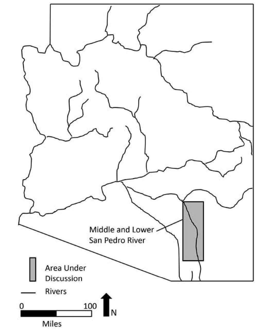
It is not feasible to talk about population adjustments in the region unless all people are accounted for, not just the most visible. Population dynamics, social networks, and regional change cannot be understood when attention is focused exclusively on the culture groups that have received the bulk of past research. The lack of consideration given to the influx of these less visible peoples unnecessarily limits our understanding of the complex nature of occurrences during the Late and Terminal Prehistoric eras. We suggest that if the arrival of new peoples is included when questions of migration, reorganization, and social networks are considered, it is possible to obtain a more accurate and interesting perspective.
The SSNP Narrative on Depopulation
Like the databases and analytical tools that support it, the revised SSNP narrative is best presented as series of steps rather than a finished product. The process began with use of the CCD for an analysis of demographic trends. As has been long known, aggregation of population into larger and fewer communities (“coalescence”) preceded population loss, but the key finding of these studies is that this process took place gradually over a period of 150 years (Hill et al. 2004:690). Actual abandonment was the final movement of a much-reduced remnant population. Climate played only an indirect role in the developments. Climatic deterioration spurred migration from the Kayenta/Tusayan area into the southern Southwest, setting off a chain of social and demographic events (Clark et al. 2004; Hill et al. 2004:698). Climate-driven processes on a more local level, such as channel incision and loss of canal headgates in the Hohokam area, local human-induced environmental degradation, and others also played a role, but the main effect of the Great Drought was the migration events that it set in motion (Clark et al. 2004; Hill et al. 2004; Hill et al. 2010).
The next phase of the study work focused on migration (Clark et al. 2004; Clark 2004; Lyons 2015; Mills et al. 2013). As has long been known, the thirteenth century saw a great exodus from the northern Southwest to destinations in the south. The far north was left abandoned (or, as we argue, at least with respect to the most visible prehistoric manifestations), and a demographic fault zone opened between the north and the south as the communities that formerly provided connections were depopulated. As described in several studies (Hill et al. 2004, 2010; Mills et al. 2013, 2015), the effects of migration varied greatly by region. In the San Pedro Valley the migrants set up communities that replicated those from which they had come, archaeologically manifest as the Salado or ancestral Pueblo culture. Concomitant with their arrival and perhaps as a result of their presence, extensive subsistence strategies that had formerly been practiced fell away in favor of almost complete reliance on irrigation agriculture (Hill et al. 2004:703). Ultimately, the migrants and the resident population mixed, forming even more aggregated communities until the population of the San Pedro Valley was contained in a single large aggregation at Flieger Ruin (AZ BB:2:7, ASM), located near the San Pedro-Aravaipa Creek confluence (Hill et al. 2004:703). When that community also failed in the mid ad 1400s, according to the SSNP narrative, the valley was devoid of population.
Setting aside other topics on migration that the SSNP has addressed, we focus here on the timing of the events as they are interpreted in the migration model. First, the migration reached a crescendo late in the thirteenth century. As discussed below, this coincides closely with an additional migration from the south by people who are ultimately recognized as the Sobaipuri O’odham, by Athabascan speakers from the north, and also by the splintering, arrival, or emergence of non-Athabascan mobile groups that may have been Uto-Aztecan-speakers and are later referred to as Jocome, Jano, and others. Second, the timing of the final “depopulation” corresponds to increased Sobaipuri O’odham occupation focused on the same riparian niche as those the northern migration displaced and by mobile peoples who competed for some of the same resources but practiced different life- ways and used different landscape sectors. The Sobaipuri Oodham immigrants were also upstream from Puebloan groups, which would have allowed them greater control of water relative to downstream settlements. This meant that Puebloan groups were marginalized with regard to water availability as well as with respect to preexisting communities. Substantial data indicate that the San Pedro Valley was not depopulated, but rather the Hohokam, ancestral Pueblo, and Trincheras had been replaced by and integrated with these culturally distinct irrigation farmers (the Sobaipuri Oodham).
The SSNP team has expanded and refined the database to examine both the demographic and migration models by use of Social Network Analysis (SNA). These methods, developed in Quantitative Sociology, have received a great deal of discussion elsewhere (for example, Knap- pett 2013), where the focus is on the way applications have refined the narrative concerning depopulation of the Southwest. Like any novel analytical approach, Social Network Analysis in archaeology has experienced growing pains, but methodological problems have been addressed elsewhere (Harlan 2012, 2016) and are of lesser concern here. Also, the SSNP team has considered a range of additional topics (Borck et al. 2015; Mills et al. 2013, 2015) that need not be addressed here.
The San Pedro, where the best data are available, is seen as a place where migrants were able to quickly establish themselves, maintaining their ethnic identities and emerging as key players, as manifest by ancestral Pueblo sites such as Davis Ranch and Reeve Ruin. Northern Pueb- loan migrants in the San Pedro were important players in a unifying set of spiritual beliefs that are physically manifest in the distribution of Salado Polychrome pottery, allowing them to achieve a high degree of centrality, while communities of the first-comer Hohokam were less central. The migrants and first-comers ultimately blended into a smaller number of more intensely aggregated mixed communities that failed, leaving the region depopulated.
The end game—both on the San Pedro and in other regions the SSNP team has investigated—is the same as that seen in the demographic and migration analyses. A smaller number of communities continued on in isolation for some time but finally failed, leading to the apparent “despoblado” that Coronado observed and the distribution of settlement as it existed in the Historic period during Father Eusebio Kino’s time (e.g., the 1690s; Clark et al. 2004). Contrary to this narrative, a fresh read of the Niza and Coronado documents in light of new archaeological data indicate that they did in fact encounter each of the three main groups that occupied the area, perhaps even visiting them in the San Pedro Valley (Seymour 2008a, 2009g).
The presence of these low-visibility sites does not fit the existing narrative and they therefore have yet to be integrated into the “comprehensive model” that assumes that “much of the population of the region was living in above-ground masonry and adobe structures that are often visible on the surface.” So while “trends in site size indicate that through time more people lived in the larger sites that have a better chance of being recorded today” (Hill et al. 2004:692), this is true only for the ancestral Pueblo segment of the population. A more inclusive and empirical rendering of the data allows for a deeper understanding and more rigorous assessment of this era.
Although not explicitly stated, the view held by the SSNP analysts intercepts with the common belief that the many artifact scatters that constitute most sites recorded in the region result either from occupations that preceded sedentism (Archaic and Basketmaker manifestations) or from the logistic subsistence activities of later sedentary groups. Because the SWSN was developed from the CCD, other sites were included in the database (although not low- visibility sites), but even those smaller sites are not generally considered in the analyses (Mills et al. 2013).
Several related studies conceded that subsistence practices might have changed in ways that rendered populations invisible, but all then proceed as if this inconvenience had no bearing on their conclusions. None of the studies even considers the fact that groups practicing mobile subsistence strategies had entered the Southwest no later than ad 1300 and that their presence must have had some bearing on the processes the studies wish to understand. This omission is a bit hard to comprehend, given the extensive literature on these less visible mobile and farming residents that has been available for some time (Seymour 1988, 1989, 1990, 1993a, 1993b, 1995, 2002, 2003a, 2007a, 2007b, 2008d, 2009a, 2009d, 2009e, 2009k 2009g), and the literature continues to accumulate (Seymour 2010a, 2010b, 2010e, 2010f, 2011a, 2011b, 2011c, 2011d, 2012a, 2012b, 2012c, 2012d, 2012e, 2013a, 2013b, 2013c, 2014a, 2017; Seymour and Sugnet 2016). If nothing else, these mobile peoples likely influenced the need for networks, affected the routes by which people could safely interact with one another, and altered the types of subsistence that could be practiced. The remainder of the discussion considers how remedying this lacuna could enrich the new narrative as presented up to this point.
The San Pedro as an Opportunity for Refinement
As indicated above, studies in the lower San Pedro Valley have played a pivotal role in the development of the refined narrative. In addition to extensive investigations that preceded its project, the SSNP has conducted test excavations at 27 sites that it believes constitute almost all known residential sites in the area occupied between ad 1200 and 1500 (Mills et al. 2013). Further, the San Pedro is considered one of the clearest cases of migration from the north (Hill et al. 2010; Lyons 2015; Mills et al. 2013) and also typifies the process the SSNP describes of spiraling aggregation leading to final failure (the “aggregation trap”; Hill et al. 2010:48).
On the other hand, extensive research not considered by the SSNP team also makes the San Pedro a particularly apt place to reexamine and refine the narrative. It is now a certainty that this was not an empty landscape after ad 1450 and that there are residential sites along the San Pedro occupied between ad 1200 and 1500 that are not included in the SSNP database. The database of known “Protohistoric” (Late and Terminal Prehistoric and Early Historic) sites has grown substantially over the last three decades, so that now many Sobaipuri Oodham, Apache, and non-Apache mobile group sites have been recorded. The San Pedro has been the focus of much of this work, which is specifically relevant to the Late Prehistoric period. Extensive survey and excavations by Seymour on both the lower and middle San Pedro and portions of the upper San Pedro have provided the official AZSite database with a string of new sites (Seymour 1989, 1990, 2011a, 2011b, 2011d, 2014a, 2016; Seymour and Sugnet 2016).
As an example of the extent and importance of this neglected information, 88 definite Sobaipuri Oodham archaeological sites are now known in southern Arizona. This is far more than the nine actual Sobaipuri sites known in the 1980s,[12] which is apparently the baseline that the Archaeology Southwest researchers are using. On the San Pedro alone there are now 59 confirmed and newly discovered Sobaipuri Oodham sites whereas three decades ago there were three actual such sites.[13] This increase in recorded Sobaipuri Oodham sites and components results both from focused effort to identify evidence from this period relating to this group by Seymour and from the fact that more archaeologists are learning to recognize these subtle remains. Moreover, modern chronomet- ric techniques (including luminescence dating, which is more appropriate for this time period than radiocarbon dating and often more precise) and fine-tuned material culture studies have allowed isolation and greater understanding of these components, which are often found on multicomponent sites, including overlying the ancestral Pueblo occupation.
Although lack of external funding has made the process of dating these sites slow, for the Sobaipuri Oodham alone there are now well over 150 chronometric dates available as compared to the nine that preceded this work (see Seymour 2011a, 2011b, 2016). We know from chronometric dates from the San Pedro and elsewhere that the sites span a period of occupation starting sometime between ad 1200 and 1300 and going up to the late 1800s, when the Sobaipuri Oodham and Apache were removed from the area by the U.S. military or private landowners (Seymour 2011a, 2011b, 2011c, 2011d, 2014a) (Table 13.1).[14]
Seymour’s work in the middle and lower San Pedro and adjacent valleys has also provided evidence for the presence of Athabascan (Cerro Rojo complex) and non-Athabascan mobile groups (Canutillo complex). There are an equal number of new chronometric dates available for these mobile groups (Seymour 2013a). This work has also given us a clear idea of the kinds of conflicts that occurred between them and the sedentary Sobaipuri Oodham in the San Pedro in Early Historic times (Seymour 2010f, 2011a, 2011d, 2014a, 2015b). Thus the San Pedro also provides a place to begin looking for the influence of non-Hohokam and non-ancestral Pueblo peoples on the processes the SSNP narrative describes. In fact, without these additional data, perceptions of the Late Prehistoric period will remain incomplete at best. Our data suggest that it is these external factors that exacerbated the effects of internal processes. Moreover, deteriorating societal conditions made room for, fostered the expression of, and heightened the impact of external factors (Seymour 2011a).
Competition between the Sobaipuri Oodham on the one hand and the Hohokam, ancestral Pueblo, and Trincheras on the other is likely to have been direct, given that all depended heavily on irrigation agriculture. The lush riparian areas must have always been contested, and this tension is likely visible on the middle and lower San Pedro in the evidence of conflict, including many burned late pueblos and arrow point concentrations that are consistent with a recently defined battlefield signature (Seymour 2010f, 2014a, 2015b). Further, the Sobaipuri Oodham have traditional stories that describe a direct role in the final days of the prehistoric groups that preceded them. Not only do modern Oodham note with reference to their migration legends that they chased the Hohokam out of the area (Edmund Garcia, personal communication to Seymour 2009), but their oral histories recorded in the late 1800s and early 1900s also document a period of conflict when newcomers crumbled the adobe walls with their magic (Oodham metaphor for warfare; see Seymour 2014a) and killed the evil leaders (Mason 1921; Russell 1908; Underhill 1939:10). Those remnant community members who accepted the new way were allowed to live side by side with the Oodham and likely account for the intermixing of prehistoric groups and newcomers (Seymour 2011a). This is not, however, the type of intermixing the SSNP migration model contemplates.
Table 13.1. Recent Thirteenth–Fifteenth-Century Chronometric Dates on Sobaipuri, Ancestral Apache, and Canutillo Complex Sites in the Southern Southwest.
| Site # | Date | Technique | Culture Group |
|
AZ EE:8:283/ Gaybanipitea |
AD 1220±80 (AD 1140–1300) |
OSL (UW2627) Whetstone Plain, Structure 26 |
Sobaipuri O’odham |
| AZ EE:9:153 |
AD 1314±140 (AD 1174–1454) |
OSL (X2062) Burned rock in fire pit, F7 |
Sobaipuri O’odham |
| AZ EE:9:153 |
AD 1370±130 (AD 1240–1500) |
X2063 Early O’odham plainware, F6 |
Sobaipuri O’odham |
|
AR 03-05-01-442/ Three Sisters |
AD 1374±40 (AD 1334 to 1414) |
TL (X1874) | Ancestral Apache |
|
LA 117112/ FB 16265 |
AD 1415 to 1490 (cal BP 535 to 460) |
14C (Beta-188760) Grass on platform cache |
Ancestral Apache |
| AZ CC:7:11, BLM |
AD 1270 to 1320 (cal BP 680 to 630) and cal AD 1350 to 1390 (cal BP 600 to 560) |
14C (Beta-203376) Grass on platform cache |
Ancestral Apache |
|
LA 37188/FB 9609/ Cerro Rojo |
1420±80 (1340–1500) |
OSL (X1517) Llano Plain sherd |
Ancestral Apache |
| FB 1640; Pronto site |
cal AD 1300–1430 (570±40 BP) |
14C (Beta-175192) Corn cupules, F3, with microtools |
Ancestral Apache |
|
AZ DD:8:44/ Sharples Site |
AD 1456±40 (AD 1416–1496) |
OSL (X2549) Plain sherd, flat on hut floor, F3 |
Canutillo |
| NMH1 |
AD 1420–1500 (cal BP 530 to 450) |
14C, Beta-167025 Charred brushy material, direct association with Soto point |
Canutillo |
| LA 84424 |
cal AD 127 to 1400 (cal BP 680 to 550) |
14C (Beta-169609) F1 |
Canutillo |
| LA 84424 |
cal AD 1400 to 1450 (cal BP 550 to 500) |
14C (Beta-172175) F2 |
Canutillo |
Note: See Seymour 2011a:Table 9.1 for numerous additional O’odham dates from this early era obtained by other researchers.
The presence of competing hunter-gatherers in the territories of sedentary agriculturalists has also received too little attention. Stated in outline, the problems for farmers who lack livestock are different than for those whose livestock provides a secure protein source. When farmers have livestock, they are able to protect their animals by keeping them under watch in herds and even bringing them inside the settlement at night. Hunter-gatherers left in the countryside (generally viewed as outlaws once effective polities have formed) may pick off the occasional stray or even have some success in stealing animals from the settlement, but the protein source is largely secure. When farmers depend on continued hunting as a significant source of protein, their more difficult task is to protect their hunting grounds from competition and to hunt individually or in small groups in the face of competing people who do not wish to share the available game. As seen in the historic relations between groups from the Plains and those residing in Southwestern Pueblos, various mechanisms of exchange and gifting could be employed, but the fundamental tension remained with violent conflict often ensuing (Seymour 2015a).
A More Complete Network Analysis for the San Pedro
Against this backdrop, we have conducted a limited network study of the lower and middle San Pedro that considers the existence of Sobaipuri Oodham farming communities and mobile group presence. The scope is restricted, owing largely to the need for additional research, especially dating studies that target successive components (Seymour 2011b), but it shows the possibilities for improving the revised narrative through inclusion of this type of information.
The analysis uses data from the SWSN and employs Archaeology Southwest’s approach to temporal control (Roberts et al. 2012).[15] The method for inferring network ties based on shared similarities in painted ceramics also closely resembles the one used in several studies, with the exception of how the similarity data are converted to binarized network ties.[16] Despite the known sensitivity of all SNA to the cutoff used in binarization (Peeples and Roberts 2013), Archaeology Southwest’s studies that require a binary network or that choose to present network ties visually have all used an arbitrary cutoff, a Brainerd-Robinson similarity coefficient of 0.75. Quick inspection of the similarity matrices for the current study indicated considerable differences in mean similarity for the different time slices, such that use of a single arbitrary cutoff would have swamped the relationships of interest here. The cutoffs used here were based on the mean similarity for each matrix, plus one standard deviation.
The results of the analysis are presented in Figures 13.2 through 13.6. Figure 13.2 encompasses the entire lower and middle San Pedro and shows that the sites Seymour has recorded and revisited occur throughout the region, whereas those in the SWSN database are confined to roughly the northern half or part of the lower San Pedro. The most fascinating aspect of this distribution is that Sobaipuri Oodham site density is exceptionally high (6 sites per mile in the densest-occupied area) on the middle San Pedro (between approximately Benson and Fairbank) and also in the Tres Alamos area (10 sites per mile in the densest-occupied area), but drops off precipitously from about Cascabel/ Kelsey Canyon north (1 to 3 per mile, with the densest area near Redington), where some of the richest agricultural lands and abundant and reliable water are located. While these Sobai- puri Oodham sites are not all contemporaneous and represent extended periods of use as settlements shifted up and down the river margins in the vicinity of existing infrastructure (Seymour 2011a), they definitely show the comparative density of sites between areas. Sites cluster in the south, resembling a logjam building against resistance, which in this instance may have been ancestral Pueblo communities. These Sobaipuri Oodham sites to the south (on the middle San Pedro) are much larger than the majority to the north, suggesting larger population aggregates. The smaller number, generally smaller size, and lower density of Sobaipuri Oodham sites in the north suggests a shallower time depth, especially as compared to the temporal depth indicated farther south. Moreover, the distributions of Sobaipuri Oodham sites relative to ancestral Pueblo sites in the SWSN database indicate a possible social-political boundary in that Sobaipuri Oodham site density drops off noticeably where the ancestral Pueblo network begins until after the latter sites are abandoned. Unless this is an artifact of the way the site data were acquired from the AZSite database when the SWSN was created, it seems possible that the Sobaipuri Oodham farmers had already moved into the area from the south, making part of the valley unavailable to both the indigenous Hohokam and the ancestral Puebloan migrants.
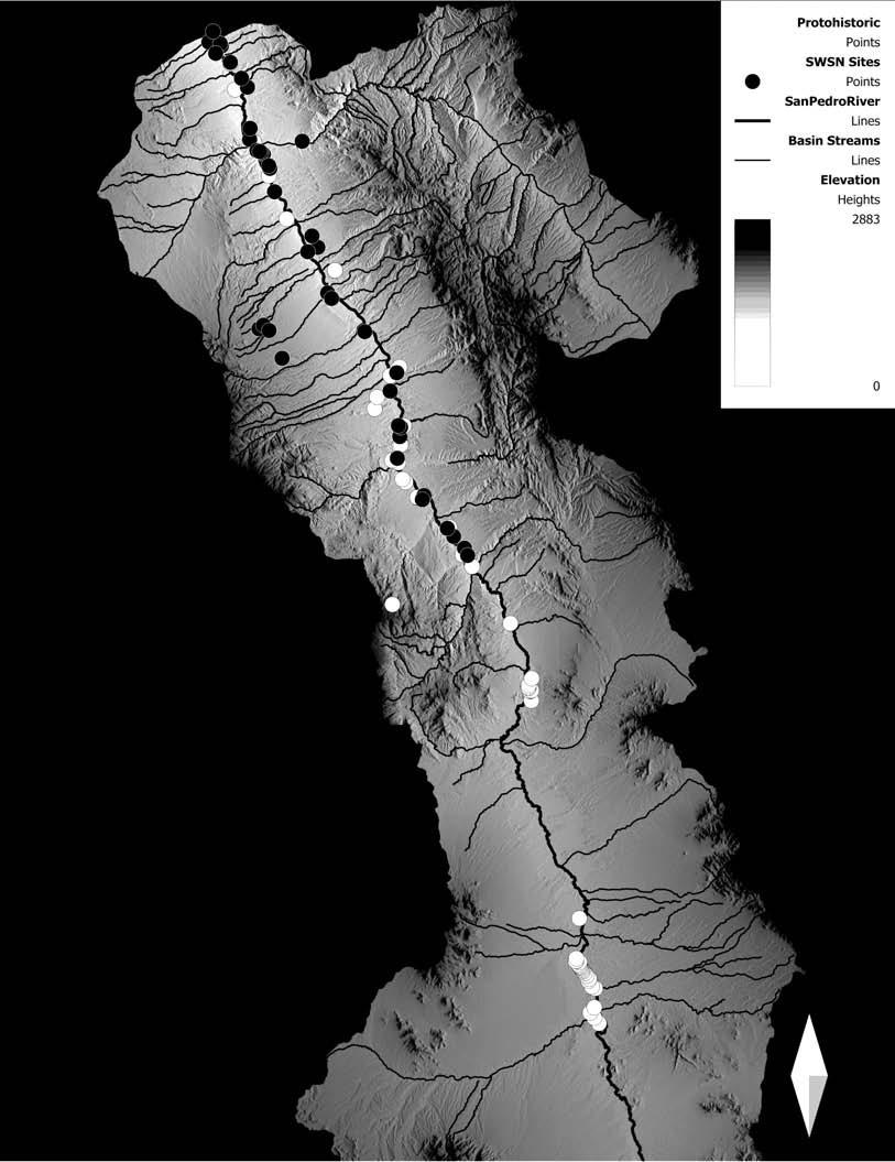
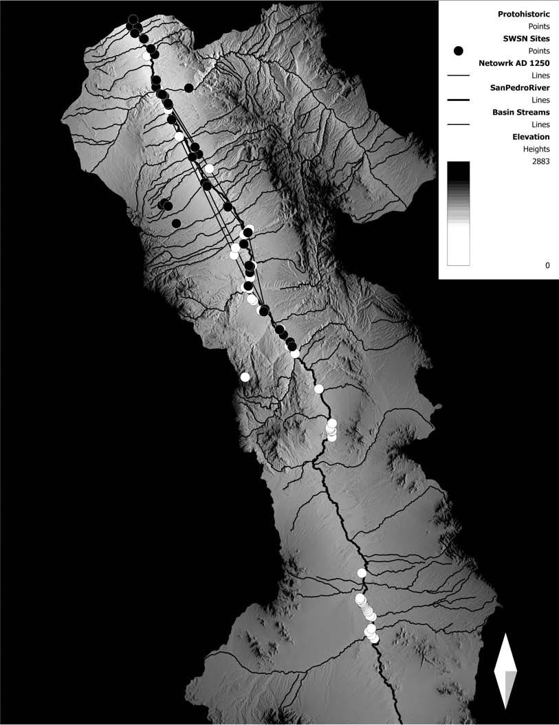


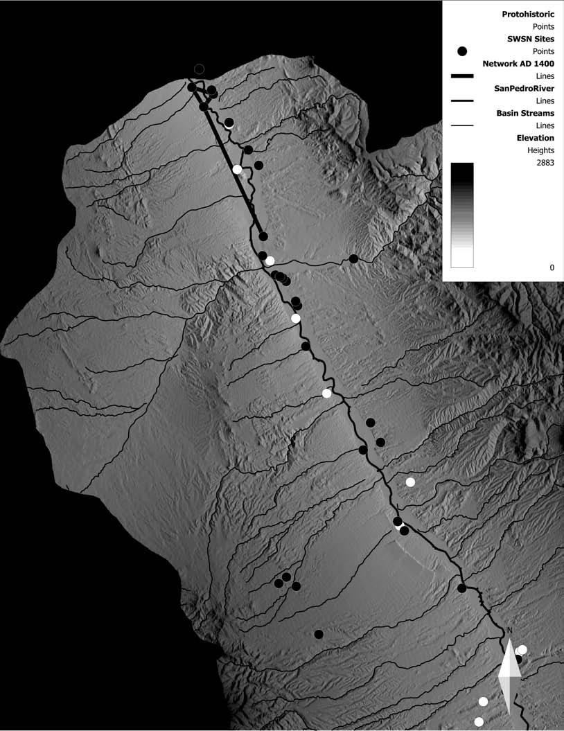
Figures 13.3–13.6 depict the network ties among the sites in the SWSN database by 50- year time slice, there being no currently available basis for constructing a network among the Sobaipuri Oodham sites, between mobile group and Apache sites, or between those sites and either the ancestral Pueblo or Hohokam sites. We know, however, that based on the chrono- metric data available, the earliest Sobaipuri Oodham sites are to the south on the middle San Pedro, these sites having produced dates as early as the ad 1200s.[17] This supports the inference that this group moved in quite early and likely influenced the expansion and contraction of the more archaeologically visible populations. As additional chronometric dates become available, more can be said about this progression.
Sobaipuri Oodham groups occupied only certain portions of any river valley, and the placement of their sites was determined by river valley attributes (see Seymour 2011a). Consequently, long segments of the San Pedro are devoid of Sobaipuri Oodham settlement because the river channel characteristics were unsuitable for irrigation agriculture. Yet all along the river in suitable areas there are both Sobaipuri Oodham and prehistoric Hohokam and ancestral Pueblo settlements. When Sobaipuri Oodham settlements grew too large for available land or when strife arose within a village, members split off to establish a new settlement. Also, others moved in from adjacent regions. These migration events and shifts (long recognized among the Oodham as village drift; Darling et al. 2004; Ezell 1961:110; Seymour 1989, 1990, 1993b, 1997, 2003a, 2007b, 2011a; Underhill 1939), along with river channel characteristics, resulted in the development of distinct territorial and irrigation-system-based political groups among the Sobaipuri Oodham. One manifestation of this occurred during the Historic period (ad 1690s), when there were two political divisions among the San Pedro Sobaipuri Oodham, one north of the Redington Narrows (the area in which the SSNP data most apply) and one to the south in the Fairbank area and downriver (north) past Tres Alamos. Historical documents indicate that there was conflict between the leaders of these two territories that was not healed until Kino’s 1697 expedition (Burrus 1971:201; Karns 1954:79).[18]
The early Sobaipuri Oodham presence on the San Pedro is relevant to the question of contemporaneity and in- and out-migrating Hohokam and ancestral Puebloan groups: in 1716 Padre Luis Velarde recorded that the residents of Santa Cruz de Gaybanipitea (where the earliest chronometric data relating to the Sobaipuri Oodham has been obtained),[19] on the middle San Pedro, used to have trade fairs with the Moquinos until they fought, at which time the friendliness and commerce ceased (Wyllys 1931:139). Many researchers have assumed that this passage refers to the populations of the modern-day Hopi Mesas, but in the context of these newest available data it is interesting to ponder whether this historical passage may be referencing relations on both the middle and lower San Pedro in the Late Prehistoric period. The many burned compound sites and presence of both Hopi pottery and Saladoan polychromes, even on the middle San Pedro, would be effectively explained by this event. This snippet of Sobaipuri Oodham history would explain the retraction of ancestral Pueblo sites (Seymour 2014a:138).
As shown in Figures 13.3–13.6, the density and extent of the ties within the ancestral Pueblo network increased steadily up through ad 1350. By ad 1400, however, this network had collapsed and the remaining ties were among only four sites located at the far northern reaches of the region. This is consistent with the distribution of Sobaipuri O’odham sites, in which densities are highest along the middle San Pedro to the south and show considerable time depth. This is also consistent with the likelihood that the Sobaipuri Oodham entered the region from the south. The temporal depth is indicated by radiocarbon and luminescence dates as well as multiple superimposed structures, structure alignments changing orientation, and multiple structure alignment groupings (or plazuela groups) that indicate reoccupation and reestablishment of a village (see Seymour 2011a, 2014a). The lower densities to the north may reflect this delay in northward movement coincident with the retraction of this ancestral Pueblo system.
The Archaeology Southwest researchers have noted similar patterns with regard to network density and extent of ties and then the subsequent collapse, which resulted in limited presence in the far north. They advanced a number of explanations, as briefly summarized above. Of course, given their belief that all processes were internal to the Hohokam and ancestral Pueblo communities or resulted from relations among them, they do not consider the possibility that the presence of Sobaipuri Oodham farmers and mobile peoples might have been an intervening or even definitive force in the developments. Although Hill and others (2010:47) make mention of Oodham oral traditions concerning their role in the end of the Hohokam, this dynamic is not given serious consideration. The strength of the pattern shown in Figures 13.2–13.6 indicates that the presence of these other groups must in fact be given real consideration if we are to understand the basis for the pattern, changes through time, and the reasons for shifts in the distribution of the more easily recognized sites.
Even at the gross level available at this stage in Sobaipuri Oodham, Apache, and non-Apache mobile group research, and with many of the components on repeated-use sites not yet dated (see Seymour 2011b, 2016), an alternative narrative suggests itself. The Sobaipuri Oodham began to move into the middle San Pedro from the south shortly after the northern migrants arrived from the north. As the region filled in, the Hohokam and ancestral Puebloans found it impossible to extend south of the midpoint in the region (or found it necessary to withdraw) because the Sobaipuri Oodham had taken and were defending the available locations for irrigation agriculture.[20] This pressure is visible in the middle San Pedro, where dense Sobaipuri Oodham site distributions butt up against and overlie ancestral Pueblo communities, and on the lower San Pedro (to the north), where Sobaipuri Oodham site densities are lower and seem to be later, perhaps representing a northward expansion as the sector emptied. Increased pressure from the Sobaipuri Oodham was also likely a key factor in intensifying the networks among ancestral Pueblo and Hohokam communities, leading to all of the deleterious effects discussed in various social network studies relating to this area. The societies thus weakened were simply unable to hold out against the Sobaipuri Oodham, known historically as the best of warriors (Nentvig in Smith 1863:105; Wyllys 1931:138). Thereby being confined to the northernmost reaches of the valley where mobile groups pressed in upon them, the ancestral Puebloans were finally pushed out completely.
Far from leaving behind an empty landscape, the ancestral Puebloan groups were removed from a region where the Sobaipuri Oodham continued to flourish, as seen by Fray Marcos de Niza in 1539 (Seymour 2008a, 2009ft 2011a, 2011b). The Sobaipuri Oodham continued as vibrant and powerful communities until decimated, initially by disease and warfare. Nonetheless, they remained a dominant community that Padre Kino sought to bring into the Christian fold. When the end-game was played out, it was not forces internal to indigenous societies that brought about the demise of the Hohokam and ancestral Pueblo communities along the San Pedro, but rather (or also) pressure from sedentary farming Sobaipuri Oodham and the Apache, Jocome, and allied groups whose raiding cultures were greatly strengthened later by the addition of horses and firearms. Neither was the end-game a matter of extinction for everyone on the San Pedro. Premature reports of their demise notwithstanding (Tucson Citizen 1930, 1931), descendants of the Sobaipuri Oodham are alive today in their community at Wa:k, where they are currently seeking to reclaim their heritage despite the loss of their lands.
Discussion
The discussion presented here is not a rejection of the revised narrative created by the SSNP team and those that have gone before them. To the contrary, it confirms its broad outlines. Abandonment by the groups in question was a process played out over the 150 years from ad 1300 to 1450, perhaps longer if some of the recently obtained dates from smaller burned ancestral Pueblo sites on the middle San Pedro are any indication. Migrations of ancestral Pueblo folk from the north seem clearly to have occurred, as was suggested previously by Di Peso (1958) and others, one motivation being the environmental degradation caused by the Great Drought. During that time, a variety of factors led to profound changes in lifeways that had undergone steady development from the tenth century onward. Yet the narrative will not be complete until it incorporates information on the groups that are not represented by the major archaeological cultures, however difficult it may be to find, document, and date their archaeological manifestations. The groups that left less visible remains were often those that were changing the course of events. It may be that the movements undertaken and the character of the social networks being studied resulted from the influence of these groups.
With this plentiful new data the notion of an empty niche should now be laid to rest. The southern Southwest, and the San Pedro Valley specifically, was a crowded and contested social landscape (Seymour 201^:43–45). Ancestral Oodham, ancestral Apache, and mobile non- Apachean groups thrived in the area, arriving at least as early as the ad 1200s and 1300s, respectively (Seymour 2009b 2009g, 2010a, 2011a, 2011b, 2012a, 2013a). Moreover, we suggest that the reorganization and repositioning noted by Craig (Chapter 12, this volume) likely relates to the influx of these new peoples, who took over the best lands and the most favorable locations along canal systems. The invalid assumptions regarding regional population estimates relate to the difficulty of seeing sites that are not represented by above-ground compounds, as was noted by Craig. These additional data demonstrate that the processes that unfolded during this period were far more complex and more interesting than current models can accommodate.
The shift to a more aggregated settlement pattern is consistent with the successful and aggressive entry of new peoples—peoples who would later be known as the best warriors and as iconic symbols of resistance. Aggregation has been suggested as a response to conflict for quite some time and is acknowledged by Hill and others (2004:689, 2010:45, 46) as reflecting “social tensions.” In the “core area,” tension, disarray, and decay are attributed to environmental factors (Hill et al. 2010:45–47). The role of newcomers who might have contributed to this “tense disarray” is not considered, including mobile raiders and Oodham who took over the best agricultural lands. Oodham traditional accounts suggest the newcomers obtained these lands by force (Bahr et al. 1994; Russell 1908:26; Underhill 1939:10), and some of the earlier historical records left by Marcos de Niza (Seymour 2007a, 2008a, 2009g, 2011a) clarify that at least some of these lands were highly productive at first contact, indicating that the newcomers fared quite well.
The decline in ancestral Pueblo health and settlement shifts noted for this period between the late fourteenth and early fifteenth centuries may represent a displacement of Hohokam and ancestral Pueblo populations by newcomers accompanied by the environmental degradation and depletion suggested (Seymour 2011a:93, 294299). The expansion of agricultural fields located at the distal ends of the irrigation systems and the abandonment of major settlements at canal heads (Hill et al. 2010:46) is easily explained by the emerging dominance of another group and the commensurate decline of the Hohokam and ancestral Puebloans rather than the decrease in overall productivity. After all, the Spaniards did the same thing in the Early Colonial period when they pushed Puebloan populations out of their villages and took the most favorable lands for themselves. The late-fourteenth-century decline of the largest sites that once controlled the intakes of the largest canal systems in the Phoenix Basin (the Hohokam core area) and the displacement of the most important settlements are effectively explained by the rise in dominance of the Oodham. Similarly, movement out of upland zones (see Hill et al. 2010:45) is an expected response to pressure from raiding and warring groups that made these areas their home.
So while it may be true that “an influx of Puebloan immigrants from the north led to a shift from a dispersed, extensive settlement/sub- sistence strategy to increased conflict, aggregation, and economic intensification” (Hill et al. 2004:689), it is not just the ancestral Puebloans and Hohokam who need to be considered. There were a minimum of three additional groups present at this time with three distinct and archaeologically recognizable adaptations in the San Pedro River Valley and adjacent areas. Thus any explanation that seeks to understand social networks and intercultural interaction must take into account these heretofore ignored groups.
Conclusion
The limited analysis presented here is only a pale indication of the potential for such studies. Unfortunately, it will be difficult to take this line of inquiry much further until two developments take place. (1) The many field archaeologists at work in the Southwest must be made aware of the site signatures for the Sobaipuri Oodham and the mobile groups that we now know were present by no later than ad 1300. Until these sites are consistently discovered and included in project documentation, we will continue to lose them to disturbance and destruction. (2) Those who control the sources of research funding will need to open the purse strings to support dating and other specialized analyses, without which the sites cannot be fully characterized. Until we have more complete information on a much larger representative corpus of sites, we will not be able to incorporate these peoples into the narrative of Southwestern transformation. It has been almost a century since Emil Haury and Charles Di Peso made clear to the profession that cultural manifestations much less obvious than ancestral Puebloan sites are present. A more complete view of the Late Prehistoric and Terminal Prehistoric/Historic period transition will occur only when the full range of sites and culture groups is included.[21]
14. Needzif
Dine Game Traps on the Colorado Plateau
James M. Copeland
Protohistoric game drives in the western United States composed of long fences used to funnel game into corrals or catch pens are not uncommon, but the level of research and attention they have garnered varies from region to region. Unlike on the High Plains or in the Great Basin, there is a dearth of research on game drives on the Colorado Plateau. In a review of antelope communal hunting (Lubinski i999:Figure 3), not a single “enclosure” (a.k.a. corral) was identified on the Colorado Plateau. Historically and ethnographically, surrounds and drives of antelope into impoundments are attributed to many groups on the plateau, including various Apache groups (Cremony 1868; Gifford 1940; Opler 1941), Zuni (Gifford 1940), Hopi (Parsons 1936; Curtis 1922), Isleta, Jemez, Santo Domingo, San Felipe, and Santa Ana pueblos (Curtis 1926), Santa Clara (Hill 1982), and the Navajo (Hill 1938; Gifford 1940).
Among the Navajo, antelope were the second-most important source of meat after mule deer except in the western area, where antelope had primacy (Hill 1938:145). Antelope yield about 20 kg of meat per animal whereas mule deer average 40–53 kg (Field et al. 2003a, 2003b). For the Navajo, the taking of antelope, along with deer, bear, and eagle, fell in the category of ritual hunting, and observances and behavior employed by the hunters followed the same prescriptions required for healing chants and for war (Hill 1938:97). Highly structured ceremonially, these methods involved various combinations of men flushing, ambushing, stalking, or running down game. Pitfall traps were also used. In some cases surrounds of upward of 20 men would be employed. In the Navajo Stalking Way ceremony an individual wore a head disguise of deer or antelope skin and horns and sought to attract the attention of the animal to the point where it could be ambushed and shot. Cremony (1868:28–29) reported that the Apache stalked antelope using the head and horns of an antelope. Franciscan Fathers (1910:475) also reported that disguised Navajo hunters would use two sticks to aid in walking while stooped over (presumably to look like a four-legged animal) and would sling their weapons below their abdomens. All hunting, for antelope or otherwise, was viewed by the Navajo as dangerous and fraught with uncertainty (Reichard 1974:167).
By far the most common Navajo hunting ritual for antelope was Corral Way, a ceremony that was most likely extinct by the early twentieth century (Franciscan Fathers 1910; Andrews 1983:8). Corral Way employed circular wooden impoundments and long wooden fences, or “wings,” whose lengths were extended upward of 1.5–3 km by brush piles that acted like a funnel as game approached the corral (Hill 1938:Figure 7). The Navajo call these traps needzu’. A Hopi antelope trap observed by Stephens in the late nineteenth century (Parsons 1936:278–279) is strikingly similar to Navajo traps, with a corral and wings diverging from the opening up to 800–1,000 m and extending several additional kilometers with brush piles and boughs. Gifford (1940:85) described a similar kind of trap in use among the Zuni.
First outlined with corn pollen or cornmeal, the Navajo corral was built in a clockwise manner, and as one faced outward from the gate, the right wing was constructed, followed by the left wing (Nez 1959). Navajo trap building and driving required the labor of up to 50 men and reportedly took three to five days to construct the corral and two to three days for the wings. Hill (1938:145–146) reported that 20 to 50 Dine men on foot or horseback would carefully drive antelope into the trap. In the event that the antelope began to turn, fires might be lit to turn the animals back toward the trap (Watson 1965). Gifford (1940:85) reported that 12 Navajo men were sufficient for driving antelope to the trap and that one animal was always released for good luck. Dave Brugge was told by Navajo informants during fieldwork for the Navajo Land Claims Project that two antelope would be released to ensure replenishment (Dave Brugge, personal communication 2012).
In comparison, Great Basin Shoshone and Paiute impoundments involved upward of 100 or more participants, men and women, and reportedly could be built in a single day (Steward 1938; Kelly 1932), although other accounts indicate that with 20 to 30 families, three to seven days would be required to build the trap and drive a herd (e.g., Egan 1917:238–241; Fowler 1989:14–19). Although both Navajo and Shoshone/Paiute drive hunts were under the direction of spiritual leaders, perhaps the smaller workforce and complex attention to ritual behavior lengthened the time the Navajo needed to build their traps.
Dine antelope hunts were in February and might be quickly repeated if successful (Hill 1938). Analysis of bone recovered from a Protohistoric Navajo antelope processing site in the San Juan Basin suggests that because no subadult remains were found, the animals at that site were harvested in early spring (Reynolds et al. 1984). In contrast, Curtis (1922:47) noted that the Hopi hunted antelope in the “warmest weather.” Great Basin hunts were held once every one to seven years (Steward 1938:33). These hunts may have been so devastating to herds that it took several years for the numbers to recover sufficiently to justify the investment of a new hunt (e.g., Egan 1917; Steward 1938).
The antiquity of constructed antelope game traps is unknown, but Hockett (2005) and Hock- ett and Murphy (2009) suggested that communal hunting in the north-central Great Basin began between 5000 and 3500 bp. Their genesis on the Colorado Plateau is unknown, but antelope bone, both worked and unworked, is reported from eleventh- and twelfth-century Chaco sites in the San Juan Basin of northwest New Mexico (Judd 1954; Carlson 1966; Akins 1987). An unambiguous depiction of an antelope game drive is presented in a twelfth-to-thirteenth-century petroglyph at a site near Holbrook, Arizona, in the drainage of the Rio Puerco of the west (Figure 14.1).
Protohistoric petroglyphs of game traps are also known from the Largo and Gobernador canyons in northwest New Mexico, an area of concentrated Navajo occupation during the fifteenth to mid-eighteenth centuries. One petroglyph of a game trap, co-located with an image of the Navajo deity Monster Slayer (Figure 14.2), may relate to his association with antelope as the tutelary of rare game animals, including antelope (Reichard 1974:Chart 1). Petroglyphs of pronghorn themselves, not associated with traps, are also known in tributaries of Largo Canyon, and in one case the animals are represented nearly life-size.
On the Navajo Indian Irrigation Project (NIIP) in the area of Cedar Canyon (a.k.a. Cedar Wash), a site excavated south of Bloomfield, New Mexico (LA 17483; Reynolds et al. 1984), yielded large amounts of antelope bone, over 200 Desert Side-notched and Cottonwood Triangular projectile points, a ceramic Dinetah Gray jar and bowl, and four radiocarbon dates between ad 1565 ± 55 and 1785 ± 50. Although no traps were identified in the 84,000 ha of NIIP surveys (Vogler et al. 1993), it is not unreasonable to think there must have been a trap in the vicinity of the Cedar Canyon processing site. In support of this presumption, Bailey and Bailey (1982:42) reported that the Navajo name for the plains on either side of Cedar Canyon was Tsin nahadzo, or Antelope Trap, and that during the Historic period there were a number of antelope traps in the area.
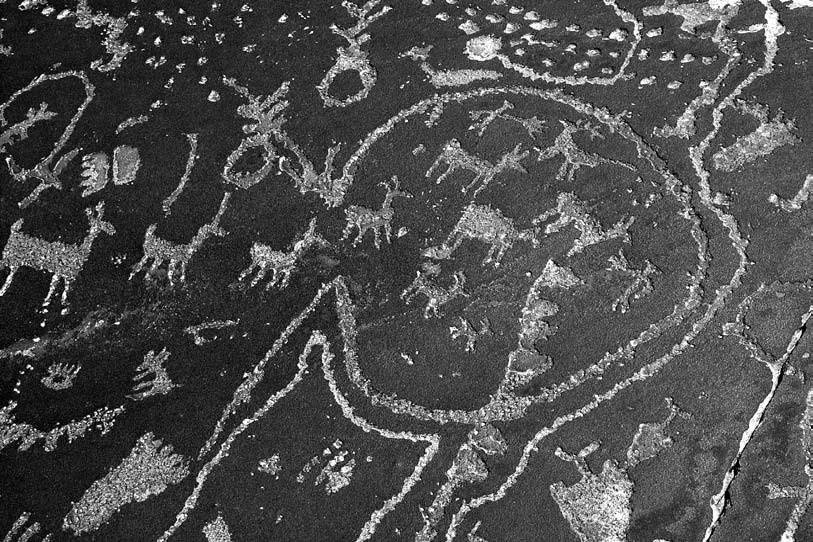
For the Navajo, antelope traps seem to have fallen out of favor after their imprisonment at Fort Sumner from 1864 to 1868, coinciding with the common acquisition of firearms in the latter part of the nineteenth century. By the late nineteenth century, what may have been one of the last Navajo hunts using a trap was reported south of Winslow, Arizona (New York Times 1895). By 1896, antelope distribution on the Colorado Plateau seems to have been essentially limited to some areas along the San Juan River (Merriam 1897).
The preeminent but little-referenced documentation and inventory of Navajo game traps on the Colorado Plateau was the work of the Navajo Land Claims (NLC) Project, carried out in support of federal judicial land claim adjudication between 1953 and 1959. As noted in the findings of fact (Littell 1967), the survey was extensive, not intensive, and many more sites (including game traps) could have been documented with additional time and resources. Most of the documented 83 NLC trap sites are on the peripheries of Navajo Country, or within the 1882 Executive Order Reservation, a.k.a. Former Joint Use Area. Little of the NLC information has been published. In the findings of fact, antelope corral data are limited to one table (Littell 1967:842) and barely one page of text. Since then, game trap documentation on the Colorado Plateau has been sporadic. For example, a search of the New Mexico Cultural Resources Information System (NMCRIS) database in 2010 yielded 54 sites in New Mexico documented as “game pit/ traps” However, most are eagle traps, simple deer blinds, pit traps, bear traps, horse traps, and the like. Only two sites, LA 68613 and LA 146900, both located south of Farmington, New Mexico, are clearly antelope game drives. These and others documented in association with cul-tural resource management projects are not well represented in the literature.
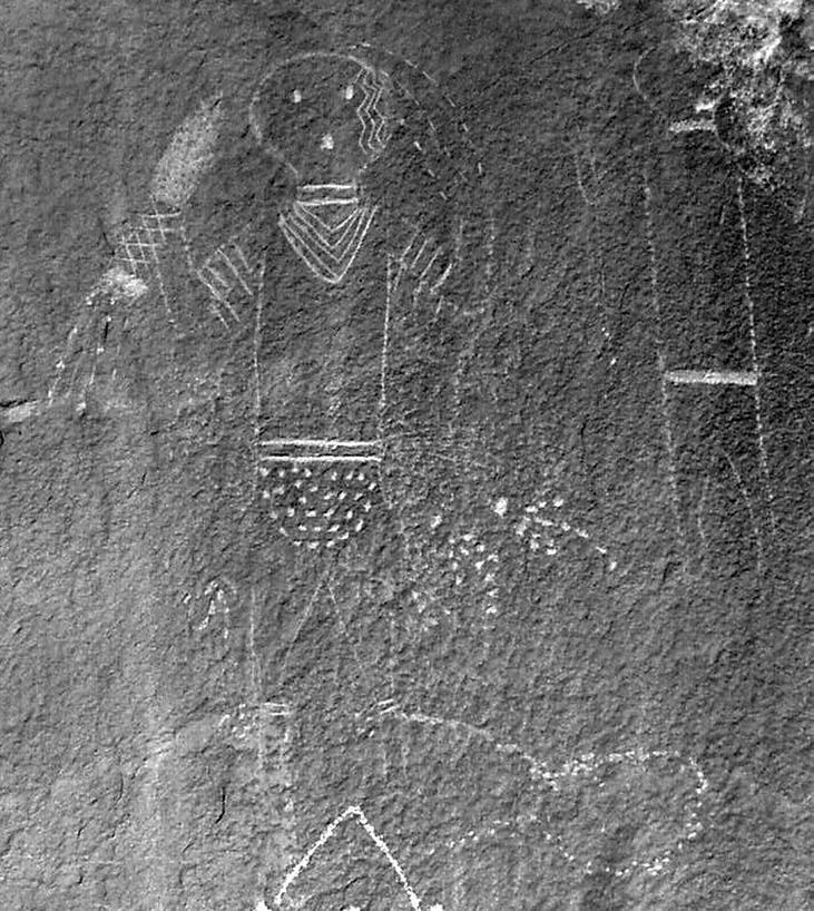
For this review, 80 individual NLC game trap records representing 83 individual traps were examined, and the physical characteristics and ethnographic data were extracted as available. NLC records vary to the extent they recorded trap characteristics: dimensions were not always given or were given only for the corral, and ethnographic information was not always available or forthcoming. Information on 11 additional traps more recently recorded to varying degrees in the San Juan Basin and in Arizona (Dennebito Wash) were similarly examined (e.g., Brugge 1977; Andrews 1983; Tipps 1987). Only traps in the San Juan Basin have been visited by the author.
Modern aerial photography and General Land Office (GLO) maps were also examined to supplement location information. “Indian corrals” or game traps have been identified on an 1884 GLO map from western Utah (Raymond 1982), but thus far no comparable examples are known to exist on the Colorado Plateau. NLC fieldworkers discovered traps in the Black Creek Valley by examining 1930s aerial photography sponsored by the Department of Agriculture (Dave Brugge, personal communication 2012). In five cases Google Earth was used to locate and measure traps originally discovered by airplane during the NLC Project but not otherwise visited (Figure 14.3).
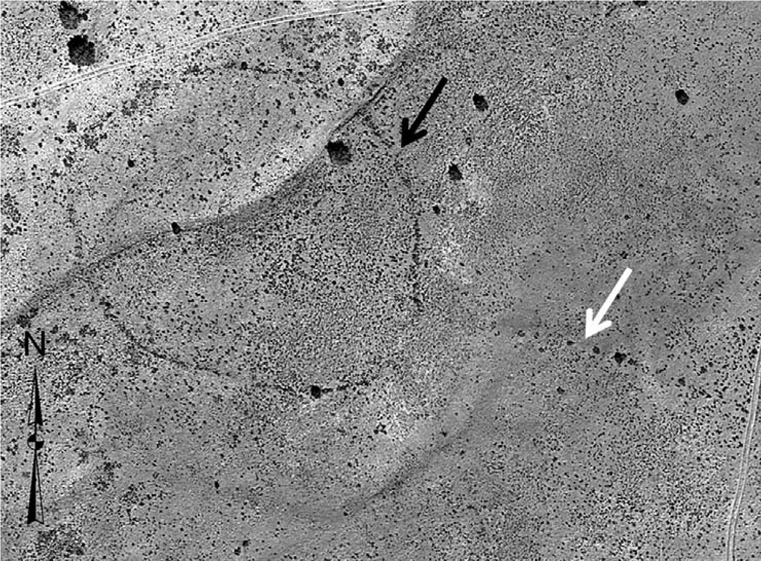
One new undocumented trap near a cluster of three NLC aerial discoveries was additionally located with Google Earth. An examination of aerial photography at four known game trap locations in the San Juan Basin yielded mixed results. Only at the Cañada Corrales trap did the corral clearly stand out, and that may be due to significant quantities of wood still in the corral, creating a microenvironment for vegetation that appears to have been detected by photography. At the others, visibility ranges from nonexistent to barely perceptible, and even then only marginally.
Distribution
Traps are distributed all across the Colorado Plateau (Figure 14.4) but seem particularly concentrated in Arizona and the areas around and near Jadi To (Antelope Water, a.k.a. Jeddito). Whether this is a real phenomenon or an artifact of concentrated NLC survey and reconnaissance is unknown. South of Steamboat, Arizona, there are four traps within 3 km of each other. In the upper Dinnebito Valley, Arizona, more than a dozen traps have been reported but not otherwise documented (Andrews 1983:12). The clustering of traps may indicate areas of very successful hunting or areas of antelope migrations, or may have been built in redundancy to have options for hunting when antelope were on the move. One trait observed at a few of the NLC sites was the close pairing of traps within 100 m of each other. Using NLC data in a spatial analysis of the distribution of late-eighteenth-to-nineteenth- century Navajo settlement, Kemrer (1974:113) observed that within 8–16 km of game traps there was an absence of contemporaneous dwellings, indicating that residences and other features of settlement were spatially separated from the traps. Hill (1938:148) reported that it took three to five days to reach the drive locations.
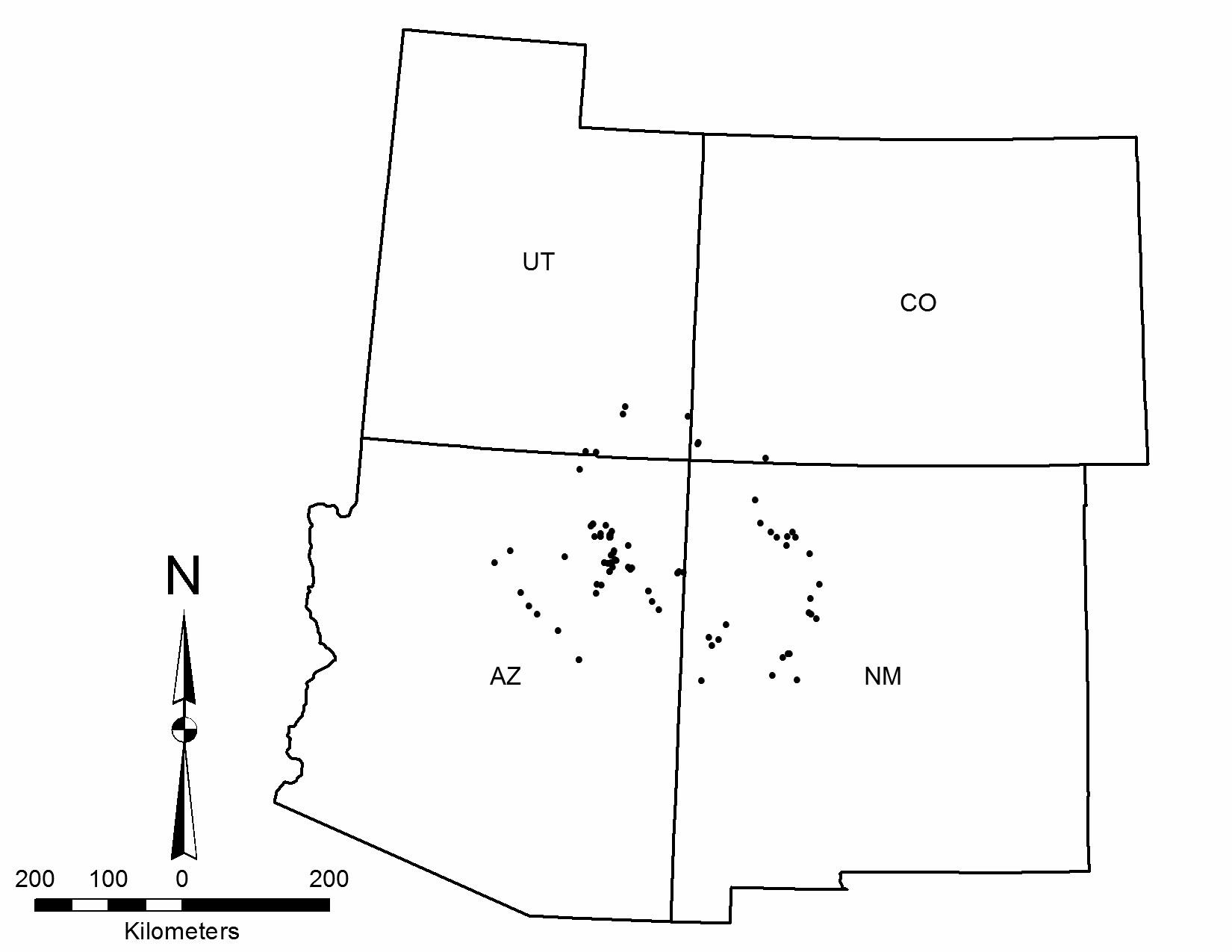
Chronology
Forty-three traps have been sampled for dendro- chronological analysis (39 NLC, 4 other). No data are available for five of the sampled NLC sites. The Laboratory of Tree-Ring Research at the University of Arizona reanalyzed the NLC samples in 2002. Fifty-three percent of the sampled traps for which there are available data did not date, and most of the 18 dated traps lack cutting dates (Table 14.1).
Juniper is the wood of choice in most traps, and in an open environment it is not surprising that deterioration and weathering would preclude precise dating due to an excess of missing outer rings. Juniper growth patterns are also often erratic, precluding a match with established chronologies. All but one date are confined to the eighteenth and nineteenth centuries. Cutting dates include the late 1700s to the early/mid 1800s. Only two sites exhibit construction (or repair) at some unknown time after the removal to Fort Sumner. This is generally consistent with NLC ethnographic histories and informants who consistently stated that traps were not built after Fort Sumner.
Physical Characteristics
The traps regularly straddle a ridge so the corral is hidden as the antelope are driven between the wings of the trap, over the ridge crest, and into the corral. Live trees are often incorporated into the corral, which varies from circular to slightly oval, and live trees may or may not be left standing within the corral. In at least one NLC case, remodeling of the corral was evident in the closing of an old gate, the abandonment of the wings, and the establishment of a new gate and wings. In many cases today the corrals and wings have been so heavily scavenged for wood that all that is left is an outline of wood scraps and the occasional limb of juniper. Four examples of game trap plan views from the San Juan Basin are shown in Figure 14.5, the largest of which is the Pierre’s Trap, at 1,869 m from wingtip to wingtip.
Table 14.1. Game Trap Dendrochronological Dates on the Colorado Plateau.
| Site Number | Date 1 | Date 2 | Date 3 | Date 4 | Date 5 | |||
| AZ-J-53-1 | 1709vv | |||||||
| AZ-J-53-2 | 1766vv | 1821+LG | inc | |||||
| E-C-UC-O | 1841vv | 1844vv | ||||||
| LA68613 | 1867vv | |||||||
| S-AS-AC-Q | 1781+vv, | 1864++vv | 1874++vv | 1875vv | 1881++vv | |||
| S-MLC-CH-X | 1842++vv | |||||||
| S-ULC-UP-P | 1798++vv | |||||||
| S-ULC-UP-Q | 1705++vv | 1705++vv | 1797++vv | |||||
| S-ULC-UP-R | 1745++vv | 1746++vv | 1758++vv | 1769++vv | 1802++vv | |||
| S-ULC-ZR-P | 1595vv | |||||||
| W-LLC-C-Y | 1866++vv | |||||||
| W-LLC-MB-G | 1819G | inc | 1840+G | inc | 1849G | inc | ||
| W-LLC-MJ-DD | 1772G | inc | 1795G | inc | 1798+G | inc | 1806G | inc |
| W-LLC-MJ-HH | 1804+vv | 1809G | inc | 1811G | inc | |||
| W-LLC-MJ-II | 1810+vv | 1819G | inc | 1822+G | inc | 1826G | ||
| W-LLC-P-F | 1710vv | |||||||
| W-LLC-P-I | 1710vv | |||||||
| W-LLC-SF-I | 1884+ | 1885+ |
Note: Dates with the symbol “vv” indicate there is no way of knowing how far the last ring is from the true outside. Dates with the symbols “G” and “L” are cutting dates in order of decreasing confidence. The symbol “+” indicates that one or more rings may be missing near the end of the series, and “++” indicates that a ring count was necessary due to the fact that beyond a certain point the specimen could not be dated. The symbol “inc” means the last ring on the sample is incomplete (it has no latewood) and indicates cutting during the growing season (spring/summer).
Where information is available (n = 67), corrals average about 60 m in diameter (2,830 m2), with a maximum of 130 m: 75 percent are greater than 45 m in diameter. In comparison, sheep corrals of the period between 1750 and 1900 (Kemrer 1974:Table 34) are significantly smaller (25–135 m2). In the Great Basin, impoundments are much larger and range from 150 to 500 m in diameter (Jensen 2007:32). Gate openings (n = 42) average 13 m, with a maximum of 45 m; 80 percent are 15 m or less. Gates are often defined by two large live trees, usually juniper.
Most corrals are reduced to grade, but some NLC records indicate corrals between 1 and 2 m high. An apparently intact corral illustrated by Kluckhohn and others (1971:Figure 1.a) appears to stand about 2 m high when compared with individuals in the photograph. Hill (1938) reported corral walls upwards of 4 m high, as did Watson (1965), but this seems excessive for what is needed to corral antelope. The antelope’s reluctance to jump is well known, and a corral 2 m in height would be more than sufficient for impoundment. Orientation is dictated in large measure by land form with no obvious patterning.
The average length of the right (n = 37) and left (n = 33) wings are 577 m and 562 m respectively, with similar minimums and maximums. However, more than twice as many of the right wings are greater than 640 m: 86 percent of right wings, compared with only 40 percent of left wings. The density of wood seems substantially less in the wings than in the corrals, probably reflecting the combined use of wood and brush to create that part of the feature. As in the corrals, live trees are often incorporated into the wings. No examples of the brush extensions reported by Hill (1938) were observed, but given the antiquity of the features, it’s not surprising that these components have deteriorated and are absent today. In some cases a natural feature, such as the rim of a canyon, served as a wing. In cases where long wings are preserved, one or both of the wings have a bow or curve in their course.
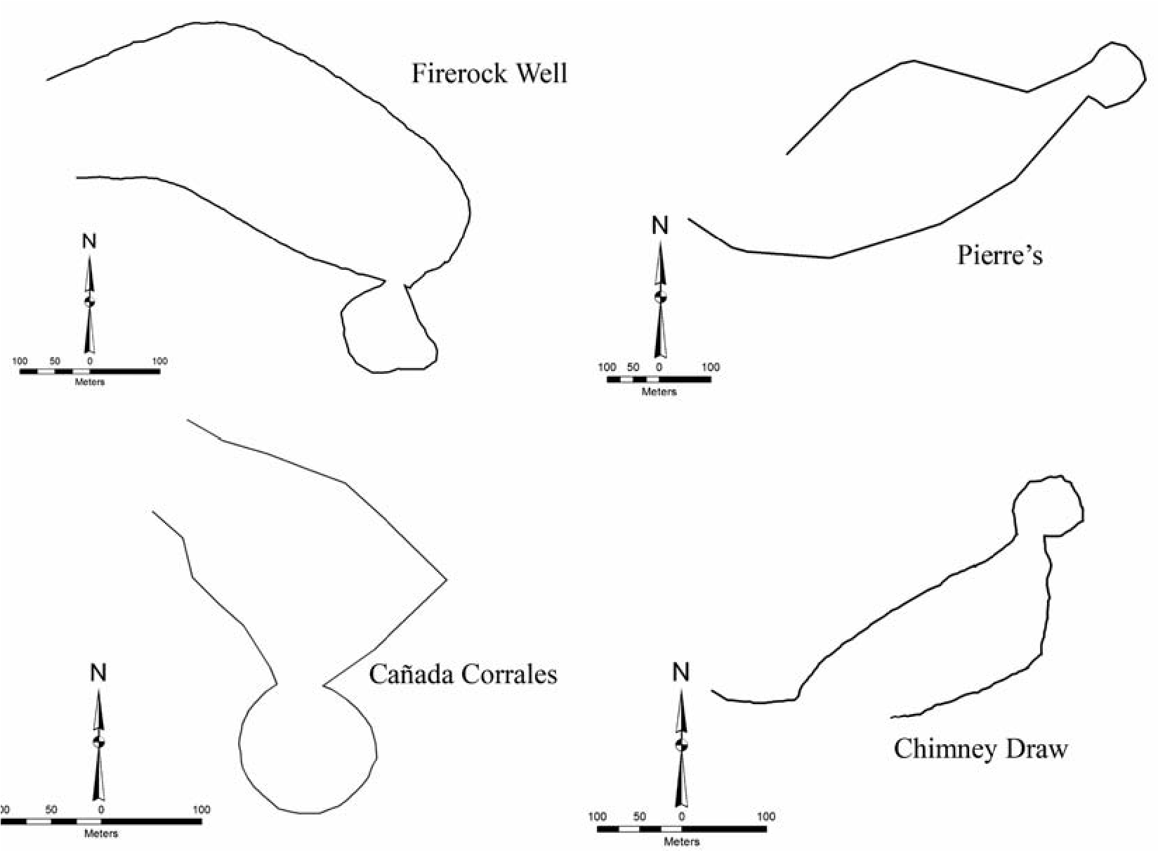
The wood is predominantly juniper, and the traps are typically located in areas that are at least sparsely populated by trees today. However, traps may occur in landscapes devoid of timber, as evidenced by one NLC site (W-LLC-PM-A) reported to be 11 km from any timber. An account in 1895 described men and boys on horseback dragging timber from upward of 16 km away to build a trap south of Winslow, Arizona (New York Times 1895). Wood in the features often exhibits burning and breakage as the manner of harvesting/procurement. Burned stumps are common in the vicinity of traps. Scores of stumps, many of them burned, have been documented at the Chimney Draw Trap (LA 146900), testifying to the deforestation that can occur during construction of a trap. At the Cedar Canyon antelope processing site (LA 17483), survey records indicate several burned stumps. Dead wood was also used in traps, evidenced by trees with roots still attached.
Both stone and metal ax cuts are reported in the site reports. Some of the metal cuts may be from wood haulers, usually identified by ethnographic informants as Hopis, Hispanics, or Anglos. The NLC observation of stone ax cuts on very weathered and exposed wood is suspect. Stone axes are one artifact type that seems absent on early Navajo sites. For example, in the voluminous numbers of Protohistoric Navajo sites recorded and/or excavated in northwest New Mexico over the past 50 years, stone axes are absent; however, metal ax marks on seventeenth- and eighteenth-century architectural wood are common at those sites.
Artifactual Remains
Trap-associated artifacts noted by NLC field researchers and others are extremely rare and include only the occasional prehistoric artifact (e.g., ancestral Puebloan sherds) or old and probably intrusive scraps of metal. A similar phenomenon is observed at traps in the Great Basin (Jensen 2007:52).
A recent intensive survey of 200 acres around the Chimney Draw Trap (LA 146900) yielded sparse lithic scatters eroding out of nearly every ridge top in the immediate vicinity but no features (Michael Dussinger, personal communication 2012). On a ridge just south of the trap a few sherds of late-eighteenth- and nineteenth-century Navajo Gray (Brugge 1981) were located. The few formal tools identified are limited to one-handed bifacial manos, a single biface, and a Desert Side-notched projectile point at the corral. Debitage from nonlocal obsidian is common and may indicate a Navajo lithic technology signature, as it often does at Protohistoric Navajo sites in the Navajo Reservoir area (e.g., Torres 2003:223–224; Sesler and Towner 2000:419). Nonlocal obsidian was a significant component of the projectile point inventory at the Cedar Canyon Protohistoric Navajo antelope processing site (Reynolds et al. 1984).
Within a kilometer of the Chimney Draw Trap, two sites, LA 117921 and LA 155605, were excavated by the University of New Mexico Office of Contract Archeology (Gerow 2009). Both are Late Archaic, based on carbon dates and/or lithic characteristics. Unlike the scatters near the Chimney Draw Trap, these sites yielded lithic artifacts of only local materials. LA 155605, a small buried rockshelter, yielded large quantities of faunal remains but no antelope. Recorded sites around the Pierre’s Trap (LA 68613) include three temporally undiagnostic lithic scatters with small artifact counts consisting of debitage of local materials and a few one-handed manos eroding out of dunal ridges.
In a study of 31 traps in the Great Basin, Hockett (2005:724) noted that projectile points (predominantly Desert Side-notched) were found at only 14 traps, usually the smaller ones (<320 m dia) and usually near the entrance. Great Basin archaeologists (e.g., Jensen 2007, 2008; Hockett 2005; Hockett and Murphy 2009) have suggested projectile point accumulations as one way to identify communal kill spots. There is, however, no consensus on the threshold of point density that would characterize such a site. Most known point accumulations in the Great Basin lack evidence of physical impoundments, and the two types of sites do not often co-occur. Jensen (2007:111) suggested that point accumulations represent a different hunting behavior than traps.
The absence of broken or complete projectile points at traps may be the result of very good shooting, the use of sharpened wooden arrow shafts (Hill 1938:96), or more likely, killing by hand. For example, Curtis (1922:47) described how Hopi men would keep the antelope in a state of constant motion to the point where “the creatures were so exhausted they either would stand still and were easily shot, or fell and were clubbed to death” An eyewitness of a Navajo hunt described how antelope were dispatched: “They find themselves in a stout pen, around which they run in a circle, never trying to jump over. The shouts and yells of the Indians at length so completely terrify the poor animals that they stand trembling and apparently unconscious of the Indians, who now approach and kill them with clubs, hatchets, stones, or anything at hand” (New York Times 1895).
Several films on YouTube, including a historic film by Homer Pickens (Pickens ca. 1930s), show the trapping and relocation of antelope, during which men easily carry and hold the live and unsedated animals. Conversations with Bureau of Land Management staff who early in their careers participated in antelope capture and transport verify that a person could manhandle an antelope by himself if needed (Mike Flaniken, personal communication 2012).
Ethnohistories
The NLC teams collected trap histories at 44 sites. Many of the traps have genealogies that include builders’ names and clans. Several traps were reportedly built before Fort Sumner, and these builders later became Fort Sumner prisoners (e.g., Behl’ h Tai/Three Fingers, Pah Athl Chini Tlani/Man with Many Children, and Biniitsidi/Scar Face). At least six different clans are identified with the individual who directed the building of traps, but no clan seemed to have a designated role or responsibility for leading or directing trap building. Six traps in the Pinyon, Arizona, area were built under the direction of a man named Ii de Chee, and several other builders elsewhere were credited with multiple traps. One informant had been at a trap when it was used around 1888, providing an age in the absence of tree-ring dates. It was related by another knowledgeable individual that a certain trap had captured over 200 antelope over several drives, and another explained how after the game was driven in, hide ropes with blankets were strung across the gate to close the pens. Andrews (1983:16) reported that knowledgeable residents near traps he recorded indicated that if a hunt was successful, a ceremony to “de-fence” or “open up” the corral by creating openings in four directions was conducted, which removed some of the spiritual restrictions associated with these features. No indication of this practice or evidence of this behavior in the traps was documented in the NLC data.
Game traps are spiritually powerful and dangerous places, and several of the knowledgeable Navajo informants made mention of this: “As a rule it is built to be holy and it should not be used for firewood, or to be removed. Women were not to be inside. The shape of the antelope trap is supposed to represent the eye of the antelope” (Apachito 1956). In addition, NLC field recorders documented a local sheep camp that had to be moved when the sheep became ill, and the old Navajos said it was because they were too close to the trap. Finally, in 1959 an aged Navajo guide and informant requested that the NLC field staff, including Navajo coworkers, allow him to sing a prayer on their behalf because they were recording antelope traps and collecting dendrochrono- logical samples.
Conclusion
Although dead juniper can last for hundreds of years in the open on the Colorado Plateau, wooden evidence of the traps will eventually be gone. At that point, what archaeological signature will remain? Probably not much. In fact, many traps have been so robbed of wood or otherwise deteriorated that present-day archaeologists conducting surveys in the San Juan Basin (and probably elsewhere) have been known to walk through traps without even realizing it, or to mistake the more well-preserved of them for sheep corrals and herding features. Hill (1938:146) reported that during the three-to- five-day journey to the drive site, evening camps were made by constructing small corrals of juniper and pinon within which the men prepared meals and slept. Archaeological signatures for these kinds of associated sites will be meager and most likely indistinguishable from other short-term temporary encampments. Without large surveys around the traps themselves, such as at the Chimney Draw site, to provide some landscape and archaeological context before all traces of them disappear, and unless projectile point accumulations or processing sites similar to Cedar Canyon are identified, this kind of archaeological signature will remain underrepresented in the research of mobile groups.
15. The Colorado Wickiup Project
Investigations into the Early Historic Ute Occupation of Western Colorado
Curtis Martin
The Colorado Wickiup Project (CWP) is an ongoing comprehensive effort to document wickiups and other ephemeral aboriginal wooden features in Colorado, features that are primarily attributable to the Ute. The CWP, during its initial 13 years, has documented 455 wooden features on 95 sites primarily in the pinon/juniper habitat of western Colorado (Figure 15.1). These features include wickiups, tipi frames, lean-tos, sunshades, canvas wall tent sites, tree platforms, windbreaks, corrals and fences, pole caches, firewood piles, tripods, utility poles and racks, and culturally modified trees (Martin et al. 2012). The findings have provided new insights into the final decades of the state’s sovereign Native American occupants, including extensive evidence of post-188os off-reservation occupation and continued occupancy of traditional, offreservation homelands after the removal of a majority of the people to reservations (Martin et al. 2011). The information that follows is based on research presented in Ephemeral Bounty: Wickiups, Trade Goods, and the Final Years of the Autonomous Ute (Martin 2016).
The text accompanying an exhibit in the Ute Museum in Montrose, Colorado, in which a field-collected wickiup has been reconstructed, reads in part:
Wickiups are widely known but rarely well-preserved in the state’s archeological record. Compared to archeological sites dating to the Archaic and Formative eras of prehistory on Colorado’s Western Slope, wickiups of the late prehistoric period and that just following are very rare. Almost no undisturbed wickiups have been recorded. Few exist in partial remains and even fewer have been archeologically tested. Site inventory data in the Colorado Historical Society’s Office of Archeology and Historic Preservation list [relatively few] known wickiup sites of any level of preservation or archeological integrity in the whole state. This [structure in the display case] is the only early example known to survive in an educational institution.
Although the ongoing research of the Colorado Wickiup Project is beginning to make obsolete some of the above statements, the point is well taken: ephemeral aboriginal wickiups and other wooden features are “regarded as among Colorado’s rarest and most fragile Native American sites” (Baker et al. 2007:104).
Almost universally attributed to the Ute, the state’s wooden features represent the cultural heritage of the only indigenous people to reside within Colorado continuosly from prehistory to the present (Baker et al. 2007:29). Unfortunately, a preponderance of such sites and features have yet to be fully documented and they are increasingly threatened by disintegration from natural processes, fire, and destruction by livestock, wildlife, and human actions, particularly in areas of rapid energy development and population growth such as is occurring on the Western Slope of the Rocky Mountains.
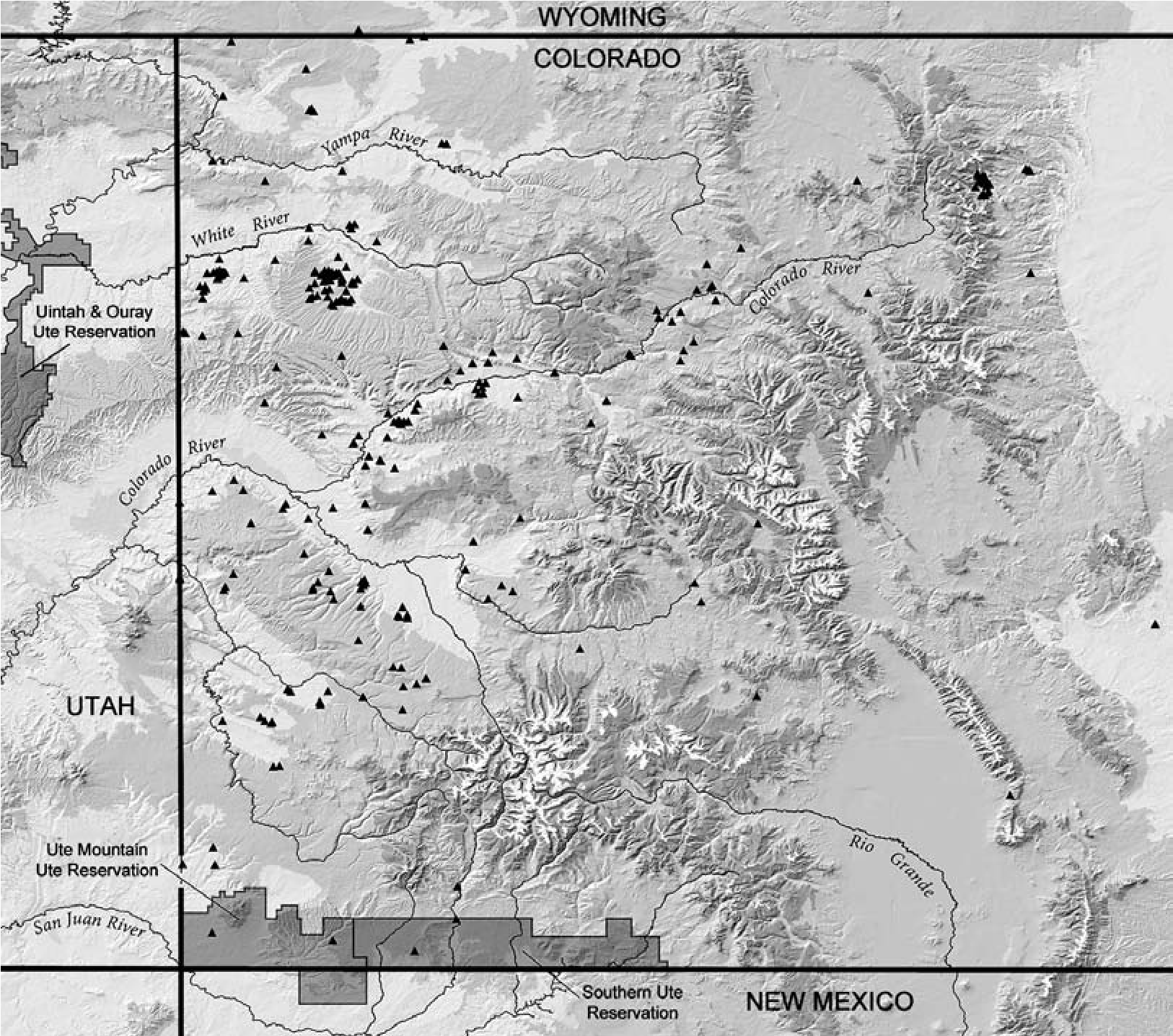
Dominquez Archaeological Research Group, Inc. (DARG), with partial funding from the Colorado State Historical Fund and the Bureau of Land Management (BLM), initiated the Colorado Wickiup Project in 2003 (Martin et al. 2005). The primary objective of the project is to mitigate the threat to Colorado’s aboriginal wooden features to the extent possible by thoroughly recording all known wooden feature sites, collecting materials for chronometric analysis, and conducting extensive data recovery-including excavation-of significant sites. Long-range goals of the project include the development of a dedicated aboriginal wooden feature knowledge base and facilitation of collaborative research and education through information sharing and professional and public outreach.
Chronometric Analysis of Ephemeral Wooden Feature Sites
To date, within the CWP, 42 of the 95 sites documented (44 percent) provide evidence of postcontact trade goods (including evidence of metal-ax scars). Trade goods, mostly metal, or evidence of their existence, have been found on an even higher percentage (54 percent) of the sites in the Upper Sonoran environment of western Colorado (39 of 72), whereas only slight evidence of such was discovered at three of the 23 sites above 8,000 feet (Martin et al. 2012). It can be assumed that even more of the sites date to postcontact times based solely on the well-preserved condition of the wooden feature elements. Although horses and metal and glass trade wares were entering parts of Colorado from the south as early as 1650, the west-central and northwest parts of the state were relatively late in acquiring such artifacts. Fort Uncompahgre in the Delta area, and its associated trading post, weren’t established until 1828, and although goods had arrived in limited numbers before that date, metal and glass weren’t commonplace until at least that time in the study area.
Accurate chronometric dating of historic aboriginal sites is critically important with respect to a number of research topics, including inter- and intrasite comparisons, regional population, settlement patterns, migrations, and so forth, yet remains one of the key problems. Dendrochronological dates from wickiup poles and radiocarbon samples from the same and associated hearths have been analyzed in Colorado for decades. Unfortunately the radiocarbon samples frequently provide date ranges of several decades, not a significant problem for archaeological contexts that are several thousand years old but certainly one for the more recent contexts. Tree-ring and radiocarbon dates also share a particular problem in these recent sites: the “old wood problem.” Since these dating techniques provide chronometric information on only a tree’s death, the resultant dates tend to be from one to eight or more centuries earlier than the cultural utilization of the sample of wood (the “target date”).
Reed and Gebauer (2004:101–104) discuss the inherent limitations with the existing database of Protohistoric/Historic dates in Colorado, which they consider too imprecise for adequate investigations into current research questions:
The primary limitations of the traditional dating approaches stem from use of long-dead wood for fuel and for habitation structures. Based on ethnographic and archaeological evidence, regional Protohistoric-era peoples lacked an effective technology for cutting large pieces of wood. The Utes had bone wedges and chopping tools that could cut wood (Smith 1974), but such tools required great amounts of labor to topple living trees. Because Protohistoric populations were highly mobile and had low demand for large beams, they probably simply toppled long-dead standing trees when needed. They may have even purposefully killed living trees for future use (Greubel and Cater 2001). Pinyon and juniper trees—which are most often represented as wood fuels and as primary structural elements of wickiups— are small enough to be pushed over by an individual if the bases are rotted. Dead trees may stand between 100 and 244 years in the Southwest before becoming capable of toppling by people.
It has been demonstrated through the efforts of the Old Wood Calibration Project (OWCP) (Baker et al. 2008, 2013) that major old-wood problems exist in archaeological sites found within the pinon and juniper habitat of Colorado. The OWCP’s findings indicate that the time elapsed between the natural death of a tree and its use as fuel wood or architectural components by humans commonly ranges from 200 to 800 years or more. The OWCP notes that the chronological structure of pinon and juniper trees is highly localized and dependent on environmental factors, especially moisture availability.
As Reed and Metcalf (1999) have discussed, too many variables are involved, such as the disparate decay rates of different species of wood in different environments, for us to rely on any arbitrary constants when attempting to resolve the old-wood issue. Locality-specific correction factors will need to be developed to refine both dendrochronological and radiocarbon dating in individual areas (Baker et al. 2008, 2013). Dates resulting from the application of these techniques must be adjusted by adding at least minimal correction factors such as those developed by the OWCP.
Until the acquisition of metal axes by the Native peoples (in the mid-i6oos at the very earliest, becoming much more common in the study area after the 1820s), wood cutting was a highly labor-intensive activity. For both fuel wood and shelter poles, long-dead wood that could be easily gathered or brought down without tools, and stripped of its branches if necessary, was far more appealing than living trees.
After the introduction of metal axes, however, it became more routine for the architects of wickiups and other features to cut down live trees and tree branches. These ax-scarred cultural poles can often provide archaeologists with dates within a few years of the cutting year. If the outer ring is present, the actual cut date— and sometimes even the “growing” (summer) or “nongrowing” (winter) season of the year—can be ascertained.
As a result, in our efforts to avoid the serious complications that the old-wood problem generates for sites that are only 300 years of age or less, in addition to a few thermoluminescence and bone collagen dates, we have concentrated on processing only dendrochronological samples from these late Numic sites—to the exclusion of radiocarbon—and only those tree-ring samples that show evidence of having been procured as live trees with metal axes. In spite of the fact that this research design has limited our chronomet- ric analyses to late sites (those that show evidence of trade goods such as axes), the results have proven to be informative. The project’s dendrochronological dates from metal ax-cut feature elements range from ad 1771 to 1915/1916, with over half of the dated sites (9 out of 16) indicating occupation during post-“removal” times—after 1881. Two of the sites were occupied after 1910 (Martin et al. 2006; Martin and Brown 2010a; Martin and Ott 2009).
The tree-ring dating results from the Colorado Wickiup Project investigations, as processed by Ronald H. Towner, assistant professor of Dendrochronology at the Laboratory of TreeRing Research at the University of Arizona in Tucson, are summarized in Table 15.1.
As the dendrochronological research on aboriginal wooden feature sites in western Colorado by the CWP has demonstrated, the potential end dates for the occupations of Historic Ute sites proves particularly interesting. The year 1881 is commonly listed as the date of the “final expulsion” of the Ute peoples from western Colorado to the reservations in Utah. However, it is known (Omer Stewart, unpublished comments at the Symposium of the Archaeology of the Eastern Ute, Grand Junction, Colorado, 1988; Mehls 1988; Simmons 2000; and period newspaper articles) that some Utes remained in western Colorado for decades after this date; either they never left or they returned to their traditional homelands after spending time on the reservations.
Notable Wooden Feature Sites
Two CWP resources have proven to be particularly productive or have revealed notably unique site types in the archaeological record of western Colorado. One, the Ute Hunters’ Camp (5RB563), is a hunting camp where canvas wall tents provided shelter for the occupants while they engaged in deer meat and hide processing, leather working, extensive bullet reloading, and possibly preparation for warfare. Another, the Pisgah Wickiup Village (5EA2740), in addition to having unique feature types, produced a wide variety of trade goods and a series of identical dates from tree-ring samples.
The Ute Hunters’ Camp, 5RB563
Although undoubtedly not unique as a site, the Ute Hunters’ Camp, 5RB563, is certainly rare in the archaeological record-nothing comparable is known to this author within the state. The range of activities represented (bullet reloading, meat roasting or smoking, living in wall or “cabin” tents, horse tending, hide or meat drying, possibly leather working, the making of expedient tools from food cans and other metal fragments, etc.) is highly unusual and serves as a rare insight into life at a Protohistoric or Early Historic aboriginal hunting camp (Martin and Brown 2010a).
The site is an open encampment consisting of aboriginal wooden features, including two apparent wall tent localities, utility poles, piles of firewood in association with large game processing areas, and an undisturbed locus (within one of the tents) where bullets were being readied for reloading and possibly leather was being processed (Figure 15.2). In addition, the site has produced a wide variety of metal and other trade ware artifacts, including numerous spent and unspent bullet primers, bullet lead and a casing, decorative brass or bronze items, horse tack, small iron punches or awls, thin plate glass fragments apparently from a broken mirror, food cans, numerous identifiable burned and unburned bone fragments including deer and horse, ceramic and nonceramic buttons, and a series of expedient cutting or scraping tools manufactured from food cans and other metal fragments—including a gunpowder scoop fashioned from the lid of a gunpowder tin.
and analyzed, including 21 tree-ring samples from metal ax-cut feature elements and tree stumps. Several types of features and trade artifacts not previously documented by the CWP were encountered. However, what distinguishes 5EA2740 as an exceptional Protohistoric site is its undisturbed nature and integrity.
Table 15.1. Dendrochronological Dating Results from the Colorado Wickiup Project.
| Site | Feature Description | Wood Type | Date of Outer Ring (“ad”) | ||
| 5RB266: Wenger Camp | Wickiup | Juniper | 1914B comp (fall/winter of 1914/1915) | ||
| 5RB266: Wenger Camp | Wickiup | Juniper | 1913vv | ||
| 5RB266: Wenger Camp | Wickiup | Juniper | 1911vv | ||
| 5RB2624 | Rader’s Village | Wickiup | Juniper | 1883rB comp (fall/winter of 1883/1884) | |
| 5RB18: Two Tall Pole | Tripod or utility rack | Piñon | 1844vv | ||
| 5RB18: Two Tall Pole | Wickiup | Juniper | 1915 GB comp (fall/winter of 1915/1916) | ||
| 5RB563 | Ute Hunters’ Camp | Utility rack | Piñon | 1879+v inc (summer) | |
| 5RB563 | Ute Hunters’ Camp | Utility rack | Juniper | 1875vv | |
| 5RB563 | Ute Hunters’ Camp | Utility rack | Juniper | 1870vv | |
| 5RB563 | Ute Hunters’ Camp | Ax-cut tree branch | Piñon | 1876vv | |
| 5RB563 | Ute Hunters’ Camp | Ax-cut tree branch | Piñon | 1878vv | |
| 5RB563 | Ute Hunters’ Camp | Ax-cut tree branch | Piñon | 1868vv | |
| 5RB563 | Ute Hunters’ Camp | Ax-cut tree branch | Piñon | 1881rB comp (fall/winter of 1881/1882) | |
| 5RB2930 | Ax-cut tree stump | Juniper | 1885rB inc (summer) | ||
| 5RB4331 | Black Sulphur Wickiup | Wickiup | Juniper | 1815vv | |
| 5RB4338 | Bead Village | Wickiup | Juniper | 1867v inc (summer) | |
| 5RB4338 | Bead Village | Wickiup | Juniper | 1866vv | |
| 5RB4338 | Bead Village | Wickiup | Juniper | 1862+vv | |
| 5RB4338 | Bead Village | Unstructured collection of wood | Juniper | 1867v inc (summer) | |
| 5ME974 | Ax-cut culturally peeled tree | Piñon | 1885 | ||
| 5ME974 | Ax-cut culturally peeled tree | Piñon | 1896 | ||
| 5RB6555 | Utility pole | Juniper | 1837vv | ||
| 5RB509 | Perforated Can Site | Utility pole | Juniper | 1857vv | |
| 5RB568 | Wickiup | Juniper | 1859vv | ||
| 5RB568 | Wickiup | Juniper | 1803+vv | ||
| 5RB568 | Ax-cut stump | Juniper | 1877rB comp (fall/winter of 1877/1878) | ||
| 5RB568 | Wickiup | Juniper | 1875vv | ||
| 5RB568 | Wickiup | Juniper | 1792vv | ||
| 5RB568 | Wickiup | Juniper | 1877LG inc (summer of 1877) | ||
| 5RB568 | Firewood pile | Juniper | 1800+vv | ||
| 5RB568 | Firewood pile | Juniper | 1771vv | ||
| 5EA2740 | Pisgah Village | Wickiup | Piñon | 1853rB comp | |
| 5EA2740 | Pisgah Village | Wickiup | Juniper | 1853rB comp | |
| 5EA2740 | Pisgah Village | Wickiup | Juniper | 1836vv | |
| 5EA2740 | Pisgah Village 40 | Wickiup | Juniper | 1851++vv | |
| 5EA2740 | Pisgah Village 0 | Brush enclosure | Juniper | 1868++B | |
| 5EA2740 | Pisgah Village | Brush enclosure | Juniper | 1850v | |
| 5EA2740 | Pisgah Village | Possible wickiup | Juniper | 1853rB comp | |
| 5EA2740 | Pisgah Village | Brush alignment | Juniper | 1852+v |
Table 15.1. (cont’d.) Dendrochronological Dating Results from the Colorado Wickiup Project.
| Site | Feature Description | Wood Type | Date of Outer Ring (“ad”) | ||
| 5EA2740 | Pisgah Village | Brush alignment | Juniper | 1853vv | |
| 5EA2740: | Pisgah Village | Wickiup | Pinon | 1826vv | |
| 5EA2740: | Pisgah Village | Wickiup | Pinon | 1853vv | |
| 5EA2740: | Pisgah Village | Wood cache | Juniper | 1849vv | |
| 5EA2740: | Pisgah Village | Ax-cut tree stump | Juniper | 1822vv | |
| 5MF5216 | Disappointment Draw | Tipi frame | Juniper | 1857vv | |
| 5MF5216 | Disappointment Draw | Brush enclosure | Juniper | 1870+vv | |
| 5MF5216 | Disappointment Draw | Brush enclosure | Juniper | 1834vv | |
| 5MF5216 | Disappointment Draw | Brush enclosure | Juniper | 1883++v | |
| 5MF5216 | Disappointment Draw | Brush enclosure | Pinon | 1852++vv | |
| 5MF5216 | Disappointment Draw | Ax-cut tree stump | Pinon | 1893v | |
| 5ME469: | Decker Big Tank Village | Wickiup | Juniper | 1795++B |
Key to the Outer Ring Codes as Presented in Table 15.1 (after Jeff Dean and Ron Towner)
vv Indicates the possibility of missing exterior rings and lack of terminal ring attributes such as bark. There is no way of estimating how far the last ring is from the true outside.
v A subjective judgment that, although there is no direct evidence of the true outside ring on the specimen, the date is within a very few years of being a cutting date.
r Less than a full section is present, but the outermost ring is continuous around the available circumference.
B Bark is present. The sample retains the bark and the last ring grown by the tree.
G Beetle galleries are present on the surface of the specimen.
+ One or more rings may be missing near the end of the ring series whose presence or absence cannot be determined because the specimen does not extend far enough to provide an adequate check.
++ A ring count was necessary due to the fact that beyond a certain point the specimen could not be dated.
comp A complete terminal ring indicating that the timber was cut after the end of that year’s growing season but prior to
the initiation of the next growing season (fall/winter).
inc An incomplete terminal ring indicative of a timber that was cut during the growing season (summer).
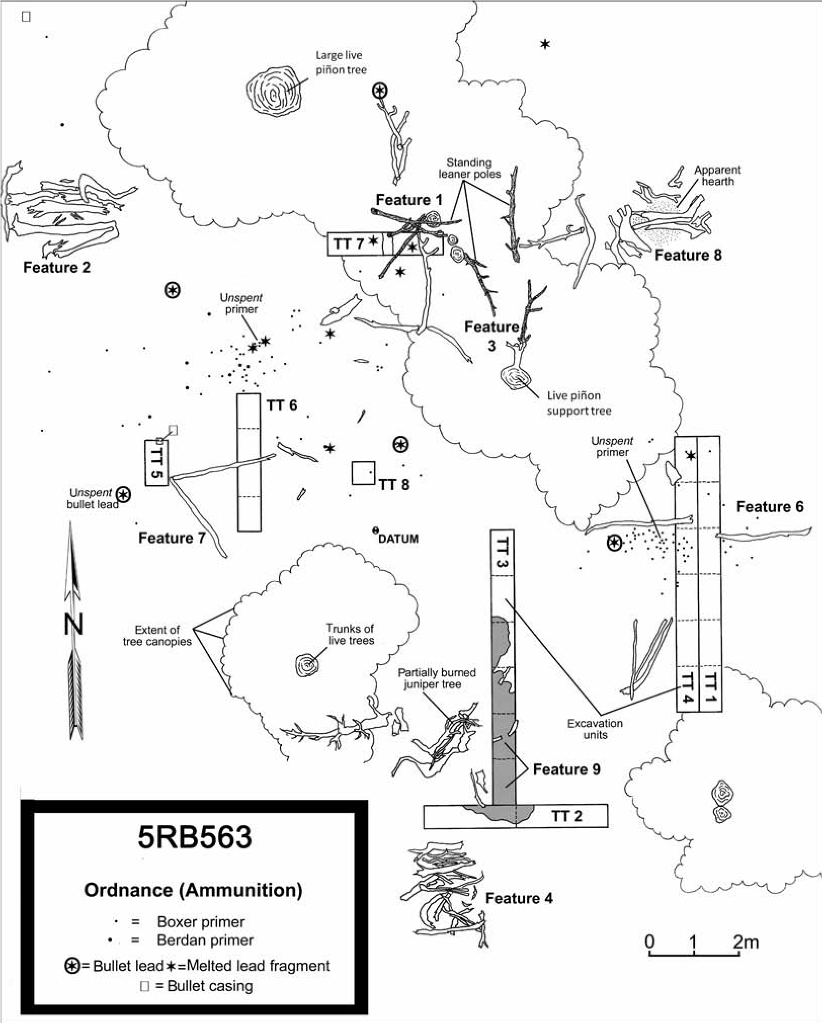
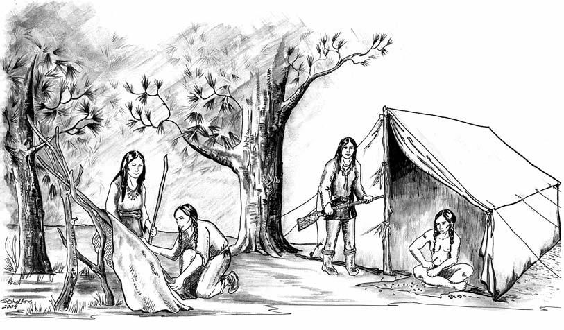
The cultural affiliation of the site is Proto- historic/Early Historic Numic (probably Ute but possibly Shoshone), dating from ad 1879 to 1881, based on tree-ring dates. Three of the seven aboriginal wooden features were selected for test excavations: Feature 1 (a three-pole utility rack), Feature 6 (a wall tent), and Feature 7 (a possible wall tent) (Figure 15.3). In addition, Concentration 2, a large area of charcoal and burned bone, was tested, resulting in the discovery of Feature 9 (a large in situ thermal feature).
In all, 640 separate items were recorded as 365 separate field specimens. Of the field specimens, 131 are ancillary collections (55 faunal specimens—almost exclusively bone—42 samples of charcoal, 13 dendrochronological samples, 13 pollen samples, four miscellaneous unidentified botanical specimens, and four soil/ macrobotanical samples) and 232 (509 individual artifacts) consist of metal, ceramic, lithic, wood, and rubber items.
Of the 509 artifacts, 148 (29 percent) are associated with ordnance (ammunition and gun parts) (see Figure 15.2). Of these, 135 consist of ammunition components, primarily spent cartridge primers. Ten are globs of melted lead (sprues) from bullet casting activities, two are pieces of a gunpowder can (the lid of which had been removed and formed into a powder scoop), and one is a machine screw that most likely came from a rifle or handgun. Other artifacts, such as one or more of the metal punches and the wire fragments, are also possibly associated with weaponry or reloading. At least two and probably three separate weapons are represented within these collections.
Another category of artifacts that was recovered in significant numbers on the site is glass seed beads. In all, 178 beads were found throughout the site. The large number of beads suggests that there are likely thousands more remaining in the unexcavated fill of 5RB563.
Also recovered were vessel glass; plate glass (mirror fragments); decorative brass tacks; other types of tacks and nails; five metal punches, awls, and perforators; five buttons of different styles and materials; 14 metal cans, can lids, or portions of cans; a jingle from a Spanish-style horse headstall; four fragments of machined strips of brass or bronze sheet metal, two of which have stamped decorative elements and two of which have punched holes; a tight roll of decorative metal strip; and various fragments of iron and possible horse tack.
Of note are a fragment of a grommet, or reinforcement eyelet, that was found several meters to the east of the Feature 6 wall tent— presumably one of the rope tie-down grommets from the canvas covering—and an aglet, most likely for a boot or shoelace or some other type of cordage.
Pisgah Wickiup Village (5EA2740)
The Pisgah Wickiup Village (5EA2740) is another notable site—a wickiup village consisting of 28 wooden features and subfeatures (Figure 15.4). In addition to the features, numerous individual portable artifacts were recorded (Martin and Brown 2010b). Although lithic debitage and tools, groundstone, a wooden artifact, and glass seed beads were found, a majority of the recovered specimens were metal. A total of 116 individual field specimens (FS) was collected and analyzed, including 21 tree-ring samples from metal ax-cut feature elements and tree stumps. Several types of features and trade artifacts not previously documented by the CWP were encountered. However, what distinguishes 5EA2740 as an exceptional Protohistoric site is its undisturbed nature and integrity.
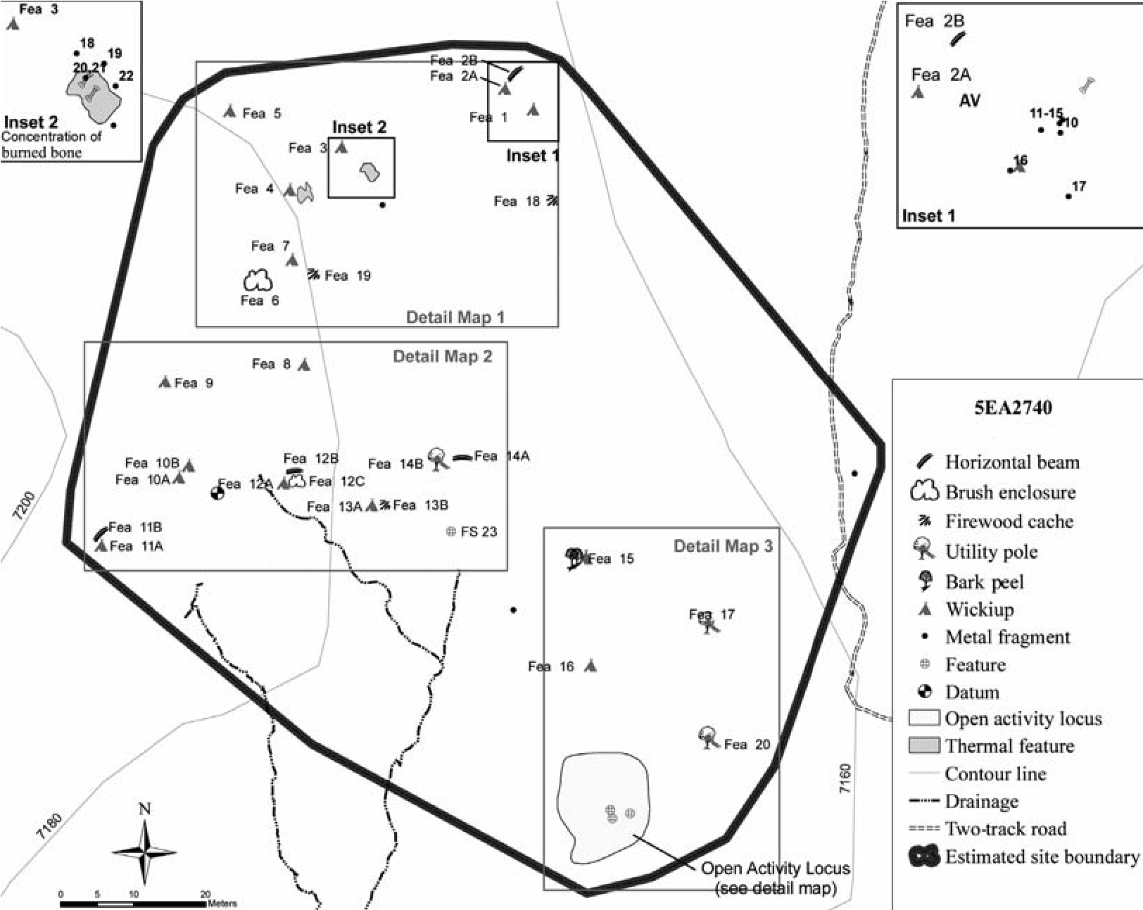
The term “Protohistory” can be defined as the period of first contact between the Native peoples of a specific region or culture area and the Euroamerican immigrants—before sustained contact and written records. Therefore, this fluid and intangible period appears in the archaeological record as evidence of trade goods at different times in different places. For the Ute, it was in place in northern New Mexico and parts of southern Colorado by the late seventeenth century, but not until the late eighteenth and early to mid-nineteenth centuries in parts of west-central and northwestern Colorado. Accordingly, the Pisgah site is interpreted as a domestic camp of the Protohistoric Ute, as indicated by the artifact assemblage and dendrochronological analysis that establish that the site was occupied in the fall or winter of ad 1853 (as indicated by many of the tree-ring dates from the wooden features; see Table 15.1). This correlates with the presence of metal projectile points and a muzzle loader percussion cap, suggesting that occupation was after the invention of percussion cap technology in the 1830s but before the possession of fixedammunition firearms by the occupants—com- monplace among the Ute in western Colorado by the middle of the nineteenth century. As a result, 5EA2740, with its 28 wooden features and subfeatures; its scores of associated lithic, metal, glass, and wooden artifacts; and its solid dating results, will undoubtedly become one of the type sites regarding the Protohistoric Ute.
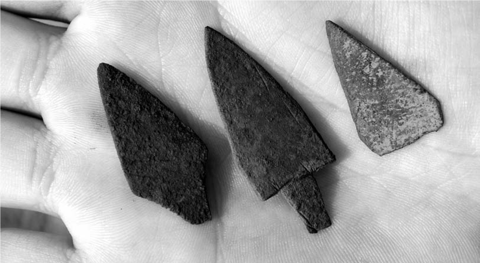
Activities represented at the site, in addition to those predictable at all campsites such as hunting, gathering, food preparation, and shelter construction, included lithic and metal tool manufacture and maintenance—as evidenced by the unfinished metal projectile points at Feature 16 (Figure 15.5), the unrolled tinkler blank from near Feature 8 (Figure 15.6), the numerous cut fragments of iron and nonferrous metal, and possible bullet or minié ball casting (indicated by the lead sprue globules).
A number of types of both wooden features and portable trade-ware artifacts not previously documented by the CWP were encountered at Pisgah. Feature 6, for instance, consists of a roughly square brush enclosure built on the southeast side of a juniper tree. Three narrow limbs were partially axed at their contacts with the support tree and then bent down to form an “archway” over the apparent entryway, on the north side of the enclosure. Hypothetical uses for this feature include a lambing pen, a children’s “playpen,” or an activity area for food preparation. Both the square nature of the enclosure and the archway over the entry are new to this project. Feature 12 consists of a distinctive complex of three associated wooden features: a wickiup within a brush enclosure and a horizontal beam suspended in the branches of a juniper tree. Directly in front of the south-facing entryway of the wickiup is an ash-and-charcoal-filled, basinshaped hearth that is situated within the brush enclosure (Figures 15.7 and 15.8).
A Reappraisal of the Final Years of Sovereign Ute Occupancy in Colorado
The historic trade-ware analysis and dendro- chronological dating results of the Colorado Wickiup Project have provided new insights into the final chapter of the sovereign Numic peoples in Colorado: the off-reservation occupancy of the late nineteenth and early twentieth centuries. The project has shown that a significant number of Northern Utes either did not take part in the forced exodus to the reservations in Utah in 1881–1882 or subsequently left the reservation and returned to west-central and northwest Colorado on hunting forays or with aspirations of more permanent residency in their traditional homelands after finding life on the reservations intolerable. As a result, the CWP studies on aboriginal wooden feature sites have demonstrated the need to revise current thinking within the discipline regarding the post-1881 Ute, and possibly Shoshone, archaeological components in the state.
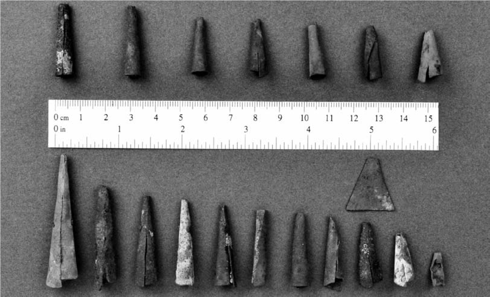
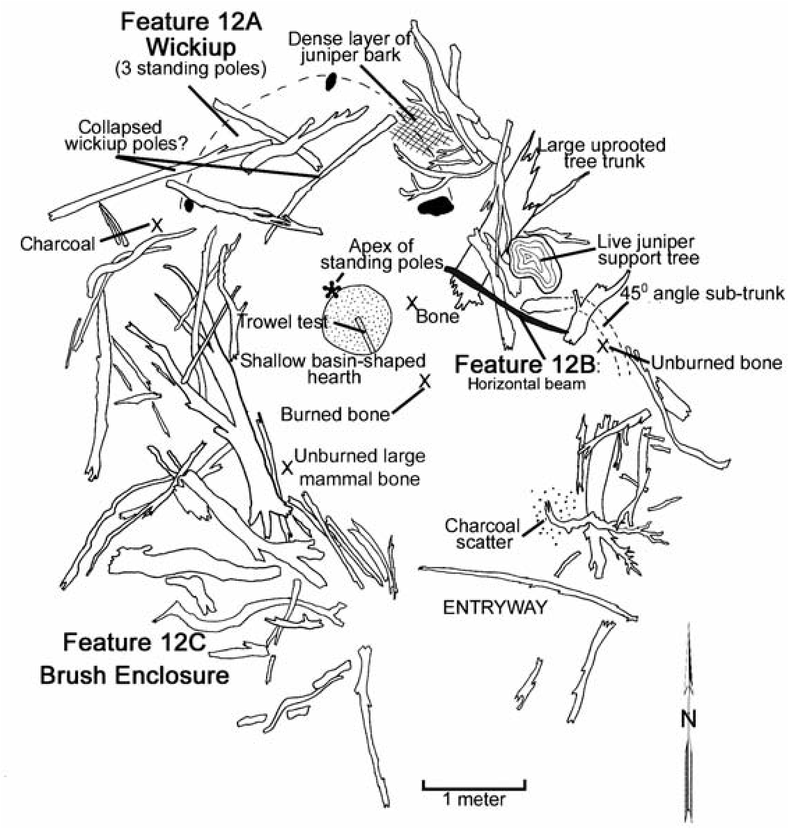
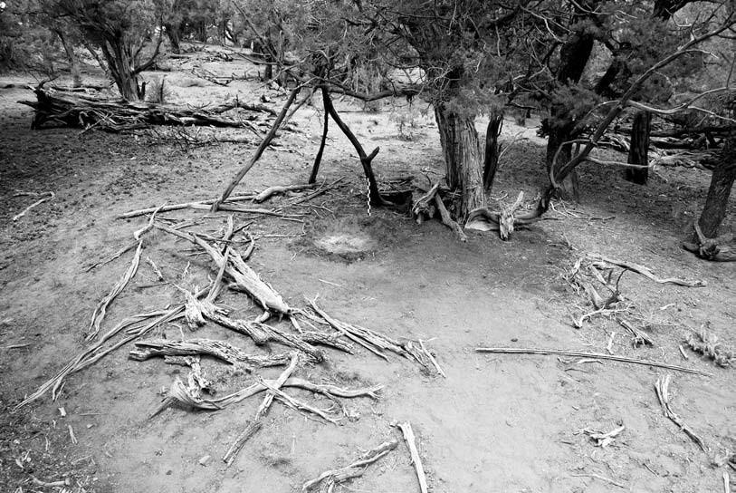
In the section on the Ute in the chapter titled “Protohistoric and Historic Native Americans” in Colorado History: A Context for Historical Archaeology (Church et al. 2007), the Baker Model of Ute Culture History for the Eastern Bands of Western Colorado is presented (Baker et al. 2007:41). A simplification and synthesis of this model, for the purpose of emphasizing the artifactual remains that are found on Ute sites, is presented in Table 15.2, with additions by this author.
The latter two phases of Baker’s model have been divided into subphases, called IV-A, IVB, V-A, and V-B. The Phase IV division follows Baker closely in that what we refer to here as Phase IV-B is already described by him for the northern area of the Eastern Ute territory. This period, referred to as the Late Contact Postremoval Fort Duchesne phase, dating from 1881 to ca. 1900, is described by Baker as characterized by “limited sites in traditional territories in northwest Colorado.” Thus far, our findings suggest that off-reservation sites from this time period are perhaps more prevalent than previously believed, and not necessarily limited to the northwest portion of the state.
Baker points out that many of the sites from the Fort Duchesne phase look very much like Euroamerican camps. We found this to be true not only for this period but for some earlier sites as well, such as the Ute Hunters’ Camp (ad 18791881) with its tin cans, bullet reloading materials, buttons, and evidence of canvas wall tents.
Phase V, the Recent Contact phase, beginning at ca. 1900, is described in the Baker Model as “not believed to be appropriate for archaeological study,” and no “archaeological phase” is defined for the period. Presumably this perception is based on the belief that there were no aboriginal peoples moving across the traditional homelands of the Eastern Utes after 1900 leaving undocumented artifacts on the landscape. The findings of the CWP, specifically those sites that have produced post-1900 tree-ring dates, have proven otherwise. Two sites, Wenger Village (5RB266) and the Two Tall Pole Wickiup Village (5RB18), have produced solid evidence of Numic peoples living more or less “traditional” Protohistoric lifestyles in western Colorado between 1914 and 1916.
Table 15.2. The Baker Model of Ute Culture History for Western Colorado.
| Archaeological phases | Dates | Suggested artifactual hallmarks | |
| Phase “V-B”: Recent Contact (Emergent Reintegration Phase) | ca. 1924-present | Reappearance of native arts and crafts | |
| Phase “V-A”: Recent Contact (“Ungacochoop Phase”) | ca. 1900–1924 | Post-1900 ax-cut tree-ring dates, coins, or clearly dated bottle types | |
| Phase “IV-B”: Late Contact Post-Removal (Fort Duchesne Phase) | 1881-ca. 1900 |
• Tobacco tins appear • Sheep and goats |
•Wagons • Post-1881 ax-cut tree-ring dates |
| Phase “IV-A”: Late Contact Pre-Removal (Chief Ouray, Chief Douglas, & Chief Ignacio Phases) | ca. 1860–1881 |
•Metal axes (“ubiquitous”) • Canvas tipi covers • Tin objects •Fixed ammunition guns/cartridges (common post-1870) •Hole-in-top food cans (round cans common post-1870) • Seed beads very common (very small specimens late in phase) • Wickiups much better preserved and recognizable • Adobe, log, and jacal structures |
•White-man’s clothing • Bottle glass (common post-1870) • Iron stoves and wall tents |
| Phase III: Middle Contact (Robideau Phase) | ca. 1820–1860 (Fur trade) |
•Metal arrow points begin to replace lithic points • Metal axes, cutting and chopping tools • Metal cooking vessels • “Little China” Prosser buttons (post-1840) • Ceramic pipes (bore diameter important) • Wickiups better preserved/more recognizable |
• Horse tack • Tipis • Seed beads (post-1840) • Percussion caps • Tinkler cones |
| Phase II: Early Contact (Rivera Phase) | ca. 1540–1820 |
•First appearance of horse equipage (increases late in phase) • Tipis (late in phase) • Trade beads (but only those larger than seed beads) • Gun flints, musket balls, gun parts (post-1800 or even later) • Brass/copper objects (as early as 1540!) • Uncompahgre ware pottery still in vogue |
• Metal knives (but few axes apparently) • Shell buttons (post-1800) |
| Phase I: Late Pre-Contact (Canalla Phase) | ca. 1500 (?)-1540 |
•Uncompahgre ware pottery • Desert Side-notched projectile points • Cottonwood Triangular projectile points (Desert S-N preforms?) |
Note: Adapted from Baker, Carrillo, and Späth in Colorado History: A Context for Historical Archaeology, 2007, p. 41 (synthesis and additions by Curtis Martin, Colorado Wickiup Project).
As a result, I propose the division of Baker’s Phase V, the Recent Contact phase, into two subphases. Phase V-B would conform to the Baker Model’s definition of “emergent reintegration” that continues to the present day. The proposed Phase V-A, however, would integrate the post- 1900 Early Historic era sites into the existing model. At this time the only suggested archaeological “hallmarks” that would aid in identifying these sites in an archaeological context would be post-1900 tree-ring cutting dates (or accurately dated coins and other trade goods) associated with wickiups and other aboriginal wooden features.
The year 1924 has been selected as the terminal date for the phase, for two reasons: it is a reasonable hypothetical date for the latest potential Ute habitations in western Colorado (outside of modern circumstances), and it is the year that American Indians were awarded citizenship. Again, it is certainly not beyond the realm of possibility that wooden structures dating even later exist. Decker (2004:xii) describes how “a local family in my hometown of Ridgeway, Colorado, can remember how, in the 1930s, a few Utes who continued to survive in the area would gather in their kitchen every morning... await their daily cup of coffee...and then disappear into the timber.”
In following the Baker Model format of naming the associated “archaeological phase” after Ute luminaries of the period, I have chosen to refer to Phase V-A as the Ungacochoop phase. Ungacochoop, or Chief Red Cap as he was also known, was a recognized leader of his people at the Uintah Valley Reservation (later consolidated into the present-day Uintah and Ouray Reservation). He reportedly was fluent in English, and in 1905 he headed a delegation to Washington, D.C., where he sought to counsel peace between his people and the United States government (O’Neil 1968; Simmons 2000).
It was Ungacochoop who advocated a journey by his tribal members to South Dakota in 1906 to leave behind the deplorable conditions in Utah, join with the Sioux or Crow, and form a league with the Plains tribes to fight against the whites. Under the leadership of Red Cap and others, several hundred well-armed Utes, along with 1,000 head of horses and about 50 head of cattle, left Whiterocks, Utah, on a well-documented, peaceful exodus that passed through northwest Colorado, western Wyoming, southeast Montana, and into South Dakota, where they had hoped to establish a less miserable life for themselves. Unfortunately the Sioux were unwilling to enter into an alliance, facing difficult times of their own. In 1908, 15 months into their sojourn, the Utes left South Dakota to return to Utah, escorted by members of the 10 th U.S. Cavalry, a journey of 1,000 miles that was completed in 101 days (O’Neil 1968; Simmons 2000).
Noteworthy to our studies, the Vernal (Utah) Express newspaper, in October 1908, described a scene during the return trip with mention of a wickiup: “An old buck [was] standing alongside his wyckiup [sic] while the squaw was baking bread. To the question as to what his name was he replied that he was too poor to have a name.”
16. A Numic and Ancestral Pueblo Ceramic Assemblage at 42UN5406 in the Uintah Basin
James A. Truesdale, David V. Hill, and Christopher James (CJ) Truesdale
Sherds attributable to both the Ute and Hopi have been found on a site in Utah far beyond the normal range of Hopi pottery. The site is inferred to be a single-use, single-component residential site occupied by the hunting-and-gathering ancestral Ute. The Ute were later described in the ethnographic record as raiders, and this would account for the presence of these Hopi and other Puebloan sherds on this site, as would trade between these peoples.
Before the Historic period, there is a paucity of well-dated evidence for the presence of Numic speakers ancestral to the Historic Ute in northeastern Utah and western Colorado (Hill 2005; Reed and Gebauer 2004:17). Site 42UN5406 provides evidence for their presence in this region during the early fourteenth century. This chronological placement is based on the presence of contemporary Hopi pottery and the direct chronometric dating of a fingernail- impressed Uncompahgre Brownware sherd attributable to the ancestral Ute using the optically stimulated luminescence (OSL) technique. We begin by presenting the physical environment of 42UN5406, followed by a discussion of the cultural material. In addition, we address implications for regional prehistory regarding the arrival of Ute peoples into Utah and western Colorado.
Physical Environment
The site is located in the Uintah Basin, 14 miles south of Ouray, Utah, on lands administered by the Utah School Institutional Trust Lands Administration (SITLA) (Figure 16.1). The Uintah Basin is structurally the lowest part of the Colorado Plateau geographical province and consists of a large, relatively flat, bowl-shaped, east-west asymmetrical syncline located near the base of the Uinta Mountains (Thornbury 1965:425). The topography of the Uintah Basin is characterized by sloping surfaces that incline northward and are mainly dip slopes on the harder layers of Green River and Uinta formations with an elevation of 5,392.32 feet (1,644 m) amsl (Childs 1950; Stokes 1986). The mean annual rainfall averages less than nine inches (222.26 mm), the wettest period being at the end of summer and the beginning of autumn. Vegetation is sparse and consists of low sagebrush, bud sage, saltbush, rabbitbrush, prickly pear cactus, and various grasses.
Located on a small knoll on a narrow ridge on the western edge of Willow Creek Canyon, the site is positioned about 500 feet above Willow Creek (Figure 16.2). Willow Creek is a permanent water source and is characterized by extremely steep exposed ridges and/or buttes of relatively thick Uinta formation sandstone, with thinner layers of clays and shale. Sediments on the site consist of shallow tan, light brown to reddish brown, poorly sorted, loosely to moderately compacted, sandy clay loam. The extreme southern portion of the site is dominated by talus slope debris that consists of poorly sorted, loosely compacted, exposed and eroding clay and shale bedrock mixed with large detached angular sandstone boulders.
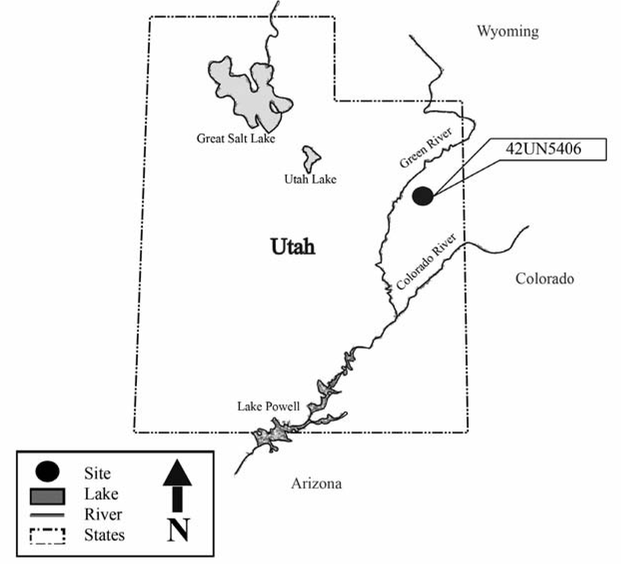
The majority of artifacts present at 42UN5406 are confined to two relatively level areas located between exposures of the Uinta formation sandstone that forms the crest of the ridge. The northern level area is approximately 50 by 35 m in size. The southern area is smaller, covering an area of 18 by 20 m. The surface of the site slopes steeply away from these level areas, leading to a steep precipice above Willow Creek. The spatially restricted amount of relatively level ground on the site and the steep slopes surrounding the level areas would constrain activities on the site to the two level areas, which have the greatest artifact concentrations.
Description of the 42UN5406 Artifact Assemblage
This site represents a single-use, singlecomponent Protohistoric Ute occupation. It measures 78 m (N-S) by 139 m (E-W) and covers 10,842 m2 (Figure 16.3), and it consists of a low- density scatter of chipped-stone tools, debitage, and ceramics. All of the artifacts are situated on the surface of the site, which is on bedrock. The site was revisited for the purpose of documenting the surface artifacts and collecting ceramic and lithic artifacts for detailed analysis.
The chipped-stone assemblage consists of five pieces of debitage made up of biface thinning debris, a dark reddish brown biface blade fragment, a white opaque chert utilized tertiary flake with a single convex working edge, a dark red chert utilized tertiary flake with a single convex working edge, a pinkish tan oolitic chert retouched primary flake end scraper with additional straight side working edges, and a dark reddish brown tri-notch Desert Side-notched projectile point. All of the chipped toolstone raw materials are from local sources in the Uintah Basin.
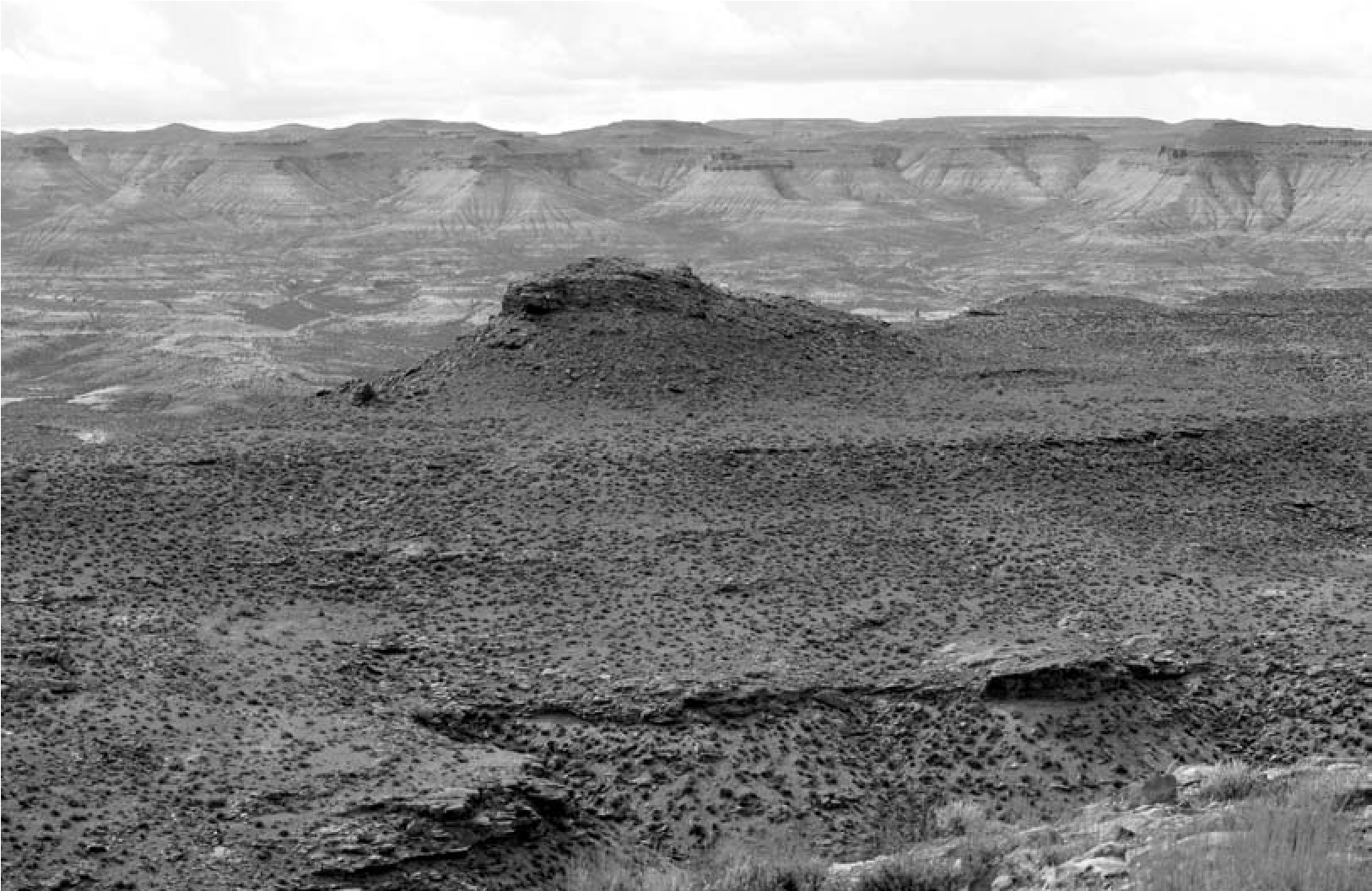
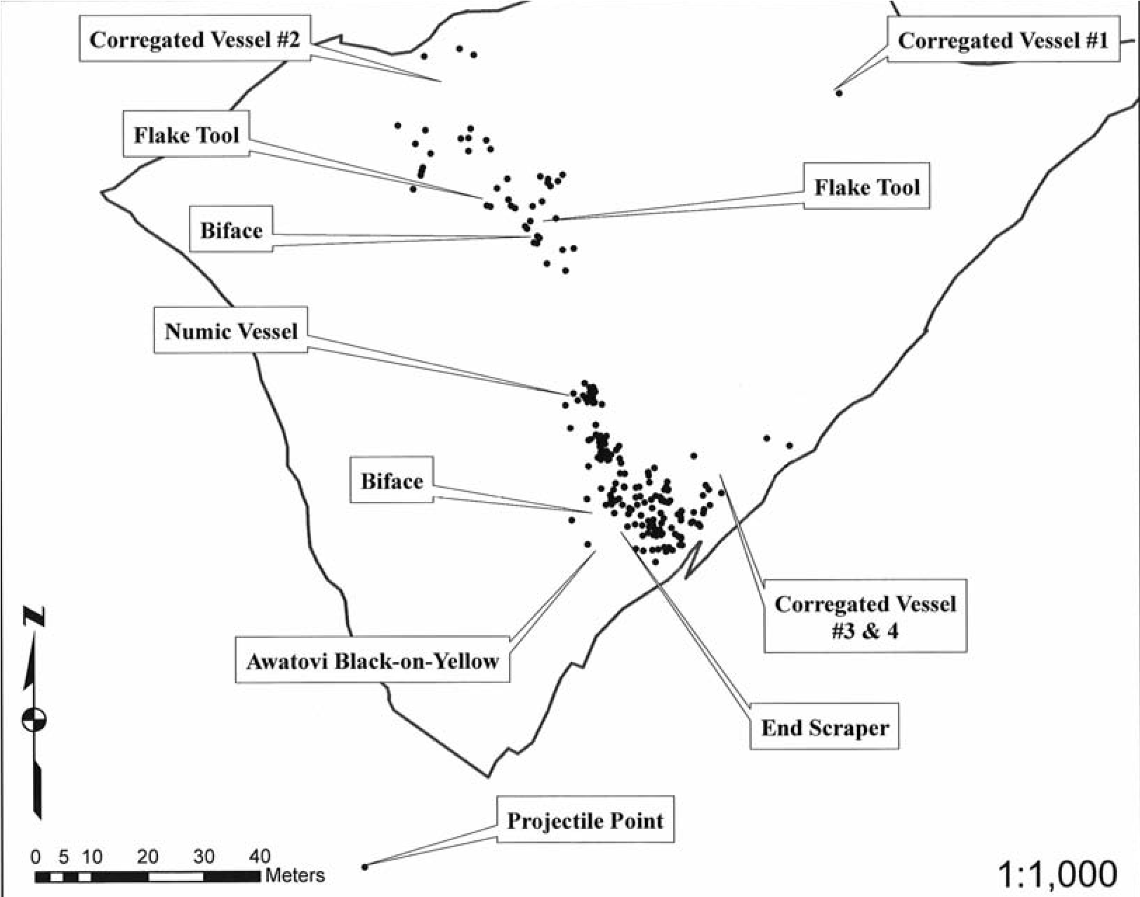
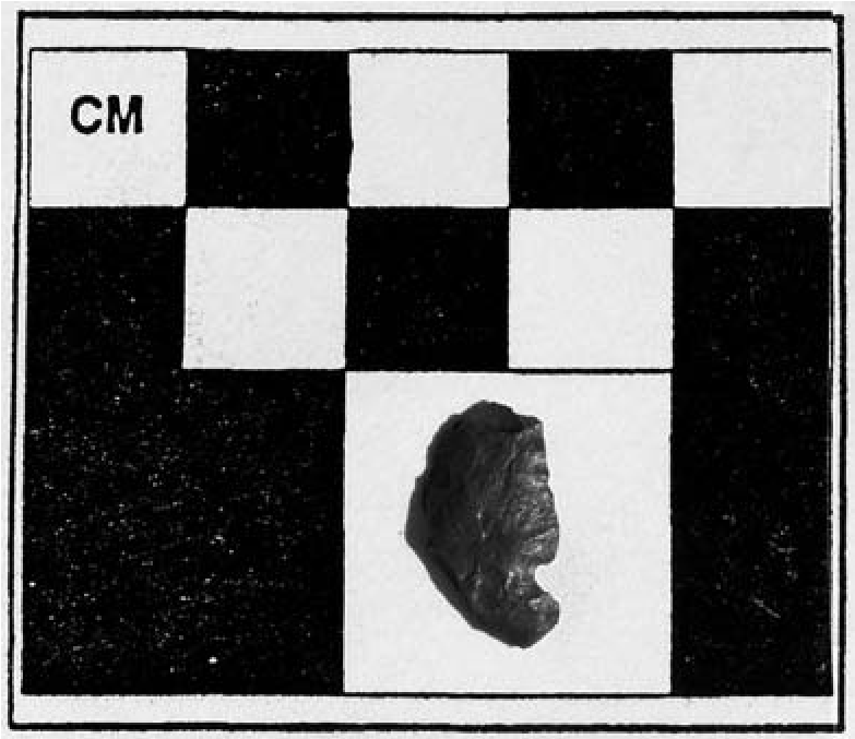
The projectile point (Figure 16.4) is made from a dark reddish brown (Madison formation) chert. It measures 2.02 cm in length and 1.1 cm in width, and has a hafting width of 0.67 cm and a hafting length of 0.64 cm. The point’s tip and one of the basal ears are broken off, and the point blade has also been broken lengthwise and crosswise. Late Prehistoric tri-notched varieties of projectile points are referred to as Desert Side-notched Sierra type, Desert Tri-notched, Shoshonean Tri-notched, and/or Farson Trinotched styles (Frison 1991; Jennings 1978). These side-notched points replace small corner- notched (Rose Spring, Rosegate) arrow points in the Uintah Basin around ad 1100 and continue throughout the period of European contact (Bet- tinger and Eerkens 1999; Fawcett and Kornfeld 1980; Jennings 1978; Truesdale 1990, 1993, 2002). Desert Side-notched projectile points are commonly associated with Ute occupations in Utah and Colorado, so this affiliation inference is well supported (Reed 1994; Spangler 2002:435).
A unifacially retouched end scraper was made from a pinkish tan oolitic chert primary flake that measures 7.39 cm in length, 3.28 cm in width, and 0.72 cm in thickness (Figure 16.5). The retouched flake is a long percussion blade that exhibits a pitted oolitic surface texture and a light to dark brown cortex that covers over 80 percent of its dorsal surface. This material can be found locally in the Uintah Basin and along the White River as lag gravels only a few miles away. The tool is a typical end scraper whose lateral edges have been retouched so that it could be used as a hafted scraper (Bordes 1972). Each of these side working edges measures 3.9 cm in width and 4.4 cm in length. The proximal end of the flake tool/scraper is restricted and exhibits a slightly shouldered base, suggesting the tool was hafted.
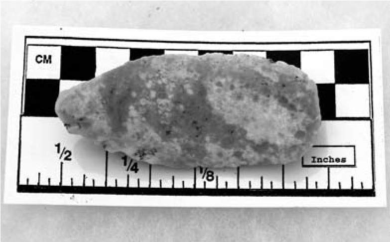
Ceramics
The ceramic assemblage consists of three distinct types and a minimum of six different contemporary vessels that date to the Late Prehistoric period. Colors of each vessel’s interior and exterior based on a Munsell Soil Color Chart and estimated rim diameters using Plog (1985:243–253) can be found in Table 16.1. The following section provides a typological description of each of the original vessels and places them in a cultural- historical framework. Petrographic analysis was conducted on one sherd from each vessel identified in order to describe the inclusions present in the paste of sherds and ascertain the origin of and distinctions between clays.
Corrugated Puebloan Ceramics
Over 200 sherds representing at least four ancestral Pueblo corrugated jars were inventoried. The attempt to distinguish different vessels was based on their discrete spatial distribution and differences in rim morphology (Figure 16.6). One sample of each of the identified vessels was analyzed petrographically. Corrugated ceramics date between the late eleventh and early fourteenth centuries AD on the Colorado Plateau, including the Hopi Mesas (Gifford and Smith 1978; Wilson and Blinman 1995). Consequently these sherds bracket the widest span of occupation for the site and indicate some form of contact with ancestral Puebloan peoples, be it trading, raiding, or use of a common landscape where stored vessels were scavenged.
Table 16.1. Color of Exterior and Interior Surface and Estimated Rim and Body Diameter for Ceramic Vessels Inventoried at 42UN5406.
| Pottery Vessel # | Ceramic Type | Exterior Color | Interior Color | Rim Diameter (cm) | Body Diameter (cm) |
| P-1 | Ancestral Pueblo Corrugated | 10YR7/1 light gray | 10YR5/1 gray | 9.9089 | 8.449 |
| P-2 | Ancestral Pueblo Corrugated | 5Y8/1 white | 5Y8/1 white | 13.1382 | 25.568 |
| P-3 | Numic | 2.5YR7/2 light gray |
5YR7/3 pink 7.5YR6/1 gray |
14.09 | 23.316 |
| P-4 | Ancestral Pueblo Corrugated | 7.5YR7/1 light gray |
10YR5/1 gray 10YR6/1 gray |
unknown | 32.22 |
| P-5 | Ancestral Pueblo Corrugated | 2.5YR7/1 light reddish gray 2.5YR6/1 reddish gray | 2.5YR7/1 light reddish gray | 12.824 | unknown |
| P-6 | Awatovi Black-on-yellow | 5YR6/83 reddish yellow |
7.5YR7/3 pink 5YR4/4 reddish brown |
16.454 | n/a |
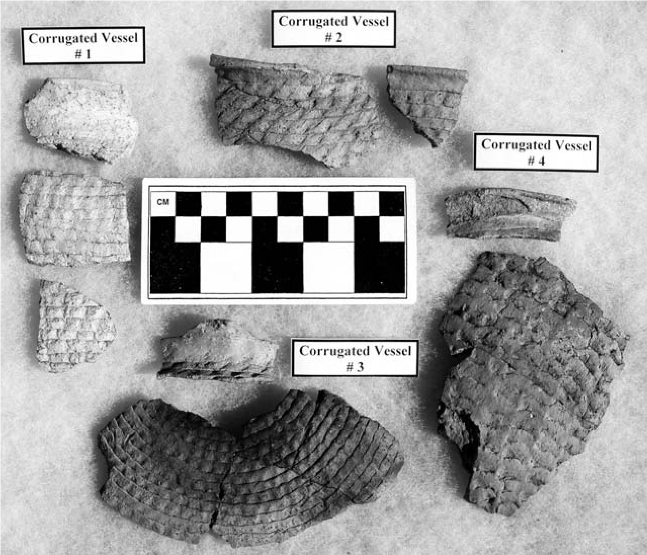
A sample of pottery vessel #1 (see Table 16.1) is an indented corrugated rim sherd that has a less everted and slightly more rounded rim than observed in vessels #4 and #5. Vessel #1 has a slightly lighter gray color than the other corrugated sherds. The paste is a dark grayish brown and has two types of inclusions: oblate pellets of dense clay and rounded grains of quartz sand. The clay pellets likely represent natural inclusions. The color of the oblate inclusions does not contrast strongly with the surrounding paste. The clay pellets, which account for approximately 10 percent of the ceramic paste, range in size from fine to medium. Grains of quartz- rich sands make up 10 percent of the ceramic paste and range continuously in size from fine to coarse. The number of sand grains decreases in ubiquity with the increasing size or coarseness of the mineral grains. Trace amounts of untwined alkali feldspar, microcline, and chert are also present among the grains of quartz sand.
Vessel #2 is also an indented corrugated body sherd with a medium brown paste. The paste contains about 10 percent by volume of quartz arenite sandstone. The sandstone is grain- supported with silica cement. The quartz grains and fragments of sandstone range in size from fine to coarse.
The vessel #4 sherd is from a corrugated jar with an everted rim and a medium brown paste with two types of inclusions. Approximately 10 percent of the paste is composed of extra-fine to medium-sized rounded sand grains composed primarily of quartz with a trace amount of untwined alkali feldspar. A single medium-sized fragment of a calcareous sandy siltstone is also present. The small size and limited amount of sand grains and the siltstone fragment suggest that these are natural inclusions in the clay.
The paste of vessel #4 was also tempered using crushed potsherds. The texture and presence of grains of sand in the paste of the sherd temper are identical to that of the enclosing ceramic paste, suggesting that sherds of the same origin were crushed to include in the paste. The crushed sherd material ranges in size from medium to very coarse and accounts for 20 percent of the ceramic paste.
While potsherd temper has been reported in corrugated pottery from the Mesa Verde area, sherd-tempered corrugated pottery is much more common in the Little Colorado area of eastern Arizona (Hays-Gilpin and Hartesvelt 1998; Hill 1995c). Without comparative material the current sherd-tempered sample and the ultimate source of this vessel will remain unidentified but will be available for future analysis. At a minimum, the constituents of this sherd suggest an origin far from the site.
The vessel #5 sample is also a rim sherd from an indented corrugated vessel. This sherd has a tag or added extension to the lip of the vessel, possibly to facilitate grasping and movement of the vessel during cooking. This sherd is also tempered with crushed arkosic sandstone composed of gray and white feldspars along with chert and clear quartz. Vessels #1, #2, and #5 are tempered with sandstones or sediments derived from sandstone. The slight differences in the size of the inclusions and differences in the minerals present indicate that the vessels were produced with different ceramic resources. Like the corrugated vessel containing crushed potsherds, these vessels were derived from outside the Uintah Basin. Their composition does not correspond to the characteristics of Uinta Gray, the local Fremont ceramic type (Madsen 1977).
Awatovi Black-on-Yellow (Hopi)
The nine sherds from a single Awatovi Black-on- yellow bowl were inventoried on the site (Figure 16.7). Awatovi Black-on-yellow pottery, a Jeddito Yellowware, was produced on the Hopi Mesas between ad 1300 and 1350/1375 (Adams et al. 1993; Gilpin and Hays-Gilpin 2012; Smith 1971). One small sherd lacking decoration from this vessel was selected for petrographic analysis. The paste of this sherd is very light yellow and contains about 50 percent very fine to fine angular grains of quartz derived from fine-grained well-sorted sandstone. The surface of the vessel was unslipped but burnished to a high degree before firing. One sherd has an interior framing line with a pendant hatched figure, a design that is characteristic of Awatovi Black-on-yellow (Smith 1971). Measurements of the rim sherds from this vessel indicate that the bowl had an original orifice diameter of 16.45 cm.
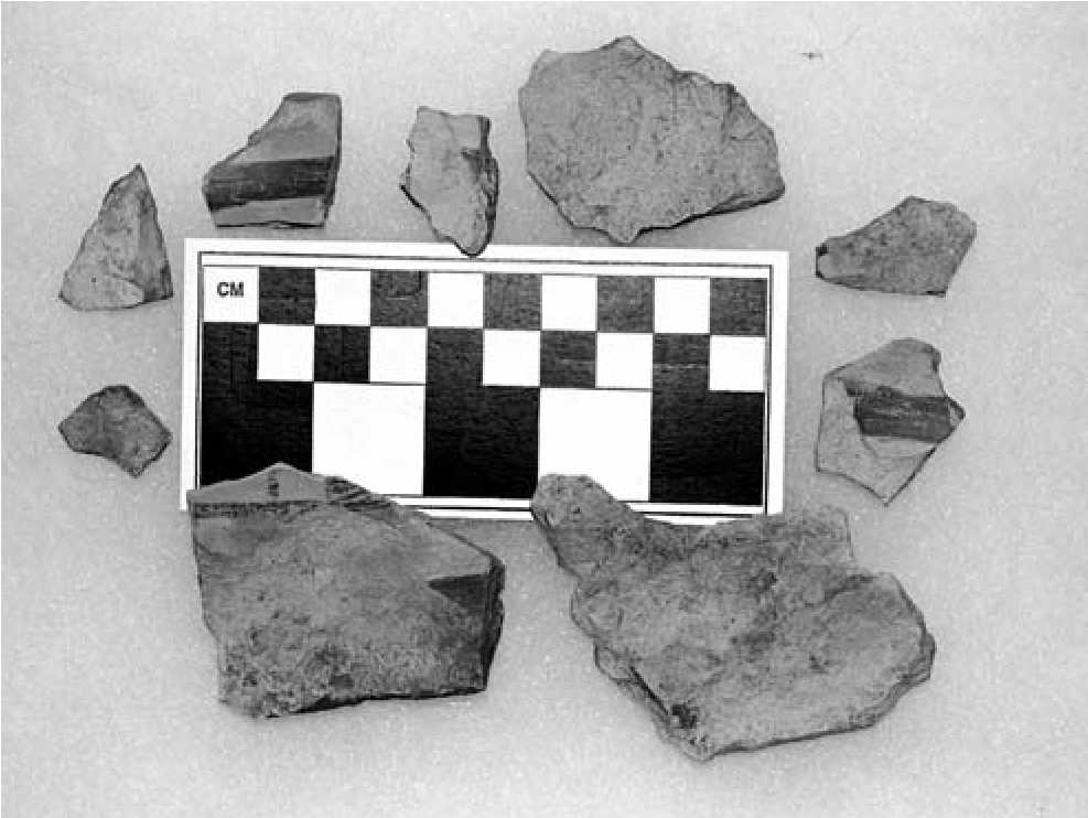
The vessel appears to have been overfired, as evidenced by the presence of heat spalling and oxidation on the exterior of the normally black pigment to a light reddish brown. As a bowl, the original vessel would not have ordinarily been used for cooking (Plog 1985:243–253), suggesting the excessive heating occurred after use as a serving vessel or is an indication of use by a different group (Ute) that did not observe the typical distinctions in vessel uses by form. This vessel represents the northernmost documented occurrence of prehistoric Hopi decorated pottery in Utah.
Uncompahgre Brownware (Ute)
The single Uncompahgre Brownware vessel from the site is represented by 24 sherds (Figure 16.8). Uncompahgre Brownware is associated exclusively with Ute occupations in Utah and Colorado (Buckles 1971; Reed 1994, 1995). The paste of these sherds is very dark brown and contains silty angular and rounded fragments of unmixed clay. These rounded clay inclusions range from silt-sized to coarse.
Isolated mineral grains and fragments of sandstone are also present in the paste and range from silt-sized to very coarse. Rounded quartz-rich sands with a trace amount of weathered untwined alkali feldspar are the major type of mineral inclusions present. Also present in the paste are 10 medium- to coarse-sized rounded pieces of sandy siltstone with distinct bedding planes.
A single very coarse-s ized fragment of fine-grained holocrystalline basalt is also included. This type of basalt can be found along the southwestern end of the Wasatch Plateau north of Boulder Mountain at the head of the Fremont River in south-central Utah (Geib and Lyneis 1993). The presence of basalt in the paste of the Uncompahgre Brownware sherd from 42UN5406 indicates that the vessel originated more than 200 miles to the southeast. Transportation of the vessel would have necessitated crossing the Green River and the rugged canyon country of central Utah. A single coarse-sized fragment of vein chalcedony is also present in the paste. Given the wide variation in rock fragments, it is likely that they represent natural inclusions.
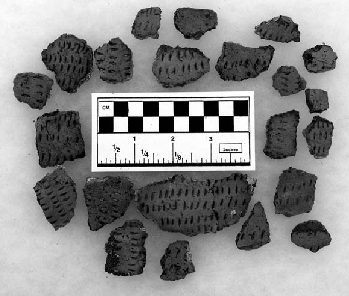
An isolated Uncompahgre Brownware sherd with a paste containing a mix of volcanic and sedimentary rocks has been reported from elsewhere on the Ashley National Forest in northeastern Utah (Jennings and Elkins 2013). The paste similarity in the partial vessel from 42UN5406 and the sherd from the Ashley National Forest indicate that the original vessels were made from a common source of materials located far to the southwest of where the ceramic samples were recovered. The presence of ceramics from south-central Utah in the Uintah Basin provides evidence of the range of mobility and/or exchange of Ute peoples before European contact.
The Uncompahgre Brownware vessel from 42UN5406 represents a jar, but not enough of the vessel was recovered for a complete vessel profile so the overall shape of the vessel is unknown. The exterior of the vessel was decorated by parallel rows of D-shaped impressions, fine parallel fingernail impressions that are present on the curved portion of the vessel. After the vessel had been incised, the surface was smoothed by hand, which slightly compressed but did not obliterate the incisions. The interior was less well smoothed and exhibits uneven incisions and striations on the vessel’s surface, indicating either that it was smoothed with a bunch of grass or that rock fragments were caught up by the scraping tool. The single rim sherd from this vessel is the same thickness as the rest of the vessel and is slightly everted with a rounded lip.
A fingernail-impressed sherd, along with a soil sample, was submitted for dating to the Research Laboratory for Archaeology and the History of Art located at the University of Oxford for dating by optically stimulated luminescence. A date of ad 740 ± 95 (ad 1175–1365) was reported (Laboratory code number X2874). The date has a Palaeodose (GY) of 2.63 ± 0.30 and a total dose rate (GY/ka) of 3.56 ± 2.21. This result is consistent with but slightly later than dates on features with Numic pottery that have been published for locations in eastern Utah and western Colorado (Reed 1994:194; Reed and Gebauer 2004:107).
Similar fingernail- impressed pottery has been classified as Uncompahgre Brownware (Buckles 1971; Reed 1995), supporting our inference that this is a Ute ware, but until now Numic occupation in the Uintah Basin has not been well documented and this site is much farther north than those other locales (Truesdale 1993, 2002, 2007; Loosle and Johnson 2000). No reliable pre-AD 1200 dates associated with Uncompahgre Brownware have been reported for the Uintah Basin (Spangler 2002:434). Moreover, the associations of Numic ceramics with independently dated features are not always clear, given problems with the associated Uncompahgre Brownwares, dates from features elsewhere on the site, or “old wood” issues (Hill 2005). This particular date is important because it represents a direct date of an artifact associated with Ute cultural activity.
Discussion of the Ceramic Assemblage
The ceramic assemblage recovered from 42UN5406 represents a single occupation. This assumption is based on the highly restricted access and circumscribed location of the site, which is situated on a narrow finger ridge that extends into a steep-walled canyon. The distribution of artifacts is restricted to this single spatially isolated setting. The single-component nature of the site is also indicated by the small assemblage and spatially restricted distribution of artifacts. The co-occurrence of ancestral Pueblo (Hopi) and independently dated Ute ceramics that date to the same time period indicate a limited occupation of the site. Gray corrugated pottery was produced on the Hopi Mesas as early as the eleventh century and well into the fourteenth century, which provides a temporal framework that bounds the use of this site in a general way. Based on the presence of arkosic sandstone in the paste of four of the corrugated vessels, it is likely that these had a common origin and may represent vessels made by a single group of individuals, indicating that the vessels were obtained from the same source. The nearest sources of ancestral Hopi corrugated vessels produced using arkosic sandstone is in southeastern Utah, southwestern Colorado, or northeastern Arizona (Hill 1995c; Wilson and Blinman 1995). Future petrographic analysis of a larger sample of the indented corrugated sherds from eastern Utah, western Colorado, and the Hopi Mesas will better resolve the origins of this pottery.
Corrugation of vessels represents a ceramic technology not shared by the Fremont of the Uintah Basin, who produced a plain-surface grayware (Madsen 1977). This highlights the distinctiveness of these sherds on this site. Also, local Fremont pottery is tempered with limestone (Truesdale and Hill 1999). The paste of the four corrugated sherds examined petrographi- cally contains fragments of sandstone or crushed potsherds, again demonstrating distinct differences from Fremont pottery. The corrugated sherds present on 42UN5406 are far from their origins somewhere in the San Juan drainage or perhaps farther south on the Hopi Mesas. Along with the other evidence, this suggests that they were brought to the site by people moving over vast areas, consistent with the known adaptation of the Ute.
The Awatovi Black-on-yellow bowl was produced at the Hopi Mesas sometime during the fourteenth century (Gilpin and Hays-Gilpin 2012; Smith 1971). Sherds of this type recovered from 42UN5406 represent the most northerly record of Hopi pottery in Utah. Their presence is consistent with the occurrence of the gray corrugated pottery in suggesting the occupants of this site obtained them from distant locations, possibly through trade or as a result of raiding.
As stated earlier, Ute pottery in eastern Utah and western Colorado first appears during the twelfth century ad (Reed 1994). The results of previous analyses are consistent with the OSL date of the Ute sherd from 42UN5406, as radiocarbon-dated regional chronologies indicate continuity in the occupation of eastern Utah and western Colorado from the Late Prehistoric into the Historic period (Reed 1994; Reed and Gebauer 2004; Spangler 2002; Truesdale 1993). It is possible that a portion of these eastern Utah and western Colorado dates represent the use of “old wood,” which is an ongoing problem in dating Protohistoric occupations across the American Southwest (Baker et al. 2008; Hill, Chapter 11 this volume; Hill and Seymour 2013; Seymour 2010a; also see Schiffer 1986). Still, the old-wood problem may not be as substantial as suggested because there is little difference in date between this earliest-dated sherd from 42UN5406 and those radiometric dates from eastern Utah and western Colorado. Thus, at a minimum this sherd from 42UN5406 represents another early date for Ute pottery in eastern Utah. In the current case the date represents a determination on an artifact associated with Ute culture, making it more reliable and precise than many radiocarbon dates. The presence of the Awatovi Black-on-yellow bowl further substantiates the fourteenth-century Numic occupation of 42UN5406, anchoring the early presence of ancestral Utes in the area.
Discussion of 42UN5406
42UN5406 represents a single Ute occupation dating to the fourteenth century. The nature of the occupation has been determined by the types of artifacts present and direct OSL dating of an Uncompahgre Brownware sherd. The southern artifact concentration at 42UN5406 produced Uncompahgre Brownware ceramics decorated with fingernail impressions attributed to the Ute ceramic tradition, sherds of an Awatovi Black-on-yellow bowl known to be made by the Hopi, and indented corrugated pottery made by the Hopi or other ancestral Western Pueb- loans. These occurrences are likely explained by intermittent interaction between Numic and Hopi groups. Numic occupations reported from southwestern Colorado are often associated with sherds of a later dated Hopi pottery type, Jeddito Black-on-yellow (Errickson and Wilson 1988). Until this project, Awatovi Black-on-yellow or other Hopi pottery had not been found in association with Numic ceramics in Utah. A number of processes can result in sherds from one indigenous group appearing on the sites of others (Seymour 2010a, 2013a). There is an occasional historic mention of Paiute and Ute groups alternating between raiding and trading with
Note
We thank the following individuals for their professional comments and support: Jean-Luc Schwenninger, Oxford Luminescence Dating Laboratory; Kelly Hays-Gilpin, who examined some of the Awatovi the Pueblos, and specific mention of the Hopi (Ambler and Sutton 1989; Beaglehole 1936). The Hopi are known to have made trips to hunt and collect plants and minerals far from their villages and came into contact with Paiute peoples and other indigenous groups (Beaglehole 1936:22). The association of Awatovi Black-on-yellow indicates that the Ute occupation at 42UN5406 took place sometime during the fourteenth century, only about 25 years later than the OSL date of the Uncompahgre Brownware sherd recovered from the same artifact concentration as the Hopi ceramics. The Desert Tri-notched point matches other known Desert Tri-notched projectile points reported from northeastern Utah and surrounding areas. Like the presence of Uncompahgre Brownware, Desert Tri-notched points are indicative of a Numic occupation.
Summary
The presence of Awatovi Black-on-yellow and contemporary gray corrugated sherds along with Numic brownwares at 42UN5406 is unique; it is the most northerly occurrence of Hopi pottery in Utah and far beyond the range known for the Hopi themselves. Rather than arguing that pottery equals people, the presence of these Hopi sherds on a Numic site suggests that raiding or trading occurred, bringing these sherds far from their origin of manufacture. The cooccurrence of Ute-related artifacts and Hopi ceramics represents probable evidence of the interaction between Hopi and Ute peoples during the fourteenth century. The huntingand-gathering Numic peoples, who traveled throughout the central and eastern portions of Utah, interacted with the settled peoples living on the Hopi Mesas. The dating and ethnic assignments of the sherds and projectile points are concordant with the available archaeological and ethnographic data.
Black-on-yellow ceramics; and the staff of Dominion Exploration and Production, Inc., and XTO Energy Corporation.
17. Three Sisters Site
An Ancestral Chokonen Apache Encampment in the Dragoon Mountains
Deni J. Seymour
The Apache in the southernmost Southwest, including the Chiricahua and Mescalero, shifted between variably sized encampments as part of their annual cycle. They occupied relatively large local group base camps for much of the year, consisting of 10 to 40 households or so (Basehart 1960; Henderson 1957; Opler 1941:182–183; Seymour 2002:66–77 [41EP396 and 41EP401], 2013a). Even larger residential groupings were formed temporarily when there was a need for a large defensive force, an organized raid, or ceremonies of certain types. Multiple families, local groups, and bands came together to form these especially large residential sites (Ball 1970:22; Basehart 1960:60–61, 110; Betzinez and Nye 1959:85; Cortés y de Olarte 1989:65; Robert Geronimo in Henderson 1957:414; Matson and Schroeder 1957:342; Seymour 2002:107–127; 2004a, 2008b; Sweeney 1991, 1992). And finally, from their moderately sized local group base camps, smaller family or task-based groups went out regularly to hunt, to raid, and to travel around (Opler 1941:364). These smaller groups, consisting of one or more families, would splinter off from the base camp and reside in their own encampments for a few weeks or months. In this way they could take advantage of locally clustered resources or avoid confrontation when strife arose in the larger ranchería.[22] As Opler (1941:364) notes, “Not infrequently more than one household or an extended family consisting of a number of households temporarily leaves the larger encampment or local group on such an errand.”
This last-described scenario is consistent with evidence found at the Three Sisters site, a small encampment in the western foothills of the Dragoon Mountains in southeastern Arizona (Figure 17.1). The presence of only three structures suggests that the Three Sisters site is a small encampment, perhaps occupied by three families or an extended family. It is called the Three Sisters site because, consistent with Apachean custom, it was likely occupied by a few, in this case three, families of related women, perhaps three sisters, or any of a number of other matrilineal relations. Related women and friends tended to go together to these types of residential locales (Basehart 1959a, 1959b, 1960; Henderson 1957; Naichee 1957:793; Opler 1941:182–183), although there are many instances in which unrelated people might camp together.
Though only meager data are available from this small site, there is more information accessible at Three Sisters than on many comparable sites. From these data we can address a range of important topics relating to the ancestral Apache and to mobile group behavior in general. We can address issues of gender, seasonality, group size, and more. Its location in the foothills and the presence of charred crystallized sap, likely from either agave or yucca, in one of the roasting pits suggest that it was a late spring or early summer encampment. These plants mature in late May and early June and tended to be harvested and processed in the spring months when they are most palatable (Castetter 1935:12; Castetter and Opler 1936:35; Opler 1941:355–358).
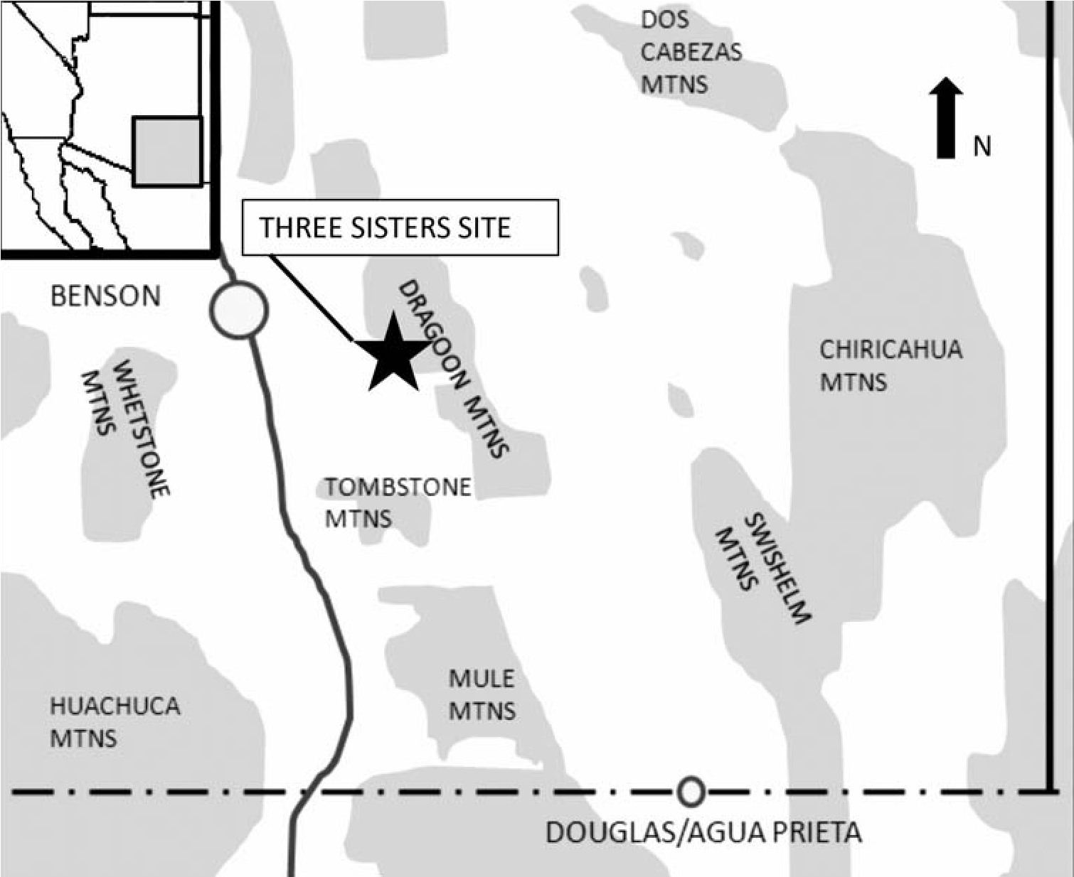
Drawing on ethnographic parallels to interpret this archaeological site, we can understand this aspect of an ancestral Apache settlement system deep in time. Early chronometric dates obtained from the site fall squarely in the preSpanish period. These are consistent with other early dates for the ancestral Apache throughout the region and suggest that this residential pattern has considerable time depth (Seymour 2012a, 2012b, 2013b). From this we can infer some degree of stability in these aspects of residential practice that are uniquely Apache. There are, of course, always questions about continuity in specific practices over the long term, but certain fundamental aspects of society and behavior persist while others fall away or are modified. We certainly cannot discount the potential problem that similar organizational structures or manifestations might take on different roles and meanings in society through time. Yet we are fortunate in our interpretive efforts when archaeological data conform so precisely through time to fundamental aspects of Apache society, such as the way the Apache formed and modified residential groups to make a living in this particular environment with a consistent range of resources present in the context of the larger political landscape. This early-fourteenth- and fifteenth-century site is described in this chapter, and its implications are discussed in the context of wider understandings of the presence and nature of early ancestral Apaches in this region. The ancestral Apache affiliation has been inferred from a variety of evidence that is discussed elsewhere in considerable detail (Seymour 2002, 2004a, 2008b, 2008c, 2009c, 2010a, 2012a, 2013a; Seymour and Harlan 1996a).
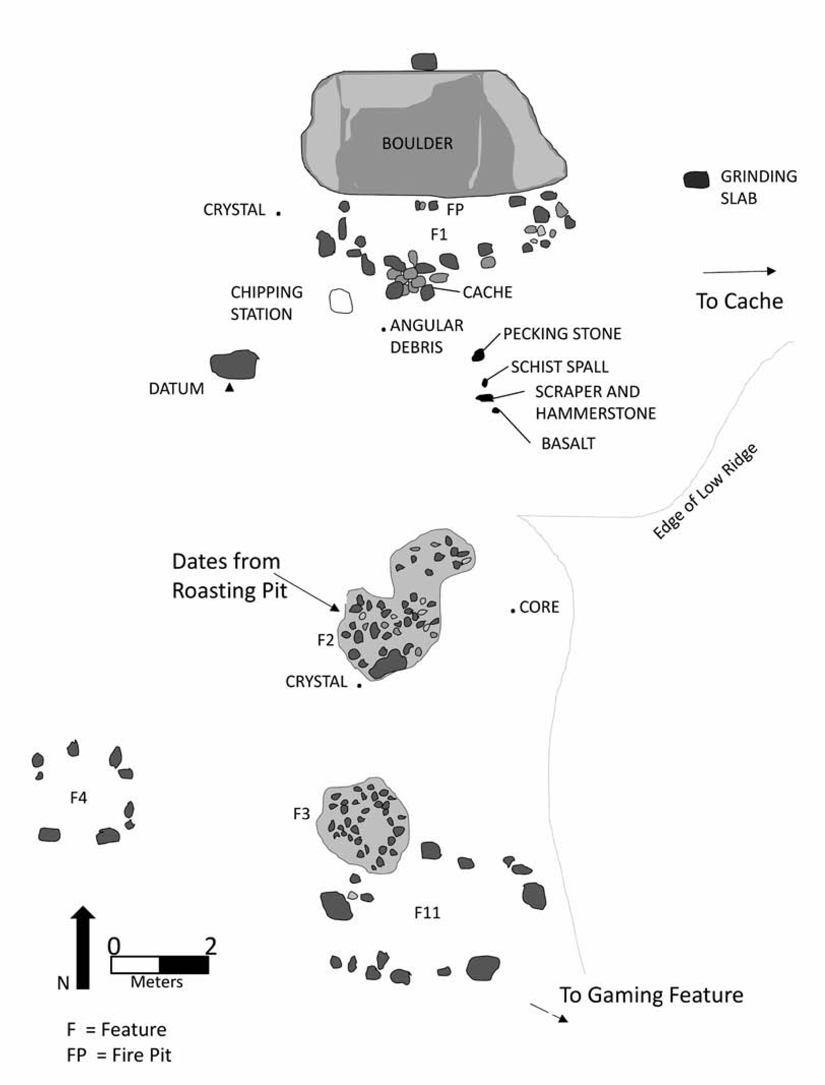
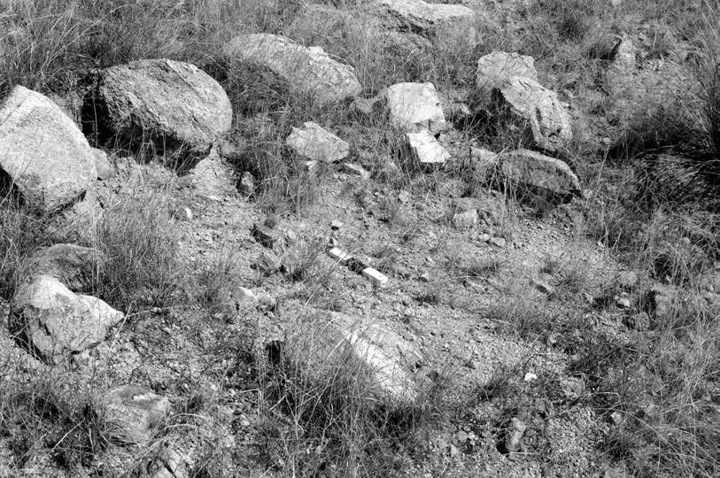
Description of the Three Sisters Site
The small residential Three Sisters site is nestled in the oak and pinon forest on a south-facing slope at the base of the Dragoon Mountains on the Coronado National Forest (Figure 17.2) (Seymour 1995; Seymour and Harlan 1996b). The Three Sisters site (previously referred to simply as the Dragoon Mountain site; AR 03-05-01-442) is characterized by three structures (a lean-to and two rock-ring structures), two small roasting pits, a probable gaming feature, a grinding slick, and a surface scatter of artifacts.
Structures
The extremely vague rock outlines that attest to the former presence of two wickiups or brush structures are characteristic of such features in the Chiricahua area (Figure 17.3). Barely discernible as cultural, the positioning of cobbles and boulders form two rough circles (Features 4 and 11). Feature 11 consists of natural boulders that have been supplemented by the addition of a few boulders and cobbles to fill in more of the circumference of the feature, presumably to hold branches and a covering in place (see Figure 17.3). Feature 4 consists of boulders and cobbles placed in a rough small elongate arrangement. In each, an area about 2 m or more in diameter is enclosed by the discontinuous rock outline. As is typical in this region, no evidence of an intramural hearth or flimsy and perishable superstructure is discernible, although excavations were not conducted owing to permit restrictions.[23]
Another structural feature (Feature 1) is a partial curvilinear rock outline positioned against a large boulder (Figure 17.4). This was apparently a lean-to and consists of a mostly single row of cobbles aligned parallel to the rock face but curved at the ends to intersect with a large boulder and enclose an area about 4 m long. A cobble on top of the large boulder may have held a hide in place, as may have the rocks that form the perimeter of the feature.
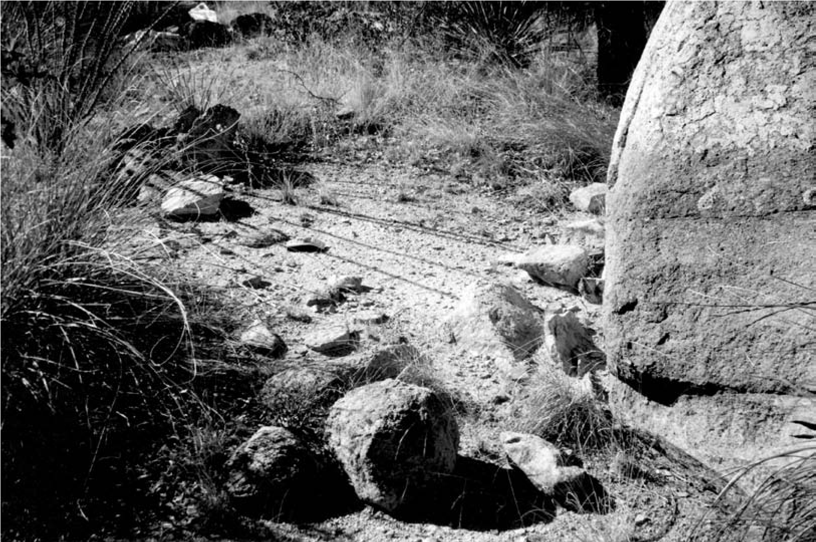
A cluster of rocks in the southwest corner of the rock alignment may have functioned as a cache or may have surrounded a post that supported the superstructure (see below). A cluster of three rocks against the base of the boulder is suggestive of an intramural fire area (Figure 17.5), which is similar in placement and form to a thermal feature found in an early-twentieth-century lean-to in the Organ Mountains (Seymour 2002). The severity of down-slope erosion has left the wall and hearth rocks slightly pedestaled and has removed any ash, charcoal, or artifacts that might once have been present.
Roasting Pits
Two roasting pits are situated in the center of the site (Figure 17.6). The features consist of discolored and fire-cracked and fire-altered rocks clustered together with dark gray-black soil. They are nothing like the large, high-profile, doughnut-shaped roasting pits considered typical of the Apache north of the Mogollon Rim (Reid and Whittlesey 1997:233). The contents of these roasting pits have been to some extent spread across the surface, seemingly more broadly than the pit outlines, where rock is most dense. This characteristic of materials spread across the surface is typical of roasting pits that have been used, cleaned out, and reused. When cleaned out, the rocks, ash, and charcoal tend to scatter around the perimeter of the feature. The limited accumulation and piling of rocks suggest that although these features were reused, there had been insufficient passage of time and reuse episodes to create a substantially mounded feature or waste rock pile.
Several additional roasting pits are present on the slopes nearby. Their similar size and morphology to those near the structures suggests that they might be related to this occupation, but only with chronometric analyses can this be discerned with certainty. These other roasting pits may have been placed to take advantage of widely spaced patches of agave, yucca, or other plants that were processed near where they were gathered. This strategy would reduce the effort involved in transport and would take advantage of widely dispersed fuel wood distributions.
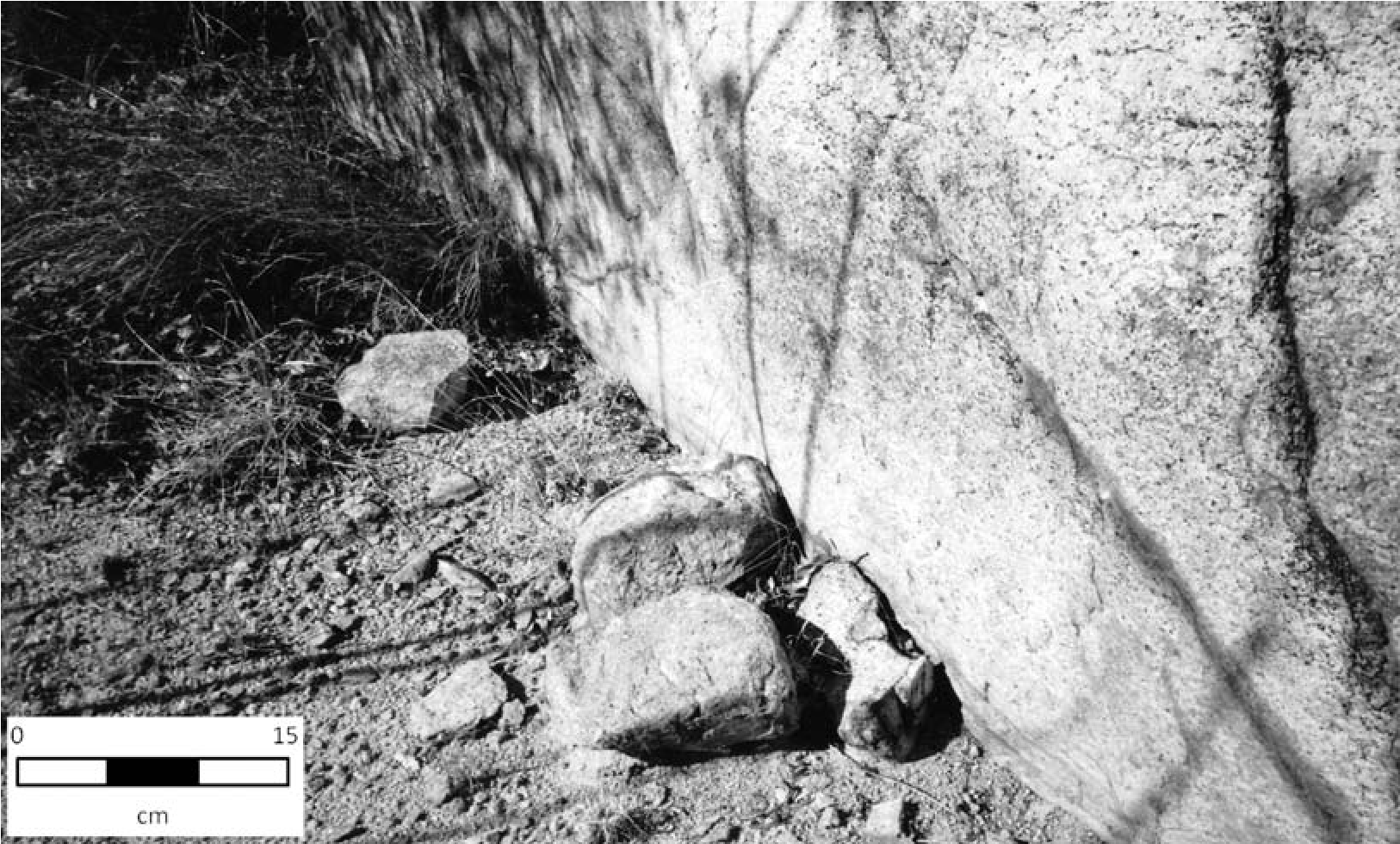
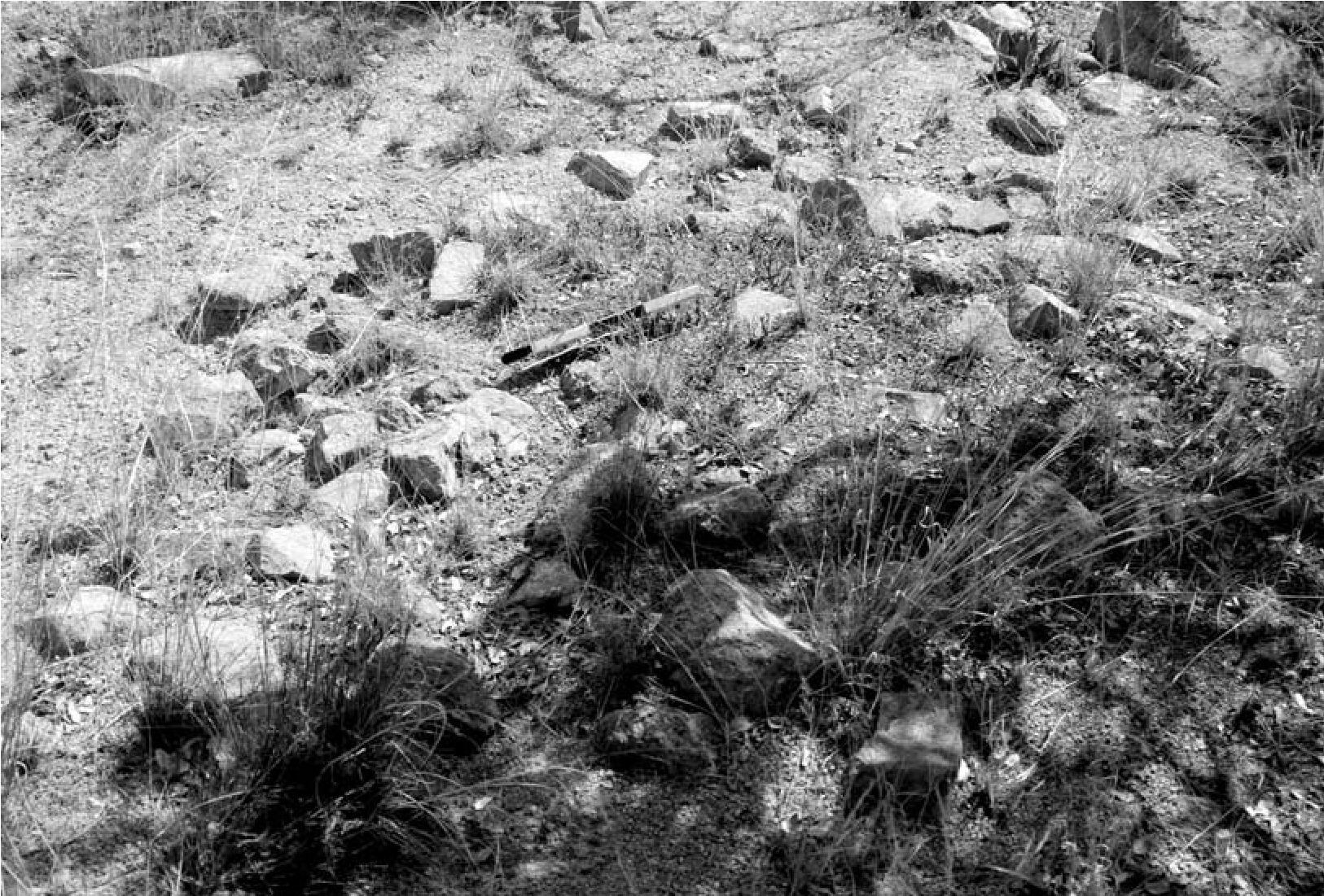
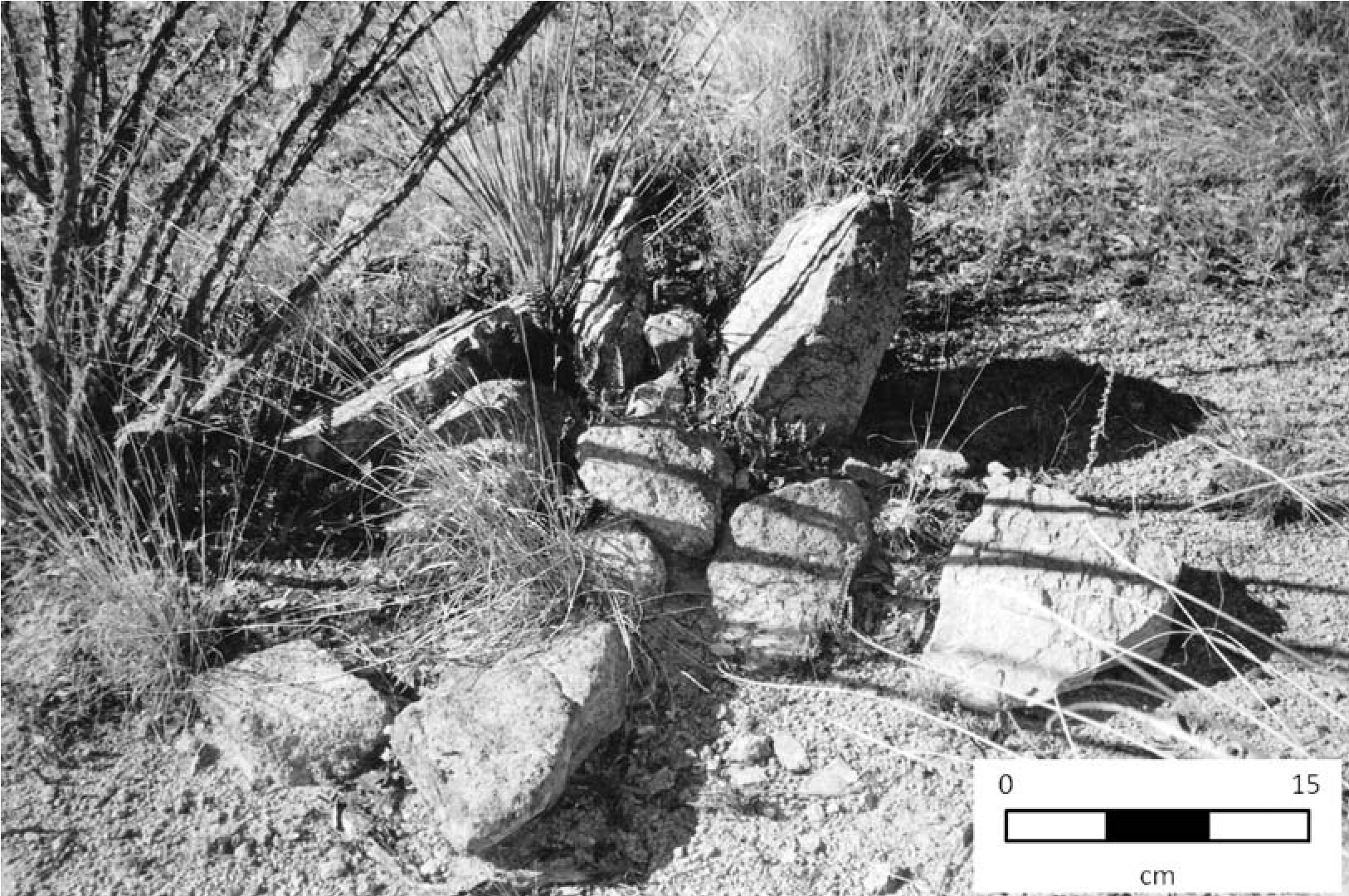
Caches
Two small caches were encountered on this site, consistent with the storage function of many residential locales that were used repeatedly. One probable cache in the corner of the wall of the lean-to, described above, was opened at some time and so its use as a cache is conjectural. Removal of the inferred contents occurred in the distant past, judging from lichen growth on the rocks (Figure 17.7). This feature could have been a post support, but the rocks are not sufficiently large to sustain this suggestion.
The second cache is located on a nearby ridge finger. The cache contains two one-hand manos. These manos are in a small cairn-like feature, enclosed by indistinct rocks, and are situated in a crevice between boulders (Figure 17.8). One is a formal, shaped, bifacial, one-hand mano while the second is unshaped and, although bifacial, shows only limited evidence of use. These may have been scavenged from a prehistoric site and hidden for reuse each time the residents returned. The only other groundstone on the site is a boulder that was used as a grinding slick (Figure 17.9) and a pestle or pounding stone.
Gaming Feature
A possible gaming feature (Figure 17.10) is present at the south end of the core area. This small rock circle is similar to another feature on a Cayetano complex (Sobaipuri Oodham) site in the Santa Cruz Valley (AZ EE:5:24, ASM; Seymour 1993b, 2011a:Fig. 5.26) and may provide evidence of a form of congenial intergroup interaction. More relevant to this discussion, this gaming board type can be recognized in ethnographically derived photographs of the White Mountain (White River) and San Carlos Apache as being used in one of several stick dice games (Culin 1907:86–89; Figs. 82, 86, 87; see Figures 17.11 and 17.12).
The archaeological feature consists of a small rock ring about 1 m in diameter with a cobble placed in the center. A chunk of unmodified magnetite was adjacent to the feature, perhaps a remnant of something involved in a bet, for beads, dress materials, and other things of small value were bet in the game, although many times things of considerable value (such as mescal and horses) were also bet (Culin 1907:88; Opler 1941:451).
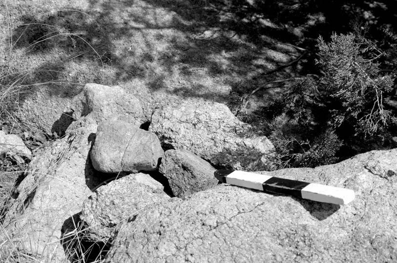
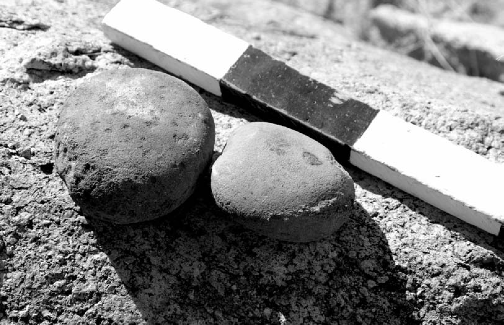
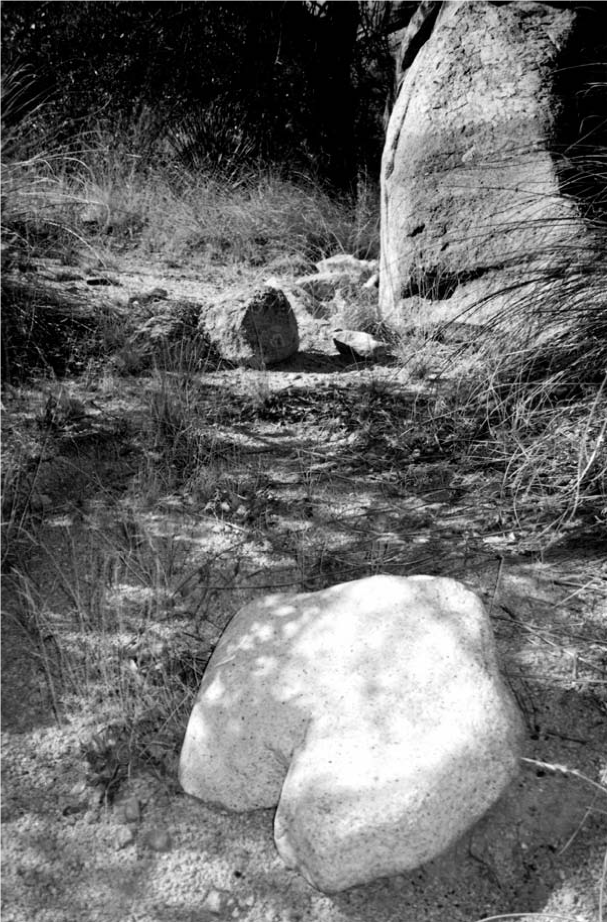
The stick dice game was usually played only by women, providing a rare insight into gender in the archaeological record (Culin 1907:88; Opler 1941:451). Yet, as Opler (1941:451) notes, men do occasionally play the game with women, but mostly a group of women play it alone and men are ostracized if they play too much. Depending on the specific game, two, three, or four may play, or even up to six. Given the small size of the archaeological feature, it is likely that few people played at this game, which is also consistent with the number of adults inferred by the wickiup outlines present.
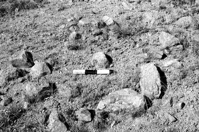
Assemblage Diversity
The diversity of the assemblage in the core area of this site and its large size relative to many other small Chiricahua Apachean sites suggest that the camp was occupied repeatedly over several years. Included on the main portion of the site are a unifacially retouched chert scraper, a pounder or crude pestle, a boulder grinding slick, and several other tools (see site plan, Figure 17.2), and an assortment of expediently produced debris, along with quartz crystals and an unmodified magnetite chunk. Stone tools were made of a variety of material types, including chert, rhyolite, schist, granite, and basalt, and both magnetite and crystals along with many of the other materials were likely brought from afar. The character of these artifacts is consistent with Cerro Rojo complex, or ancestral Apache, artifacts encountered elsewhere (Seymour 2002, 2004a, 2009c, 2012a, 2013a). No projectile points or pottery were present (artifacts customarily considered diagnostic; see Seymour 2010a; Chapter 4), nor are there prehistoric artifacts in the core portion of the site.
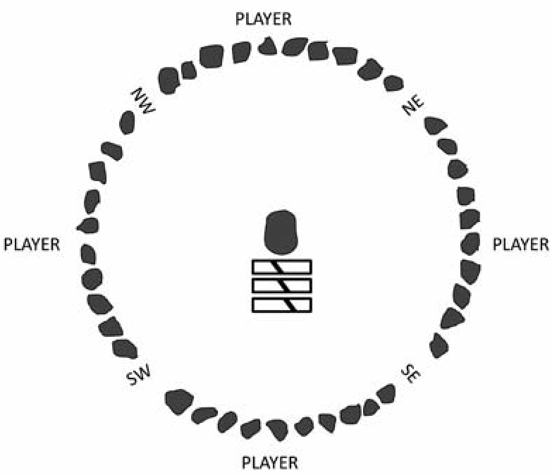
Most small Chiricahua Apachean sites have no artifacts or only one, making this assemblage at the Three Sisters site quite dense, relatively speaking. Consisting of 18 items, the assemblage exhibits a wide range of implements that would be expected for accomplishing household chores, including plant processing and perhaps hide working. The presence of these items near the structures, the completeness of the assemblage, the range of tools present, the absence of metal, and the nature of the artifacts themselves all point to an early occupation and numerous repeated short-term occupations.
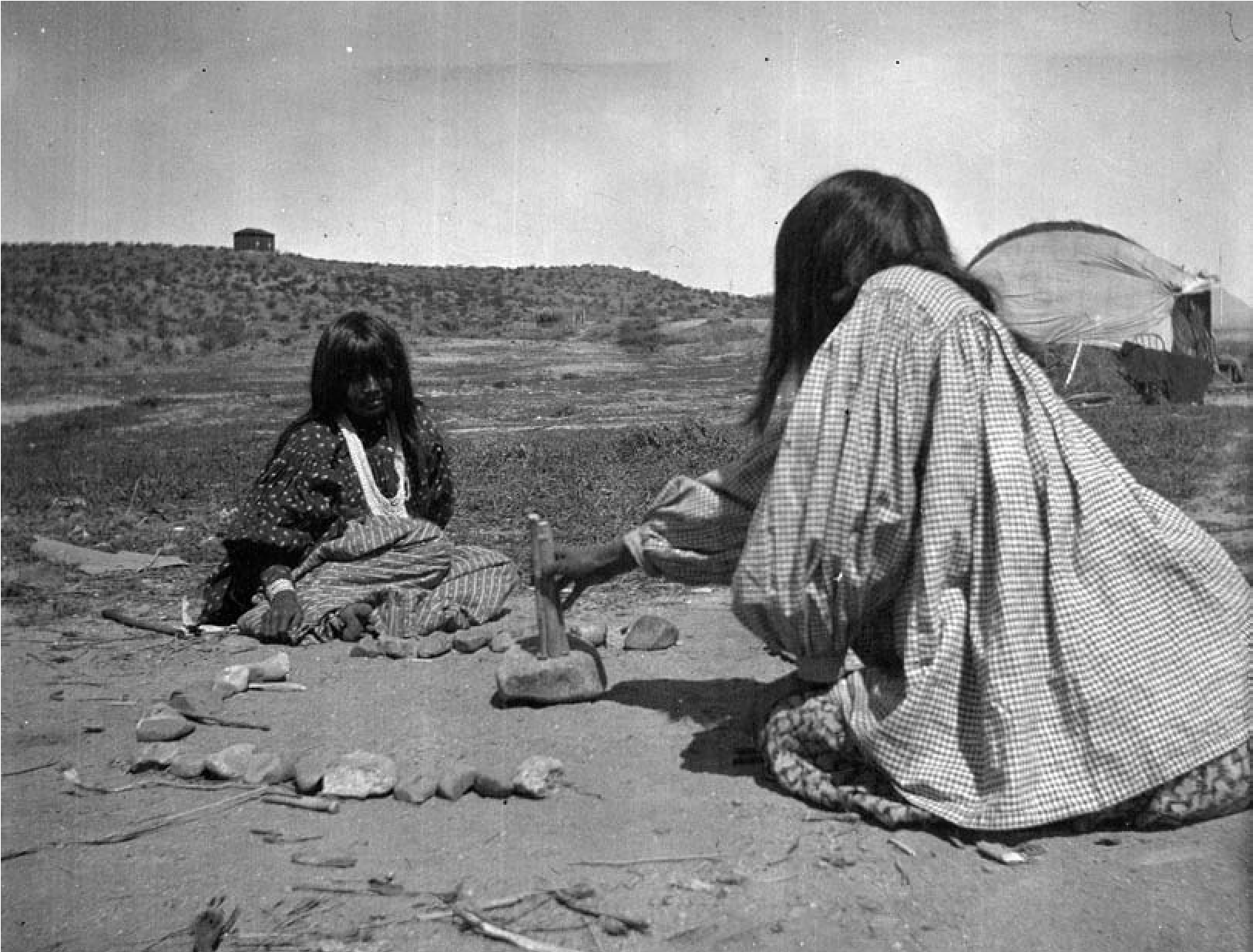
Chronometric Dates
Although the site was found in 1994 and recognized as most likely ancestral Chiricahua Apache, the opportunity to date it did not arise until 2003. This prospect was provided by vandalism in which one of the roasting pits was partially excavated and several of the artifacts were removed. This unfortunate occurrence afforded the occasion to establish a date of occupation but also resulted in the loss of a portion of the surface assemblage through selective collection (the quartz crystals and formal unifacial chert scraper disappeared).[24]
Chronometric dating of the ancestral Apache occupation is complicated in this region by the fact that suitable species for tree-ring analysis are not present. Consequently, other means of dating are required. To this end, a radiocarbon and a thermoluminescence sample were obtained and run from the “backdirt” of one of the roasting pits (Feature 2) in an effort to isolate the period of occupation. The radiocarbon sample was obtained from vitrified shiny and sugary material found in small thin sheets visible in the loose fill within the pit. The residue indicates that probably agave or yucca was being roasted. Ethnographic information on the seasonal exploitation of these plant resources would suggest a late spring or early summer use of the site (Castetter 1935:12; Castetter and Opler 1936:35; Opler 1941: 355–358). Both agave and yucca are present on and near the site today, and the area is unusually rich in the diversity of edible and usable plant species, likely accounting for its placement in this portion of the valley.
Table 17.1. Chronometric Dates from the Three Sisters Site.
| Sample No. 14C, TL | Material/Context | Calibrated Date (2 sigma) | Conventional Radiocarbon Age (1 sigma) | **1-Sigma Calibrated Result, 68% Probability |
| Beta-166882 | Carbonized shiny, sugary vitrified material from thermal feature | cal AD 1430–1520 (cal BP 520–430) and cal AD 1580–1630 (cal BP 380–320) | 410±40 BP | cal AD 1440–1490 (cal BP 510–460) |
| TL-X1874 | Burned rock from roasting pit | AD 1374±40 (AD 1334–1414) |
This sample was selected for analysis, rather than any of the plentiful wood charcoal, in order to avoid the “old wood” problem (see Schiffer 1986, 1986; Seymour 2010a, 2012a). The material was submitted to Beta Analytic and yielded a calibrated dual intercept age of 410 ± 40 bp (cal ad 1430 to 1520 [cal bp 520–430] and cal ad 1580 to 1630 [cal bp 380–320]; 2 sigma, charred material, S13C = -23.4%, Beta 166882). While it is most appropriate to use the 2-sigma date that is given at the 95 percent confidence level, many researchers will accept a greater probability that the date will fall outside the stated range. These researchers use the 68 percent probability to narrow the results. Using this approach, the age range would be cal ad 1440–1490 (cal bp 510–460) (1 sigma, Beta 166882). Either way, with the dual intercept result or the narrower 1-sigma range, these possibilities place the site squarely within southeastern Arizona’s Protohistoric period, potentially overlapping with the Terminal Prehistoric (Table 17.1). Because of its nature, the resinous material is less likely than other materials to suffer from the old-wood effect, and thus the dates should be considered reliable, other than the difficulty presented by the dual intercepts with the curve.
A rock and soil sample that was obtained from the surface of this same feature within the area disturbed by the vandal was also submitted to the Oxford Luminescence Dating Laboratory. This rock had formed part of the upper lining of or was a heating element in the roasting pit. Characteristics of the rock’s surface clearly indicated that it was intensively burned on one side, thus providing us an opportunity to isolate that last episode of high-intensity heating involving this rock in the feature. This thermoluminescence sample returned a date of 630 ± 40 bp (Oxford Sample X1874; see Table 17.1). This equates to a date range of ad 1374 ± 40 (ad 1334–1414).
Clearly the dates from these two chrono- metric techniques do not overlap, yet instead of presenting interpretive problems, these results are consistent with expectations. Mobile groups, including the ancestral Apache, are known to have practiced a lifeway that involved revisiting a specific location repeatedly through the years. Because roasting pits of this type were reused, perhaps over several decades, they potentially produce widely divergent dates from those in the base of the feature or those found around the perimeter or in the rake-out. Even pits on the same “surface” may date to widely divergent periods because sediment tends to accumulate slowly in these settings. Moreover, rocks in the fill and the upper lining of the feature may reheat differentially during each firing, only those in the direct fire being heated sufficiently (750°F; ca. 400°C) to record that heating event. Some rocks might provide dates that relate to the first firing of the pit, others to intervening firings or even the last pit use. Numerous in-depth studies of roasting pit formation processes highlight this characteristic of roasting pits, pointing out that a series of dates may be obtained that document sequential cleanings and reuse (Black et al. 1997; Hester 1970; Shiner and Shiner 1977).
Under such circumstances, widely separated date ranges are anticipated, given expectations for and evidence of feature reuse. As was noted with these two roasting pits, there is clear evidence of reuse, which could easily account for the 36-plus-year difference between the latest span of the thermoluminescence date and the earliest intercept of the radiocarbon result.
Implications
This small encampment provides important information on some of the earliest ancestral Apaches in southern Arizona. Its discovery is relevant to many issues, including documenting and understanding the archaeological signature of the earliest ancestral Apache and recognizing evidence of recurrent visits to a small habitation locale, a persistent place. Evidence from this site, along with others found throughout the region, indicates that this residential pattern of splitting off from larger encampments and revisiting specific favored locations has considerable time depth. Investigation of this site highlights issues relevant to dating mobile group sites that were occupied repeatedly for short periods. Even at this early date these small sites can be understood only when we consider the scale and nature of the persistent and defensive landscape.
Recurrent Visits
Ethnographic information on mobile groups in general, and on the ancestral Chiricahua Apache specifically, documents that many encampments were revisited repeatedly over many years. Small ancestral Apache encampments, much like the Three Sisters site, were used by one or more families as favored plant processing locales. Members took leave of the large local group encampment to harvest resources in smaller groups, capitalizing on isolated patches of protected resources. As Opler (1941:364) notes, “many times the [plant gathering] site is so far distant, and the work ahead so time-consuming, that the entire household goes with her [the woman] and sets up a temporary camp.” I suggest that this site is an archaeological example of this ethnographic encampment type. This specific locale was attractive because of the diversity of concentrated plant resources and its location near springs (a half mile or so away) that could be easily accessed without giving away the location of the camp to enemies or scaring off game that used the spring.
Several lines of evidence suggest this location was repeatedly reused by its residents and perhaps even through the years by people descendant to them. These characteristics provide substantive evidence of how recurrent use is manifest in the archaeological record for highly mobile people in ways that are much less obvious than for people occupying sedentary sites continuously for a decade or more, even for generations (also see Seymour 2010a and Chapter 4, this volume). The density and diversity of the artifacts suggest reuse over time; most ancestral Chiricahua Apache sites found in the open tend to have very few artifacts and only a limited range, owing to a short-term use or even a series of short-term occupations. While there are only 18 items visible on the surface, these represent a diversity of tool forms and material types, suggesting that a series of household activities occurred here. This is significant when we consider that each episode of visitation for a highly mobile group tends to result in the deposition of only a limited amount and diversity of (nonperishable) materials. Yet, through time, with each repeated visit involving a similar range of household activities, there is the chance for a greater range and density of items to be lost, broken, and deposited. Thus, while the accumulated material is minimal overall as compared to sites of more stationary peoples, for the southernmost Apache it represents a relatively substantial data set, not found on sites used on a more limited basis.
This assemblage, while relatively abundant for an Apache site, might be completely indistinguishable when intermixed with artifacts from other periods. Most sites are multicomponent, even those that have little evidence of habitation and those that seem to have been used on a short-term basis (Seymour 2008b, 2010a, 2013a). If we begin to recognize how light these episodes of occupation can be, even when representing repeated visits, we will be in a position to better understand this lifeway, distinguish this excessively unobtrusive component, and separate out the evidence from earlier and later occupations by other peoples.
Fortunately the Three Sisters site is not a multicomponent site. There is no evidence in the core of the site for pre-Apache or post-Apache use. Yet this was a persistent place, a locale that was visited repeatedly by the ancestral Apache over time. Once this particular encampment went out of use, the valley was recurrently visited and other encampments, at least two of them, were established. This suggests that persistent use of the valley as a landscape as a whole must be considered when we assess the concept of persistent places (also see Stokes and Tactikos, Chapter 18 this volume). Yet, in contrast to the common fallacy promoted by archaeologists, these sites have long been forgotten by modern descendant populations. As such, they do not retain significant cultural meaning, but rather are imbued with new meaning. This discontinuity results from many factors, including removal of the Apache from their ancestral homelands in the Late Historic period. Social memory is embedded in a general way in this landscape as a whole, however, and these places have renewed importance with respect to cultural identity, history, spirituality, and the Apache’s sense of well-being and connection to the past and their ancient homeland. These places are ways to connect information, conveyed by parents and grandparents, to the land. Importantly, however, there are discernible differences in historical perceptions of cultural landscapes between past mobile peoples and people once mobile who are no longer so, just as there are differences between mobile peoples who have since settled down and those who retain their mobile lifeway (see Seymour 2015a). These differences are not generally being adequately examined or captured in current cultural landscape characterizations that treat all indigenous peoples the same and rely on modern indigenous conceptions of landscape to characterize historical landscapes.
Feature diversity at the Three Sisters site is also high, with structures, roasting pits, caches, and a possible gaming feature. The presence of two small features that are inferred to be caches attests to the repeated use of the site. Cache use, as with other forms of storage, implies the intent to return. These caches suggest the deliberate protection of valued items that were likely useful in this particular procurement and processing context.
Several roasting pits of a size and morphology similar to the two in the core of the site are present on the slopes nearby, supporting the possibility of a succession of short-term occupations. This inference of repeated episodic use is also supported by the presence of the two roasting pits situated between two of the structures. The spreading nature of the fill around the pit perimeters is consistent with the reuse of these features. The dates obtained with two different dating techniques produced non-overlapping results. It is likely that each result is reliable but that each dates a different event. The radiocarbon sample dated some relatively fragile plant residue that had carbonized in the fill. With pit reuse this fragile material would have likely been crushed into a smaller size. This suggests that the consolidated plant residue provided a date for one of the last, if not the last, use of the feature, possibly in the ad 1400s. On the other hand, the burned rock probably documents the time elapsed since the last incidence of firing to about 750°F (ca. 400°C) for that particular rock. Depending on the placement of the rock in the fill, it was probably not fully reheated each time the pit was used and therefore records a much earlier use of the pit, perhaps even the first use. These results present an interesting characterization of Apache and mobile group site use. They clarify how misleading a single date can be from a site that was used sequentially but intermittently over time and stress the need to obtain multiple dates. Clearly this location was a desirable gathering and processing location for the small group that stayed here and returned through the years. Succulents provided a reliable source of carbohydrates that could be converted to a sweet, nutritious food when roasted in pits for long periods and then easily stored, and they were widely available. Their presence in this valley likely contributed to the attractiveness of the location through time.
Gender and Group Size
The gaming feature suggests time for leisure that was dedicated to interaction between family members or perhaps others visiting the encampment. Game playing and the gambling associated with it was a favorite pastime of many Apaches. The character and size of the rock ring indicate that this particular dice game was recognized as a women’s game and played mostly by them. The presence of women at the Three Sisters site is consistent with ethnographic accounts of the composition of these types of small encampments. The Three Sisters site is inferred to be a family plant gathering location composed of matrilineally related women (and their families) who splintered off seasonally from the larger local group. Sets of related women and their families likely went together to this location, and judging from the number of structures, it is reasonable to infer that three families resided here.
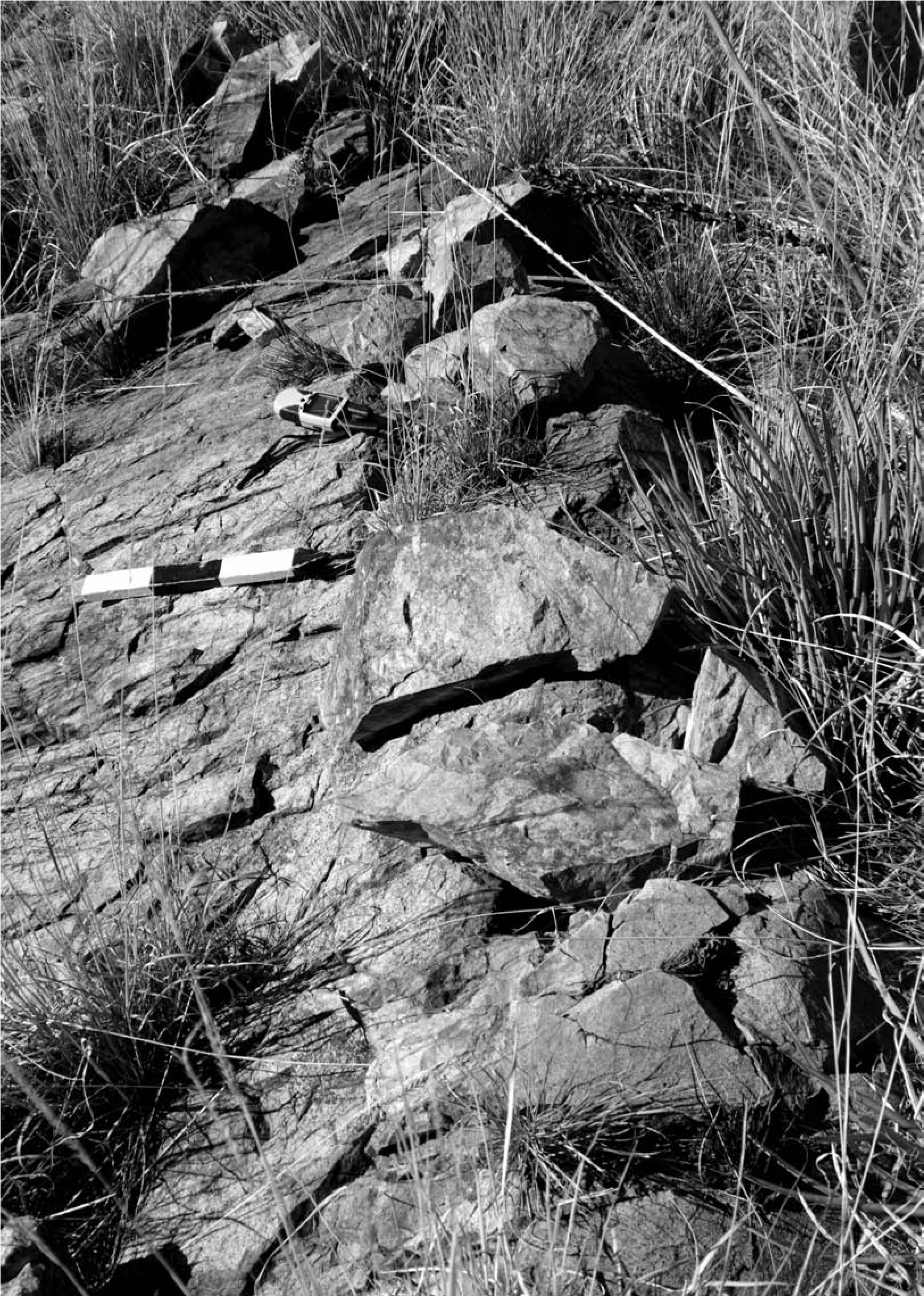
Space Use
Most Chiricahua Apachean sites have few artifacts, making this assemblage at the Three Sisters site important. The 18 items present exhibit a wide range of implements that would be expected for household tasks, focusing heavily on plant processing. The character and inferred activities at this site are consistent with ethnographic accounts that describe this type of small encampment.
Artifacts are distributed in the core portion of the site, near the structures. This distribution, the completeness of the assemblage, the tool types present, the absence of metal, and the specific uses for the artifacts themselves all point to an early occupation. Later assemblages (late 1800s) at camps tend to be smaller (unless the camp was subjected to a surprise attack, in which case most artifacts were left and often destroyed) with lower diversity, and activity areas with artifacts are often situated at some distance from the habitation area. The smaller nature of later assemblages relates in part to the use of Euroamerican materials for tools that were more durable and valuable and hence were kept longer, taken from site to site, and reused.
At these later sites (mid to late 1800s), under the pressure of military pursuit, work areas were often positioned in areas with a direct line of sight to a sentinel stationed on a distant peak, whereas structures were tucked behind vegetation or landforms to disguise their presence (Seymour 2002, 2009b, 2009c). Work areas were often widely separated from habitation areas. At the Three Sisters site, work areas of a variety of types (indicated by both features and artifacts) are clustered together in the site’s core, suggesting that the later spatial distribution mechanism for discovery avoidance had not yet occurred. Many potentially related features are scattered across the terrain, reinforcing the notion that encampments were not isolated but fall within the larger resource and defensive landscape. Defensive features are positioned strategically around the valley, while other small roasting pits are situated at the location of widely dispersed but still local resource patches.
The Defensive Landscape
This location was also probably desirable because it was easily defensible, and thus it provides a glimpse into several aspects of the defensive landscape. It is situated on the slopes of a protected valley where an abundance of trees would have hidden the wickiups and dispersed smoke. Living adjacent to the rocky cliffs, residents could have easily dispersed into the vast rugged mountains if threatened by attack, escaping deep into the heart of the mountain range. A low defensive wall positioned on a ridge overlooking this small round valley (AR 03-05-01-600) may have protected the encampment from surprise attack or defended family members as they escaped (Figure 17.13). Yet even without this feature the rocky terrain, dense high vegetation, and deep erosion channels would have provided sufficient cover. Placement of the site in a round valley, situated behind a low topographic rise, further shielded it from notice and provided ample routes for escape.
The encampment and the defensive wall are visible from the center of the valley, where a single-rock cairn is situated on a rise (Figure 17.14). A stone knife, characteristic of the large flake knives of the Cerro Rojo (ancestral Apache) complex, is situated nearby (Figure 17.15). The cairn cannot be definitively associated with the Three Sisters site or with the Apache, but my fieldwork has shown that small cairns are commonly found in the vicinity of inferred lookout stations, apparently to mark the spot that provided the best line of sight for a warrior (Seymour 2002).
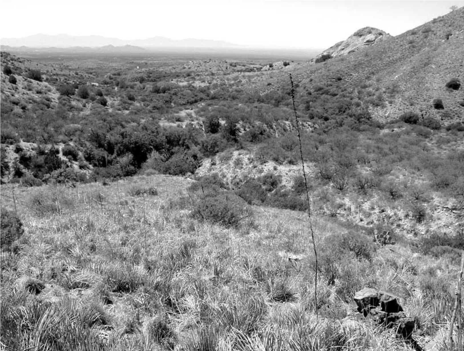
This consideration of the Three Sisters site in the larger defensive landscape may also explain the presence of another late-1800s Apache site situated nearby (AR 03-05-01-443). This multiple wickiup site located a few hundred meters away shows likely evidence of raiding. Several staples or small nails (presumably from a now deteriorated wooden or leather box or chest), square nails, other metal relating to wagon parts, and tools made of dark green glass (including a spokeshave) suggest this valley was attractive for Apache occupation through the ages. A prominent landform in the vicinity would have guided residents back to this location through the years, and they could have conveyed its sufficiently unique attributes so that visitors could find their way.
Early Ancestral Apache
At the time this site was found, efforts were still being made to identify the archaeological signature of the ancestral Chiricahua and Mes- calero Apache. Since then a number of ancestral Apache residential sites have been identified and recorded, ranging from large mountaintop multiband sites to one-time encampments (Seymour 2002, 2004a, 2008b, 2009e, 2012a, 2012b, 2013a). On the basis of these studies we can now distinguish between ancestral Apache sites and those of other groups, including the contemporaneous non-Apache mobile groups (Canutillo complex). Many more chronometric dates are now available, whereas at the time this site was dated the idea was still new that the ancestral Apache presence could be temporally placed in the ad 1300s, despite the fact that many scholars had suggested this possibility in the middle of the last century (Gladwin 1957; Harrington 1940; Hogan 1989; Huscher and Huscher 1942; Jenness 1940; Jett 1964; Reed and Horn 1990; Worcester 1951). Single dates from many sites and suites of dates from single sites, including luminescence results on Apache pottery and radiocarbon dates on annual species taken from distinctly Apache features, now provide a solid foundation for arguing for an early presence in the southernmost Southwest (Seymour 2012a, 2012b, 2013a). The Three Sisters site provides an example of a small encampment occupied by a small family group or three families. No pottery is present at this site, prohibiting us from addressing the issue of whether the earliest Apache in the southernmost Southwest made and used pottery, although distinctly Athabascan pottery has been dated to as early as the ad 1400s in southern New Mexico (ad 1420 ± 80; TL: X1185 OxL-1345; Llano Plain; FB 9609/LA 37188/Cerro Rojo site; Seymour 2002, 2013a). The flaked-stone assemblage, however, provides a look at the early Athabascan adaptation shortly after these people arrived in the southernmost portion of the American Southwest.
Conclusion
This small, unprepossessing site has characteristics that indicate an ancestral Apache affiliation (see Seymour 2002, 2004a, 2008b, 2008c, 2012a, 2013a for extensive discussions of these attributes that distinguish ancestral Chiricahua Apache from other contemporaneous groups). Chronometric dates place its occupation at the early end of the ancestral Apachean presence in this region. As such, it is an important example of lifeways at this time. Evidence indicates a temporal depth to this encampment and landscape use pattern with parallels described in the historic documentary and modern ethnographic records, suggesting this was an enduring aspect of the Apachean lifeway. Moreover, the site provides tangible insights into the types of evidence available on sites occupied by highly mobile groups in this region. Despite the meagerness of the assemblage and the vagueness of the features, research at the site has revealed evidence of gender, seasonality, group size, the use of encampment space, and the placement of the site within the larger defensive landscape.
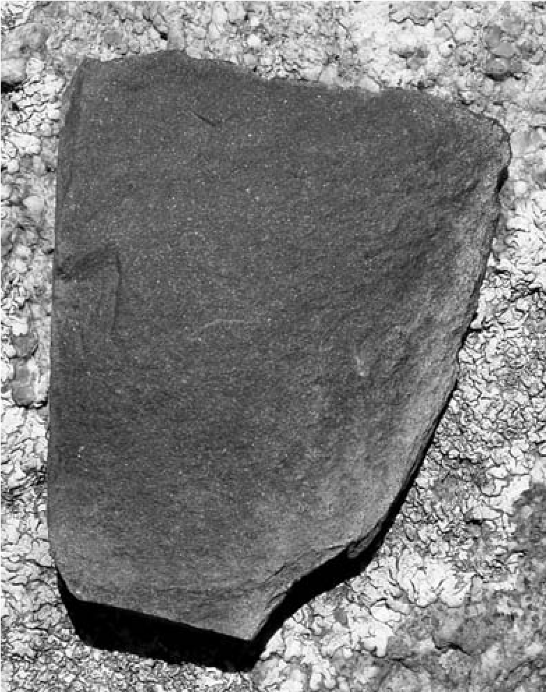
18. A Protohistoric to Historic Yavapai Persistent Place on the Landscape of Central Arizona
An Example from the Lake Pleasant Rockshelter Site
Robert J. Stokes and Joanne C. Tactikos
Our chapter is a case study of long-term Native American reuse of a small rockshelter at Lake Pleasant in central Arizona. Archaeologists have been studying the use and reuse of space by indigenous groups for many decades under the general terms of “persistent place,” “settlement pattern studies” “occupational duration and history” and “optimal land use” among others (Schlanger 1992; Schriever 2012; Seymour 2009b; Stokes 2003; Stone 1993; Wood 1978; Zedeno 1997). The idea of reuse of space as a persistent place has taken a more prominent role recently with the ascension of an overarching research umbrella known as the “cultural landscape approach” (e.g., Knapp and Ashmore 1999), which is an outgrowth of the approach used by Basso (1996) in his study of the way Apache viewed and understood their homelands in east-central Arizona. With this approach, small places on the landscape may retain significant cultural meaning to indigenous populations, even if they no longer actively visit, use, or occupy these places. In effect, the study of the reuse of space has moved from looking at long-term occupation at major places on the landscape, such as village sites, to the examination of many kinds of places, including resource procurement loci, rock art and intaglio loci, trails, and rock rings (e.g., see Altschul and Rankin 2008), and, in this case, small rockshelters that contain little evidence for substantial or sustained habitation. In other words, even sites that appear to be small role players in larger settlement, subsistence, and sociocultural systems take on more cultural meaning than they might initially exhibit when viewed in isolation.
To many indigenous peoples whose ancestors created these places, they are part of a landscape imbued with multiple layers of meaning and purpose and for whom the concepts of linear time, reuse, abandonment, and ownership are often viewed differently than archaeologists’ perceptions (Basso 1996; see also Braatz 2003; Ferguson and Colwell-Chanthaphonh 2006; Gregory and Wilcox 2010; Potter 2004). Villages are important to study, but small sites that were used intermittently over a long period of time are significant as well in the sense that the persistent use of a location or resource is empirical evidence of long-lasting cultural traditions. Archaeologists have long struggled with the meaning and role of small seasonal, special-use, and limited-activity sites beyond simply being functional components of a much larger system (e.g., see Ward 1978) and thus rarely attaining the level of importance assigned to bigger sites. Clearly, we need to know how these places functioned within larger cultural systems, but a fuller understanding of the importance of place over long periods of intermittent use requires archaeologists to embrace a broader vision than is often applied to many kinds of sites; that is, we need to ask about the cultural meanings of these sites in addition to understanding their function.
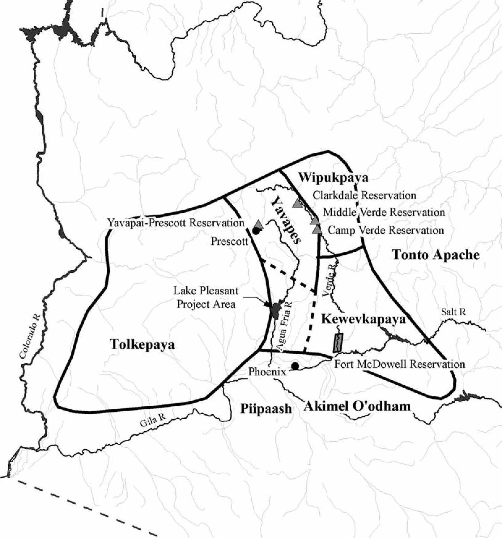
With this perspective in mind, our chapter begins with an overview of what our understandings of persistent places and cultural landscapes are and how we can apply these understandings to the interpretation of archaeological data. The data we use come from a small rockshelter excavation project at Lake Pleasant, north of Phoenix (Figure 18.1), undertaken at the request of the U.S. Bureau of Reclamation (Reclamation). The site was suspected to have a Protohistoric Yavapai component, as well as an earlier prehistoric Hohokam occupation and a later Historic period Euroamerican occupation. The site is situated well within the prehistoric Hohokam region (Pinter 2004), along the southern boundary of traditional pre-reservation Yavapai lands (Khera and Mariella 1983), and upstream from a Depression-era Euroamerican homestead along the Agua Fria River (Ayres and Seymour 1990). We then present the results of our analyses, which indicate that some of our assumptions regarding the history of use of the shelter and by whom were incorrect. These data are subsequently used to explore Yavapai connections to this site that lasted far longer than we initially suspected.
Cultural Landscape and Persistent Place Approach
The cultural landscape approach references key concepts of archaeology-time, space, and experience (Knapp and Ashmore 1999). Landscapes express time: as described by Potter (2004:323), they are “continually in a process of creation by human activity” Landscapes are also expressions of space (place) and experience where “indigenous people mapped a system of landmarks upon the physical landscape that reflected myths and cosmology” (Whittlesey 2007:28)-to which we would add that they also served as social and cultural anchors to an area considered “homelands” even if no residences are currently in use; the memory of such places can be just as tangible (Basso 1996:23). In fact, traditional subtribe names of the various Yavapai groups in the study area are taken from prominent landmarks and landforms within their traditional territories that identified them as distinctive subgroups (Braatz 2003), which is common for many of the indigenous groups in the Southwest (see Basso 1996:18–21). Without access to those landmarks, the Yavapai feared losing their identity, a crisis they faced during their quarter century of forced exile at the San Carlos Apache Reservation, which they considered akin to living in a foreign land (Braatz 2003). As such, cultural landscapes are past, present, and future centers of human action and significance that have distinctive meanings and values for their inhabitants because “of the events and actions they witness, partake in, name, and remember” (Potter 2004:323).
It is important to be aware of how ancient and modern people connect to the landscapes around them over time through the archaeological remains left behind and/or through histories and stories told to succeeding generations of indigenous peoples (Basso 1996; Potter 2004:323). As Whittlesey states (2007:12), “a primary goal of archaeological landscape reconstruction is to read the history of human interactions with the environment through time” Although this approach can be difficult without access to ethnographic and ethnohistoric accounts from descendant groups that retain memories of ancient ancestors and practices, archaeologists who study prehistoric populations within a cultural or social landscape are becoming more adept in the way they approach cultural landscape reconstruction with the archaeological data available to them (e.g., Nelson 1999; Snead 2008; Varien 1999). For the current study, we were lucky to have insights provided on the ancient Hohokam people both from Whittlesey and others on so- called northern periphery Hohokam occupations and from several ethnographic accounts of the later Yavapai peoples (e.g., Braatz 2003; Butler 2012; Gifford 1932, 1936; Khera and Mariella 1983), highlighted by a field visit to our excavation site by several members of the Yavapai- Prescott Indian Tribe.
Related to cultural landscapes is the concept of “persistent place” where signs of human use, intermittent or otherwise, are present that may stretch over hundreds of years (Schlanger 1992). Persistent places can be viewed as loci of cultural significance on the landscape that do not require a continual presence to remain culturally and functionally important, and these places can be important for multiple groups of people who share them for cultural, religious, economic, or other reasons (e.g., see Vanderpot and Altschul 2007). This concept is related to the concerns of many Native American groups that view specific places on the landscape as sacred or within traditional resource and practice areas, and although perhaps not regularly visited, these places remain important to their ongoing cultural identity, history, religion, and sense of connection and well-being (see Potter 2004 for a Yavapai example concerning rock art sites). As embodiments of time, place, and experience, cultural landscapes and persistent places may be understood as physical correlates of broader cultural and historical contexts (Crumley 1999); the actor can capture the essence of self and history by simply visiting or thinking about these places (Basso 1996).
Cultural landscapes are a powerful physical and metaphysical force, but how can archaeologists as “non-actors” capture this aspect of the past? It may not be easy, but sometimes it can be as straightforward as engaging the descendants and reviewing ethnographic accounts if available, and then attempting to connect the archaeological data to these historical accounts and recollections. We emphasize that we are not advocating a resurrection of the “direct historical approach” but instead want to remind archaeologists that indigenous populations have stories, legends, and memories that can be applicable to archaeological research, and this resource should be utilized whenever possible and allowable. However, sometimes the correlations between current indigenous memories and past events and contexts are of varying utility due to a variety of factors, including the loss of elders who had a more direct connection to the historical past and substantial sociocultural changes that affected many of the indigenous Southwestern groups after the mid-1800s. These factors are often reflected in modern recollections of past events and should be taken into account when we assess them against the archaeological record (Seymour 2012d).
Yavapai Research in Western and Central Arizona
Archaeological identification of prehistoric Yavapai occupations is difficult to discern because no clear cultural break can be established for the Western Desert groups of Yuman and Yavapai from the preceding Patayan cultural tradition of the lower Colorado River Valley. The same identification problems exist for later occupations in central Arizona because the material culture and settlement patterns of the Yavapai and Apache are so similar (Khera and Mariella 1983; Whittlesey and Benaron 1997). Their settlement systems were based on small groups of extended families that were politically autonomous and moved from camp to camp within their traditional resource territories. The Yavapai practiced a subsistence economy based on a mix of hunting, gathering, horticulture, and raiding (Braatz 2003; Khera and Mariella 1983; Stone 1987; Whittlesey and Benaron 1997). They depended heavily on a variety of plant foods found in the deserts and highlands, including agave, mesquite, pinon, and cacti, while also hunting a variety of game, large and small; the Yavapai consumed virtually anything they came across except some reptiles and fish. For a food supplement, they would often smash large mammal bone to obtain the marrow and would grind bone into meal as an additive to other foods (Gifford 1932, 1936).
Early Yavapai groups along the lower Colorado River appear to be related to other Yuman groups that likely emigrated from the interior deserts of California and Nevada. They practiced limited maize-squash-melon agriculture but never developed a farming lifestyle or aggregated into large villages; it is clear from ethnohistorical accounts and archaeological data that a hunting and gathering lifestyle was always the most important part of their subsistence practices (Khera and Mariella 1983). Before 1875, the Yavapai of central Arizona practiced occasional horticulture using a limited variety of cultigens—they planted some crops along well-watered streams in their territories in the late spring and harvested whatever survived later in the summer (Braatz 2003; Khera and Mariella 1983).
Projectile points often associated with the Yavapai include Desert Side-notched and Cottonwood Triangular styles, which first appear in the southern Great Basin and deserts of California and western Arizona around ad 900/1100 and persist to the Historic period (Whittlesey and Benaron 1997). When these projectile points are found in central Arizona, they are thought to indicate the presence of Yavapai groups at a later time than in the lower Colorado River Valley to the west; thus, they track the movement of the Yavapai into central Arizona. However, the origins of the Yavapai in central Arizona are still debated. Some researchers argue that the Yavapai were the descendants of the original middle and upper Verde River prehistoric inhabitants, whether “Pan-Southwest Hakataya” or Cohonina/Sinagua. Others argue they migrated from the west, following the Bill Williams River from the Colorado River eastward into the highlands of the Verde and Agua Fria rivers, as other subtribes migrated farther south toward the northern fringes of the Phoenix Basin (see Pilles 1981 and Chapter 19, this volume). The Yavapai did not travel farther south into the Salt and Gila river valleys because their traditional enemies, the Oodham (Pima) and Piipaash (Maricopa), already occupied settled villages there (Braatz 2003).
By the 1500s to 1600s, if not earlier, the Yavapai appear to have been firmly established in central Arizona, and the four main subtribes became known as the Western (Tolkapaya), Northeastern (Wipukpaya), and Southeastern (Kewevkapaya) Yavapai and the north-central/ northern Yavape, who associated more closely with other Pai groups nearer the Grand Canyon (Gifford 1932, 1936) (see Figure 18.1). The easternmost groups intermingled with the Apachean groups farther east, engaging in trade, mutual defense, and intermarriage; in fact, the Tonto Basin mixed groups eventually became known as Yavapai-Tonto Apache (Braatz 2003).
A recent excavation project near Mingus Mountain, north of the town of Prescott, Arizona, focused on a multicomponent site (AR-0309-05-428) that included a Protohistoric period short-term, possibly single-use Yavapai camp (Deats 2008). The Yavapai component, dated to ca. ad 1500–1670 and 1780–1800 (Deats argues for the earlier date range), was based on a single radiocarbon date from Feature 2, a roasting pit adjacent to Feature 1, a possible u-wa habitation structure. The site occupation was thought to have occurred during the agave gathering and roasting season; agave was one of the Yavapai’s traditionally used foods (Braatz 2003; Gifford 1932). If the earlier date range is accurate, it makes this site one of the earliest-dated Yavapai sites in central Arizona (also see Pilles 1981; Whittlesey et al. 1997).
Yavapai residences were typically u-was, which are round to oval domed brush structures that often use large rocks around the perimeter as pole supports or braces (see Khera and Mariella 1983 for a historical photograph and Whittlesey et al. 1997 for archaeological plan drawings); sometimes adjacent ramadas were attached to the main structure. The Yavapai also extensively used caves and rockshelters, and they often reoccupied earlier prehistoric habitation sites, which is a primary reason why Yavapai occupations can be so difficult to identify within earlier Hohokam and southern Sinagua sites (Braatz 2003; Herr et al. 2009; Khera and Mariella 1983; Whittlesey et al. 1997). Expedient groundstone and grinding slicks are often nearby, along with small manos, Yavapai-style projectile points, and plainware pottery, such as Cerbat and Aquarius Brown, Tizon Wiped, and Orme Ranch Plain and Corrugated/pinched (Pilles 1981; Whittlesey and Benaron 1997). Occasionally, Hopi Yellow- ware sherds are found mixed with Yavapai and Apache artifact assemblages, especially in their northern territories (Pilles 1981) but sometimes farther south toward the Phoenix Basin as well (e.g., Stokes 2010:137). The Yavapai maintained cultural and trading relationships with their Apache neighbors to the east and Yuman groups to the west, although alliances often shifted and hostilities could just as easily break out among these groups, especially after 1865, when the U.S. Army began operations against the Apache and “Yuma/Mohave Apache” (i.e., Yavapai) (Braatz 2003).
The period between 1865 and 1875 was tumultuous for Yavapai groups, as it was for most other Southwestern Native American tribes. This period after the end of the Civil War saw a tremendous influx of settlers, ranchers, miners, and soldiers into the Arizona and New Mexico territories, and the native groups were seen as obstacles to settlement, commerce, and land ownership. The Yavapai first fought for their territories and homes and then showed a willingness to live around newly established forts and accept a more settled lifestyle. Ultimately, however, all Yavapai groups were forced to march from their central Arizona homelands eastward to the San Carlos Apache Reservation along the Gila River. This traumatic event led to 25-plus years of “exile” with the Apache (Braatz 2003).
While at San Carlos, the Yavapai learned Euroamerican ways of farming, ranching, economy, and politics, which served them well when they finally announced their intention to return to their former central Arizona homes, followed by petitioning the federal government to grant them reservations. As a result, Late Historic period Yavapai sites often contain a range of Euroamerican goods, and it appears that native pottery production had ceased by this point (see Whittlesey et al. 1997 for discussion of a 1900-I930s Yavapai site in the Verde Valley that contained traditional structures but no traditional pottery). Many of these Euroamerican items were repurposed before final discard and, when found, aid in the identification of a Yavapai component. Sites without the presence of Yavapai projectile points and pottery may be misinterpreted as Euroamerican sites if evidence for u-wa structures and ground and chipped stone is lacking.
By 1903–1905 the Yavapai were back in portions of their homelands but were eventually restricted to three primary reservations established in central Arizona (see Figure 18.1): the Yavapai- Prescott Indian Tribe reservation (1935), the Middle Verde River area reservations (Clarkdale, Camp Verde, and Middle Verde, 1910–1914), and the Fort McDowell Indian Community near Fountain Hills (1903) (Braatz 2003; Khera and Mariella 1983). The Western Yavapai groups, which left San Carlos early and intermingled with other Yuman groups along the lower Gila and Colorado rivers, were not granted a reservation of their own.
Reclamation’s Role at Lake Pleasant
The Bureau of Reclamation uses Lake Pleasant as the primary storage reservoir for the Central Arizona Project (CAP), which brings Colorado River water to Phoenix and Tucson. The lake is situated along the Agua Fria River in the transition zone between the lower-elevation Phoenix Basin and the highlands associated with the Bradshaw Mountains to the north. The Agua Fria River slices through the mountains from the Prescott National Forest near Prescott and the Yavapai-Prescott Indian Tribe reservation to its confluence with the Gila River in the west valley of Phoenix. As the federal land managing agency, Reclamation is responsible for cultural resource compliance, as defined in the National Historic Preservation Act of 1966 (as amended). Beginning in the 1980s and culminating in 2012, the lake’s cultural resources have been surveyed, mapped, and interpreted (Moreno et al. 2002; Pinter 2004); assessed for potential impacts related to recreational use and use as the CAP reservoir; and, when necessary, mitigated (e.g., Stokes 2011). Based on these surveys, nine Yavapai-related sites were documented, including the Lake Pleasant Rockshelter (AZ T:4:150[ASM]). Most of these sites also contain earlier Hohokam occupations, resulting in a mixture of material culture and features, typical of the pattern found elsewhere in central Arizona (e.g., see Pilles 1981; Stokes 2010; Whittlesey et al. 1997) and for Protohistoric and Historic period Native American sites in general (Seymour 2004a, 2009f, 2011a). Because of the increasing use of a four-wheel-drive backcountry road passing by the base of the rockshelter, Reclamation determined that the potential adverse effects of pothunting and surface collection necessitated mitigation of the site and requested that Archaeological Consulting Services, Ltd. (ACS), undertake the excavations.
Rockshelter Excavations and Results
The Lake Pleasant Rockshelter site is a small overhang in a small rock outcrop above Tule Creek, a minor intermittent tributary of the Agua Fria River (Figure 18.2). The opening of the shelter faces southeastward toward prominent landscape features, including Indian Mesa, Wild Burro Mesa, and the Agua Fria River (Figure 18.3). The general area is highelevation Sonoran Desert with other environmental zones within short walking distances, including riparian along Tule Creek and the Agua Fria River and pinon/juniper highlands to the north toward the Bradshaw Mountains. Being in a transition zone between the highlands and lowlands, and surrounded by mountains, hills, and generally rugged topography with numerous springs, arroyos, washes, and streams, the site is ideally located to take advantage of a wide array of natural plant, animal, and mineral resources (J. Jensen in Pinter et al. 2009). Tule Creek, along the western side of the rockshelter, often has surface flow because the creek crosses near-surface bedrock, while on the eastern side an unnamed drainage has formed numerous large tinajas (scoured basins in bedrock) that can hold water for weeks after rainstorms. These watering holes attract a variety of wildlife, as we observed on several occasions during the excavations. In sum, the rockshelter represents an excellent short-term base camp for exploiting the natural resources of the area and is surrounded by distinctive natural features and landscapes.
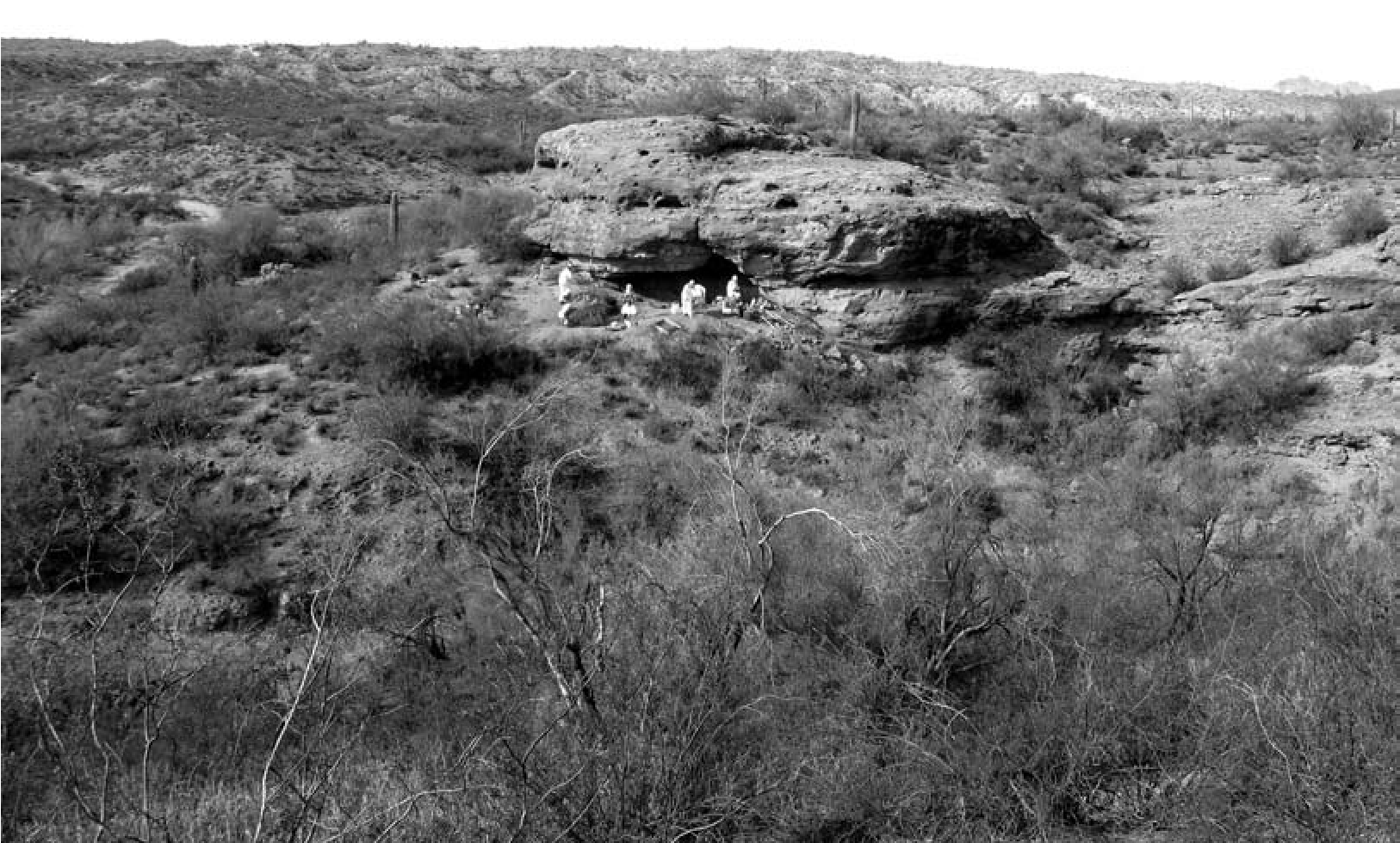
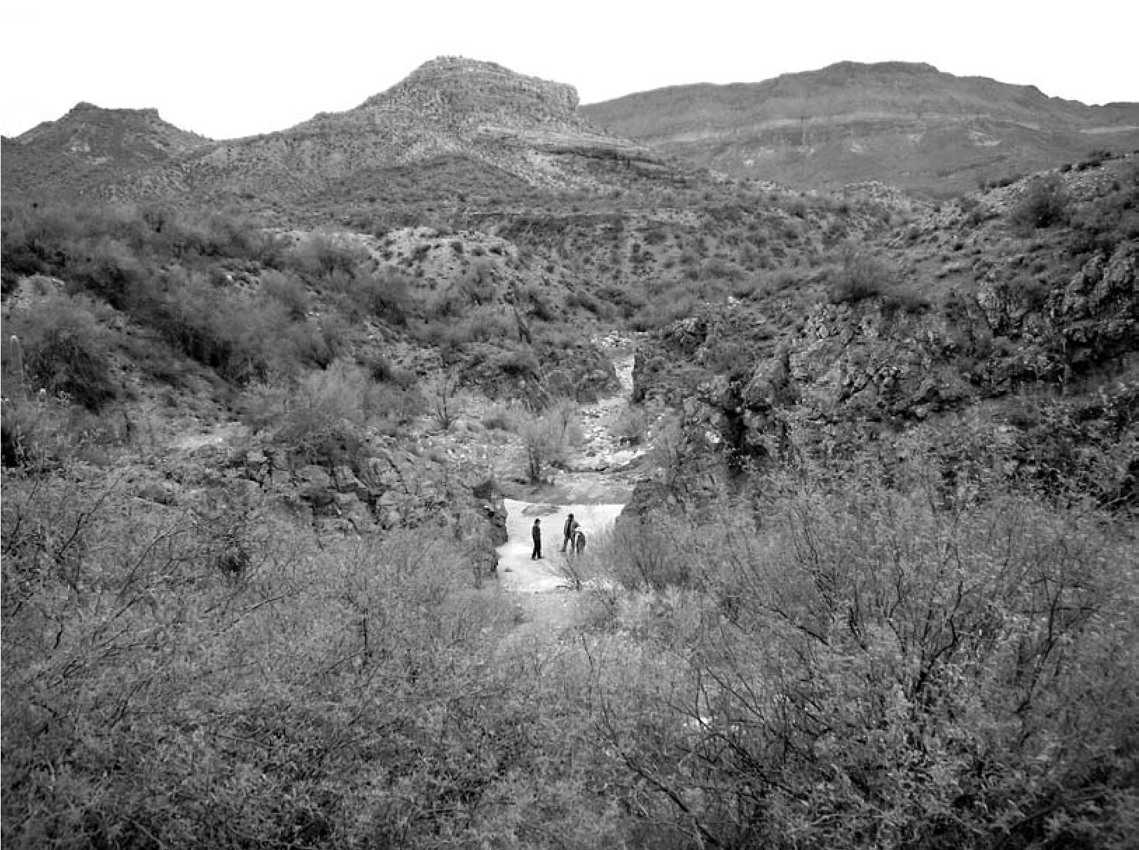
The rockshelter was first tested by ACS archaeologists in 2009 via surface collection and soil augering within the rockshelter to assess its subsurface potential (Pinter et al. 2009). The results of the surface collection indicated that the Yavapai component was mixed with earlier Hohokam and later Euroamerican occupational debris, and that fill depth was between 60 and 80 cm below surface, with ash, charcoal, faunal bone, lithics, and pottery present. A large depression toward the rear of the shelter suggested that it had been at least partially pothunted.
The following year, ACS archaeologists began data recovery within the rockshelter (Stokes 2011). The surface packrat and vegetation debris was cleaned out using safety protocols (see Figure 18.2). Once cleared, the pre-excavation surface was mapped and a hand-excavated trench was placed from the opening of the rockshelter to the rear wall. Excavations revealed a depth to the rock floor that averaged 80 to 90 cm, with several ash stains at varying levels in profile. The interior was then excavated by quadrants to the floor, from a line of rock marking the drip line to the back walls of the rockshelter. The line of rock, originally thought to be roof fall from the ceiling of the rockshelter, was in fact an early-twentieth- century stacked rock wall alignment. When the wall partially collapsed, it covered several ash and charcoal lenses that contained both historic and aboriginal artifacts, with the wall base sitting directly on top of similar cultural deposits.
In total, nine subfeatures were excavated within the rockshelter, including a pit that was built into the soft bedrock slope of the back wall (Subfeature 3.09), two thermal pits (Subfeatures 3.03 and 3.04), four ash and charcoal lenses within the fill of the rockshelter (Subfeatures 3.06, 3.07, 3.08, and 3.10), and two dry-laid stacked rock wall segments (Subfeatures 3.05 and 3.11) (Figure 18.4). Only the deepest subfeature (3.08), an ash lens with adjacent large sherds from a plainware storage vessel, was potentially prehistoric; all of the others were Protohistoric to Historic period. We also determined that a large crack in the back wall allowed water to enter the basin-shaped rockshelter, which deposited gravels and appeared to have also condensed the fill and removed all but the most recent evidence for individual stratigraphic levels. The periodic inundation of the rockshelter may also explain the depression in the rear adjacent to the crack. However, the fact that four ash and charcoal lenses and two thermal pits were located at various stratigraphic positions in the fill suggested that churning of the fill from pothunting and natural processes was both less intrusive and more localized than initially believed; therefore, artifact, feature, and sample analyses by excavation level could provide useful results for understanding the rockshelter’s history of use. Unfortunately, the periodic inundation destroyed any evidence of perishable remains, such as baskets, mats, and clothing. Additionally, no identifiable human remains were found.
Yavapai Material Culture and Subsistence over Time
In total, 7,970 artifacts and samples were recovered, including 6,611 pieces of faunal bone; 589 pieces of chipped stone, stone tools, and rare resources; 25 groundstone items; and 438 sherds. Historic artifacts totaled 145 items and were typical of hunting and camping activities, including shot shells, D batteries (one of which was labeled “Best if used before Oct. 1941”), clothing remnants, nails, and food and beverage cans (Jones 2011). The remaining items were flotation, pollen, soil, and charcoal samples. The range of all datable items suggested a prehistoric Hohokam use based on several Gila Butte-style Red-on-buff sherds, redwares, and Gila Plain pottery. Materials also suggested a later Yavapai Protohistoric to Historic use based on Pai/ Yavapai-style projectile points, Tizon Brownware, and Orme Plain and Corrugated wares, and thousands of pieces of smashed faunal bone. Also indicated was a final Late Historic Euroamerican and/or Yavapai use from the late 1800s through the late 1930s or early 1940s.
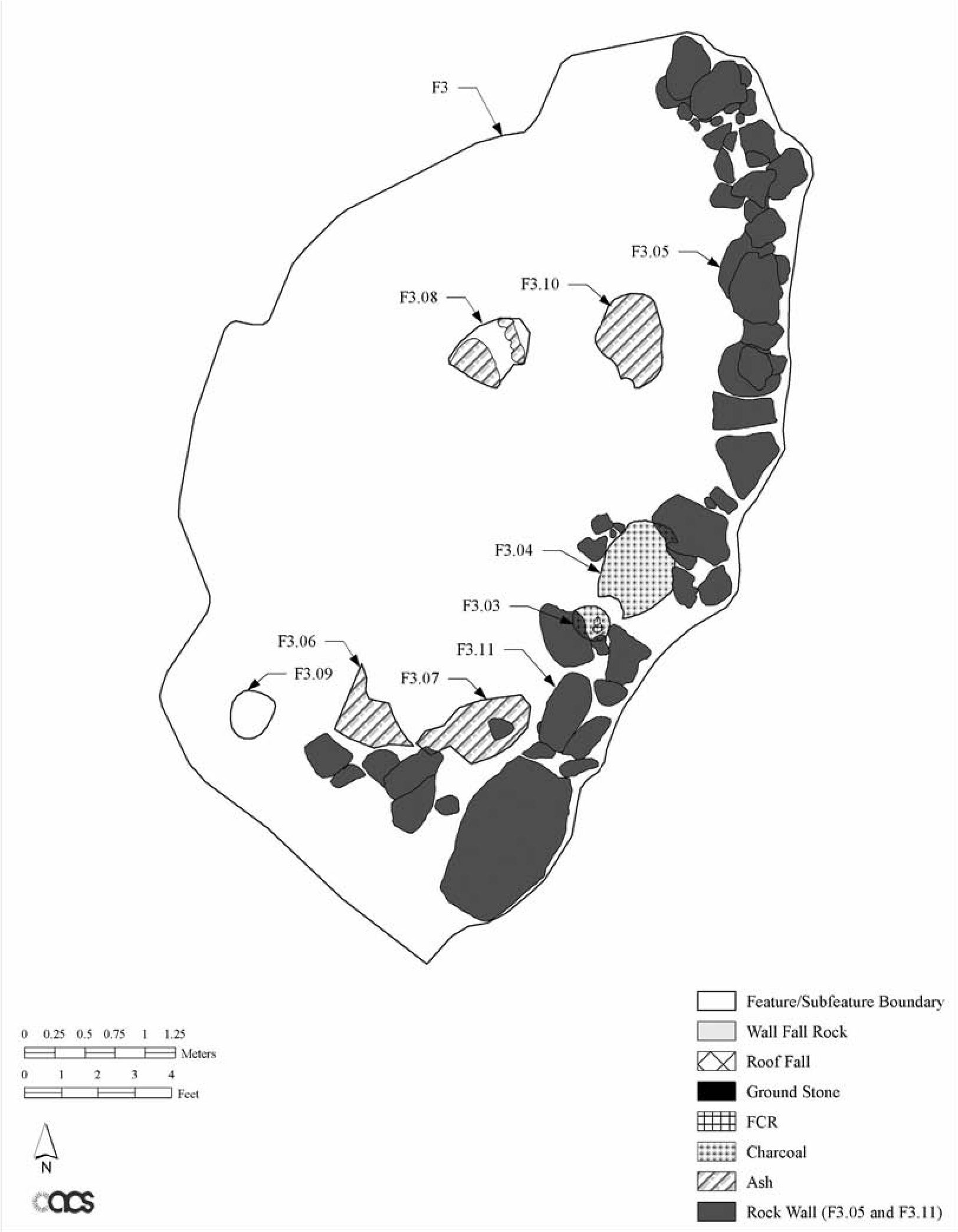
Ceramic and Subsistence Data
The sherd assemblage consisted of 75 percent plainware, 18 percent redware, 5 percent Yavapai/ Protohistoric types, 1 percent brown corrugated ware (most likely Yavapai Orme pottery), and 1 percent Hohokam buffware (Ferguson 2011). The three sherds of Preclassic period buffware (most likely Gila Butte phase, ca. ad 750–850) occurred in the lowest level of the cultural fill (see Table 18.1 for a stratigraphic examination of diagnostic artifacts). The redwares, which are typically a Classic to Post-Classic period Hohokam type, ca. ad 1200–1500, were most common in the middle to bottom levels of the shelter but occurred in the upper levels as well. The schist- and sand-tempered plainwares (Gila Plain, Gila and Salt varieties, and Wingfield Plain) also occurred throughout the fill, whereas the Yavapai sherds, including Tizon Wiped and Orme Brown Corrugated (Figure 18.5), most commonly occurred in the middle to upper levels. Redwares, plainwares, and Yavapai types co-occurred in the middle levels; in fact, the middle levels contained the highest number of overall sherds. Many Wingfield Plain sherds with large-grain sand tempering protruding or visible on the surface could be Yavapai (Telles and McConnell 2000:218), which we suggest is a likely association for the context of the Lake Pleasant Rockshelter site (see below).
Subfeature 3.09, a small pit excavated into the crumbling back wall bedrock, is stratigraphically within the middle levels of fill and produced an AMS radiocarbon date that ranged from ad 1670 to 1780 and 1800 to 1900 from a single sample. Based on other evidence, such as the subfeature’s stratigraphic position between possible prehistoric Subfeature 3.08 and historic Subfeatures 3.03 and 3.06/3.07, we feel the best date range is ad 1670 to 1780, although the later date range is also within the period of Yavapai occupation of the site. Euroamerican historic artifacts begin to appear in small numbers in the middle levels but are most common in the upper levels. Some mixing between level boundaries is evident, likely resulting from the human- and natural- caused factors discussed earlier. Based on the ceramic data and radiocarbon date, we suggest that the Yavapai were in the project area south of the Bradshaw Mountains by the late 1600s, and likely earlier given the Yavapai-style projectile points found in deeper levels, as discussed below. Pilles (1981) suggests that the Yavapai were in the middle and upper Verde Valley by the late 1500s, and so a date in the 1600s for initial Yavapai use of the rockshelter is plausible. It also suggests that sand-t empered redware and plainware sherds from the Late Prehistoric period, such as Wingfield Plain, may have been used by the Yavapai during the Post-Classic Hohokam period. Wells (2006:16–20), in his study of middle Gila River Valley prehistoric, Protohistoric, and Historic sites, notes that sand-tempered redwares and plainwares occur with increasing frequency from the prehistoric to Protohistoric but differ from pottery found at Historic sites. He also notes that some researchers, such as Deaver (1990), see similarities to Lower Patayan pottery from western Arizona (Wells 2006:19–20). Given that the Yavapai originated in western Arizona before moving into central Arizona, there may be a deep connection with that ancestral area, and coarse sand-tempered red- and plainwares may be representative of ancient homelands.
The faunal remains indicate two primary trends: first, most of the larger mammal bone was smashed into thousands of pieces, and second, a wide range of smaller animals were exploited, such as turtle, rabbits, rodents, carnivores, and birds, including duck, in addition to reptiles and possibly eggs. It appears that during the Protohistoric to Historic periods the occupants of the rockshelter were eating virtually anything they came across and were reducing the larger bone to splinters, likely to get to the marrow (Gregory 2011). Ethnographic research on the Yavapai indicates that this would be a typical subsistence pattern for them, as noted earlier (Gifford 1932, 1936). This pattern is less typical for the earlier Hohokam and virtually nonexistent for later Euroamericans, even during the Great Depression. However, ethnographic studies also suggest the Yavapai avoided aquatic resources, such as fish and waterfowl, and so the duck remains, although not common, are somewhat anomalous (Gifford 1936). Clearly, a tremendous amount of animal processing occurred at the site from the Protohistoric period onward, which is corroborated by the ground- stone, cutting tools, and stone pounders found at the site (see discussion below).
| Levela | Ceramics (Ware) | Chipped Stone | Groundstone | Historic All Types | Total | |||||||||
| Buff Ware | Red Ware | Tizón Wiped | Proto historic | Hohokam Corrugated Proj. Pt.b | Yavapai Proj. Pt. | Mano, Round | Mano, Rectangular | Metate, Trough | Metate, Slab/Basin | Metate, Lapstone | ||||
| 1 | 2 | 1 | 3 | 17 | 23 | |||||||||
| 2 | 4 | 1 | 1 | 2 | 44 | 52 | ||||||||
| 3 | 11 | 1 | 3 | 2 | 1 | 1 | 1 | 8 | 28 | |||||
| 4 | 7 | 1 | 5 | 1 | 1 | 15 | ||||||||
| 5 | 1 | 9 | 1 | 1 | 12 | |||||||||
| Total | 1 | 33 | 5 | 3 | 4 | 0 | 5 | 5 | 1 | 1 | 1 | 1 | 70 | 130 |
| Unit 2027, Northeastern Quadrant Extension | ||||||||||||||
| 1 | 1 | 1 | ||||||||||||
| 2 | 3 | 1 | 3 | 1 | 1 | 2 | 11 | 22 | ||||||
| 3 | 9 | 2 | 4 | 15 | ||||||||||
| 4 | 1 | 18 | 1 | 1 | 21 | |||||||||
| Total | 1 | 30 | 3 | 3 | 1 | 0 | 1 | 2 | 1 | 17 | 59 | |||
| Grand Total | 2 | 63 | 8 | 6 | 5 | 0 | 6 | 7 | 1 | 1 | 2 | 1 | 87 | 189 |
a Levels for Units 2010, 2011,2012, and 2013 are In 10-cm Increments below the uppermost disturbed sediments; Unit 2027 levels represent 20-cm Increments. b Hohokam-style projectile points were found In disturbed fill; they are shown here only to denote their presence at the site.
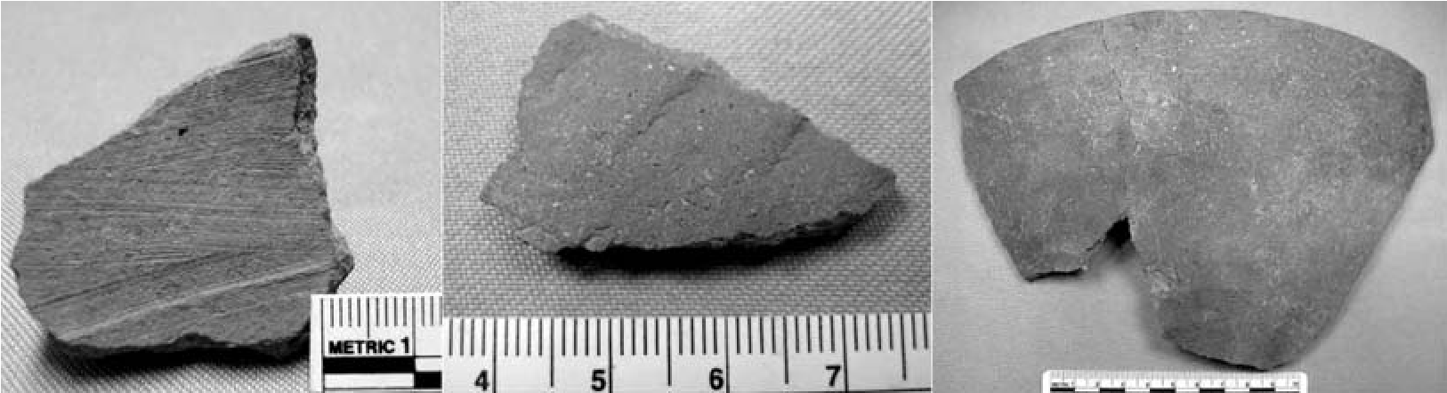
The paleobotanical analyses documented an almost exclusive reliance on local wild foods, including mesquite, cacti, chokecherry, and seeds. Only one maize cupule was found (Stuart 2011). Cultivation likely did not occur in this area, suggesting that hunting and gathering wild resources were the primary foci of the occupants over time. The paleobotanical analysis hinted at a spring through summer occupation period, with little evidence suggesting a wintertime use (although it cannot be discounted) or horticulture of any kind. Because the larger mammal bone was so heavily processed, the presence of juveniles could not be detected.
Lithic Artifacts and Protein Residue Analysis Results
In total, 614 lithic artifacts, including 585 chipped stone and tools, 25 groundstone, and four rare resources/exotics, were recovered from the rock- shelter (Tactikos 2011). Artifacts were produced on more than 20 different raw material types, the most common being chalcedony, quartzite, and chert. With the exception of obsidian, a nonlocal material that was used in the production of only two projectile points, high-quality materials were used in both informal and formal tool production, indicating that such materials were abundantly available (Andrefsky 1994).
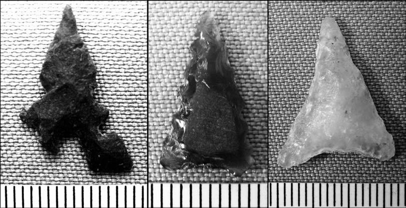
Lithic assemblage characteristics indicate that while intensive core reduction occurred, the technological focus at the site was on tool production (Bradbury and Carr 1995; Prentiss and Romanski 1989; Tomka 1989). Informal tools occur at a relatively high frequency in this assemblage and represent a generalized toolkit that can accommodate a variety of tasks. Tool morphology and use-wear traces suggest that tools were produced for a multitude of functions including, but not limited to, chopping, engraving, incising, gouging, perforating, scraping, and cutting. Formal tools are less abundant but display a more focused functional morphology that includes engraving, gouging, incising, and scraping. These informal and formal tool functions might be associated with field processing of animal resources (e.g., meat and hides) as well as working more resistant materials, such as bone or wood. Projectile points recovered from the site represent an unambiguous hunting function. The projectile point typology suggests a Yavapai occupation (Desert Side-notched and Cottonwood Triangular points) with an earlier, Colonial through Classic period Hohokam occupation (e.g., Concave-base Triangular) (Figure 18.6).
The groundstone tools can be interpreted as representing plant and animal food processing activities. The groundstone assemblage appears to be primarily suited to the expedient use of available wild plant resources rather than domesticates, similar to patterns seen at other Yavapai sites (e.g., see Whittlesey and Benaron 1997). Groundstone is represented by basin metates and lapstones, rectangular and round manos, and other stones with evidence of battering and grinding. No true trough metates were found that would be more indicative of larger-scale food processing as typically seen at larger habitation sites, such as Hohokam villages. The diversity of groundstone artifacts correlates well with ethnographic accounts of the Yavapai that indicate reuse of existing tools from abandoned prehistoric sites (Khera and Mariella 1983; Whittlesey and Benaron 1997). That is, some of the groundstone, especially the rectangular manos and basin metates, which occur at various stratigraphic levels, may have been left behind by the earlier occupants of the rockshelter or other nearby sites and later reused by the Yavapai.
Analysis of Protein Residue on Selected Artifacts
A small sample of chipped-stone and ground- stone artifacts that displayed distinctive use- wear traces (Hayden 1979; Keeley 1980; Semenov 1964) in the form of residues on the surfaces or working edges was selected for animal and plant protein residue analyses. Samples were sent to the Laboratory of Archaeological Science Research Center at California State University- Bakersfield (CSU-B) for protein residue analyses using the molecular technique of cross-over immunoelectrophoresis (CIEP). This technique utilizes an antigen-antibody immune reaction to identify faunal and botanical residues preserved on artifacts (Yohe 2011). Although various techniques for examining organic residues on stone tools have been an archaeological mainstay for decades, from low-power visual examination of Near Eastern sickle blades for plant-based “sickle sheen” to high-power magnification of stone tools to identify macro- and microscopic trace elements left behind (e.g., Sobolik 1996), CIEP takes advantage of recent advances in molecular biology and DNA studies to pinpoint plant and animal families, which can often be further refined to a group of species within that family (see Yohe 2011).
Of the seven stone tools and one soil control sample delivered to CSU-B, only three stone artifacts from the rockshelter registered positive reactions for animal proteins (Figure 18.7); none tested positive for plant species (Tactikos 2011; Yohe 2011). An argillite burin/scraper tool tested positive for rabbit, which is not an unexpected result given the site context, but this tool also tested positive for bovine antiserum proteins. Bovine proteins were also found on a vesicular basalt flat/concave mano and an andesite flake tool. The bovine proteins are most likely from Historic period cattle rather than bison, given that bison were not known to be present in the Lake Pleasant area prehistorically or historically. In fact, their presence in ancient Arizona is best described as increasingly limited to the cienegas and playas of southern Arizona after the end of the Pleistocene (Agenbroad and Haynes 1975) with only limited reports of bison in southern Arizona (e.g., San Simon, San Rafael, and Santa Cruz valleys) by the Spanish (Mead and Johnson 2004). Seymour (2009f:438-44o) argues that the Protohistoric southern Southwest Canutillo complex and its lithic toolkit was in part based on exploitation of bison, at least in the San Simon Valley.
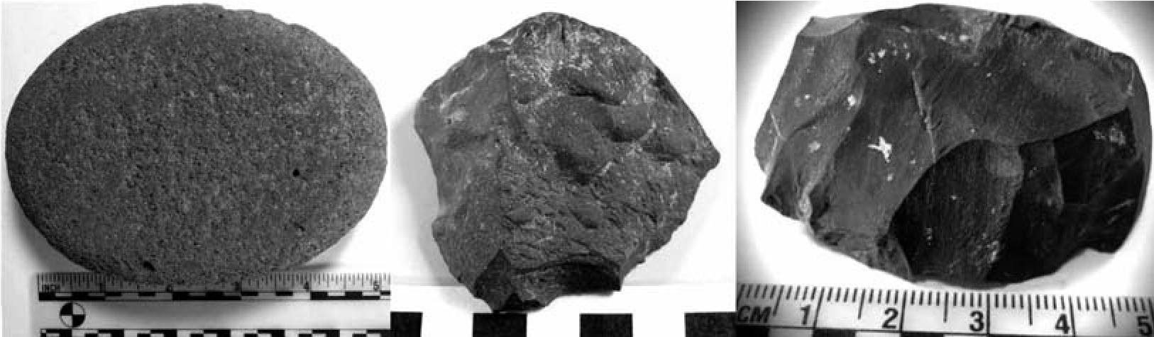
In the archaeological record for the Ho- hokam period and later, there are only a few accounts of bison bone in faunal assemblages of Arizona (e.g., see Gregory 2007 and Seymour 2004b, 2009f for recent summaries), although Mead and Johnson (2004) suggest that it may be underrepresented in Hohokam archaeological assemblages due to misidentification. Although during the Late Historic period non-native animal species were often introduced into various Arizona habitats (e.g., elk), no record could be found indicating bison were historically introduced anywhere near the current project area. As a result, we feel confident that the bovine protein residues found on these tools are most likely from domesticated cattle.
Yavapai groups were known to trade items such as animal skins, baskets, and agave to other groups for food, and this could account for bison or cattle products in the assemblage. However, the presence of animal proteins on informal and formal tools may point to a more specialized aspect of the toolkit that might be associated with in situ field processing of animal resources (e.g., meat and hides) as well as working more resistant materials such as bone (Adams 1988). The presence of bovine antiserum on the mano indicates that bone grinding or smashing and/or hide processing was occurring during the Historic period after the first herds of cattle were driven onto local public lands in the 1870s (Martin 1990; Solliday 2008). The round mano shows evidence for significant edge battering in addition to surface grinding and smoothing. Pounding the large bones of cows to splinter them would result in similar significant damage to hand stones, while the two chipped-stone tools are suitable for cutting, scraping, gouging, and perforating tasks expected for processing meat, bone, and hide. The faunal analysis for this project did not specifically identify cow (or bison) bone in the assemblage but noted that most of the large mammal bone was so splintered and battered that species identification was virtually impossible. It is likely that a portion of the fragmented large mammal faunal assemblage is from at least one cow. Although it appears that stone tools were used to process a Late Historic period cow at the site, the occupants also had access to metal tools, as other pieces of identifiable faunal bone exhibited cut marks resulting from non-stone implements (Gregory 2011:141–142). No metal tools were found at the site, but it is expected that valuable Euroamerican metal tools would have been taken away with their owners when they left the site.
Envisioning a Long-Term Yavapai Persistent Place
The analyses described above clearly indicate a long-term but sporadic use of the rockshelter first by the Colonial to Classic period Hohokam and then by the Protohistoric to Early Historic Yavapai. The original interpretation of a Euroamerican presence based on the Historic period material was, however, reassessed. It had been assumed that by the late 1800s to early 1900s the Yavapai were permanently absent from the Lake Pleasant area, but three stone tools pulled from the rockshelter tested positive for bovine protein residue. It is unlikely (but not impossible) that Late Historic period Euroamericans would have used stone tools to process cows, although there is evidence of stone tool use by the earlier Colonial period Spanish in New Mexico (see Moore, Chapter 8, this volume). If we can use these subsistence data to attribute at least part of the Late Historic period occupation to the Yavapai, then it demonstrates their intermittent use of the rockshelter beyond just the Protohistoric to Early Historic periods. The small size of the rockshelter and its relative isolation on the landscape suggest that its use would have been sporadic, yet it remained an important place for the Yavapai generation after generation, even into the Late Historic period (early twentieth century). It is likely that occupation skipped generations, and yet the Yavapai returned. If this scenario is true—and we recognize that, without nicely stratified and dated fill deposits, other interpretations can be offered—then we have potentially identified a Yavapai long-term “persistent place” on the landscape, which is remarkable for a highly mobile group of people.
The rockshelter occurs along the southwestern fringe of the Southeastern subtribe’s former territory but may also have been part of the Yavape subtribe’s traditional use area (see Figure 18.1). This area abuts the “boundary” of the Western and Northeastern subtribes, and with the Oodham and Piipaash groups to the south, the general site area may have been riskier for Yavapai occupation given these possibly overlapping territories and the conflicts that could arise. Braatz (2003:xv, Map 1) indicates that by ca. 1850 the Lake Pleasant area was completely within Yavape territory, which would indicate traditional ties to the descendants living at the Yavapai-Prescott Indian Tribe community along the northern Agua Fria River. However, Khera and Mariella (1983:39, Fig. 1) depict a retreat northward of Yavape territory by the Late Historic period, and instead place the Lake Pleasant area in the Southeastern subtribe’s territory, potentially indicating Late Historic ties to the Yavapai at Fort McDowell. Differences in historical Yavapai maps are not unexpected, given the fluid nature of territorial boundaries over time, the haphazard documentation of ethnohistoric accounts for the Yavapai during the 1800s and early 1900s, and the regular misidentification of Yavapai as Apache by Euroamericans during the pre-reservation era (Braatz 2003).
As settlers, ranchers, miners, and homesteaders filled the Phoenix Basin in the late 1800s to early 1900s, it was believed that the Yavapai had permanently relocated to their northern reservations along the upper Verde and Agua Fria rivers after returning from exile ca. 1904–1905. And yet, at some point after ca. 1870 and their forced removal to San Carlos, and possibly even as late as the early twentieth century, Yavapai hunters must have been present—and we are surmising they were Yavapai given a lack of evidence for any other aboriginal group using the rockshelter during the Historic period (e.g., Oodham or Piipaash). These hunters could have been among those who hid from the U.S. Army and remained in their homelands during the exile period, making a living as best they could under these harsh circumstances (Braatz 2003).
However, if the rockshelter was last used after the Yavapai’s return from exile, they most likely traveled south along the Agua Fria River Valley to reach the project area after 1905 and then relocated a small rockshelter that had been used only intermittently over hundreds of years. If this scenario is correct, then it is even more remarkable given that a generation would have passed (25+ years) from before the Yavapai’s forced removal to the end of their San Carlos exile. Additionally, while the Yavapai were at San Carlos, U.S. authorities, ranging from the military and Bureau of Indian Affairs agents to school and church officials, worked ceaselessly to erase the Yavapai’s indigenous ways of thinking and doing things in order to integrate them into American society (Braatz 2003:186). Yet the rockshelter, now located on Euroamerican patented lands, was found anew and at least one domesticated cow was partially processed with stone tools. Clearly, the Yavapai clung to traditional ways of doing things in traditionally used places while adapting to living under the cultural pressures discussed above.
It is not known if one or more of these hunters had previously visited the site or if oral traditions had indicated where the former Yavapai camps, shelters, and resource areas could be found. Some Native Americans in the Southwestern desert lands are known to have relied on songs that both tell their history and describe their important and sacred places on the landscape (Darling and Lewis 2007), even if those places had not been used or visited for generations (e.g., see Laird 1976 for a discussion of the songs of the Chemehuevi along the lower Colorado River). Perhaps the Southeastern and Yavape subtribes of the Yavapai have similar songs, stories, or memories that tell them about their time spent in the southern Agua Fria River Valley, similar to Apache experiences discussed
Note
We wish to thank the Bureau of Reclamation and Jon Czaplicki for supporting this project and providing us the opportunity to undertake this research. We thank the Archaeological Consulting Services field staff (including several Yavapai tribal members), analysts, and drafters. Our understanding of the project by Basso (1996). It is clear that even after first being forcibly removed by the U.S. Army and then pushed out by later Euroamerican settlers, the Yavapai revisited places in their former territories and practiced their traditional ways while learning to live within Euroamerican society. Perhaps these hunters ventured this far south from their upper Agua Fria and Verde river homelands out of hunger or perhaps as a way to stay in touch with their past and retain their cultural identity by associating with and viewing important landmarks and places and using traditional items (Braatz 2003). This is a pattern typical of many subjugated groups as a method of passive resistance against domination by more powerful segments of society (Ferguson 1992).
During the course of data recovery at the rockshelter, a site tour was organized for Reclamation and Yavapai-Prescott Indian Tribe members and cultural management staff. Those in attendance were very interested in the archaeological findings and impressed by the beauty of the local Sonoran Desert scenery, and asked many good questions relating to the occupation and use of the site. At the end of the tour the Yavapai-Prescott Tribal members became thoughtful and then shared with us that this place on the landscape felt like home and was very meaningful to them. Although these excavations and the subsequent research were undertaken for Reclamation, we felt that we had also given something back to the Yavapai people, who, like most indigenous peoples of the Americas, had suffered so much at the hands of colonizing Europeans and Americans.
data was enhanced by discussions with Peter Pilles. Sarah Herr and Deni Seymour provided insightful comments on this chapter that improved it substantively, theoretically, and grammatically. We dedicate this chapter to the Yavapai people.
19. Now You See ’Em, Now You Don’t
In Search of Yavapai Structures in the Verde Valley
Peter J. Pilles Jr.
In Protohistoric times, about 10 million acres in western and central Arizona were the exclusive territory of the Yavapai. The Yavapai were organized into four general groups: the Tolkepaya, or Western Yavapai, in the southwest; the Kewevkapaya, or Southeastern Yavapai; the Yavape in the Prescott and Black Hills region; and the Wipukpaya, or Northeastern Yavapai, in the Verde Valley (Figure 19.1). Numerous and conflicting ideas exist about the origins of the Yavapai, their relations to prehistoric groups, and the dating of their occupation of central Arizona (Pilles 1981). Radiocarbon dates confirm that they were present by ad 1300 and probably earlier (Pilles and McKie 1998). This was a time when many other mobile groups moved into the Southwest (see, for example, Chapters 1, 13, 16, and 17, this volume).
Yavapai sites are difficult to recognize archaeologically because the material culture of these highly mobile people tended to be lightweight, easily transportable, and made of perishable material that does not survive in open sites. Lithic debitage, a groundstone assemblage characteristic of seed and wild plant food processing, and the remains of nebulous brush structures have been associated with Archaic and other Protohistoric/Historic groups with similar lifestyles. The proclivity for Yavapai to occupy and salvage materials from earlier Sinagua sites results in a mixture of evidence that is often lost within the more dominant Sinagua component, something noted elsewhere for Apachean and non-Apachean mobile groups (Seymour 2002, 2009b, 2010a, 2015a, and Chapter 4, this volume). Nonetheless, over 30 years a number of artifactual, technological, architectural, and pictorial data have been recognized that distinguish the Yavapai from other groups in the Verde Valley of central Arizona.
Summary of Yavapai Archaeological Work
While little has been published about Yavapai history, traditions, material culture, organization, or ethnography, there is even less on Yavapai archaeology. When I summarized Yavapai excavations (Pilles 1981), only limited work had been conducted at seven Yavapai sites representing three caves, four ±1-m-diameter possible Yavapai roasting pits, an eroded Yavapai sherd area, and three sites with possible rock-outlined structures. Only the cave sites produced any quantity of usable Yavapai data. Since 1981 more work has been conducted, involving (a) surface mapping of u-was (brush structures) at three historic Yavapai sites (Keller and Stein 1985); (b) testing of several artifact scatters (Vanderpot et al. 2011; Weaver and Spalding 1999:26), a burned u-wa (Deats 2011), four possible roasting pits (Weaver 1995:136–147), and 11 roasting pits (Coconino National Forest site files; Greenwald 1989:82–103; Logan and Horton 2000:20–86; Pilles and Blood 2004:6–7; Vanderpot et al. 2011:6.22, 13.5); and (c) documentation of Yavapai rock art at 13 sites (Coconino National Forest site files). Many of these have been small projects, but collectively they have proven useful for recognizing the presence of a people who lived lightly on the land.
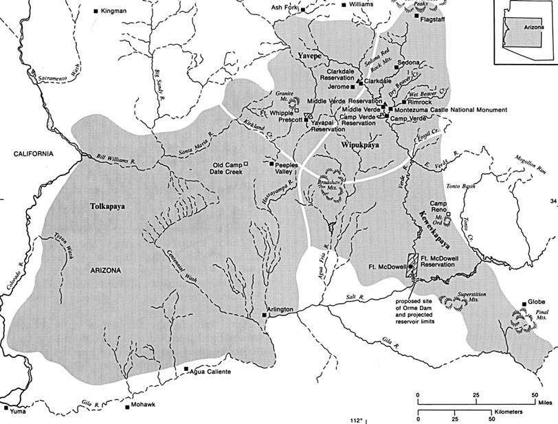
Yavapai Attributes
Many Yavapai-specific attributes previously identified (Pilles 1981) continue to be reinforced by ongoing work, despite the fact that difficulties remain distinguishing the Yavapai archaeologically from surrounding cultural groups, most notably the Dilzhee (the Northern Tonto Apache; Whittlesey and Benaron 1997). These groups share much of the same adaptation, have at least partially overlapping territories, were present at the same time, and were known to have traded and intermarried. These problems have been reported in other areas where the combination of traits and a focus on unique stylistic attributes have been emphasized to distinguish between neighboring, often overlapping, and difficult-to-discern groups (Seymour 2002, 2004a, 2009N262 and 266–267, 2009f, 20i2a:io8; Whittlesey and Benaron 1997). Because the spatial and cultural boundaries of mobile groups are often not as distinctive as they are for sedentary farming peoples, new methodological formulations and conceptual frameworks are needed to distinguish them (cf. Seymour 2008c; 2008N241; 20i0a:i58, 162–164; 2012a).
Pottery
Tizon Brownware is an important hallmark of the Pai people: the Yavapai, Walapai, and Havasupai, as well as the Paipai in Baja California. Examples of Protohistoric/Historic Tizon Brownware are rare; fewer than a dozen vessels have been found in Arizona, and most of these are Cerbat Brown (Figure 19.2a) and Tizon Wiped (Figure 19.2b). These types are easily confused with early Sinagua or Cohonina pottery, such as (a) Rio de Flag Brown (which is similar in its chocolate to dark gray color, relative thinness, and lack of polish), (b) one of any number of undescribed Alameda Brownware temper variations, and (c) Dead- mans Gray, often with a wiped surface. To the discerning eye, distinctions include the fact that Deadmans Gray usually has only interior wiping while Tizon Wiped usually shows striations on both exterior and interior surfaces (Christenson 2011:245; Dobyns and Euler 1985; Euler 1958).
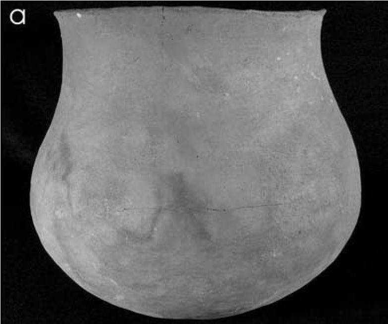
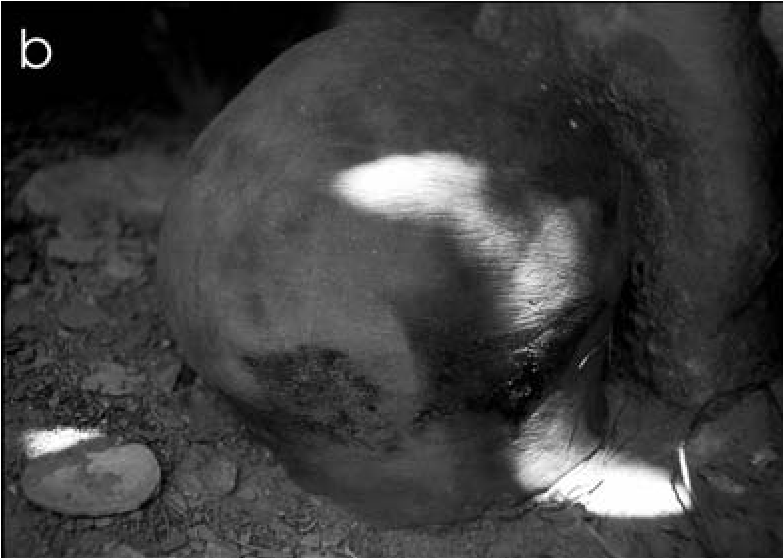
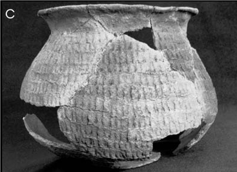
A rarer form of Yavapai pottery is Orme Ranch Plain (Breternitz 1960), a vertically corrugated brownware with slightly obliterated corrugations (Figure 19.2c). This is evocative of several Late Prehistoric types, such as Elden Corrugated, Salado Red, or corrugated Mogollon brownwares, and so is easily misidentified. It has been recognized at only a few sites in the Agua Fria and Verde River valleys, but these limited occurrences may simply indicate that Orme Ranch Plain is not being recognized.
Tizon Wiped and Orme Ranch Plain sherds have been luminescence dated (Vanderpot et al. 2011), and both were confirmed as Protohistoric types that probably extend back into prehistoric times. Two Tizon Wiped sherds dated to ad 1128 ± 66 (AR-03-04-06-745) and ad 1791 ± 29 (AR- 03-04-06-561), and two Orme Ranch Plain sherds dated to ad 1155 ± 99 and ad 1608 ± 51 (AR-03-04-06-745) (Feathers 2011:257; Lengyel 2011:260).
Consistent with the two prehistoric-era dates, Yavapai components are often associated with prehistoric Prescott Grayware and Wingfield Plain. On this basis, some have suggested that the Yavapai originated in Arizona earlier than commonly believed (Pilles and McKie 1998; Schroeder 1975:56), either as an outgrowth of these prehistoric peoples or as a pre-AD 1300 entrance into central Arizona.
A few sherds of Awatovi and Jeddito Black- on-yellow and their associated utility pottery, Awatovi Yellowware, are often associated with Yavapai and Apache sites. Hopi pottery is expected on Yavapai sites because the Yavapai were raiders and traders (Chapters 1 and 16, this volume). However, these types are also indicative of post-AD 1300 Tuzigoot phase Sinagua sites, making their presence difficult to interpret in the absence of other supportive data.
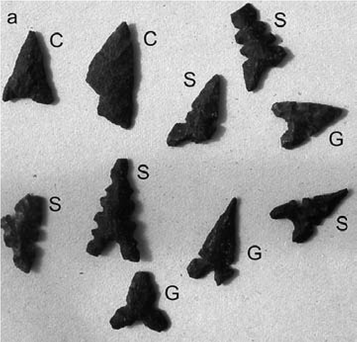
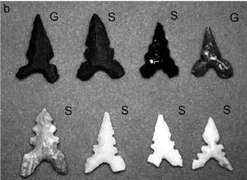
Projectile Points
Several projectile point types have long been recognized as Protohistoric and Early Historic: (1) Cottonwood Triangular, simple equilateral triangular points (Figure 19.3a); (2) Desert Side- notched, which resemble Cottonwood Triangular points with side-notches (Figure i9.3a-b); and (3) Desert Side-notched, Sierra style, with deep basal notches (Figure i9.3a-b). Some researchers also suggest that “Pai points” which are Desert Side-notched, Sierra style points with multiple serrations (Figure i9.3a-b), are most common in Yavapai sites; however, only 16 percent of 128 Desert Side-notched points have multiple serrations (Pilles and McKie 1998). The most typical point found on Yavapai sites is the General Desert Side-notched variety (45 percent), closely followed by the deep basally notched Sierra variety (39 percent; Pilles and McKie 1998). Although Desert Side-notched points are found throughout the West, they are one of the most diagnostic Yavapai artifacts when associated with other Yavapai characteristics.
Groundstone Tools
Several groundstone tool forms are indicative of the Yavapai, including “lap stones” or “anvils” These are roughly circular heavy stones with two opposed flat surfaces that show use from pecking and grinding, and are usually polished on at least one face (Figure 19.4a). They were an all-purpose “workbench.”
Flat sandstone slabs, particularly those with a small pecked depression on one side (see Figure 19.4a), are also typical. These were probably used for cracking hard seeds and nuts, such as black walnuts, which were used in many ways by the Yavapai (Gifford 1936:256; Waddell 1986: 138–139), or as anvils for smashing small nodules of chert for flakes. As with many gathering groups that stay for only short episodes, expedient rubbing and grinding tools, made from various size stones with little modification, are typical.
Agave Knives (“Tabular Tools”)
Agave is ubiquitous throughout the rocky soil zones of central Arizona and was a major food staple and trade item for many groups, including the Apache and Yavapai (see Hodgson 2001:14–43). Plants were harvested using large oval to subrectangular flakes of flow basalt that were ground or bifacially flaked to an edge to saw off the sharp exterior leaves (Figure 19.4b).
Agave knives are thinner (ca. 2–4 mm at the distal edge) than prehistoric hoes (ca. 5–20 mm) and have longitudinally abraded or polished edges and striations. Such reciprocal cutting motion produces wear patterns that differ from the wear striations on hoes, which are perpendicular to the longitudinal edge, indicating vertical chopping to break up hard earth or to cut weeds. Diffuse striations resulting from moving loose soil around are evident on some hoes. The longitudinal edge is often considerably rounded, polished, and worn through use by soil abrasion. A polished area from holding the tool in the palm may characterize one face.
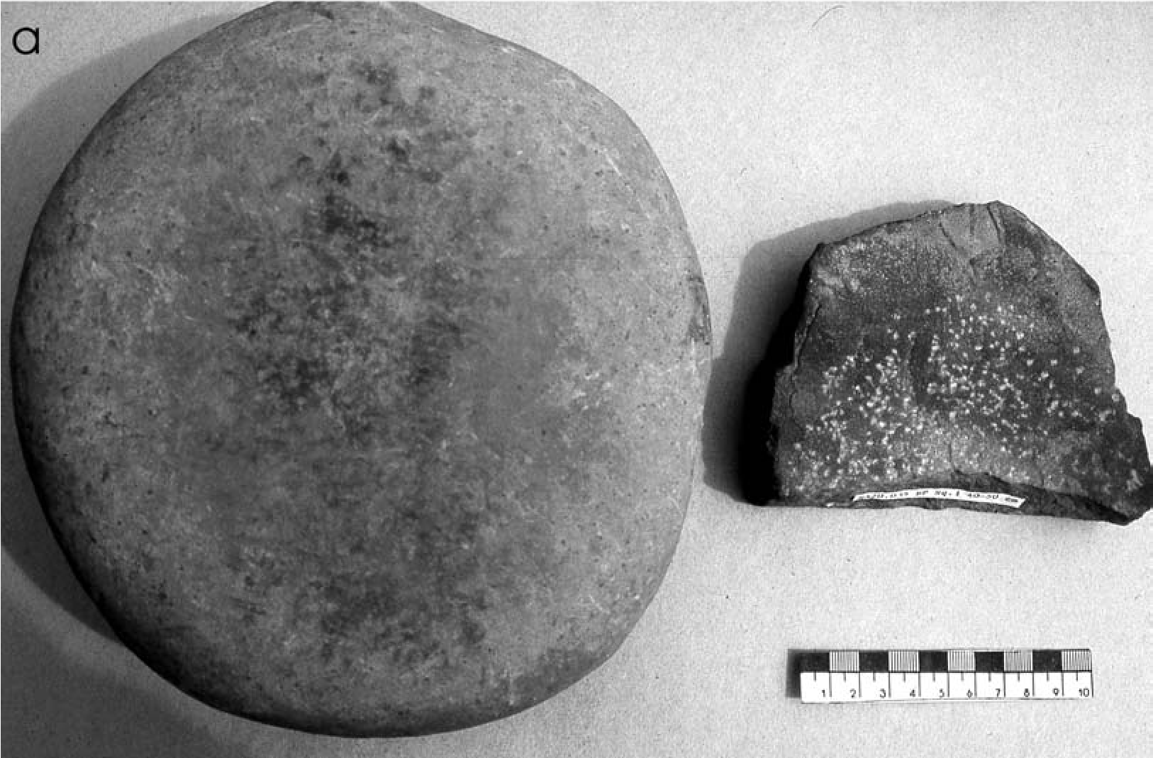
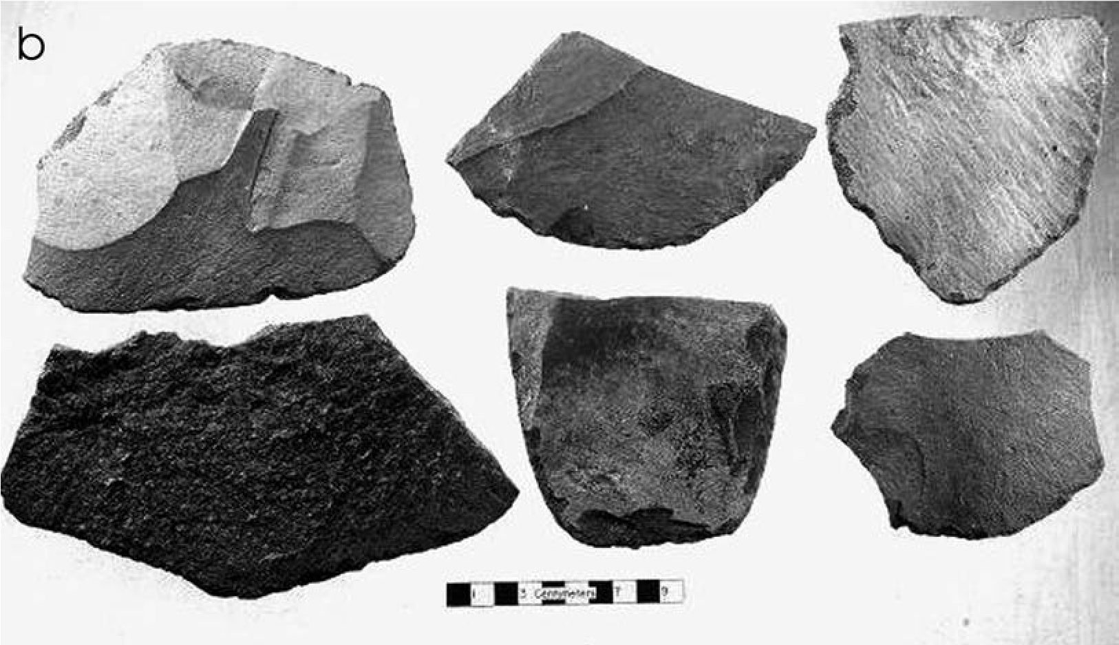
Longitudinally hafted examples of agave knives in split wooden handles have been found that use pine pitch for glue and have the handle ends tied to hold the knife in place (Figure 19.5a). Hough (i930:Plate 7) illustrates this style of agave knife from the White Mountain Apache Reservation in eastern Arizona (Figure 19.5a).
Complete and fragmentary agave knives are commonly found in the piñon/juniper zone of central Arizona. They are indicative of both Yavapai and Apache, as they are commonly found on sites with other distinctive Yavapai or Apache materials, but are much more infrequent on prehistoric sites. This contrasts with southern Arizona, where they are associated with extensive prehistoric Hohokam agave fields (e.g., Fish et al. 1992). They are not, however, found in Kay- enta Anasazi sites to the north.
Agave Scrapers
Another Yavapai agave-processing tool is often referred to as an agave “knife” but should more correctly be termed a “scraper.” They are large, ca. 7–10 cm long, subtriangular bifaces (Figure 19.5b), originally set into wood or agave stalk handles and glued in place with pine pitch (Figure 19.5c). They typically have a flat or slightly rounded broad end, tapering to a point on the other end. Sometimes the scraper goes completely through the handle, providing a broad scraping edge on one side of the handle and a scarifying point to separate fibers on the other.
Hafted agave scrapers have been found in Protohistoric Paiute sites in the Great Basin (Baldwin 1944; Harrington 1942), and the Southern Paiute continued to use them into recent times, but with blades of metal rather than stone (Fowler 1995:106, Fig. 4; Harrington 1942:68). They are similar to hafted agave multipurpose tools reported from Texas, New Mexico, Arizona, and northern Mexico (Seymour 2002:277280, 2009ft 2014a) and are often hafted, using a wedge to hold the blade in place.
Such scrapers are described for the Northeastern Yavapai (Gifford 1936:279), Walapai (Kroeber 1935:57), and Havasupai (Spier 1928: 105). Four complete examples have been preserved in cave sites in Pai territory, one each from a small cave along the Mogollon Rim (Figure 19.5c), Honanki (Fewkes 1898:571, Fig. 251, Plate CLXXIa), the Grand Canyon, and near Flagstaff, where it was associated with Jeddito Black-on-yellow sherds (Bartlett 1934:18–19). Agave scraper bifaces attributable to the Pai have not otherwise been reported from Southwestern sites. Their rare occurrence may relate to their not being recognized as a specialized agave tool and a lack of study in Pai sites.
Roasting Pits
The most important identifier of Yavapai sites is the large agave roasting pit mound (Figure 19.6a). Such roasting pits represent an important food resource and signify a lifeway that was central to Yavapai culture: the communal harvesting, processing, and consumption of agave. Sinagua roasting pits are much smaller, about 1 m or less in diameter, suggesting individual family use, not the industrial-size, multifamily processing of agave as practiced by the Hohokam, Yavapai, and Apache.
Yavapai roasting pits consist of mounds of black, burned soil ca. 8–9 m in diameter and 0.51+ m high and fire-cracked rocks. They began as slab- or stone-lined pits 1.5–2 m wide. With continued use, the mounds grew in width and height and became the locations where many smaller rock-lined roasting pits were dug into the larger mounds. Eight individual roasting pits were found within a 1-m-wide trench across the main mound at Dry Creek (AR-03-04-06-883; Figure 19.6b).
The types and densities of artifacts found in the large mounds vary, ranging from a single broken mano to a quantity of basket and moccasin fragments, flakes, fragments of ground sandstone slabs, agave scrapers, one-hand/basin manos, and basin metates. These latter items all suggest that some processing of agave was done nearby. Prehistoric sherds accompany Protohistoric Tizon Wiped, Orme Ranch Plain, Jeddito Black-on-yellow, and Awatovi Yellowware, confirming a Yavapai presence, connections with the Hopi, and reuse of the location.
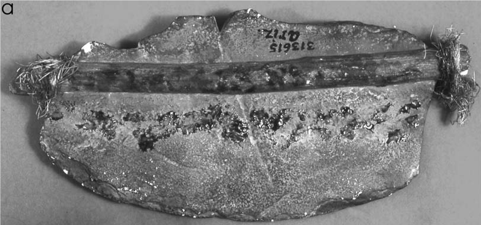
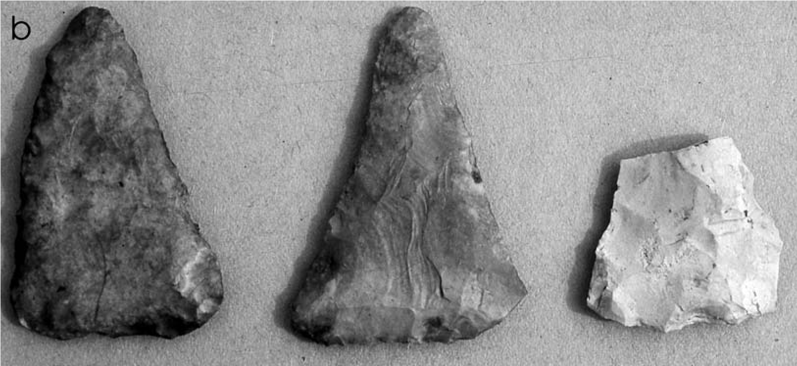
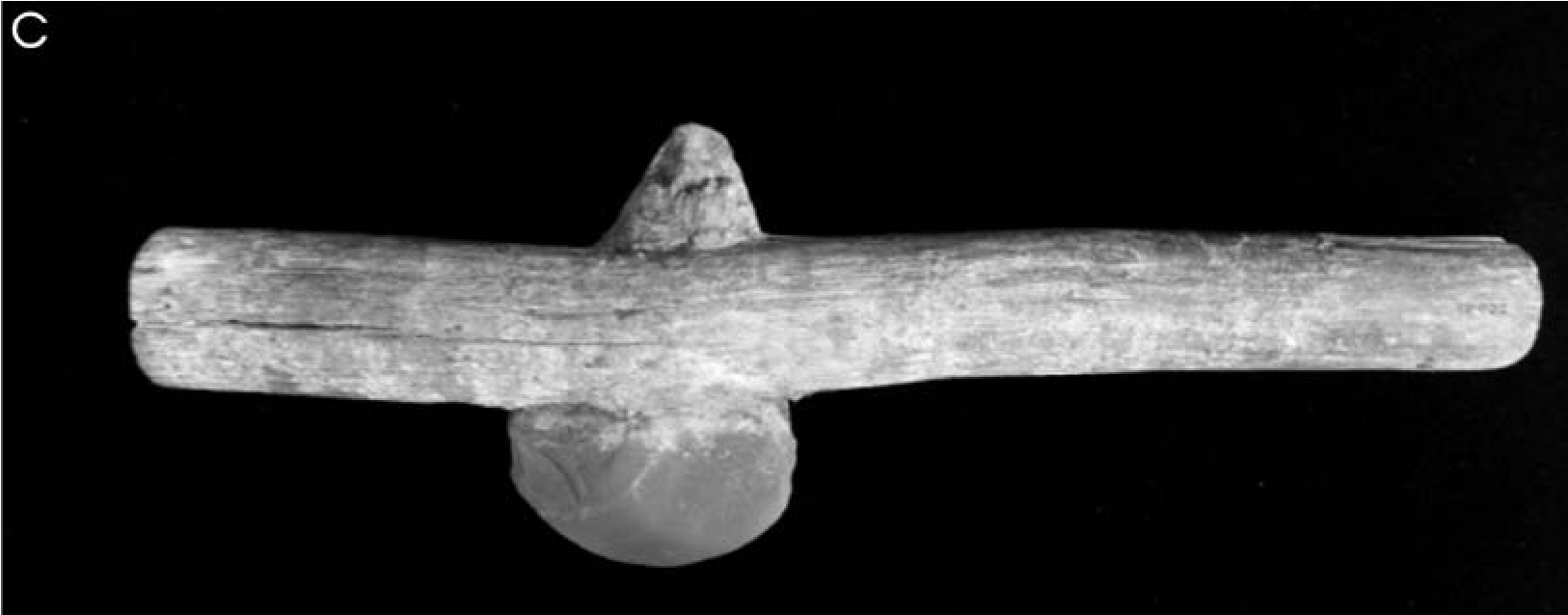
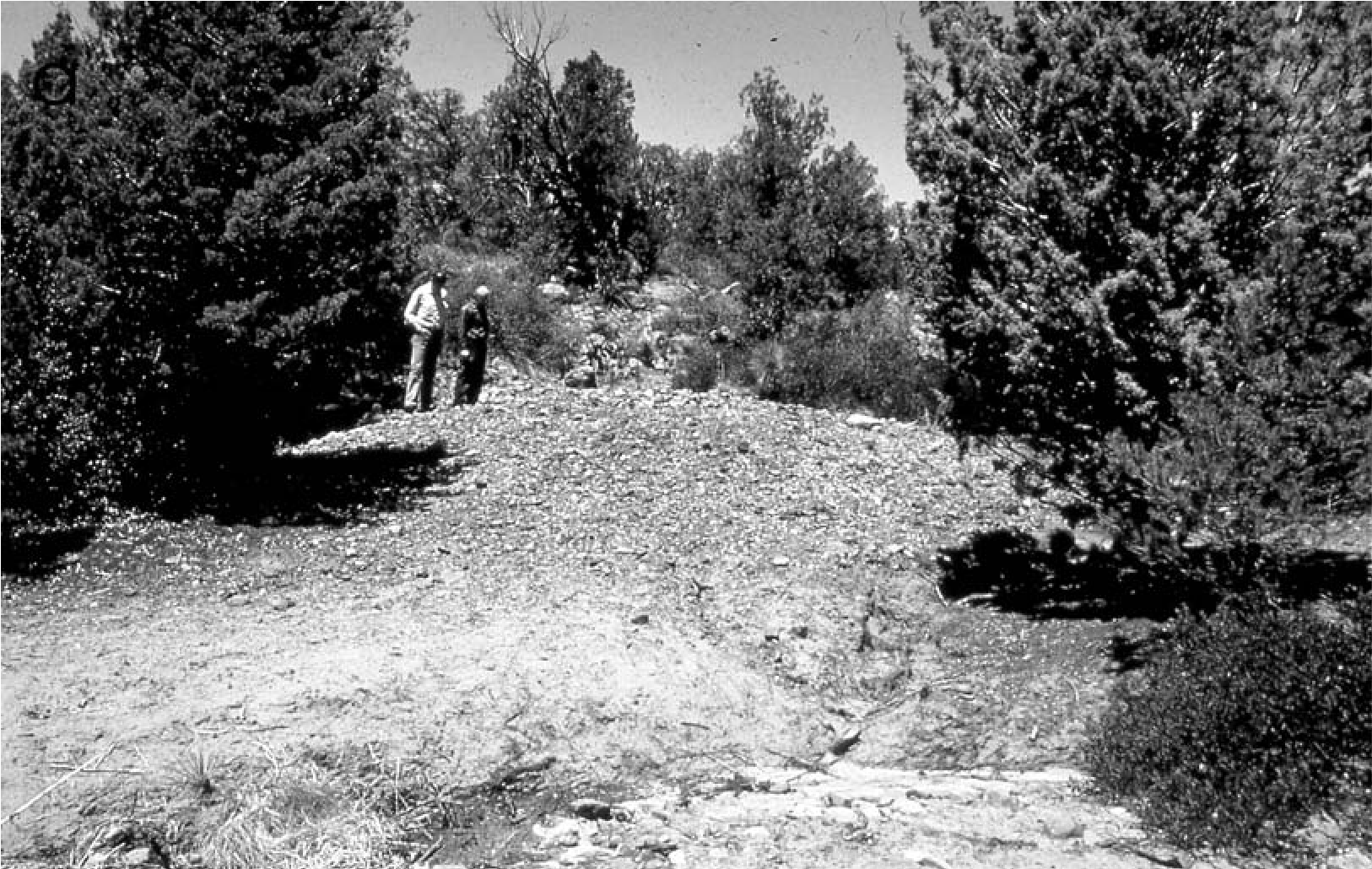
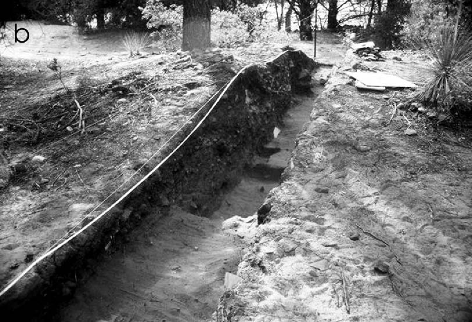
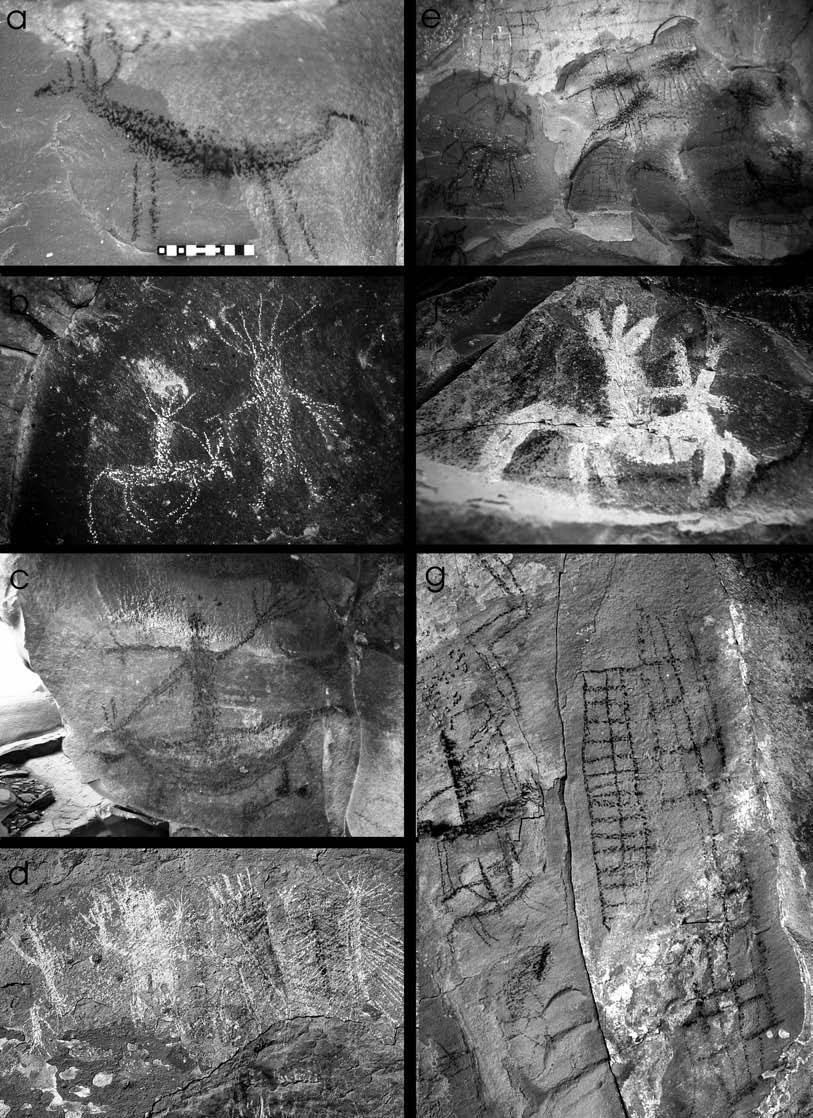
Large roasting pits are important sources of radiocarbon samples. Approximately 100 roasting pits have been recorded on the Coconino National Forest, and five have been tested to examine their internal character and to evaluate their dating potential. Four of the small roasting pits inside the Dry Creek mound provided radiocarbon dates of ad 1434–1524, ad 1457–1648, ad 1526–1554, and ad 1670–1950. These match the small roasting pits’ stratigraphic sequence within the mound and show likely intermittent use over several centuries. Such longevity and the large size of the mounds suggest they may have marked band territories and served as longterm gathering places for otherwise independent families.
At a roasting pit near Palatki (AR-03-04-06287), soot-covered historic dates of 1882 and 1896 above the mound suggest a late last use, which was confirmed by 14C dates from the roasting pit of ad 1839–1876. Earlier use is indicated by an AMS 14C date of ad 1280–1620 from an adjacent Yavapai pictograph (Armitage et al. 2000:262).
Over 30 radiocarbon and obsidian hydration dates from a number of sites demonstrate a Yavapai presence in central Arizona by at least ad 1300, possibly as early as the late ad 1100s. This indicates Yavapai contemporaneity with Late Prehistoric populations for at least a century or more (Pilles and McKie 1998:Appendix 2), which also explains the consistent co-occurrence of prehistoric pottery on Yavapai sites.
Rock Art
Unique rock art styles in the Sedona area can be used in the absence of other forms of data to identify a Yavapai presence. Rock art sites in the Red Rock country are numerous, and rock art attributed to the Yavapai can be distinguished on the basis of differential preservation, element superpositioning, stylistic uniqueness, repeated motifs, and pictorial content. Their location in the heartland of Wipukpaya tradition and multiple informant confirmations of specific elements, motifs, and places used historically for initiations, religious training, and ceremonial purposes (Pilles 1994) further confirm a Yavapai association.
Pictographs are most numerous and are made with charcoal, red mud, white limestone- derived clay, red hematite, and yellow limonite (Figure 19.7). The rarer petroglyphs are mostly scratched (Figure 19.7b) or lightly incised into sandstone rockshelter walls, but some direct percussion was also used.
Big game animals (Figure 19.7a) and mounted horsemen in charcoal (Figure 19.7b, c, and f) are dominant, with animals frequently occurring multiple times (Figure 19.7e), as if made during repeated visits. Some horsemen are fairly realistically portrayed, but most are abstract or stick figures. Feather-like depictions often extend from their heads, sometimes in multiple colors, such as black with white tips (eagle feathers?) (Figure 19.7c) and red with black tips (red-tailed hawk feathers?). Archers are also present, but there are no depictions of rifles, revolvers, wagons, cattle, cowboy hats, or buildings that would suggest Euroamerican influence. Geometric designs—grids, hatched lines, zigzag lines, and diamond chains—are also common (Figure 19.7g). Some pictographs replicate nearby Southern Sinagua pictographs.
Most intriguing are composite zoomorphs merging feline and bird characteristics, and anthropomorphs wearing horns or feather fan headdresses, with body decorations, exaggerated hands, and rays emanating from their torsos (Figure 19.7b, d). Yavapai informants consistently identify these unusual anthropomorphs as little spirit beings known as kakaka (qaqaqs, akaka) who live in certain mountains (Gifford 1936:308; Khera and Mariella 1983:52). At several larger sites, panels can be recognized as scenes from Yavapai oral traditions (Pilles and Vaughn 1999). These pictographs are inferred to be Yavapai because this style occurs only in the Sedona area and the Yavapai view many places in the Red Rock country as the locations where legendary events in their history occurred.
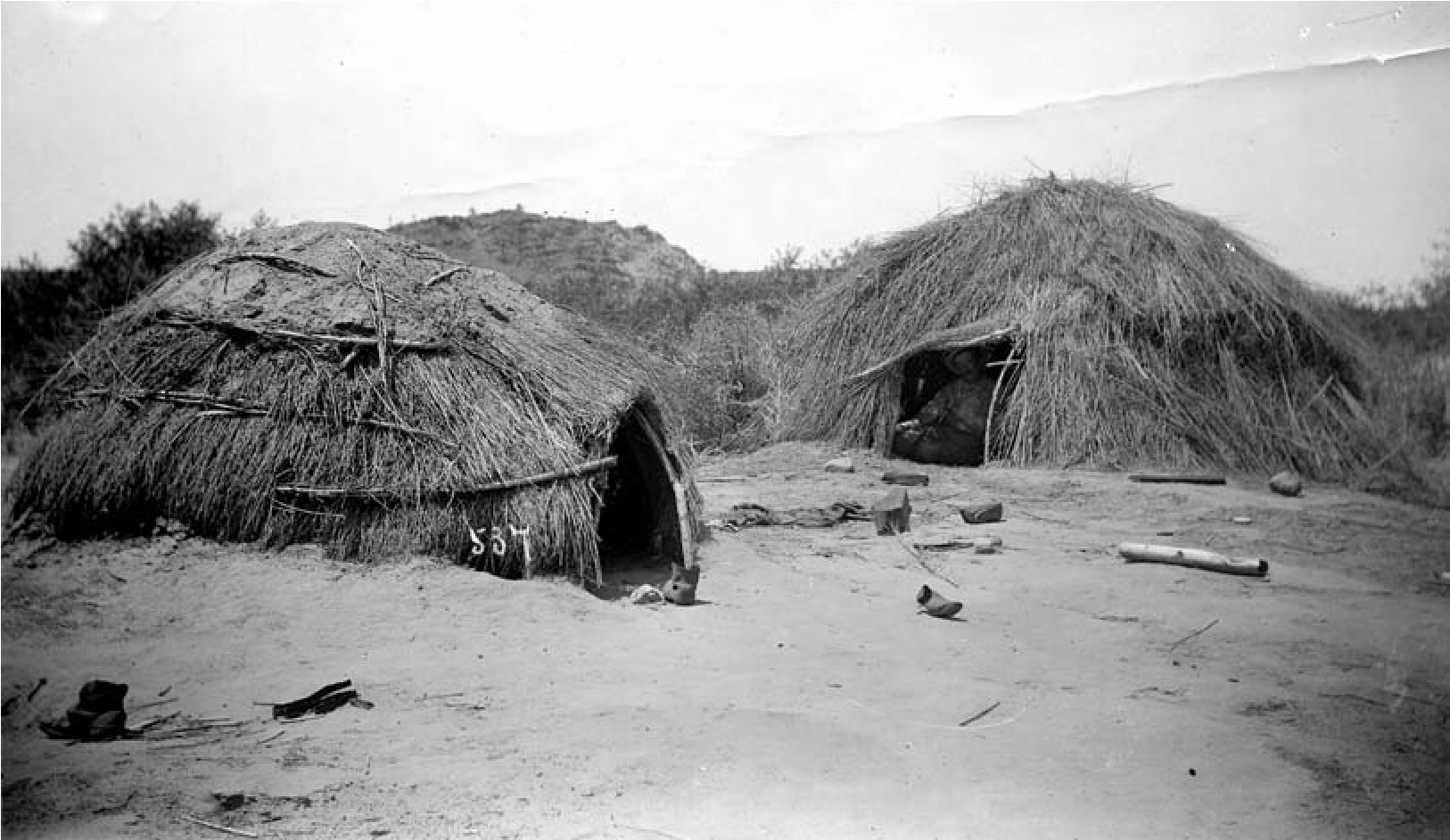
The Yavapai have also identified certain sites as initiation places, training locations for medicine man novitiates, and places where medicine men would perform ceremonies. One such site is marked by the name of a noted medicine man from the 1940s.
Architecture
During the cold winter months, rockshelters and caves were valued for habitation and were also used for long-term storage of jar-sealed food (Gifford 1932:203–204, 1936:269–272; Harrison and Williams 2012:302–303, 310; Keller and Stein 1985; Khera and Mariella 1983:49–50). Several caves with evidence for both habitation and storage have been found (Breternitz 1960; Euler 1958; Pilles and Katich 1967), and Tizon Wiped and Orme Ranch Plain jars have been recovered from rockshelters on the Prescott and Coconino National Forests.
Where caves were not available, and for main camps, large domed brush structures, called wahmbunias, were built. As Burns (2010:237) illustrates, they were constructed with embedded posts that supported brush walls that were strong enough for people to stand on when making public announcements (Gifford 1932:203; Figure 19.8). They were about 4 x 4 m and larger and could house 10 or more people. Wahmbunias had hearths or stoves in the center for warmth, but cooking was done outdoors. Ethnographies indicate that doorways faced east and were covered with a yucca mat in the wintertime.
Walls were composed of several layers of brush and grass, and the outer layer was made of bear grass or broad strips of juniper bark to repel water. Some structures, particularly in the Western Yavapai area, were covered with earth and were called u-wawatamarvas (Gifford 1936:271) or just watamarvas (Harrison and Williams 2012: 302). After a rain, the walls would be tamped to seal and harden them (Harrison and Williams 2012:302). More typically, however, animal skins, blankets, or canvas covered the brush walls of winter structures but were removed in the summer to promote cooling and air flow.
The Yavapai used temporary brush structures during most of the year. Several types of historic structures have been identified: (1) dome-shaped sweat houses covered with grass and mud, used by the Northeastern and Southeastern Yavapai but not the Western Yavapai; (2) lean-tos that were three-sided temporary brush and pole structures to provide shade or serve as a windbreak (Khera and Mariella 1983:49); and (3) somewhat more substantial summer ramadas or washehelva that were rectangular flat-topped shades supported by four embedded posts with partly open sides or loosely piled walls of brush or branches (Gifford 1936:271).
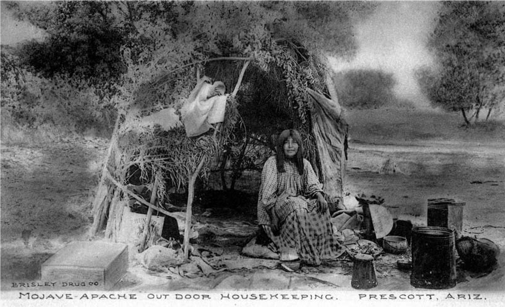
The most commonly used structure type, especially in temporary camps, was the u-wa, which was a brush structure about 3–4.5 m in diameter (Keller and Stein 1985:4). Walls were made by anchoring branches against rocks or in postholes and bending the branches to form a dome-shaped frame that was covered by cane, brush, grass, or juniper bark or, in later times, blankets and tarpaulins. Stones were wedged into the outer edge of postholes to brace the bent branches to create the frame (Gifford 1936:271) (Figures 19.9 and 19.10).
Yavapai structures left little evidence of their presence beyond small clearings where rocks were removed to smooth the ground, irregular rock rings, and scattered foundation stones. The results of two projects, described below, confirm that surficial suggestions of features are Yavapai structures or activity areas and establish their co-occurrence with prehistoric artifacts.
NA10946—The Orme School Site
Excavations were conducted at a small historic Yavapai site at the Orme School atop a hill 100 m from the west bank of Ash Creek (Figure 19.11). Scattered over the hill were abundant basalt, quartzite, and chert flakes, broken groundstone tools, and a few sherds. Three features were visible: a 3-m-diameter mound of burned and fire-cracked rock (Feature 1), a rock-outlined structure incorporating a basalt outcrop (Feature 2), and an irregular oval area that had been cleared of larger rocks but had rock concentrations on its east and west sides (Feature 3). All three features and two associated work areas found during excavation are inferred to be Yavapai.
Feature 1 was a shallow roasting pit 2.35 x 3 m and 15 cm high, similar to those found at other Yavapai sites (Vanderpot et al. 2011:6.2–6.25, 6.29–6.30; Weaver 2000:140–143, 100). Due to the rocky nature of the hill, the feature rested on the surface, with no indications of a pit beneath or adjacent to it. Both burned and unburned 2-30-cm rocks were mixed with ash, charcoal, and loose soil, as were flakes, burned animal bone, and several Levi’s rivets and buttons.
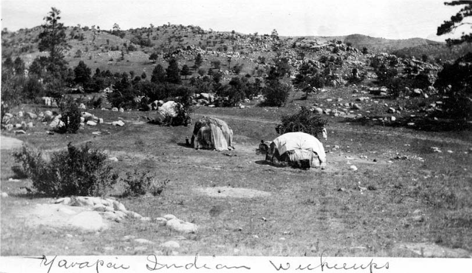
The west wall of the 2.2-x-5-m bedrock room (Feature 2; Figure 19.11a) was formed by upright basalt slabs and rocks, while the basalt outcrop formed the opposite downslope wall with large rocks placed to fill gaps and extend the wall. The north side was only an irregular alignment of a few rocks, and there was no indication of a south wall. No prepared floor or use-compacted surfaces were found. A 30-cm-diameter, 10+-cm- deep burned area in the northeast corner was filled with ash and charcoal flecks, as was the area behind it for about 1 m. This unlined irregular basin was dug into the rocky soil substrate.
An u-wa (Feature 3) was visible on the surface as an oval outline of discontinuous rocks (Figure 19.11b). Beneath the 5–10 cm of loose fill, the rock outline evident on the surface became much more difficult to discern as numerous additional rocks and large stones were uncovered (Figure 19.11c). A general oval outline about 2.15 x 2.65 m was visible, but no plaster, use-compacted surface, or features could be discerned to indicate a floor. A slightly harder reddish-colored soil around the wall stones was inferred to be remnants of mud mortar used to stabilize the basal course of rocks or plaster on the lower walls of the u-wa. Several possible postholes were identified in a flat area near Feature 3 that suggested a ramada, a similar structure, or perhaps an activity area where most of the site’s sherds came from.
During test excavations on the west edge of the site, another 5-x-7-m rock-cleared area was identified. Feature 4 is interpreted as a Yavapai work area owing to the high number of waste flakes and historic metal fragments in and around it.
Artifacts were concentrated in the southeast and northeast quadrants of the site, in the general area around the features and the slopes below them. Lithic artifacts resulting from primary reduction of fine-grained chert, quartzite, and basalt cobbles from nearby Ash Creek were particularly abundant. Cores and several scraper types were found, along with three prehistoric projectile points. Basin metate fragments and basin one-hand manos were most numerous. With the exception of a single unifacially worked trough (two-hand) mano, groundstone tools associated with prehistoric farming groups were absent.
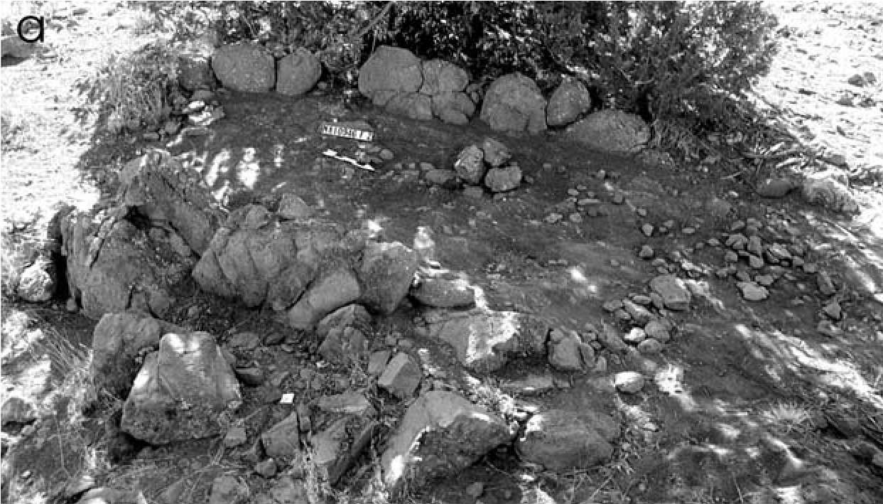
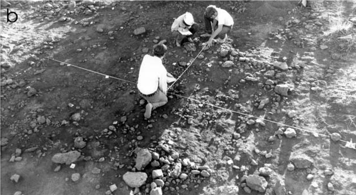
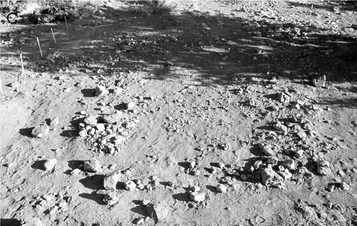
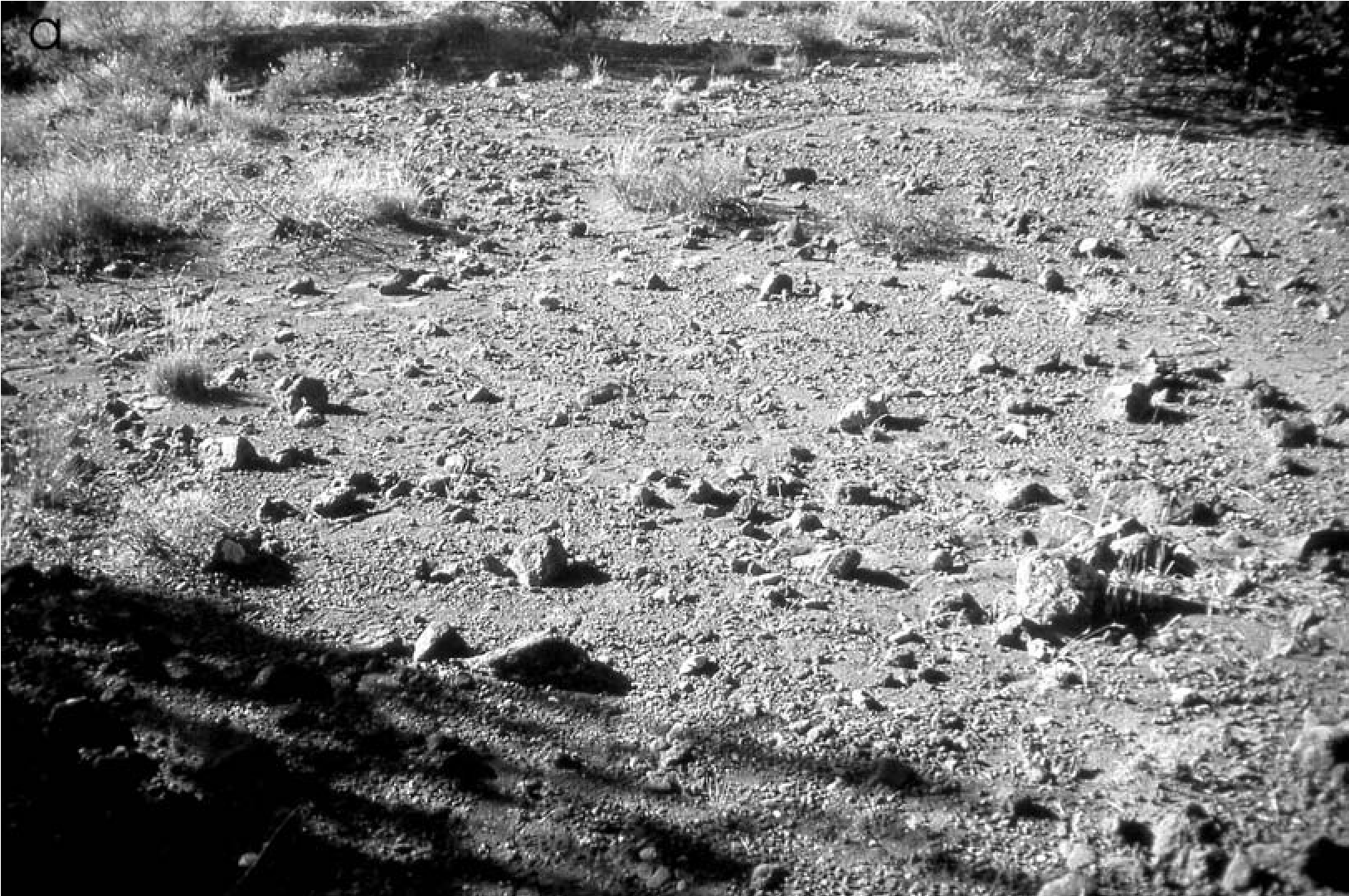
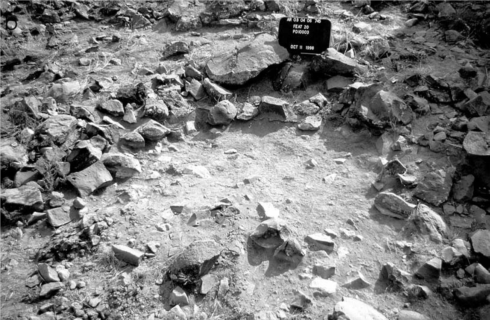
Ceramics were sparse and mostly prehistoric. One Ash Creek Brown sherd was marked with three parallel lines of fingernail indentations. Such decorations are generally associated with Protohistoric/Historic pottery, such as Rimrock Plain, an Apache type (Schroeder 1975:81); Apache Plain, Strawberry variety (Ferg 2003b: 147–149); Paiute Brownware (Baldwin 1950:54); and Shoshone Brownware (Rudy 1953:94). Fingernail-indented sherds have been found on other sites in Yavapai territory (e.g., Christenson 2011:Fig. B.3; Pilles 1981:Fig. 2); however, as Wood (1987:115) notes, fingernail indentations are occasionally seen on prehistoric plainwares across central Arizona as well.
Historic period artifacts were numerous, but their distribution and location could be related to disturbance from students’ use of the hill and from cattle grazing. The historic artifact assemblage, the Levi’s buttons and rivets, and information provided by Orme School teachers indicate the area was used as a camp for Yavapai workers hired to clear vegetation along Ash Creek for farming between 1900 and 1920. This interpretation seems likely because most Verde Valley Wipukpaya and Dilzhee were forcibly removed to the San Carlos Reservation in 1875 and were not allowed to leave until 1892, although by 1902 all had returned to the valley (Braatz 2003:211–212).
AR-03-04-06-745—State Route 89A
AR-03-04-06-745 is the most extensive Yavapai site known on the Coconino National Forest, with numerous artifacts and possible structures. The site is located on a basalt hill on a ridge that forms a divide between Spring Creek and Oak Creek, approximately seven miles southwest of Sedona, Arizona. Middle and Late Archaic projectile points, and sherds from the Southern Sinagua, Northern Sinagua, Prescott, Cohonina, Hohokam, Kayenta, and Little Colorado River Valley areas, indicate a long prehistoric occupation, although primarily during the ad 900–1150 period. The Yavapai occupation was indicated by 166 sherds of Jeddito Black-on-yellow, Jeddito Plain, Tizon Wiped, Cerbat Brown, and Orme Ranch Plain; a large number of expedient groundstone tools; and small flat sandstone slabs, some with intensively pecked circular areas. Nineteen rock-cleared areas irregularly outlined with larger stones were interpreted as possible u-was (Figure 19.12a). There were also a number of Southern Sinagua features, including grid-bordered fields, a field house, and a possible storage feature (Figure 19.12b). Only features that are likely Yavapai are discussed here (also see Vanderpot et al. 2011).
The site extends over 140,765 m2 and contained 8,924 prehistoric and Yavapai artifacts: 4,610 pieces of flaked stone, 225 pieces of ground- stone, and 4,089 sherds. Artifact concentrations and topography divide the site into 14 more or less discrete loci that differed in artifact densities and composition (Figure 19.13).
Structural Features
Keller and Stein’s (1985) work on Historic period Yavapai structures included examination of historic photographs for characteristics that might be preserved archaeologically. They noted that 7-10-m-diameter areas around u-was were compacted and lacked vegetation. Locations where u-was previously stood could be identified in historic photographs by circular areas of compacted earth with no vegetation (see Figure 19.10). Low ridges of earth surrounded some structure perimeters where exterior mud plaster had washed down. Irregular semi-circular clusters of stone and stone alignments were used as retaining walls to level out sloping hillsides where u-was were constructed. Keller and Stein’s work suggested that use-compacted floors should be expected within structures and at activity areas around them.
With this as a model, we tested 6 of the 19 rock-cleared areas thought to be u-was and extended our trenches at least a meter beyond the edge of the rock-cleared areas looking for evidence of peripheral postholes and exterior work areas. None were found. Nor were any artifact concentrations discerned that could be associ-ated with a specific structure, only the general concentrations associated with the clusters of potential u-was.
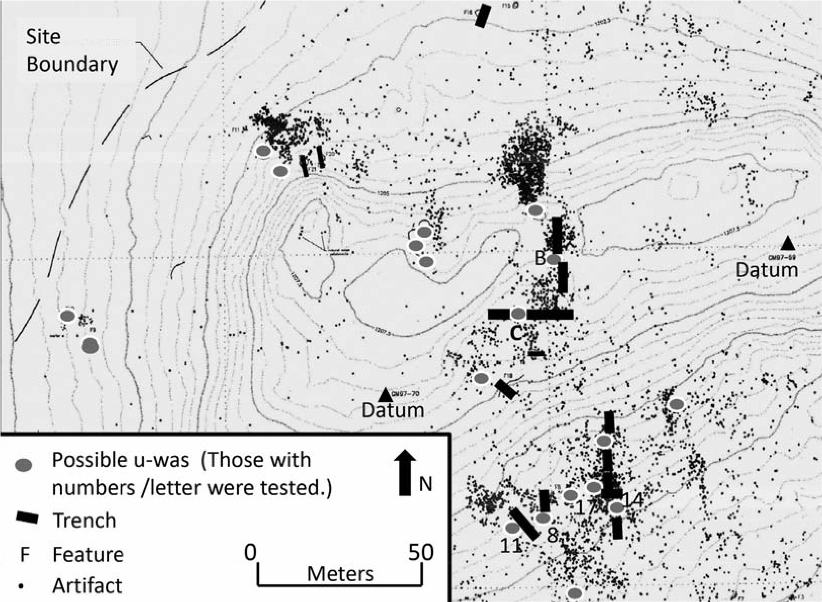
Four of the u-was we tested are described here. These and two other possible u-was that were not tested were in a locus where Tizon Wiped and Prescott Grayware sherds were abundant. Excavations revealed little, if any, soil formation near the possible u-was. Two thin strata (no more than 10 cm) overlaid a basalt substrate. An eroded clay surface was thought to be the original prehistoric and Yavapai ground surface because artifacts and the u-wa rock outlines rested on it.
Feature 8 was an arc of basalt rocks around a 2.6-x-5-m rock-cleared area with sherds, flakes, a ground sandstone slab, and a chert core (Figure 19.14a). Remnants of the clay surface were found in only a few locations.
Feature 11 was another rock-outlined structure, 4.5 x 9.6 m, with an interior cleared of rocks. Loose 3-4-cm-thick gray fill rested on an eroded compacted gold clay surface that was evident along the suspected edges of the structure and around the possible wall stones where it was protected. Although the surface extended beneath the wall stones, it did not have the same compacted character noted for remnants inside the feature. These surface remnants were the best-preserved examples of a use-compacted surface found in any of the u-was.
Feature 14 was a 4.8-X-6.3 m area slightly cleared of rocks. Fill rested on the friable and eroded gold clay layer. The only area where a compacted surface was found was along the south wall where stones rested on the gold clay surface (Figure 19.14b). The absence of a compacted surface within and a lack of artifacts suggest this was probably not an u-wa.
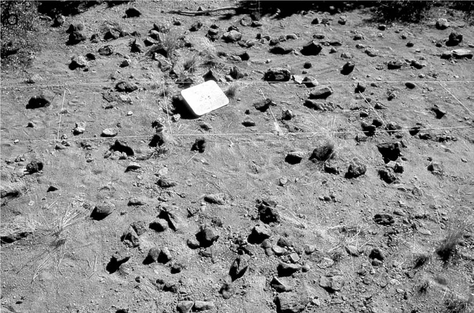
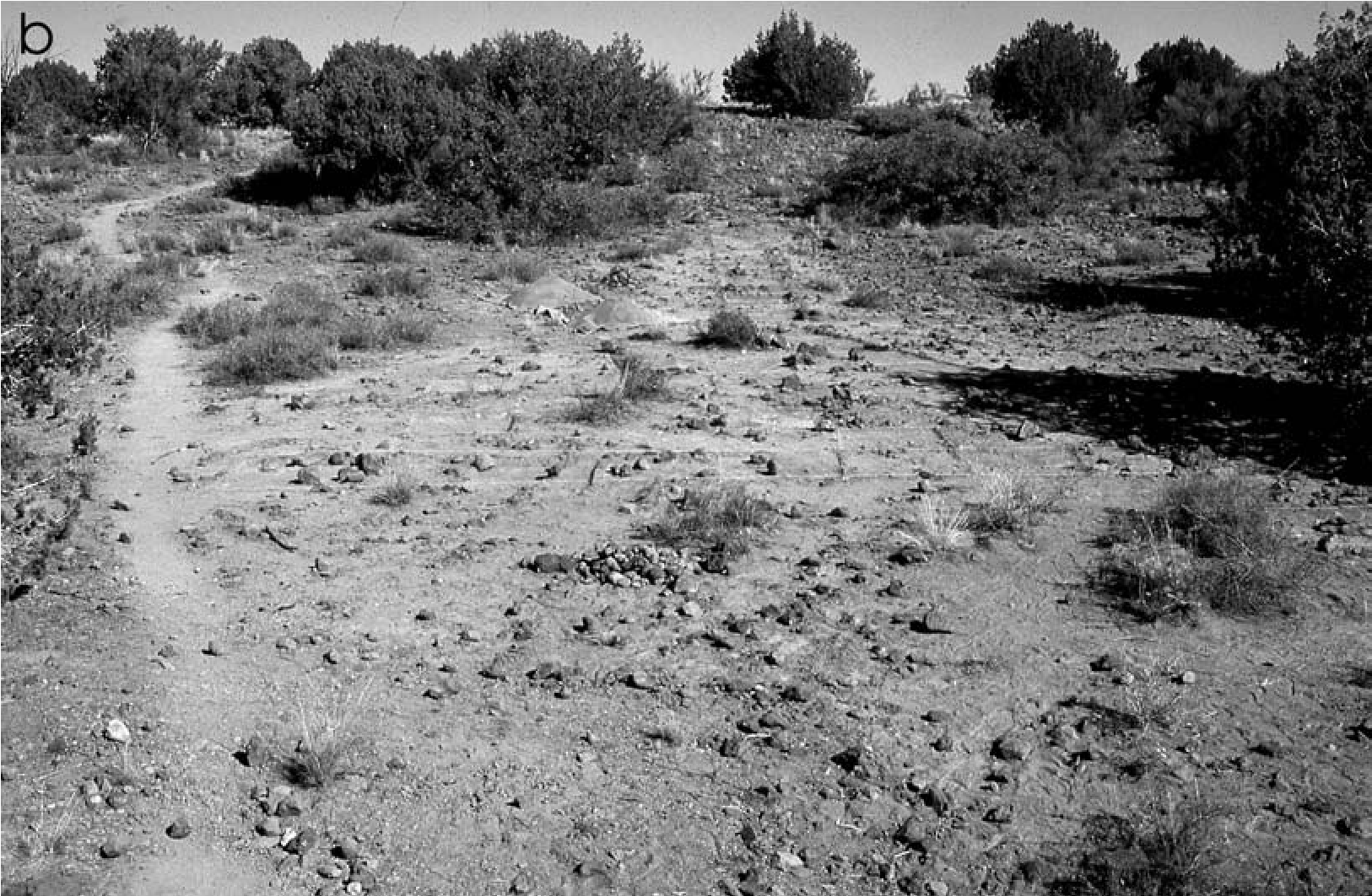
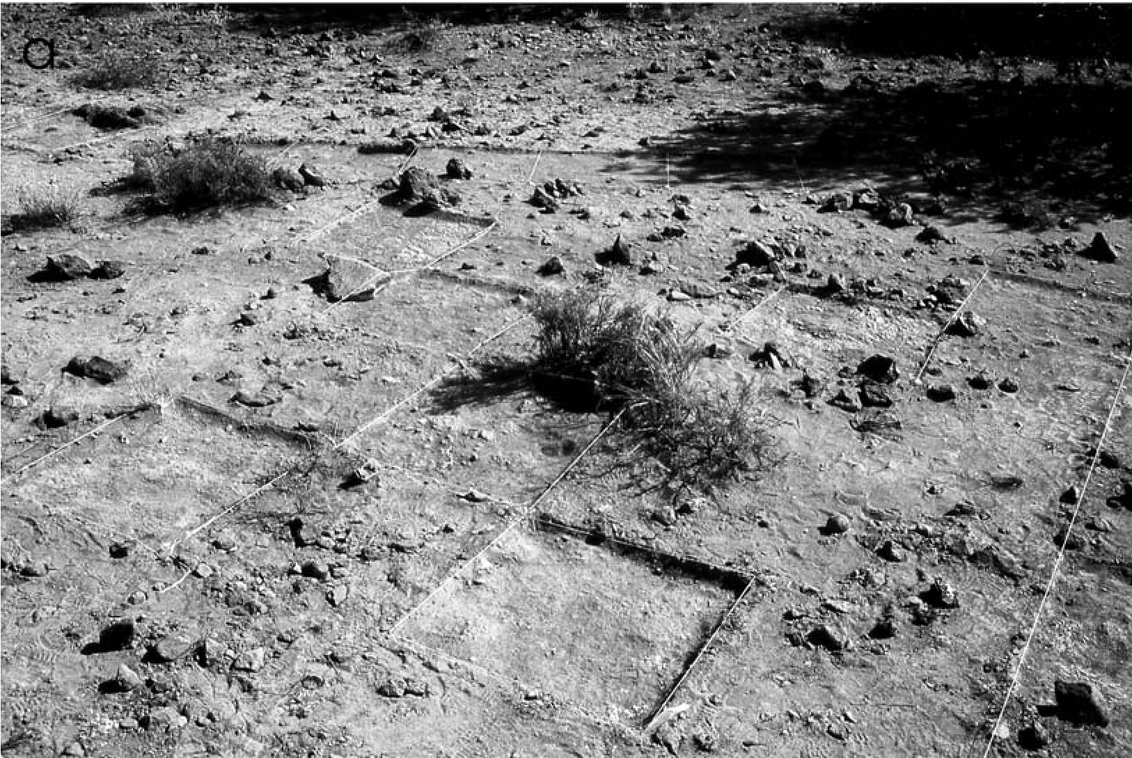
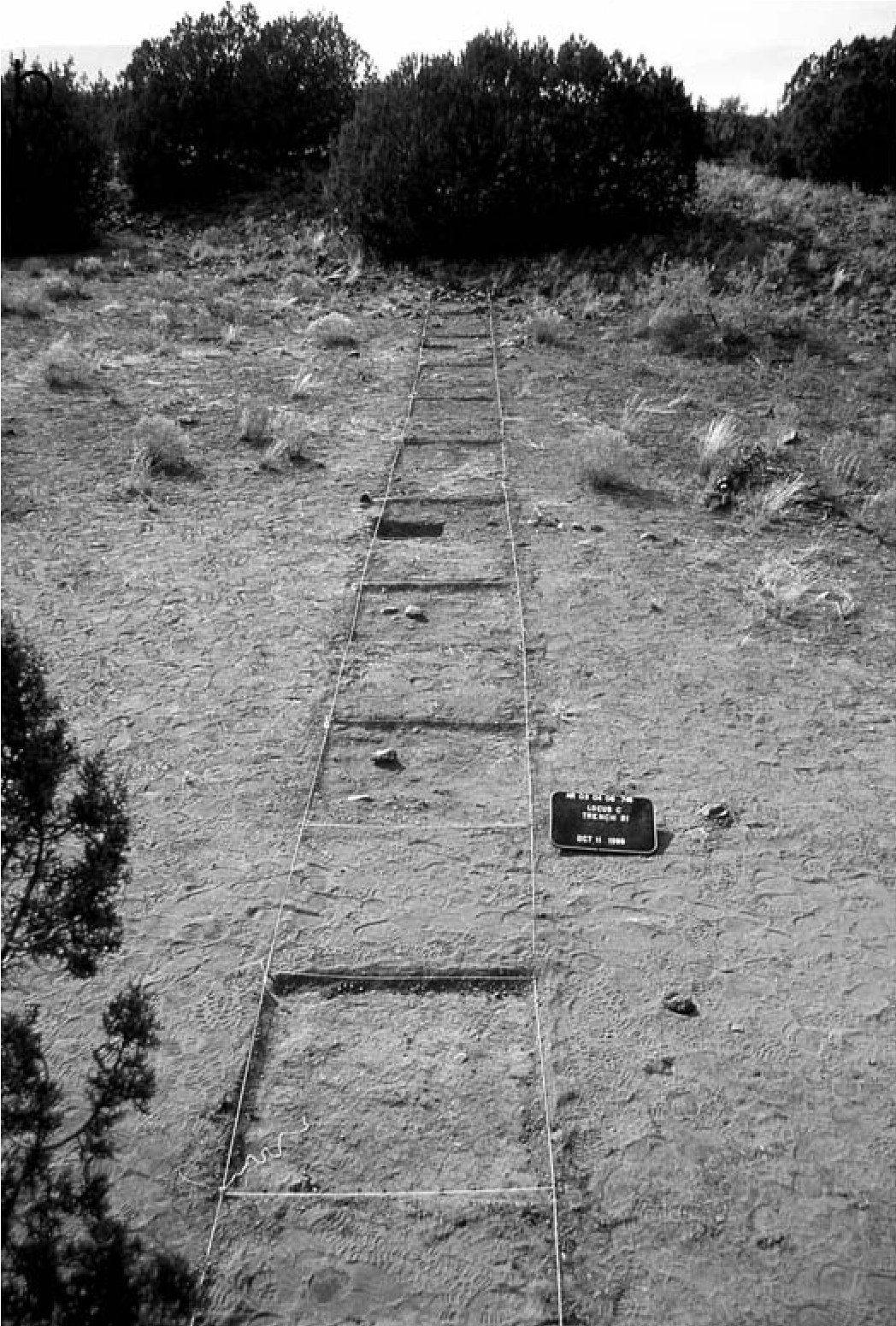
(a) Feature 17, a possible u-wa, excavated in alternate 1-m squares;
(b) test units across basin on top of hill, possibly cleared of rocks, showing soil that has not been compacted by use. Courtesy of Coconino National Forest. Photographs by Peter J. Pilles Jr.
Feature 17 was indicated by a circular 4.8- x-6-m rock outline whose interior was slightly cleared of rocks (Figure 19.15a). The 1-6-cm thick fill rested on the gold clay surface. Only a few highly weathered patches of the surface were found within the rock outline, and no trace of it was outside the north wall. Although associated features and a prepared surface were lacking, artifact frequencies were relatively high, including Orme Ranch Plain sherds, a deer phalange, ground sandstone, a mano, and a sandstone disk, suggesting this is an u-wa.
Test excavations were also conducted on the hilltop, where there were other possible u-was represented by rock-cleared and outlined areas and a dense concentration of sherds, flakes, and five flaked-stone tools on the west side of the basin. The east end of the hill, on the upper edge of the basin, had two artifact concentrations, suggesting the presence of u-was or work areas. Locus B was a dense scatter of sherds, flakes, a chert cobble, metate fragments, and a tabular piece of ground sandstone with a pecked depression in it adjacent to a 13-m-diameter rock- cleared area that was a possible u-wa.
Two perpendicular trenches were excavated across the extent of the basin and through the rock-cleared possible u-wa and the artifact concentrations (Figure 19.15b). In the possible u-wa, stratigraphy was similar to what was found below the hill: 0–7 cm of gray sandy eolian soil covered a highly eroded gold clay surface on top of a basalt substrate. As before, the gold clay surface could not be confirmed as a structure floor, but its presence, even in eroded condition, and the artifact density and variety suggest it was a floor or defined work area.
Rock-Cleared Areas: Yavapai U-was or Natural Features?
The Yavapai presence at AR-03-04-06-745 is indicated by sparse diagnostic artifacts, such as sherds of Tizon Wiped and Orme Ranch Plain, and the distinctive agave scraper. The highest density of Orme Ranch Plain sherds occurred in the southern cluster of u-was, along with Jeddito Yellowware and with less culturally distinctive artifacts such as basin metates, manos, and worked sandstone slab manuports. Although these latter artifacts are not uniquely Yavapai, they are part of the assemblage typically found on Yavapai sites. In fact, 95 percent of all sandstone slab manuports from the SR 89A project came from AR-03-04-06-745 (Vanderpot et al. 2011:156), where they made up 25 percent of the entire groundstone assemblage. Only two other project sites had such slabs, and one of these also had Yavapai ceramics.
The Jeddito Yellowware suggests an occupation in the fourteenth century or later, and luminescence dating of Tizon Wiped and Orme Ranch Plain sherds documents an earlier presence as well, going back to the twelfth century (Feathers 2011:257).
The ephemeral construction and short-term use of the u-was make them difficult to identify. Their placement with little modification to the ground surface accounts for their poor visibility and the difficulty of defining their character and extent. Additionally, the rocky nature of the soil is not conducive for identifying postholes. The near-surface nature of the u-wa floors and their location on a windswept slope contribute to their poor condition.
Moreover, u-was tended to be taken apart when a camp was left. John Williams remembered his grandmother doing this: “And when we start to move out, she pulls the sticks out and throws everything away” (Harrison and Williams 2012:301). Despite these difficulties, ethnographic, historic, archaeological, and photographic evidence from nearby regions supports the interpretation that these features are u-was (Seymour 2008b:250, 252; 2009b; 2009c; 2013c), as does the work by Keller and Stein (1985).
Burning would facilitate recognition of a structure, but no fire areas were found at AR-0304-06-745. If the site was occupied in the summer, there would be no need for an interior fire pit. Deats (2011:3.57–3.61) reports a burned u-wa that did not have a fire pit, and had it not been intentionally burned, it would have been difficult to recognize. Moreover, of the 35 Historic period Apache wickiups excavated near Roosevelt Dam, only 11 (31 percent) had fire evidence or features (Ayres et al. 1994:255–382). Even when fire features were present, they were seldom formal but were typically unmodified areas on or near the surface, as at Feature 2 at Orme School and at other Yavapai sites (Breternitz 1960:25; Euler 1–958:3:17–346; Hohmann 1999:103–104; Pilles and Katich 1967:10; Wright 2002:48–51; Stokes and Tactikos, Chapter 18 this volume).
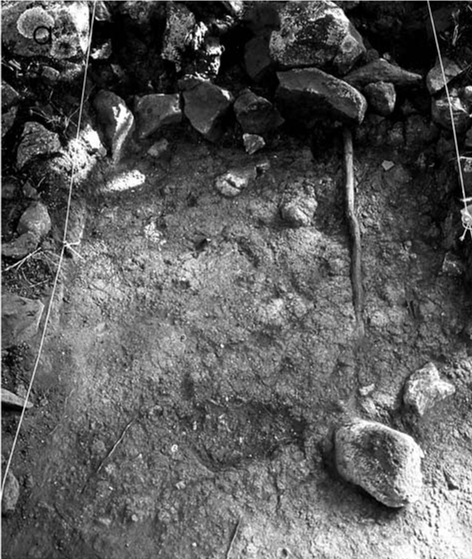
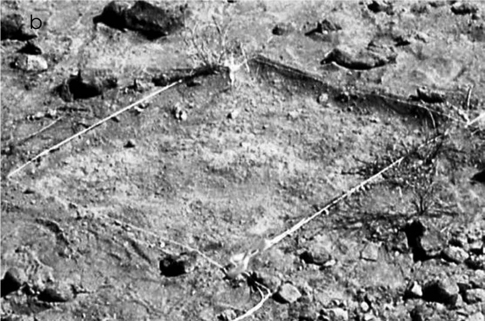
(a) Feature 21, a prehistoric Southern Sinagua field house showing detail of “floor”—a use-compacted surface;
(b) use-compacted surface in Feature 17, a possible u-wa, at AR-03-04-06-745. Courtesy of Coconino National Forest. Photographs by Peter J. Pilles Jr.
Structures were indicated by remnant use surfaces and artifact density, diversity, and types. The gold clay surfaces were eroded, but the compactness does not appear to have been natural. The interpretation that these surfaces were cultural is supported by the more substantial Southern Sinagua structures, Features 20 and 21, where the floor remnants are virtually identical (Figure 19.16a, b). The compacted gold clay surfaces were found only within the rock-cleared areas, not in areas tested outside, and, as at Orme School, were best preserved in the interior at the base of rocks that formed the structure outline. Additionally, no use-compacted surfaces were found in trench segments located outside the borders of these features, even when such areas were specifically tested to see if such surfaces were present.
Compacted surfaces were restricted to locations where structures were suspected by other indications of cultural presence, such as artifact and ground surface modifications. This is consistent with the types of evidence found on other mobile group sites; for example, no evidence of floor surfaces or postholes were found at the 35 Apache wickiups reported by Ayres and others (1994:225–382). When these feature attributes are placed in a broader context and found in association with Yavapai-specific material culture, it is reasonable to infer that these are Yavapai structures.
Like most sites occupied by mobile groups, AR-03-04-06-745 has an overwhelming presence of prehistoric artifacts and features, including almost 4,000 sherds, projectile points, field houses, and a rock-bordered field, which indicate a substantial Southern Sinagua component. Yavapai site characteristics, including ephemeral structures, are not common for the Sinagua, whose sites consist of a dominance of Alameda Brownware with pithouses, field houses, and multiroom pueblos. On this basis and as discussed above, I infer that these are Yavapai structures on a multicomponent site.
Caveats on “Diagnostic” Yavapai Characteristics
The Yavapai complex is consistent and abundant in the Sedona area of the Verde Valley, yet it is difficult to distinguish because many of the attributes recognized as diagnostic of the Yavapai also occur in other cultural groups. Expedient groundstone tools, tabular pieces of sandstone, and lap stones can be found at almost any site used for limited periods. Equilateral triangularshaped projectile points are found throughout the United States. Desert Side-notched points are not unique to the Yavapai and are associated with other groups in many post-AD 1300 contexts. However, in northern Arizona, Desert Side-notched points are associated with the Pai people: the Yavapai, Hualapai, and Havasupai, whereas in the Great Basin they are associated with the Paiute.
Only rock art style seems sufficiently distinctive by itself to differentiate the Yavapai from other groups. Yavapai pictograph elements described above and shown in Figure 19.7 are abundant throughout the Red Rock country near Sedona but do not appear on the east side of the Verde Valley, a distribution that associates them spatially with the Yavapai.
Yavapai rock art is substantially different from Mescalero and Chiricahua Apache rock art, and lacks the emphasis on full-bodied human figures, hourglass figures, masks, bird-like forms, spirals, crosses, and zigzag lines (Burton 1988: 262–271; Schaafsma 1980:333–341; Seymour 2012a:100–104). Dilzhee rock art has not been studied, but examples farther east in the Payson (North et al. 2005:31, 36, 63, 79, 90, 184, 185) and East Clear Creek regions (Figure 19.17a-!), within historic Dilzhee territory, have similarities to that of the Chiricahua but are different from Yavapai rock art.
Another rock art style thought to relate to the Dilzhee consists of deeply incised grooves, lines, quadrupeds, geometrics, and drilled holes (Figure 19.18a-c) (Pilles 1998). They are more common on the east side of the Verde Valley and continue farther east into the White Mountains region (Apache country), but they only rarely occur in the Red Rock area.
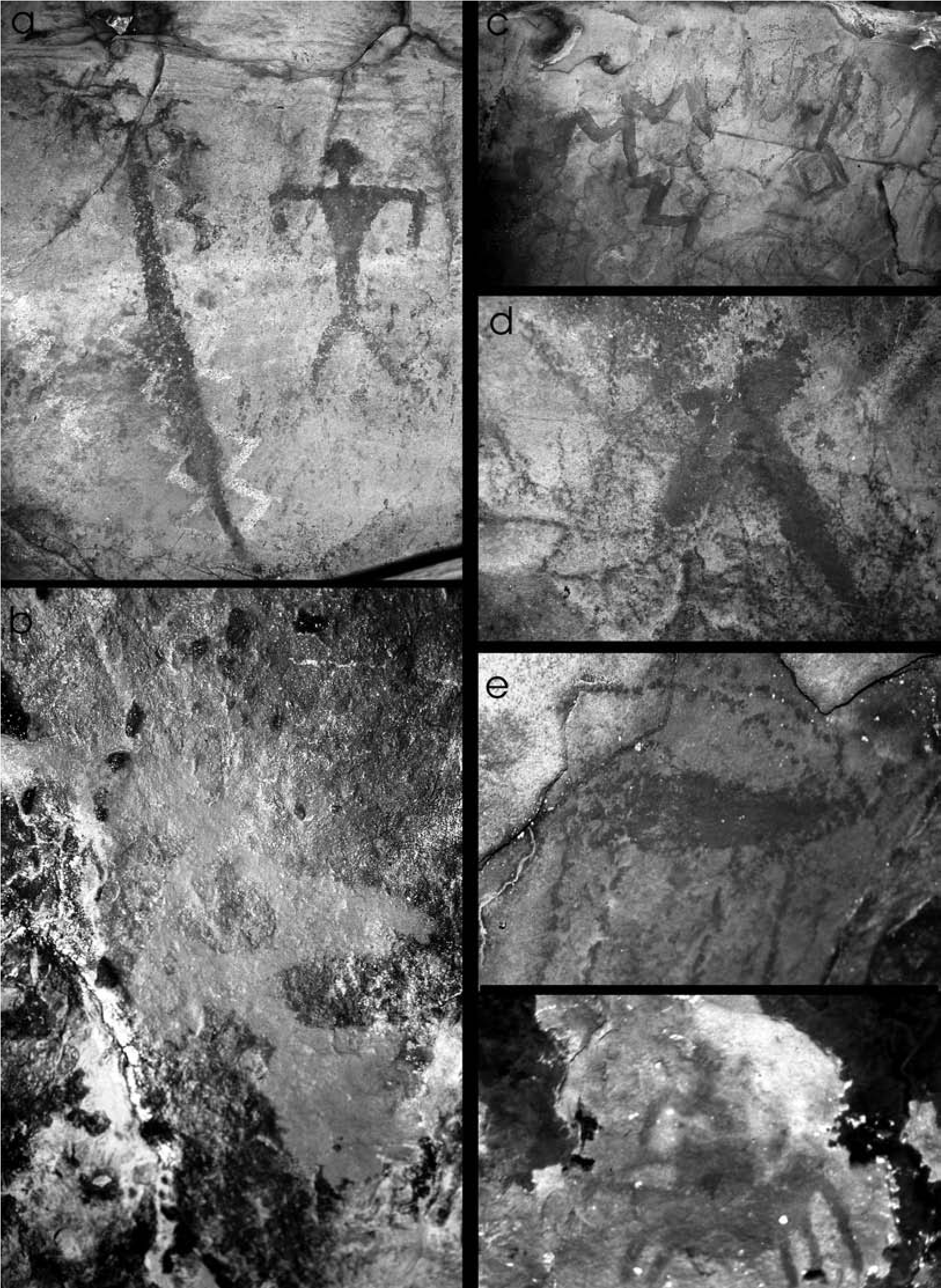
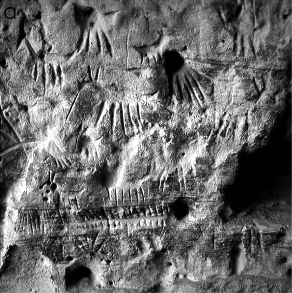
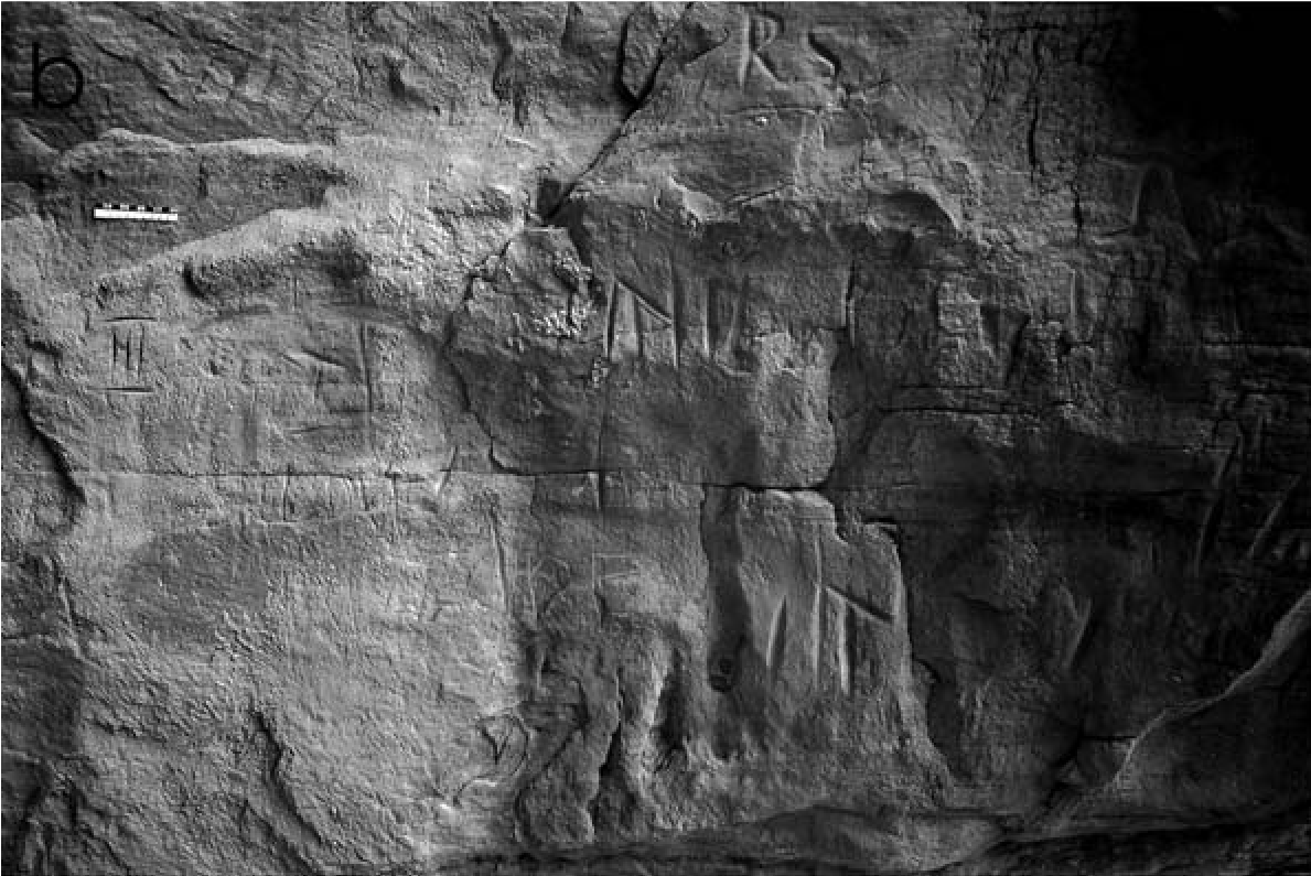
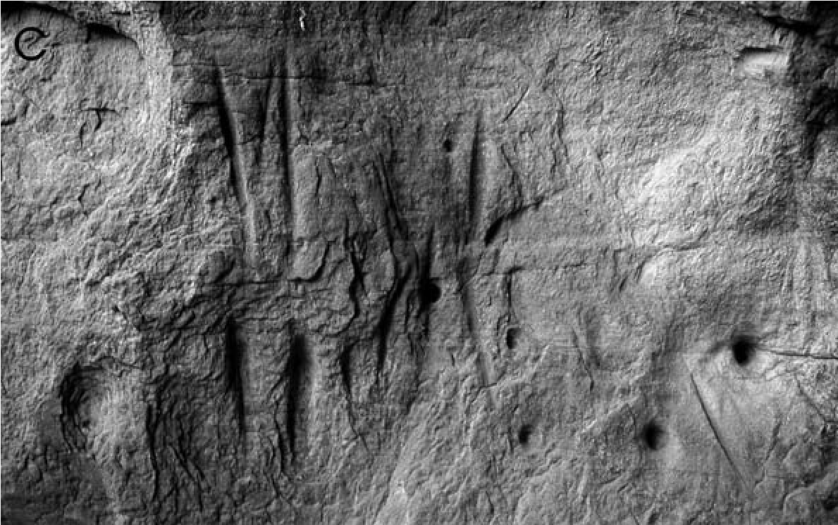
Concluding Remarks
Considerable evidence for a Yavapai presence has been identified in the Verde Valley. However, before the full story of the Yavapai people in central Arizona can be told, conceptions will need to be changed so that we can recognize what evidence exists, differentiate it from what we expect for more sedentary groups, and accept unobtrusive evidence for what it is.
Note
I thank Pat Hoyt of Orme School for organizing the excavation project; Alexander J. Lindsay, Jr., and Charles D. James, who supervised the Orme School excavations; and the Arizona Department of Transportation, which sponsored State Route 89A excavations and reports. I owe special thanks to Statistical Research, Inc., particularly Rein Vanderpot, Lisa Folb, and Carla Van West, for the State Route 89A excavations, and to Jim Holmlund and Ellen Brennan of Western Mapping Co. for the site map. Sandra Lynch, Amy Kelch, and Brenda Taylor of the Sharlot Hall Museum Library and Archives graciously provided last-minute help to obtain historic photographs. I also want to recognize the assistance from members of the Verde Valley, Flagstaff, and Yavapai chapters of the Arizona Archaeological Society, especially Tom Woodall and Walter Gosart. The Yavapai-Apache Nation and the Yavapai-Prescott Tribe generously provided funding for radiocarbon dating and helped us to understand their values and share their traditions. Members ofthe Camp Verde, Prescott, and Fort McDowell communities have taught me much about their Yavapai heritage. The work of their cultural preservation staff officers and the input of Yavapai tribal elders are invaluable.
20. It’s Complicated
Discerning the Post-Puebloan Period in Southern Nevada’s Archaeological Record
Heidi Roberts
When the first Euroamericans — Fray Francisco Dominguez and Fray Silvestre Velez de Escalante—traveled through Southern Paiute territory in southwestern Utah in 1776, they observed that some Paiute groups lived as foragers/ collectors while others, such as those in the St. George Basin of Utah, were farmers (Warner 1995). The Southern Paiutes who farmed lived in brush shelters rather than the adobe or masonry pueblos of the ancestral Virgin Puebloans who had occupied the same region before ad 1300, and they preferred basketry over pottery. This cultural disconnect between the sedentary life- ways of the prehistoric Virgin Branch Puebloan farmers and those of the mobile ethnographic Numic-speaking groups has typically been attributed to a population replacement. In other words, the region was abandoned by its Pueb- loan and Fremont farmers and then reoccupied by Numic groups that later learned to farm. The timing of this migration is typically placed after ad 1200 (Madsen 1975; Madsen and Rhode 1994; Sutton and Rhode 1994).
Various models have been proposed to explain the mechanisms behind this population expansion of Numic groups from their proposed homeland in the Mohave Desert near Owens Valley, California, into the Great Basin and northern portions of the Colorado Plateau (Aikens 1994; Aikens and Witherspoon 1986; Bettinger and Baumhoff 1982; Bettinger 1994;
Gunnerson 1962; Lyneis 1994; Madsen 1975; Madsen and Rhode 1994; Sutton and Rhode 1991). While the professional consensus is that this migration occurred after the Puebloan and Fremont abandonment of the region (Madsen and Rhode 1994), new archaeological data from southern Nevada paint a far more confusing and ambiguous picture, showing that the current migration model does not fit southern Nevada’s archaeological record (Roberts 2012; Roberts and Ahlstrom 2006).
This chapter synthesizes data from 51 excavated Post-Puebloan (ad 1300–1776) sites in southern Nevada and examines material culture, subsistence and settlement strategies, trade, interactions, and cultural identity (Roberts 2012). We can infer from these data that both ancestral Mojave (Patayan) and Numic groups moved into the region in a temporally fluid pattern of land use that makes cultural identification in the archaeological record complicated. Explanations other than population replacement can be invoked to understand the archaeological record’s complexity, such as Lyneis’s (1994) proposal that those groups that made Great Basin Brownware pottery were likely co-residents with the Pueb- loans before Puebloans abandoned the region. Shifting trade relationships between Great Basin groups and Puebloan groups could also account for the mixed appearance of archaeological deposits and the early thermoluminescence dates on Great Basin Brownware. This chapter demonstrates that a static “pots equal people” concept of culture inhibits understanding of the complex cultural dynamics during this period of culture change.
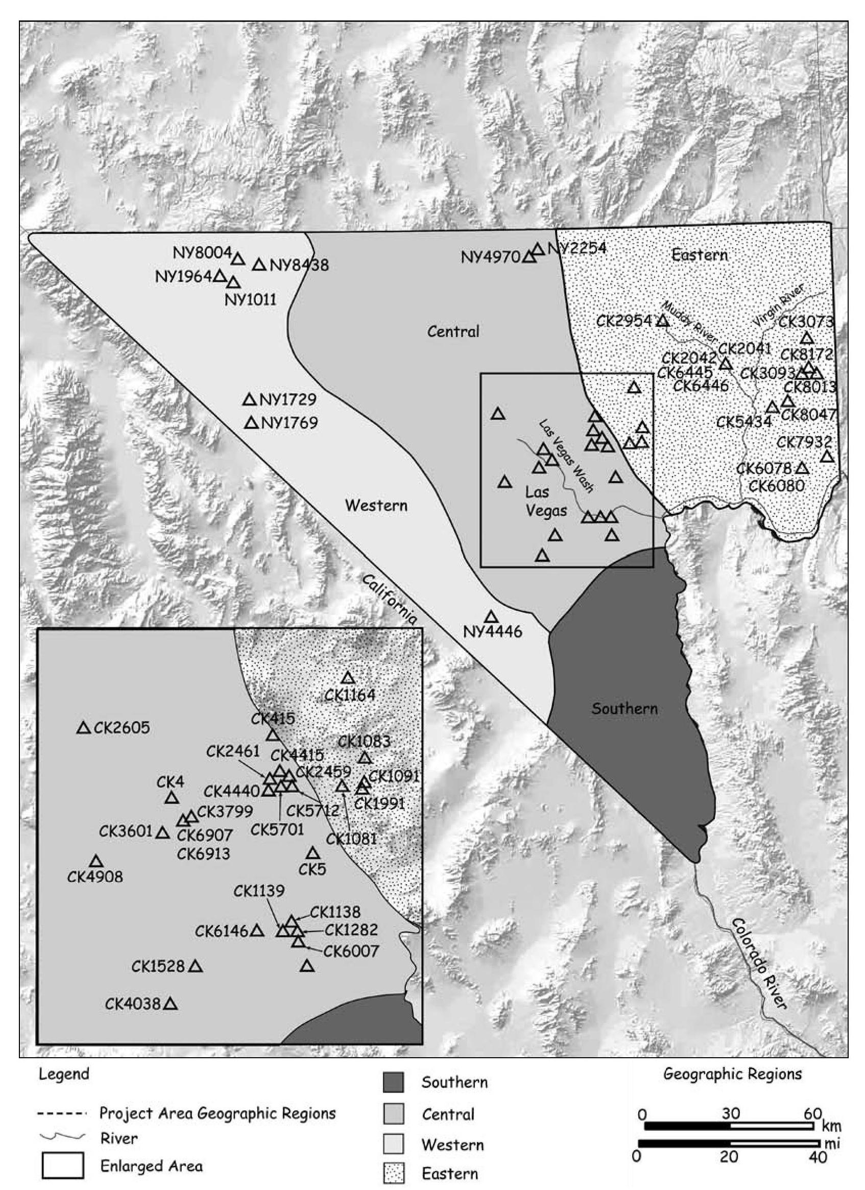
Southern Nevada’s Environment and Chronological Framework
Southern Nevada occupies the boundary between several cultural and environmental regions. It is typically included in the Great Basin culture area, yet its biotic environment is most like that of the Mohave Desert; moreover, it is hydrologically linked to the Colorado River system and therefore the American Southwest. As part of the Mohave Desert, the area possesses several economically significant plant and animal species, such as mesquite and agave, that do not extend northward into the Great Basin proper.
When the first Euroamericans explored the region, they found that southern Nevada was occupied by three bands of Southern Paiutes centered on the Las Vegas Valley, Pahrump region, and Moapa Valley. The bands had close ties to Chemehuevi groups and the Mojave people who lived in the Mohave Desert to the west and along the Colorado River to the south. These ethnographic culture areas roughly correspond to the four geographic divisions devised in the 2012 Prehistoric Context for Southern Nevada, and the regional cultural differences become evident in the archaeological record around 2,000 years ago (Roberts and Ahlstrom 2012a). The geographic divisions and radiocarbon-dated sites discussed in this chapter are shown in Figure 20.1.
The Archaeological Data (ad 1300–1776)
Fifty-one sites have been excavated in southern Nevada with radiocarbon dates or radiocarbon- dated components that fall within the period ad 1300–1776 (Ahlstrom 20i2:Appendix A). Many of the sites have radiocarbon dates that span the entire period or also contain earlier components. The following section briefly reviews the archaeological data from these excavated sites for each of the four regions of southern Nevada (Roberts 2012).
Western Region
Radiocarbon dates associated with this period have been obtained from two sites in Ash Meadows National Wildlife Refuge, two sites associated with artifacts in the Yucca Mountain area, and one site at the southern edge of the Western Region (see Figure 20.1; Roberts 2012: Appendix H). A single hearth associated with Great Basin Brownware at the Barnett site in Ash Meadows was used between ad 1150 and 1955. At the Fairbanks site, also in Ash Meadows, a radiocarbon date with a calibrated date range of ad 1400–1460 was obtained on charred prickly pear and thornberry seed fragments from an occupation surface (Eskenazi and Roberts 2011; Muto et al. 1976). Artifacts associated with this feature included groundstone, bifaces, and debitage. Although Southern Paiute people who occupied Ash Meadows during the Historic period were farming, the limited archaeological evidence for the Post-Puebloan period indicates wild plant processing and temporary camps rather than agriculture and pithouse habitations.
In the Yucca Mountain area (Figure 20.1; Roberts 2012:Appendix H) the Sever Tanks site contained a charcoal lens that yielded a calibrated radiocarbon date of ad 1280–1630 and a luminescence date on Great Basin Brownware of ad 1812 (Rhode 1994). The charcoal lens was associated with grinding implements and a Rose Spring point, which are used in the region by ad 500; an adjacent excavation unit yielded Great Basin Brownware and an incised stone. The second site in the Yucca Mountain area consisted of a cache in a rockshelter with a Paiute winnowing tray (twined), milling implements, grasses that were likely materials for basket making, a stone manuport, and a curved wooden artifact.
Unlike in the other three regions of southern Nevada, artifacts considered diagnostic of Southern Paiute groups dominate the few well-provenienced and securely dated sites in the Western Region. Great Basin Brownware is the most prevalent type, and a twined winnowing tray yielded a calibrated radiocarbon date range of ad 1525–1955. These dates may extend the Southern Paiute occupation of the Western Region back to the early part of this period. The sites are temporary camps, and archaeological evidence for farming is currently lacking. The association of incised stones at these sites also has important implications, which are discussed at length in the chapter’s conclusion.
Southern Region
Several sites were excavated in the Southern Region along the Colorado River, south of Hoover Dam, before the area was inundated by Lake Mohave (Baldwin 1948; Schroeder 1961; Wright 1954); however, only one of these, Catclaw Cave, has been thoroughly radiocarbon dated. Perhaps the most famous of the excavated sites is Willow Beach (Schroeder 1961), which was a stratified open site with evidence of use from the Archaic to the Post-Puebloan period. The upper strata contained an oval-shaped, burned hut (3 x 4 m in diameter) with a hearth located 15 cm below the surface. This feature was associated with tortoise shells with drilled holes, Olivella shell beads, bone, hematite, cotton cloth, a broken metate, yucca cordage, possible basketry fragments coated with pine resin, and a small assemblage of pottery consisting of four sherds: two Pyramid Gray, one Moapa Black-on-gray, and one Tusayan Whiteware.
Recently, Gilreath (2012) obtained 10 radiocarbon dates from basketry, cordage, and other perishables collected from the Catclaw Cave excavations (Wright 1954). Eight of the dates on basketry and cordage are “645 cal bp or younger,” which suggests to Gilreath (2012) that the main occupation, including the small habitation structure and cache pits, was during the Post-Puebloan period. Only a figure-eight sandal that dates to 1012 cal bp, grayware pottery, and Rose Spring/Saratoga Springs projectile points indicated an earlier occupation. The pottery assemblage was dominated by Pyramid Gray and other Patayan buffwares, and the ephemeral habitation was a shallow, concave, semi-rectangular depression (.85 x 1 m) with a partially plastered floor. Postholes were found in each corner, and some of them were rock lined. The house floor contained pits with fish bones, willow string, and a yucca pod. A Pyramid Gray sherd was found on the plastered surface.
This feature is the only Patayan habitation feature that has been excavated in the region, and its late date points to an ancestral relationship to the modern Mojave and Colorado River Indian Tribes. The structure does not resemble the Puebloan or Southern Paiute ephemeral brush structures that have been excavated in the Las Vegas Valley and at Willow Beach. Instead, its subrectangular shape suggests ties to the Ho- hokam region or to other lower Colorado River groups. This connection to culture areas of Arizona is supported by the coiled baskets, which according to Wright (1954:52) resembled Pima (Akimel Oodham) or Papago (Tohono Oodham) baskets. The figurines found at the site have stylistic similarities to Hohokam artifacts, particularly their narrow pinched noses (Neitzel 1991). They also resemble figurines collected during the Lost City excavations (Shutler 1961:Plate 78) and from Black Dog Cave (Winslow and Blair 2003). Long-distance travel or trade is indicated by the presence of a bison horn core and cotton string. The presence of gourds, maize, and fish bones indicates a farming economy supplemented by fishing, which is entirely consistent with historic Mojave strategies.
Central Region
Twenty-six archaeological sites in the Central Region contain components with radiocarbon dates that fall within the Post-Puebloan period (Figure 20.2). Most of the excavated sites are located in Las Vegas Valley or the surrounding foothills, and many were excavated because of urban expansion.
Sites excavated in the Central Region fall into several different types, including rock- shelters (n = 12), open camps with or without small thermal features (n = 10), middens (n = 2), fragile pattern sites (n = 1), and cache sites (n = 1). Fragile pattern sites are common in southern Nevada’s bajada, which is covered by a layer of pebbles, or “desert pavement” that occurs widely across the Desert West. In many locations the pebble surface has been disturbed by archaeological features that were the product of past human activity. These features include cleared circles in the pebble surface, complete or partial rings of rocks that are set into the ground surface, and cleared circles that are partially or entirely ringed by rocks (Figure 20.3). The archaeological sites that incorporate these features, the surface artifact scatters, or both the features and the artifacts are referred to as “fragile-pattern sites” because these remains are located primarily at the ground surface and, therefore, easily damaged or destroyed by modern human activity on the bajada. While many fragile-pattern sites have rock-ring features that may have functioned as informal habitations, no formal habitation features typical of more sedentary populations have been excavated in the region, except for a possible structure at the Corn Creek site (Hardin and Roberts 2013). Most sites are small rockshelters and open camps that contain associated hearths, small roasting pits, or large agave roasting mounds.
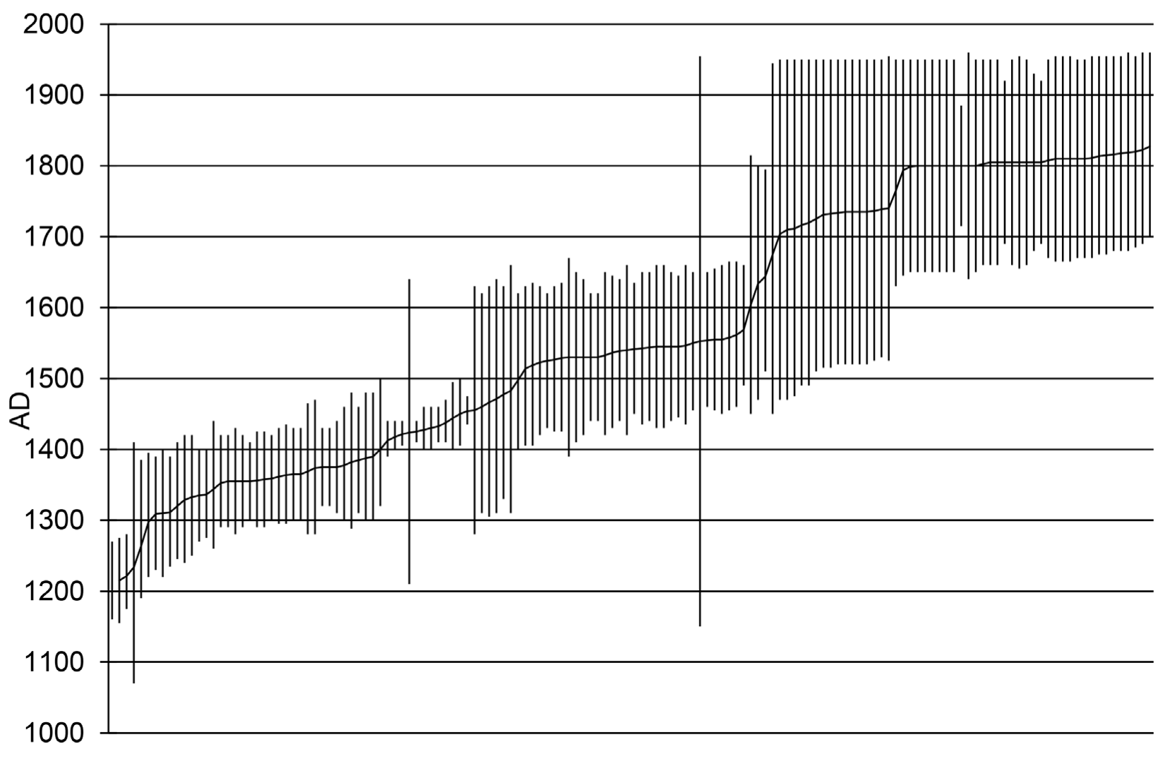
Wild plants and animals dominate the subsistence record for this period in the Central area (Roberts 20i2:Table 7.2), although maize pollen was recovered from two storage pits at the Larder site with a date range of ad 1430 to 1620 and one possible habitation structure at the Corn Creek site. During a recent monitoring project at the Corn Creek site north of Las Vegas, a possible pithouse was identified in a backhoe trench profile (Hardin and Roberts 2013). Without complete excavation we cannot be certain of the feature’s function; however, the analysis of pollen and flotation samples from the feature (Feature 72) included a single grain of maize, which hints at maize cultivation by the pithouse inhabitants. The flotation samples contained charcoal from juniper, mesquite, creosote bush, hackberry, and saltbush (Stuart 2013). The variety of wood charcoal in the sample indicates that juniper, creosote bush, and saltbush were used as construction materials but the hackberry and mesquite were burned for fuel (Stuart 2013). Seeds identified in the macrobotanical sample included saltbush and grass seeds. A triple intercept radiocarbon date with a 2-sigma calibrated range of ad 1680 to 1730 and ad 1810 to 1930 and post-1950 was obtained from charcoal and burned seeds.
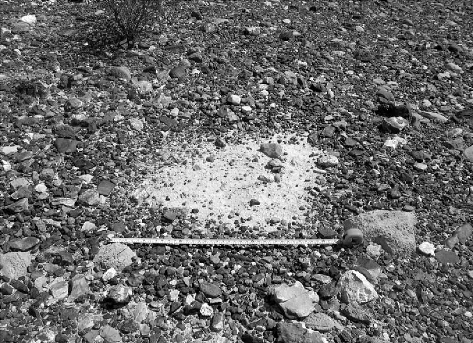
Archaeological evidence for maize cultivation by Post-Puebloan groups on a modest scale is accumulating elsewhere in the Southern Paiute culture areas, particularly the St. George Basin of Utah and the Moapa Valley of Nevada (Ahlstrom 2008; Allison et al. 2008). Maize from a structure excavated in the Moapa Valley was recently dated to the early nineteenth century from a house (House 46) at site 26CK8411 in the Moapa Valley (Gilreath 2012:Table 17). It is not clear if the habitation feature also dates to this late period or was reused. Wild plants recovered from sites excavated in the Central Region indicate that mesquite, chenopods, pine nuts, screwbeans, yucca, grass seeds, and various cactus species were important foods. Taken together, these data support a model of settlement mobility with a mixed economy and periodic movement to wild resource patches. This model is consistent with historic Southern Paiute subsistence strategies as outlined by Kelly’s consultants for southern Nevada (Fowler 2010).
Sites in the northern portion of the Central Region are more likely to be associated with Great Basin Brownware, whereas in the eastern Central Region graywares are present; buffwares dominate the Post-Puebloan site assemblages recovered from sites in Clark County Wetlands Park and at sites on lower Duck Creek. At the Corn Creek Dunes site, located north of Las Vegas, Great Basin Brownwares are associated with Post-Puebloan thermal features, and the brownware pottery was made with the same temper as the earlier graywares (Lyneis 2011a). Desert Side-notched points dominate the projectile point assemblages recovered from components excavated in the Central Region.
Eastern Region
Twenty archaeological sites contain components with radiocarbon dates that fall within the Post-Puebloan period in the Eastern Region (see Figure 20.1). Most of the sites are clustered in the California Wash area on the eastern edge of the Eastern Region or in the Gold Butte area at the western edge. Two of the sites are located in the upper Moapa Valley along the Muddy River, and radiocarbon dates associated with this period were also recovered from the Yamishita sites on the lower Muddy River (Lyneis 2012) and House 46 (Harry 2008). Sites excavated using modern methods are clustered outside the major modern population area of the Moapa Valley primarily because development projects and land management projects were focused on these regions rather than the Moapa Valley. Early research in the Moapa Valley (Shutler 1961) and recent investigations by Lyneis (2012) and Harry (2008) demonstrate that Post-Puebloan use was extensive during this period.
Sites excavated in the Eastern Region fall into several different types, including rockshel- ters (n = 6), open camps with or without thermal features such as agave mounds (n = 6), and middens (n = 3). No fragile-pattern sites or open cache sites have been investigated in this region. Formal habitation features are also missing, although earlier Puebloan habitation structures were frequently reused and middens are present (Lyneis 2012; Harry 2008). The majority of the sites are small rockshelters and open camps with associated hearths, small roasting pits, or large agave roasting mounds. Agave mounds are particularly well represented in the Gold Butte area along the Utah-Nevada border (McGuire et al. 2010) and California Wash area (Blair 1986); many of these sites also contain earlier components.
Economic plant data have been recovered from only four of these sites, and the wild plants represented in the samples processed include goosefoot, pine nuts, grasses, tansy mustard, saltbush, seepweed, cheno-ams, sedge, and bulrush (Roberts 2012:Table 7.2). As mentioned previously, maize was recently radiocarbon dated to the early nineteenth century from a house at site 26CK8411 in the lower Moapa Valley (Gil- reath 2012:Table 17). Harrington (1930) reported that Paiute Cave, which has not been radiocarbon dated, contained stratigraphic evidence that maize was stored in pits during the Post- Puebloan occupation of that site.
Most sites in the Eastern Region contain mixed assemblages of graywares, Great Basin Brownware, and buffwares. Buffwares were common pottery at the Post-Puebloan sites in the Gold Butte area (McGuire et al. 2010), and Great Basin Brownware is most often associated with sites in the Moapa Valley. The temporal and cultural implications of these assemblages are discussed in detail later in this chapter.
As in the Central Region, Desert Side- notched points dominate the assemblages from excavated sites in this area regardless of period. If the total number of points are tallied from excavated sites (n = 46) in this region, the percentage of each type is as follows: Desert Side- notched, 57 percent; Rose Spring, 13 percent; Elko Corner-notched, 17 percent; Cottonwood Triangular, 6 percent; and Eastgate, diagnostic of the earlier Puebloan period, 4 percent. Desert Side-notched points are temporal indicators of the Post-Puebloan period.
Chronology
The 138 radiocarbon dates that fall into the Post- Puebloan period (see Figure 20.2) represent 35 percent of all of the dates accumulated for southern Nevada. What these dates demonstrate is that the region continued to be used extensively during and after the abandonment by the Virgin Puebloans. A cursory look at the distribution of the mean dates for the Post-Puebloan period shows that with two exceptions the dates are fairly evenly distributed throughout the period. Only during the ad 1200s (see Roberts and Ahl- strom 2012a:Fig. 6.4) and ad 1500s and 1600s do the numbers fall from approximately 20 radiocarbon dates per century to four or five dates per century. Although these data provide insight into the changes in the number of dated components through time, they should not be viewed as representative of the actual human population.
Projectile Points
Single-component sites that contain only one episode of use, or were used for a short period of time, can shed light on what artifacts are temporally sensitive during this period. Regional archaeologists generally consider the Desert Side-notched points (including Sierra Side-notched and Delta Side-notched) and the Cottonwood Triangular points to be diagnostic types for this period (Jennings i986:Fig. 3; Justice 2002a, 2002b; Thomas 1983; Warren and Crabtree 1986:192), and both point styles are widely distributed throughout the Great Basin and Southwest (Justice 2002a, 2002b:Map 46). Justice (2002a) shows the distribution of Cottonwood Triangular points as extending north to Oregon and southern Idaho, west to the California coast, and east to western New Mexico and Colorado. Desert Side-notched points are typically viewed as a Great Basin style; however, following Justice (2002a, 2002b), they closely resemble Pueblo Side-notched points. If Pueblo Side-notched points are grouped with Desert Side-notched, then their distribution covers California, the Great Basin, and most of the Greater Southwest (Justice 2002a:Map 43). Both the Pueblo Side- notched and Desert Side-notched points are found in the archaeological record after ad 1150, and their use continues into the Historic period. Justice (2002N368) concludes that Cottonwood Triangular points appear in the archaeological record slightly earlier, around ad 900. Their use also extends into the Historic period.
Of the 11 single-component or short- occupation radiocarbon-dated Post-Puebloan sites in our project area, four contain projectile points and all but one of these four sites contain Desert Side-notched points to the exclusion of other types (Roberts 2012:Tables 7.1 and 7.2). Three Desert Side-notched points were recovered from a small campsite (26CK6913) occupied between ad 1300 and 1400 in the Central Region (King et al. 2006); one of the obsidian points was sourced to the Modena/Panaca source. In the Eastern Region two single-component sites, the Coyote Springs Rockshelter (26CK2954) (Harper 2006) and the Dune Field site in the Gold Butte region (26CK8013; McGuire et. al. 2010), contained only Desert Side-notched points; Coyote Springs Rockshelter had six points (Harper 2006), and the Dune Field site had three (McGuire et al. 2010). Both of these sites were occupied sometime between ad 1520 and 1950. Euroamerican artifacts found at the sites demonstrate use as late as the Early Historic period. Only one of the single-component sites, Sever Tanks, which was located in the Western Region of the project area, did not have Desert Side-notched points. The three projectile points collected during the test excavations at that site included one Rose Spring point and two unknown types (Pippin 1984).
Cottonwood Triangular points were not recovered from any of the single-component Post- Puebloan sites, but they were well represented in multiple-component sites, a circumstance that may be related to sample size. Cottonwood Triangular points were associated with six (15 percent) of the multiple-component sites, and Desert Side-notched points were recovered from 14 (35 percent). Only four sites contained both Cottonwood Triangular and Desert Side- notched points, and three (26CK5, 26CK1139, and 26CK4908) of these four sites were located in the Central Region. The fourth site— 26CK1081—is a small rockshelter located in the Eastern Region.
Five rockshelters (26CK5 [Room 1], 26CK1081, 26CK1139, 26CK4038, and 26CK5712) were used extensively throughout the Post- Puebloan period with occupation beginning around ad 950; they contained Elko Corner- notched, Rosegate, Humboldt, Cottonwood Triangular, and Desert Side-notched points. Garrett’s Shelter (26CK5712) contained a dartlike point. This point type has been reported throughout the Southwest between 1600 bc and ad 300 (Justice 2002a:174). Elko Corner-notched points are common throughout the Great Basin and Southwest between 1500 bc and ad 700 (Justice 2002N312), while Rosegate (Rose Spring Corner-notched, East Gate Expanding Stem, and Parowan Basal-notched) points are common in the Great Basin and are associated with the introduction of the bow around ad 500 to ad 1300 (Justice 2002b).
In summary, the data from these sites suggest that Desert Side-notched points are the most temporally sensitive projectile point style of the Post-Puebloan period in southern Nevada. While other point types may be associated with this period, Desert Side-notched points appear to have been introduced to the area after AD 1200.
Pottery
Most of the single-component sites that date to this period lack associated pottery; in fact, only three (Sever Tanks, Dune Field site, and Coyote Springs Rockshelter) out of 11 singlecomponent Post-Puebloan sites contain pottery. The Dune Field site (26CK8013), located in the Gold Butte area, postdates ad 1515. Eight Great Basin Brownware sherds and 86 corrugated Great Basin Brownware sherds from a single vessel were recovered from the site. A lead musket ball found on the surface of the site supports an Early Historic period date. The Sever Tanks site (26NY1964) is located in the Western Region and was investigated as part of the Yucca Mountain Project (Pippin 1984; Rhode 1994). The pottery assemblage from this site included five plain Great Basin Brownware sherds, three corrugated and/or incised Brownware sherds, and one Snake Valley Gray Fremont sherd. A thermoluminescence date of ad 1081 ± 100 was obtained from one of the obliterated corrugated brownware sherds, and a thermoluminescence date of ad 1812 ± 14 was obtained from a plain brownware sherd, clearly distinguishing the two components (Roberts 2012:Table 7.3). The third site, the Coyote Springs Rockshelter (26CK2954), also had associated historic Euroamerican artifacts. Four Great Basin Brownware sherds and three Virgin Series sherds were found in the rockshelter. Luminescence dates were obtained on four of these sherds. Three dates, on a North Creek Black-on-gray sherd (Roberts 2012:Table 7.3) and two brownware sherds, fell within the expected eighteenth-century range. A fourth sherd, a North Creek Gray sherd with an everted rim, dated to ad 1250 ± 38, suggesting the sherd was made well before the main period of use of the shelter.
Ceramic data have been used by regional scholars to suggest both overlap and no overlap between the earlier grayware-producing Pueb- loan groups and later brownware-using mobile peoples. In discussing the Numic expansion, Lyneis (1994) closely examined the region’s archaeological record with the goal of tracing the arrival of Great Basin Brownware in southern Nevada. Based on her reevaluation of the Great Basin Brownware collected during the Lost City excavations, she was able to dismiss Shutler’s (1961) claims that the Southern Paiute occupation overlapped with the Virgin Puebloan occupation because he mistakenly identified Shivwits Plainware as Great Basin Brownware. She also noted that the large ceramic assemblages recovered from three late sites in the Moapa Valley— the Steve Perkins site, Bovine Bluff, and Mesa House—entirely lacked Great Basin Brownware ceramics. This meant that there was a clear distinction between the later brownwares and the earlier graywares, suggesting that there was no overlap in the presence of these groups.
Nevertheless, other claims for contemporaneity in the production of these two types of pottery and therefore contemporaneity of mobile and Puebloan groups are more difficult to dismiss. Conaway and O’Malley caves, located just north of the present project area in the Meadow Valley, contained stratified cultural deposits with undisturbed strata that included Virgin Pueb- loan, Fremont, and Great Basin Brownware pottery. Fowler and others (1973) concluded that all three of the wares were contemporaneous. Using luminescence dating, Rhode (1994) directly dated some of the pottery recovered from these levels. The dates, shown in Table 20.1, lend support to the excavator’s conclusion that the brownware and grayware types may indeed be contemporaneous. Lyneis (2012) recently recovered brownware pottery from the Virgin Puebloan Yamashita sites, and her radiocarbon results and luminescence dates on brownware and North Creek Gray lend additional support to the possibility that both pottery types were made in the Muddy River area in the early part of this period (see Table 20.1). If we assume that the luminescence dates shown in Table 20.1 are a correct reflection of the pottery’s manufacture date, then we must conclude that Great Basin Brownware was made in the region as early as ad 800. Furthermore, the Virgin Series Graywares and Fremont Graywares continued to be produced much later than previously assumed. Both of these inferences substantially change notions about the sequence of use and replacement.
Table 20.1. Thermoluminescence Dates on Pottery Collected from Post-Puebloan Period Components.
| Lab Sample | Site Number | Sample Type | Cat. # | Provenience | Age Years AD | Reference | |
| UW1056 | 26CK2954 |
Great Basin Brownware |
FN 57 |
24N26E, Stratum A |
1820±52 | Harper 2006s | |
| UW1057 | 26CK2954 |
North Creek Black-on-gray |
79 |
23N23E, Stratum A |
1749±42 | Harper 2006 | |
| UW1058 | 26CK2954 |
Great Basin Brownware |
179 |
21N26E, Stratum A |
1793±22 | Harper 2006 | |
| UW1059 | 26CK2954 |
North Creek Gray (everted rim) |
155 |
20N24E, Stratum A |
1250±38 | Harper 2006 | |
| UW1074 | 26CK2042 |
Yamashita-5S North Creek |
Corrugated | A232-0781 |
298N105W, -55 to -62 cm |
1274±58 | Lyneis 2012 |
| UW1075 | 26CK6445 |
Yamashita -2 Great Basin |
Brownware |
A229-3348 210N80W, -30 to -35 cm |
1521±59 | Lyneis 2012 | |
| UW1076 | 26CK6445 |
Yamashita-2 Great Basin |
Brownware |
A229-3722 212N64W, -30 to -40 cm |
1312±77 | Lyneis 2012 | |
| UWTL-64 | 26NY1964, Sever Tanks | Brownware, obliterated finger-impressed corrugations | N/A Unknown | 1081±100 | Rhode 1994 | ||
| UWTL-81 | 26NY3042, Dune Wash | Brownware | N/A | Unknown | 1496±35 | Rhode 1994 | |
| UWTL-83 | 26NY3022, Azrael Ridge | Brownware | N/A | Unknown | 1532±28 | Rhode 1994 | |
| UWTL-67 | 26NY1964, Sever Tanks | Brownware | N/A | Unknown | 1812±14 | Rhode 1994 | |
| UWTL-84 | 26NY3055, Prow Pass | Brownware | N/A | Unknown | 1814±14 | Rhode 1994 | |
| UWTL-63 | 26NY5842 | Brownware | N/A | Unknown | 1836±19 | Rhode 1994 | |
| UWTL-89 | Conaway | Shelter | Snake Valley Gray |
FS78/8 Feature 20, Stratum IV |
1066±74 | Rhode 1994 | |
| UWTL-88 | Conaway | Shelter | Brownware | FS78/9 |
Feature 20, Stratum IV |
822±105 | Rhode 1994 |
| UWTL-91 | O’Malley | Shelter | Snake Valley | Black-on-gray |
FS 195/20 Stratum 17, Unit V |
1512±41 Rhode 1994 |
What can the rest of the multicomponent sites that were used over a period of hundreds of years tell us about the earliest and latest manufacture dates for these pottery types? Does a pattern emerge if we group the sites together into two-hundred-year intervals: ad 1200–1400, ad 1400–1600, and post-AD 1600? Eight sites (Gypsum Cave Room 1, Burial site, Pardee site, 26CK6007, Yamashita 5S, Tule Springs Locus 41, 26CK6913, and 26CK6907) have radiocarbon date ranges that fall exclusively within the AD 1200 to 1400 period, and half of these are associated with pottery (Roberts 2012). Significantly, three of these sites contain only North Creek Gray, North Creek Corrugated, or North Creek Black-on-gray pottery, and one component (Yamashita 5S) is dominated by North Creek Corrugated, which suggests that use and possibly manufacture of Virgin Puebloan pottery continued to ad 1400. The fourth site, the Pardee site, contained three Great Basin Brownware sherds and 26 North Creek Gray sherds, suggesting that brownware was in use.
There are four sites (Larder site, Fairbanks Spring, 26CK8163, and 26LN2254) with components that date to the next 200-year period, between ad 1400 and 1630, and none of these components is associated with pottery (Roberts 20i2:Appendix H). Four sites (Cedar Basin Midden, 26CK7932, Dart Shaft Shelter, and Firebrand Cave) contain components that postdate ad 1600; all are located in the Gold Butte area (McGuire et al. 2010). Pottery was associated with two of these sites, including the late component at the Cedar Basin Midden, which contained 9 buffware sherds, 7 Logandale Gray, 14 Moapa Gray, and 28 Tusayan Grayware sherds; and the late component at Dart Shaft Shelter, which included 1 Paiute Brownware, 1 Shivwits Plain, and 1 Tusayan Grayware sherd.
The dominance of North Creek Gray, found in the earliest sites to the exclusion of other pottery types, was followed by a dearth of pottery in the next two centuries. This distribution may represent continued manufacture of North Creek Gray by Puebloans into the ad 1300 or 1400s and then abandonment of the region by these groups between ad 1400 and 1600. The argument for continued manufacture is supported by the thermoluminescence dates from the Coyote Springs site. The pattern of variable pottery types in the Gold Butte area, if it is in fact a valid trend and not simply the result of component mixing, could reflect an eastern migration by Virgin Puebloans. In fact, radiocarbon dates and the prevalence of corrugated pottery in that area hint that use of the Gold Butte area spiked after the Pueblo II period (McGuire et al. 2010:Fig. 99). Could this area have served as a Puebloan population refugia or a seasonal resource procurement area for Virgin Puebloans who migrated to the upland regions of the Virgin Mountains and Shivwits Plateau?
What is the chronological relationship between Puebloan (North Creek Grayware, Virgin Series, and North Creek Whiteware) and Patayan (Lower Colorado Buffware and Tizon Brownware) pottery in the region? The radiocarbon-dated Post-Puebloan components in the present project area frequently contain mixed assemblages of pottery represented by Great Basin Brownware, Lower Colorado Buffware, Tizon Brownware, and Puebloan graywares and brownwares, although Patayan pottery is dominant in dated sites that have small assemblages (Roberts 20i2:Fig. 7.9). In the past, some of the confusion regarding pottery distinctions is likely related to the misidentification of Shivwits Brownware, which is a Puebloan utility ware, with Great Basin Brownware, which is typically considered a Southern Paiute utility ware (Lyneis 20i2:Appendix I).
Regardless of these potential sources of confusion, if pottery assemblages from Post- Puebloan sites are examined on a region-byregion basis, there is a tendency for sites in the Western Region to be dominated by Great Basin Brownware. The northern and eastern halves of the Central Region tend to be dominated by Puebloan wares and Great Basin Brownwares. Sites in the southern edge of the Central Region are dominated by Patayan wares (Ahlstrom 2003; Brooks et al. 1975; Rafferty 2008; G. Seymour 1997), and Puebloan wares and Great Basin Brownwares dominate the pottery assemblages of sites in the Moapa Valley and California Wash areas of the Eastern Region. This suggests that pottery traditions were dynamic and undergoing changes.
Recent research along the Colorado River in the Eastern Region, however, suggests that Patayan types are dominant (McGuire et al. 2010). During the Puebloan period Patayan pottery types are documented at Lost City sites in the Eastern Region (Lyneis 1988), although not in the quantities claimed by Shutler (1961). It seems, then, that the closer a site lies to the Colorado River, the more likely that its pottery assemblage is dominated by Patayan wares. Colton identified the demographic potential of the prehistoric Patayans and their Yuman-language-speaking descendants. He noted that these groups were characterized by “a dense... population producing a surplus of food [and] a surplus population that radiated out on all the important trails where subsistence was possible” (Colton 1945: 118). The distribution of buffware ceramics suggests that this included movement into portions of the Southern Nevada Region. Still, much of this distribution may instead have resulted from the movement of pots as trade items.
G. Seymour (1997) and Rafferty (2008) have suggested that this shift in the dominant pottery types from Puebloan to Patayan wares after ad 1100 in the Central Region represents a population movement into southern Nevada of people living along the Colorado River. Roberts and Ahlstrom (2012b) believe that this pattern reflects shifting alliances and trade routes. They hypothesized that before ad 1200, trade goods such as shell and turquoise flowed into the Southwest through the Virgin Puebloan region. After this date proto-Mojave groups dominated the shell trade, and exotic goods moved to the east via the Mojave and Pai regions south of the Colorado River.
The archaeological record and the ethno- historic record reveal that pottery technology during the Post-Puebloan period is dynamic and undergoing change, yet there are hints that some level of technological continuity exists with the earlier period. For example, the Puebloan occupants of Corn Creek and Ash Meadows used the same temper in their grayware and corrugated grayware as was used by Corn Creek’s later residents in their buffware and brownware (Lyneis 2011a, 2011b). In southwestern Utah, Great Basin Brownware is made using a coiling technique, it is sometimes corrugated, and a variety of shapes that are not typically associated with Great Basin Brownware have been described.
The problems inherent in equating ceramic technology, namely pottery types, to linguistic or ethnic groups was made powerfully clear by one of Isabel Kelly’s consultants in the 1930s (Fowler 2010). Daisy Smith provided Kelly with a detailed description of pottery making in the Las Vegas Valley. Smith was born in Las Vegas to a Southern Paiute family, and she married a Chemehuevi man named Bishop Smith (Fowler 2010). After her marriage she lived at times in the Chemehuevi Valley and in Las Vegas. When Kelly asked her to describe pottery making in the Las Vegas Valley, she described manufacture techniques for buffware rather than Great Basin Brownware, despite that fact that she considered her pottery to be the Las Vegas style (Fowler 2010:182) rather than the Mojave style. She said she obtained her clay from Cottonwood Island, located over 60 miles south on the Colorado River, and the temper she used was a white rock from the Las Vegas Valley that was heated. She described making pottery vessels into buffware shapes using paddle-and-anvil techniques. An archaeological site containing sherds from her vessels would be labeled Patayan, when in reality the makers of the vessel were Chemehuevi and Paiute. If the clay was sourced, it would be shown to have been made on Cottonwood Island, and if the temper was sourced, it would indicate a Las Vegas Valley origin.
Textiles
The distribution of baskets, sandals, and other types of perishables varies through time and space and is considered by some to be diagnostic of ethnic groups within the Great Basin (Ado- vasio 1986; Fowler and Dawson 1986). In the eastern Great Basin, Fremont basketry is one- rod-and-bundle; stacked foundation coiling and multiple rod coiling were also present. The one- rod-and-bundle type disappeared completely after ad 1200 in the Fremont regions. Parching baskets in these areas were replaced with twined forms similar to ethnographic types (Adovasio 1986). Virgin Puebloan types are also dominated by coiling, although multiple rods are typical.
In 1994 C. Fowler compared more than 800 Southern Paiute-provenienced objects, representing a period of collecting from 1867 into the 1930s, with their Virgin Puebloan equivalents. Objects included baskets, bows, arrows, quivers, ladles, tortoiseshell dishes, clubs, nets, cordage, rabbit hooks, figurines, games, arrow gear, pipes, brushes, chipped stone, clothing, cradles, groundstone, horse gear, beads, and pottery. She concluded that there are continuities and discontinuities in the assemblages: “Some of the general type, perhaps reflecting an older cultural base common to the whole of the region: use of netting, cordage, basketry, ground stone, etc. Others would seem to reflect a great degree of relationship, such as the figurines, certain features of coiled basketry, one sandal type, etc” (Fowler 1994:110). Fowler found that Southern Paiute basketry types contained more diverse types and techniques than Northern Paiute types (Fowler 1994:108). She suggested that Southern Paiute coiling “bears some relationship to that of the Anasazi, although never exactly” (Fowler 1994: 108–109). The flat coiled tray, for example, goes back to at least Basketmaker III times (ad 600) in this region, although these early foundation types and decorations are unlike Southern Paiute forms. By Pueblo III times (ad 1200), similarities are greater, including some use of a characteristic Southern Paiute splice type (Fowler 1994:109). Her analysis suggested that both Southern Paiute and Virgin Anasazi sandals are variable in form and technique (Fowler 1994:109).
Eight sites that date to the Post-Puebloan period in southern Nevada contain perishables such as basketry, sandals, and cordage. The earliest cordage recovered from a Post-Puebloan period site is two pieces of cordage from Room 1 of Gypsum Cave in the Central Region. Cotton and yucca cordage (S-twist, which is a hallmark of Numic basketry) from this room have a combined calibrated radiocarbon date of ad 1050 to 1390. Yucca cordage (two-ply, Z-twist—a more ancient technology—and S-twist) was also recovered from Garrett’s Shelter in the Central Region.
Twined basketry was collected from three sites. Two closed-twined winnowing trays (two rods with an up-to-the-right slant) were recovered from the Mended Basket site (26CK4038) in the Central Region and radiocarbon dated to ad 1240 to 1420, and another twined winnowing tray, from site 26NY8004 in the Western Region, produced a date range of ad 1525 to 1955. One fragment of a close diagonal twined basket was excavated from a cave site—26CK4446—in the Western Region. According to Fowler (1994:108), twined Southern Paiute basketry is predominantly diagonally twined with an up-to-the- right direction of twists. The baskets found in both of these project areas are consistent with this pattern.
A rockshelter (26CK4415) in the Central Region contained two sandals that were both radiocarbon dated. Specimen 1 was made of yucca fiber and was roughly rectangular with a rounded toe area and square heel. The construction technique was twined, and the calibrated radiocarbon date was ad 1445 to 1645. The other sandal (Specimen 2), with a calibrated radiocarbon date range of ad 1510 to 1795, is a plain-weave figure-eight-type sandal. Another plain-weave sandal was recovered from the Flaherty Rockshelter in the Central Region and radiocarbon dated to ad 1440 to 1640. Barker (2008) recently reviewed the figure-eight sandal type and its spatial and temporal distribution within the Great Basin and concluded that it is abundant in the Great Basin since the Archaic period.
Settlement Patterns and Systems
Throughout this period, site types change from reoccupied Puebloan sites in the Moapa Valley and large open midden sites in the Central Region to highly mobile camps occupied by small numbers of individuals. Some of the larger open sites also contain midden deposits, sometimes as much as a meter deep, which represent the accumulated debris from short-term camps that were reused for hundreds of years. The fact that nonlocal plant foods, such as pine nuts, are found at some of the valley’s Post-Puebloan sites suggests that a seasonal round was practiced that may have resembled the historic Southern Pai- ute pattern described by Kelly (Fowler 2010): fall relocation to the mountains to harvest pine nuts and hunt, followed by spring agave roasting camps and then summer camps around springs where farming was done on a small scale.
The archaeological record suggests that farming may have continued, but probably on a smaller scale than during the preceding Puebloan period, and the evidence is convincing only in the Central Region at the Larder site (Ahl- strom 2008), where maize was stored in pits. In the poorly watered arid slopes between the Central and Eastern regions, people foraged for plants and tortoises between ad 1300 and 1600.
In the Moapa Valley of the Eastern Region, room blocks consisting of habitation features, several adobe storage rooms, and central work plazas drop out of the archaeological record after ad 1200. Some of these abandoned features were reused as windbreaks for hearths at the Yamashita sites after ad 1300 (Lyneis 2012: Appendix D). So here the question becomes, was this expedient use by mobile groups that were in general contemporaneous with Puebloans but used this abandoned site, or is this a region-wide replacement, representing a sequence of abandonment, inward movement, and replacement? In the eastern edge of southern Nevada in the Gold Butte area, McGuire and others (20i0:Figs. 98, 99) see an increase in use during the Pueblo III period (ad 1200–1300), which is supported by the pottery types, obsidian dates, and radiocarbon dates. This pattern is also found in the Western Region, where sites are rockshelters with caches, while in the Ash Meadows area, open campsites with hearths are associated with locally made brownware pottery.
Rockshelters were favored camping locations between ad 950 and 1200 in the Central Region, and then, between ad 1250 and 1300, camps shifted to open sites. The rockshelters that date to the early part of the Post-Puebloan period were used sporadically since about ad 950, and all are situated away from the central population centers of the Las Vegas and Moapa valleys in the low foothills surrounding the valleys. Ahl- strom and Roberts (1999) observed that these camps were used overnight or for a few days and that people were exploiting the resources of the arid slopes. Southern Paiute elders who were asked their opinions felt that relocation into rockshelters reflected raiding or invasion by other, nonresident populations. They suggested that the population’s relocation to the more peripheral and rugged uplands region between the core settlement areas of the Las Vegas and Moapa valleys signaled the arrival of enemy groups (Southern Paiute Language Group, personal communication 2001). Regardless of their ethnic affiliation, these sites reflect use of marginal areas, surrounding the lush river valleys, by mobile people who are different from those settled along the rivers.
During the Post-Puebloan period in the Eastern Region, cache pits in caves and rock- shelters replace surface storage. The caching of material culture and food in caves or subsurface pits was a common practice throughout prehistory, but particularly in southern Nevada during the Archaic, Early Basketmaker, Late Pueblo II, Post-Puebloan, and Historic periods, when a more mobile lifeway was practiced. When settlement patterns became less mobile during the Basketmaker III, Pueblo I, and early Pueblo II periods, linked adobe rooms situated next to habitation features were used for storage.
Gilman (1987), and more recently Metcalf (2008), links food storage to settlement mobility and defense. Metcalf has studied storage structures in the Range Creek Fremont sites in Utah, where 62 granaries were built on the edges of cliffs or in other precarious settings. To learn more about storage choices, Metcalf examined the literature on animal behavior and learned that there are two types of storage behavior: larder storing and scatter storing, or hoarding. “Larder storing is usually centralized, in areas where the stores can be defended. Scatter storing is what animals do when they cannot defend their stores in a central location or they leave the area for substantial lengths of time” (Metcalf 2008:121). Applying this behavior to Range Creek’s cliff granaries and subsurface storage pits, Metcalf concluded that two behaviors could account for the granaries: seasonal mobility and protection from raiders. This same reasoning can explain the shift in storage behavior in the Moapa Valley from adobe rooms linked to habitations to buried pits in caves.
The shift in storage behavior, particularly in the Eastern Region, implies a disruption in the settlement system beginning in the Central Region around ad 950 and in the Eastern Region after ad 1150 to 1200. In the Central Region there are other hints of this disruption. For example, the presence of intaglios throughout southern Nevada (Rafferty 2012) and Patayan pottery indicate that Patayan or proto-Mojave groups may have expanded north along the Colorado River into the Central Region. Patayan pottery has also been found in the Moapa Valley region, although the relationship between the Puebloan and Pa- tayan groups in the Eastern Region is far from clear. What is evident is that habitations, and sites in general, become less permanent and site size decreases, which suggests that settlement size, and possibly social complexity, decreases and shifts to smaller groups.
Subsistence
Macrobotanical and pollen samples have been processed from 18 of the sites with components that date to this period, and faunal remains have been collected and analyzed from 23 sites in the Central Region. These data suggest that the region’s Post-Puebloan occupants relied primarily on wild plants and animals and possibly practiced some farming (Roberts 20i2:Table 7.2). The evidence for use of cultigens during the Post-Puebloan period continues to accumulate; however, it is clear that farming, if practiced, was done on a much reduced scale from the earlier Puebloan period. This pattern is consistent with the early ethnographic data collected in the region (Fowler 2010; Kelly and Fowler 1986).
Six of the excavated sites that date to this period contain evidence of cultigens—squash, maize, and beans. Only one site, the Larder site (Ahlstrom 2008) in the Central Region, contained convincing evidence for small-scale gardening of maize by the region’s occupants before the arrival of Euroamericans. The Larder site contained hundreds of small storage pits, and the site appears to have served a storage and food processing function fairly continuously for 2,000 years. Using the pollen and macrofloral evidence from the Larder site, Ahlstrom (2008) has argued that small-scale gardening, like that practiced historically by Southern Paiute and Chemehuevi bands (Fowler 2010), began in the Central Region as early as 200 bc and continued throughout the Puebloan and Post-Puebloan periods.
The other five sites lack pollen evidence that would suggest the plants were grown or processed nearby. Squash seeds were recovered along with wild plants from one of the earliest occupied rockshelters, the Mended Basket site (ad 943–1473) in the Central Region. Maize and squash were recovered from a rockshelter in Clark County Wetlands Park, 26CK1139, in that same region, and Ahlstrom (2003) reported calibrated date ranges of ad 1600 to 1950 on a kernel and cob of maize from that site. A similar date was obtained from maize collected from an open site in Clark County Wetlands Park (26CK1282) (Ahlstrom 2003). Maize, beans, and squash were reported from Harrington’s excavations in Room 1 at Gypsum Cave in the Central Region, and three were radiocarbon dated after the recent reanalysis of the collections (Gilreath 2009, 2012). The latest date on one of these cobs yielded a median probability date of ad 1234. Harrington (1930) also reported finding maize and squash in the Paiute levels at Paiute Cave in the Eastern Region, and a late date was obtained on maize from House 46 in the Moapa Valley by Gilreath (2012:Table 17). While evidence is accumulating for continued small-scale farming, it is also possible that some of the cultigens could have been obtained through trade networks with Patayan or other groups.
Trade and Exchange
Because the excavated Post-Puebloan sites often include earlier components, and the pottery assemblages contain several different wares, it is difficult to determine which pottery was locally made and which types were obtained through trade. With that caveat, it appears that Patayan wares dominate the southern portion of the project area and Great Basin Brownware dominates the assemblages of the Western Region, as well as the northern portions of the Central and Eastern Regions. These data suggest that contacts increased with Patayan or proto-Mojave groups living along the Colorado River. Although we do not currently understand what form these relationships took, intaglio features, which are usually linked to Pai groups, are found throughout the Central and Southern regions (Rafferty 2012).
While contacts increased with the Colorado River groups, the dissolution of the Virgin Puebloan and larger Puebloan system may indicate that ties with the Southwest lessened. Hopi Yellowware, which is found throughout the Southwest and as far west as Kanab, Utah, has not been reported in the Moapa Valley. Hopi Yellowware was not recovered from any of the radiocarbon-dated sites in the project area, nor is it reported in the unexcavated sites. In fact, the only Hopi Yellowware pottery that has been reported in the immediate region consists of two Jeddito Black-on-yellow sherds from Bighorn Cave, located in northwestern Arizona (Geib and Keller 2002:84). While pottery indicates links to the Colorado River groups, small assemblages of marine shell beads collected from nine of the radiocarbon-dated Post-Puebloan sites indicate that trade continued with California (Roberts 2012). All of the sites that contain shell beads are rockshelters, and most of these assemblages consisted of one to three pieces (Roberts 2012).
Glass trade beads are probably the first Euroamerican goods to appear consistently in the archaeological record. They are reported at six sites in southern Nevada with radiocarbon- dated components (Roberts 2012), at three sites excavated during the Lost City investigations, and at House 46, recently excavated by the University of Nevada-Las Vegas (Shutler 1961; Harry 2008). All but one of these sites are situated on or within a short distance of the route followed by the Spanish Trail, which was used by pack trains in the 1830s (Roberts 2012).
Obsidian sources for projectile points from the excavated Post-Puebloan period sites (Desert Side-notched and Cottonwood points) provide important clues regarding regional relationships (Roberts 2012:Fig. 7.15, Table 7.8). Although no obsidian has been sourced from Post-Puebloan sites in the Southern Region, our analysis demonstrates that obsidian procurement patterns vary widely for the other three regions. Obsidian sources most commonly used in the Western Region were located in southwestern Nevada or California. This pattern is dramatically different from that of the Central Region, where the most common obsidian sources are located in western Utah, namely the Modena/ Panaca, Wild Horse Canyon, and Pumice Hole Mine sources. The Wild Horse Canyon source is located near Milford, Utah, at a distance of over 220 miles from the Central Region. The Modena/Panaca source is located on the Nevada-Utah border more than 170 miles from the region. In view of the fact that most of the obsidian sourced from the Eastern Region came from the Gold Butte area on the Utah-Arizona border, it is surprising that the Wild Horse Canyon source was not more prevalent in the Gold Butte assemblages. The most common sources for the Eastern Region were Modena/Panaca, Kane Springs, and Partridge (in Arizona).
What these data suggest is that there may have been some type of trading or social relationship between the Post-Puebloan occupants of the Central Region and the people who occupied southwestern Utah. Likewise, these data demonstrate a relationship in the Eastern Region with the groups living in southwestern Utah and northwestern Arizona. Obsidian sources are different in the Western Region, where local sources dominate and only a small quantity of obsidian can be traced to the Utah sources. Two California sources, West Sugarloaf and Castle Mountains, were also used during the Post-Puebloan period in the Western Region, which suggests possible trade relationships with California groups. Alternatively, it could be that mobile groups used different territories and therefore obtained their obsidian from different sources. Perhaps future obsidian studies will help us better delineate territories and define population replacements.
Roberts and Ahlstrom (2012b) recently argued that after the collapse of the Puebloan system around ad 1200, domination of the shell and turquoise trade shifted from trade corridors north of the Colorado River, through the Virgin Puebloan territories, to south of the river. Dominating the shell trade were Patayan groups that occupied territories along the Colorado River’s south side that were held historically by Pai groups. During the Historic period Kelly’s Southern Paiute consultants remembered trading expeditions composed of a small group of Southern Paiute, Chemehuevi, and Walapai individuals who traveled from southern Nevada to Hopi for cotton blankets and other goods (Fowler 2010; Kelly and Fowler 1986). According to Kelly’s consultants, shell beads were the standard medium of exchange used by all tribes, including the Southern Paiute, Mojave, and Cahuilla (Fowler 2010; Kelly and Fowler 1986).
Cultural Boundaries and Ethnographic Groups
In southern Nevada plainware pottery is problematic for identifying ethnic boundaries; however, broad changes do occur during this period in the dominant wares represented. Patayan buff- wares dominate the excavated sites located near the Colorado River or its tributaries (except the Moapa Valley), while a mix of brownware and plain grayware dominates in the Western Region, the Moapa Valley, and the northern half of the Central Region. Although it is questionable whether plainware pottery can actually signal population movements or be equated with ethnic groups or even “prehistoric cultures” during this period, there are indications that other types of archaeological phenomena, for example those tied to art and religion, may be useful in this regard.
Two categories of archaeological phenom- ena—incised stones (Quinlan 2012) and geoglyphs, or intaglios (Rafferty 20i2)—are possibly more useful than plainware pottery or basketry in identifying prehistoric cultures and regional connections. Incised stones, small portable slabs with etchings, have been found throughout the Great Basin and Mohave Desert as early as the Archaic period (Thomas 1983; Tuohy 1986), yet they are not reported at Puebloan, Hohokam, or Mogollon sites in the Southwest. Incised stones have not been recovered from any of the Puebloan sites excavated in the Muddy River, and they are not typically associated with other Southwestern Puebloan traditions (Shutler 1961). Thomas (1983) identified three styles of incised stone decoration at Gatecliff Shelter in central Nevada; the project area falls within the Southern style, which includes southern Nevada and Death Valley. This style tends to “integrate curvilinear elements and to append disparate motifs” (Tuohy 1986:230).
Incised stones were recovered from six of the excavated Post-Puebloan sites in southern Nevada, in the Western, Central, and Eastern regions (Roberts 2012; Quinlan 2012). The pottery assemblages from these sites are highly variable, and most contain a mix of Virgin Puebloan and Patayan wares. Only one site’s pottery assemblage was dominated by Great Basin Brownware (Roberts 2012). The site (26CK4440) with the largest number of incised stones (n = 6) was a small rockshelter excavated in the central region (Roberts 2012:Appendix H). The site’s hearth features dated primarily to the Post-Puebloan period, yet the small pottery assemblage was dominated by North Creek Gray and other Puebloan period wares (Harper 2006). The Coyote Springs Rockshelter (26CK2954) in the Moapa Valley, which dated to the Early Historic period, had a small assemblage of incised stones (Figure 20.4) (Harper 2006; Roberts 2012).
Intaglios, or earth figures, are typically associated with Yuman groups, such as the Mojave and Quechan, who occupied the Colorado River and adjacent regions when Europeans first explored the area (Rafferty 2012). The figures are seen as a physical representation of these groups’ spiritual world view; they served as dance or ceremonial centers; and they tell of events that occurred in the past (Rafferty 2012). They functioned as identifiers of social identity or a common cultural or ethnic identity, and they served to distinguish group membership and identity (Royse 1982:7). Their presence at sites in southern Nevada (Rafferty 2008, 2012) strengthens the argument for Patayan influences in the region, probably after ad 1000. Rafferty (2008) has made the strongest case for these connections, in the sense that Patayan or proto-Mojave groups played an active role, as occupants or visitors, in southern Nevada, particularly along the Colorado River and its tributaries, such as Las Vegas Wash, after this time. The Yuman/Mojave influence no doubt continued into the Historic period, as the first Mormon settlers mentioned the Mojave visiting the Las Vegas Valley, and the Chemehuevi combine both Southern Paiute and Mojave cultural practices.
A Push-Pull Model for Southern Nevada
How do these data support the various models proposed for the Numic migration into the region? My analysis suggests a picture of greater complexity than each of the proposed Numic migration models imply. Some of the influences and practices, such as the continued use of farming at least in limited areas and Patayan cultural influences from the south, are not taken into account by these previous models. Patayan/Yuman material culture and ideological systems appear in the region around ad 950. Buffware pottery made with paddle-and-anvil techniques and intaglios associated with trails indicative of Patayan or proto-Mojave groups occur as far north as Clark County Wetlands Park in the Central Region and as far east as the Gold Butte area of the Eastern Region. These movements of Patayan/Yuman groups north along the Colorado River and into the Mohave Desert, visible in the archaeological record, have not been incorporated into any of the current models that argue for or against prehistoric-ethnographic discontinuity. This new evidence means that the Patayan/ Yuman groups would have been present with the Puebloan groups, co-residing but occupying different niches or different regions.
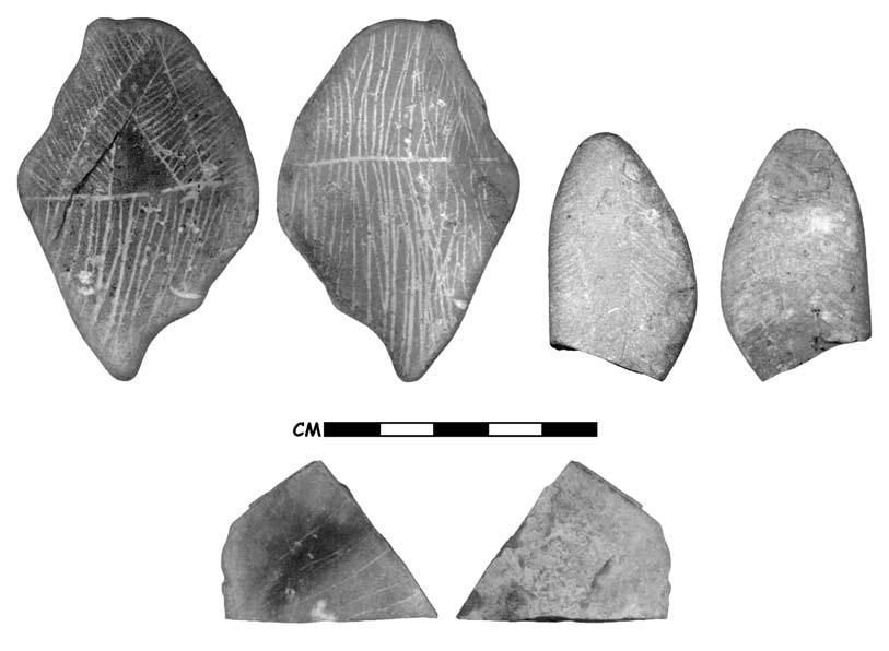
The importance of farming in the region’s economy during the Post-Puebloan period has also not been incorporated into these models. Bettinger and Baumhoff (1982) focus on the shift from a highly mobile hunting-driven economy to a seed-based one, and technological advances are invoked to explain the process of cultural replacement. Their models, and a third one by Sutton and Rhode (1991, 1994), ignore the evidence in southern Nevada’s prehistoric and historic record for farming economies that began during the Terminal Archaic period and continued into the Historic period. Their models also do not incorporate wild plant species, such as mesquite pods or agave, which are common in southern Nevada but absent throughout much of the Great Basin.
Only Gunnerson (1962), Aikens (1994), and Lyneis (1994) consider the importance of farming in their models. They do not, however, consider the possibility that farming continued during the Post-Puebloan period. Aikens and Witherspoon’s (1986; Aikens 1994) model fits the evidence for continuity in lifeways since the Archaic, and they recognized that agricultural groups occupied the Great Basin’s eastern and western edges until periods of aridity occurred after ad 1200. However, the growing evidence that farming continued into the ad 1500s, and possibly later in the Moapa Valley, is a game changer that has not been adequately addressed (Harry 2008; Gilreath 2012:Table 17, see House 46, Site 26CK7592). This completely alters our view of this late period, the nature of adaptations, and the types of groups that inhabited the area.
Lyneis’s (1994) idea of “mutualism,” possibly inspired by work on trade between Puebloan and Plains groups in New Mexico, best captures the complexity inherent in the archaeological record. She proposed that Great Basin Brownware pottery makers were co-residents with the Puebloans. As foragers, the makers of Great Basin Brownware traded goods, such as skins and meat, which they procured from the upland areas, with the Puebloans for cultigens, salt, and pottery, much as the Plains traders did with the Eastern Frontier Pueblos and the Jumano, described in Chapters 3 and 4 of this volume. Trade relationships between the Great Basin’s more mobile groups and the more sedentary Puebloan ones could account for the mixed appearance of archaeological deposits at the O’Malley and Conaway caves and at shallow caves throughout the region. It could also explain the early thermoluminescence dates on brownware and the appearance of brownware in the Moapa Valley immediately after its abandonment by Virgin Puebloans. Raiding and co-residence behavior may also have contributed to the varied mix of pottery types.
The million-dollar question remains: What happened to the Puebloans who occupied the Moapa Valley? Drought would probably not have stopped the flow of the Muddy River’s many springs, so decreasing rainfall and a drying environment cannot fully explain the dramatic cultural changes (Lyneis 1995). Perhaps the Puebloan abandonment of the area can be explained in terms of population pressures from groups like the Numic, Patayan/Yumans, and possibly other groups from the north such as the Athabascans, who would become the Navajos and Apaches. Both Numic groups and Athabascans made pottery that resembled Great Basin Brownware. Could population pressures that resulted in territorial skirmishes, or even warfare, explain the mixing of ceramic assemblages and the other changes in the archaeological record? Perhaps these pressures became too great for the Puebloan groups, driving them east into the uplands of the Shivwits Plateau or possibly to join other Puebloan groups migrating to the east (Ambler 2008). It is possible that some Pueb- loans chose to stay, moving to more sparsely populated upland areas or blending with Great Basin groups located in western Utah and northern Nevada; these groups could have brought their obsidian with them when they moved south to share the sparsely populated Moapa Valley. This could explain the late thermoluminescence dates on grayware and the presence of Utah obsidian.
It is not clear when European exploration and settlement of the region began impacting populations with their host of new diseases and territorial disruptions (Fowler and Fowler 1981). Insect-borne diseases introduced from Europe, such as malaria, were endemic in the region when the first Mormons attempted settlement (Larson 1950:39; Roberts 2002; Sterner and Ezzo 1996:100; Tobiasson and Hall 2010:7). Malaria likely traveled through Native populations much as European cultigens did. Wheat and watermelons were being cultivated by the Southern Paiutes when the Mormons entered the region in the 1850s; presumably these plants or their seeds were obtained by the Paiutes from tribes such as the Mojave, who traded with tribes from southern Arizona that were in contact with the Spanish (Fowler and Fowler 1981). Smallpox, malaria, and other highly contagious Old World diseases likely arrived along the same route that Euroamerican cultigens followed into the region. A demographic collapse, perhaps equating to the decrease in radiocarbon-dated components around ad 1600 and then again around ad 1750, would have caused further disruptions and resulted in the mixing of ethnic groups as survivors banded together. By the time Kelly (Roberts 2002) began recording Southern Paiute lifeways in the 1930s, some of the largest bands, such as those along the Santa Clara, Virgin, and Pah- ranagat rivers, had been completely eliminated by epidemics, the slave trade, and a plethora of other cultural disruptions.
The Post-Puebloan period’s archaeological record is characterized by mixed artifact assemblages, disruptions in settlement patterns, and abandonment of architecture. Perhaps the “messiness” of this period is a reflection of this chaotic period of change. The consequence of these pressures was increased settlement mobility, which in turn resulted in a decline in the visibility of the archaeological record (Seymour 2011a; Upham
Note
This chapter was partially funded by the Bureau of Reclamation and the Southern Nevada Public Land Management Act. I especially thank Deni Seymour, 1988). Some of these cultural disruptions were no doubt caused by regional climate changes, resulting population pressures, and the push of Native American groups—Yuman, Athabascan, and Numic groups—into the region. Over time, these groups merged with the existing populations (Chemehuevi) and forged new ties along the periphery. Consequently, the Post-Puebloan period’s jumbled mix of artifact assemblages and the dramatic shifts in settlement and subsistence strategies are all a reflection of a complex mosaic of region-wide culture change, which began in the twelfth century. The pace of these changes, and their impacts, accelerated with European colonization of the New World after 1492. Future research, particularly on single-component and short-term-use sites, will help us isolate and recognize these patterns of culture change.
Don and Kay Fowler, Mark Slaughter, Pat Hicks, and the Southern Nevada Agency Partnership for their guidance, support, and encouragement.
21. Tweaking the Conventional Wisdom in Southwestern Archaeology
David Hurst Thomas
Let me express my gratitude to Deni Seymour for permitting me to read and comment on the chapters in this book. I enjoyed them and believe that the contributors have successfully crafted a number of innovative approaches to the archaeology of the vastly ignored Protohistoric period in the American Southwest. In this concluding chapter my simple goal is to contextualize the contributions both theoretically and geographically, and then develop the four major themes that emerge from the conversation: (1) closing the perceived “hiatus” separating the prehistoric and colonial intervals in the American Southwest, (2) looking at the pros and cons of newly emergent chronological frameworks within the greater Southwest, (3) defining some appropriate signatures for explicating the nature of Protohistoric mobility, sedentism, and ethnicity, and (4) reflecting on the ongoing impatience with the received wisdom regarding the archaeology of the Southwestern Protohistoric period.
Situating Protohistoric Archaeology
Most of the contributors express their impatience with conventional wisdoms regarding the Protohistoric period in the Southwest, effectively critiquing the two-part “Grand Narrative” that has long conditioned our understanding of the Terminal Prehistoric and Colonial periods. Most authors take a fairly pragmatic tack, but it is apparent that the contributions fit rather comfortably within the new range of emergent theoretical approaches that address Protohis- toric/Colonial-era archaeology as practiced elsewhere. This section attempts to contextualize the chapters within that framework.
Contextualizing the Protohistoric
With respect to the Terminal Prehistoric era, Seymour (Chapter 1) powerfully deconstructs a received wisdom that has long defined an occupational hiatus separating the well-established prehistoric cultures in the American Southwest (including ancestral Pueblos, Hohokam, Mogo- llon, Trincheras, and Salado) from more mobile populations said to have moved in during the Historic period (including the Apache, Oodham, Jano, Suma, and their neighbors). Several authors question this “great divide” at ad 1450, arguing instead for considerable overlap between extant prehistoric cultural entities and those present in the Historic period.
Moving into the Colonial period, Seymour (Chapter 1) likewise emphasizes how the physical record of the Protohistoric interval has been overshadowed by literal, uncritical readings of the documentary evidence, in the process skewing colonial historiography toward a history of Europeans along the northern frontier of New Spain—at the expense of the indigenous populations already living there (see also Mathers 2013: 205). The resulting Grand Narrative defines a Spanish Colonial period that witnessed a nearly complete disruption of indigenous lifeways. Through this lens, virtually all Pueblo Indians appear as fully subjugated by Franciscans until a handful of rebels and malcontents touched off the unpleasantness of 1680, with non-Pueblo people largely written off as irrelevant raiders and traders. Such views dominate the historiography of France Scholes (1937, 1942) and many others. In places, these antiquated views continue to be articulated by those uncritically accepting documentary evidence at face value (Ivey and Thomas 2005).
Constructed centuries after the fact, this conventional wisdom defined Colonial America mostly in terms of culture clash, encouraging investigators to dwell almost exclusively on themes of conquest, disease, assimilation, and loss—too often resulting in what Wilcox (2009:11–15) calls “terminal narratives” Liebmann and Murphy (2010:7, 17–18) argue persuasively for a more enlightened discourse transcending the simplistic dualisms of dominant cores/dominated peripheries and active colonizers/passive colonized, as well as widespread misperception of indigenous survivals and extinctions (see also Silliman 2005:59).
Most authors writing in this book reject this long-standing Grand Narrative, contextualizing instead a colonial interval freed from simplistic models of dependency, assimilation, and cultural extinction. Rodriguez and Seymour (Chapter 6) effectively argue that understanding the postcontact American Southwest requires an explicit native voice that recognizes complex interactions among multiple players with multiple agendas (Ferris 2009; Mitchell and Scheiber 2010). Silliman (2005:62) puts it well when he states, “Colonialism is not about an event but, rather, about processes of cultural entanglement, whether voluntary or not, in a broader world economy and system of labor, religious conversion, exploitation, material value, settlement, and sometimes imperialism”
Threadbare, top-down models of universal European domination/indigenous resistance are being replaced by agent-centered and practice- based approaches that recognize the importance of the “practical politics” that played out across the Spanish Borderlands (Silliman 2001; Panich 2013:108–109). By emphasizing the new findings from archaeology and bringing in oral history, the extant historical documentation is being contextualized and evaluated in terms that are relevant to all descendant communities, including those of modern Native America (e.g., Liebmann and Murphy 2010; Brooks 2013; Pearsall 2013).
Simultaneously Addressing Continuity and Change
Rather than perceive the Protohistoric Southwest as an irrevocable break from the past, most contributors stress instead the continuities that went before, identifying indigenous people as active agents of social change and identity-before and during the Colonial period, extending into persistent forms that survive today. This emphasis on simultaneous change and continuity requires appropriate powerful methodologies that not only relate to contact with others but also reflect a sense of the change emanating from within indigenous groups that draw on existing practices and thought patterns to actively negotiate the Protohistoric period (Mitchell and Scheiber 20i0:i8)-what Ferris (2009) has termed “changing continuities” (see also Silliman 2009; Panich 2013:107).
Unlike so many conversations about the Protohistoric period, then, this is not really a book about early Europeans in the Southwest or even about indigenous interactions with Euro- americans. It is instead an attempt to define an archaeology that addresses “the People themselves, in their own right” (Seymour, Chapter 1).
Closing “the Hiatus”
Contributors to this sometimes edgy volume effectively question the concept of “Protohistoric” as conventionally applied to the American Southwest and its periphery. Although conventionally dated ad 1450–1700, the Protohistoric interval has long been characterized by chronological uncertainty, defining an uncomfortable in-between period sandwiched by the prehistoric and historic eras-“a negative, a void, and an absence of knowledge and evidence” (Seymour, Chapter 1).
The Protohistoric American Southwest has been conventionally dated to ad 1450–1700, with a built-in “post-AD 1450 hiatus” before which classic ancestral Pueblo/Mogollon and Hohokam “ended”—although continuity throughout the Puebloan sequence was generally assumed. This artificial roadblock has long enabled the unfortunate tendency among Southwestern archaeologists to stop short and just look at prehis- tory—thereby defining an “empty niche” that has long permitted models of massive die-out and out-migration to persist unchallenged.
This book marshals mounting evidence that pushes the initial “protohistoric adaptations” considerably back into the ad 1200s and i300s—not only overlapping with well-known prehistoric cultures but also clouding the archaeological visibility of more mobile Protohistoric groups. Seymour (Chapter 1), for instance, cites chronometric dates on Apachean material culture extending back into the ad 1300s, suggesting that the Apache had “‘free reign’ for roughly 600 years.” Coupled with terminal dates in the ad 1200s, along with mobile neighbors (Jano, Jocome, Manso, and Suma), present as early as the 1400s, this evidence argues against an occupational hiatus.
Harlan and Seymour (Chapter 13) take up and expand this issue in some detail, addressing the Southwest Social Networks Database (SSND), with a specific focus on the San Pedro River Valley. By design, the database concentrated on archaeological sites between ad 1200 and 1700, each of which have a dozen or more rooms visible on the surface. Harlan and Seymour argue that this protocol renders highly mobile groups and low-visibility sedentary farmers such as the Sobaipuri Oodham invisible to those strictly adhering to the guidelines of the SSND. Rather than Pueblo groups moving into an empty niche, these investigators suggest that the San Pedro Valley was a “crowded and contested” landscape in which incoming migrants interacted with ancestral Oodham, ancestral Apache, and mobile non-Apachean groups.
Implications for the practice of contemporary archaeology are important, including the call to transcend the bogus and now dysfunctional distinctions between prehistoric and historic archaeologists-like it or not, we’re all sharing the same boat (Seymour, Chapter 1; see also Lightfoot 1995; Rubertone 2012; Silliman 2009; Wilcox 2009).
Archaeologies of Unexpected Times and Unexpected Places[25]
These fresh theoretical perspectives accompany those Southwestern archaeologists eager to venture into relatively unexplored times and places. Long relegated to the conceptual and geographic periphery of conventional Southwestern archaeology, the Protohistoric period is today recognized as a time of remarkable diversity and variability. This book demonstrates the extraordinary variability that now characterizes the Protohistoric period, a time when highly mobile populations occupied niches vastly different from their Pueblo neighbors. Investigators are exploring potential parallels between initial European contact and previous encounters among other vastly different indigenous communities. Several authors underscore the importance of operating at multiple temporal scales and employing both longer- and shorter- term chronologies to monitor the nuances in how indigenous societies both transformed and perpetuated themselves (Mitchell and Scheiber 2010:17; Thomas 2013).
Refining Protohistoric Chronologies
A century ago Laufer argued that “chronology is at the root of the matter, being the nerve electrifying the dead body of history” (1913:577), and these words still ring true today. Laufer was operating within the general paradigm of Wissler’s “new archaeology,” which squarely emphasized the importance of establishing finegrained cultural chronologies, in the American Southwest and elsewhere (Wissler 1917; see also Browman and Givens 1996). This “first new archaeology” (Dunnell 2003) fostered the pacesetting stratigraphic excavations by Nelson in the Galisteo Basin (1914) and led directly to Kidder’s (1958) classic work at Pecos (which, as discussed below, evolved into the “conventional wisdom” of Pueblo archaeology currently under consideration).
Then as now, developing meaningful chronologies remains “at the root of the matter.” This book is about identifying and studying mobile Protohistoric populations in the American Southwest-taking exception to the conventional wisdom that the Protohistoric archaeological record is too ephemeral and unobtrusive to be much use. I agree completely with Seymour (Chapter 1), who emphasizes the critical issues of chronology that remain for archaeological studies on the Protohistoric period.
“Protohistoric” Interactions on the Northern Periphery
Chronology is particularly critical for defining the entrance of mobile groups into the Southwest and for articulating their relationship with established farming populations. This question, of course, has a long history played out in the Southwest proper and beyond. Steward’s excavations at the Promontory Caves in northwestern Utah (Steward 1937, 1940), for instance, convinced him that these sites contained materials left by an intrusive and migrating Dené population arriving in northern Utah sometime after ad 1000—probably about ad 1200—and then moving southward before European contact.
Ives recently revisited Steward’s hypothesis, and the results are relevant to the current discussion (Ives et al. 2012; Ives et al. 2014). Combined kinship, linguistic, and genetic evidence establishes a deep differential among Apachean dialects dating to about ad 1200, with the separation of proto-Apachean from other Canadian Dené having taken place several centuries earlier. One or more small, cohesive proto-Apachean groups of southern Subarctic Dené entered the Plains and eastern slopes region of Alberta, where they adopted a bison-hunting economy and experienced some population growth (Ives 1990, 1998, 2003; Billinger and Ives 2015). Smaller daughter groups fissioned off and moved toward the Southwest and Southern Plains. Ives concurs with Steward that the Promontory Caves likely contain archaeological material evidence left by these migrating Dené peoples.
Steward’s excavations at the Promontory Caves suggested to him that the Dené presence in the northern periphery of the Southwest postdated the Fremont occupation but predated the Shoshone arrival (Steward 1937:83, 86; i940:473)—in effect implying a “hiatus” like that long thought to separate prehistoric from Protohistoric intervals in the Southwest proper. Ives and others (2012) present evidence to the contrary, backed up by a remarkable series of 60 radiocarbon dates from Promontory Caves 1 and 2. The raw dates range across an interval from 679 through 826 rcybp, but when they are appropriately analyzed, it becomes clear that the occupations at both caves took place during the surprisingly brief (2-sigma) interval cal ad 1250–1290.
The Promontory Cave results are relevant to the Protohistoric discussion in several ways. For one thing, Steward’s ideas about a Plains connection to Promontory Cave assemblages are much more strongly warranted than when originally expressed in the 1930s. But these new data likewise strongly support two of the most important arguments made in the present volume—the first being that the Protohistoric period of the Greater Southwest began earlier than previously estimated, effectively positioning “protohistoric patterning” a century or two before European contact. Ives’s recent research at the Promontory Caves likewise erases the hiatus between Utah Dené and Fremont occupations. This indicates that these proto-Apachean ancestors and Fremont farmers interacted significantly in the late 1200s, presaging similar histories that played out farther south.
The Promontory Cave evidence likewise has important methodological implications for Protohistoric studies in the Southwest, underscoring the importance of developing large, high-precision temporal data sets—in this case with results approaching a human-scale timeframe. Not only do the results help track population movements, but the fine-grained results also facilitate comparison with evidence of contemporary short-term paleoclimatic change. These impressive findings also underscore the importance of employing multiple temporal scales—crafting both longer- and shorter-term chronologies to monitor the nuances in how indigenous societies transformed and perpetuated themselves (Mitchell and Scheiber 2010:17; Thomas 2013).
That said, the Promontory Cave example should not be seen as diminishing in any way the arguments of this book for increased awareness of far-less-than-perfect surface assemblages with few artifacts and little to date. I continue to believe that archaeology proceeds best when embracing the broadest range of site types approached from multiple methodological and theoretical perspectives.
Fresh Approaches to Radiocarbon Dating
It is worthwhile, then, to consider how Ives and his research team derived such precise chronological results. As discussed below, one key element is the definition of relevant archaeological signatures, which were coupled with an aggressive program of targeted high-precision 14C dating and analysis. These protocols have rich potential for parallel studies of the Protohistoric Southwest proper.
Seymour (Chapter 1), Kurota (Chapter 7), Martin (Chapter 15) and Truesdale, Hill, and Truesdale (Chapter 16) caution about the “old wood” problems encountered in radiocarbon dating of Protohistoric occupations (see also Schiffer 1986; Kennett et al. 2002; Bayliss 2009: 125). New approaches to Accelerator Mass Spectrometry (AMS) 14C dating have great potential for working around issues with samples having unknown age-at-death offsets, especially by paying greater attention to the collection and dating of short-lived samples from archaeological sites (e.g., Waters and Stafford 2007). It is worth noting that the remarkable results from the Promontory Caves emerged not just from a large set of high-precision AMS WC dates but also due to the Bayesian chronological framework that permitted Ives and his team to fine-tune their results to a scale approaching dendrochronology in accuracy and relevance.
Classical statistical methodologies have long dominated archaeological inquiry because they are well suited to a wide range of observations made by archaeologists (e.g., Thomas 1986; see also Seymour 2010a). But unlike classical statistics, the Bayesian statistical environment employs chronological models that meld prior knowledge with available radiocarbon data sets through an iterative procedure for fine-tuning the results, ultimately providing a coherent framework for integrating multiscalar chronological measures (including ceramic and lithic typologies, den- drochronological and radiocarbon dates). That is, by combining fresh “posterior” information (a posteriori) with prior evidence (a priori), we can extract a likelihood function (Buck 2004). Two major benefits emerged from the Bayesian approach: (1) a statistical environment is created to incorporate a wider range of observations and knowledge (including both relative and absolute chronologies), and (2) these models can be used to direct research and make further sampling decisions.
The best archaeological examples to date come from chronology-building exercises in which a variety of nonquantitative contextual information (e.g., stratigraphic position, diagnostic artifact assemblages) can be integrated with probability distributions from radiocarbon dates (e.g., Bayliss and Bronk Ramsey 2004; Ives et al. 2012; Kennett et al. 2014). Readily available programs like OxCal (Bronk Ramsey 2000, 2005) provide a prepackaged set of Bayesian statistical tools to help develop more robust archaeological site chronologies.
Stochastic Calibration Distortions
Newly emerging radiocarbon data sets can also provide archaeologists with proxy estimates derived from Rick’s (1987) important arguments about “dates as data.” In this way, archaeologists are exploring the empirical and theoretical implications of tracking radiocarbon dates on a grand scale. The ultimate objective in this approach is to generate a series of summed probability distributions of 14C determinations that can provide proxies reflecting the long-term history of population fluctuations across time and/or space. Such studies proceed under the general assumption that within a sufficiently large number of dates, valid patterns will emerge that can be taken as indicative of general patterns in population history. “While some dates may be incorrect, or incorrectly related to their supposed context, these will be the exception rather than the rule and will not determine the aggregate pattern.... It is our view then that there is safety in numbers as far as dates are concerned” (Shennan and Edinborough 2007:1340; see also Gamble et al. 2005; Kuzmin and Keates 2005; Surovell and Brantingham 2007; Roberts, Chapter 20 this volume).[26]
This approach, I believe, has great merit and potential. But we must keep in mind that the very process of calibrating 14C dates itself creates potential problems because the radiocarbon time scale is not linear. In fact, the slope of the distribution of calibrated ^C dates can become quite irregular simply due to the interaction of the changing slope of the calibration curve and the stochastic distribution of counting errors (Stolk et al. 1989; Stuiver and Reimer 1989; McFadgen et al. 1994:221; Knox and McFadgen 1997).
The so-called calibration stochastic distortion effect (CSD) tends to deplete the number of 14C dates per calendar year on those parts of the calendrical time scale corresponding to gentle slopes of the calibration curve, and increase the numbers of dates where the slopes are steep (e.g., Geyh 1980; Stolk et al. 1989). Because some time spans are represented by flat spots on the curve, the conversion of a Before Present date to calendrical years creates an artificially broad age range, even with a small sigma (Stuiver and Reimer 1989:823). Alternatively, for those temporal periods characterized by a steep gradient in the calibration curve, even dates with a medium sigma range can generate a more precise date in sidereal years. In other words, there are “good” and “bad” time spans for calibrating WC dates.
Figure 21.1 shows precisely how such calibration effects impact the radiocarbon record of the Protohistoric period. The post-cal ad 1200 era is dominated by significant stochastic distortions, interrupted by only three “sweet spots” in which high-precision AMS WC dating can be effectively applied. For comparative purposes, I have plotted the new suite of the “Apachean” radiocarbon dates from the Promontory Caves (drawing on data in Ives et al. 2012; see also Ives et al. 2014). Note that the projected 2-sigma limits of cal ad 1250–1290 fall at the terminal end of the sweet spot dating cal ad 1150–1290.
Because it seems unlikely that the Protohistoric era in the Southwest extends very much pre-cal ad 1290, only two narrow windows (at cal ad 1400–1470 and cal ad 1630–1670) are available for effective use of high-precision WC dating. All other Protohistoric intervals remain problematic for the radiocarbon approach, and great caution is required when interpreting the apparent peaks and valleys noted in radiocarbon profiles for this period.
Such stochastic calibration distortions are clearly evident in Roberts’s (Chapter 20) discussion of radiocarbon dating in the Post- Puebloan period in southern Nevada, with her important database of 138 ^C dates from this interval. The resulting radiocarbon profile (see Figure 20.2) plots the mean dates for the Post- Puebloan period, and (with only two exceptions) this relatively even distribution demonstrates a continuity of occupation both during and postabandonment by the Virgin Puebloans.
But the exceptions are important because a comparison of Figure 21.1 with 20.2 clearly shows the stochastic calibration distortion in action. As noted above, the century before ad 1290 is a “good” interval, meaning that minimal distortions are evident. During the cal ad 1200s, 1500s, and 1600s, the overall proportion of roughly 20 dates/century drops to only 4–5 dates/century. This distribution is entirely to be expected based on calibration distortion effects, which would narrow the date ranges immediately pre-AD 1290 and broaden the date distributions during the “bad” interval of cal ad 1290–1400. Roberts’s second exception takes place between cal ad 1400 and roughly cal ad 1450, corresponding almost precisely with the cal ad 1400–1470 “sweet spot” defined in Figure 21.1. Once again, the 14C record is compressed during the fifteenth century because it corresponds to a steep vertical interval on the master calibration curve. After this, the date margins fall into the next “bad” part of the curve, artificially concentrating a large proportion of dates between cal ad 1470 and cal ad 1630. The moving-average trend in Figure 20.2 turns more steeply vertical about cal ad 1570 and continues to cal ad 1700, swamping the final and brief “good” calibration interval at cal ad 1630–1670 (see Figure 21.1).
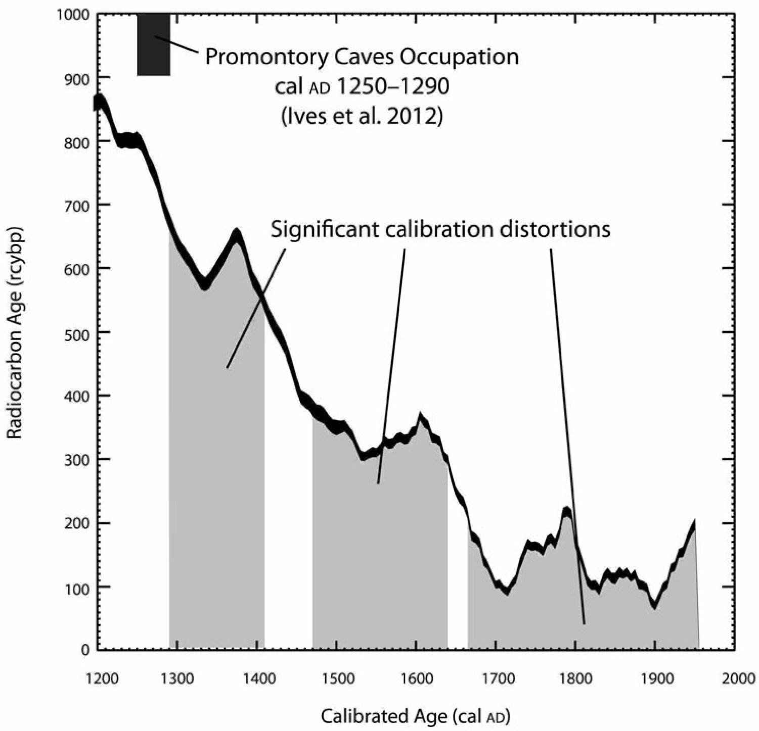
As Roberts notes, the overall trend evident in these 138 14C dates reflects a continuity of occupation during the Post-Puebloan period. But quite properly, she cautions that the radiocarbon profile in Figure 20.2 “should not be viewed as representative of the actual human population.” This is because the fine-grained patterning in Figure 20.2 must be attributed almost exclusively to the dramatic stochastic calibration distortions evident throughout most of the Protohistoric interval.
Several other investigators in this book take note of the calibration issues during the Protohistoric period. Seymour (Chapter 1), Hill (Chapter 11), and Martin (Chapter 15) suggest increased use of optically stimulated luminescence (OSL) and thermoluminescence (TL) techniques to avoid the multiple crossing problems in radiocarbon dating (see also Seymour 2010a). Noting the lingering “old wood” problems, Kurota (Chapter 7) emphasizes the increased use of dendrochronology as well.
Defining Relevant Signatures of Mobility, Sedentism, and Ethnicity
Seymour (Chapter 4) and Kurota (Chapter 7) stress the importance of deriving and testing archaeological signatures relevant to the specifics of the Protohistoric period. In particular, it is critical to distinguish mobile group encampments from the evidence of farmers who were tethered to their more permanent pueblo habitations and fields. As Seymour argues (correctly, in my view), the explicit recognition of multiple scales of residential mobility helps to distinguish the Pueblo residences that shifted on a decadal or century scale from the high-frequency residential mobility that characterized the foragers who visited the Pueblo world. Doing so requires an understanding of the material and spatial differences between essentially settled farmers and highly mobile foragers. Beyond teasing out the nature of the hosting Pueblo habitations, Seymour addresses in some detail the kind of structures constructed by Protohistoric foragers. These are not conical tipi rings, as on the Great Plains, but more like the wickiups common to the Intermountain West. As Seymour notes (Chapter 1), “many of the archaeological correlates established to define the ancestral Apache—such as structural rings—actually apply to mobile groups in general.”
Feature and Artifact Correlates
In his study of Diné game traps on the Colorado Plateau, Copeland (Chapter 14) makes some important comparisons to well-studied traps and ambushes in the Intermountain West, where considerable evidence is available today. At least in the Great Basin, both bighorn and pronghorn procurement have considerable antiquity, going back at least to the Middle Holocene. But logistic bighorn hunting trailed off through time, ending entirely about 2,000 years ago, to be replaced by residentially based hunters working alone; by contrast, communal antelope procurement strategies appear to have persisted largely unchanged from the late Middle Holocene through the Historic period.
Pilles (Chapter 19) discusses the Yavapai structures in the Verde Valley—probably dating to the ad 1300s, but the timing is difficult to pin down. The highly mobile Yavapai relied on lightweight, transportable, and often perishable material culture. It is particularly difficult to separate the chipped and groundstone assemblages from the Protohistoric period from those from the much earlier Archaic—an issue plaguing Apachean and non-Apachean archaeology throughout the Southwest (Seymour 2010a and Chapter 1, this volume).
Further, whereas agave knives (tabular tools) and agave scrapers are considered indicative of Yavapai and Apache in central Arizona, in southern Arizona these artifacts are also found associated with the extensive precontact Hohokam agave fields. Pilles (Chapter 19) concludes that the most significant Yavapai diagnostics are large agave roasting pits and mounds. Of the 100 recorded in Coconino National Forest, several have been radiocarbon dated. Although multiple dates are available here, it is difficult to interpret whether the pattern reflects intermittent usage or further calibration issues. In any event, it would seem clear that a combination of these diagnostics best serves to identify Yavapai sites in central and western Arizona.
Also relevant here is Seymour’s (Chapter 17) discussion of Three Sisters, a “small, unprepossessing site” in the Dragoon Mountains of Arizona. Given the lack of appropriate dendro- chronological specimens, she relies on 14C and thermoluminescence dating, concluding that the occupation dates to the ad 1300-1400s interval. By judiciously selecting short-lived residues, likely agave or yucca, she has minimized the likelihood of significant age-at-death offsets (old-wood impacts); but as highlighted on Figure 21.1, there is a problem with dual intercepts that blurs the overall precision of radiocarbon results for this time interval. Although the available dates do not agree with one another, I believe that Seymour is correct in suggesting that this spread likely reflects multiple occupations rather than specific dating inaccuracies. The apparent absence of metal further supports the contention that Three Sisters is among the earliest ancestral Apache occupations in southern Arizona.
Although multiple visits are evident, then, Three Sisters is not a multicomponent site because it lacks evidence of pre-Apache and post-Apache occupations. This underscores the importance of single-component archaeological sites during the Protohistoric interval, because as Seymour (Chapter 1) points out, such “pure” Protohistoric assemblages are relatively rare owing to the extensive raiding and trading at the time.
Moore (Chapter 8) amplifies this point, questioning the conventional wisdom regarding lithic tool manufacture. Building on an impressive set of “pure” assemblages from Spanish sites dating to the Late Spanish Colonial and Santa Fe Trail periods, he argues persuasively that one can no longer assume that lithic debris is an ethnic signature for indigenous occupations. Moore meticulously documents the ubiquity of chipped-stone technology evident from stratified, unmixed deposits “at just about every Spanish site excavated in New Mexico” that dates to the early 1600s through the late 1800s. Evidence of lithic reduction in fire-making kits and gunflints is hardly surprising, but its use extended to hunting/warfare, hide working, and the manufacture and maintenance of tools made of perishables (such as leather rope making).
Martin (Chapter 15) documents hundreds of aboriginal wooden structures at several dozen archaeological sites in western Colorado. This remarkable range of features includes wickiups, tipi frames, lean-tos, ramadas, corrals, and fences that are almost universally attributed to the late Numic (Ute) occupations. These sites are particularly important because they reveal some of the shortcomings of the available documentary and historical evidence—in particular demonstrating that a number of Northern Ute people did not participate in the forced exodus to reservations in Utah between 1881 and 1882. Both the Ute Hunters’ Camp and the Pisgah Wickiup Village demonstrate the great potential for investigating these sites, especially when they are more precisely dated with dendrochronology. Significantly, evidence of trade goods, mostly metal, was found at more than half of these Northern Ute sites, making them excellent venues for applying the newest techniques of systematic metal detection.
Metal artifacts can potentially assume great importance as Protohistoric diagnostics, but this requires a willingness to experiment with innovative field techniques. New methodologies employing high-precision metal detecting, for example, have produced important archaeological evidence of the sixteenth century at Hawikku (Damp 2005) and Piedras Marcadas (in downtown Albuquerque; Mathers 2013).
Particularly relevant to the current discussion are the recent metal detection and geophysical surveys in search of evidence documenting the seventeenth-century Apache occupation to the east of the mission church at Pecos (Haecker 2012; Charles Haecker, personal communication 2013). The trade fair area proper showed little evidence of Plains Indian encampments, perhaps due to poor drainage and/or contamination from nineteenth- and twentieth-century usage (including the deposition of backdirt during Kidder’s excavations at nearby Pecos Pueblo). But Haecker’s survey did identify four ovoid anomalies, one of them likely the seventeenth- century Apache structure previously tested in the 1960s (Gunnerson and Gunnerson 1970; see also Seymour, Chapter 4 this volume). Haecker also found three rectilinear structures within the trade fair area, the 1-m width of the foundations suggesting a Spanish Colonial construction (rather than precontact Pecos Pueblo room blocks). A cluster of eight circular anomalies, identified a few hundred meters southeast of the park headquarters, were interpreted as tipi rings (perhaps evidence of the eighteenth- century Comanche trading camps mentioned in the documentary evidence). To the north and east of Pecos Pueblo is evidence of Plains Indian encampments and metal arrowheads from the Spanish Colonial era, which may have resulted from the numerous recorded attacks by Apache and Comanche during the mid-eighteenth century.
Some would argue against the use of metal detectors on Protohistoric sites in the American Southwest, correctly emphasizing the degree to which unchecked and unprofessional metal detection has harmed the archaeological record in many cases. While this is true, I believe that newer approaches are available today to overcome the abuses of the past. In particular, the recent Pecos surveys likewise highlight the potential of combining pulse-induction metal detection with GPS and various methods of geophysical prospection (especially electrical resistivity and ground-penetrating radar). Not only are these methods cost-effective, but they are minimally invasive.
Some contributors to this volume stress the importance of identifying highly mobile Protohistoric group presence without relying on European artifacts. While I certainly agree that such approaches have merit, these research directions by no means preclude the responsible use of modern metal detecting technology. I continue to believe that whenever possible, archaeologists should employ multiple perspectives, relying on a broad array of methodological approaches. There’s some truth in the quote attributed to political commentator Walter Lippman that “when everyone thinks alike, no one thinks very much” In the long run, such “cubist” approaches to the past will produce far more satisfying results (Thomas 1989).
Defining Signatures of Ethnic Identity
Archaeological signatures are needed not only to track mobility patterning in the prehistoric but also to monitor the ethnic identities of these nonsedentary groups. The best example was introduced earlier in the discussion of the Promontory Cave evidence, relevant for Protohistoric studies in the Southwest not only for the sophisticated use of 14C evidence but also for how materiality can be linked with pertinent chronological, linguistic, and genetic evidence.
Steward recovered something like 250 moccasins during his Promontory Cave excavations, and these distinctive artifacts have proved invaluable for investigating proto-Apachean movements into the Southwest. Through painstaking analysis, Ives has refocused attention on this highly conservative technology, which retains diagnostic elements long after other clothing elements changed across North America. The patterns of construction and decoration on these distinctive two-piece moccasins are entirely out of place in the material assemblages from the Great Basin and neighboring areas. The Promontory Cave assemblage signals a wholly different cultural identity closely aligned with the proto-Dené homeland and the moccasins from contemporaneous occupations in the Colorado Rockies (see also Billinger and Ives [2015] for some innovative demographic inferences based on the Promontory moccasin assemblage). In fact, the S13 value from one of the Promontory moccasins demonstrates that the animal contributing to this artifact specimen came from somewhere in Kansas, eastern Colorado, or even Texas. Such isotopic and material culture signatures have the potential of defining “interaction spheres that led far afield” along the pathways familiar to migrating Apachean ancestors (Ives et al. 2012). Such patterns are further supported by additional parallels in the netting and tabular scrapers from the Promontory Caves, which likewise link up with local rock art evidence.
Beckett (Chapter 5) employs somewhat similar archaeological, documentary, and linguistic evidence of the Historic period Jumano and Suma, arguing they are the same people and defining ceramic archaeological markers linking Historic Jumano populations with the eastern extension of the Jornada Mogollon. But other investigators express a growing suspicion and mistrust of ceramics as ethnic diagnostics during this interval.
Pilles (Chapter 19), for instance, discusses the difficulties in defining Yavapai ceramic signatures, noting that Tizon Brownware seems to be common to all Pai people (even with an unexpectedly early thermoluminescence date). Hopi ceramics are also complicated for dating these sites because of the compounded difficulties posed by raiders and traders. Hill (Chapter 11) brings Great Basin ceramics into the conversation for their relevance to nonsedentary population comparisons, but he concludes that the nature of ceramic production among mobile groups involves much greater distances for both clay and lithic sources, creating considerable variability in Protohistoric plainwares.
Roberts (Chapter 20) also reviews the relevance of plainware ceramics and other diagnostics from the settlement histories of Numic foragers and part-time farmers in the southern Great Basin, where she defines a relationship distinct from previous ancestral Virgin Branch Puebloans who had lived here up to ad 1300. Conventional wisdom calls for a Puebloan and Fremont abandonment of the region, followed by a replacement by Numic populations migrating from homelands in southeastern California across the Great Basin and northern part of the Colorado Plateau. Roberts infers instead that Numic and ancestral Mojave (Patayan) populations that moved into southern Nevada pursued a “temporally fluid pattern of land use,” making it difficult for us to define cultural identity markers and bringing into question the issue of population replacement.
Based on new archaeological data from 51 excavated Post-Puebloan (ad 1300–1776) sites in southern Nevada, Roberts paints a “far more confusing and ambiguous picture” that leads her to question the current migration model. She documents a usage of caves and rockshelters from ad 950 to 1200 in the central region, but after that there is a shift to open sites. Roberts suggests two different settlement patterns at this point, with mobile foragers in the uplands and farmers living along the river. During the Post- Puebloan period, habitations and sites in general become smaller and less permanent, suggesting a reduction in settlement size and perhaps a decrease in social complexity with a shift to smaller groups. Numic groups constructed residential brush shelters rather than adobe and masonry pueblos; they also preferred basketry to pottery.
Roberts specifically questions the “static ‘pots equal people’ concept” as masking current understanding of the dynamics that played out during this period of considerable cultural change. She sketches an excellent example from the Southern Paiute, detailing how residential mobility undermines conventional approaches to ceramic sourcing and renders plainware pottery “problematic” for defining ethnic boundaries, at least in southern Nevada.
She argues instead that material culture studies should move beyond ceramics and basketry to investigate those media more closely linked to art and religion, namely incised stones and intaglios (geoglyphs). While incised stones are not reported in Puebloan, Hohokam, or Mogollon contexts, they are not uncommon in Great Basin contexts. At Gatecliff Shelter and elsewhere in Monitor Valley we found more than 500 incised stones, clearly dating back to 3600 cal bc and surviving into the Historic period (Thomas 1983:Chap. 11). Recent excavations at Coyote Springs and elsewhere in southern Nevada have recovered similar incised stones in Post-Puebloan contexts, leading Roberts to the intriguing suggestion that such incised stones might be an effective ethnic marker for Numic occupations. Somewhat similarly, intaglios — massive earth figures typically associated with Yuman populations (such as Mojave and Que- chan)—were being made on the Colorado River at initial European contact, suggesting they may function as signals of social identity.
The important point here (and elsewhere) is that whereas mobile foragers and sometime-farmers in the Protohistoric Southwest did produce ceramics, the manufacture and use of pottery differed in important ways from ceramic practice by more settled peoples.
An Impatience with the Conventional Wisdom
As the title of this book implies, the volume sets out to explicate the “Protohistoric Non-Pueblo World,” effectively positioning the Pueblo orthodoxy as a foil for understanding the highly mobile populations of the American Southwest. Implicit in this dichotomy is an impatience with widely held beliefs on which most people act (the “conventional wisdom”) and a call for unconventional behaviors and thoughts grounded in the non-Pueblo world.
The Pueblo orthodoxy, it is fair to say, springs from Kidder’s work at Pecos, a watershed moment in the history of American archaeology. Kidder’s summary of the first six seasons at Pecos was published in 1924 as An Introduction to the Study of Southwestern Archaeology—one of the true classics in New World archaeology and a cornerstone of the current orthodoxy of Pueblo archaeology.
While a Harvard graduate student in 1908, Kidder announced his intention to abandon plans for medical school in favor of a career in Southwestern archaeology. Surprisingly, as he explained his goals to a faculty adviser, Kidder was famously schooled to take up work in another field because everyone knew “the Southwest is a sucked orange.”[27]
In light of the lasting significance of Kidder’s 1924 Introduction—a book that remarkably remains in print today—it’s easy to forget the degree to which Kidder was swimming against the tide of archaeological thinking in the day. By ignoring well-meaning advice about the futility of Southwestern archaeology and doggedly pushing ahead, Kidder himself was expressing “an impatience with the conventional wisdom,” and his monumental work at Pecos (and elsewhere) would eventually create its own orthodoxy.
This, then, is my final theme. The archaeological Southwest was not a sucked orange a century ago, and it’s not a sucked orange today— particularly when it comes to the Protohistoric period. Nowhere is this better illustrated than in Speth’s sparkling contribution (Chapter 3), a terrific example of impatience with that orthodox truism that farmers farm and hunters hunt. Speth patiently walks us through the evolution of his own thinking about mobility, bison hunting, and sedentism at the interface between the Plains and Pueblo worlds. As such, his experiences encapsulate to a significant degree both the tempo and direction of thought reflected throughout this book.
Contrasting the Semi-sedentary and the Highly Mobile
Speth’s saga started with his 1977 excavation of the Garnsey site, a relatively modest midfifteenth-century bison kill in the Pecos Valley (New Mexico). Reflecting the thinking of the day, he assumed that Garnsey resulted from the multiple springtime kill events undertaken by full-time bison hunters. But as the dig progressed, he began to wonder if perhaps these same hunters might have spent the rest of their year as farmers, supplementing their horticultural yields with springtime bison meat. Given the lack of systematic butchering and culling of marginal low-utility cuts, he suspected that year- round settlement should be nearby somewhere.
Searching the Roswell area for appropriate candidates, Speth was repeatedly assured by well-meaning avocational archaeologists that all the best sites had disappeared long ago and none of the survivors had much potential. In effect, Roswell archaeology was just another sucked orange in the sorry saga of Southwestern archaeology.
But, like Kidder a half-century earlier, Speth politely disregarded the proffered advice and took a different tack. Overlooking the obvious vandalism and pothunting, he found a likely candidate for the missing year-round settlement at the Henderson site, a 70-room adobe “pueblo” dating to the late ad 1200s and early 1300s. Soon discouraged by the obvious lack of bison bones in his room excavations, he switched field strategy to the town plazas, where he found several massive roasting pits. Relying on his newly developed, fine-grained ceramic seriation, Speth concluded that Henderson was a semi-sedentary settlement, abandoned by its residents after the harvest to hunt bison.
Immediately after ad 1300 this subsistence pattern shifted abruptly as communal bison hunting skyrocketed in importance, with the Henderson residents now involved in longdistance exchange networks across the greater Southwest. Speth sees this as the beginning of the widespread Plains-Pueblo interactions documented by subsequent Spanish accounts (and noted by Kidder’s work at Pecos).
Seeking another, slightly later occupation to explain the nature of this interregional exchange, Speth turned to the Bloom Mound, another sucked-orange site less than a mile from Henderson. Once again ignoring the naysayers, Speth ramped up excavations that located well-preserved subterranean structures—buried (ironically) beneath decades of backdirt from avocational excavations. Like Henderson, Bloom was a semi-sedentary community that had apparently been raided when many of the ablebodied adults were absent, likely away hunting, trading with Pueblos, or perhaps raiding other communities on their own.
This innovative field program provides a tantalizing glimpse of the social and political turmoil that engulfed the Southern Plains immediately before European contact. As Speth notes, the Plains-Pueblo interaction “was not just a benevolent bond of economic cooperation and interdependence.... It may at times have been a costly and blood-stained relationship that arose out of the wreckage of more than a century of conflict between scores of competing entities, only a few of which survived to witness the Spanish entrada”
Speth’s work at Roswell is emblematic of some major themes in this volume, among them persistence, patience, and a commitment to longitudinal research within a single area. Even more importantly, this research reflects a healthy skepticism of the conventional wisdom and a willingness to generate unconventional archaeological data in places and time periods written off by others. Kidder famously did this at Pecos a century ago, and several contributors to this book are doing the same with regard to long- ignored evidence of Protohistoric occupations in the American Southwest.
This southeastern New Mexico perspective likewise raises serious questions about encounters involving mostly sedentary and largely mobile societies during the Terminal Prehistoric and Colonial intervals. Although there is certainly cooperation and mutualism, there is also evidence of severe conflict that took place before the Spanish entrada. This underscores the importance of questioning the Grand Narrative and begs investigators to examine their assumptions undergirding the separation of well-known Pueblo from the non-Pueblo “Other”
When Should a Farmer Forage?[28]
Speth’s research centered on marginal hunters of the Great Plains who sometimes occupied pueblos—a difference underscoring the conceptual contrast between highly mobile groups and stationary groups that are seasonally mobile. Whereas the archaeological conclusions approach these findings from a shifting seasonal perspective, at a grander scale, questions also arise regarding the decision-making processes among sedentary farming and more mobile foraging options as framed through human behavioral ecology.
Considering this question with respect to Fremont horticulture, Barlow emphasizes that “maize farming should be viewed not as a transition from ‘being’ a forager to ‘being’ a farmer, but as the outcome of a series of foraging decisions made by various points throughout the growing season” (Barlow 2006:97; see also Bet- tinger 2006:312–314, 316–317). So viewed, maize horticulture is approached as a sequence of subsistence-related activities, each of which is expected to yield an anticipated return. Human behavioral ecology predicts that foragers should invest time in a particular farming activity (such as burning grass, planting maize, hoeing weeds, or harvesting ripe ears) only when doing so generates an overall increase from various foraging options (see also Gremillion 2004; Winterhalder and Kennett 2006). The degree to which an individual elects to forage or to farm, then, depends on the anticipation of project returns for each activity. As Barlow (2006:96) points out, “whether she invests time weeding should be strongly influenced by foraging opportunities at ‘weeding time.’” The benefits that accompany weeding might be expected to diminish with time. Whereas weeding during the first several days might be expected to increase the anticipated yield by a couple of bushels per acre, continuing to remove weeds over the next two or three weeks will probably not dramatically increase the expected yield.
Thus, the decision to plant and weed the garden must also be weighed against the anticipated yields of foraging opportunities at that moment (such as participation in the bison alternative). Similarly, if prolonged drought conditions threaten to wipe out the summer maize harvest, the forager might downplay her weeding of fields in favor of collecting mollusks or seeking summer-ripening wild grapes or blackberries.
The aggregate of such decisions determines whether an individual, a household, or a community pursues a “farming” a “foraging” or a “mixed” subsistence strategy for that given year. The obvious implication, then, is that farming investments intensify when higher-ranked foraging opportunities diminish, and farming activities decrease when higher-ranked foraging opportunities increase. So, rather than view maize horticulture as a cultural complex or an all-encompassing lifestyle (to be embraced or rejected), we can regard aboriginal farming practices as an amalgam of economic behaviors of varied intensity and complexity, depending on the circumstances at hand.
Concluding Thoughts
This book is about critiquing a Grand Narrative that has long held sway in the American Southwest. Thanks to the efforts of these contributors, no longer can archaeologists conceptually separate those well-known Southwestern cultures (the ancestral Pueblos, the Hohokam, and all the rest) from the more mobile groups that moved in a half-millennium ago. Instead, Southwestern archaeologists are recognizing the degree to which the more visible, largely sedentary “prehistoric” populations interacted with their new, more mobile neighbors—and well before the arrival of the European newcomers.
Gone are the days when we must view these forager-farmer interactions from a submillennial scale. Increasingly accurate and precise measures allow archaeologists to monitor these interactions at the scale of human life spans. Understanding the potentials, but also the restrictions, of high-precision 14C dating during this interval, contributors to this book have taken matters into their own hands, exploring alternate chronometric tools to further pinpoint the timeframes involved.
Archaeologists working on the Southwestern Protohistoric are becoming more sophisticated in approaching the ceramic industries of this era. Although conventional pottery types may sometimes still help sort out some sites, investigators are recognizing the different processes involved in ceramic manufacture and exchange by mobile Protohistoric populations. When available, perishable artifacts remain important, but some archaeologists are also involving rock art and incised stones because these material media are most closely linked with art and religion. House forms and social spaces differ between essentially settled indigenous farmers and their more mobile neighbors. Whereas considerable difficulty remains in separating out the multiple occupations by different cultures in sites of this period, new signatures are emerging.
This book helps spread the word that Southwestern archaeologists are doing important research on long-ignored sites and histories of the Protohistoric period. While still operating on the margins of the Pueblo world, these new studies and perspectives demonstrate that these boundaries are considerably more permeable and overlapping than Kidder ever could have imagined when he too was tweaking the conventional wisdom in Southwestern archaeology.[29]
References
Abbott, A. L., R. D. Leonard, and G. T. Jones
1996 Explaining the Change from Biface to
Flake Technology: A Selection Application. In Darwinian Archaeologies, edited by H. G. D. Maschner, pp. 33–42. Plenum Press, New York.
Abbott, David R.
2003 Centuries of Decline during the Hohokam Classic Period at Pueblo Grande. University of Arizona Press, Tucson.
Adams, Charles, and Andrew Ian Duff
2004 The ProtohistoricPueblo World, a.d. 12751600. University of Arizona Press, Tucson.
Adams, E. Charles, Miriam T. Stark, and
Deborah S. Dosh
1993 Ceramic Distribution and Exchange: Jeddito Yellow Ware and Implications for Social Complexity. Journal of Field Archaeology 20(i):3–21.
Adams, Jenny L.
1988 Use-Wear Analyses on Manos and HideProcessing Stones. Journal of Field Archaeology 15(3)307–315.
Adler, Michael A.
1996 The Prehistoric World, a.d. 1150–1350. University of Arizona Press, Tucson.
Adovasio, James M.
1986 Prehistoric Basketry. In Great Basin, edited by Warren L. d’Azevedo, pp. 194–205. Handbook of North American Indians. Vol. 11, William C. Sturtevant, general editor. Smithsonian Institution, Washington, D.C.
Adovasio, James M., and David R. Pedler
1994 A Tisket, a Tasket: Looking at the Numic Speakers through the “Lens” of a Basket. In Across the West: Human Population Movement and the Expansion of the Numa, edited by David B. Madsen and David Rhode,
pp. 114–123. University of Utah Press, Salt Lake City.
Agenbroad, Larry D., and C. Vance Haynes
1975 Bison bison at Murray Springs, Arizona.
Kiva 40:309–314.
Ahler, Stanley A.
1971 Projectile Point Form and Function at
Rodgers Shelter, Missouri. Research Series No. 8. Missouri Archaeological Society, Columbia.
1992 Phase Classification and Manufacturing
Technology in Plains Village Arrowpoints. In Piecing Together the Past: Applications of Refitting Studies in Archaeology, edited by J. L. Hoffman and J. G. Enloe, pp. 36–62. BAR International Series 578. Archaeopress, Oxford.
Ahlstrom, Richard V. N.
2003 The Las Vegas Wash Collections Project: Analysis of Artifacts and Biological Specimens from Past Archaeological Excavations in Clark County Wetlands Park, Southern Nevada. HRA Inc. Archaeological Report No. 01–01. Draft Report, submitted to the Bureau of Reclamation, Lower Colorado Regional Office, Boulder City. HRA Inc., Conservation Archaeology, Las Vegas.
2008 Persistent Place: Archaeological Investigations at the Larder and Scorpion Knoll Sites, Clark County Wetlands Park, Southern Nevada. HRA Papers in Archaeology No. 7. HRA Inc., Conservation Archaeology,
Las Vegas.
2012 Southern Nevada Radiocarbon Dates. In A Prehistoric Context for Southern Nevada, edited by Heidi Roberts and Richard V. N. Ahlstrom, pp. A1-A52, Appendix A, HRA Inc., Conservation Archaeology, Las Vegas. Available at http://shpo.nv.gov/dm documents/SNV_PrehistContext_2012.
Ahlstrom, Richard V. N., and Heidi Roberts
1999 Archaeology at the Apex: A Site Location
Model in the Las Vegas Valley, Clark County, Nevada. For NECI, Henderson, Nevada. HRA Inc., Conservation Archaeology,
Las Vegas.
Aikens, C. Melvin
1994 Adaptive Strategies and Environmental
Change in the Great Basin and Its Peripheries as Determinants in the Migrations of Numic-Speaking Peoples. In Across the West: Human Population Movement and the Expansion of the Numa, edited by David B. Madsen and David Rhode, pp. 35–43. University of Utah Press, Salt Lake City.
Aikens, C. Melvin, and Younger T. Witherspoon
1986 Great Basin Numic Prehistory: Linguistics, Archaeology, and Environment. In Anthropology of the Desert West: Essays in Honor of Jesse D. Jennings, edited by Carol Condie and Don D. Fowler, pp. 7–20. University
of Utah Anthropological Papers No. 110. University of Utah Press, Salt Lake City.
Akins, Nancy J.
1987 Faunal Remains from Pueblo Alto. In Investigations at the Pueblo Alto Complex, Chaco Canyon, New Mexico, 1975–1979, pp. 445650, Vol. 3, Part 2. Publications in Archaeology 18F, Chaco Canyon Studies. National Park Service, Santa Fe, New Mexico.
Allen, J. R. L.
1965 A Review of the Origin and Characteristics of Recent Alluvial Sediments. Sedimentology 5(2^89–191.
Allison, James R., Cathryn M. Meegan, and Shawn
Sabrina Murray
2008 Archaeology and Archaeobotany of Southern Paiute Horticulture in the Saint George Basin, Southwestern Utah. Kiva 73(4)^17–448.
Altschul, Jeffrey H., and Adrianne G. Rankin
2008 Fragile Patterns: The Archaeology of the Western Papagueria. SRI Press, Tucson.
Ambler, Richard J.
2008 Prehistoric Paiute, Hopi, and Keresan
Migrations. Manuscript on file with Deni Seymour, Albuquerque.
Ambler, J. Richard, and Mark Q. Sutton
1989 The Anasazi Abandonment of the San Juan Drainage and the Numic Expansion. North American Archaeologist 19(0:39–53.
Andrefsky, William, Jr.
1994 Raw-Material Availability and the Organization of Technology. American Antiquity
59:21–34.
Andrews, Michael J.
1983 Archaeological and Ethnographic Investigations at Two Navajo Game Corrals Near Hard Rock, Arizona. CRMP Project 83–175. Manuscript on file, Navajo Nation Cultural Resource Management Program, Window Rock, Arizona.
Apachito, Vicente
1956 Ethnographic Interview. Navajo Land Claim Site Record S-AS-AC-Q, December 9.
Armitage, Rush Ann, Marvin Hyman, Marvin W.
Rowe, Lawrence L. Loendorf, and John R. Southon
2000 Dated Rock Paintings at Red Cliffs, Arizona. Kiva 65(3)^53–266.
Arnold, Dean E.
1985 Ceramic Theory and Cultural Process. Cambridge University Press, Cambridge.
Ayer, Mrs. Edward E. (translator)
1965 The Memorial of Fray Alonzo Benavides,
1630. Horn and Wallace, Albuquerque.
Ayres, James, A. E. Rogge, Melissa Keane, Diane L.
Douglas, Everett J. Bassett, Diane L. Fenicle,
Cindy L. Myers, Bonnie J. Clark, and Karen
Turnmire
1994 The Historical Archaeology of Dam Construction Camps in Central Arizona. Research Paper No. 11. Dames and Moore Intermountain Cultural Resource Services, Phoenix.
Ayres, James E., and Gregory R. Seymour
1990 Life on a 1930’s Homestead: Historical
Archaeological Investigations of the Brown Homestead on the Middle Agua Fria River, Yavapai County, Arizona. Anthropological Paper No. 2. SWCA Environmental Consultants, Flagstaff, Arizona.
Bahr, Donald M.
2009 Tribal Perspectives on the Hohokam. Old Pueblo Archaeology Bulletin 60:1–9.
Bahr, Donald M. (editor)
2001 O’odham Creation and Related Events as Told to Ruth Benedict in 1927 in Prose, Oratory, and Song by the Pimas William Blackwater, Thomas Vanyiko, Clara Ahiel, William Stevens, Oliver Wellington, and Kisto. University of Arizona Press, Tucson.
Bahr, Donald M., Juan Smith, William Smith
Allison, and Julian Hayden
1994 The Short, Swift Time of Gods on Earth: The Hohokam Chronicles. University of California Press, Berkeley.
Bailey, Garrick A., and Roberta G. Bailey
1982 Historic Navajo Occupation of the Northern Chaco Plateau. Department of Anthropology, University of Tulsa, Tulsa, Oklahoma.
Baker, Steven G., Richard F. Carrillo, and Carl D.
Späth
2007 Protohistoric and Historic Native Americans. In Colorado History: A Context for Historical Archaeology, by Minette C. Church, Steven G. Baker, Bonnie J. Clark, Richard F.
Carrillo, Jonathon C. Horn, Carl D. Späth,
David R. Guilfoyle, and E. Steve Cassells. Colorado Council of Professional Archaeologists, Denver.
Baker, Steven G., Jeffrey S. Dean, and Ronald H.
Towner
2008 Final Report for the Old Wood Calibration Project, Western Colorado. Manuscript prepared for the State Historical Fund, Colorado State Historical Society and Montrose Community Foundation. Centuries Research, Montrose, Colorado, and Laboratory of Tree-Ring Research, University of Arizona, Tucson.
2013 The Old Wood Calibration Project and Dating the Advent of the Eastern Ute Archaeological Tradition. Paper presented at the Bi-annual Meeting of the Rocky Mountain Anthropological Conference, Taos, New Mexico.
Baker, Tim
2001 The Causes of Arrow Speed. In Primitive Technology II: Ancestral Skills, edited by David Wescott, pp. 107–114. Society of Primitive Technology, Gibbs Smith, Salt Lake City.
Baldwin, Gordon C.
1944 Mescal Knives from Southern Nevada. American Antiquity 9(3)330–333.
1948 Archaeological Surveys and Excavations in the Davis Dam Reservoir Area. Manuscript on file, National Park Service, Region 3, Lake Mead Recreation Area, Boulder City, Nevada.
1950 The Pottery of the Southern Paiute. American Antiquity 16(1)30–56.
Baldwin, Stuart J.
1988 Tompiro Culture, Subsistence and Trade.
Unpublished Ph.D. dissertation, University of Calgary, Calgary, Alberta.
1997 Apacheans Bearing Gifts: Prehispanic
Influence on the Pueblo Indians. Arizona Archaeologist No. 29. Arizona Archaeological Society, Phoenix.
Ball, Eve
1970 In the Days of Victorio: Recollections of a Warm Springs Apache. University of Arizona Press, Tucson.
1988 Indeh: An Apache Odyssey. University of Oklahoma Press, Norman.
Bamford, Douglas B.
1986 Technological Organization and Tool Curation. American Antiquity 51:38–50.
Bancroft, Hubert H.
1886 The Native Races of the Pacific States of
North America, Volume I: Wild Tribes. San Francisco.
Bandelier, Adolph F.
1890 Final Report of Investigations among the Indians of the Southwestern United States, Carried on Mainly in the Years from 1880 to 1885, Vol. 1. Archaeological Institute of America, Cambridge, Massachusetts.
Bandelier, Adolph F. A., and Fanny R. Bandelier
1937 Historical Documents Relating to New
Mexico, Nueva Vizcaya, and Approaches Thereto, to 1773, Vol. 3, edited by C. Hackett. Carnegie Institution, Washington, D.C.
Banks, Kimball M., and J. Signe Snortland
1995 Every Picture Tells a Story: Historic Images, Tipi Camps, and Archaeology. Plains Anthropologist 4o(152):125–144.
Bannon, John Francis, S.J.
1955 The Mission Frontier in Sonora, 1620–1687. Monograph Series Vol. XXVI. United States Catholic Historical Society, Yonkers, New York.
Barker, Pat
2008 Woven Sandals as Boundary Markers between the Great Basin and Southwest Culture Areas. In Past, Present, and Future Issues in Great Basin Archaeology: Papers in Honor of Don D. Fowler, edited by Bryan Hockett, pp. 125–145. Cultural Resource Series No. 20. Bureau of Land Management, Reno, Nevada.
Barlow, K. Renee
2002 Predicting Maize Agriculture among the Fremont: An Economic Comparison of Farming and Foraging in the American Southwest. American Antiquity 67(0:65–88.
2006 A Formal Model for Predicting Agriculture among the Fremont. In Foraging Theory and the Transition to Agriculture, edited by Douglas J. Kennett and Bruce Winterhalder. University of California Press, Berkeley.
Barnard, Hans, and Willeke Wendrich
2008 The Archaeology of Mobility: Definitions and Research Approaches. In The Archaeology of Mobility: Old and New World Nomadism, edited by Hans Barnard and Willeke Wendrich, pp. 1–21. Cotsen Institute of Archaeology, University of California,
Los Angeles.
Barth, Fredrik
1998 [1969] Introduction. In Ethnic Groups
and Boundaries, edited by Fredrik Barth, pp. 9–38. Waveland Press, Prospect Heights, Illinois.
Bartlett, Katharine
1934 The Material Culture of Pueblo II in the San Francisco Mountains, Arizona. Museum of Northern Arizona Bulletin No. 7. Flagstaff, Arizona.
Barton, R. N. E., and C. A. Bergman
1982 Hunters at Hengistbury: Some Evidence
from Experimental Archery. World Archaeology 14:237–248.
Basehart, Harry W.
1959a Chiricahua Apache Subsistence and SocioPolitical Organization, Section I. Report of the Mescalero-Chiricahua Land Claims Project. University of New Mexico, Albuquerque.
1959b Chiricahua Apache Subsistence and SocioPolitical Organization, Section II. Report of the Mescalero-Chiricahua Land Claims Project. University of New Mexico, Albuquerque.
1960 Mescalero Apache Subsistence Patterns and Socio-Political Organization, Sections I and II. Report of the Mescalero-Chiricahua Land Claims Project. University of New Mexico, Albuquerque.
Basso, Keith H.
1996 Wisdom Sits in Places: Landscape and Language among the Western Apache. University of New Mexico Press, Albuquerque.
Basso, Keith H., and Grenville Goodwin
2004 Western Apache Raiding and Warfare: From the Notes of Grenville Goodwin. University of Arizona Press, Tucson.
Baugh, Dick
2001 A Note on Primitive Bow Making: Or the Secrets of Sinew Revealed. In Primitive Technology II: Ancestral Skills, edited by David Wescott, pp. 117–118. Society of Primitive Technology, Gibbs Smith, Salt Lake City.
Baugh, Timothy G.
1984 Southern Plains Societies and Eastern Frontier Pueblo Exchange during the Protohistoric Period. In Collected Papers in Honor of Harry L. Hadlock, edited by Nancy L. Fox, pp. 156–167. Papers of the Archaeological Society of New Mexico No. 9. Albuquerque Archaeological Society Press, Albuquerque.
1991 Ecology and Exchange: The Dynamics of
Plains-Pueblo Interaction. In Farmers, Hunters, and Colonists: Interaction between the Southwest and Southern Plains, edited by K. A. Spielmann, pp. 107–127. University of Arizona Press, Tucson.
Bayliss, Alex
2009 Rolling Out Revolution: Using Radiocarbon Dating in Archaeology. Radiocarbon 51(1): 123–148.
Bayliss, Alex, and Christopher Bronk Ramsey
2004 Pragmatic Bayesians: A Decade of Integrating Radiocarbon Dates into Chronological Models. In Tools for Constructing Chronologies: Crossing Disciplinary Boundaries; Lecture Notes in Statistics 177, edited by Caitlin E. Buck and Andrew R. Millard, pp. 25–41. Springer, New York.
Beaglehole, Ernest
1936 Notes on Hopi Economic Life. Yale University Publications in Anthropology No. 15. Yale University Press, New Haven.
Beck, C.
1998 Projectile Point Types as Valid Chronological Units. In Unit Issues in Archaeology: Measuring Time, Space and Material, edited by A. F. Ramenofsky and A. Steffen, pp. 2140. University of Utah Press, Salt Lake City.
Beckett, Patrick H.
1985 Distribution of Chupadero Black-on-White: Or the Black and White of Jug Use. In Southwestern Culture History: Collected Papers in Honor of Albert H. Schroeder, edited by Charles H. Lange, pp. 27–30. Archaeological Society of New Mexico, Santa Fe.
Beckett, Patrick H., and Terry L. Corbett
1992 The Manso Indians. COAS Publishing and Research, Las Cruces, New Mexico.
Benavides, Alonso de
1630 Relación y memorial escritos por Alonso de Benavides de las conversiones en Nuevo México. Manuscript 841, Vol. 115C. Propaganda Fide, Vol. 259, Parte 1. Center for Southwest Research, University of New Mexico, Albuquerque.
Benfer, Robert A.
1970 Review of Towards a Statistical Overview of Archaic Cultures in Central and Southwest Texas, by Le Roy Johnson, Jr. American Antiquity 35:119–120.
Benfer, Robert A., and Alice N. Benfer
1981 Automatic Classification of Inspectional Categories: Multivariate Theories of
Archaeological Data. American Antiquity 46:381–396.
Bentley, Mark T.
1993 Hot Well Village and Reservoir: A Preliminary Overview. The Artifact 3i(2):i-32.
Bergman, Christopher A., and Edward McEwen
1997 Sinew-Reinforced and Composite Bows: Technology, Function and Social Implications. In Projectile Technology, edited by Heidi Knecht, pp. 143–160. Plenum Press, New York.
Bergman, Christopher A., and Mark E. Newcomer
1983 Flint Arrowhead Breakage: Examples from Ksar Akil, Lebanon. Journal of Field Archaeology 10:238–243.
Berlandier, Jean Luis
1969 The Indians of Texas in 1830. Edited by
John Ewers, translated by Patricia Reading Leclerq. Smithsonian Institution Press, Washington, D.C.
Berlin, Brent, Dennis B. Breedlove, and Peter H.
Ronen
1968 Covert Categories and Folk Taxonomies. American Anthropologist 70:290–299.
Berman, Mary Jane
1978 The Mesa Top Site: An Early Mogollon
Village in Southeastern Arizona. Cultural Resources Management Division Report No. 280. New Mexico State University,
Las Cruces.
Bernbeck, Reinhard
2008 An Archaeology of Multisited Communities. In The Archaeology of Mobility: Old and New World Nomadism, edited by Hans Barnard and Willeke Wendrich, pp. 45–77. Cotsen Institute of Archaeology, University of California, Los Angeles.
Bettinger, Robert L.
1994 How, When, and Why Numic Spread. In Across the West: Human Population Movement and the Expansion of the Numa, edited by David B. Madsen and David Rhode,
pp. 44–55. University of Utah Press, Salt Lake City.
2006 Agriculture, Archaeology, and Human
Behavioral Ecology. In Behavioral Ecology and the Transition to Agriculture, edited by Douglas J. Kennett and Bruce Winterhalder, pp. 304–322. University of California Press, Berkeley.
Bettinger, Robert L., and Martin A. Baumhoff
1982 The Numic Spread: Great Basin Cultures in Competition. American Antiquity 47:
485–503.
Bettinger, Robert L., L. R. Boyd, and P. J. Richardson
1996 Style, Function and Cultural Evolutionary Process. In Darwinian Archaeologies, edited by H. G. D. Maschner, pp. 133–164. Plenum Press, New York.
Bettinger, Robert L., and Jelmer Eerkens
1997 Evolutionary Implications of Metrical Variation in Great Basin Projectile Points. In Rediscovering Darwin: Evolutionary Theory and Archaeological Explanation, edited
by Michael Barton and Geoffrey A. Clark, pp. 177–191. Archaeological Papers No. 7. American Anthropological Association, Arlington, Virginia.
1999 Point Typologies, Cultural Transmission, and the Spread of Bow and Arrow Technology in the Prehistoric Great Basin. American Antiquity 64:231–242.
Betzinez, Jason, and Wilbur Sturtevant Nye
1959 I Fought with Geronimo. University of Nebraska Press, Lincoln.
Bill, Joseph H.
1862 Notes on Arrow Wounds. In The American Journal of the Medical Sciences, edited by Isaac Hays, pp. 365–387. Blanchard and Lea, Philadelphia.
1882 Arrows Wounds. In International Encyclopedia of Surgery: A Systematic Treatise on the Theory and Practice of Surgery by Authors of Various Nations, edited by John Ashhurst, Jr., pp. 103–118. William Wood, New York.
Billinger, Michael, and John W. Ives
2015 Inferring Demographic Structure with
Moccasin Size Data from the Promontory Caves, Utah. American Journal of Physical Anthropology 156:76–89.
Binford, Lewis R.
1962 Archaeology as Anthropology. American Antiquity 28:217–225.
1963 Red Ocher Caches from the Michigan Area: A Possible Case of Cultural Drift. Southwestern Journal of Anthropology 19:89–107.
1980 Willow Smoke and Dogs’ Tails: Hunter-
Gatherer Settlement Systems and Archaeological Site Formation. American Antiquity
45(1):4–20.
1989 The “New Archaeology” Then and Now. In Archaeological Thought in America, edited by C. C. Lamberg-Karlovsky, pp. 50–62. Cambridge University Press, Cambridge.
1990 Mobility, Housing, and Environment: A
Comparative Study. Journal of Anthropological Research 46:119–152.
Black, Stephen L.
1989 Central Texas Plateau Prairie. In From the Gulf to the Rio Grande: Human Adaptation in Central, South, and Lower Pecos Texas, edited by T. R. Hester, S. L. Black, D. G.
Steele, B. W. Olive, A. A. Fox, K. J. Reinhard, and L. C. Bement, pp. 17–38. Research Series No. 33. Arkansas Archeological Survey, Fayetteville.
Black, Stephen L., Linda W. Ellis, Darrell G. Creel,
and Glenn T. Goode
1997 Hot Rock Cooking on the Greater Edwards Plateau: Four Burned Rock Midden Sites in West Central Texas. Studies in Archaeology No. 22. Texas Archaeological Research Laboratory, University of Texas, Austin.
Blair, Lynda M.
1986 A New Interpretation of Archaeological
Features in the California Wash Region of Southern Nevada. Unpublished Master’s thesis, Department of Anthropology, University of Nevada, Las Vegas.
Blair, Terrence C., Jeffrey S. Clark, and Stephen G.
Wells
1990 Quaternary Stratigraphy and Landscape Evolution and Its Application to Archeological Studies. In Landscape Archeology in the Southern Tularosa Basin, Vol. 1: Small Site Distribution and Geomorphology, edited by Kurt Anschuetz, William Doleman, and Richard Chapman, pp. 167–203. Report
No. 185-324D. Office of Contract Archeology, University of New Mexico, Albuquerque.
Blanchette, Jean-Francois
1975 Gunflints from Chicoutimi Indian Site
(Quebec). Historical Archaeology 9:41–54.
Bleed, Peter
1986 The Optimal Design of Hunting Weapons: Maintainability or Reliability. American Antiquity 51:737–747.
1991 Operations Research and Archeology. American Antiquity 56:19–35.
Bolton, Herbert E.
1911 The Jumano Indians in Texas, 1650–1771.
Quarterly of the Texas State Historical Association 15:66–84.
1948 Kino’s Historical Memoir of Pimeria Alta:
A Contemporary Account of the Beginnings of California, Sonora, and Arizona, by
Father Eusebio Francisco Kino, S. J., Pioneer Missionary, Explorer, Cartographer, and Ranchman, 1683–1711. University of California Press, Berkeley.
Borck, Lewis, Barbara J. Mills, Matthew A. Peeples,
and Jeffery J. Clark
2015 Are Social Networks Survival Networks?
An Example from the Late Pre-Hispanic US Southwest. Journal of Archaeological Method and Theory 22:33–57.
Bordes, Francois
1972 A Tale of Two Caves. Harper and Row, New York.
Bourke, John
1890 Vesper Hours of the Stone Age. In The
American Naturalist: The Anthropological Society of Washington III:55–63. Judd and Detweiler, Washington, D.C.
Bovee, Dana L., and Douglas W. Owsley
1994 Evidence of Warfare at the Heerwald Site.
In Skeletal Biology in the Great Plains: Migration, Warfare, Health, and Subsistence, edited by D. W. Owsley and R. L. Jantz,
pp. 355–362. Smithsonian Institution Press, Washington, D.C.
Bowen, Thomas, and Edward Moser
1968 Seri Pottery. Kiva 33(3):89–132.
Braatz, Timothy
2003 Surviving Conquest: A History of the Yavapai Peoples. University of Nebraska Press, Lincoln.
Bradbury, Andrew P., and Phillip J. Carr
1995 Flake Typologies and Alternative Approaches: An Experimental Assessment. Lithic Technology 20(1):100–115.
Brand, Donald D.
1935 The Distribution of Pottery Types in Northwest Mexico. American Anthropologist 37(2^287–303.
Braun, D. P.
1995 Style, Selection and Historicity. In Style, Society and Person: Archaeological and Ethnological Perspectives, edited by C. Carr and J. E. Neitzel, pp. 123–141. Plenum Press, New York.
Breternitz, David A.
1960 Orme Ranch Cave, NA6656. Plateau 33(2):
25–39.
Bright, Jason R., and Andrew Ugan
1999 Ceramics and Mobility: Assessing the Role of Foraging Behavior and Its Implications for Culture-History. Utah Archaeology 12:
17–30. Utah Statewide Archaeological Society, Salt Lake City.
Brinkerhoff, Sidney B., and Pierce A. Chamberlain
1972 Spanish Military Weapons in Colonial America, 1700–1821. Stackpole Books, Harrisburg, Pennsylvania.
Bronk Ramsey, Christopher
2000 Comment on “The Use of Bayesian Statistics for 14C Dates of Chronologically Ordered Samples: A Critical Analysis.” Radiocarbon 42:199–202.
2005 OxCal v. 3.10. Oxford Radiocarbon Accelerator Unit, University of Oxford. Available at http://ci4.arch.ox.ac.uk/embed.php?File =oxcal.html.
Brooks, James F.
2013 Women, Men and Cycles of Evangelism in the Southwest Borderlands, a.d. 750-1750. American Historical Review 118:738-764.
Brooks, Richard H., Daniel O. Larson, Kathryn
Olson, Joseph King, Gregory King, Robert Leavitt,
and Patricia Anderson
1975 Prehistoric and Historic Research along the Navajo-McCullough Transmission Line Right-of-way. Report No. 4-2-1. Nevada Archaeological Survey, University of Nevada, Las Vegas.
Brooks, Robert L.
1994 Warfare on the Southern Plains. In Skeletal Biology in the Great Plains: Migration, Warfare, Health, and Subsistence, edited by D. W. Owsley and R. L. Jantz, pp. 317-324. Smithsonian Institution Press, Washington, D.C.
2004 From Stone Slab Architecture to Abandonment: A Revisionist View of the Antelope Creek Phase. In The Prehistory of Texas, edited by Timothy K. Perttula, pp. 331-344. Texas A&M University Press, College Station.
Brosowske, Scott D.
2005 The Evolution of Exchange in Small-Scale Societies of the Southern High Plains. Unpublished Ph.D. dissertation, Department of Anthropology, University of Oklahoma, Norman.
Browman, David L., and Douglas R. Givens
1996 Stratigraphic Excavation: The First “New Archaeology.” American Anthropologist 98(1):80-95.
Brown, Kenneth L., and Bradley J. Vierra
1997 Excavations at Valencia Pueblo (LA 953) and a Nearby Hispanic Settlement (LA 67321),
Valencia County, New Mexico. OCA/UNM Report No. 185-400D. Office of Contract Archeology, University of New Mexico, Albuquerque.
Browne, James
1938 Antiquity of the Bow. American Antiquity
3:358-359.
1940 Projectile Points. American Antiquity
5:209-213.
Browning, Cody Bill
1991 El Paso Phase Structural Sites in the
Southern San Andres Mountains. Jornada Mogollon Archaeology: Collected Papers from the Fifth and Sixth Jornada Mogollon Conferences, edited by Meliha S. Duran and Patrick H. Beckett, pp. 17-34. COAS Publishing and Research and Human Systems Research, Las Cruces, New Mexico.
Brugge, David M.
1977 Tsegai: An Archaeological Ethnohistory of the Chaco Region. Division of Chaco Research, National Park Service, Albuquerque.
1981 Navajo Pottery and Ethnohistory. Navajo Nation Papers in Anthropology No. 4. Navajo Nation Cultural Resource Management Program, Window Rock, Arizona.
Brunswig, Robert H.
2005 Prehistoric, Protohistoric, and Early Historic Native American Archeology of Rocky Mountain National Park: Final Report of Systemwide Archeological Inventory Program Investigations by the University of Northern Colorado (1998-2002). Department of Anthropology, University of Northern Colorado, Greeley.
2013 Final Report on University of Northern
Colorado 2012 Field Investigations, North Park, Colorado: Report to the Bureau of Land Management, Kremmling District. Department of Anthropology, University of Northern Colorado, Greeley.
Buck, Caitlin E.
2004 Bayesian Chronological Data Interpretation: Where Now? In Tools for Constructing Chronologies: Crossing Disciplinary Boundaries; Lecture Notes in Statistics 177, edited by Caitlin E. Buck and Andrew R. Millard, pp. 1-24. Springer, New York.
Buckles, William G.
1971 The Uncompahgre Complex: Historic Ute Archaeology and Prehistoric Archaeology on the Uncompahgre Plateau in West
Central Colorado. Ph.D. dissertation, University Microfilms, Ann Arbor, Michigan.
Burch, Monte
2004 Making Native American Hunting, Fighting, and Survival Tools. Lyons Press, Guilford, Connecticut.
Burns, Mike
2010 All of My People Were Killed: The Memoir of Mike Burns (Hoomothya), a Captive Indian. Sharlot Hall Museum, Prescott, Arizona.
Burrus, Ernest J.
1971 Kino and Manje: Explorers of Sonora and
Arizona. Sources and Studies for the History of the Americas Vol. 10. Jesuit Historical Institute, Rome.
Burton, Jeffery F.
1988 Prehistoric Rock Art of the Southeast Arizona Uplands: A Formal Record of 53 Rock Art Sites on the Coronado National Forest. TransSierran Archaeological Research, Tucson.
Bustoz, David, Glen E. Rice, and C. M. Thomas
2009 Special Artifacts, Projectile Points, and
Bifaces from Los Cremaciones. In Las Cremaciones: A Hohokam Ball Court Center in the Phoenix Basin, edited by Glen E. Rice and John L. Czarzasty, pp. 85-122. Occasional Papers No. 6. Pueblo Grande Museum, Phoenix.
Butler, Carolina C. (editor)
2012 Oral History of the Yavapai. Acacia Publishing, Gilbert, Arizona.
Butler, William B.
1975 The Atlatl: The Physics of Function and Performance. Plains Anthropologist 20:105-110.
Cadiou, Yves, and Alphonse Richard
1977 Modern Firearms. Chartwell Books, London.
Carlson, Roy L.
1966 Twin Angels Pueblo. American Antiquity 31(5)^76-682.
Carmichael, David L.
1990 Patterns of Residential Mobility and Seden- tism in the Jornada Mogollon Area. In Perspectives on Southwestern Prehistory, edited by Paul E. Minnis and Charles L. Redman, pp. 122-134. Westview Press, Boulder, Colorado.
Carr, C., and J. E. Neitzel
1995 Style, Society and Person. In Style, Society and Person, edited by C. Carr and J. E. Neitzel, pp. 3-17. Plenum Press, New York.
Castetter, Edward F.
1935 Uncultivated Native Plants Used as Sources of Food. Ethnobiological Studies in the
American Southwest, Vol. I. University of New Mexico Bulletin, Biological Series 4(1). University of New Mexico, Albuquerque.
Castetter Edward F., and Morris Opler
1936 The Ethnobiology of the Chiricahua and
Mescalero Apache. A. The Use of Plants for Foods, Beverages, and Narcotics. Ethnobiological Studies in the American Southwest, Vol. III. University of New Mexico Bulletin, Biological Series 4(5). University of New Mexico, Albuquerque.
Cattle, Dorothy J., Charles H. Carroll, and
David E. Stuart
1981 Ethnoarcheological Investigations of Sheep- herding at the Pueblo of Laguna. Environmental Quality Services, Bureau of Indian Affairs, Albuquerque Area Office, Albuquerque.
Chamberlin, Matthew, Alison Rautman, and Julie
Solometo
2011 Consolidation and Conflict. Archaeology Southwest 25(2):4-7.
Chapman, Kenneth L.
1926 An Archaeological Site in the Jornada del Muerto. El Palacio 2o(6):118-122.
Chavez, Fray Angelico
1954 The Penitentes of New Mexico. New Mexico Historical Review 29:97-123.
Chebahtah, William, with Nancy M. Minor
2007 Chevato: The Story of the Apache Warrior
Who Captured Herman Lehman. University of Nebraska Press, Lincoln.
Cheshier, Joseph, and Robert L. Kelley
2006 Projectile Point Shape and Durability:
The Effect of Thickness; Length. American Antiquity 71:353-363.
Childs, O. E.
1950 Geologic History of the Uinta Basin. Guidebook to the Geology of Utah, No. 5:49-59. Utah Geological and Mineralogical Survey, Salt Lake City.
Christenson, Andrew L.
1997 Side-Notched and Unnotched Arrowpoints: Assessing Functional Differences. In Projectile Technology, edited by Heidi Knecht, pp. 131-142. Plenum Press, New York.
2011 Petrographic Analysis of Pottery Presumed to Have Been Made by the Yavapai: Tizon Wiped and Orme Ranch Plain. In The Lower Oak Creek Archaeological Project: Archaeological Data Recovery along State Route 89A; Cottonwood to Sedona, Yavapai County, Arizona, edited by Rein Vanderpot, Carla
Van West, and Stephanie M. Whittlesey, pp. 237-245. Technical Series No. 85. Statistical Research, Tucson.
Church, Minette C., Steven G. Baker, Bonnie J.
Clark, Richard F. Carrillo, Jonathon C. Horn,
Carl D. Späth, David R. Guilfoyle, and E. Steve
Cassells
2007 Colorado History: A Context for Historical Archaeology. Colorado Council of Professional Archaeologists, Denver.
Churchill, Ward
1999 The Crucible of American Indian Identity: Native Tradition versus Colonial Imposition in Postconquest North America. American Indian Culture and Research Journal 23(1): 39-67.
Clark, Jeffery J.
2004 Tracking Cultural Affiliation: Enculturation and Ethnicity. In Identity, Feasting and the Archaeology of the Greater Southwest, edited by Barbara J. Mills. University Press of Colorado, Boulder.
Clark, Jeffery J., and Patrick D. Lyons
2003 Mounds and Migrants in the Classic Period. Archaeology Southwest 17(3):10.
Clark, Jeffery J., J. Brett Hill, and Patrick Lyons
2004 Precontact Population Decline and Coalescence in the Southern Southwest. National Science Foundation proposal, Center for Desert Archaeology, Tucson.
Clark, Tiffany C.
2006 Production Exchange and Social Identity:
A Study of Chupadero Black-on-White Pottery. Unpublished Ph.D. dissertation, Arizona State University, Tempe.
Collins, Michael B.
1968 The Andrews Lake Locality: New Archeological Data from the Southern Llano Estacado, Texas. Unpublished Master’s thesis, Department of Anthropology, University of Texas, Austin.
Colton, Harold S.
1945 The Patayan Problem in the Colorado River Valley. Southwestern Journal of Anthropology 1(1):114-121.
Cooley, W. W., and P. R. Lohnes
1971 Multivariate Data Analysis. John Wiley and Sons, New York.
Corley, John A.
1965 Proposed Eastern Extension of the Jornada Branch of the Mogollon. In Transactions of the First Regional Archaeological Symposium for Southeastern New Mexico and Western
Texas, edited by John W. Runyan, pp. 30-36. Bulletin No. 2. Lea County Archaeological Society , Hobbs, New Mexico.
Cortés y de Olarte, José Maria
1989 Views from the Apache Frontier. Edited by Elizabeth A. H. John; translated by John Wheat. University of Oklahoma Press, Norman.
Cotterell, Brian, and Johan Kamminga
1992 Mechanics of Pre-industrial Technology. Cambridge University Press, New York.
Coues, Elliot
1866 Some Notes on Arrow Wounds. In Chicago Medical Examiner, edited by N. S. Davis,
7(i):350-357.
Craig, Doug B.
1992 Chipped Stone Artifacts. In The Rye Creek Project: Archaeology in the Upper Tonto Basin, Volume 2: Artifacts and Special Analyses, edited by M. D. Elson and D. B. Craig, pp. 215-248. Anthropological Papers No. 11. Center for Desert Archaeology, Tucson.
2011 Archaeological and Geoarchaeological
Investigations along the Santa Cruz River Floodplain: The Pima County Plant Interconnect Project. Technical Report No. 09-47. Northland Research, Tempe.
Cremony, John C.
1868 Life among the Apaches. Roman, New York.
Cribb, Roger L.
2008 No Room to Move: Mobility, Settlement and Conflict among Mobile Peoples. In The Archaeology of Mobility: Old and New World Nomadism, edited by Hans Barnard and Willeke Wendrich, pp. 543-556. Cotsen Institute of Archaeology, University of California, Los Angeles.
Crown, Patricia L.
1994 Ceramics and Ideology: Salado Polychrome Pottery. University of New Mexico Press, Albuquerque.
Crumley, Carole L.
1999 Sacred Landscapes: Constructed and Conceptualized. In Archaeologies of Landscape: Contemporary Perspectives, edited by Wendy Ashmore and A. Bernard Knapp, pp. 269276. Blackwell, Malden, Massachusetts.
Culin, Stewart
1907 Games of the North American Indians. 24th Annual Report of the Bureau of American Ethnology, 1902-1903, pp. 1-846. Smithsonian Institution, Washington, D.C.
Curran, Bryan
1993 Reply to Roscoe. American Anthropologist 95:154-155-
Curtis, Edward S.
1922 The North American Indian: Being a Series of Volumes Picturing and Describing the Indians of the United States, the Dominion of Canada, and Alaska (Vol. 12). Johnson Reprint, New York.
1926 The North American Indian: Being a Series of Volumes Picturing and Describing the Indians of the United States, the Dominion of Canada, and Alaska (Vol. 16). Johnson Reprint, New York.
Damp, Jonathan E.
2005 The Battle of Hawikku: Archaeological Investigations of the Zuni-Coronado Encounter at Hawikku, the Ensuing Battle, and the Aftermath during the Summer of 1540. Report No. 884, Research Series 13. Zuni Cultural Resource Enterprise, Zuni, New Mexico.
Darling, J. Andrew
2011 S-cuk Kavick: Thoughts on Migratory
Processes and the Archaeology of O’odham Migration. In Rethinking Anthropological Perspectives on Migration, edited by G. S. Cabana and J. J. Clark, pp. 68-83. University Press of Florida, Gainesville.
Darling, J. Andrew, and Barnaby V. Lewis
2007 Songscapes and Calendar Sticks. In The
Hohokam Millennium, edited by Suzanne K. Fish and Paul R. Fish, pp. 130-139. School for Advanced Research Press, Santa Fe, New Mexico.
Darling, J. Andrew, John C. Ravesloot, and
Michael R. Waters
2004 Village Drift and Riverine Settlement: Modeling Akimel O’odham Land Use. American Anthropologist 106(2^282-295.
Dean, Jeffrey S., Richard C. Euler, George J.
Gumerman, Fred Plog, Richard V. Hevly, and
T. N. V. Karlstrom
1985 Human Behavior, Demography, and Paleo- environment on the Colorado Plateau. American Antiquity 50:537-554.
Dean, Patricia Anne
1992 Prehistoric Pottery in the Northeastern Great Basin: Problems in the Classification and Archaeological Interpretation of Undecorated Fremont and Shoshoni Wares. Unpublished Ph.D. dissertation, Department of Anthropology, University of Oregon, Eugene.
Dean, Patricia Anne, and Kathleen Heath
1990 Form and Function: Understanding Gray Pottery in the Northeast Great Basin. In Hunter-Gatherer Pottery from the Far West, edited by Joanne M. Mack, pp. 19-28. Anthropological Papers No. 32. Nevada State Museum, Carson City.
Deats, Stewart
2008 Archaeological Data Recovery of Site AR-0309-05-428 at the Mingus Substation, Prescott National Forest, Verde Ranger District, Yavapai County, Arizona. Project/Report No. 1224-06. Envirosystems Management, Flagstaff, Arizona.
2011 Archaeological Data Recovery of AZ N:4:iio (ASM) at Grey Fox Ridge, Cottonwood, Yavapai County, Arizona. EnviroSystems Management, Flagstaff, Arizona.
Deaver, William L.
1990 Native American Ceramics. In Archaeology of the Ak-Chin Indian Community West Side Farms Project: Material Culture and Human Remains, edited by Robert E. Gasser, C. K. Robinson, and Cory D. Breternitz, pp. 15.115.35. Publications in Archaeology No. 9. Soil Systems, Phoenix.
DeBoer, Warren R.
1988 Subterranean Storage and the Organization of Surplus: The View from Eastern North America. Southeastern Archaeology 7(1): 1-20.
Decker, Peter R.
2004 “The Utes Must Go!” American Expansion and the Removal of a People. Fulcrum Publishing, Golden, Colorado.
DeJong, David H.
2009 Stealing the Gila: The Pima Agricultural Economy and Water Deprivation, 1848-1921. University of Arizona Press, Tucson.
Delvigne, Jean E.
1998 Atlas of Micromorphology of Mineral Alteration and Weathering. Canadian Mineralogist Special Publication No. 3. Ottawa, Ontario.
Densmore, Frances
1929 Papago Music. Bureau of American Ethnology Bulletin No. 90. Smithsonian Institution, Washington, D.C.
Diehl, M. W.
1992 Architecture as a Material Correlate of Mobility Strategies: Some Implications for Archaeological Interpretation. CrossCultural Research 26:1-35.
Di Peso, Charles C.
1953 The Sobaipuri Indians of the Upper San
Pedro River Valley, Southwestern Arizona. Amerind Foundation Publication No. 6. Dragoon, Arizona.
1958 Western Pueblo Intrusion into the San Pedro Valley. Kiva 23(4):i2-i6.
1974 Casas Grandes: A Fallen Trading Center of the Gran Chichimeca. Vol. 3. Amerind Foundation, Dragoon, Arizona.
Dobyns, Henry F., and Robert C. Euler
1985 Tizon Brown Ware: A Descriptive Revision. In Pottery Types of the Southwest, edited
by Harold S. Colton. Museum of Northern Arizona Ceramic Series No. 3-D. Museum of Northern Arizona, Flagstaff.
Doelle, William H.
1984 The Tucson Basin during the Protohistoric Period. Kiva 49(3-4^195-211.
1995 A Method for Estimating Regional Population. In The Roosevelt Community Development Study: New Perspectives on Tonto Basin Prehistory, edited by M. D. Elson,
M. T. Stark, and D. A. Gregory, pp. 201-226. Anthropological Papers No. 15. Center for Desert Archaeology, Tucson.
Dominguez, Steven, and Kenneth E. Kolm
2005 Beyond Water Harvesting: A Soil Hydrology Perspective on Traditional Southwestern Agricultural Technology. American Antiquity 70(4)732-765.
Doyel, David E.
1978 The Miami Wash Project: Hohokam and Salado in the Globe-Miami Area, Central Arizona. Contributions to Highway Salvage Archaeology in Arizona No. 52. Arizona State Museum, Tucson.
Dunnell, Robert C.
1978 Style and Function: A Fundamental Dichotomy. American Antiquity 43:192-202.
1986 Methodological Issues in Americanist Artifact Classification. Advances in Archaeological Method and Theory 9:149-20.
2003 The First New Archaeology and the
Development of Chronological Method.
In Picking the Lock of Time: Developing Chronology in American Archaeology, edited by James Truncer, pp. 9-21. University Press of Florida, Gainesville.
Duran, Meliha S.
1982 Patterns of Prehistoric Land Use in Doña Ana County, New Mexico. Cultural Resources Management Division Report
No. 471. New Mexico State University, Las Cruces.
Eagle, Douglas S.
1988 Making Indian Bows and Arrows the Old
Way. Eagle’s View Publishing, Liberty, Utah.
Eder, F. James
1984 The Impact of Subsistence Change on Mobility and Settlement Pattern in a Tropical Forest Foraging Economy: Some Implications for Archeology. American Anthropologist 6(4):837-85i.
Eerkens, Jelmer W.
2007 Organic Residue Analysis and the Analysis of Fatty Acids in Ancient Potsherds. In Theory and Practice in Residue Analysis, edited by W. Barnard and J. W. Eerkens, pp. 90-98. International Series 1650. British Archaeological Reports, Oxford.
Eerkens, Jelmer W., and Robert L. Bettinger
2001 Techniques for Assessing Standardization in Artifact Assemblages: Can We Scale Material Variability? American Antiquity 66:493-504.
Egan, Major Howard
1917 Pioneering the West, 1846-1878. William M. Egan Estate, Salt Lake City.
Eiselt, B. Sunday
2002 Historic Vernacular Dwellings on the Gila River Indian Community, Arizona. P-MIP Technical Report No. 2002-11. Gila River Indian Community, Cultural Resources Program, Sacaton, Arizona.
2004 Historic Micaceous Pottery Production and Raw Material Procurement in a Southwestern Horse Nomad Society: The Jicarilla Apache of Northern New Mexico. Paper presented at the 69th Annual Meeting of the Society for American Archaeology, Montreal.
2006 The Emergence of Jicarilla Apache Enclave Economy during the 19th Century in Northern New Mexico. Unpublished Ph.D. dissertation, Department of Anthropology, University of Michigan, Ann Arbor.
2012 Becoming White Clay: A History and Archaeology of Jicarilla Apache Enclavement. University of Utah Press, Salt Lake City.
Ellis, Christopher J.
1997 Factors Influencing the Use of Stone Projectile Tips: An Ethnographic Perspective. In Projectile Technology, edited by Heidi Knecht, pp. 37-74. Plenum Press, New York.
Emslie, Steven D., John D. Speth, and Regge N.
Wiseman
1992 Two Prehistoric Puebloan Avifaunas from the Pecos Valley, Southeastern New Mexico. Journal of Ethnobiology 12(i):83-ii5.
Erlandson, Jon M., Jack L. Watts, and Nicholas P. Jew
2014 Darts, Arrows, and Archaeologists: Distinguishing Dart and Arrow Points in the Archaeological Record. American Antiquity 79(i):i62-i69.
Errickson, Mary P., and C. Dean Wilson
1988 Ceramic Evidence of Post-Anasazi Occupation in the Dolores Project Area. In Dolores Archaeological Program: Aceramic and Late Occupations at Dolores, compiled by G. C. Gross and A. E. Kane, pp. 403-411. Bureau of Reclamation, Engineering and Research Center, Denver, Colorado.
Eskenazi, Suzanne, and Heidi Roberts
2011 Archaeological Testing at the Fairbanks Spring Site (26NY1729), Ash Meadows National Wildlife Refuge, Nye County, Nevada. Report No. 08-19. HRA Inc., Conservation Archaeology, Las Vegas.
Euler, Robert C.
1958 Walapai Culture History. Unpublished
Ph.D. dissertation, University of New Mexico, Albuquerque.
Evans, Arthur J.
1887 On the Flint-Knapper’s Art in Albania. Journal of the Anthropological Institute of Great Britain and Ireland 16:65-68.
Evans, O.
1957 Probable Use of Stone Projectile Points. American Antiquity 23:83-84.
Ezell, Paul H.
1961 The Hispanic Acculturation of the Gila River Pimas. Memoirs No. 90. American Anthropological Association, Menasha, Wisconsin.
1983 History of the Pima. In Southwest, edited by Alfonso Ortiz, pp. 149-160. Handbook of North American Indians, Vol. 10, William C. Sturtevant, general editor. Smithsonian Institution, Washington, D.C.
1994 Plants without Water: The Pima-Maricopa Experience. Journal of the Southwest 36(4): 315-392.
Fawcett, William B., and Marcel Kornfeld
1980 Projectile Point Neck-Width Variability and Chronology on the Plains. Wyoming Contributions to Anthropology 2(Spring): 66-69.
Feathers, James
2011 Thermoluminescence Dating of Ceramics from the Lower Oak Creek Archaeological Project (LOCAP) Sites along State Route 89A between Cottonwood and Sedona, Arizona. Appendix C in The Lower Oak Creek Archaeological Project: Archaeological Data Recovery along State Route 89A: Cottonwood to Sedona, Yavapai County, Arizona, edited by Rein Vanderpot, Carla Van West, and Stephanie M. Whittlesey. Technical Series No. 85. Statistical Research, Tucson.
Fenenga, F., and J. B. Wheat
1940 An Atlatl from the Baylor Rock Shelter, Cul- verson County, Texas. American Antiquity 5:221-223.
Ferg, Alan
2003a Traditional Western Apache Mescal Gathering as Recorded by Historical Photographs and Museum Collections. Desert Plants 19:2.
2003b Western Apache Pottery and Traded
Trinkets. In Settlement History along Pinal Creek in the Globe Highlands, Arizona, Volume3: Material Culture and Special Analyses, edited by David E. Doyel and Teresa L. Hoffman, pp. 147-181. Archaeological Consulting Services, Tempe.
Ferguson, Deborah L.
2011 Ceramic Artifacts. In Phase 2 Data Recovery Investigations at AZ T:4:i5o(ASM), a MulticomponentHohokam, Yavapai, and Euroamerican Rockshelter Site at Lake Pleasant Regional Park, Yavapai County, Arizona, edited by Robert J. Stokes, pp. 73-89. Cultural Resources Report No. 148. Archaeological Consulting Services, Tempe, Arizona.
Ferguson, Leland G.
1992 Uncommon Ground: Archaeology and Early African America, 1650-1800. Smithsonian Institution Press, Washington, D.C.
Ferguson, T. J., and Chip Colwell-Chanthaphonth
2006 History Is in the Land: Multivocal Tribal Traditions in Arizona’s San Pedro Valley. University of Arizona Press, Tucson.
Ferris, Neal
2009 The Archaeology of Native-Lived Colonialism: Challenging History in the Great Lakes. University of Arizona Press, Tucson.
Fertelmes, Craig M., David R. Abbott, and
M. Steven Shackley
2012 Obsidian Source Characterization at Las Colinas: Shifting Exchange Patterns during the Hohokam Sedentary to Classic Transition. Kiva 77:281-311.
Fewkes, Jesse Walter
1898 Archeological Expedition to Arizona in
1895. In 17th Annual Report of the Bureau of American Ethnology, pp. 519-577. Smithsonian Institution, Washington, D.C.
Field, R. A., F. C. Smith, W. G. Hepworth, and W. J. Means
2003a The Pronghorn Antelope Carcass. Publication B-565R. University of Wyoming Agricultural Experiment Station, Laramie.
2003b The Mule Deer Carcass. Publication B-589R. University of Wyoming Agricultural Experiment Station, Laramie.
Fish, Paul R., Suzanne K. Fish, George J. Gumerman, and J. Jefferson Reid
1994 Toward an Explanation for Southwestern “Abandonments.” In Themes in Southwest Prehistory, edited by George J. Gumerman, pp. 135-163. School of American Research Press, Santa Fe, New Mexico.
Fish, Suzanne K., Paul R. Fish, and John H. Madsen 1992 Evidence for Large-Scale Agave Cultivation in the Marana Community. In The Ma- rana Community in the Hohokam World, edited by Suzanne K. Fish, Paul R. Fish, and John H. Madsen, pp. 73-87. Anthropological Papers of the University of Arizona No. 56. University of Arizona Press, Tucson. Flenniken, J. J., and A. W. Raymond 1986 Morphological Projectile Point Typology: Replication Experimentation and Technological Analysis. American Antiquity 51: 603-614.
Flenniken, J. J., and P. J. Wilkie 1989 Typology, Technology and Chronology of Great Basin Dart Points. American Anthropologist 91:149-158.
Flint, Richard
2002 Great Cruelties Have Been Reported: The 1544 Investigation of the Coronado Expedition. Southern Methodist University Press, Dallas.
Flint, Richard, and Shirley Cushing Flint 2005 Documents of the Coronado Expedition,
1539-1541: “They Were Not Familiar with His Majesty nor Did They Wish to Be His Subjects.” Southern Methodist University Press, Dallas.
Flores, Blas M.
1892 Exploración practicada en el desierto de
Coahuilay Chihuahua. Oficina Tipográfica de la Secretaría de Fomento, Mexico City. Available at cdigital.dgb.uanl.mx/la/ 1020003621/1020003621. PDF.
Forbes, Jack D.
1959 Unknown Athapaskans: The Identification of the Jano, Jocome, Jumano, Manso, Suma, and Other Indian Tribes of the Southwest. Ethnohistory 6(2):97-159.
Ford, James A.
1954a Comment on Spaulding’s “Statistical Technique for the Discovery of Artifact Types.” American Antiquity 19:390-391.
1954b On the Concept of Types: The Type Concept Revisited. American Anthropologist 56:
42-53.
Ford, James A., and James B. Griffin
1937 (A Proposal) A Conference on Pottery
Nomenclature for the Southeastern United States. Newsletter of the Southeastern Archaeological Conference 7:5-9.
Fowler, Catherine S.
1994 Material Culture and the Proposed Numic Expansion. In Across the West: Human Population Movement and the Expansion of the Numa, edited by David B. Madsen and David Rhode, pp. 103-113. University of Utah Press, Salt Lake City.
1995 Some Notes on Ethnographic Subsistence Systems in Mojavean Environments in the Great Basin. Journal of Ethnobiology 15(1):
99-117.
2010 Facing Snow Mountain: Las Vegas-Pahrump- Desert Southern Paiute Culture in the Late 19th Century. Archaeological Report No. 0728. HRA Inc., Conservation Archaeology, Las Vegas.
Fowler, Catherine S. (editor)
1989 Willard Z. Park’s Ethnographic Notes on the Northern Paiute of Western Nevada, 1933-1944, Vol. 1. University of Utah Anthropological Papers No. 114. University of Utah Press, Salt Lake City.
Fowler, Catherine S., and Lawrence E. Dawson
1986 Ethnographic Basketry. In Great Basin,
edited by Warren L. d’Azevedo, pp. 705-737. Handbook of North American Indians,
Vol. 11, William C. Sturtevant, general editor. Smithsonian Institution, Washington, D.C.
Fowler, Catherine S., and Don D. Fowler
1981 The Southern Paiute, a.d. 1400-1776. In The Protohistoric Period in the North American
Southwest, a.d. 1450-1700, edited by David Wilcox and W. Bruce Masse, pp. 129-162. Anthropological Papers No. 24. Arizona State University, Tempe.
Fowler, Don D., David B. Madsen, and Eugene M.
Hattori
1973 Prehistory of Southeastern Nevada. Publication in the Social Sciences No. 6. Desert Research Institute, Reno.
Fowles, Severin M.
2009 The Enshrinded Pueblo: Villagescape
and Cosmos in the Northern Rio Grande. American Antiquity 74(3^448-466.
Fowles, Severin, Leah Minc, Sam Duwe, and
David V. Hill
2007 Clay, Conflict and Village Aggregation: Compositional Analysis of Pre-Classic Pottery from Taos, New Mexico. American Antiquity 72(i):125-152.
Franciscan Fathers
1910 An Ethnologic Dictionary of the Navaho Language. Franciscan Fathers, Saint Michaels, Arizona.
Frison, George C.
1991 Prehistoric Hunters of the High Plains. Academic Press, New York.
Gamble, Clive, William Davies, Paul Pettitt, Lee
Hazelwood, and Martin Richards
2005 The Archaeological and Genetic Foundations of the European Population during the Late Glacial: Implications for “Agricultural Thinking.” Cambridge Archaeological Journal 15(2):193-223.
Garkovik, A. V., and I. S. Zhushchikhovskaya
1995 The Earliest Ceramic Assemblage in the Pri- morye Region. In The Origins of Pottery in Eastern Asia and the Far East: International Symposium, edited by Hiroshi Kajiwara, pp. 52-53. Tohoku Fukushi University, Sendai, Japan.
Garrett, Elizabeth M.
1991 Preliminary Report on the Petrographic Analysis of 200 Sherds from the Capitan North Areas. In Mogollon V, edited by Patrick Beckett, pp. 191-196. COAS Publishing and Research, Las Cruces, New Mexico.
Gatschet, Albert S.
1884 Lipan Vocabulary Taken at Ft. Griffin,
Texas, September-October 1884. Manuscript 81, A and B. National Anthropological Archives, Smithsonian Institution, Washington, D.C.
Gayton, A. H.
1929 Yokuts and Western Mono Pottery-Making. University of California Publications in American Archaeology and Ethnology,
Vol. 24, No. 3. University of California Press, Berkeley.
Geib, Phil R., and Donald R. Keller
2002 Bighorn Cave: Test Excavations of a Stratified Dry Shelter, Mohave County, Arizona. Bilby Research Center Occasional Paper No. 1. Northern Arizona University, Flagstaff.
Geib, Phil R., and Margaret M. Lyneis
1993 Sources of Igneous Temper for Fremont
Ceramics of South-Central Utah. Proceedings of the First Biennial Conference on Research in Colorado Plateau National Parks, pp. 166-183. Transactions and Proceedings Series NPS/NRNAU/NRTP-93/10. Fort Collins, Colorado.
Gerald, Rex E.
1974 The Suma Indians of Northern Chihuahua and Western Texas. In Apache Indians III, pp. 69-88. Garland Publishing, New York.
Gerow, Peggy A.
2009 The MAPL Western Expansion Project, Volume 2: Research Design, Construction Monitoring, and Data Recovery along Segment 8, Rio Arriba and Sandoval Counties, New Mexico. Report No. 185-971. Office of Contract Archeology, University of New Mexico, Albuquerque.
Geyh, M. A.
1980 Holocene Sea-Level History: Case Study of the Statistical Evaluation of 14C Dates.
In Proceedings of the 10th International 14C Conference. Radiocarbon 22(3^695-704.
Gibbs, V., V. Brown, A. Martinez, D. Reynolds,
Doan T. Kim-Trieu, and L. Winkelspecht
2006 Cultural Resources Survey of Proposed Border Protection Access Roads: Border Improvements and Equipment Staging Areas in Luna and Hidalgo Counties, New Mexico. Report No. LCS-06-041. Zia Engineering and Environmental Consultants, Las Cruces, New Mexico.
Gifford, Edward W.
1932 The Southeastern Yavapai. University of California Publications in American Archaeology and Ethnology, Vol. 29, No. 3. University of California Press, Berkeley.
1936 The Northeastern and Western Yavapai. University of California Publications in
American Archaeology and Ethnology,
Vol. 34, No. 3. University of California Press, Berkeley.
1940 Culture Element Distributions: XII, ApachePueblo. University of California Anthropological Records, Vol. 4, No. 1. University of California Press, Berkeley.
Gifford, James C.
1960 The Type-Variety Method of Ceramic
Classification as an Indicator of Cultural Phenomena. American Antiquity 25:341-347.
Gifford, James C., and Watson Smith
1978 Gray Corrugated Pottery from Awatovi and Other Jeddito Sites in Northeastern Arizona. Reports of the Awatovi Expedition No. 18. Papers of the Peabody Museum of Archaeology and Ethnology Vol. 69. Harvard University, Cambridge.
Gilby, Joanne
2010 Large Rocks, Small Rocks, Rocks in a Ring: Three Types of Protohistoric Thermal Features in Southwestern New Mexico. Paper presented at NMAC conference, Maxwell Museum, Albuquerque, November.
Gile, Leland H., J. W. Hawley, and R. B. Grossman
1981 Soils and Geomorphology in the Basin and Range Area of Southern New Mexico: Guidebook to the Desert Project. Memoir No. 39. New Mexico Bureau of Mines and Mineral Resources, Socorro.
Gilman, Patricia A.
1987 Architecture as Artifact. American Antiquity 52:538-564.
Gilpin, Dennis, and Kelly Hays-Gilpin
2012 Polychrome Pottery of the Hopi Mesas.
In Potters and Communities of Practice: Glaze Paint and Polychrome Pottery in the American Southwest, a.d. 1250-1700, edited by Linda S. Cordell and Judith A. Habicht- Mauche, pp. 45-54. Anthropological Papers of the University of Arizona No. 75. University of Arizona Press, Tucson.
Gilpin, Dennis, and David A. Phillips, Jr.
1998 The Prehistoric to Historic Transition Period in Arizona, circa ad 1519 to 1692. Prepared by SWCA for the Arizona State Historic Preservation Office, Phoenix.
Gilreath, Amy J.
2009 Gypsum Cave Revisited, Vols. I and II. Nevada Cultural Resources Report CR5-2462- 4(P). Far Western Anthropological Research Group, Davis, California.
2012 Improving the Prehistoric Chronology for Southern Nevada. Far Western Anthropological Research Group, Henderson, Nevada.
Gladwin, Harold Sterling
1957 A History of the Ancient Southwest. Bond Wheelwright, Portland, Maine.
Goodwin, Grenville
1929-1939 Pottery. Goodwin Papers, 1929-1939.
MS 17. Archives, Arizona State Museum, Tucson.
1942 The Social Organization of the Western Apache. University of Chicago Press, Chicago.
Graves, M. W., and C. K. Cachola-Abad
1996 Seriation as a Method of Chronologically Ordering Design Traits: An Example from Hawa'i. Archaeology in Oceania 31:19-32.
Graves, M. W., and T. N. Ladefoged
1995 The Evolutionary Significance of Ceremonial Architecture in Polynesia. In Evolutionary Archaeology: Methodological Issues, edited by P. A. Telser, pp. 149-174. University of Arizona Press, Tucson.
Graves, William M.
2011 Inter-village Relations and Status in the Salinas Area. In The Salinas Province: Archaeology at the Edge of the Pueblo World, edited by Katherine A. Spielmann. Archaeology Southwest 25:10-11.
Greenwald, David H. (editor)
1989 The Verde Valley Ranch Project: Archaeological Investigations in the Middle Verde Valley, Yavapai County, Arizona. SWCA Environmental Consultants, Flagstaff, Arizona.
Gregg, Josiah
1844 The Commerce of the Plains. 1933 edition. Southwest Press, Dallas.
Gregory, Andrea
2007 Faunal Analysis. In Intensive Testing for the San Xavier Farm Rehabilitation Project, San Xavier District, Tohono O’odham Nation, Pima County, Arizona, edited by Robert J. Stokes and Linda M. Schilling, pp. 356-376. Cultural Resources Report No. 140. Archaeological Consulting Services, Tempe, Arizona.
2011 Faunal Analysis. In Phase 2 Data Recovery Investigations at AZ T:4:i¡o(ASM), a Multicomponent Hohokam, Yavapai, and Euroamerican Rockshelter Site at Lake Pleasant Regional Park, Yavapai County, Arizona, edited by Robert J. Stokes, pp. 123-152.
Cultural Resources Report No. 148. Archaeological Consulting Services, Tempe, Arizona.
Gregory, David A.
1991 Form and Variation in Hohokam Settlement Patterns. In Chaco and Hohokam: Prehistoric Regional Systems in the American Southwest, edited by P. L. Crown and W. J. Judge, pp. 159-93. School of American Research Press, Santa Fe, New Mexico.
Gregory, David A., and David R. Wilcox
2010 Zuni Origins: Towards a New Synthesis of Southwestern Archaeology. University of Arizona Press, Tucson.
Gremillion, Kristen J.
2004 Seed Processing and the Origins of Food Production in Eastern North America. American Antiquity 69(2):215-233.
Greubel, Rand A., and John D. Cater
2001 Schmidt Site (5MN4253). In The TransColorado Natural Gas Pipeline Archaeological Data Recovery Project, Western Colorado and Northwestern New Mexico, edited by Alan D. Reed. Prepared by Alpine Archaeological Consultants, Montrose, Colorado. Submitted to TransColorado Gas Transmission, Lakewood, Colorado, and Bureau of Land Management, Montrose, Colorado.
Grissino-Mayer, Henri D., Christopher H. Baisan,
and Thomas W. Swetnam
1997 A 1,373 Year Reconstruction of Annual
Precipitation for the Southern Rio Grande Basin. Submitted by Department of Physics, Astronomy, and Geosciences, Valdosta State University, and Laboratory of Tree-Ring Research, University of Arizona, to Directorate of Environment, Natural Resources Division, Fort Bliss, Texas.
Grossman, Frank E.
1873 The Pima Indians of Arizona. In Annual
Report of the Board of Regents of the Smithsonian Institution Showing the Operations, Expenditures, and Condition of the Institution for the Year 1871, pp. 407-419. U.S. Government Printing Office, Washington, D.C.
Gunn, Joel E., and Elton R. Pruitt
1975 Automatic Classification: Projectile Points from West Texas. Plains Anthropologist 20:139-149.
Gunnerson, Dolores A.
1974 The Jicarilla Apaches: A Study in Survival. Northern Illinois University Press, DeKalb.
Gunnerson, James H.
1962 Plateau Shoshonean Prehistory: A Suggested Reconstruction. American Antiquity 28(1):
41-45.
1969 Archaeological Survey On and Near Pecos National Monument, Preliminary Report. Report prepared for and on file at Pecos National Historic Park, Pecos, New Mexico. Also on file at the Archaeological Records Management Section, New Mexico Historic Preservation Division, Department of Cultural Affairs, Santa Fe.
1970 Preliminary Report of 1970 Archaeological Investigations by Northern Illinois University. Report prepared for and on file at Pecos National Historic Park, Pecos, New Mexico. Also on file at the Archaeological Records Management Section, New Mexico Historic Preservation Division, Department of Cultural Affairs, Santa Fe.
Gunnerson, James H., and Dolores A. Gunnerson
1970 Evidence of Apaches at Pecos. El Palacio 76(3):1-6.
Habicht-Mauche, Judith A.
1993 The Pottery of Hondo Pueblo: Tribalization and Trade in the Northern Rio Grande. Arroyo Hondo Archaeological Series No. 8. School of American Research Press, Santa Fe, New Mexico.
Hackenberg, Robert A.
1974 Aboriginal Land Use and Occupancy of the Pima-Maricopa Indians, Vol. II. American Indian Ethnohistory: Indians of the Southwest. Garland Publishing, New York.
Hackett, General Sir John
1983 The Profession of Arms. Macmillan, New York.
Haecker, Charles
2012 Metal Detection Sample Survey within the Trade Fair Area, Pecos National Historical Park, New Mexico. Park Papers PECO-01, NMCRIS 124066. National Park Service.
Hamilton, T. M.
1980 Colonial Frontier Guns. Pioneer Press,
Union City.
Hamm, Jim
1991 Bows and Arrows of the Native Americans. Lyons Press, New York.
Hammond, George Peter, and Agapito Rey
1929 Expedition into New Mexico Made by Antonio de Espejo, 1582-1583. The Quivira Society, Los Angeles.
1953 Don Juan de Onate: Colonizer of New Mexico, 1595-1628. University of New Mexico Press, Albuquerque.
1966 The Rediscovery of New Mexico, 1580-1594. University of New Mexico Press, Albuquerque.
Hardin, Keith, and Heidi Roberts
2013 Archaeological Monitoring at the Corn Creek National Register Site, Desert National Wildlife Refuge, Clark County, Nevada. Report No. 10-12. HRA Inc., Las Vegas.
Harlan, Mark E.
2002 Appendix B: Projectile Point Study. In
Conquest and Concealment: After the El Paso Phase at Fort Bliss; An Archaeological Study of the Manso, Suma, and Early Apache. Historic and Natural Resources Report No. 01-06. United States Army Air Defense Artillery Center and Fort Bliss Directorate of the Environment ATZC-DOE-C 1733. Lone Mountain Archaeological Services,
El Paso, Texas. On file at ARMS; Arizona State Museum, Tucson; and Zimmerman Library, University of New Mexico, Albuquerque.
2006 Protohistoric Arrow Head Variability in the Greater Southwest. Manuscript.
2012 Social Network Analysis in Archaeology:
New Promise or Old Error? Paper presented at the 77th Annual Meeting of the Society for American Archaeology, Memphis, Tennessee.
2016 Strong Methods in All Cases. In The Strong Case Approach in Behavioral Archaeology, edited by Michael B. Schiffer, Charles R. Riggs, and J. Jefferson Reid. University of Utah Press, Salt Lake City.
Harmon, Harry H.
1967 Modern Factor Analysis. University of Chicago Press, Chicago.
Harper, Christopher
2006 A Room with a View: Data Recovery of an Early Historical Rockshelter Site Located in the Upper Moapa Valley, Clark County, Nevada. Papers in Archaeology No. 5. HRA Inc., Conservation Archaeology, Las Vegas.
Harrington, J. C.
1978 Archaeology as Auxiliary Science to American History. In Historical Archaeology: A Guide to Substantive and Theoretical Contributions, edited by R. L. Schuyler, pp. 3-7, Baywood, Farmingdale, New York.
Harrington, J. P.
1940 Southern Peripheral Athapaskan Origins,
Divisions, and Migrations. Smithsonian Miscellaneous Collections, Vol. 100. Smithsonian Institution, Washington, D.C.
Harrington, Mark R.
1930 Paiute Cave. In Archaeological Explorations in Southern Nevada, pp. 106-126. Papers No. 4. Southwest Museum, Los Angeles.
1942 A Rare Mescal Knife. Masterkey 16(2^67-68.
Harrison, Mike, and John Williams
2012 Oral History of the Yavapai. Acacia Publishing, Gilbert, Arizona.
Harry, Karen G.
2008 Main Ridge 2006 Research Project: Condition Assessments, Test Excavations, and Data Analyses for the UNLV Fall 2006 Field School. Prepared for the Lake Mead National Recreation Area. Department of Anthropology and Ethnic Studies and the Public Lands Institute, University of Nevada, Las Vegas.
Haury, Emil W.
1975 [1950] The Stratigraphy and Archaeology of
Ventana Cave. University of Arizona Press, Tucson.
1985 Mogollon Culture in the Forestdale Valley,
East Central Arizona. University of Arizona Press, Tucson.
Haury, E. W., and E. B. Sayles
1947 An Early Pit House Village of the Mogollon Culture, Forestdale Valley, Arizona. Social Science Bulletin No. 16. University of Arizona Bulletin Vol. 18, No. 4. University of Arizona, Tucson.
Hayden, Brian
1979 Lithic Use-Wear Analysis. Academic Press, New York.
1995 The Emergence of Prestige Technologies and Pottery. In The Emergence of Pottery: Technology and Innovation in Ancient Societies, edited by W illiam K. Barnett and John W. Hoopes, pp. 1-7. Smithsonian Institution, Washington,
Hayes, Alden C.
1981 Contributions to Gran Quivira Archeology. Gran Quivira National Monument, New Mexico. Publications in Archeology No. 17. National Park Service, Washington, D.C.
Hayes, Alden C., Jon Young, and A. H. Warren
1981 Excavation of Mound 7. Gran Quivira National Monument, New Mexico. Publications in Archeology No. 16. National Park Service, Washington, D.C.
Hays-Gilpin, Kelly, and Eric van Hartesvelt
1998 Prehistoric Ceramics of the Puerco Valley,
Arizona. Ceramic Series No. 7. Museum of Northern Arizona, Flagstaff.
Heath, Hari
2001 Wood under Stress. In Primitive Technology II: Ancestral Skills, edited by David Wescott, pp. 104-106. Society of Primitive Technology, Gibbs Smith, Salt Lake City.
Hildebrandt, William H., and Jerome King
2012 Distinguishing between Darts and Arrows in the Archaeological Record: Implications for Technological Change in the American West. American Antiquity 77:789-799.
Henderson, Richard N.
1957 Field Notes of Mescalero-Chiricahua Land Claims Interviews with Various Chiricahua Tribal Members. Papers in possession of Deni Seymour.
Henderson, T. Kathleen, and Mark R. Hackbarth
2000 What Is Going on at the Hohokam Village? A Fourteenth and Fifteenth Century Perspective. In The Hohokam Village Revisited, edited by D. E. Doyel, S. K. Fish, and P. R. Fish, pp. 287-316. Southwestern and Rocky Mountain Division of the American Association for the Advancement of Science, Fort Collins, Colorado.
Herr, Sara, Chris North, and J. Scott Wood
2009 Scouting for Apache Archaeology in the Sub-Mogollon Rim Region. Kiva 75:35-62.
Hester, Thomas R.
1970 Burned Rock Midden Sites on the Southwestern Edge of the Edwards Plateau, Texas. Plains Anthropologist 15(50):237-250.
1986 On the Misuse of Projectile Point Typology in Mesoamerica. American Antiquity 51:
412-414.
1995 The Prehistory of South Texas. Bulletin of the Texas Archeological Society 66:427-459.
Hickerson, Nancy Parrott
1994 The Jumanos: Hunters and Traders of the South Plains. University of Texas Press, Austin.
2003 The War for the South Plains, 1500-1700.
In The Coronado Expedition: From the Distance of 460 Years, edited by Richard Flint and Shirley Cushing Flint, pp. 187202. University of New Mexico Press, Albuquerque.
Higgins, George J.
1978 The Aerodynamics of an Arrow. Journal of the Franklin Institute 216:91-101.
Hill, David V.
1994 Technological Analysis: Making and Using Ceramics on Black Mesa. In Function and Technology ofAnasazi Ceramics from Black Mesa, Arizona, edited by Marion F. Smith, pp. 23-54. Center for Archaeological Investigations Occasional Paper No. 15. Southern Illinois University, Carbondale.
1995a Ceramic Analysis. In Preliminary Reports: Sino-American Jiangxi Origin of Rice Agriculture Project, edited by Richard S. MacNeish and Jane Libby, pp. 35-44. El Paso Centennial Museum Publications in Anthropology No. 13. University of Texas,
El Paso.
1995b Petrographic Analysis of Selected Ceramics and Clay Samples from LA 55185. In Fruit- land Archaeological Data Recovery Program: Excavations at LA 55185, an Anasazi Pueblo I Multiple Residence near La Jara Canyon, Rio Arriba County, New Mexico, by Meade F. Kemrer, Appendix E. Mariah Associates, Albuquerque.
1995c Technological Analysis: Making and Using Ceramics on Black Mesa. In Function and Technology of Ceramics from Anasazi Black Mesa, edited by Marion F. Smith, pp. 23-53. Center for Archaeological Investigations Occasional Paper No. 14. Southern Illinois University, Carbondale.
1999 Petrographic Analysis of Selected Ceramic and Clay Samples. In Ceramics, Miscellaneous Artifacts, Bioarchaeology, Bone Tools, and Faunal Analysis, edited by Yvonne R. Oakes and Dorothy A. Zamora, pp. 173-182. Museum of New Mexico, Office of Archaeological Studies, Santa Fe.
2000 Results of Ceramic Analysis. In Excavation of Thirteen Archaeological Sites along the D.S.E. El Paso Pipeline, Otero and Chaves Counties, Southeastern New Mexico, edited by Christian J. Zier, Appendix C. Centennial Archaeology, Fort Collins, Colorado.
2003 Petrographic Analysis of Ceramics and Clay Samples from AZ:U:3:405 and AZ:U:3:410. Manuscript on file, Statistical Research, Tucson.
2005 Ceramic Raw Materials Used by Historic Native Peoples of Northwestern New Mexico and Western Colorado. Colorado Archaeology: A Peer-Reviewed Issue of
Southwestern Lore 7i(4):35-5i. Colorado Council of Professional Archaeologists and Colorado Archaeological Society, Boulder.
2006 Ceramics from LA 43319. Manuscript on file, Carlsbad Resource Area, Bureau of Land Management, Carlsbad, New Mexico.
2009 Regional Mobility and the Sources of
Ceramics Recovered in Southeastern New Mexico and West Texas. In Beyond Provenance: Ceramic Petrography and Ceramic Technology, symposium sponsored by the Society for Archaeological Sciences. 74th Annual Meeting, Society for American Archaeology, April 22-26, Atlanta.
2012a Ceramics Recovered from Big Bend National Park and Vicinity. Manuscript on file, Center for Big Bend Studies, Sul Ross State University, Alpine, Texas.
2012b Variation in the Production of Ceramics by Athapaskans in the Western United States. In From the Land of Ever Winter to the American Southwest: Athapaskan Migrations, Mobility, and Ethnogenesis, edited by Deni J. Seymour, pp. 225-240. University of Utah Press, Salt Lake City.
2014 Understanding Sources of Variability of
Brownware Ceramics in Southeastern New Mexico. Manuscript on file, State of New Mexico, Historic Preservation Division, Santa Fe.
Hill, David V., and Allen E. Kane
1988 Characterization of Ute Occupations and Ceramics from Southwestern Colorado.
In Archaeology of the Eastern Ute, edited by Paul R. Nickens, pp. 62-78. Occasional Paper No. 1. Colorado Council of Professional Archaeologists, Denver.
Hill, David V., and Deni J. Seymour
2013 Issues for Dating Numic and Athapaskan Occupations in the Southwest. Paper presented at the 78th Annual Meeting of the Society for American Archaeology, Honolulu.
Hill, David V., and David P. Staley
1999 Pots, Points and Dates: New Information toward Understanding the Archaic-Formative Transition in Southeastern New Mexico. In Sixty Years of Mogollon Archaeology: Papers from the Ninth Mogollon Conference, edited by S. M. Whittlesey, pp. 157-162. Statistical Research, Tucson.
Hill, David V., and David Wolfe
2016 Raven’s Nest (48su3871): A Late Prehistoric/ Shoshone Lithic Tool and Pottery-Making Site in Southwestern Wyoming. Plains Anthropologist 61(237):1-28.
Hill, J. Brett, Jeffery J. Clark, William H. Doelle,
and Patrick D. Lyons
2004 Prehistoric Demography in the Southwest: Migration, Coalescence, and Hohokam Population Decline. American Antiquity 69(4): 689-716.
2010 Depopulation of the Northern Southwest.
In Leaving Mesa Verde: Peril and Change in the Thirteenth-Century Southwest, edited by Timothy A. Kohler, Mark D. Varien, and Aaron M. Wright, pp. 34-52. University of Arizona Press, Tucson.
Hill, Willard Williams
1938 The Agricultural and Hunting Methods of the Navajo Indians. Yale University Publications in Anthropology No. 18. Yale University Press, New Haven.
1982 An Ethnography of Santa Clara Pueblo, New Mexico. Edited by Charles H. Lange. University of New Mexico Press, Albuquerque.
Hockett, Bryan
2005 Middle and Late Holocene Hunting in the Great Basin: A Critical Review of the Debate and Future Prospects. American Antiquity
70:713-731.
Hockett, Bryan, and Timothy W. Murphy
2009 Antiquity of Communal Pronghorn Hunting in the North-Central Great Basin. American Antiquity 74:708-734.
Hodge, Frederick Webb
1895 The Early Navaho and Apache. American Anthropologist 8:223-240.
1910a Handbook of American Indians North of
Mexico, Part 2. Bureau of Ethnology Bulletin No. 30. Government Printing Office, Washington, D.C.
1910b The Jumano Indians. Proceedings of the
American Antiquarian Society 20:249-268.
Hodge, F. W., George P. Hammond, and
Agapito Rey
1945 Revised Memorial of Fray Alonso de Benavides, 1634. University of New Mexico Press, Albuquerque.
Hodgson, Wendy C.
2001 Food Plants of the Sonoran Desert. University of Arizona Press, Tucson.
Hoffman, Charles M.
1985 Projectile Point Maintenance and Typology: Assessment with Factor Analysis and Canonical Correlation. In For Concordance in Archaeological Analysis, edited by C. Carr, pp. 566-612. Waveland Press, Prospect Heights, Illinois.
Hogan, Patrick
1989 Dinétah: A Reevaluation of Pre-revolt
Navajo Occupation in Northwestern New Mexico. Journal of Anthropological Research 45(i):53-56.
Hohmann, John W.
1999 Excavations at the Boulder Rockshelter Site, AZ U:5:18(ASM). In McDowell Mountains Archaeological Symposium: Publications of Papers Presented March 20,1999, Scottsdale Civic Center Library, Scottsdale, edited by K. C. Schroeder, pp. 95-110. Roadrunner Publications in Anthropology No. 10. Roadrunner Archaeology and Consulting, Tempe, Arizona.
Hoijer, Harry
1975 The History and Customs of the Lipan, as told by Augustina Zuazua. Linguistics 161: 5-38.
Holtkamp, David
2012 Nineteen Canyon Ground Stone Analysis.
In The Border Fence Project: Archeological Monitoring of Road Construction at LA 125753 in Nineteen Canyon, Luna County, New Mexico, edited by Alexander Kurota, pp. 77-88. OCA/UNM Report No. 185-1080. Office of Contract Archeology, University of New Mexico, Albuquerque.
Hoopes, John W., and William K. Barnett
1995 The Shape of Early Pottery Studies. In
The Emergence of Pottery: Technology and Innovation in Ancient Societies, edited by William K. Barnett and John W. Hoopes, pp. 1-7. Smithsonian Institution, Washington, D.C.
Hough, Walter
1930 Exploration of Ruins in the White Mountain Apache Indian Reservation, Arizona. Proceedings of the United States National Museum 78(13^1-2.
Hughes, Chris J.
2010 Lithic Analysis. In The Border Fence Project: LA 125753; Excavations at a Protohistoric Site in Nineteen Canyon, Luna County, New Mexico, edited by Alexander Kurota, pp. 99138. OCA/UNM Report No. 185-980B. Office of Contract Archeology, University of New Mexico, Albuquerque.
Hughes, Chris J., Jason McInteer, and David
Holtkamp
2009 Lithic Analysis. In The Border Fence Project: Archeological Data Recovery at Three Protohistoric Sites in Luna County, New Mexico— LA 85776, LA 85777, and LA 85779, edited by Alexander Kurota, pp. 97-118. OCA/UNM Report No. 185-986B. Office of Contract Archeology, University of New Mexico, Albuquerque.
Human Systems Research
1989 Mountains of Sunlit Silence: White Sands Missile Range Inventory Sample Survey of the Southern San Andres Mountains, New Mexico. Report HSR 8855. Human Systems Research, Tularosa, New Mexico.
Huscher, Betty H., and Harold A. Huscher
1942 Athabaskan Migration via the Intermontane Route. American Antiquity 8:80-88.
Indian Claims Commission
1975 Lipan Apache Tribe, the Mescalero Apache Tribe, et al. vs. The United States of America. Land Claims Commission document, Docket No. 22-C. Available at http://digital .library.okstate.edu/icc/v35/iccv35p302.pdf.
Ives, John W.
1990 A Theory of Northern Athapaskan Prehistory. Westview Press, Boulder, Colorado; University of Calgary Press, Calgary, Alberta.
1998 Developmental Processes in the Pre-contact History of Athapaskan, Algonquian and Numic Kin Systems. In Transformations of Kinship, the Round Table: Dravidian, Iroquois and Crow-Omaha Kinship Systems, edited by M. Godelier, Thomas R. Trautmann, and Franklin Tjon Sie Fat, pp. 94-139. Smithsonian Institution Press, Washington, D.C.
2003 Alberta, Athapaskans and Apachean
origins. In Archaeology in Alberta: A View from the New Millennium, edited by Jack W. Brink and John F. Dormaar, pp. 256-289. Archaeological Society of Alberta, Medicine Hat, Alberta.
Ives, John W., Duane G. Froese, Joel C. Janetski,
Fiona Brock, and Christopher Bronk Ramsey
2012 A Large Series of AMS Ages for Promontory Caves 1 and 2. Paper presented at the Great Basin Anthropological Conference, South Lake Tahoe, October 17-20.
2014 A High Resolution Chronology for Steward’s Promontory Culture Collections, Promontory Point, Utah. American Antiquity 79(4): 616-637.
Ivey, James E., and David Hurst Thomas
2005 “The Feeling of Working Completely in the Dark”: The Uncertain Foundations of Southwestern Mission Archaeology. In Current Views on the American Southwest, edited by Linda S. Cordell and Don D. Fowler, pp. 204-219. University of Utah Press, Salt Lake City.
Janetski, Joel C.
1990 Ethnicity and Post-Formative Ceramics in the Eastern Great Basin. In Hunter-Gatherer Pottery from the Far West, edited by Joanne M. Mack, pp. 53-66. Anthropological Papers No. 32. Nevada State Museum, Carson City.
1994 Recent Transitions in Eastern Great Basin Prehistory. In Across the West: Human Population Movement and the Expansion of the Numa, edited by David B. Madsen and David Rhode, pp. 157-178. University of Utah Press, Salt Lake City.
Jelinek, Arthur
1967 A Prehistoric Sequence in the Middle Pecos Valley New Mexico. Anthropological Papers No. 31. Museum of Anthropology, University of Michigan, Ann Arbor.
1976 Form, Function and Style in Lithic Analysis. In Cultural Change and Continuity: Essays in Honor of James Bennett Griffin, edited by C. E. Cleland, pp. 19-34. Academic Press, New York.
Jenness, Diamond
1940 Prehistoric Culture Waves from Asia to
America. Annual Report of the Smithsonian Institution for 1940. Smithsonian Institution, Washington, D.C.
Jennings, Jesse D.
1978 Prehistory of Utah and the Eastern Great Basin. University of Utah Anthropological Papers No. 98. University of Utah Press, Salt Lake City.
1986 Prehistory: Introduction. In Great Basin, edited by Warren L. d’Azevedo, pp. 113-119. Handbook of North American Indians,
Vol. 11, William C. Sturtevant, general editor. Smithsonian Institution, Washington, D.C.
Jennings, Sarah, and Melissa Elkins
2013 Berry Petroleum: A Class III Cultural Resource Inventory of 1673 Acres in Ashley National Forest-South Unit, Duchesne County,
Utah, (Phase 3, Part3). Metcalf Archaeological Consultants, Wheat Ridge, Colorado.
Jensen, Jill
2007 Sexual Division of Labor and Group-Effort Hunting: The Archaeology of Pronghorn Traps and Point Accumulations in the Great Basin. Unpublished Master’s thesis, Department of Anthropology, Sacramento State University, Sacramento.
2008 Point Accumulations and Pronghorn Traps: Distinguishing Mass Kill and Communal Events in the Great Basin. Paper presented at the Sixth World Archaeological Congress, Dublin, Ireland.
Jett, S. C.
1964 Pueblo Indian Migrations: An Evaluation of the Possible Physical and Cultural Determinants. American Antiquity 29:281-300.
John, Elizabeth A. H., and John Wheat
1991 Views from a Desk in Chihuahua: Manuel Merino’s Report on Apaches and Neighboring Nations, ca. 1804. Southwestern Historical Quarterly 95(2^138-176.
Johnson, Jerald J.
1990 Prehistoric Ceramics of the Southwestern Sierra Nevada, California. In Hunter- Gatherer Pottery from the Far West, edited by Joanne M. Mack, pp. 160-170. Anthropological Papers No. 32. Nevada State Museum, Carson City.
Johnson, LeRoy
1994 The Life and Times of Toyah-Culture Folk as Seen from the Buckhollow Encampment, Site 41KM16, of Kimble County, Texas. Report No. 38. Texas Department of Transportation and Texas Historical Commission, Office of the State Archeologist, Austin.
Jones, Hester
1932 Uses of Wood by the Spanish Colonists in New Mexico. New Mexico Historical Quarterly 7:273-291.
Jones, Thomas E.
2011 Historic Artifacts. In Phase 2 Data Recovery Investigations at AZ T:4:i5o(ASM), a MulticomponentHohokam, Yavapai, and Euroamerican Rockshelter Site at Lake Pleasant Regional Park, Yavapai County, Arizona, edited by Robert J. Stokes, pp. 113-122. Cultural Resources Report No. 148. Archaeological Consulting Services, Tempe, Arizona.
Jordon, Peter, and Marek Zvelebil
2009 Ex Oriente Lux: The Prehistory of Hunter- Gatherer Ceramic Dispersals. In Ceramics
before Farming, edited by Peter Jordan and Marek Zvelebil, pp. 33-90. Left Coast Press, Walnut Creek.
Judd, Neil M.
1954 The Material Culture of Pueblo Bonito. Smithsonian Miscellaneous Collections Vol. 124. Smithsonian Institution, Washington, D.C.
Justice, Noel D.
2002a Stone Age Spear and Arrow Points of the
Southwestern United States. Indiana University Press, Bloomington.
2002b Stone Age Spear and Arrow Points of California and the Great Basin. Indiana University Press, Bloomington.
Kajiwara, Hiroshi
1995 The Origins of Pottery in the Eastern Asia and Far East: International Symposium. Tohoku Fukushi University, Sendai.
Kajiwara, Hiroshi, and Aleksei V. Kononenko
1999 The Origin of Early Pottery in Northeast Asia in the Context of Environmental Change. In Proceedings of the Society for California Archaeology Vol. 12, edited by Judyth Reed, Greg Greenway, and Kevin McCormick, pp. 64-79. California State University at Chico, Chico.
Karns, Harry J.
1954 Luz de Tierra Incognita. Arizona Silhouettes, Tucson.
Keeley, Lawrence H.
1980 Experimental Determination of Stone Tool Uses: A Microwear Analysis. University of Chicago Press, Chicago.
1982 Hafting Retooling: The Effects on the
Archaeological Record. American Antiquity
47:798-809.
Keller, Donald R., and Pat H. Stein
1985 Archaeological Study at Three Twentieth Century Yavapai Wickiup Sites, Prescott, Arizona. Museum of Northern Arizona, Flagstaff.
Kelley, J. Charles
1955 Juan Sabeata and Diffusion in Aboriginal Texas. American Anthropologist 57(5):
981-995.
1986 Jumano and Patarabueye Relations at La Junta de los Rios. Anthropological Papers No. 77. Museum of Anthropology, University of Michigan, Ann Arbor.
Kelley, Jane Holden
1966 The Archaeology of the Sierra Blanca Region of Southeastern New Mexico. Unpublished
Ph.D. dissertation, Department of Anthropology, Harvard University, Cambridge.
1984 The Archaeology of the Sierra Blanca Region of Southwestern New Mexico. Anthropological Papers No. 74. Museum of Anthropology, University of Michigan, Ann Arbor.
Kelly, Isabel
1932 Ethnography of the Surprise Valley Paiute. University of California Publications in American Archaeology and Ethnology Vol. 31, No. 3. University of California Press, Berkeley.
Kelly, Isabel T., and Catherine S. Fowler
1986 Southern Paiute. In Great Basin, edited by Warren L. d’Azevedo, pp. 368-397. Handbook of North American Indians, Vol. 11, Williams C. Sturtevant, general editor. Smithsonian Institution, Washington, D.C.
Kelly, Robert L., Lin Poyer, and Bram Tucker
2005 An Ethnoarchaeological Study of Mobility, Architectural Investment, and Food Sharing among Madagascar’s Mikea. American Anthropologist 107:403-416.
2006 Mobility and Houses in Southwest Madagascar: Ethnoarchaeology among the Mikea and Their Neighbors. In Archaeology and Ethnoarchaeology of Mobility, edited by Frederic Sellet, Russell Greaves, and Pei-Lin Yu, pp. 75-107. University Press of Florida, Gainesville.
Kemrer, Meade F.
1974 The Dynamics of Western Navajo Settlement, a.d. 1750-1900: An Archaeological and Dendrochronological Analysis. Unpublished Ph.D. dissertation, Department of Anthropology, University of Arizona, Tucson.
1995 Fruitland Archaeological Data Recovery Program: Excavations at LA 55185, an Anasazi Pueblo I Multiple Residence near La Jara Canyon, Rio Arriba County, New Mexico. TRC Mariah Associates, Albuquerque.
2002 Archaeological Studies in the Cedar Mountains, Luna County, New Mexico. Bureau of Land Management, Las Cruces Field Office, Las Cruces, New Mexico.
2003a Fleck Ranch Village: A Late Pueblo Community in the San Andres Mountains, Doña Ana County, New Mexico. White Sands Missile Range Environmental Document Report No. 477. Environmental Stewardship Division, White Sands Missile Range.
2003b Magnetic Mapping in the Adobe Walls (LA 32079) and Indian Tank (LA 59560) Pueblos, White Sands Missile Range, Dona County, New Mexico. Environment Stewardship Division WSMR Report No. 463. White Sands Missile Range.
2004 The Sherman Site (LA 144607), a Postclassic Mimbres Occupation in Dona Ana County, New Mexico. Environment Stewardship Division WSMR Report No. 490. White Sands Missile Range.
2006 Late Pueblo Occupation in the Southern San Andres Mountains, South Central New Mexico. Environment Stewardship Division WSMR Draft Report. White Sands Missile Range.
2009 Agriculture in the Southern San Andres Mountains, a.d. 900-1400. In Quince: Papers from the 15th Biennial Jornada Mogo- llon Conference, edited by Marc Thompson, pp. 73-88. El Paso Museum of Archaeology, El Paso, Texas.
2013 Archaeological Work in the Cottonwood Springs (LA 175), South-Central New Mexico. In Advances in Jornada Mogollon Archaeology: Proceedings from the 17th Jornada Mogollon Conference, edited by Todd L. VanPool, Elizabeth McCarthy, and Christine S. VanPool, pp. 41-46. El Paso Museum of Archaeology, El Paso, Texas.
Kemrer, Meade F., and Margaret Berrier
2013 Late El Paso Phase Defense in the Jornada Basin, South Central New Mexico. Paper presented at the 18th Biennial Jornada Mogollon Conference, El Paso Museum of Archaeology, El Paso, Texas, October 4-5.
Kenmotsu, Nancy A.
2007 The Toyah Phase: A Retrospective. Paper presented at the 72nd Annual Meeting of the Society for American Archaeology, Austin.
Kenmotsu, Nancy A., and Douglas K. Boyd (editors)
2012 The Toyah Phase of Central Texas: Late Prehistoric Economic and Social Processes. Texas A&M University Press, College Station.
Kenmotsu, Nancy A., and Maria F. Wade
2002 Amistad National Recreation Area, Del Rio, Texas: American Indian Tribal Affiliation Study Phase I; Ethnohistoric Literature Review. Archeological Studies Program Report No. 34. Texas Department of Transportation and the National Park Service, Austin.
Kennedy, John F., and Meade F. Kemrer
2006 Geoarcheology in a Prehistoric Site in the
San Andres Mountains, South-Central New
Mexico. Paper presented at the Geological Society of America, Rocky Mountain Section, meetings, Gunnison, Colorado, May 17-19.
Kenner, Charles L.
1969 A History of New Mexico-Plains Indian Relations. University of Oklahoma Press, Norman.
Kennett, Douglas J., Brendan Culleton, Jaime
Dexter, Scott Mensing, and David Hurst Thomas
2014 High Precision AMS 14C Chronology for
Gatecliff Shelter, Nevada. Journal of Archaeological Science 52:621-632.
Kennett, Douglas J., B. Lynn Ingram, John R.
Southon, and Karen Wise
2002 Differences in WC Age between Stratigraph- ically Associated Charcoal and Marine Shell from the Archaic Period Site of Kilometer 4, Southern Peru: Old Wood or Old Water? Radiocarbon 44(1)^3-58.
Kent, Susan
1992 Studying Variability in the Archaeological Record: An Ethnoarchaeological Model for Distinguishing Mobility Patterns. American Antiquity 57(4^635-660.
Khera, Sigrid, and Patricia S. Mariella
1983 Yavapai. In Southwest, edited by Alfonso Ortiz, pp. 38-54. Handbook of North American Indians, Vol. 10, William C. Sturtevant, general editor. Smithsonian Institution, Washington, D.C.
Kidder, Alfred V.
1924 An Introduction to the Study of Southwestern Archaeology. Yale University Press, New Haven.
1932 The Artifacts of Pecos. Peabody Foundation for Archaeology. Papers of the Southwestern Expedition No. 6. Yale University Press,
New Haven.
1958 Pecos, New Mexico: Archaeological Notes. Papers of the R. S. Peabody Foundation for Archaeology Vol. 5. Philips Academy, Andover, Massachusetts.
King, Jerome, Allika Ruby, and Amy Gilreath
2006 Mitigation of Sites 26CK6907 and 26CK6913, Northern Las Vegas Valley, Clark County, Nevada. BLM Report No. 5-2524. Far Western Anthropological Research Group, Davis, California.
Kintigh, Keith W.
1984 Measuring Archaeological Diversity by Comparison with Simulated Assemblages. American Antiquity 49:44-54.
1985 Settlement, Subsistence, and Society in Late Zuni Prehistory. Anthropological Papers No. 44. University of Arizona Press, Tucson.
Kintigh, Keith W., Donna M. Glowacki, and
Deborah L. Huntley
2004 Long-Term Settlement History and the Emergence of Towns in the Zuni Area. American Antiquity 69(3):432-456.
Kirkpatrick, David T., Sergio Mendez, and Mark
Sechrist
1994 Archaeological Testing on 12 Sites for Joint Task Force-Six Project, Southern New Mexico. HSR Report No. 9114B. Human Systems Research, Tularosa, New Mexico.
Kleidon, James H.
1984 Investigations on the Ormiston Point Road: Site 5DL444 (Lone Aspen Camp), 5DL445, and 5DL446. Dolores Archaeological Project, Technical Reports No. DAP-173. Manuscript on file, Dolores Archaeological Project Archive, Anasazi Heritage Center, Dolores, Colorado.
Klingelhofer, Eric
1987 Aspects of Afro-American Material Culture: Artifacts from the Slave Quarters at Garrison Plantation, Maryland. Historical Archaeology 21:112-119.
Klopsteg, Paul E.
1993 The Physics of Bows and Arrows. In Physics of Sports, edited by Angelo Armenti, pp. 928. American Institute of Physics, New York.
Kluckhohn, Clyde, W. W. Hill, and Lucy Wales
Kluckhohn
1971 Navajo Material Culture. Harvard University Press, Cambridge.
Knapp, A. Bernard, and Wendy Ashmore
1999 Archaeological Landscapes: Constructed, Conceptualized, Ideational. In Archaeologies of Landscape: Contemporary Perspectives, edited by Wendy Ashmore and A. Bernard Knapp, pp. 1-30. Blackwell Publishers, Malden, Massachusetts.
Knappett, Carl (editor)
2013 Network Analysis in Archaeology. Oxford University Press, Oxford.
Knox, F. B., and B. G. McFadgen
1997 Least-Squares Fitting a Smooth Curve to
Radiocarbon Calibration Data. Radiocarbon
39(2):193-204.
Kooi, Bote W.
1983 On the Mechanics of the Bow and Arrow. Unpublished Ph.D. dissertation, Mathema- tisch Instituut, Rijksuniversiteit Groningen, Netherlands.
Krieger, Alex D.
1944 The Typological Concept. American Antiquity 9:271-288.
Kroeber, A. L. (editor)
1935 Walapai Ethnography. Memoirs No. 43. American Anthropological Association, Menasha, Wisconsin.
Kubler, George
1939 Gran Quivira-Humanas. New Mexico Historical Review 14:418-421.
Kuckelman, Kristin A.
2007 Summary and Conclusions. In The Archaeology of Sand Canyon Pueblo: Intensive Excavations at a Late-Thirteenth-Century Village in Southwestern Colorado, edited by Kristin A. Kuckelman. Crow Canyon Archaeological Center, Cortez, Colorado.
Kurota, Alexander (editor)
2009a The Border Fence Project: Archeological Data Recovery at Three Protohistoric Sites in Luna County, New Mexico—LA 85776, LA 85777, and LA 85779. OCA/UNM Report No. 185- 986B. Office of Contract Archeology, University of New Mexico, Albuquerque.
2009b The Border Fence Project: Excavations at 11 Sites near Cloverdale Playa and the U.S.- Mexico Border (HV1-3), Hidalgo County, New Mexico. OCA/UNM Report No. 185-1004B. Office of Contract Archeology, University of New Mexico, Albuquerque.
2010 The Border Fence Project: LA 125753; Excavations at a Protohistoric Site in Nineteen Canyon, Luna County, New Mexico. OCA/UNM Report No. 185-980B. Office of Contract Archeology, University of New Mexico, Albuquerque.
2012 The Border Fence Project: Archeological Monitoring of Road Construction at LA 125753 in Nineteen Canyon, Luna County, New Mexico. OCA/UNM Report No. 1851080. Office of Contract Archeology, University of New Mexico, Albuquerque.
Kurota, Alexander, and Leslie G. Cohen (editors)
2010a The Border Fence Project: A Cultural
Resources Survey of Proposed Lordsburg Tactical Infrastructure Vehicle Fence Corridors, Access Roads, and Staging Areas on and near the US Mexico Border in the Boot Heel Region, Hidalgo County, New Mexico. OCA/UNM Report No. 185-966C. Office
of Contract Archeology, University of New Mexico, Albuquerque.
2010b Summary and Recommendations. In The Border Fence Project: LA 12573; Excavations at a Protohistoric Site in Nineteen Canyon, Luna County, New Mexico, edited by Alexander Kurota, pp. 173-190. OCA/UNM Report No. 185-980B. Office of Contract Archeology, University of New Mexico, Albuquerque.
Kurota, Alexander, Christopher A. Turnbow, and
Richard C. Chapman
2008 The Border Fence Project: A Cultural
Resources Survey of Proposed Vehicle Fence Corridors, Access Roads, and Staging Areas (JV1 to 3) on and near the US-Mexico Border, Santa Teresa Station, Doña Ana County, New Mexico. OCA/UNM Report No. 185-990. Office of Contract Archeology, University of New Mexico, Albuquerque.
Kuzmin, Yaroslav V., and Susan G. Keates
2005 Dates Are Not Just Data: Paleolithic Settlement Patterns in Siberia Derived from Radiocarbon Records. American Antiquity 70(4):773-789.
Laird, Carobeth
1976 The Chemehuevis. Malki Museum Press, Banning, California.
Lang, Richard W.
1977 Archaeological Survey of the Upper San Cristobal Arroyo Drainage, Galisteo Basin, Santa Fe County, New Mexico. Contract Archaeology Program Report No. 37. School of American Research, Santa Fe, New Mexico.
Larson, Andrew Karl
1950 Irrigation and Agriculture in Washington County. In Under Dixie Sun: A History of Washington County, Utah, compiled by Washington County Chapter Daughters of Utah Pioneers, pp. 35-59. Garfield County News, Panguitch, Utah.
Larson, Daniel O.
1978 A Study of Settlement Patterns of Southern Nevada as Reflected by the Archaeological Record. Unpublished Master’s thesis, Department of Anthropology, University of Nevada, Las Vegas.
Laubin, Reginald, and Gladys Laubin
1980 American Indian Archery. University of Oklahoma Press, Norman.
Laufer, Berthold
1913 Remarks on the Relationship of Archeology
to Ethnology. Presentation at the Annual Meeting of the American Anthropological Association, December, New York. American Anthropologist i5(4):573-577.
Laumbach, Karl W., William W. Russell, Neal
Ackerly, and Delton Estes
2003 An Archaeological Survey of 82.3 Miles along Portions of the White Sands Missile Range Boundary in Sierra, Otero, Socorro, and Doña Ana Counties, New Mexico. Report HSR 2005G. Human Systems Research, Tularosa, New Mexico.
Lavin, James D.
1965 A History of Spanish Firearms. Arco Publishing, New York.
Leach, Jeff D., Federico A. Almarez, Brenda Buck,
and Galen R. Burgett
1993 The Hueco Mountain Reservoir: A Preliminary Assessment of an El Paso Phase Water Catchment Basin. The Artifact 31(2)33-45.
LeBlanc, Steven A.
1982 The Advent of Pottery in the Southwest.
In Southwestern Ceramics: A Comparative Review. Arizona Archaeologist 15, edited by Albert H. Schroder, pp. 27-51. Arizona Archaeological Society, Phoenix.
1997 Modeling Warfare in Southwestern
Prehistory. North American Archaeologist
18(3):235-276.
1999 Prehistoric Warfare in the American Southwest. University of Utah Press, Salt Lake City.
2001 Warfare and Aggregation in the El Morro Valley, New Mexico. In Deadly Landscapes: Case Studies in Prehistoric Southwestern Warfare, edited by Glen E. Rice and Steven A. LeBlanc, pp. 19-50. University of Utah Press, Salt Lake City.
LeBlanc, Steven A., and Glen E. Rice
2001 Southwestern Warfare. In Deadly Landscapes: Case Studies in Prehistoric Southwestern Warfare, edited by Glen E. Rice and Steven A. LeBlanc, pp. 1-18. University of Utah Press, Salt Lake City.
Legare, David V.
2011 Elements of Pueblo Ritual Landscapes in the Jornada Mogollon Region of Southern New Mexico. In Patterns in Transition: Papers from the 16th Biennial Jornada Mogollon Conference, edited by Melinda R. Landreth, pp. 99-109. El Paso Museum of Archaeology, El Paso, Texas.
Lehmer, Donald J.
1948 The Jornada Branch of the Mogollon. Social Science Bulletin No. 17. University of Arizona, Tucson.
Lekson, Stephen H.
1985 Archaeological Reconnaissance of the Rio Grande Valley, Sierra County, New Mexico. New Mexico State Historic Preservation Division, Santa Fe.
1989 An Archaeological Reconnaissance of the Rio Grande Valley, Sierra County, New Mexico. The Artifact 27(2)11-87.
Lekson, Stephen H., and Allen S. Rorex
1987 Archaeological Survey of the Cottonwood Spring and Indian Tank Sites, Doña Ana County, New Mexico. Report No. 8634. Human Systems Research, Tularosa, New Mexico.
1994 The Cottonwood Spring and Indian Tanks, Dona Ana County, New Mexico. The Artifact 33(2)0-36.
Lengyel, Stacey
2011 Lower Oak Creek Archaeological Project (LOCAP) Thermoluminescence Dating Analysis. Appendix D in The Lower Oak Creek Archaeological Project: Archaeological Data Recovery along State Route 89A: Cottonwood to Sedona, Yavapai County, Arizona, pp. 259-260, edited by Rein Van- derpot, Carla Van West, and Stephanie M. Whittlesey. Technical Series No. 85. Statistical Research, Tucson.
Leslie, Robert H.
1970 The Merchant Site, L.C.A.S. E-4. Transactions of the First Regional Archeological Symposium for Southeastern New Mexico and Western Texas, 23-29.
1978 Projectile Point Types and Sequence of the Eastern Jornada Mogollon, Extreme Southeastern New Mexico. Transactions of the 13th Regional Archeological Symposium for Southeastern New Mexico and Western Texas, 81-157.
1979 The Eastern Jornada Mogollon: Extreme Southeastern New Mexico (A Summary). In Jornada Mogollon Archaeology: Proceedings of the First Jornada Conference, edited by
P. H. Beckett and R. N. Wiseman, pp. 179199. New Mexico State University, Cultural Resources Management Division, and State of New Mexico, Office of Cultural Affairs, Historic Preservation Division, Las Cruces and Santa Fe.
Liebmann, Matthew, and Melissa S. Murphy
2010 Rethinking the Archaeology of “Rebels, Backsliders, and Idolaters.” In Enduring Conquests: Rethinking the Archaeology of Resistance to Spanish Colonialism in the Americas, edited by Matthew Liebmann and Melissa S. Murphy, pp. 3-18. School for Advanced Research Press, Santa Fe, New Mexico.
Lightfoot, Kent G.
1984 The Duncan Project: A Study of the Occupation Duration and Settlement Pattern of an Early Mogollon Pithouse Village. Anthropological Field Studies Monograph No. 6. Arizona State University, Tempe.
1995 Culture Contact Studies: Redefining the
Relationship between Prehistoric and Historical Archaeology. American Antiquity 60:
199-217.
Linton, Ralph
1944 North American Cooking Pots. American Antiquity 9(4)369-380.
Lipan Apache Tribe of Texas
2015a Official Membership Roll of the Lipan
Apache Tribe of Texas. Document on file with Lipan Apache Tribe of Texas.
2015b Timeline of the Lipan Apache of Texas and Northern Mexico, ca. 1600-1903. Available at http://www.lipanapache.org/History/time line.html.
Littell, N. M.
1967 Proposed Findings of Fact in Behalf of the Navajo Tribe of Indians in the Area of the Overall Navajo Claim, Docket 229. Navajo Printing Section.
Lockett, Cari, and Lonnie Pippin
1990 Re-examining Brownware Ceramics in the Central and Southern Great Basin. In Hunter-Gatherer Pottery from the Far West, edited by Joanne M. Mack, pp. 67-82. Anthropological Papers No. 32. Nevada State Museum, Carson City.
Lockhart, Bill
1997 Protohistoric Confusion: A Cultural Comparison of the Manso, Suma, and Jumano Indians of the Paso del Norte Region. Journal of the Southwest39(1):113-149.
Loendorf, Chris
2010 Regional and Temporal Variation in Obsidian Use within the Hohokam Region. Journal of Arizona Archaeology 1(0:47-59.
2012 The Hohokam-Akimel O’odham Continuum: Sociocultural Dynamics and Projectile Point
Design in the Phoenix Basin, Arizona. Gila River Indian Community Anthropology Research Papers No. 5. University of Arizona Press, Tucson.
2014 Historic Period Akimel O’odham Projectile Points and Settlement Patterns. Kiva 79(1): 83-103.
Loendorf, C., C. M. Fertelmes, and B. V. Lewis 2013 Hohokam to Akimel O’odham: Obsidian Acquisition at the Historic Period Sacate Site (GR-909), Gila River Indian Community, Arizona. American Antiquity 78(2): 266-284.
Loendorf, Chris, and Glen E. Rice 2004 Projectile Point Typology, Gila River Indian Community, Arizona. Anthropological Research Papers No. 2. University of Arizona Press, Tucson.
Loendorf, Chris, Lynn Simon, Daniel Dybowski,
M. Kyle Woodson, R. Scott Plumlee, Shari Tiedens, and Michael Withrow
2015 Warfare and Big Game Hunting: Flaked- Stone Projectile Point Designs along the Middle Gila River in Arizona. Antiquity
89(346):1-14.
Logan, W. Noel, and Sara L. Horton 2000 Archaeological Excavations of Sites AR-0304-06-703 and AR-03-04-06-722 in the Verde Valley, Coconino National Forest, Arizona. Southwestern Environmental Consultants, Sedona, Arizona.
Loosle, Byron, and Clay Johnson 2000 Dutch John Excavations: Seasonal Occupations on the North Slope of the Uinta Mountains. Heritage Report 1-01/2000. U.S. Department of Agriculture, Forest Service, Intermountain Region, Ashley National Forest.
Lubinski, Patrick M.
1999 The Communal Pronghorn Hunt: A Review of the Ethnographic and Archaeological Evidence. Journal of California and Great Basin Anthropology 21(2):158-181.
Lyneis, Margaret M.
1988 Tizon Brown Ware and the Problems Raised by Paddle-and-Anvil Pottery in the Mojave Desert. Journal of California and Great Basin Anthropology 10(2):146-155.
1994 East and onto the Plateaus? An Archaeological Examination of the Numic Expansion in Southern Nevada, Northern Arizona, and Southern Utah. In Across the West: Human Population Movement and the Expansion of the Numa, edited by David B. Madsen and David Rhode, pp. 141-149. University of Utah Press, Salt Lake City.
1995 The Virgin Anasazi, Far Western Puebloans. Journal of World Prehistory 9(2):199-241.
2011a Ceramic Analysis. In Archaeological Excavations at the Corn Creek National Register Site, Desert National Wildlife Refuge, Clark County, Nevada, prepared by Heidi Roberts and Jerry Lyon, pp. 149-173. Archaeological Report No. 08-22. Draft report submitted to U.S. Fish and Wildlife Service. HRA Inc., Conservation Archaeology, Las Vegas.
2011b Ceramic Analysis. In Shared Place: Cultural Landscapes in the Ash Meadows National Wildlife Refuge, Nye County, Nevada, prepared by Jerry Lyon, Heidi Roberts, Richard V. N. Ahlstrom, Christopher Harper, Suzanne Eskenazi, Robert Davide, Catherine Fowler, and Elizabeth von Till Warren, pp. 101-130. Draft outreach report prepared for U.S. Fish and Wildlife Service. HRA Inc., Conservation Archaeology, Las Vegas.
2012 A Synopsis of the Yamashita Sites. In A Prehistoric Context for Southern Nevada, edited by Heidi Roberts and Richard V. N. Ahlstrom, Appendix D, pp. 1-20. HRA Inc., Conservation Archaeology, Las Vegas. Available at http:// nvshp o.org/dmdocuments ZSNV_PrehistContext_2012_AppD.zip.
Lyons, Patrick D.
2004 Cliff Polychrome. Kiva 69(4)361-400.
2015 A Behavioral Archaeology of Ancient
Migrations. In Explorations in Behavioral Archaeology, edited by William H. Walker and James M. Skibo, pp. 37-51. University of Utah Press, Salt Lake City.
Mack, Joanne
1990 Siskiou Ware: Hunter-Gather Pottery, It’s Not Just for Cooking. In Hunter-Gatherer Pottery from the Far West, edited by Joanne M. Mack, pp. 124-130. Anthropological Papers No. 32. Nevada State Museum, Carson City.
Madrid, Enrique R. (translator)
1992 Expedition to La Junta de los Rios, 1747-1748: Captain Commander Joseph de Ydoiaga’s Report to the Viceroy of New Spain. Office of the State Archeologist Special Report No. 33. Texas Historical Commission, Austin.
Madsen, David B.
1975 Dating Paiute-Shoshoni Expansion in the Great Basin. American Antiquity 40:82-86.
Madsen, David B., and David Rhode (editors)
1994 Across the West: Human Population Movement and the Expansion of the Numa. University of Utah Press, Salt Lake City.
Madsen, Rex E.
1977 Prehistoric Ceramics of the Fremont. Ceramic Series No. 6. Museum of Northern Arizona, Flagstaff.
Mallouf, Robert A.
1987 Las Haciendas: A Cairn-Burial Assemblage from Northeastern Chihuahua, Mexico. Office of the State Archeologist Report No. 35. Texas Historical Commission, Austin.
Marmaduke, William S., and T. Kathleen Henderson
1995 Archaeology in the Distribution Division of the Central Arizona Project. Northland Research, Flagstaff, Arizona.
Marshall, John T.
2001 Flaked Stone Artifacts. In The Grewe
Archaeological Research Project: Volume 1, Project Background and Feature Descriptions, edited by Douglas B. Craig, pp. 109124. Anthropological Papers No. 99-1. Northland Research, Tempe, Arizona.
2009 Archaeological Investigations of the Cactus Forest Site (AZ AA:3:214[ASM]): A Late Classic Period Hohokam Settlement in the Middle Gila River Valley. Anthropological Papers No. 09-04. Northland Research, Tempe, Arizona.
Marshall, Michael P.
1973 Background Information on the Jornada Culture Area. In Technical Manual: 1973 Survey of the Tularosa Basin, edited by Human Systems Research staff, pp. 49-119. Human Systems Research, Tularosa, New Mexico.
Martin, Curtis
2016 Ephemeral Bounty: Wickiups, Trade Goods, and the Final Years of the Autonomous Ute. University of Utah Press, Salt Lake City.
Martin, Curtis, and Michael J. Brown
2010a The Colorado Wickiup Project Volume V: Test Excavation of the Ute Hunters’ Camp (5RB563) and Documentation of Five Additional Aboriginal Wooden Feature Sites in Rio Blanco County, Colorado. Manuscript on file, Office of Archaeology and Historic Preservation, Denver, and the Bureau of Land Management, Colorado State Office, Lakewood.
2010b A Further Assessment of 5EA2740, the Mount Pisgah Wickiup Village in Eagle County, Colorado. Manuscript on file, Office of Archaeology and Historic Preservation, Denver, and the Bureau of Land Management, Colorado State Office, Lakewood.
Martin, Curtis, Michael J. Brown, and John E.
Lindstrom
2011 The Colorado Wickiup Project Volume VI: Test Excavation of the Black Canyon Ramada (5DT222) and the Documentation of Four Additional Premier Aboriginal Wooden Feature Sites in Colorado. Manuscript on file, Office of Archaeology and Historic Preservation, Denver, and the Bureau of Land Management, Colorado State Office, Lakewood.
Martin, Curtis, John E. Lindstrom, and Holly “Sonny” Shelton
2012 The Colorado Wickiup Project Volume VII: Documentation of Selected Ephemeral Wooden Feature Sites in Rocky Mountain National Park, Colorado. Manuscript on file, Office of Archaeology and Historic Preservation, Denver, and Rocky Mountain National Park, Estes Park, Colorado.
Martin, Curtis, and Richard Ott
2009 The Colorado Wickiup Project Volume IV: Recordation and Re-evaluation of Twelve Aboriginal Wooden Structure Sites in Eagle, Garfield, Mesa, and Rio Blanco Counties, Colorado. Manuscript on file, Office of Archaeology and Historic Preservation, Denver, and the Bureau of Land Management, Colorado State Office, Lakewood.
Martin, Curtis, Richard Ott, and Nicole Darnell
2005 The Colorado Wickiup Project Volume I: Context, Data Assessment and Strategic Planning. Manuscript on file, Office of Archaeology and Historic Preservation, Denver, and the Bureau of Land Management, Colorado State Office, Lakewood.
2006 The Colorado Wickiup Project Volume III: Recordation and Re-evaluation of Twelve Aboriginal Wooden Structure Sites in Eagle, Garfield, Mesa, and Rio Blanco Counties, Colorado. Manuscript on file, Office of Archaeology and Historic Preservation, Denver, and the Bureau of Land Management, Colorado State Office, Lakewood.
Martin, John
1990 The History of Arizona’s Ranching. Manuscript on file, Arizona Collection, Hayden Library, Arizona State University, Tempe.
Mason, J. Alden
1921 The Papago Migration Legend. Journal of American Folklore 34(31:254-268.
Mason, Otis T.
1894 North American Bows, Arrows, and Quivers. U.S. Government Printing Office, Washington, D.C.
Mason, Robert B.
1995 Criteria for the Petrographic Characterization of Stonepaste Ceramics. Archaeometry 37(2):307-321.
Masse, W. Bruce
1981 A Reappraisal of the Protohistoric Sobaipuri Indians of Southeastern Arizona. In The Protohistoric Period in the North American Southwest, ad 1450-1700, edited by David R. Wilcox and W. Bruce Masse, pp. 28-56. Anthropological Research Papers No. 24. Arizona State University, Tempe.
1991 The Quest for Subsistence Sufficiency and Civilization in the Sonoran Desert. In Chaco and Hohokam: Prehistoric Regional Systems in the American Southwest, edited by P. L. Crown and W. J. Judge, pp. 195-223. School of American Research Press, Santa Fe, New Mexico.
Mathers, Clay
2013 Contest and Violence on the Northern
Borderlands Frontier: Patterns of Native- European Conflict in the Sixteenth-Century Southwest. In Native and Spanish New Worlds: Sixteenth-Century Entradas in the American Southwest and Southeast, edited by Clay Mathers, Jeffrey M. Mitchem, and Charles M. Haecker, pp. 205-230. University of Arizona Press, Tucson.
Matson, Dan S., and Albert H. Schroeder
1957 Cordero’s Description of the Apache, 1796. New Mexico Historical Review 32(41:335-356.
Matson, R. G., William D. Lipe, and William R.
Haase
1988 Adaptational Continuities and Occupational Discontinuities: The Cedar Mesa Anasazi. Journal of Field Archaeology 15:245-264.
McFadgen, B. G., F. B. Knox, and T. R. L. Cole
1994 Radiocarbon Calibration Curve Variations and Their Implications for the Interpretation of New Zealand Prehistory. Radiocarbon 36(21:221-236.
McGuire, Kelly, William Hildebrandt, Amy Gil-
reath, Jerome King, and John Berg
2010 Final Research Results for the Gold Butte Study Area, Clark County, Nevada: Vol. I, Prehistoric Resources. BLM Report No. 52617. Far Western Anthropological Research Group, Davis, California.
McGuire, R. H., and M. B. Schiffer
1983 A Theory of Architectural Design. Journal of Anthropological Archaeology 2:277-303.
Mead, Jim I., and Catherine B. Johnson
2004 Bison and Bos from Protohistoric and
Historic Localities in the San Rafael Valley, Arizona. Kiva 70(21:183-193.
Mehls, Steven F.
1988 The Valley of Opportunity: A History of
West-Central Colorado. Cultural Resources Series No. 12. Bureau of Land Management, Denver.
Mera, H. P.
1938 Reconnaissance and Excavation in Southeastern New Mexico. Memoirs No. 51. American Anthropological Association, Menasha, Wisconsin.
1940a Population Changes in the Rio Grande Glaze- Paint Area. Technical Series Bulletin No. 9. Laboratory of Anthropology, Santa Fe.
1940b An Approach to the Identity of the Jumano Pueblos in the Saline-Medano District through Archaeological Evidence. Contributions to American Anthropology and History, Carnegie Institution of Washington 6(34):
291-299.
Merriam, Florence A.
1897 Range of the Pronghorn Antelope in 1896. Forest and Stream, January 2.
Mescalero Apache Tribe
2015 Our Culture: Tribal History. Available at http://mescaleroapachetribe.com/our -culture/.
Metcalf, Duncan
2008 Range Creek Canyon. In The Great Basin: People and Place in Ancient Times, edited by Catherine S. Fowler and Don D. Fowler, pp. 117-123. School for Advanced Research Press, Santa Fe, New Mexico.
Miller, Myles R.
2004 Site Structure and Occupation Histories of Jornada Mogollon Pueblo Settlements:
A Southern Variant. Paper presented at the 13th Mogollon Archaeology Conference, Western New Mexico University Museum, Silver City.
2005 Architecture and Social Integration in
Jornada Mogollon Pueblos. Paper presented at the 14th Jornada Mogollon Conference,
El Paso Museum of Archaeology, El Paso, Texas.
Miller, Myles, and Nancy A. Kenmotsu
2004 Prehistory of the Jornada Mogollon and Eastern Trans-Pecos Regions of West Texas. In The Prehistory of Texas, edited by Timothy K. Perttula, pp. 205-265. Texas A&M University Press, College Station.
Mills, Barbara J.
1984 Functional Analysis of Ceramics from the Anderson Site. In Ladder Ranch Research Project: A Report of the First Season, edited by Margaret C. Nelson, pp. 67-81. Technical Series No. 1. Maxwell Museum of Anthropology, Albuquerque.
Mills, Barbara J., M. A. Peeples, W. R. Haas, Jr.,
L. Borck, J. J. Clark, and J. M. Roberts, Jr.
2015 Multiscalar Perspectives on Social Networks in the Prehispanic Southwest. American Antiquity 80:3-24.
Mills, Barbara J., John M. Roberts, Jr., Jeffery J.
Clark, William R. Haas, Jr., Deborah Huntley,
Matthew A. Peeples, Lewis Borck, Susan C. Ryan,
Meaghan Trowbridge, and Ronald L. Breiger
2013 The Dynamics of Social Networks in the
Late Prehispanic U.S. Southwest. In Network Analysis in Archaeology, edited by Carl Knappett, pp. 181-202. Oxford University Press, Oxford.
Milner, G. R.
2005 Nineteenth-Century Arrow Wounds and Perceptions of Prehistoric Warfare. American Antiquity 70(1):144-156.
Minge, Ward Alan
1963 The Last Will and Testament of Don
Severino Martinez. New Mexico Quarterly 33:33-56.
Minor, Nancy McGown
2009a The Light Gray People: An Ethno-History of the Lipan Apaches of Texas and Northern Mexico. University Press of America, Lanham, Maryland.
2009b Turning Adversity to Advantage: A History of the Lipan Apaches of Texas and Northern Mexico, 1700-1900. University Press of America, Lanham, Maryland.
Mitchell, Mark D., and Laura L. Scheiber
2010 Crossing Divides: Archaeology as LongTerm History. In Across a Great Divide: Continuity and Change in Native North American Societies, 1400-1900, edited by Laura L. Scheiber and Mark D. Mitchell, pp. 1-22. Amerind Studies in Archaeology. University of Arizona Press, Tucson.
Montgomery, John, and Kathleen Bowman
1989 Archaeological Reconnaissance of the
Chupadera Arroyo Drainage, Central New Mexico. ACA Report CD89.1. Agency for Conservation Archaeology, Eastern New Mexico University, Portales.
Moore, James L.
2001a Analysis of the Chipped Stone Artifact
Assemblage. In Valencia: A Spanish Colonial and Mexican Period Site alongNM 47 in Valencia County, New Mexico, by N. Akins, pp. 61-85. Archaeology Notes No. 267. Office of Archaeological Studies, Museum of New Mexico, Santa Fe.
2001b Analysis of the Chipped Stone Assemblages. In Prehistoric and Historic Occupation of Los Alamos and Guaje Canyons: Data Recovery at Three Sites near the Pueblo of San Ildefonso, by J. Moore, pp. 77-128. Archaeology Notes No. 244. Office of Archaeological Studies, Museum of New Mexico, Santa Fe.
2003 Analysis of the Chipped Stone Assemblages. In Occupation of the Glorieta Valley in the Seventeenth and Nineteenth Centuries: Excavations at LA 76138, LA 76140, and LA 99029, by J. Moore, pp. 127-161. Archaeology Notes No. 262. Office of Archaeological Studies, Museum of New Mexico, Santa Fe.
2004 Spanish Chipped Stone Artifacts. In Adaptations on the Anasazi and Spanish Frontiers: Excavations at Five Sites Near Abiquiü, Rio Arriba County, New Mexico, by J. Moore, J. Boyer, and D. Levine, pp. 179-200. Archaeology Notes No. 187. Office of Archaeological Studies, Museum of New Mexico, Santa Fe.
2005 Chipped Stone Artifacts from San José de las Huertas. Manuscript on file, Office of Archaeological Studies, Museum of New Mexico, Santa Fe.
2016 Land Use, Settlement, and Community in the Southern Tewa Basin, Vol. 2: The Euroamerican Sites. Archaeology Notes No. 404, draft. Office of Archaeological Studies, Museum of New Mexico, Santa Fe.
Moreno, Jerryll, Carol Telles, John Rapp, Karolyn
Jackman, and Deborah Ferguson
2002 Intensive Cultural Resources Survey of Lake Pleasant Regional Park, Maricopa and Yavapai Counties, Arizona. Cultural Resources Report No. 119. Archaeological Consulting Services, Tempe, Arizona.
Morenon, E. Pierre, and T. R. Hays
1984 Archaeological Investigations in the Placitas Arroyo, New Mexico. Institute of Applied Science, Denton.
Morgan, George, and Omer C. Stewart
1984 Peyote Trade in South Texas. Southwestern Historical Quarterly 87(3):269-296.
Muto, Guy R., Peter J. Mehringer, Jr., and Claude N.
Warren
1976 A Technological Analysis of Projectile Points from a Burial, Amargosa Desert, Nevada. Kiva 41(3-4^267-276.
Naichee, Christian
1957 Interview between Christian Naichee and
Richard Henderson. Chiricahua land claims documents collected by Richard Henderson. On file with Deni J. Seymour.
Naylor, Thomas H.
1969 The Extinct Suma of Northern Chihuahua: Their Origin, Cultural Identity, and Disappearance. The Artifact 7(4):1-14. El Paso Archaeological Society, El Paso, Texas.
1981 Athapaskans They Weren’t: The Suma Rebels Executed at Casas Grandes in 1685. In The Protohistoric Period in the North American Southwest, ad 1450-1700, edited by David R. Wilcox and Bruce Masse, pp. 275-281. Anthropological Research Papers No. 24. Arizona State University, Tempe.
Neighbors, Robert S.
1846 Neighbors to the Commissioner of Indian Affairs, Feb. 4. In The Indian Papers of Texas, Vol. 3, edited by Dorman H. Winfrey and James M. Day. Texas State Historical Association, Austin.
Neitzel, Jill
1991 Hohokam Material Culture and Behavior. In Exploring the Hohokam, edited by George J. Gumerman, pp. 177-230. University of New Mexico Press, Albuquerque.
Nelson, Ben A., and Roger Anyon
1996 Fallow Valleys: Asynchronous Occupations in Southwestern New Mexico. Kiva 61:
275-294.
Nelson, Margret C.
1997 Projectile Points: Form, Function, and
Design. In Projectile Technology, edited by Heidi Knecht, pp. 371-382. Plenum Press, New York.
1999 Mimbres during the Twelfth Century: Abandonment, Continuity, and Reorganization. University of Arizona Press, Tucson.
Nelson, Nels C.
1914 Pueblo Ruins of the Galisteo Basin, New Mexico. Anthropological Papers Vol. 15,
Pt. 1. American Museum of Natural History, New York.
Newcomb, W. W., Jr.
1961 The Indians of Texas. University of Texas Press, Austin.
New York Times
1895 Antelope Trapping in the West: How the Navajo Indians Slaughter Them in Large Numbers. September 28. Available at http:// query.nytimes.com/gst/abstract.html?res =F3oDnFA3A5911738DDDAooA94D1405B8 585F0D3.
New York Times Special Correspondent
1903 Where Indians Trade: Members of the Lipan Tribe Drive Close Bargain with Langtry Merchants. New York Times, January 6.
Nez, John
1959 Ethnographic interview. Navajo Land Claim site record W-LLC-MJ-DD, April 2.
Nieman, Fraser D.
1990 An Evolutionary Approach to Archaeological Inference: Aspects of Architectural Variation in 17th Century Chesapeake. Ph.D. dissertation, Yale University, New Haven. University Microfilms, Ann Arbor, Michigan.
1995 Stylistic Variation in Evolutionary Perspective: Inferences from Decorative Diversity and Interassemblage Distance in Illinois Woodland Ceramic Assemblages. American Antiquity 60:7-36.
North, Chris, Dennis Gilpin, F. Michael O’Hara III,
and Alan Ferg
2005 An Ethnohistoric Survey of the Payson
Ranger District. SWCA Cultural Resources Report No. 04-374. SWCA Environmental Consultants, Phoenix.
Oakes, Yvonne R.
1998 LA 457: An Early Mesilla Phase Occupation along North Florida Avenue, Alamogordo, New Mexico. Archaeology Notes No. 180. Office of Archaeological Studies, Museum of New Mexico, Santa Fe.
O’Brien, M., and T. D. Holland
1990 Variation, Selection and the Archaeological
Record. Archaeological Method and Theory 2:31-79.
O’Connell, James F.
1979 Room to Move: Contemporary Alyawara Settlement Patterns and Their Implications for Aboriginal Housing Policy. In A Black Reality: Aboriginal Camps and Housing in Remote Australia, edited by M. Heppell, pp. 97-120. Institute of Aboriginal Studies, Canberra, Australia.
O’Conor, Col. Hugo
1994 The Defenses of Northern New Spain: Hugo O’Conor’s report to Teodoro de Croix, July 22,1777. Edited and translated by Donald C. Cutter. DeGoyler Library and Southern Methodist University Press, Dallas.
Odell, George H., and Frank Cowan
1986 Experiments with Spears and Arrows on Animal Targets. Journal of Field Archaeology 13:195-212.
O’Laughlin, Thomas C.
1985 Jornada Mogollon Occupation in the Rincon Valley, Southern New Mexico. The Artifact 23(1-4):41-57.
2001 Long Lessons and Big Surprises: Firecracker Pueblo. In Following Through: Papers in Honor of Phyllis S. Davis, edited by Regge Wiseman, Thomas O’Laughlin, and Cordelia T. Snow, pp. 115-132. Archaeological Society of New Mexico No. 27. Albuquerque.
Olsen, Jesper, Jan Heinemeier, Karen Margrethe
Hornstrup, Pia Bennike, and Henrik Thrane
2013 “Old Wood” Effect in Radiocarbon Dating of Prehistoric Cremated Bones? Journal of Archaeological Science 40(1)30-34.
O’Neil, Floyd A.
1968 The Anguished Odyssey: The Flight of the Utes, 1906-1908. Utah Historical Quarterly
36(4):315-327.
Opler, Morris E.
1941 An Apache Life-Way: The Economic, Social, and Religious Institutions of the Chirica- hua Indians. University of Chicago Press, Chicago.
2001 Lipan Apache. In Plains, edited by R. J.
DeMallie, pp. 941-952. Handbook of North American Indians, Vol. 13, William C. Sturtevant, general editor. Smithsonian Institution, Washington, D.C.
Ortiz, Alfonso
1969 The Tewa World. University of Chicago Press, Chicago.
Owens, Mark, Chris R. Loendorf, Vince Schiavitti,
and Larry L. Loendorf
2000 Archaeological Sites in the Black Hills of the Pinon Canyon Maneuver Site, Las Animas County, Colorado. Fort Carson Cultural Resource Management Series Contribution No. 4. Fort Carson, Colorado.
Panich, Lee
2013 Archaeologies of Persistence: Reconsidering the Legacies of Colonialism in Native North America. American Antiquity 78(1):105-122.
Parsons, Elsie C.
1936 Hopi Journal of Alexander M. Stephen. Columbia University Contributions to Anthropology No. 23. Columbia University Press, New York.
Pearsall, Sarah M. S.
2013 Having Many Wives. In Two American Rebellions: The Politics of Households and the Radically Conservative. American Historical Review, October, pp. 1000-1028.
Peeples, Matthew A., and John M. Roberts
2013 To Binarize or Not to Binarize: Relational Data and the Construction of Archaeological Networks. Journal of Archaeological Science 40:3001-3010.
Peterson, Harold L.
1956 Arms and Armor in Colonial America, 1526-1783. Bramhall House, New York.
Phelps, Alan L.
1987 Soto: A Distinctive Projectile Point Type. The Artifact 25:7-22.
Pickens, Homer
ca. 1930s Antelope Trapping. Historic film by Homer Pickens, New Mexico Game and Fish. Available at http://www.youtube.com /watch?v=84Y1XzYyjvg.
Pilles, Peter J., Jr.
1981 A Review of Yavapai Archaeology. In The Protohistoric Period in the North American Southwest, ad 1450-1700, edited by David R. Wilcox and W. Bruce Masse, pp. 163-182. Anthropological Research Papers No. 24. Arizona State University, Tempe.
1994 Rock Art of the Red Rocks Canyons,
Sedona, Arizona. Paper presented at the 1994 International Rock Art Congress, Rock Art-World Heritage, Northern Arizona University, Flagstaff, May 30-June 4.
1998 Verde Incised: A Possible Apache Rock Art Style in the Verde Valley, Arizona. Paper presented at the 25th Annual American
Rock Art Research Association Meeting, Ridgecrest, California, May 23-24.
Pilles, Peter J., Jr., and Sharynn-Marie Blood
2004 Final Report: Honanki Cliff Dwelling. Save America’s Treasures Grant, Coconino National Forest, Arizona. Manuscript on file, Coconino National Forest Supervisor’s Office, Flagstaff.
Pilles, Peter J., Jr., and Joseph F. Katich
1967 The Excavation of Olla Negra, a Rock Shelter Site in Central Arizona. Manuscript on file, Department of Anthropology, Arizona State University, Tempe.
Pilles, Peter J., Jr., and James McKie
1998 Conquest, Replacement, or Continuity?
The Prehistoric and Protohistoric Period Yavapai in Central Arizona. Paper presented at The Transition from Prehistory to History in the Southwest conference, Albuquerque, February 27-28.
Pilles, Peter J., Jr., and Ted Vaughn
1999 Supernaturals and Ceremonialism: Yavapai Rock Art of the Red Rocks Country, Sedona, Arizona. Manuscript on file, Coconino National Forest Supervisor’s Office, Flagstaff, Arizona.
Pinter, Teresa L.
2004 Lake Pleasant Regional Park Cultural Resources Management Plan, Maricopa and Yavapai Counties, Arizona. Cultural Resources Report No. 127. Archaeological Consulting Services, Tempe, Arizona.
Pinter, Teresa L., Lourdes Aguila, Michael Droz,
Walter Punzmann, Glenn S. L. Stuart, Jessica A.
Jensen, Deborah Ferguson, Andrea Gregory,
Glennda Luhnow, Christopher E. Rayle, and
Joanne Tactikos
2009 Mapping, Surface Collection and Soil Coring Investigations at AZ T:4:150(ASM), Multicomponent Rockshelter Site at Lake Pleasant Regional Park, Yavapai County, Arizona. Report No. 07-306-06. Archaeological Consulting Services, Tempe, Arizona.
Pinter, Teresa L., and Robert J. Stokes (editors)
2009 Settlement History along SR 88/188 from the Globe Highlands to Tonto National Monument, Arizona: Part 1. Cultural Resources Report No. 141. Archaeological Consulting Services, Tempe, Arizona.
Pippin, Lonnie C. (editor)
1984 Limited Test Excavations at Selected Archaeological Sites in the NNWSI Yucca Mountain
Project Area, Southern Nye County, Nevada. Technical Report No. 40. Desert Research Institute, Social Sciences Center, Reno, Nevada.
Plog, Steven
1985 Estimating Vessel Orifice Diameters: Measurement Methods and Measurement Error. In Decoding Prehistoric Ceramics, edited by Ben A. Nelson. Southern Illinois University Press, Carbondale.
Pope, Saxton
1918 Yahi Archery. University of California
Publications in American Archaeology and Ethnology. University of California Press, Berkeley.
1923 A Study of Bows and Arrows. University of California Publications in American Archaeology and Ethnology. University of California Press, Berkeley.
2000 [1923] Hunting with the Bow and Arrow.
Sylvan Toxophilite Classics, Joe St. Charles.
Potter, James M.
2004 The Creation of Person: The Creation of Place; Hunting Landscapes in the American Southwest. American Antiquity 69(2):
322-338.
Powell, Shirley
1983 Mobility and Adaptation: The Anasazi of Black Mesa, Arizona. Southern Illinois University Press, Carbondale.
Prentiss, W. C., and E. J. Romanski
1989 Experimental Evaluation of Sullivan and
Rozen’s Debitage Typology. In Experiments in Lithic Technology, edited by Daniel S. Amick and Raymond P. Mauldin, pp. 89100. BAR International Series 528. British Archaeological Reports, Oxford.
Prewitt, Elton R.
1981 Cultural Chronology in Central Texas.
Bulletin of the Texas Archeological Society 52:65-89.
1985 From Circleville to Toyah: Comments on Central Texas Chronology. Bulletin of the Texas Archeological Society 54:201-238.
Quinlan, Angus R.
2012 Rock Art. In A Prehistoric Context for
Southern Nevada, edited by Heidi Roberts and Richard V. N. Ahlstrom, pp. 209-236. HRA Inc., Conservation Archaeology,
Las Vegas. Available at http://shpo.nv.gov/dmdocuments/SNV_PrehistContext_2012_AppD.zip.
Rafferty, Kevin A.
2008 The Las Vegas Wash Intaglio and Patayan/ Yuman Occupation of the Las Vegas Valley. Nevada Archaeologist 23:1-16.
2012 Intaglios, Rock Alignments, and Trails. In Prehistoric Context for Southern Nevada, edited by Heidi Roberts and Richard V. N. Ahlstrom, pp. 237-276. HRA Inc., Conservation Archaeology, Las Vegas. Available at http://shpo.nv.gov/dmdocuments/SNV_Pre histContext_2012_AppD.zip.
Ramenofsky, Ann F., Fraser D. Neiman, and
Christopher D. Pierce
2009 Measuring Time, Population, and Residential Mobility from the Surface at San Marcos Pueblo, North Central New Mexico. American Antiquity 74:505-530.
Randolph, Brenda G., J. Andrew Darling, Chris
Loendorf, and Bonny Rockette
2002 Historic Piman Structure and the Evolution of the Sacate Site (GR-909), Gila River Indian Community. In Visible Archaeology on the Gila River Indian Reservation. Papers presented at the 67th Annual Meeting of the Society for American Archaeology, Denver, Colorado, March 21-24. P-MIP Report No. 21. Gila River Indian Community, Sacaton, Arizona.
Ratzat, Craig
1999 Atlatls: Throwing for Distance. In Primitive Technology: A Book of Earth Skills, edited by David Wescott. Society of Primitive Technology. Gibbs Smith, Layton, Utah.
Ravesloot, John C.
2007 Changing Views of Snaketown in a Larger Landscape. In The Hohokam Millennium, edited by Suzanne K. Fish and Paul R. Fish, pp. 91-98. School for Advanced Research Press, Santa Fe, New Mexico.
Ravesloot, John C., and Michael R. Waters
2004 Geoarchaeology and Archaeological Sites Patterning on the Middle Gila River, Arizona. Journal of Field Archaeology 29(1-2): 203-214.
Ravesloot, John C., and Stephanie M. Whittlesey
1987 Inferring the Protohistoric Period in
Southern Arizona. In Archaeological Series 171, pp. 81-98. Prepared for the Arizona Department of Transportation, Contract 84-37, Project ER-19-1(97). Cultural Resource Management Division, Arizona State Museum, University of Arizona, Tucson.
Raymond, Anan
1982 Two Historic Aboriginal Game-Drive Enclosures in the Eastern Great Basin. Journal of California and Great Basin Anthropology 4(2): 23-33.
Rea, Amadeo M.
1997 At the Desert’s Green Edge: An Ethnobotany of the Gila River Pima. University of Arizona Press, Tucson.
1998 Folk Mammalogy of the Northern Pimas. University of Arizona Press, Tucson.
2007 Wings in the Desert: A Folk Ornithology of the Northern Pimans. University of Arizona Press, Tucson.
Read, Dwight W.
1989 Intuitive Typology and Automatic Classification: Divergence or Full Circle. Journal of Anthropological Archaeology 8:1-31.
Rebolledo, Tey Diana, and Maria T. Márquez
2000 Women’s Tales from the New Mexico WPA. Arte Público Press, Houston.
Reed, Alan D.
1994 The Numic Occupation of Western Colorado and Eastern Utah during the Late Prehistoric and Historic Periods. In Across the West: Human Population Movement and the Expansion of the Numa, edited by David B. Madsen and David Rhode, pp. 188-199. University of Utah Press, Salt Lake City.
1995 Ute Ceramics. In Archaeological Pottery of Colorado: Ceramic Clues to the Prehistoric and Protohistoric Lives of the State’s Native Peoples, edited by Robert H. Brunswig,
Bruce Bradley, and Susan M. Chandler, pp. 120-128. Occasional Papers No. 2. Colorado Council of Professional Archaeologists, Denver.
Reed, Alan D., and Rachel Gebauer
2004 A Research Design and Context for Prehistoric Cultural Resources in the Uncompah- gre Plateau Archaeological Project’s Study Area, Western Colorado. Manuscript on file, Uncompahgre Plateau Study Project, Montrose, Colorado.
Reed, A. D., and J. C. Horn
1990 Early Navajo Occupation of the American Southwest: Reexamination of the Dinétah Phase. Kiva 55:283-300.
Reed, Alan D., and Michael D. Metcalf
1999 Colorado Prehistory: A Context for the Northern Colorado River Basin. Colorado Historical Society, Denver.
Reher, Charles A.
1983 Analysis of Spatial Structure in Stone Circle Sites. Plains Anthropologist 28:193-222.
Reichard, Gladys A.
1974 Navaho Religion: A Study of Symbolism. Princeton University Press, Princeton.
Reid, Jefferson, and Stephanie Whittlesey
1997 The Archaeology of Ancient Arizona. University of Arizona Press, Tucson.
Reid, Kenneth C.
1989 A Material Science Perspective on Hunter- Gatherer Pottery. In Pottery Technology: Ideas and Approaches, edited by Gordon Bronitsky, pp. 167-180. Westview Special Studies in Archaeological Research. Westview Press, Boulder, Colorado.
1990 Simmering Down: A Second Look at Ralph Linton’s “North American Cooking Pots.”
In Hunter-Gatherer Pottery from the Far West, edited by Joanne M. Mack, pp. 7-18. Anthropological Papers No. 32. Nevada State Museum, Carson City.
Republic of Texas
1838 Treaty of Live Oak Point, January 8. In The Indian Papers of Texas and the Southwest, 1825-1916, edited by Dorman H. Winfrey and James M. Day, Vol. 1. Texas State Historical Association, Austin, 1995. Also available at http://www.lipanapache.org/Treaties/Live O akTreaty_Abb ott.html.
Reynolds, William E., Nancy S. Cella, and Evelyn
Caballero
1984 Archaeological Investigations in the Gallegos Canyon Area: Blocks IV and V of the NIIP. Chambers Consultants and Planners, Albuquerque.
Rhode, David
1994 Direct Dating of Brown Ware Ceramics
Using Thermoluminescence and Its Relation to the Numic Spread. In Across the West: Human Population Movement and the Expansion of the Numa, edited by David B. Madsen and David Rhode, pp. 124-132. University of Utah Press, Salt Lake City.
Rice, Glen E., and Steven A. LeBlanc (editors)
2001 Deadly Landscapes: Case Studies in Prehistoric Southwestern Warfare. University of Utah Press, Salt Lake City.
Rick, John W.
1987 Dates as Data: An Examination of the
Peruvian Preceramic Radiocarbon Record. American Antiquity 52(1)^5-73.
Ricklis, Robert A.
1992 The Spread of a Late Prehistoric Bison Hunting Complex: Evidence from the SouthCentral Coastal Prairie of Texas. Plains Anthropologist 37(140):261-273.
Rieder, M.
1999 JTF-6 Border Road Improvement Project, Columbus, New Mexico. Archaeological Series Report No. 8. Aztlan Archaeology, Tucson.
Riley, Carroll L.
1987 The Frontier People: The Great Southwest in the ProtohistoricPeriod. University of New Mexico Press, Albuquerque.
Ripplinger, David S.
1984 Making Sure-Fire Tinder. Track of the Wolf, Osseo, Minnesota.
Robbins, M. C.
1966 House Types and Settlement Patterns: An Application of Ethnology to Archaeological Interpretation. Minnesota Archaeologist 28:3-26.
Roberts, Heidi
2002 Settlement and Subsistence Strategies of
the Southern Paiute in the St. George Basin, Southern Utah. Spanish Traces 8(3^19-25.
2012 Post-Puebloan Period (a.d. 1300-1776). In A Prehistoric Context for Southern Nevada, edited by Heidi Roberts and Richard V. N. Ahlstrom, pp. 165-207. HRA Inc., Conservation Archaeology, Las Vegas. Available at http://shpo.nv.gov/dmdocuments/SNV_Pre histContext_2012.
Roberts, Heidi, and Richard V. N. Ahlstrom
2006 Numic Spread Sure Goes Good With White Bread. Manuscript on file, HRA Inc., Conservation Archaeology, Las Vegas.
2012a A Prehistoric Context for Southern Nevada. HRA Inc., Conservation Archaeology, Las Vegas. Available at http://shpo.nv.gov/dm documents/SNV_PrehistContext_2012.
2012b Gray, Buff, and Brown: Untangling Chronology, Trade, and Culture in the Las Vegas Valley, Southern Nevada. In Meetings at the Margins: Prehistoric Cultural Interactions in the Intermountain West, edited by David Rhode, pp. 211-228. University of Utah Press, Salt Lake City.
Roberts, John M., Barbara J. Mills, Jeffery J. Clark,
William R. Haas, Jr., Deborah Huntley, and
Meaghan Trowbridge
2012 A Method for Chronological Apportioning of Ceramic Assemblages. Journal of Archaeological Science 39:1513-1520.
Robinson, Sherry
2013 I Fought a Good Fight: A History of the Lipan Apaches. University of North Texas Press, Denton.
Rocek, Thomas R., and John D. Speth
1986 The Henderson Site Burials: Glimpses of a Late Prehistoric Population in the Pecos Valley. Technical Report No. 18. Museum of Anthropology, University of Michigan, Ann Arbor.
Rogers, Malcolm J.
1936 Yuman Pottery Making. Papers No. 2. San Diego Museum of Man, San Diego.
Rogers, R. N.
1980 The Chemistry of Pottery Smudging. Pottery Southwest 7:2-4. Albuquerque Archaeological Society.
Roney, John R.
1996 The Pueblo III Period in the eastern San Juan Basin and Acoma-Laguna Areas. In The Prehistoric Pueblo World, a.d. 1150-1350, edited by Michael A. Adler, pp. 145-169. University of Arizona Press, Tucson.
Rouse, Irving
1958 The Inference of Migrations from Anthropological Evidence. In Migrations in New World Culture History, edited by Raymond H. Thompson, pp. 63-68. University of Arizona Bulletin 29(2), Social Science Bulletin 27. University of Arizona, Tucson.
1962 Southwestern Archaeology Today. In An Introduction to the Study of Southwestern Archaeology, by Alfred Vincent Kidder.
Yale University Press, New Haven.
Royse, Anya P.
1982 Ethnic Identities: Strategies of Diversity. Indiana University Press, Bloomington.
Rubertone, Patricia E.
2000 The Historical Archaeology of Native Americans. Annual Review of Anthropology 29:
425-446.
2012 Archaeologies of Colonialism in Unexpected Times and Unexpected Places. In DecolonizingIndigenous Histories: Exploring Prehistoric Colonial Transitions in Archaeology, edited by Maxine Oland, Siobhan M. Hart, and Liam Frink, pp. 267-281. University of Arizona Press, Tucson.
Rudy, Jack R.
1953 Archeological Survey of Western Utah. Anthropological Papers No. 12. University of Utah, Salt Lake City.
Runnels, Curtis N.
1982 Flaked-Stone Artifacts in Greece during the Historical Period. Journal of Field Archaeology 9:363-373.
Russell, Frank
1908 The Pima Indians. 26th Annual Report of the Bureau of American Ethnology, 1904-1905. Smithsonian Institution, Washington, D.C.
Sabloff, Jeremy A., and Robert E. Smith
1969 The Importance of Both Analytic and Taxonomic Classification in the Type-Variety System. American Antiquity 34:278-285.
Sackett, James R.
1977 The Meaning of Style in Archaeology: A General Model. American Antiquity 42: 369-380.
1985 Style and Ethnicity in the Kalahari: A Reply to Wiessner. American Antiquity 50:154-159.
Sale, Mark, and Karl W. Laumbach
1989 Reconnaissance in the Upper Jornada del Muerto and Hembrillo Canyon and Other Special Projects, White Sands Missile Range, New Mexico. Report No. 8721. Human Systems Research, Tularosa, New Mexico.
Sauer, Carl O.
1934 The Distribution of Aboriginal Tribes and Languages in Northwestern Mexico. IberoAmericana No. 5. University of California Press, Berkeley.
Savishinsky, Joel S.
1974 The Trail of the Hare: Life and Stress in an
Arctic Community. Gordon and Breach: New York.
Sayles, E. B.
1938 Houses. In Excavations at Snaketown: Material Culture, pp. 59-92. Medallion Papers No. XXV. Gila Pueblo, Globe, Arizona.
Scarborough, Vernon L.
1985 Anapra Pueblo Site. In Proceedings of the Third Jornada Mogollon Conference, edited by Michael S. Foster and Thomas C. O’Laughin, pp. 129-136. The Artifact 23:1-2.
1988 A Water Storage Adaptation in the American Southwest. Journal of Anthropological Research 44(1):21-40.
Schaafsma, Polly
1980 Indian Rock Art of the Southwest. School of American Research, Santa Fe, New Mexico.
2000 Warrior, Shield, and Star: Imagery and
Ideology of Pueblo Warfare. Western Edge Press, Santa Fe, New Mexico.
Schiffer, Michael B.
1986 Radiocarbon Dating and the “Old Wood” Problem: The Case of the Hohokam Chronology. Journal of Archaeological Science 13:13-30.
Schilz, Thomas F.
2015 Castro, Cuelgas de. In The Handbook of Texas Online. Texas State Historical Association. Available at https://tshaonline.org /handbook/online/articles/fca92.
Schlanger, Sarah H.
1992 Recognizing Persistent Places in Anasazi Settlement Systems. In Space, Time, and Archaeological Landscapes, edited by Jacqueline Rossignol and LuAnn Wandsnider, pp. 91-112. Plenum Press, New York.
Scholes, France V.
1937 Church and State in New Mexico, 1610-1650. Historical Society of New Mexico, Albuquerque.
1942 Troublous Times in New Mexico, 1659-1670. Historical Society of New Mexico, Albuquerque.
Scholes, France V., and H. P. Mera
1940 Some Aspects of the Jumano Problem.
Contributions to American Anthropology and History. Carnegie Institution, Washington, D.C.
Schriever, Bernard A.
2012 Mobility, Land Tenure, and Social Identity in the San Simon Basin of Southeastern Arizona. Kiva 77:413-438.
Schroeder, Albert H.
1961 The Archaeological Excavations at Willow Beach, Arizona. University of Utah Anthropological Papers No. 50. University of Utah Press, Salt Lake City.
1969 Spanish Entradas, the Big Houses, and the Indian Groups of Northern Mexico. The Artifact 7:15-22.
1975 The Hohokam, Sinagua, and the Hakataya. Occasional Paper No. 3. Imperial Valley College Museum Society, El Centro, California.
Schroeder, Albert H., and Dan S. Matson
1965 A Colony on the Move: Caspar Castaho de Sosa’s Journal, 1590-1591. School of American Research, Santa Fe, New Mexico.
Schutler, Richard, Jr.
1961 Lost City: Pueblo Grande de Nevada.
Anthropological Papers No. 5, Nevada State Museum, Reno.
Schuyler, Robert L.
1970 Historical and Historic Sites Archaeology as Anthropology: Basic Definitions and Relationships. Historical Archaeology 4:83-89.
Seaman, Timothy J., and William H. Doleman
1988 The 1986 GBFEL-TIE Sample Survey on White Sands Missile Range, New Mexico. Report No. 185-306. Office of Contract Archeology, University of New Mexico, Albuquerque.
Sebastian, Lynne, and Signa Larralde
1989 Living on the Land: 11000 Years of Human Adaptation in Southeastern New Mexico;
An Overview of Cultural Resources in the Roswell District. Cultural Resources Series No. 6. Bureau of Land Management, Roswell, New Mexico.
Sechrist, Mark
1994 The Joint Task Force-Six Border Survey: Archaeological Survey along the U.S./Mexico Border Road from Anapra to Antelope Wells, New Mexico. Report No. HSR 9114A. Human Systems Research, Tularosa, New Mexico.
Seed, Patricia
1995 Ceremonies of Possession in Europe’s Conquest of the New World, 1492-1640. Cambridge University Press, New York.
Semenov, S. A.
1964 Prehistoric Technology: An Experimental
Study of the Oldest Tools and Artefacts from the Traces of Manufacture and Wear. Barnes and Noble, New York.
Sesler, Leslie M., and Ronald H. Towner
2000 Frances Mesa Lithic Analysis. In Frances Mesa Alternative Treatment Project, compiled by Richard H. Wilshusen, Timothy D. Hovezak, and Leslie M. Sesler, pp. 401-433. Research Papers No. 3. La Plata Archaeological Consultants, Dolores, Colorado.
Seymour, Deni J.
1988 Sobaipuri Settlement along the Upper San Pedro River Valley, Arizona. Paper presented at the 53rd Annual Meeting of the Society for American Archaeology, Phoenix.
1989 The Dynamics of Sobaipuri Settlement in the Eastern Pimeria Alta. Journal of the Southwest 31(2):205-222.
1990 Sobaipuri-Pima Settlement along the Upper San Pedro River: A Thematic Survey between Fairbank and Aravaipa Canyon. Report
submitted to the Bureau of Land Management, Sierra Vista, Arizona. On file, Arizona State Museum, Tucson.
1993a In Search of the Sobaipuri Pima: Archaeology of the Plain and Subtle. Archaeology in Tucson 7(i):i-4.
1993b Piman Settlement Survey in the Middle
Santa Cruz River Valley, Santa Cruz County, Arizona. Report submitted to Arizona State Parks. On file, Arizona State Museum, Tucson.
1995 Behavioral Approach to the Recognition of Inconspicuous Apachean Sites. Paper presented at the 68th Annual Pecos Conference, Gila Wilderness, New Mexico.
1997 Finding History in the Archaeological Record: The Upper Piman Settlement of Guevavi. Kiva 62(3^245-260.
2002 Conquest and Concealment: After the El Paso Phase at Fort Bliss; An Archaeological Study of the Manso, Suma, and Early Apache. Historic and Natural Resources Report No. 01-06. United States Army Air Defense Artillery Center and Fort Bliss Directorate of the Environment ATZC-DOE-C 1733. Lone Mountain Archaeological Services,
El Paso, Texas. On file at ARMS; Arizona State Museum, Tucson; and Zimmerman Library, University of New Mexico, Albuquerque.
2003a Sobaipuri-Pima Occupation in the Upper San Pedro Valley: San Pablo de Quiburi.
New Mexico Historical Review 78(2^147-166.
2003b Protohistoric and Early Historic Temporal
Resolution. Lone Mountain Report 560-003. Conservation Division, Directorate of Environment, Fort Bliss, Texas, ARMS.
2003c The Cerro Rojo Complex: A Unique Indigenous Assemblage in the El Paso Area and Its Implications for the Early Apache.
In Proceedings of theXII Jornada Mogollon Conference in 2001. Geo-Marine, El Paso.
2004a A Ranchería in the Gran Apachería: Evidence of Intercultural Interaction at the Cerro Rojo Site. Plains Anthropologist 49(190):153-192.
2004b Before the Spanish Chronicles: Early Apache in the Southern Southwest, pp. 120 -142.
In Ancient and Historic Lifeways in North America’s Rocky Mountains. Proceedings of the 2003 Rocky Mountain Anthropological Conference, Estes Park, Colorado, edited by Robert H. Brunswig and William B. Butler.
Department of Anthropology, University of Northern Colorado, Greeley.
2007a An Archaeological Perspective on the
Hohokam-Pima Continuum. Old Pueblo Archaeology Bulletin No. 51:1-7.
2007b Delicate Diplomacy on a Restless Frontier: Seventeenth-Century Sobaipuri Social and Economic Relations in Northwestern New Spain, Part I. New Mexico Historical Review
82(4):469-500.
2008a Despoblado or Athapaskan Heartland: A Methodological Perspective on Ancestral Apache Landscape Use in the Safford Area. In Crossroads of the Southwest: Culture, Ethnicity, and Migration in Arizona’s Safford Basin, pp. 121-162, edited by David E. Purcell. Cambridge Scholars Press, New York.
2008b Surfing behind the Wave: A Counterpoint Discussion Relating to “A Ranchería in the Gran Apachería.” Plains Anthropologist 53: 241-262.
2008c Apache Plain and Other Plainwares on Apache Sites in the Extreme Southern Southwest. In Chasing Chaco and the Southwest: Papers in Honor of Frances Joan Mathien, edited by Regge N. Wiseman, Thomas C. O’Laughlin, Cordelia T. Snow, and Cathy Travis, pp. 163-186. Archaeological Society of New Mexico No. 34. Archaeological Society of New Mexico, Albuquerque.
2008d Delicate Diplomacy on a Restless Frontier: Seventeenth-Century Sobaípuri Social and Economic Relations in Northwestern New Spain, Part II. New Mexico Historical Review
83(2):171-199.
2009a Father Kino’s ‘Neat Little House and
Church’ at Guevavi. Journal of the Southwest 51(2):285-316.
2009b Distinctive Places, Suitable Spaces: Conceptualizing Mobile Group Occupational Duration and Landscape Use. International Journal of Historical Archaeology 13(3^255- 281.
2009c Nineteenth-Century Apache Wickiups: Historically Documented Models for Archaeological Signatures of the Dwellings of Mobile People. Antiquity 83(319):157-164.
2009d Manso Tipis and Other Non Sequiturs
Relating to the Protohistoric Southwest. In Quince: Papers from the 15th Biennial Jornada Mogollon Conference, edited by Marc Thompson, pp. 107-119. El Paso Museum of Archaeology, El Paso, Texas.
2009e The Cerro Rojo Site (LA 3ji88)—A Large Mountain-Top Ancestral Apache Site in Southern New Mexico. Available at http:// www.seymourharlan.com/My_Homepage _Files/Pagei3.html.
2009f The Canutillo Complex: Evidence of Protohistoric Mobile Occupants in the Southern Southwest. Kiva 74(4^421-446.
2009g Evaluating Eyewitness Accounts of Native Peoples along the Coronado Trail from the International Border to Cibola. New Mexico Historical Review 84(3)399-435.
2009h Comments on Genetic Data Relating to
Athapaskan Migrations: Implications of the Malhi et al. Study for the Apache and Navajo. American Journal of Physical Anthropology 139(3):28i-283.
2010a Contextual Incongruities, Statistical Outliers, and Anomalies: Targeting Inconspicuous Occupational Events. American Antiquity 75:158-176.
2010b Introduction: Rethinking Mobility: Method and Theory for the 21st Century. Paper presented at the 2010 Fall Conference of the New Mexico Archeological Council: Indigenous Mobile Groups of the Protohistoric and Historic Periods, Albuquerque, November 13.
2010c The Ancestral Apache Signature in the
Southern Southwest. Paper presented at the 2010 Fall Conference of the New Mexico Archeological Council: Indigenous Mobile Groups of the Protohistoric and Historic Periods, Albuquerque, November 13.
2010d Cycles of Renewal, Transportable Assets: Aspects of Ancestral Apache Housing. Plains Anthropologist 55(214):133-152.
2010e Beyond Married, Buried, and Baptized:
Exposing Historical Discontinuities in an Engendered Sobaipuri-O’odham Household. In Engendering Households in the Prehistoric Southwest, edited by Barbara Roth, pp. 229-259. University of Arizona Press, Tucson.
2010f Archaeological Insights into the 1698 Victory of the Sobaipuri O’odham over the Enemies of the Sonoran Province. Old Pueblo Archaeology Center Bulletin 64:1-11.
2011a Where the Earth and Sky Are Sewn Together: Sobaipuri-O’odham Contexts of Contact and Colonialism. University of Utah Press, Salt Lake City.
2011b Dating the Sobaipuri: A Case Study in
Chronology Building and Archaeological Interpretation. Old Pueblo Archaeology Bulletin 67:1-13.
2011c 1762 on the San Pedro: Reevaluating
Sobaipuri-O’odham Abandonment and New Apache Raiding Corridors. Journal of Arizona History ¡2(2):i69-i88.
2011d Data Recovery on Sobaipuri and Spanish Colonial Sites along the Middle and Lower San Pedro River on Bureau of Land Management Lands. Report submitted to the Bureau of Land Management in fulfillment of Permit No. AZ-000455. On file, Bureau of Land Management and Arizona State Museum, Tucson.
2012a Isolating a Pre-differentiation Athapaskan Assemblage in the Southern Southwest:
The Cerro Rojo Complex. In From the Land of Ever Winter to the American Southwest: Athapaskan Migrations, Mobility, andEthno- genesis, edited by Deni J. Seymour, pp. 90123. University of Utah Press, Salt Lake City.
2012b Gateways for Athabascan Migration to the American Southwest. Plains Anthropologist 57(222):9-21.
2012c “Big Trips” and Historic Apache Movement and Interaction: Models for Early Athapaskan Migrations. In From the Land of Ever Winter to the American Southwest: Athapaskan Migrations, Mobility, andEthnogenesis, edited by Deni J. Seymour, pp. 377-409. University of Utah Press, Salt Lake City.
2012d When Data Speak Back: Resolving Source Conflict in Apache Residential and FireMaking Behavior. International Journal of Historical Archaeology 16(4^828-849.
2012e Athapaskan Migrations, Mobility, and Ethnogenesis: An Introduction. In From the Land of Ever Winter: Athapaskan Migrations, Mobility, and Ethnogenesis, edited by Deni J. Seymour, pp. 1-19. University of Utah Press, Salt Lake City.
2013a Platform Cave-Cache Encampments:
Implications for Mobility Strategies and the Earliest Athabascans. Journal of Field Archaeology 38(2):161-172.
2013b Native Americans as Historic Peoples. New Mexico Archeological Council Newsletter, November.
2013c Geronimo’s Wickiup: Methodological
Considerations Regarding Mobile Group Hut Signatures. International Journal of Historical Archaeology 17(1):182-195.
2014a A Fateful Day in 1698: Archaeological
Insights into the Remarkable Sobaipuri- O’odham Victory over the Apache and Their Allies. University of Utah Press, Salt Lake City.
2014b Reevaluation of Archival Evidence Relating to the Salinas Pueblo Jumanos. Prepared in partial fulfillment of the Office of the State Historian’s History Scholars Grant.
2015a Mobile Group Visitation to the Eastern Frontier Pueblos: An Archaeological Example from Tabira. Plains Anthropologist 6o(233):4-39.
2015b Behavioral Assessment of a Pompeii-Like Event and Its Battlefield Signature. In Explorations in Behavioral Archaeology, edited by William H. Walker and James M. Skibo, pp. 8-21. University of Utah Press, Salt Lake City.
2016 Defining the Jocome and Their “Gifts of Little Value.” Kiva 82(2^137-173.
2017 Perceiving the Protohistoric: When Weak Signatures Represent the Strongest Cases. In The Strong Case Approach in Behavioral Archaeology, edited by Michael Brian Schiffer, Charles R. Riggs, and J. Jefferson Reid. University of Utah Press, Salt Lake City.
Seymour, Deni J., and Tim Church
2007 Apache, Spanish, and Protohistoric Archaeology on Fort Bliss. LMAS Report No. 56005. Lone Mountain Archaeological Services, El Paso, Texas.
Seymour, Deni J., and Mark E. Harlan
1996a Behavioral Correlates for Identifying the Archeological Manifestations of Protohistoric and Early Historic Apachean Groups. Paper presented at the 61st Annual Meeting of the Society for American Archaeology, New Orleans.
1996b Southern Apachean Archaeology. Submitted to James McDonald, Coronado National Forest, Tucson, June 14, for fulfillment of the terms of Challenge Cost-Share Grant.
Seymour, Deni J., and George Robertson
2008 A Pledge of Peace: Evidence of the Cochise- Howard Treaty Campsite. Historical Archaeology 42(4):154-179.
Seymour, Deni J., and Christopher Sugnet
2016 Thematic Inventory of Protohistoric and Terminal Prehistoric Sites in Southeastern Arizona. Submitted to and on file at the Arizona State Museum, University of Arizona, Tucson.
Seymour, Gregory R.
1997 A Reevaluation of Lower Colorado Buff
Ware Ceramics: Redefining the Patayan in Southern Nevada. Unpublished Master’s thesis, Department of Anthropology, University of Nevada, Las Vegas.
Shaw, Anna M.
1994 A Pima Past. University of Arizona Press, Tucson.
Shennan, Stephen, and Kevan Edinborough
2007 Prehistoric Population History: From the
Late Glacial to the Late Neolithic in Central and Northern Europe. Journal of Archaeological Science 34:1339-1345.
Shepard, Anna O.
1964 Temper Identification: “Technological
Sherd-Splitting” or an Unanswered Question. American Antiquity 29(4^518-520.
Shiner, Joel L., and Maxine V. Shiner
1977 Structure and Organization of a Burned Rock Midden: The Indian Creek Site, Real County, Texas. Plains Anthropologist 22(78): 263-282.
Shott, Michael J.
1993 Spears, Darts, and Arrows: Late Woodland Hunting Techniques in the Upper Ohio Valley. American Antiquity 58:425-443.
1996 Innovation and Selection in Prehistory: A Case Study from the American Bottom. In Stone Tools: Theoretical Insights into Human Prehistory, edited by G. H. Odell, pp. 279309. Plenum Press, New York.
1997 Stone and Shafts Redux: The Metric Discrimination of Chipped-Stone Dart and Arrow Points. American Antiquity 62:86-101.
Shutler, Richard, Jr.
1961 Lost City: Pueblo Grande de Nevada. Anthropological Papers No. 5. Nevada State Museum, Carson City.
Sierra Gorda Peace Treaty
1799 Conde de Sierra Gorda, Ygnacio de Es-
candon, Bexar Archives. Transcription in Dolph Brisco Center for American History, University of Texas, Provincias Internas,
Vol. 12, No. 7, Archivo General, pp. 199-203, and in Box 2S73, Roll 28, Frame 699.
Silliman, Stephen W.
2001 Agency, Practical Politics, and the Archaeology of Culture Contact. Journal of Social Archaeology 1(2^190-209.
2005 Culture Contact or Colonialism: Challenges in the Archaeology of Native North America. American Antiquity 70(1^55-74.
2009 Change and Continuity, Practice and
Memory: Native American Persistence in Colonial New England. American Antiquity 74(2):2ii-230.
Simmons, Marc
1970 Governor Anza, the Lipan Apaches and Pecos Pueblo. El Palacio 77(i):35-40.
2014 Report Gives Early 19th-Century Spaniard’s View of Apaches. Santa Fe New Mexican, May 30, pp. A-8, 10.
Simmons, Marc, and Frank Turley
1980 Southwestern Colonial Ironworking. Museum of New Mexico Press, Santa Fe.
Simmons, Virginia McConnell
2000 The Ute Indians of Utah, Colorado, and
New Mexico. University Press of Colorado, Boulder.
Simms, Steven R., Jason R. Bright, and Andrew
Ugan
1997 Plain-ware Ceramics and Residential Mobility: A Case Study from the Great Basin. Journal of Archaeological Science 24:779792.
Sires, Earl W., Jr.
1987 Hohokam Architectural Variability and
Site Structure during the Sedentary-Classic Transition. In The Hohokam Village: Site Structure and Organization, edited by David E. Doyel, pp. 171-182. Southwestern and Rocky Mountain Division of the American Association for the Advancement of Science, Glenwood Springs, Colorado.
Smith, Anne M. (Cooke)
1974 Ethnography of the Northern Utes. Papers in Anthropology No. 17. Museum of New Mexico, Albuquerque.
Smith, Buckingham
1863 Rudo Ensayo, Tentativa de una Prebencional Descripción Geographica de la Provincia de Sonora, sus Términos y Confines; ó Mejor, Colección de Materiales para Hacerla Quien lo Supiere Mejor. Munsell, Albany. Available at https://babel.hathitrust.org/cgi/pt?id=loc .ark:/13960/t8cg0hn4w;view=1up;seq=9.
Smith, Marion F., and David V. Hill
1994 Coding and Data: Stereoscopic Examination of Vessel Technology. In Function and Technology ofAnasazi Ceramics from Black Mesa, Arizona, edited by Marion F. Smith, pp. 203-217. Occasional Paper No. 15, Appendix E. Center for Archaeological Investigations, Southern Illinois University, Carbondale.
Smith, Watson
1971 Painted Ceramics of the Western Mound at Awatovi. Papers of the Peabody Museum of Archaeology and Ethnology Vol. 38. Harvard University, Cambridge.
Snead, James E.
2008 Ancestral Landscapes of the Pueblo World. University of Arizona Press, Tucson.
Sobolik, Kristin D.
1996 Lithic Organic Residue Analysis: An
Example from the Southwestern Archaic. Journal of Field Archaeology 23:461-469.
Solliday, Scott
2008 Homesteading and Ranching in the Vicinity of Lake Pleasant Regional Park, Maricopa and Yavapai Counties, Arizona. Project No. 07-306-01. Archaeological Consulting Services, Tempe, Arizona.
Solometo, Julie P.
2004 The Conduct and Consequences of War: Dimensions of Conflict East-Central Arizona. Unpublished Ph.D. dissertation, Department of Anthropology, University of Michigan, Ann Arbor.
Spangler, Jerry D.
2000 One-Pot Pithouses and Fremont Paradoxes: Formative Stage Adaptations on the Tava- puts Plateau Region of Northeastern Utah.
In Intermountain Archaeology, edited by David B. Madsen and Michael D. Metcalf, pp. 25-38. University of Utah Anthropological Papers No. 122. University of Utah Press, Salt Lake City.
2002 Paradigms and Perspectives Revisited:
A Class I Overview of Cultural Resources in the Uinta Basin and Tavaputs Plateau. Manuscript on file, U.S. Forest Service, Ashley National Forest, Vernal, Utah.
Spaulding, Albert C.
1953a Statistical Techniques for the Discovery of Artifact Types. American Antiquity 18:
305-313.
1953b Review of Measurement of Some Prehistoric Design Developments in the Southeastern United States. American Anthropologist 55: 588-591.
1954 Reply (to Ford). American Anthropologist 56: 112-114.
1960 Statistical Description and Comparison of Artifact Assemblages. Application of Quantitative Methods in Archaeology 28:60-83.
1973 The Concept of Artifact Type in Archaeology. Plateau 45:149-163.
1977 On Growth and Form in Archaeology:
Multivariate Analysis. Journal of Anthropological Research 33:1-15.
Speth, John D.
1983 Bison Kills and Bone Counts: Decision
Making by Ancient Hunters. University of Chicago Press, Chicago.
1986 Foreword to Jumano and Patarabueye: Relations at La Junta de los Rios, by J. Charles Kelley. Anthropological Papers No. 77. Museum of Anthropology, University of Michigan, Ann Arbor.
1991 Some Unexplored Aspects of Mutualistic Plains-Pueblo Food Exchange. In Farmers, Hunters, and Colonists: Interaction between the Southwest and the Southern Plains, edited by K. A. Spielmann, pp. 18-35. University of Arizona Press, Tucson.
2004 Life on the Periphery: Economic Change in Late Prehistoric Southeastern New Mexico. Memoir No. 37. Museum of Anthropology, University of Michigan, Ann Arbor.
2005 The Beginnings of Plains-Pueblo Interaction: An Archaeological Perspective from Southeastern New Mexico. In Engaged Anthropology: Research Essays on North American Archaeology, Ethnobotany, and Museology, edited by Michelle Hegmon and B. Sunday Eiselt, pp. 129-147. Anthropological Papers No. 94. Museum of Anthropology, University of Michigan,
Ann Arbor.
Speth, John D., and Khori Newlander
2012 Plains-Pueblo Interaction: A View from
the “Middle.” In The Toyah Phase of Central Texas: Late Prehistoric Economic and Social Processes, edited by N. A. Kenmotsu and D. K. Boyd, pp. 152-180. Texas A&M University Press, College Station.
Speth, John D., and Susan L. Scott
1989 Horticulture and Large-Mammal Hunting: The Role of Resource Depletion and the Constraints of Time and Labor. In Farmers as Hunters, edited by S. Kent, pp. 71-79. Cambridge University Press, New York.
Speth, John D., and Laura Staro
2012 Bison Hunting and the Emergence of PlainsPueblo Interaction in Southeastern New Mexico: A Synopsis. In From the Pueblos to the Southern Plains: Papers in Honor of Regge Wiseman, edited by Emily J. Brown, Carol J. Condie, and Helen K. Crotty, pp. 141-146. Papers of the Archaeological
Society of New Mexico No. 39. Archaeological Society of New Mexico, Albuquerque.
2013 Bison Hunting and the Emergence of PlainsPueblo Interaction in Southeastern New Mexico: The View from Rocky Arroyo and Its Neighbors. The Artifact 50:1-44.
Spielmann, Katherine A.
1982 Inter-societal Food Acquisition among Egalitarian Societies: An Ecological Study of Plains/Pueblo Interaction in the American Southwest, Volume I. Unpublished Ph.D dissertation, University of Michigan, Ann Arbor.
1983 Late Prehistoric Exchange between the Southwest and Southern Plains. Plains Anthropologist 28(102):257-272.
1991 Coercion or Cooperation? Plains-Pueblo Interaction in the Protohistoric Period. In Farmers, Hunters, and Colonists: Interaction between the Southwest and the Southern Plains, edited by K. A. Spielmann, pp. 36-50. University of Arizona Press, Tucson.
2011 The Salinas Province: Archaeology at the Edge of the Pueblo World. Archaeology Southwest 25(2):1-3.
Spielmann, Katherine A. (editor)
1991 Farmers, Hunters, and Colonists: Interaction between the Southwest and the Southern Plains. University of Arizona Press, Tucson.
Spier, Leslie
1928 Havasupai Ethnography. Anthropological Papers Vol. 29, Pt. 3. American Museum of Natural History, New York.
1933 The Yuman Tribes of the Gila River. University of Chicago Press, Chicago.
Stallings, W. S., Jr.
1932 Notes on the Pueblo Culture in SouthCentral New Mexico and in the Vicinity of El Paso, Texas. American Anthropologist 34(1):67-78.
State of Texas
2009 Senate Resolution 438, House of Representatives Bill 812. Available at http://www.hpan apache.org/StateRecognition/StateRecog nitionEvent.html.
Sterner, Matthew A., and Joseph A. Ezzo
1996 Religion, Ranching, and Railroads: The History of the Muddy and Virgin River Valleys. In A Class I Cultural Resources Survey of the Moapa and Virgin Valleys, Clark County, Nevada, edited by Joseph A. Ezzo, pp. 79130. Statistical Research, Tucson.
Stevens, Edward T.
1870 Flint Chips: A Guide to Pre-historic Archaeology. Brown and Co., F. A. Blake, Salisbury, U.K.
Stevens, Frank
1935 Primitive Fire-Making. Antiquity 9:479-481.
Steward, Julian H.
1933 Archaeological Problems of the Northern Periphery of the Southwest. Museum of Northern Arizona Bulletin No. 5. Flagstaff.
1937 Ancient Caves of the Great Salt Lake Region. Bureau of American Ethnology Bulletin No. 115. Smithsonian Institution, Washington, D.C.
1938 Basin-Plateau Aboriginal Sociopolitical Groups. Bureau of American Ethnology Bulletin No. 120. Smithsonian Institution, Washington, D.C.
1940 Native Cultures of the Intermontane (Great Basin) Area. In Essays in Historical Anthropology of North America: Published in Honor of John R. Swanton, edited by Julian H. Steward, pp. 445-502. Smithsonian Miscellaneous Collections Vol. 100. Washington, D.C.
Stewart, Omer C.
1987 Peyote Religion: A History. University of Oklahoma Press, Norman.
Stokes, Robert J.
2003 Aspects of Land Tenure in an Ancient Southwestern Farming Society in the Mimbres Valley, New Mexico. Ph.D. dissertation, Department of Anthropology, University of Oklahoma, Norman. University Microfilms, Ann Arbor, Michigan.
2005 Private Property, Land Tenure, and Landless Subgroups in Classic Mimbres Society. In Proceedings of the 13th Mogollon Conference, October 1-2, 2004, Western New Mexico University Museum, Silver City, edited by Lonnie C. Ludeman, pp. 79-89. New Mexico State University, Las Cruces.
Stokes, Robert (editor)
2010 Final Report of Archaeological Investigations at Four Sites (AZ T:3:29, T:3:55, T:3:264, and T:3:274[ASM]) on State Land along
the Morgan to Pinnacle Peak 500/230/69W Power Line in the North Phoenix Area, Maricopa County, Arizona. ACS Cultural Resource Series Report No. 144. Archaeological Consulting Services, Tempe, Arizona.
2011 Phase 2 Data Recovery Investigations at AZ T:4:i5o(ASM), a Multicomponent Hohokam,
Yavapai, and Euroamerican Rockshelter Site at Lake Pleasant Regional Park, Yavapai County, Arizona. Cultural Resources Report No. 148. Archaeological Consulting Services, Tempe, Arizona.
Stokes, William D.
1986 Geology of Utah. Occasional Papers No. 6. Utah Museum of Natural History, Salt Lake City.
Stolk, A. D., Koos Hogervorst, and Henk Berendsen
1989 Correcting 14C Histograms for the Nonlinearity of the 14C Time Scale. Radiocarbon
31(2):169-177.
Stone, Connie L.
1987 People of the Desert, Canyons, and Pines: Prehistory of the Patayan Country in West Central Arizona. Cultural Resource Series No. 5. Bureau of Land Management, Arizona State Office, Phoenix.
Stone, Tammy
1993 Small Site Function and Duration of Occupation in the Hohokam Periphery. Kiva 59: 65-82.
Stuart, David E., and Rory P. Gauthier
1981 Prehistoric New Mexico: Background for Survey. Historic Preservation Bureau, Santa Fe, New Mexico.
Stuart, Glenn S. L.
2011 Paleoethnobotany. In Phase 2 Data Recovery Investigations at AZ T:4:i5o(ASM), a Multicomponent Hohokam, Yavapai, and Euroamerican Rockshelter Site at Lake Pleasant Regional Park, Yavapai County, Arizona, edited by Robert J. Stokes, pp. 153-186. Cultural Resources Report No. 148. Archaeological Consulting Services, Tempe, Arizona.
2013 Ethnobotany Analysis. In Archaeological
Monitoring at the Corn Creek National Register Site, Desert National Wildlife Refuge, Clark County, Nevada, by Keith Hardin and Heidi Roberts, pp. 105-116. Report No. 10-12. HRA Inc. Las Vegas.
Stuiver, Minze, and Paula Reimer
1989 Histograms Obtained from Computerized Radiocarbon Age Calibration. Radiocarbon
31(3):817-823.
1993 Extended WC Database and Revised CALIB Radiocarbon Calibration Program. Radiocarbon 35:215-230.
Suhm, Dee A., and Edward B. Jelks
1962 Handbook of Texas Archeology: Type Descriptions. Special Publication No. 1. Texas Archeological Society, Austin.
Sullivan, Alan P., III, Robert A. Cook, Matthew P.
Purtill, and Patrick M. Uphus
2001 Economic and Land-Use Implications of
Prehistoric Fire-Cracked Rock Piles, Northern Arizona. Journal of Field Archaeology 28:367-382.
Surovell, Todd A., and P. Jeffrey Brantingham
2007 A Note on the Use of Temporal Frequency Distributions in Studies of Prehistoric Demography. Journal of Archaeological Science 34:1868-1877.
Sutton, Mark Q., and David Rhode
1991 Approaches to Linguistic Prehistory. North American Archaeologist 12(4)303-324.
1994 Background to the Numic Problem. In
Across the West: Human Population Movement and the Expansion of the Numa, edited by David B. Madsen and David Rhode, pp. 6-15. University of Utah Press, Salt Lake City.
Swanton, John R.
1952 The Indian Tribes of North America. Bureau of American Ethnology Bulletin No. 145. U.S. Government Printing Office, Washington, D.C.
Sweeney, Edwin R.
1991 Cochise: Chiricahua Apache Chief. University of Oklahoma Press, Norman.
1992 Merejildo Grijalva: Apache Captive, Army Scout. Southwestern Study Series No. 96. Texas Western Press, University of Texas at El Paso.
Tactikos, Joanne C.
2011 Lithic Artifacts. In Phase 2 Data Recovery Investigations at AZ T:4:150(ASM), a Multicomponent Hohokam, Yavapai, and Euroamerican Rockshelter Site at Lake Pleasant Regional Park, Yavapai County, Arizona, edited by Robert J. Stokes, pp. 90-112. Cultural Resources Report No. 148. Archaeological Consulting Services, Tempe, Arizona.
Tainter, Joseph A., and Frances Levine
1987 Cultural Resources Overview: Central New Mexico. U.S. Forest Service, Southwestern District, Albuquerque.
Tainter, Joseph A., and Fred Plog
1994 Strong and Weak Patterning in Southwestern Prehistory: The Formation of Pueb- loan Archaeology. In Themes in Southwest Prehistory, edited by George J. Gumerman, pp. 165-181. School of American Research Press, Santa Fe, New Mexico.
Teague, Lynn S.
1989 The Post-Classic and the Fate of the Hohokam. In The 1982-1984 Excavations at Las Colinas: Synthesis and Conclusions, edited by L. S. Teague and William L. Deaver, pp. 145-168. Archaeological Series 162,
Vol. 6. Arizona State Museum, University of Arizona, Tucson.
1993 Prehistory and the Traditions of the
O’odham and Hopi. Kiva 58(4^435-454.
Telles, Carol, and Kathleen McConnell
2000 Artifact Assemblages of Yavapai Sites in the Agua Fria River Valley, Yavapai and Maricopa Counties, Arizona. In Archaeology in West-Central Arizona: Proceedings of the 1996 Arizona Archaeological Council Prescott Conference, edited by Thomas N. Motsinger, Douglas R. Mitchell, and James M. McKie, pp. 215-226. Sharlot Hall Museum Press, Prescott, Arizona.
Thomas, David H.
1978 Arrowheads and Atlatl Darts: How the
Stones Got the Shaft. American Antiquity
43:461-472.
1981 How to Classify Projectile Points from Monitor Valley, Nevada. Journal of California and Great Basin Anthropology 3:7-43.
1983 The Archaeology of Monitor Valley, 2:
GatecliffShelter. Anthropological Papers Vol. 59, No. 1. American Museum of Natural History, New York.
1986 Refiguring Anthropology: First Principles of Probability and Statistics. Waveland Press, Long Grove, Illinois.
1989 The Spanish Borderlands in Cubist Perspective. In Columbian Consequences, Volume 1: Archaeological and Historical Perspectives on the Spanish Borderlands West, edited by David Hurst Thomas, pp. 1-14. Smithsonian Institution Press, Washington, D.C.
2013 Great Basin Projectile Point Typology: Still Relevant? Journal of California and Great Basin Anthropology 33(2):133-152.
2014 Alta Toquima: Why Did Foraging Families Spend Summers at 11,000 feet? In Archaeology for All Times: Papers in Honor of Don D. Fowler, edited by Joel Janetski and Nancy Parezo, pp. 130-148. University of Utah Press, Salt Lake City.
Thomas, David Hurst, Brendan J. Culleton, and
Douglas J. Kennett
2013 Gatecliff Shelter: A Bayesian Analysis of the Radiocarbon Chronology. Paper presented at the 78th Annual Meeting of the Society for American Archaeology, Honolulu.
Thompson, Jennifer L., Raymond P. Mauldin, and
Steve A. Tomka
2007 A Research Design for the Analysis of Data
Recovered at41KM69, Kimble County, Texas. Report prepared for the Texas Department of Transportation, Environmental Affairs Division, Austin.
Thornbury, William D.
1965 Regional Geomorphology of the United States. John Wiley and Sons, New York.
Tipps, Betsy
1987 Cultural Resource Investigations near Big Mountain, Arizona: Inventory andEthno- history along the Turquoise Trail. Cultural Resources Report No. 414-1-8625. P-III Associates, Salt Lake City.
Tobiasson, Virginia “Beezy” Lani, and Georgia
May Bagshaw Hall
2010 Muddy Valley Reflections: 145 Years of Settlement. Cox Printing, Mesa, Arizona.
Todd, Lawrence C.
1987 Analysis of Kill-Butchery Bonebeds and Interpretation of Paleoindian Hunting. In The Evolution of Human Hunting, edited by M. H. Nitecki and D. V. Nitecki, pp. 225-266. Plenum Press, New York.
Tomka, S. A.
1989 Differentiating Lithic Reduction Techniques: An Experimental Approach. In Experiments in Lithic Technology, edited by Daniel S. Amick and Raymond P. Mauldin, pp. 137-162. BAR International Series 528. British Archaeological Reports, Oxford.
Torres, John A.
2003 Early Navajo Lithic Technology of Dinetah. In The Morris Site 1 Early Navajo Land Use Study: Gobernador Phase Community Development in Northwestern New Mexico, edited by Douglas D. Dykeman, pp. 191-231. Navajo Nation Papers in Anthropology No. 39. Window Rock, Arizona.
Toulouse, Joseph H., Jr., and Robert L. Stephenson
1960 Excavations at Pueblo Pardo, Central New Mexico. Papers in Anthropology No. 2. Museum of New Mexico, Santa Fe.
Towner, Ronald H., and Miranda Warburton
1990 Projectile Point Rejuvenation: A Technological Analysis. Journal of Field Archaeology 17:311-320.
Troike, Rudolph
1988 Amotomanco (Otomoaco) and Tampachoa
as Uto-Aztecan Languages, and the Jumano Problem Once More. International Journal of American Linguistics 54:235-241.
Truesdale, James A.
1990 Archaeological Investigations of the “Uintah Basin” Fremont in Dinosaur National Monument. Paper presented at the 48th Annual Plains Anthropological Society Conference, Norman, Oklahoma.
1993 Archaeological Investigations at Two Sites in Dinosaur National Monument: 42UN1724 and 5MF2645. Selections from the Division of Cultural Resources No. 4. National Park Service, Rocky Mountain Region, Denver.
2002 A Cultural Resource Assessment of Flat Rock Mesa, East Tavaputs Plateau, Uintah-Ouray UteReservation, Uintah County, Utah. Report for Wind River Corporation, Laramie, Wyoming.
2007 The Neola Burn Area: A Cultural Resource Inventory for a Reseeding and Fencing Project, Uintah-Ouray Ute Reservation, Duchesne County, Utah. Report prepared for the Branch of Forestry, Uintah-Ouray Agency, Bureau of Indian Affairs, Department of Interior, by AIA, Laramie, Wyoming.
Truesdale, James A., and David V. Hill
1999 A Reevaluation of the Fremont Uinta Gray Pottery from Dinosaur National Monument, Utah/Colorado. Southwestern Lore 65(4):
22-33.
Tucson Citizen
1930 Last of Sobaipuri Tribe Passes with “Red Evening”; Words Left to White Man: Toribio Aragon, 85, Laid to Rest Last Night at San Xavier Mission Which His Forefathers Built-Service Is Simple. March 14.
1931 Soba Puris Once Ruled Tucson Area: Encar- nacion Mamake, Only Survivor, Taken by Death. December 21.
Tuggle, David H., and J. Jefferson Reid
2001 Conflict and Defense in the Grasshopper Region of East-Central Arizona. In Deadly Landscapes: Case Studies in Prehistoric Southwestern Warfare, edited by Glen E.
Rice and Steven A. LeBlanc, pp. 85-107. University of Utah Press, Salt Lake City.
Tuohy, Donald R.
1986 Portable Art Objects. In Great Basin, edited by Warren L. d’Azevedo, pp. 227-237. Handbook of North American Indians, Vol. 11, William C. Sturtevant, general editor. Smithsonian Institution, Washington, D.C.
1990 Second Thoughts on Shoshoni Pots from Nevada and Elsewhere. In Hunter-Gatherer Pottery from the Far West, edited by Joanne M. Mack, pp. 83-106. Anthropological Papers No. 32. Nevada State Museum, Carson City.
Ugalde, Juan de
1787 Diario de la primera campaña general de Juan de Ugalde. July 10. Provincias Internas, Vol. III, Archivo General de México.
1788 Diario den que extratadamente se comprende quanto a ocurrido en la Linea de Fronter de las Provincias Ynternas de Oriente. February 27-29. Provincias Internas, Vol. III, Archivo General de México.
Underhill, Ruth M.
1939 Social Organization of the Papago Indians. Columbia University Press, New York. Reprinted by AMS Press, New York, 1969.
United States Government
2014 Federal Register 79(19, January 29, Notices): 4748.
2015a Procedures for Federal Acknowledgment of Indian Tribes. Code of Federal Regulations, Title 25, Part 83. Available at http://www .ecfr.gov/cgi-bin/text-idx?tpl=/ecfrbrowse /Title25/25cfr83_main_02.tpl.
2015b Federal Register 80(126, July 1)37866.
Upham, Stedman
1983 Aspects of Gila Pima Acculturation. In
Alicia: The History of a Piman Homestead, edited by G. E. Rice, S. Upham, and L. Nicholas, pp. 37–59. Anthropological Field Studies No. 4. Office of Cultural Resource Management, Department of Anthropology, Arizona State University, Tempe.
1988 Archaeological Visibility and the Underclass of Southwestern Prehistory. American Antiquity 53(2^245–261.
Vanderpot, Rein, and Jeffrey H. Altschul
2007 The Mescal Wash Site: A Persistent Place in Southeastern Arizona. In Hinterlands and Regional Dynamics in the Ancient Southwest, edited by Alan P. Sullivan III and James M. Bayman, pp. 50–69. University of Arizona Press, Tucson.
Vanderpot, Rein, Carla Van West, and Stephanie M.
Whittlesey
2011 The Lower Oak Creek Archaeological Project: Archaeological Data Recovery along State Route 89A: Cottonwood to Sedona, Yavapai County, Arizona. Technical Series No. 85. Statistical Research, Tucson.
Vanpool, Todd L.
2003 Explaining Changes in Projectile Point
Morphology: A Case Study from Ventana Cave. Unpublished Ph.D. dissertation, University of Arizona, Tucson.
Vargas, Victoria D.
1995 Copper Bell Trade Patterns in the Prehispanic U.S. Southwest and Northwest Mexico. Archaeological Series No. 187. Arizona State Museum, University of Arizona, Tucson.
Varien, Mark D.
1999 Sedentism and Mobility in a Social Landscape: Mesa Verde and Beyond. University of Arizona Press, Tucson.
Vehik, Susan C.
2002 Conflict, Trade, and Political Development on the Southern Plains. American Antiquity 67(1):37–64.
Vierra, Bradley J.
1997 Lithic Analysis. In Excavation at Valencia Pueblo (LA 953) and a Nearby Hispanic Settlement (LA 67321), Valencia County, New Mexico, edited by K. Brown and B. Vierra, pp. 277–322. Report No. 185-400D. Office of Contract Archeology, University of New Mexico, Albuquerque.
Vivian, Gordon
1964 Excavations in a 17th-Century Jumano
Pueblo, Gran Quivira. Archeological Research Series No. 8. National Park Service, Washington, D.C.
Vogler, Lawrence E., Kristin Langenfeld, and
Dennis Gilpin
1993 Dáa’ák’eh Nitsaa: An Overview of the Cultural Resources of the Navajo Indian Irrigation Project, Northwestern New Mexico. Navajo Nation Papers in Anthropology No. 29. Navajo Nation Archaeology Department, Window Rock, Arizona.
Waddell, William
1986 Ethnobotany of the Northeastern Yavapai. Unpublished Master’s thesis, Department of Biology, Northern Arizona University, Flagstaff.
Wade, Maria de Fatima
2003 The Native Americans of the Texas Edwards Plateau, 1582–1799. Texas Archaeology and Ethnohistory Series. University of Texas Press, Austin.
Walde, Dale
2014 Concerning the Atlatl and the Bow: Further Observations Regarding Arrow and Dart
Points in the Archaeological Record. American Antiquity 79(i):156-i6i.
Wang, Xiao Qing
1995 The Appearance of Pottery and the Development of Technology in China—Mainly Southern China. In The Origins of Pottery in Eastern Asia and the Far East: International Symposium, edited by Hiroshi Kajiwara, pp. 87–91. Tohoku Fukushi University, Sendai, Japan.
Ward, Albert E.
1978 Limited Activity and Occupation Sites: A Collection of Conference Papers. Contributions to Anthropological Studies No. 1. Center for Anthropological Studies, Albuquerque.
Warner, Ted J. (editor)
1995 The Dominguez-Escalante Journal: Their Expedition through Colorado, Utah, Arizona, and New Mexico in 1776. Translated by Fray Angelico Chavez. University of Utah Press, Salt Lake City.
Warren, Claude N., and Robert H. Crabtree
1986 Prehistory of the Southwestern Area. In
Great Basin, edited by Warren L. d’Azevedo, pp. 183–193. Handbook of North American Indians, Vol. 11, William C. Sturtevant, general editor. Smithsonian Institution, Washington, D.C.
Waters, Michael R., and John C. Ravesloot
2000 Late Quaternary Geology of the Middle Gila River, Gila River Indian Reservation, Arizona. Quaternary Research 45:49–57.
2001 Landscape Change and the Cultural Evolution of the Hohokam along the Middle Gila River and Other River Valleys in SouthCentral Arizona. American Antiquity 66(2): 285–299.
Waters, Michael R., and Thomas W. Stafford, Jr.
2007 Redefining the Age of Clovis: Implications for the Peopling of the Americas. Science 315(58i5):ii22-ii26.
Watson, Editha L.
1965 A Navajo Antelope Hunt. True West, November/December, 35–52.
Weaver, Donald E., Jr.
1995 Prehistoric People of the Red Rocks—The
Archaeology of Red Rock State Park, Yavapai County, Arizona. Plateau Mountain Desert Research, Flagstaff, Arizona.
2000 Prehistoric People of the Red Rocks—The
Archaeology of Red Rock State Park, Yavapai County, Arizona: Final Report. Archaeological Series No. 5. Plateau Mountain Desert Research, Flagstaff, Arizona.
Weaver, Donald E., Jr., and Nathanael E. Spalding
1999 Archaeological Testing Results at Five Sites,
AR-03-04-06-238, -516, -611, -758 and -759, and One Artifact Scatter, NSAS #4, along State Route 179, South of Sedona, Yavapai and Coconino Counties, Arizona. Plateau Mountain Desert Research, Flagstaff, Arizona.
Webb, George
1959 A Pima Remembers. University of Arizona Press, Tucson.
Weigle, Mary Martha
1971 Los Hermanos Penitentes: Historical and Ritual Aspects of Folk Religion in Northern New Mexico and Southern Colorado. Unpublished Ph.D. dissertation, Department of Folklore and Folklife, University of Pennsylvania, Philadelphia.
Wells, E. Christian
2006 From Hohokam to O’odham: The Protohistoric Occupation of the Middle Gila River Valley, Central Arizona. Anthropological Research Papers No. 3. Gila River Indian Community, Cultural Resources Program, Sacaton, Arizona.
Whalen, Michael E.
1977 Settlement Patterns of the Eastern Hueco Bolson. El Paso Centennial Museum Publications in Anthropology No. 4. University of Texas, El Paso.
1978 Settlement Patterns of the Western Hueco Bolson. El Paso Centennial Museum Publications in Anthropology No. 6. University of Texas, El Paso.
1980 The Pueblo Periods of South-Central New Mexico. In Archeological Synthesis of SouthCentral and Southwestern New Mexico, edited by Steven A. LeBlanc and Michael E. Whalen, pp. 317–386. Office of Contract Archeology, University of New Mexico, Albuquerque.
1982 Human Adaptations to the Basin-and- Range Zone of the Mogollon Area. In Mogollon Archaeology: Proceedings of the 1980 Mogollon Conference, edited by Patrick Beckett and Kira Silverbird, pp. 179–189. Acoma Books, Ramona, California.
White, Stephen W.
1975 Gunflints: Their Possible Significance for the Northwest. Northwest Historical Anthropological Research Notes 9(i):51–69.
Whiting, John W., and Barbara Ayers
1968 Inferences from the Shape of Dwellings.
In Settlement Archaeology, edited by K. C. Chang, pp. 117–133. National Press, Palo Alto, California.
Whittemore, Issac T.
1898 The Pima Indians, Their Manners and Customs. In Among the Pimas; or, The Mission to the Pima and Maricopa Indians. Ladies Union Social Association, Albany, New York. Whittlesey, Stephanie M.
2007 Not the Northeastern Periphery: The Lower Verde Valley in Regional Context. In Hinterlands and Regional Dynamics in the Ancient Southwest, edited by Alan Sullivan III and James Bayman, pp. 11–30. University of Arizona Press, Tucson.
Whittlesey, Stephanie M., and Su Benaron 1997 Yavapai and Western Apache Ethnohistory and Material Culture. In Vanishing River: Landscapes and Lives of the Lower Verde Valley, edited by Stephanie M. Whittlesey, Richard Ciolek-Torrello, and Jeffrey H. Altschul, pp. 143–183. SRI Press, Tucson. Whittlesey, Stephanie, William Deaver, and J. Jefferson Reid
1997 Yavapai and Western Apache Archaeology of Central Arizona. In Vanishing River: Landscapes and Lives of the Lower Verde Valley, edited by Stephanie M. Whittlesey, Richard Ciolek-Torello, and Jeffrey H. Altschul, pp. 185–214. SRI Press, Tucson. Wiesner, Polly
1982 Beyond Willow Smoke and Dogs’ Tails: A Comment on Binford’s Analysis of Hunter- Gatherer Settlement Systems. American Antiquity 47:171–178.
1983 Style and Social Information in Kalahari San Projectile Points. American Antiquity
48:253–276.
1985 Style or Isochrestic Variation: A Reply to Sackett. American Antiquity 50:160–166. Wilcox, David R.
1984 Multi-ethnic Division of Labor in the Protohistoric Southwest. In Collected Papers in Honor of Harry L. Hadlock, edited by Nancy L. Fox, pp. 141–155. Papers of the Archaeological Society of New Mexico No. 9. Albuquerque Archaeological Society Press, Albuquerque.
Wilcox, David R., William H. Doelle, J. Brett Hill,
and James P. Holmlund
2003 Coalescent Communities GIS Database.
Museum of Northern Arizona, Center for Desert Archaeology, Geo-Mapm Inc. On file, Center for Desert Archaeology, Tucson.
Wilcox, David R., and W. Bruce Masse
1981 The Protohistoric Period in the American
Southwest, a.d. 1450–1700. Anthropological Research Papers No. 24. Arizona State University, Tempe.
Wilcox, David R., Gerald Robertson, and J. Scott
Wood
2001 Organized for War: The Perry Mesa Settlement System and Its Central Arizona Neighbors. In Deadly Landscapes: Case Studies in Prehistoric Southwestern Warfare, edited by Glen E. Rice and Steven A. LeBlanc, pp. 141–194. University of Utah Press, Salt Lake City.
Wilcox, Michael V.
2009 The Pueblo Revolt and the Mythology of Conquest: An Indigenous Archaeology of Contact. University of California Press, Berkeley.
Wilson, C. Dean
1999 Ceramic Dating. In Ceramics, Miscellaneous Artifacts, Bioarchaeology, Bone Tools, and Faunal Analysis, Vol. 4, edited by Yvonne R. Oakes and Dorothy A. Zamora, pp. 87–130. Office of Archaeological Studies, Museum of New Mexico, Santa Fe.
Wilson, C. Dean, and Eric Blinman
1995 Ceramic Types of the Mesa Verde Region. In Archaeological Pottery of Colorado: Ceramic Clues to the Prehistoric and Protohistoric Lives of the State’s Native Peoples, edited by Robert H. Brunswig, Bruce Bradley, and Susan M. Chandler, pp. 33–88. Occasional Papers No. 2. Colorado Council of Professional Archaeologists, Denver.
Wilson, John P.
1984 The El Paso Electric Survey: Amrad to
Eddy County, Southwestern New Mexico. Archaeological and Historical Research Report No. 34. Submitted to El Paso Electric Company and the Bureau of Land Management, Cultural Resources Management Division, Roswell District Office, Roswell, New Mexico.
2014 Peoples of the Middle Gila: A Documentary History of the Pimas and Maricopas, I500s-1945. On file, Cultural Resource Management Program, Gila River Indian Community, Sacaton.
Wimberly, Mark, and Alan Rogers
1977 Cultural Succession, a Case Study: Archeological Survey, Three Rivers Drainage, New Mexico. The Artifact 15.
Winslow, Diane L., and Lynda Blair
2003 Black Dog Cave, Vol. 2: Mitigation,
Black Dog Mesa Archaeological Complex (26CK5686/BLM 53–7216). BLM Report No. 5- 2430(2), HRC Report No. 5-4-26(2). Harry Reid Center for Environmental Studies, Marjorie Barrick Museum of Natural History, University of Nevada, Las Vegas.
Winterhalder, Bruce, and Douglas J. Kennett
2006 Behavioral Ecology and the Transition from Hunting and Gathering to Agriculture. In Behavioral Ecology and the Transition to Agriculture, edited by Douglas J. Kennett and Bruce Winterhalder, pp. 1–21. University of California Press, Berkeley.
Wiseman, Regge N.
1996 The Land in Between: Archaic and Formative Occupations along the Upper Rio Hondo
of Southeastern New Mexico. Archaeology Notes No. 125. Office of Archaeological Studies, Museum of New Mexico, Santa Fe.
1997 A Preliminary Look at Evidence for Late Prehistoric Conflict in Southeastern New Mexico. In Layers of Time: Papers in Honor of Robert H. Weber, edited by Meliha S. Duran and David T. Kirkpatrick, pp. 135146. Papers of the Archaeological Society of New Mexico No. 23. Archaeological Society of New Mexico, Albuquerque.
2002 The Fox Place: A Late Prehistoric Hunter-
Gatherer Pithouse Village near Roswell, New Mexico. Archaeology Notes No. 234. Office of Archaeological Studies, Museum of New Mexico, Santa Fe.
Wissler, Clark
1916 Harpoons and Darts in the Stefansson Collection. Anthropological Papers Vol. 14, Pt. 2. American Museum of Natural History, New York.
1917 The New Archaeology. American Museum Journal 17:100–101.
Witthoft, John
1966 A History of Gunflints. Pennsylvania Archaeologist 36(12):12–49.
Wobst, H. M.
1977 Stylistic Behavior and Information Exchange. In Papers for the Director: Research Essays in Honor of James B. Griffin, edited by C. E. Cleland, pp. 317–342. Anthropological Papers No. 61. University of Michigan, Ann Arbor.
Wocherl, Helga (editor)
2007 Archaeological Investigations at the El Taller, AZAA:12:92(ASM), andRillito Fan, AZAA: 12:788(ASM), Sites along the Eastbound I-10 between Sunset and Ruthrauff Roads, Tucson, Pima County, Arizona. Technical Report No. 2003–08. Desert Archaeology, Tucson.
Wolfe, William L.
1931 Archaeological Report on the Hondo Sites. El Palacio 31(7):108–112.
Wood, John J.
1978 Optimal Location in Settlement Space: A Model for Describing Location Strategies. American Antiquity 43:258–270.
1987 Checklist of Pottery Types for the Tonto National Forest: An Introduction to the Archaeological Ceramics of Central Arizona. Arizona Archaeologist No. 21. Arizona Archaeological Society, Phoenix.
Wood, Robert D. (translator)
1998 Letter from Francisco Fernández to Mayor of Laredo approving request for land at Carrisitos by Cuelgas de Castro to settle 100 Lipan families, May 29, 1835. In Archivos de Laredo: Documentos referentes a los Indios; Documents on the Indians, p. 44. Laredo Archive Series No. 2. Available at https://drive .google.com/fileM/0B0RvWRBm_f2BZGY wYkxVcVdIR2c/view.
Woodburn, James
1972 Ecology, Nomadic Movement, and the Composition of Local Groups among Hunter Gatherers: An E. African Example. In Man, Settlement, and Urbanism, edited by Peter J. Ucko, Ruth Tringham, and G. W. Dimbleby, pp. 193–206. Duckworth, London.
Woodson, M. Kyle
2002 Archaeological Investigations at the Sweetwater Site along State Route 587 on the Gila River Indian Community. P-MIP Technical Report No. 2002–14. Cultural Resources Management Program, Gila River Indian Community, Sacaton, Arizona.
2010 The Social Organization of Hohokam
Irrigation in the Middle Gila River Valley, Arizona. Unpublished Ph.D. dissertation, School of Human Evolution and Social Change, Arizona State University, Tempe.
Woodward, Arthur
1960 Some Notes on Gunflints. Missouri Archaeologist 22:29–39.
Worcester, D. E.
1951 The Navajo during the Spanish Regime in
New Mexico. New Mexico Historical Review 26:101–118.
Wright, Barton A.
1954 Excavation of Catclaw Cave, Lower Colorado River. Unpublished Master’s thesis, Department of Anthropology, University of Arizona, Tucson. Reprinted by the Arizona Archaeological Society, 2008.
Wright, Paul (transcriber)
2000 Enumeration of Presidio County 1880: The 1880 Census for Precinct 1, the Fort Davis area, and Precinct 2, the Irrigated Area around Present-Day Balmorhea. Census Records-Presidio County, TX—1880, U.S. Census. Available at http://files.usgwarchiv es.net/tx/presidio/census/1880/presid80.txt.
Wright, Thomas E.
2002 Archaeological Testing of AZ U:r.2¡(ASM), the Browns Ranch Rock Shelter Site, in Northern Scottsdale, Maricopa County, Arizona. Arizona Archaeologist No. 31. Arizona Archaeological Society, Phoenix.
Wu, Xiaohong, Chi Zhang, Paul Goldberg, David
Cohen, Yan Pan, Trina Arpin, and Ofer Bar-Yosef
2012 Early Pottery at 20,000 Years Ago in
Xianrendong Cave, China. Science 336: 1696–1700.
Wyllys, R. K.
1931 Padre Luís Velarde’s Relación of Pimería Alta, 1716. New Mexico Historical Review 6(2):111–157.
Yellen, John E.
1977 Archaeological Approaches to the Present: Models for Reconstructing the Past. Academic Press, New York.
Yeo, Herbert W.
1931 Notes. On file, Laboratory of Anthropology, Santa Fe, New Mexico.
Yohe, Robert
2011 Appendix B: Protein Residue Analysis of Seven Artifacts and One Soil Sample from Lake Pleasant Regional Park, North Phoenix, Arizona. In Phase 2 Data Recovery Investigations at AZ T:4:150(ASM), a MulticomponentHohokam, Yavapai, and Euroamerican Rockshelter Site at Lake Pleasant Regional Park, Yavapai County, Arizona, edited by Robert J. Stokes, pp. B- 1-B-9. Cultural Resources Report No. 148. Archaeological Consulting Services, Tempe, Arizona.
Zedeno, María Nieves
1997 Landscapes, Land Use, and the History of Territory Formation: An Example from Puebloan Southwest. Journal of Archaeological Method and Theory 4(i):67–103.
Zedeno, M. Nieves, and Daniela Triadan
2000 Ceramic Evidence for Community Reorganization and Change in East-Central Arizona. Kiva 65(3):2i5-233.
Zeigler, Kate
2009 Lithic Material Analysis. In The Border
Fence Project: Archeological Data Recovery at Three Protohistoric Sites in Luna County, New Mexico—LA 85776, LA 85777, and LA 85779, edited by Alexander Kurota, pp. 119–127. Report No. 185-986B. Office of Contract Archeology, University of New Mexico, Albuquerque.
Zeigler, Kate, Patrick Hogan, Chris Hughes, and
Alexander Kurota
2011 Native American Lithic Procurement along the International Border in the Boot Heel Region of Southwestern New Mexico. Solid Earth 2:75–93.
Zhushchikhovskaya, Irina S.
2005 Prehistoric Pottery-Making of the Russian Far East. Edited by Richard L. Bland and C. Melvin Aikens. BAR International Series 1434. British Archaeological Reports, Oxford.
Contributors
Patrick H. Beckett, MA COAS Publishing and Research Las Cruces, NM
James M. Copeland, MA Bureau of Land Management,
Farmington Field Office Farmington, NM
Douglas B. Craig, PhD Northland Research, Inc.
Marana, AZ
Mark E. Harlan, PhD Independent Research Archaeologist Albuquerque, NM
David V. Hill, PhD
Department of Sociology and Anthropology Metropolitan State University at Denver Denver, CO
Meade F. Kemrer, PhD Jornada Experimental Range Las Cruces, NM
Alexander Kurota, MA Office of Contract Archeology Albuquerque, NM
Chris Loendorf, PhD Gila River Indian Community Cultural Resource Management Program Sacaton, AZ
Curtis Martin, MA
Dominquez Archaeological Research Group, Inc. Grand Junction, CO
James L. Moore, MA Office of Archaeological Studies, Museum of New Mexico Santa Fe, NM
Peter J. Pilles Jr., BA Coconino National Forest Flagstaff, AZ
Heidi Roberts, MA
HRA Inc., Conservation Archaeology
Las Vegas, NV
Oscar S. Rodriguez, MA
Tribal Administrator, Lipan Apache Tribe of Texas McAllen, TX
Deni J. Seymour, PhD Jornada Research Institute and Independent Research Archaeologist Albuquerque, NM
John D. Speth, PhD Department of Anthropology University of Michigan Ann Arbor, MI
Robert J. Stokes, PhD
New Mexico State Parks Archaeologist
Santa Fe, NM
Joanne C. Tactikos, PhD Western Area Power Administration Phoenix, AZ
David Hurst Thomas, PhD American Museum of Natural History New York, NY
Christopher James Truesdale, BA Bureau of Land Management Miles City, MT
James A. Truesdale, MA Independent Archaeologist Laramie, WY
Index
abandonment (depopulation, relocation, replacement), 11, 13, 20, 23, 24, 31, 51, 67, 68, 69, 70, 71, 72, 73, 74, 76, 103, 144, 161–62, 167–69, 170–71, 17273, 185, 240, 281, 287, 291, 294, 299, 300, 306, 311, 312. See also hiatus; empty niche Abo, 45, 50, 54, 62, 70 Adovasio, James M., 292 Agenbroad, Larry D., 253 Agua Fria River, 242, 244–45, 254–55, 258 aggregation, 19, 20, 21, 23, 24, 25, 27, 37, 81, 161, 168,
169, 172, 173, 174, 175, 177, 185, 186, 243, 306 aggregation trap, 175
Alibates, 39, 59, 61
alliance, 3, 5, 9, 23, 26–27, 78–79, 85, 211, 244, 292 Amerind Foundation, 73
ancestral Pueblo, 12, 115, 159, 173, 174, 175, 177, 183, 184, 185, 186, 187n10, 196, 215, 216, 217, 220, 301, 303, 314 animal remains. See faunal remains antelope (pronghorn), 31, 32, 36, 188–97, 308; game traps, 188–97. See also faunal remains Antelope Creek, 38 Antelope Mesa, 5 Antelope Wells, 100
Apache: Chiricahua, 44, 86, 222–39, 277; Jicarilla,
78, 83, 86; Lipan, 13, 77–88, 302; Mescalero, 44,
79, 83. 84, 85, 86, 222, 238, 277; Navajo, 159–60,
170, 188–93, 196–97, 299; Tonto (Dilzhe’e), 59, 244, 257, 271, 277–80; Western (San Carlos, White Mountain) 228, 232, 242, 244, 261
Apache Hills, 100 arrow heads. See projectile points Athabascan speakers. See Apache Awatovi, 5. See Awatovi Black-on-yellow under ceramic types Ayres, James, 242, 275, 277 AZSite database, 175, 183
Bahr, Donald M., 8, 144, 185 Ball, Eve, 83, 84, 222,
band, 13, 28, 36, 75, 77, 77–88, 128, 265, 283, 300 Bandelier, Adolph, 107, 170, 171 Bannon, John Francis, S.J., 73 Barth, Fredrik, 41 “barbarian”, meaning and use of term, 15n3 Basehart, Harry W., 222 Basso, Keith H., 144, 240, 242, 243, 255 Bayesian statistics, 171, 305, 314n2 Benavides, Fray Alonso, 1–2, 72 Big Hatchet Mountains, 90 Binford, Lewis R., 41, 44, 127, 155 bison, 28, 31–32, 35–39, 58, 61, 76, 128, 136, 253, 284, 304, 312–13. See also faunal remains Bloom Mound, 28–29, 32–38, 312 Bolton, Herbert E., 64, 147
botanical remains (flora, flotation, plants), 91, 99, 102–4, 158, 166, 203, 247, 251, 252, 285–86, 295 Bourke, John, 141 Brugge, David, 189, 191, 192, 196 burials, 33–37, 128, 164–65, 166, 290 Burro Mountains, 100
Cabeza de Vaca, 9
caching: 226, 228, 283–84, 294; concealed placement of metates intent to return 228, 235; projectile points in, 128–29; storage, 228 Cactus Forest site, 161, 164, 166–67, 169 Caguate, 75
California, 137m, 155, 243, 281, 288, 296, 311; Baja, 257; Gulf of, 32, 166 Canutillo complex. See chronology Carrizalillo Hills, 89, 90, 103 Casas Grandes, 67–68, 69, 71–76, 157 Cedar Canyon, 189, 190, 195, 196, 197 Cedar Mountains, 89, 96, 100 ceramic types: Agua Fria Glaze-on-red, 20, 21, 22; Apache Plain, 271; Aquarius Brown, 244; Ancestral Pueblo Corrugated, 215, 216, 217, 220,
221; Ash Creek Brown, 271; Awatovi Black-on- yellow, 216, 217–18, 220, 221, 258, 265; Cerbat Brown, 160, 244, 257, 258, 271; Chihuahua wares, 32, 35; Chupadero Black-on-white, 18, 20, 21,
22, 26, 66, 67–70, 71–74; Cliff Polychrome, 165, 166; Deadmans Gray, 258; Dinetah Gray, 159,
189; Early O’odham plainware, 176; Elden Corrugated, 258; El Paso Brown, 18, 21, 67, 68, 69,
89; El Paso Polychrome, 18, 20, 21, 22, 26, 31, 32, 33; Fremont Graywares, 290; Gila Butte-style Red-on-buff sherds, 247; Gila Plain, 247, 249; Gila Polychrome, 18, 19, 20, 21, 22, 26, 32, 35,
166; Great Basin Brownware, 281, 283, 286, 287, 289, 290, 291, 292, 295, 297, 299; Heshotauthla Polychrome, 32; Hopi pottery, 159, 212, 217,
218, 220, 221, 244, 258, 265, 275, 295–96, 310; Jeddito Black-on-yellow, 221, 258, 261, 265, 271, 296; Jeddito Plain, 271; Jornada Brown, 68, 70; Lincoln Black-on-red, 18, 19, 26, ; Lincoln Black- on-white, 21, 22; Llano Plain, 176, 239; Logandale Gray, 291; Lower Colorado buffware, 291; Lower Patayan pottery, 249; Moapa Black-on-gray, 284, 291; Mogollon brownwares, 64, 154, 258; North Creek Black-on-gray, 289, 290, 291, 297; Ochoa Brown, 68; Ochoa Indented, 36; Orme Corrugated, 244, 249, 250, 251; Orme Ranch Plain,
244, 249, 258, 265, 266, 271, 275; Paiute Brownware, 271, 291; Patayan pottery, 284, 291, 292–95, 297; Pinto Polychrome, 166; Playas Red, 18, 19,
89; Prescott Grayware, 258, 272; Pyramid Gray 284; Ramos Polychrome, 18, 20, 21, 22; Rimrock Plain, 271; Rio de Flag Brown, 257; Rio Grande Glazes, 32, 35; Salado Polychrome, 165, 166, 174, 183; Salado Red, 258; Salinas Red, 70, ; Seco Corrugated, 18, 19, 20, 21, 22, 26; Shivwits Plain, 289, 291; Shoshone Brownware, 271; Snake Valley Gray Fremont, 289, 290; Three Rivers Red-on-terracotta, 18, 19, 21, 22; Tizon Brownware, 160, 249, 257, 291, 310; Tizon Wiped, 244, 250, 251, 257, 258, 265, 266, 271, 272, 272; Tonto Polychrome, 20, 21, 166; Tusayan pottery 284, 291; Uncompahgre Brownware, 159, 210, 212, 218–20, 221; Uinta Gray, 217; Ute pottery, 158,
159, 210, 216, 218–20, 221; Virgin Series Gray- wares, 289, 290, 291, 292, 297; Whetstone Plain, 176, 187n9; Wingfield Plain, 249, 251, 258 Cerro Rojo complex. See chronology Cerro Rojo site, 59, 63, 89, 176, 239 Chamuscado-Rodríguez expedition, 2, 4 Chinarra, 72, 75 Cholome, 75
chronology: Baker Model of Ute Culture History, 209–11; Canutillo complex, 128, 175, 176, 238, 253; Cerro Rojo complex, 175, 231, 237; Early Historic (artifacts;, contact; documents; period), 13, 27,
38, 39, 97, 104, 106–8, 111, 115, 159, 175, 185, 200, 201, 203, 210, 211, 254, 259, 288, 289, 297, 309; Diablo Phase, 73; Late Prehistoric, 3, 4, 8, 12, 27, 28, 36, 38, 39, 159, 161, 170, 171, 172, 175, 183, 186, 198, 215, 220, 249, 258, 265; Ochoa phase, 36, 38; protohistoric/protohistory definition, 3, 4–12,
27, 138, 175, 203, 244, 302–3; seriation, 33, 171, 312;
Spanish Colonial period, 39, 106–14, 301–2, 30910; Terminal Prehistoric, 3, 6–8, 10–12, 16, 116, 172, 175, 186, 233, 301, 313; Toyah phase, 36, 38 chronometric analysis: dendrochronology/tree- ring dating, 170, 193, 194, 197, 200–3, 206, 207, 305, 307, 308, 309; luminescence dating (TL, OSL), 7, 94, 149, 159, 175, 184, 201, 212, 219, 23234, 239, 258, 275, 281–83, 289, 290, 291, 299, 307, 308, 310; old wood problem/effect, 91, 200, 201,
220, 232–33, 235, 239, 305, 307, 322; Old Wood Calibration Project, 200; radiocarbon dating (carbon 14, AMS), 30, 89, 90, 91, 94, 97, 149, 157, 165, 184, 189, 220, 232, 244, 249, 256, 265, 282–87,
288, 289, 290, 291, 293, 294, 295–96, 299, 304–5,
308; issues in this period, 7, 159, 175, 200, 201,
221, 232–35, 305–7, 308 Chupadera Mesa, 27, 67, 69–72, 74, 76 Cielo complex, 128 classification, 6, 43, 121, 123–27, 129 climate change, 170, 171, 173, 300
Coalescent Communities Database (CCD), 162–64, 171
colonial, colonialism, colonization, 10, 79, 79–80, 82, 85, 107, 108, 145, 185, 301, 302 Colton, Harold S., 291–92 community, 13, 23–26, 27, 31, 37, 81–82, 85–87 Concho, 72, 73, 75
confederacies, Lipan and forerunners, 77–79, 83,
84, 86
conflict: 8, 12, 26, 33–38, 254, 313; bows, arrows, and points, 37, 136, 152; competing hunter-gatherers and sedentary agriculturalists, 176–77; empty niche, 8; enter historic record as a result of,
84; evidence of, 20, 24, 26, 27, 33–38, 69, 176,
185, 186; first contact, 9; conflict reduction and “no-man’s zones”, 25; Hohokam abandonment, 161; intercultural, 161, 170, 175; O’odham oral histories, 144, 176, 183, 185. See also warfare copper bells, 9, 32, 33, 37 Corley, John A., 36, 64, 67, 68 corrals, 61, 188–97, 198, 309
Coronado, Francisco Vásquez de, 1, 4, 15m, 170, 174 Cottonwood villages, 17, 21–23, 23–26 Cremony, John C., 82, 188 cultural continuity, 8, 68, 75, 81, 83, 161, 162, 220,
223, 235, 292, 298–99, 302–3, 306–7
Davis Ranch, 174
defense, 23–26, 27, 78, 111, 244, 294 defensive landscape, 24–27, 234, 237–38, 239 depopulation. See hiatus Dené, 5, 170, 304, 310 Densmore, Frances, 145
Diné (Navajo), 3, 188, 189, 308
diagnostics, 7, 14, 41, 44, 59, 89, 105, 109, 115, 147,
165, 196, 231, 259, 275, 277, 283–84, 287, 288, 292, 308, 309, 310. See also ceramic types; ethnicity; projectile points
Di Peso, Charles, 4, 73, 74–75, 185, 186 Domínguez-Escalante expedition, 4, 281 Dragoon Mountains, 222, 223, 225, 308
early ancestral Apache, 5, 7, 14, 59, 68, 170, 176, 185, 222–23, 231, 232–35, 238–39, 303, 308 Eastern Frontier Pueblos, 12, 39, 40, 41, 43, 44, 47, 51, 59, 61, 63, 69, 299 Edwards Plateau, 36, 38 El Paso del Norte (Juárez), 69, 75, 76 empty niche, 8, 185, 303. See also hiatus enclaves, 77, 79, 85, 86–87, 170 Espejo expedition, 2, 75 Esteban (Niza), 9
ethnicity, 5, 14, 26, 27, 44, 81, 301, 307–8, 310 exchange. See trade
expansion: movement, 183, 184, 185; Numic 212, 220, 221, 281, 289, 297–98. See also migration Ezell, Paul H., 140, 145, 147, 161, 183
farmers, farming, 4, 5, 8, 11, 12, 15, 16, 26, 28, 31,
37, 41, 42, 43, 68, 69, 73, 76, 115, 161, 167, 170, 171, 173, 174, 177, 183, 184, 243, 245, 257, 271, 281, 283, 284, 293, 295, 297–99, 303, 304, 308, 310, 311, 312, 313–14
faunal remains, 31, 35, 36–37, 39, 61, 91, 136, 166–67, 189, 196, 200, 201, 203, 243, 247–49, 251, 253–54, 268, 284, 295, 312; arrow heads (bone), 117, 140. See also antelope; bison Fewkes, Jesse Walter, 261 “final expulsion” of the Ute from Colorado, 201 fire pits. See thermal features Fleck Draw village, 17, 19–20, 23–26 Fleck Ranch village, 17–19, 23–26 Flieger Ruin, 173 flora. See botanical remains forager, foraging, 103, 104, 281, 293, 299, 308, 310,
311, 313–14; optimal foraging theory, 149 Forbes, Jack D., 72, 75, 76 Ford, James A., 127
Galisteo Basin, 39, 60, 61, 303
game. See antelope; bison; faunal remains
game board (gaming feature), 225, 228, 230, 231, 235
Garcia, Edmund (O’odham elder), 176
Garnsey site, 28, 312
gender, 35, 37, 197, 222, 230, 235, 237, 239
Gerald, Rex, 69, 74
Gifford, Edward W., 188, 189, 242, 243, 244, 251, 259, 261, 265, 266, 267 Gifford, James C., 217
Gila River, 140, 145–47, 149, 161, 164, 244, 245, 249 Gila River Indian Community (GRIC), 138, 139, 140, 147, 148, 149, 151
golf bag analogy. See projectile points Goodwin, Grenville, 59, 144 Gran Quivira (Las Humanas), 49, 67, 68, 69, 70, 71, 73, 74, 76
Great Basin, 7, 118, 158, 188, 189, 194, 196, 243, 261, 277, 281, 283, 286, 287, 288, 289, 290, 291, 292, 293, 295, 297, 298, 299, 308, 310, 311, 314n2 Great Drought, 16, 19, 170, 173, 185 Great Salt Lake, 158 Grossman, Frank E., 140
group size, 222, 235–37. See also community; household; population; room counts Gunnerson, Dolores A., 78 Gunnerson, James H., 39, 61, 281, 298, 309
Habicht-Mauche, Judith A., 27 Hackenberg, Robert A., 147 hallucinogenic, 104 Hammond and Rey, 2, 49, 70, 73, 75 Harrington, J. P., 238, 261 Harrington, Mark R., 287, 295 Haury, Emil, 6, 8, 155, 186 Hayes, Alden C., 39, 49, 56, 59, 63, 67, 70
hearth. See thermal features Henderson site, 28, 29–32, 33, 35–38, 312–13 hiatus, 8–9, 66, 170, 175–76, 185, 301–3. See also empty niche
hides: armor, weapons, ropes, 117, 140, 197; containers, 58; huts, 47, 51, 61, 225; working of, 94, 106, 201, 231–32, 251, 253, 309; trade, 37, 58 Hodge, F. W., 2, 8, 41, 64, 140, 144 Hohokam, 8, 12, 115, 140, 145, 161, 164, 167–68, 171, 173, 174, 175–76, 183, 184, 185–86, 187n10, 241, 242, 244, 245, 247, 249, 250, 251, 252, 253, 254, 261, 271,
284, 301, 303, 308, 311, 314
Hoijer, Harry, 82
homelands and territories, 4, 5, 9, 11, 13, 36, 67, 69, 72, 76, 78, 79, 83, 84, 85, 86, 176–77, 183, 198, 201, 207, 209–11, 235, 240–45, 249, 254–55, 257, 265, 277, 281, 296, 299, 310, 311 Hondo River, 29, 32, 69
Hopi, 5, 115, 170, 183, 188, 189, 195–96; Moquinos,
183; pottery, 159, 212, 217–18, 220–21, 244, 258,
265, 295–96, 310
horses, 158, 184, 189, 190, 195, 200, 201, 203, 205, 210, 211, 230, 264, 265, 278, 292
household, 14, 43, 111, 222, 231–32, 234, 237 Huhugam, 8. See also Hohokam
Ibarra, Francisco de, 75
identity (cultural, emerging, ethnic, legal, political, social, tribal), 13, 77, 79, 81–82, 84, 85, 86, 115, 127, 242, 255, 281, 297, 302, 310–11. See also band; ethnicity; local group Indian Tank village, 17, 20–21, 23–26 interaction index, 59. See also raiding intercultural interaction, 3, 4, 5, 12, 59, 82, 131, 135, 144, 149, 174, 221, 302, 303, 304–5, 310, 312–13, 314; pressure, 68, 69, 76, 79, 84, 86, 184, 186, 237, 255, 299, 300. See also conflict; Plains-Pueblo interaction; social networks; trade intragroup interaction, 228, 235 intrasite spatial patterning, 35, 41–43, 96, 102, 193, 213, 215, 220, 237
Jano, 7, 8, 66, 67, 69, 72, 73, 75, 90, 173, 301, 303 Jelinek, Arthur, 8, 41, 127, 128 Jennings, Jesse D., 215, 288,
Jocome, 7, 66, 67, 69, 72, 73, 75, 90, 173, 184, 303 Jumano, 4, 8, 11, 13, 15, 27, 36, 64–76, 128, 299, 310 Jumano Mesa, 70
Jornada Mogollon: as precursor to protohistoric groups, 8, 11, 27, 64, 66, 67–76, 310; ceramic assemblages in, 157; Eastern Extension of, 13, 64–76; end of, 27; relation to Salinas Pueblos, 27; terminal Puebloan occupation, 16
Kansas, 78, 83, 310
Kelley, Jane, 18, 19, 21, 32, 33, 34, 67, 70, 71 Kelley, J. Charles, 2, 36, 64, 72 Kelly, Isabel, 189, 286, 292, 293, 296, 300 Kidder, A. V., 4, 39, 170, 171, 303, 309, 311–12, 313,
314
Kino, Father Eusebio Francisco, 5, 161, 174, 183, 184
Klondike Hills, 100
“kung fu effect.” See projectile points
Laguna de los Moscos, 97 La Junta, 69, 75
Lake Pleasant Rockshelter, 245, 246, 249, 251, 252 landscape: basis for cultural affiliation assignment, 14, 41, 42, 43, 58, 61, 173; and culturalmeaning, 13, 235, 240–43, 254, 255; defensive or contested, 172, 175, 184, 185, 237–38, 239, 303; and mobility, 2, 43, 172; ritual or sacred aspects of, 61, 189, 197, 235, 242, 255, 297; and social/political- differences,
43, 184, 185, 223, 234; and visiting, 49–57. See also land use; persistent places land use: when dispersed, flexible, or shifting, 161,
162, 281, 311; and village drift, 148, 161–62, 183.
See also landscape; persistent place language: 26, 69, 75–76, 158, 292, 304, 310; Amoto- monco, 76; Athabascan speakers, 3, 5, 107, 170, 173, 175; Nahuatl, 76; Numic-speakers, 4, 12, 203, 212, 281; Shuman, 75–76; Southern Paiute Language Group, 294; Uto-Aztecan, 75, 144, 173; Yuman 144, 291 Las Sierras de los Moscos, 96 learning: curve, 116–18 (see also kung fu effect);
networks/traditions, 131 Lehmer, Donald, 16, 20, 21, 23, 64–70 Leslie, Robert H., 31, 36 linguistics. See language Little Hatchet Mountains, 100 local groups, 13, 85, 222, 234, 237 logistics: camps, 94; expeditions, 115 Lyneis, Margaret M., 218, 281, 286, 287, 289, 290,
291, 292, 294, 298, 299
macaw, 37
Manso, 2, 7, 27, 64, 66, 67, 69, 72, 73, 75, 76, 90, 303 Marcos de Niza, 5, 9, 170, 174, 184, 185 Mera, H. P., 27, 64, 68, 69, 75 metal: absence of, 232, 237, 308; adhesions, 109; economy/economically marginal, 14, 106, 107–8; European artifacts/trade wares, 148, 149, 196, 200, 201, 203–10, 238, 253–54, 261, 268, 309; identifying sites without metal, 10, 14; metal ax-cut, 61, 195–96, 199–201; metal detector use, 309–10; projectile points, 140, 141, 206–7, 309; rare 14.
See also copper bells
migration, 8, 9, 16, 19, 20, 27, 41, 42, 68, 170, 171, 172, 173, 174, 175, 176, 183, 185, 192, 200, 281, 291, 29798, 303, 311. See also expansion Minor, Nancy McGown, 79, 82, 83, 85 mobility, 13, 14, 39, 41–43, 77, 102, 155, 158, 219, 286,
294, 300, 301, 307–8, 311, 312
Mojave (tribe), 281, 283, 284, 292, 294, 295, 296, 297, 298, 299, 311. See also Patayan movement (population; settlement; vs migration), 12, 41–43, 67, 136, 147, 173, 184, 185, 186, 243, 286,
292, 294, 297, 298, 304, 310
multicomponent sites. See site reuse
Nahuatl. See language
Native Americans, as historic peoples, 9–10
Navajo. See Dine
Naylor, Tom, 72, 74, 76
niches, 4, 173, 298, 303. See also empty niche
Nineteen Canyon (project area), 90–96, 103–5
nomadic, 28; versus mobile, 15n2
non-Apache mobile groups, 82, 85, 175, 184, 185, 238, 256, 303, 308. See also Caguates; Canutillo complex; Concho; Chinarra; Cholome; Jano; Jocome; Jumano; Manso; Patarabueyes; Suma; Tanpachoas
Nuestra Señora de Guadalupe church, 76 Numic-speakers. See language
Oklahoma, 38, 79, 84 Otermín, Governor, 76
O’odham, 3, 4, 5, 7, 12, 13, 15, 42, 115, 138–53, 161, 17087, 228, 244, 254, 284, 301, 303
Opler, Morris E., 59, 82, 85, 188, 222, 223, 230, 232, 234 Ortiz, Alfonso, 61 Otomoaco, 75–76
ordnance/ammunition/cartridge casings, 114, 203–5, 206, 210
Pai (Yavapai), 2, 160, 244, 249, 252, 257, 259, 261, 277,
292, 295, 296, 310
Paiute, 4, 189, 221, 261, 271, 281–300, 311 Papago (Tohono O’odham), 3, 284. See also O’odham Patarabueyes, 69
Patayan, 4, 243, 249, 281, 284, 291–92, 294, 295, 296,
297–98, 299, 311
Pecos Pueblo, 39, 49, 113, 303, 309, 311–12, 313 Pecos River Valley, 28, 36, 67, 69, 75, 312 Pedro (Luxán’s servant), 75
persistent place, 7, 42, 43, 234–35, 240, 241, 242–43,
254
petrography, 157, 158, 160, 166, 215, 217, 220 Picuris, 39
Pima, 3, 138, 140, 144, 244, 284. See also O’odham Piro pueblos, 70, 75. See also Tompiro pueblos Pisgah Wickiup Village (5EA2740), 202–3, 205–8,
309
Plains (Great, High, Southern), 9, 36, 37, 38, 39,
40, 47, 51, 58, 59, 67, 75, 77, 78, 79, 82, 83, 84, 157, 177, 188, 211, 299, 304, 308, 309, 312, 313; Llano Estacado, 68. See also Southern Plains Plains assemblage, 31–32, 35–36, 37, 38, 39, 58–61 Plains-Pueblo interaction. See trade pollen analysis, 158, 166, 189, 203, 247, 285, 295 Pope, Saxton, 116, 118, 141, 145 population: concentrated, 9, 16, 69 (see also aggregation); decline, depopulation, displacement, replacement, 11, 78, 163–64, 170, 171, 172–74, 185, 281, 311; dynamics, 161, 172; estimates, 168, 169; pressure, 299, 300; refugees, 69, 78; refuges/ refugia, 26, 86, 291; room counts, 163, 167, 169, 174; shift, 12, 17, 19, 20, 41, 161–62, 292, 294, 296, 297; (see also migration; movement); site visibility 183, 185; trends, 163, 167, 169
Principal Components Analysis, 120–21 projectile points: bodkins and broadheads, 117–18, 121–23, 127, 128, 129, 131; design, 140, 141–43; golf bag analogy, 121–22; kung fu effect, 116–17; landmarks, 118–19; Discriminant Analysis, 120, 12327, 129–30, 134, 135; K-Means cluster analysis, 121–22, 130; multivariate analysis, 118, 120, 123, 127, 129; Perdiz, 36, 37, 128, 128; serration, 130,
136, 148, 259; Soto, 122, 123–26, 129, 130, 176; style vs. function, 127–29, 131, 135. See also trade Promontory Cave, 11, 304–7, 310 protein residue analysis, 251–54 protohistoric: definition, 3, 4–12, 27, 138, 175, 203, 244, 302–3; period of study 4–6; time frame 6–8. See also chronology
Pueblo Blanco, 47, 49, 52, 53, 57, 63, 68, 69, 70 Pueblo Colorado, 48, 55, 68, 70 Pueblo Pardo, 51, 68, 69, 70
Quarai, 50, 70
quartz crystals, 100, 104, 231, 232
raiders, raiding, 5, 11, 14, 24, 26, 33, 35, 37, 59, 85, 88, 147, 149, 170, 184, 185, 186, 212, 217, 220, 221, 222, 238, 243, 258, 294, 299, 302, 309, 310, 312 Reeve Ruin, 174
regional change, 4, 6, 7–8, 68, 108–9, 110, 111, 116, 136, 138, 170–71, 172, 185, 243, 297, 299, 300, 302, 304 recurrent visits (episodic reuse), 234–35 recurve bow, 37–38, 140, 143–45, 147, 151–52, 153 Requerieminto (the Requirement), 1 residential mobility, 42, 77, 308, 311 residue analysis, 160, 251–54 Rillito Fan site, 161, 164–66, 167, 169 ring middens. See thermal features roasting pits. See thermal features rock art (petroglyphs, pictographs), 27, 60, 61, 144,
189, 240, 242–43, 257, 264–66, 277–80, 310, 314
Rocky Arroyo, 37, 38
Roswell, 28, 29, 32, 33, 36, 38, 312, 313
Russell, Frank, 140, 141, 144, 145, 147, 176, 185
Sacate site, 147–51 Salado, 173, 301
Salinas pueblos (province), 11, 27, 39, 74 Salt Cedar site, 36 Salt River, 5, 147, 170, 244 San Cristobal, 39, 64
San Pedro Valley, 5, 12, 13, 163, 170–87, 303
Santa Cruz de Gaybanipitea, 176, 183, 187n9
Sauer, Carl, 64, 75, 76
Sayles, E. B., 149, 155
Schiffer, Michael B., 44, 220, 233, 305
Scholes, France V., and H. P. Mera, 64, 68, 69, 75 Schroeder, Albert H., 72, 222, 258, 271, 284 seasonality, 9, 12–13, 16, 21, 23, 28, 31, 35, 39, 41, 42, 51, 58, 90, 96, 103, 104, 105, 157, 166, 189, 194, 201–3, 206, 222–23 232–33, 237, 240, 243, 244, 251, 266, 267, 275, 291, 293, 294, 312, 313
semi-sedentary, 12, 31, 35, 76, 155, 157, 159, 160, 312–13 Shaw, Anna M., 147
shell (marine), 32,35, 37, 39, 166, 167, 210, 284, 292, 296 Shepard, Anna O., 160 shields, 37, 140
Shoshone, 189, 203, 209, 215, 271, 304 Shuman language, 75–76 Sierra Blanca region, 16–27, 67–70, 71–72, 74 site reuse (multicomponentcy), 7, 13, 58, 91, 157, 159, 184, 226, 228, 233–35, 240, 244, 252, 265, 277, 287, 288, 290, 293, 294, 308–9, 314. See also persistent places; recurrent visits skeletal remains. See burials Sobaipuri O’odham, 4, 5, 12, 42, 170–87, 228, 303 social networks, 12, 161–69, 170–87, 303 Southern Plains, 36, 38, 304, 312 space use. See use of space Spier, Leslie, 141, 145, 148, 261 stick (or stave) dice game, 228–31 storage, connection to settlement mobility and defense, 294; See also caching Suma, 2, 7, 8, 13, 64–76, 90, 301, 303, 310 Swanton, John R., 75
Tanpachoas, 2 Taos, 39, 78, 108 Tenabo, 39, 49, 56, 63, 70
Texas, 36, 37, 38, 64, 66, 67, 68, 69, 70, 71, 72, 73, 74, 76, 77, 78, 79, 80, 82, 83, 85, 86, 87, 90, 118, 120, 157, 261, 310 thermal features, 31, 35, 36, 49, 89, 90, 91–94, 97, 98–99, 102, 104, 165, 166, 200, 203, 207, 226–27, 232–34, 235, 237, 244, 256, 261–65, 266, 267–68, 283, 284, 285, 286, 287, 293, 294, 297, 308, 312; agave association, 91, 104, 222–23, 226, 232, 244, 261–65, 285, 287, 308; animal remains in, 31, 35, 36, 166; artifacts associated with, 96, 222–23; closure offering, 31; marking territory boundaries, 265; plant remains in, 91, 99, 104, 222–23, 232, 235; public/group roasting features, 31, 104; radiocarbon dating, 91–94, 99, 232–34, 244, 265; rake-out (waste rock), 91, 226, 233; recurrent use of, 226, 233–34; spatial patterning, 96, 102–4, 226; thermoluminescence dating, 176, 232–34; typology, 89, 91–93, 101 Three Sisters site, 7, 176, 222–39, 308 Three Sites (project area), 90, 96–105
Tompiros, 69–70 trade: 5, 11, 31, 37, 38, 67, 111, 155, 157, 159, 183, 281, 295–96; “coals to Newcastle”, 58; exchange, 28, 31–32, 33, 35, 36, 58, 59, 166, 167, 171, 177, 219, 29596, 312, 314; in nation-to-nation negotiations, 80; Jumano traders, 68, 69; Peyote trade, 87; Plains-Pueblo interaction, 31, 33, 35, 38, 58, 299, 309; pottery, 59, 159, 212, 220, 292, 310; projectile points, 129; slave traders, 9, 300; and trade goods, 10, 31, 35, 36, 58, 59, 68, 70, 71, 74, 199–201, 203, 206, 207, 201, 211, 244, 253, 257, 259, 284, 292, 295, 299, 309
Trincheras, 173, 175, 183n10, 301 Tres Alamos, 177, 183 Tularosa Basin, 22, 67, 157 Tule Creek, 245, 247 turquoise, 32, 35, 37, 61, 292, 296
U-Bar Ridge, 90 Ulibarri, Juan de, 4 Underhill, Ruth M., 176, 183, 185 Ungacochoop (Chief Red Cap), 211 Ungacochoop phase, 210, 211 use of space, 42, 43, 44, 57, 102–4, 237, 314 Ute, 3, 7, 11, 12, 13, 158, 159, 198, 200, 206–11, 212, 213, 215, 218–20, 221, 309 Ute Hunters’ Camp (5RB563), 201–5 Uto-Aztecan-speakers. See language vacant, vacated, 25, 26, 31, 35. See also empty niche; recurrent visits; seasonality Velarde, Padre Luis, 183 village drift, 148, 161, 183 violence. See conflict; warfare Vivian, Gordon, 69
Wa:k community, 184 warfare: magic as metaphor, 176; Sobaipuri O’odham as best warriors, 184 Whalen, Michael E., 16, 64
wickiup (hut, house), 17, 44–49, 61, 89, 158–59, 198211, 225–26, 237, 238, 275–77, 308, 309
Willow Creek Canyon, 212; 42UN5406, 212–21 Wiseman, Regge, 19, 23, 33, 38, 69, 157
Yavapai, 2, 3, 7, 11, 12, 13, 160, 240–55, 256–80, 308, 310,
Yavapai-Prescott Indian Tribe, 2, 242, 245, 254, 255 Yeo, Herbert W., 16, 21, 22
Yuma, Yuman, 155, 160, 243, 244, 245, 287, 298, 299, 300, 311. See also language; Patayan
Zuni, 115, 170, 188, 189
[1] This statement from Flint 2002:353 comes from AGI, Patronato 216, N.2, “Affidavit of testimony on behalf of Francisco Vázquez de Coronado, Culiacán, 1545, in a legal action concerning Nuño de Chávez, Mexico City, 1566,” fol. 4v.
[2] The term “mobile people” is preferred over “nomadic” to differentiate people who are frequent movers from those who herd animals or pursue big game.
[3] In this sense the Europeans were not unique in their ethnocentric views, as this classification is common to humans across the globe and through time. After all, the term “barbarian” originates from the ancient Greek word barbaros, and, following from this, the Greek idiom that whoever is not Greek is a barbarian (pas me Hellen barbaros). It has been used for millennia to reference foreigners and also as a term of derision. In Mesoamerica, for example, Chichimeca was used to denote a group of mobile hunter-gatherers who skirted the northern perimeter of the empire and were viewed as primitive and uncivilized by their contemporaries.
[4] It is for this reason that I hesitated to subtitle the book The Protohistoric Non-Pueblo World in the American Southwest because this perforce defines the content with reference to something else, to something it isn’t. I was not inclined to define this period as a negative, as a sideline to Pueblo archaeology and protohistory. Nonetheless this subtitle was selected because it complements the book The Protohistoric Pueblo World, a.d. 1275–1600 (Adams and Duff 2004), and as such it clearly defines the content.
[5] Interestingly, sharpened hardwood shafts were also used by a number of indigenous groups in California for their war arrows. Justice (2002a:4o) attributes this to a desire to maximize the number of arrows they could afford to shoot at their enemies, but it is just as likely that these people designed their weapons to wound deeply but not to kill.
[6] In practice, this proved difficult. Problems with varying image quality had to be overcome, and reformatting the data for statistical analysis required a good deal of database manipulation, including writing a fair amount of code.
[7] The photographs used in this study were taken only as backups for the previous metric study and were not standardized in ways that would have been most useful for the present approach. Problems separating the points from the background resulted in discarding some data, and it was necessary to adjust for camera height, which varied for groups of photos.
[8] Principal Components, as used in the archaeological literature, actually refers to a variety of matrix reduction techniques. Some of these employ various methods for removing the unities from the principal diagonal of the correlation matrix in order to reduce the variance in the eigenvector associated with the first eigenvalue in hopes of making the reduced-space solution easier to interpret. The problem with these approaches is that the reduced-space solution bears no specifiable relationship to the original correlation data. The Principal Components Analyses discussed here have been applied to unrotated correlation matrices with unities on the principal diagonal. This leaves the lion’s share of the variance with the first eigenvector, making groups more difficult to discern, but also preserves the relationship to the underlying data.
[9] The measures of length and width and size are derived from the data extracted from the photographs in different ways. Length and width were determined from a pixel count of the longest dimension and widest dimension of the point in the photo. Area is a count of the total pixels in the photo occupied by the image of the point. In both cases the pixel counts have been normed for camera height.
[10] An independent source of typological categories avoids the possibility of a single investigator contaminating the results by applying metric criteria that are not appropriate to the typologies. A further advantage is the fact that Seymour is more familiar with the Protohistoric point types than I am.
[11] Research that resulted in the database was supported by the NSF Human and Social Dynamics Program (University of Arizona No. 0827007 and Archaeology Southwest 0827011).
[12] The actual Sobaipuri sites known in the 1980s include AZ BB:13:14, ASM; AZ DD:8:128, ASM; AZ DD:8:129, ASM; AZ EE:2:80, ASM; AZ EE:2:83, ASM; AZ EE:2:95, ASM; AZ EE:8:15, ASM; AZ BB:n:20, ASM; and AZ BB:6:9, ASM. Others have since been shown not to be Sobaipuri.
[13] While many more sites were thought to be So- baipuri, only three actual Sobaipuri sites were known on the San Pedro in the 1980s: AZ EE:8:15, ASM; AZ BB:11:20, ASM; and AZ BB:6:9, ASM.
[14] Table 13.1 includes only recently obtained chrono- metric dates and those collected or evaluated by Seymour. These pertain only to the 1200s through the 1400s because this is the period of concern for the SSND and has been used to address social processes inferred to have occurred between ad 1300 and 1450. Numerous additional Oodham dates are presented in Seymour 20iia:Table 9.1 from the thirteenth through fifteenth centuries, collected by other researchers. Numerous additional dates are also available for the ad 1500s and later (to begin, see Seymour 2002, 2003c, 2004a, 2008c, 2011a:Tables 9.1 and 9.2, 2009b, 2010a, 2011b, 2013a; Chapter 17, this volume).
[15] The actual similarity matrices by time slice were kindly provided by Matthew Peeples.
[16] The Sobaipuri Oodham made plainware pottery that cannot be seriated with the precision available for sites with decorated pottery calibrated by tree-ring dates.
[17] Efforts have only recently focused on isolating the earliest Sobaipuri Oodham components, so most of the dates currently available have targeted some of the latest occupations (see Seymour 2011b).
[18] There was a third political grouping along the Babocomari River (which may or may not be included in the middle San Pedro cluster) and a possible fourth one up Aravaipa Creek, although these seem connected to the main two.
[19] The earliest date being referenced is ad 1220 ± 80 (ad 1140–1300; Structure 26, UW2627) on a Whetstone Plain sherd from one of the early components at Santa Cruz de Gaybanipitea.
[20] One part of the scenario not addressed here is that ancestral Pueblo sites extend into the middle San Pedro but may stop at the Trincheras boundary. A boundary is apparent on both the San Pedro and Santa Cruz rivers. Sobaipuri Oodham site distribution overlaps that of the Trincheras, ancestral Pueblo, and Hohokam in the middle San Pedro and is part of the basis for suggesting a likely withdrawal of ancestral Pueblo occupation north.
[21] We thank Chris Sugnet, Ron Stewart, and Doug Craig for providing comments on this chapter.
[22] Small encampments might also be used as people scattered after an attack on a larger ranchería.
[23] Termite activity ensures that any flimsy branches left on the surface would soon decay in all but the most recent historic examples.
[24] Otherwise the site was not excavated, and information derives solely from surface investigations.
[25] This title is appropriated from Rubertone (2012: 267).
[26] My own Great Basin research relies on a database of more than 3,200 [MC dates that not only permit fine-grained Bayesian analysis of contemporaneity but also allow comparison with the increasingly precise paleoenvironmental records—pro- vided we adequately factor in the problems raised by stochastic calibration distortions, as discussed above (Thomas 2013, 2014).
[27] Reflecting on these words some years later, Kidder admitted, “I only wish I could return to that wonderful country and wet my aged lips once again in the rich juice of a fruit which a halfcentury of research has little more than begun to tap” (Kidder 1958:332).
[28] This title is a variation on Barlow (2002, 2006).
[29] I gratefully acknowledge the assistance of Jack Ives, Lorann S. A. Pendleton, Diana Rosenthal, and Jennifer Steffey in producing this chapter.